MTG EUMETCast Africa Product User Guide AfricaPUG - EUMETSAT
←
→
Page content transcription
If your browser does not render page correctly, please read the page content below
MTG EUMETCast Africa Product
 User Guide [AfricaPUG]

 EUMETSAT
Doc.No. : EUM/MTG/USR/19/1148454 Eumetsat-Allee 1, D-64295 Darmstadt, Germany
 Tel: +49 6151 807-7
Issue : v2B e-signed Fax: +49 6151 807 555
Date : 15 January 2021 http://www.eumetsat.int
WBS : MTG-831300

 © EUMETSAT
 The copyright of this document is the property of EUMETSAT.
EUM/MTG/USR/19/1148454
 v2B e-signed, 15 January 2021

 MTG EUMETCast Africa Product User Guide [AfricaPUG]

Page left intentionally blank

 Page 2 of 64
EUM/MTG/USR/19/1148454
 v2B e-signed, 15 January 2021

 MTG EUMETCast Africa Product User Guide [AfricaPUG]

Page left intentionally blank

 Page 3 of 64
EUM/MTG/USR/19/1148454
 v2B e-signed, 15 January 2021

 MTG EUMETCast Africa Product User Guide [AfricaPUG]

Document Change Record

 Issue / Date DCN. No Changed Pages / Paragraphs
 Revision

 1 13/12/2019 Creation.

 1A 16/12/2019 Merged all products for EUMETCast Africa.
 Source of information:
 • FCI 1C datasets based on [FCIL1PUG] v1H.
 • FCI level 2 based on [FCIL2FS] v2I and ATBD.
 • RGBs from:
 o Compilation of RGB Recipes, #1140581
 o MSG Channels and RGB Colour Interpretation
 Guide, #919413
 PDF guides:
 http://eumetrain.org/rgb_quick_guides/index.html

 1B-1E 07/01/2020 Internal reviews for feasibility assessment.

 2 09/03/2020 This preliminary version provides more details than those
 presented at the RAIDEG meetings and is submitted to
 RA-I-DEG for a last check that the proposed approach
 fulfils the needs of the users.

 2A 14/07/2020 It reflects the status after the RAIDEG meeting in June
 2020.
 §1.3.1 clarified Africa specific aspects in [GFS].
 §1.4 open issues and assumptions
 §2.2 Slight modifications to align text with update in
 [FCIL1PUG], Version 1J
 §3.8 Remove bullet ‘Solar zenith angle calculation’.
 Alignment with [FCIL1PUG], Version 1J
 §4.1.3 Table 8 corrected the periodicity and SSD for Fire
 RGB in line with agreement at RAIDEG #10. Table 9 & 10:
 Clarified SCON and NMPHY dissemination.
 §4.3 The description of the RGB NMPHY, on the micro-
 physics of clouds particles, has been improved also adding
 a link to a guide.
 §4.7 added for characteristics of locally generated RGB
 §6 Added products sizes for LI-2-AFA.
 §7 SAF
 A.3 Slight modifications to align text with update in
 [FCIL1PUG], Version 1J
 Miscellaneous tracked with change bars.

 2B 15/01/2021 §1.1 Scope and status updated

 Page 4 of 64
EUM/MTG/USR/19/1148454
 v2B e-signed, 15 January 2021

MTG EUMETCast Africa Product User Guide [AfricaPUG]

 §1.4 open issues updated, in particular the #6 & #7 on
 SAF.
 §5.4 Clarified that OCA is an option, should the available
 bandwidth would increase, as per open issue #4. It is not
 currently part of the baseline.
 §3.2 removed an ambiguity by clarifying that each FCI
 channel after application of the coverage mask is in a
 single file without chunk.
 §7 The list of disseminated SAF products is not yet
 agreed. This chapter provides only a list of candidate.

 Page 5 of 64
EUM/MTG/USR/19/1148454
 v2B e-signed, 15 January 2021

 MTG EUMETCast Africa Product User Guide [AfricaPUG]

Table of Contents
1 Introduction ........................................................................................................................... 8
 1.1 Scope ............................................................................................................................ 8
 1.2 Acronyms and Definitions............................................................................................... 9
 1.3 Applicable and Reference Documents.......................................................................... 10
 1.4 Open Issues & Assumptions ........................................................................................ 11
2 Mission overview and General considerations .................................................................. 14
 2.1 Mission overview.......................................................................................................... 14
 2.2 Level 1c Reference Grid tailored for EUMETCast Africa ............................................... 15
 2.3 Coverage masking applicable to products disseminated via EUMETCast Africa ........... 17
3 Flexible Combined Imager (FCI) Level 1 ............................................................................. 20
 3.1 Introduction .................................................................................................................. 20
 3.2 List of FCI L1c Products at 3km and 1 km .................................................................... 20
 3.3 FCI L1c Product details ................................................................................................ 21
 3.4 Instrument Characteristics............................................................................................ 23
 3.5 FCI Level 1 Processing Algorithms............................................................................... 23
 3.6 Characteristics of the level 1c Registered Radiance Dataset ........................................ 23
 3.7 Format ......................................................................................................................... 24
 3.8 FCI L1 Dataset Usage.................................................................................................. 25
4 Flexible Combined Imager (FCI) RGB ................................................................................. 26
 4.1 Introduction .................................................................................................................. 26
 4.2 FCI-1C-RGB-SCON-AF, Severe Convection (Storms) RGB ......................................... 30
 4.3 FCI-1C-RGB-NMPHY-AF, Night Microphysics (Fog/low Clouds)................................... 33
 4.4 FCI-1C-RGB-TCOL-AF, True Colour ............................................................................ 36
 4.5 FCI-1C-RGB-FIRET-AF, Fire Temperature................................................................... 39
 4.6 FCI-1C-RGB-CPHAS-AF, Cloud Phase........................................................................ 41
 4.7 Characteristics of locally generated RGB ..................................................................... 43
5 Flexible Combined Imager (FCI) Level 2 ............................................................................. 44
 5.1 Introduction .................................................................................................................. 44
 5.2 FCI-2-FIR, Fire Product................................................................................................ 44
 5.3 FCI-2-GII, Global Instability Indices .............................................................................. 46
 5.4 FCI-2-OCA, Optimal Cloud Analysis (option) ................................................................ 47
6 LI-2-AFA, Accumulated Flash Area ..................................................................................... 49
7 SAF Products ....................................................................................................................... 51
Appendix A Subsampling of FCI imagery......................................................................... 53
 A.1 Effective_radiance ....................................................................................................... 53
 A.2 Pixel_quality ................................................................................................................ 54
 A.3 Index_map ................................................................................................................... 56
Appendix B Format Descriptions...................................................................................... 58
Appendix C FCI Level 1C Channel Wavelengths.............................................................. 59
Appendix D Naming Convention ....................................................................................... 60

 Page 6 of 64
EUM/MTG/USR/19/1148454
 v2B e-signed, 15 January 2021

 MTG EUMETCast Africa Product User Guide [AfricaPUG]

List of Figures
Figure 1: Diagrams illustrating the spatial alignment of the L1c reference grids. ............................... 15
Figure 2: Angular Definition of the Reference Grid ........................................................................... 16
Figure 3: Coverage Full Disc, but no America. ................................................................................. 19
Figure 4: Coverage Africa + 1650km offshore. ................................................................................. 19
Figure 5: Coverage Subsahara but no America. ............................................................................... 19
Figure 6: Coverage Subsahara + 1650km offshore. ......................................................................... 19
Figure 7: Coverage Subsahara + 100km offshore. ........................................................................... 19
Figure 8: Coverage Subsahara + 20 km offshore. ............................................................................ 19
Figure 9: Coverage Subsahara land only. ........................................................................................ 19
Figure 10: Gamma correction with Gamma=0.5. .............................................................................. 27
Figure 11: Night Microphysics RGB from SEVIRI, 23 January 2017, 01:25 UTC............................... 33
Figure 12: True colour RGB from the AHI, on-board Himawari-8 satellite. ........................................ 36
Figure 13: Fire temperature RGB from ABI, on-board GOES-16. See fire complex on the right side. 39
Figure 14: Himawari AHI Cloud Phase RGB, NW coast of Australia. ................................................ 41
Figure 15: Examples of RGB that can be generated locally with an SSD of 3x3km ........................... 43
Figure 16: Fire detection over Greece .............................................................................................. 45
Figure 17 Lightning service coverage area ....................................................................................... 49
Figure 18: pixel_quality, subsampling calculation example. .............................................................. 55
Figure 19: index_map, subsampling calculation example. ................................................................ 57

List of Tables
Table 1: Values per SSD for the reference grids used for FCI L1c .................................................... 17
Table 2: List of FCI 1C products....................................................................................................... 20
Table 3: Example of FCI L1C Product IDs for EUMETCast Africa..................................................... 21
Table 4: Size, daily volume, and data rate per FCI Level 1C product ................................................ 22
Table 5: Numbering of rows and columns ........................................................................................ 23
Table 6: Comparison between the FCI level 1C products disseminated via EUMETCast Africa and via
 EUMETCast Europe. ............................................................................................................... 25
Table 7: Template of the parameters used on the RGB recipes........................................................ 26
Table 8: List of FCI RGB products ................................................................................................... 28
Table 9: Size, daily volume, and data rate per FCI RGB product generated continuosly day and
 night........................................................................................................................................ 28
Table 10: Size, daily volume, and data rate per FCI RGB product generated during 12h/day............ 28
Table 11: Severe Convection (Storms) RGB from SEVIRI, 29 June 2006, 12:25 UTC. ..................... 30
Table 12: Recipe for generating the Severe Convection RGB. ......................................................... 30
Table 13: Recipe for generating the Night Microphysics RGB........................................................... 33
Table 14: Recipe for generating the True Colour RGB. .................................................................... 36
Table 15: Recipe for generating the Fire Temperature RGB. ............................................................ 39
Table 16: Recipe for generating the Cloud Phase RGB. ................................................................... 41
Table 17: List of FCI Level 2 products .............................................................................................. 44
Table 18: Size, daily volume, and data rate per FCI Level 2 product................................................. 44
Table 19: Main parameters in FCI L2 FIR product. ........................................................................... 45
Table 20: List of SAF products candidate for dissemination.............................................................. 52
Table 21: Selected algorithm for subsampling: bilinear interpolation. ................................................ 53
Table 22: Description of flags in pixel_quality parameter. ................................................................. 54
Table 23: Breakdown of the fields in the file naming convention ....................................................... 64

 Page 7 of 64

EUM/MTG/USR/19/1148454
 v2B e-signed, 15 January 2021

 MTG EUMETCast Africa Product User Guide [AfricaPUG]

1 INTRODUCTION

1.1 Scope
The proposed dissemination approach for MTG products via EUMETCast Africa has been
discussed during successive WMO RA-I-DEG sessions over the last years. This preliminary
Product User Guide provides more details on the disseminated product proposal and is
submitted to RA-I-DEG for feedback / validation.
It reflects the status after the RAIDEG meeting in June 2020 and December 2021.
The dissemination proposal, as documented in [MTGDIS], has been approved by EUMETSAT
Council in December 2020. Internal software development to implement the agreed baseline is
on-going.
The residual open points will be addressed during future RAIDEG and evolution of the
dissemination proposal will be submitted to the EUMETSAT Council for approval.
Relevant information will also be provided by EUMETSAT to reception station and display
system manufacturers to support the adaptation of their systems to the EUMETCast Africa
baseline.

This document is a User Guide for the Meteosat Third Generation (MTG) products
disseminated by EUMETCast Africa. It describes the specifics of the dissemination via
EUMETCast Africa by amending when relevant the Products User Guides.

The IODC services provided by MSG are not addressed in this document.

The bandwidth for the dissemination of products via EUMETCast Africa is very limited.
Consequently, products for EUMETCast Europe (which are the inputs for EUMETCast Africa)
have been tailored in order to provide the best fit for the needs of the End Users.

Although this document represents our current best knowledge of the instruments, and their
customisations, it is likely that there will be evolutions in this knowledge in the years up to the
launch of the first MTG satellite that will lead to updates in future releases of this document.

The following table presents the products presented in this document.

 Description Customised for Section
 EUMETCast
 Africa?
 16 products corresponding to the 16 FCI channels (Tuned Customised 3.3
 MSG continuity with MTG innovation)
 HRV continuity Customised 3.3
 FCI Severe Storm RGB Customised 4.2
 FCI Night Micro-physics RGB Customised 4.3
 FCI True Colour RGB Customised 4.4
 FCI Fire Temperature RGB Customised 4.5
 FCI Cloud Phase RGB Customised 4.6

 Page 8 of 64
EUM/MTG/USR/19/1148454
 v2B e-signed, 15 January 2021

 MTG EUMETCast Africa Product User Guide [AfricaPUG]

 Description Customised for Section
 EUMETCast
 Africa?
 FCI Fire product Native 5.2
 Subset of the FCI Global Instability Indices Customised 5.3
 Subset of the FCI Optical Cloud Analysis (option) Customised 5.4
 Lightning Imager, Accumulated Flash Area Native 6
 Subset of SAF Products Customised 7

The column “Customised for EUMETCast Africa” means:
 • Customised: This product is generated specifically for End Users in Africa.
 • Native: This is one of the standard MTG products, and thus standard documentation is
 applicable. For example, [LIL2PUG] will be the Product User Guide for LI-2-AFA.

1.2 Acronyms and Definitions
 Abbreviation/Term Meaning
 ABI Advanced Baseline Imager
 AHI Advanced Himawari Imager
 DT Data Tailor (formerly EPCT)
 EPCT EUMETSAT Product Customisation Toolbox (currently Data Tailor)
 FCI Flexible Combined Imager
 FD Full Disc
 FDHSI Full Disc High Spectral Resolution Imagery
 FDSS Full Disc Scanning Service
 IR Infrared
 MSG Meteosat Second Generation
 MTG Meteosat Third Generation
 ncML netCDF Markup Language
 netCDF network Common Data Format
 NIR Near-Infrared
 RC Repeat Cycle
 SEVIRI Spinning Enhanced Visible and Infrared Imager
 SRF Spectral Response Function
 SSD Spatial Sample Distance
 TAS Thales Alenia Space
 UTC Coordinated Universal Time
 VIIRS Visible Infrared Imaging Radiometer Suite (NOAA instrument)
 VIS Visible
 VNIR Visible and Near Infrared
 VSM Variable Source Matrix

 Page 9 of 64
EUM/MTG/USR/19/1148454
 v2B e-signed, 15 January 2021

 MTG EUMETCast Africa Product User Guide [AfricaPUG]

 Abbreviation/Term Meaning
 WMO World Meteorological Organisation
 XML Extensible Markup Language

1.3 Applicable and Reference Documents

1.3.1 Applicable Documents

 Acronym Reference Number Title
 [FCIL1FS] EUM/MTG/SPE/10/0447, v4A MTG FCI Level 0 & 1 Format
 Specification
 [FCIL1PUG] EUM/MTG/USR/13/719113 MTG FCI L1 Product User Guide
 [FCIL2PUG] TBW (not yet available) MTG FCI L2 Product User Guide
 [GFS] (2) EUM/MTG/SPE/11/0252, v4A MTG Generic Format Specification
 [LIL2PUG] EUM/GEO/TEN/15/828715, Draft MTG LI L2 Product User Guide
 (not yet available)
 [MTGDIS] (1) EUM/MTG/DOC/17/946090 MTG Products Distribution Baseline
 [SAFPUG] TBW MTG SAF Product User Guide
 (1) It will be replaced once available (after the launch) by the corporate EUMETCast
 dissemination baseline document.
 (2) [GFS] is expanded as follows:
 • “type” can also take the value “RGB”.
 • “subtype” can also take the value “3KM”, “1KM”, “SCON“, “NMPHY“, “TCOL“,
 “FIRET“, “CPHAS“, “AFRICA“.
 • “coverage” can also take the value “AF” (referring to a subset focused on Africa).

1.3.2 Reference Documents

 Acronym Reference Number Title
 [CF] http://cfconventions.org/ CF Conventions Document
 [Meteosat-Grids] https://www.eumetsat.int/website/wc Geostationary Projection
 m/idc/idcplg?IdcService=GET_FILE Grids for Three Generations
 &dDocName=PDF_CONF_2018_S1 of METEOSAT, Poster and
 _MUELLER_P&RevisionSelectionM Proceedings, EUMETSAT
 ethod=LatestReleased&Rendition=W Meteorological Satellite
 eb Conference, 2018
 [Miller] https://doi.org/10.1175/BAMS-D-15- A sight for sore eyes.
 00154.1
 [NACDD] https://geo- NetCDF Attribute
 ide.noaa.gov/wiki/index.php?title=Ne Convention for Dataset
 tCDF_Attribute_Convention_for_Dat Discovery
 aset_Discovery

 Page 10 of 64
EUM/MTG/USR/19/1148454
 v2B e-signed, 15 January 2021

 MTG EUMETCast Africa Product User Guide [AfricaPUG]

 Acronym Reference Number Title
 [WMO-386] http://www.wmo.int/pages/prog/www WMO Manual on the Global
 /ois/Operational_Information/Publica Telecommunication System -
 tions/WMO_386/WMO_386_Vol_I_ Volume I. 2009 Edition.
 2009_en.pdf

1.4 Open Issues & Assumptions
Open Issues from corresponding Product User Guides (for example: [FCIL1PUG]) are also
relevant for products disseminated via EUMETCast Africa. Therefore, this section only
presents additional Open Issues that are relevant for EUMETCast Africa only.

 ID Description
 1 Product sizes
 All product sizes and data rates are estimated before launch and will be refined during
 in-orbit commissioning). They are typical values and are subject to change in particular
 due to actual meteorological conditions.
 2 In case of data rate larger than 3.5 Mbps
 Should the product be larger than foreseen, exceeding the allocated bandwidth, the
 periodicity and coverage of channels and central RGB will be tuned to fit the allocation
 (no drop of channel or product). See also Coverage mask for RGB night
 microphysics ( FCI-RGB-NMPHY-AF).
 3 Coverage mask for RGB night microphysics ( FCI-RGB-NMPHY-AF)
 As per extraordinary RAIDEG of June 2020, the coverage for FCI-RGB-NMPHY-AF
 has been extended to Africa + 1650km offshore with the assumption that more
 bandwidth should be available at night, due to a higher compression ratio of visible
 channels. Should the bandwidth at night be insufficient, the coverage of this product
 can be reduced to subsahara+ 20km.
 4 In case of required data rate smaller than estimated
 Should the product be smaller than foreseen, below the allocated bandwidth, the
 RAIDEG will be able to select between:
 • some additional SAF, or
 • an improvement of channel/central RGB periodicity, or
 • changing product coverage, or
 • adding a subset of OCA (currently no OCA in the baseline)

 5 Coverage over islands
 Current situation:
 It remains to be clarified for islands from the Atlantic and Pacific Oceans to the waters
 off Africa which ones are included in the coverage while ensuring a compromise
 between coverage, bandwidth and spatio-temporal continuity.
 Way forward: To be revisited when implementing the precise coverage per product, to
 be reviewed during a RAIDEG in 2021.

 Page 11 of 64
EUM/MTG/USR/19/1148454
 v2B e-signed, 15 January 2021

 MTG EUMETCast Africa Product User Guide [AfricaPUG]

ID Description
6 NWC-SAF in reception station
 Current situation:
 The inclusion of NWC SAF software in the reception stations (e.g. PUMA 20XX)
 would require complex SW adaptation to cope with specific aspects of EUMETCast
 Africa dissemination (e.g. file format, chunking, channel resolution of 3x3, coverage
 & periodicity configurable per channel). During execution an internet access is
 regularly required but cannot be assumed (and is thus a showstopper).
 This has been analysed by the NWCSAF and discarded. The main difficulties are the
 reduced periodicity of some channels and the need of access to internet
 Way forward/Assumption:
 Thus this is no more considered and being replaced by the central
 generation/dissemination of NWCSAF products (see next item).
 Alternatively:
 - EUMETCast terrestrial would solve the problem for those able to connect in
 2024 (connectivity tests on-going).
 - External funding to cover dissemination cost would allow to disseminate
 more data and run NWCSAF software locally (after some tuning).

7 Centrally generated/disseminated NWC SAF
 Current situation:
 The list of disseminated SAF products is not yet agreed. The chapter 7 SAF Products
 provides only a list of candidate. Some MSG based SAF products are generated in
 EUMETSAT by executing the NWCSAF software (e.g. RDT) and then disseminated.
 There is a global provision of 0.4Mbps for the SAF in the bandwidth. However, this
 provision is not sufficient for transmitting all the MTG SAF products. Taking the
 example of RDT, a preliminary assessment indicates a significant impact on bandwidth
 e.g. around 0.2Mbps for a sub-sahara coverage every 10mn before compression.
 Way forward:
 RAIDEG to review the needs, potential solution and assess priorities among the SAF
 and NWCSAF products.
 NWC SAF to support EUMETSAT for tailoring/configuring the NWCSAF to reduce
 the volume of data (e.g. no forecast only diagnosis, remove 2D image, remove lat/lon
 plan, subsahara + 1650km off-shore, lossless compression…) while satisfying the
 African User main needs. If deemed necessary, consider to make it part of SAF
 proposal for decision by EUM council by June 2021 for an implementation after March
 2022 (as part of CDOP-4).
 EUMETSAT to run centrally the tailored NWCSAF and disseminate the agreed
 tailored subset of the NWCSAF and SAF products.

 Page 12 of 64
EUM/MTG/USR/19/1148454
 v2B e-signed, 15 January 2021

 MTG EUMETCast Africa Product User Guide [AfricaPUG]

ID Description
8 Non duplication on EUMETCast terrestrial
 Assumption:
 The data disseminated via EUMETCast Africa are not duplicated via EUMETCast
 terrestrial.
 Rationale:
 No use case identified for reception of EUMETCast Africa data via EUMETCast
 TERrestrial. If a user in Africa has access to EUMETCast TERrestrial with enough
 bandwidth, it is able to retrieve from it a copy of the EUMETCast Europe data with
 higher quality (resolution, coverage, periodicity…) compared to EUMETCast Africa.
 Way Forward:
 It will be re-addressed in the future when we know how many users are able to connect
 to the Terrestrial service and the associated performance. Should this assumption be
 erroneous, it will be easy to reconfigure EUMETCast at any time, to add a copy of
 EUMETCast Africa on EUMETCast TERrestrial.

 Page 13 of 64
EUM/MTG/USR/19/1148454
 v2B e-signed, 15 January 2021

 MTG EUMETCast Africa Product User Guide [AfricaPUG]

2 MISSION OVERVIEW AND GENERAL CONSIDERATIONS

This document has been written taking other Product User Guides as a reference. Therefore, in
order to avoid duplicating information references to the original Product User Guide are
provided throughout this document.

2.1 Mission overview
MTG is a highly innovative geostationary satellite system for Europe and Africa to support
meteorological and related environmental services, especially for improving forecasts from
several minutes up to a few hours (‘nowcasts’). Forecasts such as these are the ‘last line of
defence’ in weather forecasting, vital to protect the life and property of citizens in the case of
severe storm events, and for complementing the skill of numerical weather prediction models.

As the successor of the current Meteosat Second Generation (MSG), MTG has the capability
to fulfil the geostationary satellite data requirements of users in Europe and Africa, needed to
continue supporting and improving applications and services at national meteorological
centres. The first MTG data are planned to be available in 2022, when the commissioning will
start..

The MTG programme includes the following observation missions on the MTG-I (Imager)
satellite series, for the benefit of enhanced weather and related environmental services

- Spectral imagery mission, achieved through the Applications benefitting from the
Flexible Combined Imager (FCI), providing 16 MTG spectral imager (FCI)
channels in the visible and infrared spectrum with a include:
spatial sampling distance in the range of 1-2 km (also - detection of rapid
called normal resolution or Full Disc High Spectral atmospheric processes such
resolution Imagery (FDHSI)); and/or four channels as severe storms;
with a spatial sampling distance in the range 0.5-1 km - monitoring of clouds, dust
(also called High spatial Resolution Fast Imagery outbreaks, aerosols, fires,
(HRFI)). The FCI scans the Earth disc in 10 minutes in land surface changes and a
support of the Full Disc Scanning Service (FDSS), or range of other phenomena.
the upper quarter of the disc (i.e., Europe) in 2.5 minutes
in support of the Rapid Scanning Service (RSS).
 Applications benefitting from the
- Lightning imagery mission, achieved through the MTG lightning imager (LI)
Lightning Imager (LI) instrument, detecting include:
lightning discharges taking place in clouds or between - improved monitoring and
cloud and ground continuously over almost the full forecasting of severe storms;
Earth disc, with a location defined in a grid of 2km.. - enhanced lightning-related
 safety for air traffic routing and
The EUMETCast Africa service will provide data control.
products to End Users derived from the FCI Full Disc
Scanning Service (FDSS) and the LI instrument.

The following sections introduced general information necessary to understand the rest of the
document.

 Page 14 of 64
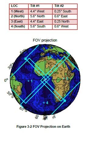
EUM/MTG/USR/19/1148454
 v2B e-signed, 15 January 2021

 MTG EUMETCast Africa Product User Guide [AfricaPUG]

2.2 Level 1c Reference Grid tailored for EUMETCast Africa
The reference grid defines the geo-referenced position of the image pixel centroids of FCI
imagery at level 1c in a normalized geostationary projection. The normalized geostationary
projection describes the view from a virtual satellite to an idealized Earth. The virtual satellite
is in a geostationary orbit, perfectly located in the Equator plane at nominally 0 degrees
longitude. This point on the equator is the origin of the projection.
The level 1c Reference Grid steps are equiangular in both the virtual satellite azimuth and
elevation and equal to the spatial sampling angle of the considered channel. The corresponding
projected distance at the sub-satellite point is the spatial sampling distance (SSD).

 Figure 1: Diagrams illustrating the spatial alignment of the L1c reference grids.

The Figure 1 illustrates how the reference grids for the different SSD values are aligned, with
the origin pixel at position (1,1) located in the SW corner. Information to generate the reference
grid in the GEOS “Normalized Geostationary Projection” is provided in the dataset.
Information on how to use the parameters given in the Level 1c product to reconstruct the
reference grid are provided in [FCIL1PUG]. Additional information about the Meteosat grids
is provided in [Meteosat-Grids]. Note that the 3x3km grid is unique for the products that are
disseminated via EUMETCast Africa.

The normalized geostationary projection defines the line of sight of each pixel centre P as a
vector representing the view from the virtual satellite. This vector is expressed as a function of
the two angles elevation (φS) and azimuth (λS) and is defined as follows:

 Page 15 of 64
EUM/MTG/USR/19/1148454
 v2B e-signed, 15 January 2021

 MTG EUMETCast Africa Product User Guide [AfricaPUG]

 Figure 2: Angular Definition of the Reference Grid

The diagram above shows the angular definition of the reference grid where:
 1. the frame (s1,s2,s3) has its origin at the satellite position, (s3) points northwards,
 and (s1) directs to the centre of the Earth
 2. the vector r of coordinates (r1 , r2, r3) in the frame (s1,s2,s3) is a pixel line of sight
 vector with r = XP/norm(XP)

In order to geolocate the radiances, the user must first calculate the corresponding azimuth,
elevation coordinate for each row and column pixel, and then calculate the corresponding
latitude, longitude coordinate from the azimuth, elevation information. This is described in the
following:

Let (r,c) be the coordinates (row and column) of any pixel of the L1c image. Row and columns
are counted increasingly when going from bottom to up (south to north) and left to right (west
to east) and beginning at 1. Therefore, the South-West corner of a L1c image has coordinates
(1,1). For each channel, the correspondence between the row and column position (r, c) and the
azimuth and elevation position (λ, φ) of the pixel centre is written:

 λs = λ0 – (c-1) · Azimuth_Grid_Sampling
 φs = φ0 + (r-1) · Elevation_Grid_Sampling

where:
 1. Azimuth_Grid_Sampling and Elevation_Grid_Sampling are the reference grid spatial
 sampling angles, representing viewing angle increments between pixels in the W-E
 and S-N directions, respectively. The corresponding values are given in Table 1.
 2. λ0 and φ0 are the angles from the centre of the projection to the centre of the pixel in
 the first row and first column of the reference grid, respectively. Note that the first
 row, column of the reference grid is indexed (1,1). The values correspond to
 Azimuth_Grid_Sampling * (columns –1)/2 or Elevation_Grid_Sampling * (rows –
 1)/2, respectively, and are given in Table 1 too.

 Page 16 of 64
EUM/MTG/USR/19/1148454
 v2B e-signed, 15 January 2021

 MTG EUMETCast Africa Product User Guide [AfricaPUG]

Note that the E-W viewing angle (λ0) does not correspond to the standard definition of azimuth,
for an observation from the instrument perspective, which runs from negative to positive from
West to East. Instead, it runs from negative to positive from East to West.
The N-S viewing angle corresponds to the standard definition of elevation, for an observation
from the instrument perspective.

 SSD λ0 φ0 Grid Sampling Columns in Rows in
 (km) Full Disc Full Disc
 degrees radians degrees radians degrees radians

 1 8.9138402398 0.1555758612 -8.9138402398 -0.1555758612 0.001601048988 2.7943576E-05 11136 11136

 2 8.9130397083 0.1555618893 -8.9130397083 -0.1555618893 0.003202097973 5.5887153E-05 5568 5568

 3 8.9122391722 0.1555479173 -8.9122391722 -0.1555479173 0.004803146953 8.3830729E-05 3712 3712

 Table 1: Values per SSD for the reference grids used for FCI L1c

With these values, the coordinates of the Earth centre (origin of the projection) in the Full Disc
image are (5568.5, 5568.5), (2784.5, 2784.5), and (1856.5, 1856.5) for the 1km, 2km, and 3km
channels, respectively.

2.3 Coverage masking applicable to products disseminated via EUMETCast Africa
In order to reduce the product size, a masking algorithm per product is applied during the
processing. The coverage masks (see Figure 5 to Figure 11) are set such that they give a
radiance measurement within the same extent on Earth, (e.g. for all channels, on the level 1c
grid). Operationally, this extent is always covered if the spacecraft orbit and pointing are within
their tolerances. The user can therefore expect to have data (e.g. a radiance measurement)
everywhere in the un-masked area all the time, i.e. from one repeat cycle to the next. An
exception being that the orbit longitude or maximum inclination is changed but in that case,
the masks will be regenerated.

The coverage masks are a compromise between the disseminated area of interest and the size
of the product. The effect on the size of the products is estimated by the “area” which is
available:
 • 100% represents all the Earth pixels in a Full Disc (it excludes deep space pixels).
 • 0% means that no pixel at all is disseminated.

The considerations made when selecting which parts of the Earth disc are selected or not on a
product (channel) are:
 • Global or large coverages are considered for channels relevant to airplane navigation.
 • The region of Africa north of the Sahara region is discarded when the data are only
 relevant to the countries in this region as they can receive the data via EUMETCast
 Europe.
 • Pixels over the oceans, for channels which are more related to applications over land.
 For this purpose the distance from the pixel to the coast can be tuned.
 • The Gulf of Guinea is of interest for navigation routes, for ships sailing between the
 Cape of Good Hope in South Africa and the North Atlantic Ocean.

 Page 17 of 64
EUM/MTG/USR/19/1148454
 v2B e-signed, 15 January 2021

 MTG EUMETCast Africa Product User Guide [AfricaPUG]

 • America, because the weather over America is of limited interest for End Users in
 Africa.

These coverage masks are applied to FCI level 1, FCI level 2, and RGB datasets provided to
EUMETCast Africa.

The coverage masks consist of a static array as big as the image to mask. For every pixel, there
is a Boolean value:
 • True: The corresponding pixel is disseminated.
 • False: The output pixel value is set to NC_FILL_VALUE (the default netCDF value
 when the data is missing).

These tables present the candidate coverage masks:

 Area [%] Coverage of Full Disc
 100.00% GEO Full Disc
 94.76% Disc but no America
 50.00% Africa + 1650 km offshore
 33.00% Africa + 500km offshore
 27.00% Africa + 100 km offshore
 25.75% Africa + 20 km offshore
 25.50% Africa land only
 Area [%] Coverage of Subsahara
 68.62% Subsahara but no America
 36.44% Subsahara + 1650 km offshore
 20.62% Subsahara + 100 km offshore
 19.72% Subsahara + 20 km offshore
 19.51% Subsahara land only

 Page 18 of 64
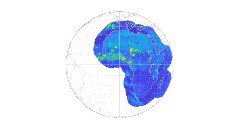
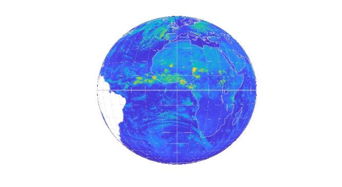
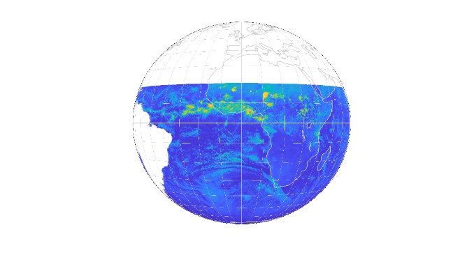
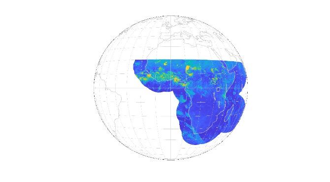
EUM/MTG/USR/19/1148454
 v2B e-signed, 15 January 2021

 MTG EUMETCast Africa Product User Guide [AfricaPUG]

The following figures display the coverage masks.

 Figure 3: Coverage Full Disc, but no America. Figure 4: Coverage Africa + 1650km offshore.

 Figure 5: Coverage Subsahara but no America. Figure 6: Coverage Subsahara + 1650km offshore.

 Figure 7: Coverage Subsahara + 100km offshore. Figure 8: Coverage Subsahara + 20 km offshore.

 Figure 9: Coverage Subsahara land only.

 Page 19 of 64
EUM/MTG/USR/19/1148454
 v2B e-signed, 15 January 2021

 MTG EUMETCast Africa Product User Guide [AfricaPUG]

3 FLEXIBLE COMBINED IMAGER (FCI) LEVEL 1

3.1 Introduction
The FCI will provide follow-on services currently provided by the Meteosat Second Generation
(MSG) Spinning Enhanced Visible and Infrared Imager (SEVIRI).

The main aim of the FCI 1C datasets disseminated via EUMETCast Africa is to provide
continuity of the MSG service in terms of channels and pixel resolution. In addition, this aim
is improved with more channels, higher radiometric precision and better periodicity.

The Products disseminated to End Users via EUMETCast Africa are always derived from the
Full Disc Scanning Service (FDSS). To reduce the size of Products, subsampling has been
applied by reducing their coverage and spatial resolution (details are provided in Appendix A).

3.2 List of FCI L1c Products at 3km and 1 km
The baseline is to disseminate the 16 FCI L1c channels as 16 independent products, in 16
different files, not as a single product containing the data of the 16 channels in chunks (which
is the approach for EUMETCast Europe). Each product corresponds to a channel at a given
periodicity, covering a subset of the Earth disc (after application of its own coverage mask).
In addition, the VIS06 channel is distributed at 1 km SSD, providing some continuity of the
SEVIRI broadband high-resolution visible (HRV) channel. Therefore, there are up to 17 FCI
L1c products per 10-minute Repeat Cycle.

 Spectral
 Description Product ID Coverage Periodicity
 Channel
 Tuned MSG continuity FCI-1C-RRAD-3KM-AF-VIS04 VIS 0.4 Subsahara land only ≤4 times/day
 with MTG innovation, FCI-1C-RRAD-3KM-AF-VIS05 VIS 0.5 Subsahara land only ≤4 times/day
 3km SSD FCI-1C-RRAD-3KM-AF-VIS06 VIS 0.6 Full Disc but no America 10 minutes
 FCI-1C-RRAD-3KM-AF-VIS08 VIS 0.8 Full Disc but no America 10 minutes
 FCI-1C-RRAD-3KM-AF-VIS09 VIS 0.9 Africa + 1650 km offshore 30 minutes
 FCI-1C-RRAD-3KM-AF-NIR13 NIR 1.3 Full Disc but no America 30 minutes
 FCI-1C-RRAD-3KM-AF-NIR16 NIR 1.6 Full Disc but no America 10 minutes
 FCI-1C-RRAD-3KM-AF-NIR22 NIR 2.2 Full Disc but no America 30 minutes
 FCI-1C-RRAD-3KM-AF-IR38 IR 3.8 Full Disc but no America 10 minutes
 FCI-1C-RRAD-3KM-AF-IR63 WV 6.3 Full Disc but no America 20 minutes
 FCI-1C-RRAD-3KM-AF-IR73 WV 7.3 Full Disc but no America 20 minutes
 FCI-1C-RRAD-3KM-AF-IR87 IR 8.7 Africa + 1650 km offshore 10 minutes
 FCI-1C-RRAD-3KM-AF-IR97 IR 9.7 Full Disc but no America 10 minutes
 FCI-1C-RRAD-3KM-AF-IR105 IR 10.5 Full Disc but no America 10 minutes
 FCI-1C-RRAD-3KM-AF-IR123 IR 12.3 Full Disc but no America 10 minutes
 FCI-1C-RRAD-3KM-AF-IR133 IR 13.3 Subsahara land only ≤4 times/day
 HRV continuity, same
 as 3KM VIS06 product, FCI-1C-RRAD-1KM-AF-VIS06 VIS 0.6 Africa + 500 km offshore 10 minutes
 but with 1km SSD
 Table 2: List of FCI 1C products

The Table 2 presents the summary of FCI level 1C products disseminated via EUMETCast
Africa. Both the coverage and periodicity are configurable parameters and therefore subject to
changes. The interpretation of the coverage names is provided in Appendix A (Product
Subsampling).

 Page 20 of 64
EUM/MTG/USR/19/1148454
 v2B e-signed, 15 January 2021

 MTG EUMETCast Africa Product User Guide [AfricaPUG]

The periodicity of one repeat cycle of the native FCI L1c full-disc radiance dataset (FCI-1C-
RRAD-FDHSI-FD) is 10 minutes. Therefore:
 • Channels disseminated every 10 minutes have the same periodicity as the native
 dataset.
 • Channels disseminated every 20 minutes or every 30 minutes, corresponding to every
 second or every third native dataset.
 • Channels disseminated “up to 4 times a day” have low priority. They are disseminated
 at fixed time of the day, when there is enough bandwidth, avoiding the peak periods
 of the day (e.g. noon).

All the product are formatted in netCDF and have a SSD of 3x3km except for the HRV
continuity product which has an SSD of 1x1km.

The Product ID is built as illustrated in Table 3.

 Elements to build the Product ID
 Data Processing
 Type Subtype Coverage Sub-setting
 Product ID Source Level
 e.g. VIS04
 3KM or
 FCI-1C-RRAD-3KM-AF-VIS04 FCI 1C RRAD AF as per Table
 1KM
 2
 Table 3: Example of FCI L1C Product IDs for EUMETCast Africa.

3.3 FCI L1c Product details

3.3.1 Description

There are two groups of FCI Level 1C RRAD products:
 • The 16 products at 3km SSD: subtype labelled “3KM”
 • The single product at 1km SSD: subtype labelled “1KM”

Regarding the 16 products, each of them contains a single FCI 1C channel. This represents a
significant change with respect to the native FCI-1C-RRAD product (which is disseminated
via EUMETCast Europe), because the native product includes the 16 channels in the same
product for a single Repeat Cycle.

These 16 products ensure the continuity of MSG in term of channels and pixel resolution, but
with improved periodicity of 10 minutes for eight of the 16 channels (see Table 3), including
the new FCI channels (VIS0.4, VIS0.5, VIS0.9, NIR1.3, NIR2.2).

The SSD of these 16 products is always the same: 3km. In addition, the coverage depends on
the channel, see Table 2 for a summary.

The HRV product is also a single channel FCI 1C RRAD product. It only contains the VIS 0.6
channel, at 1km SSD. Note that the VIS 0.6 channel is also provided in one of the 3km SSD
products.

 Page 21 of 64
EUM/MTG/USR/19/1148454
 v2B e-signed, 15 January 2021

 MTG EUMETCast Africa Product User Guide [AfricaPUG]

 Table 4: Size, daily volume, and data rate per FCI Level 1C product

For information, the estimated product size before compression, or the space required in
memory after decompression, is:
 Each of the 3KM products: 72 MB/product
 1KM (HRV) product: 651 MB/product

Note 1: The average product sizes after compression (Table 4) are maximum upper estimates
(i.e. solar channels during daylight).

Note 2: All these product sizes include 5% system margin.

3.3.2 Short format description

The format of these products is as described in [FCIL1FS].

These products do not contain trailer chunks. Body chunks are aggregated in a single file
product, and relevant information from trailer chunks is inserted into the final file.

The exact description for these products, provided as ncML files, can be found in Appendix B.

 Page 22 of 64
EUM/MTG/USR/19/1148454
 v2B e-signed, 15 January 2021

 MTG EUMETCast Africa Product User Guide [AfricaPUG]

3.3.3 File name examples

See Appendix D for a full description of the file names and how to build them. These are 2
examples:

W_XX-EUMETSAT-Darmstadt,IMG+SAT,MTI1+FCI-1C-RRAD-3KM-AF-IR105-CHK-BODY---
NC4E_C_EUMT_20180101121212_DT_OPE_20180101103000_20180101103020_N_JLS_C_0034_0002.nc

W_XX-EUMETSAT-Darmstadt,IMG+SAT,MTI1+FCI-1C-RRAD-1KM-AF-VIS06-CHK-BODY---
NC4E_C_EUMT_20180101121212_DT_OPE_20180101103000_20180101103020_N_JLS_C_0034_0002.nc

3.4 Instrument Characteristics
This information can be found in [FCIL1PUG], in particular for what relates to:
 • Spectral Channels
 • Spectral Response Function (SRF)
 • Image Acquisition Principle
 • Focal Plane Arrangement
 • On-board Calibration Principle
 • Detection Chain

3.5 FCI Level 1 Processing Algorithms
This information can be found in [FCIL1PUG], in particular for what relates to:
 • Stray-Light Correction
 • INR
 • GSICS

3.6 Characteristics of the level 1c Registered Radiance Dataset

3.6.1 Row and Column Numbering

The general concept can be found in [FCIL1PUG].

The numbering of the rows and columns in these products is presented in the Table 5.

 3KM Products 1KM Product
 (3km SSD) (1km SSD)
 Rows, from South to North From 1 until 3712 From 1 until 11136
 Columns, from West to East From 1 until 3712 From 1 until 11136
 Table 5: Numbering of rows and columns

 Page 23 of 64
EUM/MTG/USR/19/1148454
 v2B e-signed, 15 January 2021

 MTG EUMETCast Africa Product User Guide [AfricaPUG]

3.6.2 Level 1c Reference Grid

Regarding the topics indicated in the following table, please find more information in the
corresponding document.

 Topic Where to find more information
 Normalized Geostationary Projection See [FCIL1PUG]
 Spectral Channels See [FCIL1PUG]
 Availability within timeliness See [EURD] & [MTGDIS]

3.7 Format
Regarding the topics indicated in the following table, please find more information in the
corresponding document.

 Topic Where to find more information
 Data Chunks Not used over Africa, one file per product, see table below
 Rectified Radiance See [FCIL1PUG]
 Swath Information See [FCIL1PUG]
 Radiance Encoding See [FCIL1PUG]
 Pixel Quality See Appendix A
 Index Mapping See Appendix A
 Special Compression CharLS as per [FCIL1PUG].

The differences between the FCI L1c products disseminated via EUMETCast Africa (3KM and
1KM), and the products disseminated via EUMETCast Europe, are presented in the following
table.

 EUMETCast Africa EUMETCast Europe
 Characteristic FCI 1C 3KM FCI 1C 1KM FCI 1C FDHSI
 Periodicity Multiple of 10 minutes in Repeat cycle of 10 minutes Repeat cycle of 10
 the range 10 minutes to 4 minutes
 times a day (it depends on
 the product)
 Number of Products Up to 16 products (1 per 1 product (only vis_06 1 product (containing
 per Repeat Cycle FCI 1C channel) channel) all 16 channels)
 Number of Body No chunk (a single file per No chunk (a single file per 40 chunks
 Chunks per Repeat product) product)
 Cycle
 Body Chunks Content Each file contains data of a Each file contains data of a Each chunk contains
 single channel single channel data of 16 channels
 Number of Trailer No trailer chunk No trailer chunk 1 per Repeat Cycle
 Chunks
 Total Number of Not applicable Not applicable 41 (40 bodies + 1
 Chunks per Repeat trailer)
 Cycle

 Page 24 of 64
EUM/MTG/USR/19/1148454
 v2B e-signed, 15 January 2021

 MTG EUMETCast Africa Product User Guide [AfricaPUG]

 How the information of Each product contains the Each product contains the 40 body chunks and 1
 the input chunks is aggregation of all the body aggregation of all the body trailer chunk.
 inserted in the final chunks in a single file (a chunks in a single file (a
 product body chunk). In addition, body chunk). In addition,
 there is a netCDF group there is a netCDF group
 containing the information containing the information
 from the trailer chunk. from the trailer chunk.
 Table 6: Comparison between the FCI level 1C products disseminated via EUMETCast
 Africa and via EUMETCast Europe.

The decision of disseminating each channel as a product over the full coverage, instead of all
channels in a single product (and in chunks) as done for EUMETCast Europe, has these
consequences:

 • The 16 products at 3x3 km SSD and the product at 1x1km are formatted the same
 way.
 • The users can select which channels are received/archived/processed and drop the
 others.
 • Each channel has its own transmission priority (particularly important in case of
 dissemination congestion).
 • Each individual product/file has a stable and repetitive size.
 • All the products/file correspond to the earth disc (after coverage mask application).
 • Each product is provided in a single file (no chunk to be aggregated).
 • It is easy to implement at EUMETSAT and easy to use by African users.
 • It avoids tiny files.

3.8 FCI L1 Dataset Usage
The following can be found in [FCIL1PUG].
 • Reconstructing Reference Grids
 • Unpacking Coded Radiances
 • Effective Radiance Unit Conversion
 • Effective Radiance to Brightness Temperature for IR Channels
 • Converting Effective Radiance to Reflectance for VNIR Channels
 • Radiometric Noise Assessment
 • Radiometric Accuracy Assessment
 • Special decompression of Radiances
 • Radiometric Noise and Accuracy Look-Up Tables
 • Timing Information

 Page 25 of 64
EUM/MTG/USR/19/1148454
 v2B e-signed, 15 January 2021

 MTG EUMETCast Africa Product User Guide [AfricaPUG]

4 FLEXIBLE COMBINED IMAGER (FCI) RGB

4.1 Introduction

4.1.1 General information about RGBs

General information about RGBs can be found in the following guidance documents:
 • WMO/EUMETSAT standard RGB schemes:
 http://www.wmo.int/pages/prog/sat/documents/RGB-WS-2012_FinalReport.pdf
 • EUMETrain RGB quick guides: http://eumetrain.org/rgb_quick_guides/index.html
 • EUMETrain Colour interpretation guides: http://eumetrain.org/RGBguide/rgbs.html
 • EUMETrain MSG Interpretation Guide: http://www.eumetrain.org/IntGuide/

4.1.2 Generation of RGB Datasets

This document contains descriptions (the so-called ‘recipes’) about how to create the standard
RGB types from FCI L1c data. For each RGB type, a table contains the needed parameters:

 Colour beam Channel (difference) Range Gamma
 Value
 Red Channel1a – Channel1b MIN1 MAX1 K or % Gamma1
 Green Channel2a – Channel2b MIN2 MAX2 K or % Gamma2
 Blue Channel3a – Channel3b MIN3 MAX3 K or % Gamma3
 Table 7: Template of the parameters used on the RGB recipes.

The first column refers to the colour of the output RGB channel.

The second column shows which channels (or channel combinations) should be visualised in
the red, green and blue colours beams. Before combining them, these images have been
calibrated and enhanced.
 • The measured values have been calibrated by calculating reflectivity (R) or brightness
 temperature (BT) values. In case of solar channels, the calibration includes solar
 zenith angle correction as well: the reflectivity has been divided by the cosine of the
 solar zenith angle. Note: the zenith angle has been capped (e.g. at 80 degree).
 • Then the images are enhanced. The enhancement expands the range (MIN, MAX) of
 R or BT values to the full range of display values (0-255, BYTE) by a linear
 stretching and possibly a non-linear stretching.
 o The images are linearly stretched within the brightness temperature or
 reflectivity ranges. The 3rd and 4th columns of Table 7 contain the lower and
 upper limit of the corresponding ranges, while the 5th column contains the
 unit. In some cases, the range is “inverted”, i.e. the MAX and the MIN values
 are reversed.
 o In some cases, a non-linear stretching is applied. It could be a piecewise linear
 expansion, or a so-called “gamma correction”. If the gamma parameter (6th

 Page 26 of 64
EUM/MTG/USR/19/1148454
 v2B e-signed, 15 January 2021

 MTG EUMETCast Africa Product User Guide [AfricaPUG]

 column of Table 7) is greater than 1 then the image becomes brighter and the
 contrast of the darker tones increases. If gamma parameter is lower than 1 then
 the image becomes darker and the contrast of the brighter tones increases. If
 gamma is equal to 1 then no gamma correction is needed.
 • The 6 column contains the Gamma parameter for stretching the interval.
 th

The equation of the gamma correction is:
 − 1/
 = 255 ∗ � �
 −

Where:
 • X is the input value, the actual calibrated value: Reflectivity (R) or Brightness
 Temperature (BT).
 • MIN and MAX are the lower and upper limit of the range of the stretching.
 • Gamma is the parameter of the gamma correction.
 • BYTE is the output value, the intensity of the enhanced image. The full range of
 displayed values is 0-255.

Before combining the channels, each of them is calibrated and enhanced in one or two steps:
 • First a linear stretch is performed within the brightness temperature or reflectivity
 ranges.
 • Afterwards a so-called gamma correction is performed for the green component.

The gamma correction enhances the contrast in the darker or in the brighter tones (depending
on the Gamma parameter), and it makes the image darker or brighter. In the case of the green
component of the Severe Convection RGB, Gamma equals 0.5, and therefore the contrast of
the bright tones are increased.

 Figure 10: Gamma correction with Gamma=0.5.

 Page 27 of 64
EUM/MTG/USR/19/1148454
 v2B e-signed, 15 January 2021

 MTG EUMETCast Africa Product User Guide [AfricaPUG]

4.1.3 Summary of Centrally generated RGB Products

The Table 8 provides a summary of the RGB products available via EUMETCast Africa, in
particular their coverage mask, periodicity, and SSD. The coverage mask and periodicity are
configurable parameters, therefore submit to changes. The list of available coverage masks is
given in Section 2.3.

Product Name Product ID Coverage Mask Periodicity SSD
 Subsahara +
Severe Convection RGB FCI-1C-RGB-SCON-AF 20km offshore 10 minutes 1x1km
 Subsahara +
Night Microphysics RGB FCI-1C-RGB-NMPHY-AF 20km offshore 20 minutes 1x1km
True Colour RGB FCI-1C-RGB-TCOL-AF Full Disc 20 minutes 3x3km
 Subsahara +
Fire Temperature RGB FCI-1C-RGB-FIRET-AF 20km offshore 30 minutes 1x1km
 Subsahara +
Cloud Phase RGB FCI-1C-RGB-CPHAS-AF 20km offshore 10 minutes 1x1km
 Table 8: List of FCI RGB products

Table 9: Size, daily volume, and data rate per FCI RGB product generated continuosly day
 and night

 Table 10: Size, daily volume, and data rate per FCI RGB product generated during
 12h/day

Note that SCON (Severe Convection) and NMPHY (Night Microphysics) are never
disseminated during the same time interval. It is one or the other, SCON during daylight and
NMPHY during night.

 Page 28 of 64
EUM/MTG/USR/19/1148454
 v2B e-signed, 15 January 2021

 MTG EUMETCast Africa Product User Guide [AfricaPUG]

4.1.4 Naming Convention

Following the naming convention indicated in Appendix D, these are some example file names.

W_XX-EUMETSAT-Darmstadt,IMG+SAT,MTI1+FCI-1C-RGB-SCON-AF--CHK-BODY---
NC4E_C_EUMT_20180101121212_DT_OPE_20180101103000_20180101103020_N_x_C_0034_0002.tif

W_XX-EUMETSAT-Darmstadt,IMG+SAT,MTI1+FCI-1C-RGB-NMPHY-AF--CHK-BODY---
NC4E_C_EUMT_20180101121212_DT_OPE_20180101103000_20180101103020_N_x_C_0034_0002.tif

W_XX-EUMETSAT-Darmstadt,IMG+SAT,MTI1+FCI-1C-RGB-TCOL-AF--CHK-BODY---
NC4E_C_EUMT_20180101121212_DT_OPE_20180101103000_20180101103020_N_x_C_0034_0002.tif

W_XX-EUMETSAT-Darmstadt,IMG+SAT,MTI1+FCI-1C-RGB-FIRET-AF--CHK-BODY---
NC4E_C_EUMT_20180101121212_DT_OPE_20180101103000_20180101103020_N_x_C_0034_0002.tif

W_XX-EUMETSAT-Darmstadt,IMG+SAT,MTI1+FCI-1C-RGB-CPHAS-AF--CHK-BODY---
NC4E_C_EUMT_20180101121212_DT_OPE_20180101103000_20180101103020_N_x_C_0034_0002.tif

 Page 29 of 64
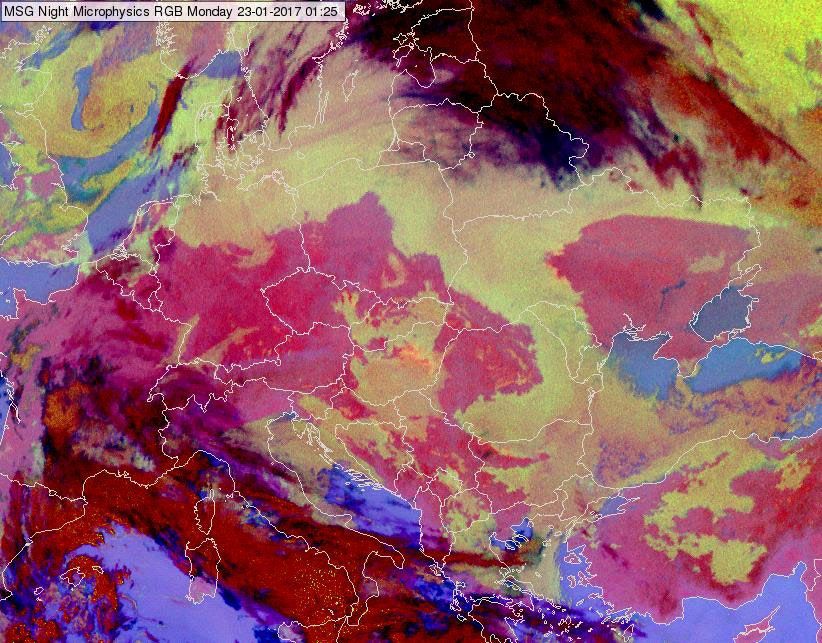
EUM/MTG/USR/19/1148454
 v2B e-signed, 15 January 2021

 MTG EUMETCast Africa Product User Guide [AfricaPUG]

4.2 FCI-1C-RGB-SCON-AF, Severe Convection (Storms) RGB

4.2.1 Description

Primary aim: Monitoring of convection.

Secondary aims: Monitoring (the cloud top microphysics) of high clouds.

Time period and area of its main application: Daytime, in convection season at low- and mid-
latitudes, although different tunings/version should be used for low- and mid-latitudes.

Guidelines: Ice clouds usually have large ice crystals at the top. For the mid-latitude continental
storms the presence of small ice crystals on (or above) the cloud top and/or very cold cloud top
temperatures are possible indicators of severity. This RGB was tuned to highlight such high
clouds, and it does this with excellent colour contrast.

 Table 11: Severe Convection (Storms) RGB from SEVIRI, 29 June 2006, 12:25 UTC.

4.2.2 Generation

These datasets are generated according to the recipe presented the following table.

 Colour beam Channel (difference) Range Gamma
 Red WV6.3 – WV7.3 -35 +5 K 1
 Green IR3.8 – IR10.5 -5 +60 K 0.5
 Blue NIR1.6 – VIS0.6 -75 +25 % 1
 Table 12: Recipe for generating the Severe Convection RGB.

The table above shows which channel differences are visualised in the red, green, and blue
colour beams.

 Page 30 of 64
You can also read