Oamaru Harbour Development Strategy - Waitaki District Council Creating a Destination
←
→
Page content transcription
If your browser does not render page correctly, please read the page content below
Oamaru Harbour
Development Strategy

           Creating a Destination
                   2011
           Waitaki District Council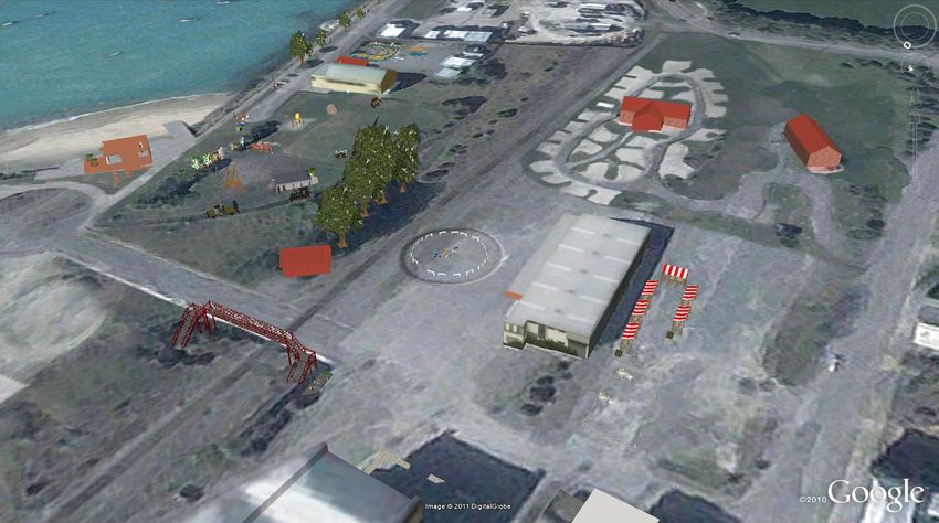
Contents
                                                       Page
   Introduction
           Map of Oamaru Harbour                         1
           Summary                                       2
           Preface                                       3

   Vision/ Values, principles and objectives            4

   Introduction and Background                         5-6

   Harbour Development Projects                        7-8

   The Oamaru Harbour Framework                         9

   Harbour and Precinct Development                   10 - 28

   Revenue Streams for the Harbour and Precinct         29

   Review of the Harbour Strategy                       30

   Harbour Management                                   31

   Appendicies
        Oamaru Harbour Developments Timeline          33 - 35
        Twelve key reports individually summarised.   36 - 41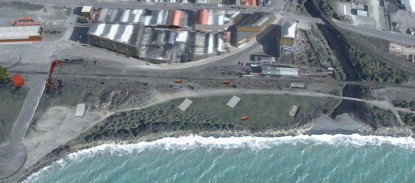
Oamaru Harbour

                 1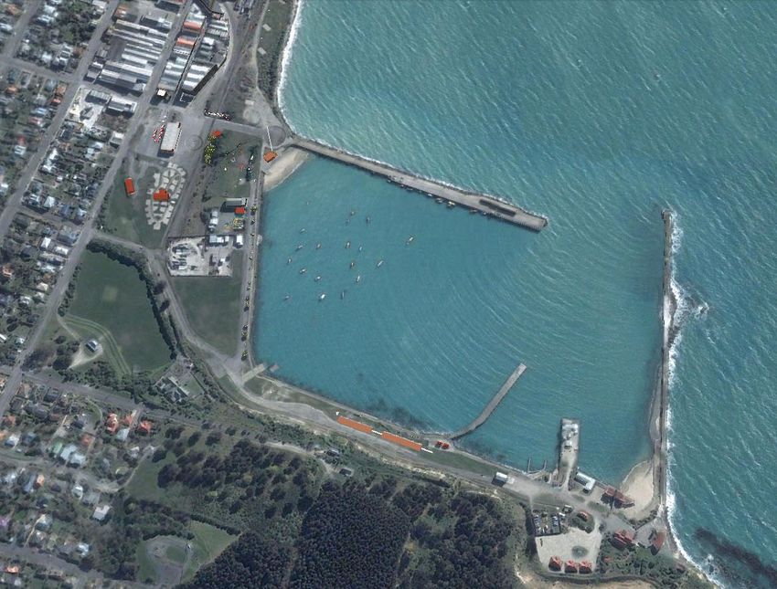
Introduction
Summary
The Council wants Oamaru Harbour to be one of the best little harbours in the country and will shortly start
to transform this historic area into a destination.

Over the next decade our goal is to create a harbour that sees commercial operations, tourism and
development, all providing a family friendly waterfront for locals to treasure.

Tomorrow‟s harbour will be a place filled with history, stories, creativity and activity.

To do this Council is beginning work that will transform various harbour areas including the:-
       Freezer building and north of the Oamaru stream
       Rail to ocean foreshore
       Old carnival site and Friendly Bay
       Railgoods yard area
       Wharves and slipways
       Roads
       Portside beach and the eastern tip

This will mean the harbour and waterfront area are better connected to the town and imbued with „a sense of
place‟. The harbour will be easy for people to get to, and move around. Cycling will be encouraged while
roads will be limited to servicing the harbour‟s commercial requirements, supporting business and tourism.
There will be more centralised parking.

The parks and beaches within the harbour will be rejuvenated and made family friendly. A playground that is a
destination with exciting, well designed play equipment, will be sited on the Friendly Bay „Carnival ‟site.

There will be outdoor staging to support creativity and entrepreneurial activity.

Tourism will be encouraged with the harbour‟s natural environment and history on show. There will be
artefacts and historic traces that express the richness of the area and the diversity of marine life. Storyboards
will take the visitor on a journey around the area describing what is historic and treasured.

Rail heritage, working trains and steam machinery that connect with the past will all be on display.

Water and marine activities will be encouraged whether it be commercial fishermen, club activity, small trailer
boats, fishing or just playing in the water. There will be improved launching facilities, wharf space, water and
beach access.

Residential, commercial and tourist accommodation will be enabled with connecting walkways and green space.
Visitors to the harbour will be able to relax with seating, shelter and public toilets. People will be encouraged
by the surroundings to rest a while, to become more connected with the Port and to explore its rich heritage.

Landscape and vegetation will flow with different areas enticing the visitor to explore. A wilderness landscape
that provides a timeless quality, utilising native plants and maintaining elements of the industrial core of the
harbour.

Tomorrows harbour is a people space, a place to work live and play.

                                                                                                                2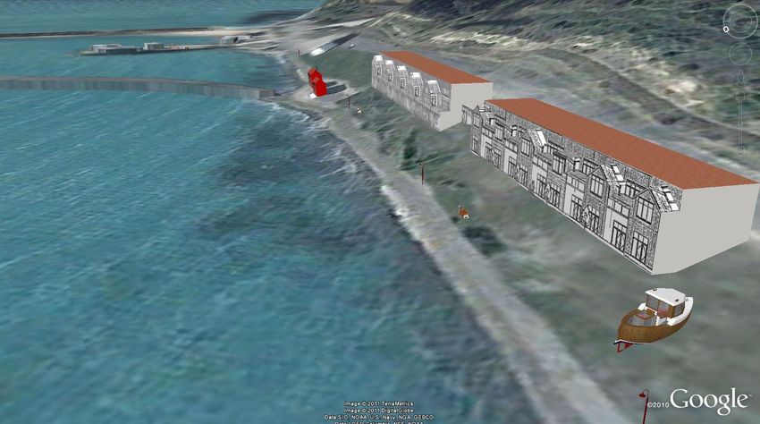
Preface
Oamaru deserves a revitalised and lively waterfront, accessible and used by all parts of the community. We aim
to create a waterfront that encourages families, young people, older people and tourists to linger while also
giving fishermen and recreational users ready access to water based services and activities. Council wants to
get the „mix‟ for the harbour and its precincts right, to help build the wealth of the community, socially and
financially. We have been inspired by the enthusiasm shown by community leaders, harbour interest groups
and the many exciting options suggested to make the harbour an inviting place.

This 2011strategy review seeks to increase the use of the harbour. The Friendly Bay beach and carnival site
will be rejuvenated, encouraging business development and increased community participation, effectively
designing a harbour that meets many users‟ needs. We are addressing key new initiatives including the
popularity of Steam Punk, the Rugby World Cup and the Alps to Ocean Cycle Way.

The strategy draws extensively on past reports on the harbour, particularly the draft development strategy
(2007) entitled „Harbourside‟. This strategy has pulled together the best of several reports into an up-to-date
document that reflects current requirements for the harbour.

The strategy has been developed collaboratively and is underpinned by a number of workshops, site visits to
the harbour precinct by the Harbour Sub Committee and consideration of over 130 potential projects. Many
of the projects considered come from the twelve previous consultant‟s reports on the harbour (commissioned
over the last 20 years) as well as more recent investigations.

This strategy is evolving and will be reviewed annually for project timing, costs, and resources, funding,
opportunities and issues. A full review will be undertaken following Council elections. Selective consultation
with affected users and groups will also be undertaken at this point. This will ensure the best opportunities
are identified for the harbour and its users.

While we recognise there are always competing priorities for resources and money, we believe there is a real
opportunity for the harbour to again be the jewel in Waitaki‟s Crown. There is a chance now for the port to
again contribute to the future growth of the area instead of being a relic of a past era.

                                                                                                                  3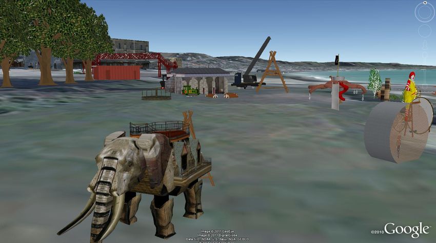
1. Vision
The Oamaru Harbour and precinct are transformed into a destination.

A harbour encouraging commercial operations, tourism and development, all providing a family friendly
waterfront for locals to treasure, filled with history, heritage, creativity and activity.

2. Values, principles and objectives
Our objectives for the harbour precinct and port are to:

            Encourage commercial operations that maximise the return from harbour assets
            Encourage investment in harmony with the harbour‟s natural, and historic environment
            Enhance tourism for Oamaru and encourage exploration of the wider district
            Make the waterfront readily accessible to people
            Create a harbour and precinct that can cater for outdoor events
            Encourage creativity and celebration
            Encourage waterfront activity
            Integrate activities within the precinct, port and harbour
            Protect significant harbour aspects and tell their story
            Respect the unique heritage of the harbour, including its rail and semi industrial elements
            Recognise the Historic Places Act registration

The principles followed within the harbour to achieve this vision and objectives are discussed when looking at
the various aspects of the harbour development.

Throughout this strategy we‟ve included an artist‟s visual interpretations of various elements of „Tomorrow‟s
harbour‟ to enhance the reader‟s understanding of the planned development. These images will change as the
harbour develops over time, new businesses come into the area and buildings and plantings take shape.

                                                                                                                 4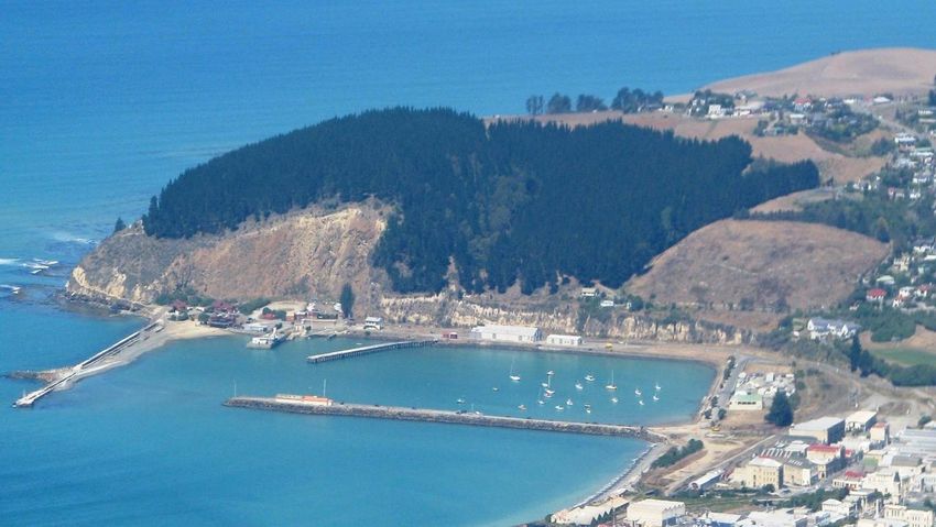
3. Introduction and background

3.1.     History
Oamaru‟s history as a service and port town with an early involvement in the development of the frozen meat
export trade is reflected in our buildings, port and industry. The history of the Port is discussed below and a
chronological summary is included in Appendix 1.

In the early 1880s Oamaru depended on the sea. The Oamaru port and dock was built and became the main
entrance to the town. In certain conditions of wind and sea, the port and sea were extremely hazardous.
Shipwrecks were common.

A jetty running out northwards from near the end of the cape was destroyed by a storm in 1868, a few
months after completion. In 1869 the provincial government set up the Oamaru Dock Trust to build a dock in
the lagoon with a protected entrance. While the overall scheme was not finalised, one part of it, the
construction of a breakwater roughly on the line of the old jetty, was undertaken.

In 1874 the Oamaru Harbour Board, consisting entirely of government nominees (except the Mayor ex officio)
replaced the Oamaru Dock Trust. By 1875 the incomplete breakwater was giving sufficient shelter to end the
long series of wrecks that had marred the port‟s reputation. That year the board began building a concrete
wharf (Macandrew Wharf) along the inner side of the breakwater. At the beginning of 1878 the breakwater
had reached a length of 286.5 metres. It was built of solid concrete blocks capped by masses of concrete, and
had resisted all storms.

In 1872 contractors completed a tramline at the water‟s edge to transport building materials to the
breakwater. This became a railway station linked to the government lines. This formed the main connection,
and was almost the only means of communication with the harbour.

Because it had no rating powers, the Board borrowed to expand since it earned more than enough from
harbour dues and rents to cover interest and expenditure. The position of the board was then very sound and
no one dreamed of the financial storms that would overwhelm it.

The Harbours Act (1878) saw the government appoint four of the 12 members of the board. The other
members were the Mayor, three members elected by the ratepayers of the town, four representing the
Waitaki County Council and the three local Road Boards. Government, town, and country shared control
equally. With the safety of the port now assured, large quantities of goods passed over the wharves. Oamaru
was no longer just a coastal port.

Over time, the railways gradually reduced short distance coastal trade, and the growth in tonnage of export
ships and container terminals took its toll on the port. The port officially closed to shipping in 1975, when it
ceased to provide shipping services. The Oamaru Harbour Board was abolished in 1978 with administration
taken over by Council.

Appendix 1 details the key developments of the port and harbour including more recent milestones such as
the Oamaru Blue Penguin Colony (1992) and tetrapod breakwater work (2006).

                                                                                                                   5
3.2.    Recognition of Oamaru as a Historic Port and Precinct

The physical remains of the historic port, such as the harbour side Freezer Building and the purpose built
Sumpter Wharf still remain intact from the Victorian Era. The historic precinct and harbour both have New
Zealand Historic Places Registration, number 7064.

Conservation of the historic remnants associated with the port needs to recognise the full 100 years of
operation of the port and should provide historical context around:
            Building and development of the harbour
            History of the Port
            Sumpter Wharf
            Captain Scott
            Shipwrecks and the Rocket Brigade

Development of the meat industry can also be celebrated within the harbour context with the unique
architecture and stories of the Freezer Building and the fact that Oamaru was the first port to refrigerate meat
sent to Britain.

Where they are compatible or complement each other, commercial and recreational activities that have
coexisted should continue to do so. This will incorporate the rich history of the port into its future
development, which will recognise that:

            The port has historic character worthy of preservation;
            Oamaru is unlikely to commence full blown port operations of importance;
            The port will maintain operations for recreational and commercial users;
            The commercial users include fishermen, tourist operations; and
            The recreational users include club users (rowers, yacht and motor sport clubs), swimmers and
            locals enjoying the waterfront.

                                                                                                              6
4. Harbour Development Projects
There have been 12 reports commissioned and written on the development of the Oamaru harbour area over
the last 20 years. This 2011 strategy borrows shamelessly from the best of the opportunities identified by
each of the experts who have provided advice on the harbour.

For most of the last 20 years, Council has not had control of the land and/or activities in a large part of the
area. Council has now purchased the railway land and is reviewing perpetual leases in order to gain control.
Control of the land within the harbour precinct enables a greater opportunity for harbour development. This
report looks at that opportunity, builds on past reports and considers how Council‟s vision for the harbour
will be met.

The 12 reports referred to in this strategy are:

      1.    Feasibility Study Harbour/Tyne Street Area - Arthur Young (Christchurch) 1988;
      2.    Friendly Cove-Design Study - T B Lander 10/1994;
      3.    WDC Oamaru Harbour – Port of Oamaru „Strategic Focus and Management Plan‟, WDC
            property manager 10/1996;
      4.    Harbourside Co-ordination Group 1996;
      5.    Railway Goods Yard and Harbour Development -Dugal Armour 9/1997;
      6.    Oamaru Central Area Design Guidelines - John Gray (Heritage Architect) 1998;
      7.    Oamaru Heritage and Port Area Concept - Davie, Lovell-Smith Partners and Waitaki
            Development Board 10/1998;
      8.    Oamaru Harbourside Stakeholder Workshops WDC & WDB7/2003 & 11/2003;
      9.    Harbourside Village - Davie, Lovell-Smith Partners and Athfield 5/2003;
      10.   Oamaru Harbourside Report- Jenny May (Heritage Management Services) 2004/05;
      11.   Harbourside „Herald‟ Concept Map - Projenz 2007;
      12.   “Harbourside” Draft Development Strategy - Dugal Armour 12/2007.

These individual reports are briefly summarised in Appendix 2 and the common themes are noted in the table
overleaf.

                                                                                                              7
Common Themes to Reports:

Theme / Action                                                                 Action Status
Develop a Victorian town at work                                               Established in historic precinct
Establish an Oamaru Whitestone Trust                                           Established and active
Dismantle and relocate Sumpter Wharf                                           Not currently progressing
Establish a campervan park close to the harbour                                Application made by operator
Establishing activities which will generate visitor traffic to the area        Commenced
Close Arun Street                                                              Not progressed
Tyne/Arun Street corner of land to be mixed use recreation                     To be considered
The Esplanade to be the main link (road) to the Penguin Colony                 Not progressed
Restore the Esplanade                                                          Rock wall restored, landscaping
Plant trees on Harbourside road                                                Finalising in March
The carnival space at Friendly Bay to remain as an open area                   Established
New level crossing near over bridge                                            Established
Parking and public toilets near goods shed                                     Parking established, toilets being
                                                                               assessed
Improve walkway linkages to include King George Park with heritage             Not progressed
area and the port
Uninterrupted pedestrian access around the harbour edge                        Walkway/cycleway link Oamaru
                                                                               township with Cape Wanbrow
Develop historic port buildings for arts/crafts and residential
accommodation
Restore railway bridge to link Friendly Bay                                    Current discussions with Rotary
                                                                               and other interested groups
Extend Wansbeck Street as main link to Esplanade and harbour                   Complete to Holmes Wharf
Conservation walkway from Cape Wanbrow to Oamaru Creek and                     Walkway/cycleway link Oamaru
CBD                                                                            township with Cape Wanbrow
Heritage trails with interpretive panels                                       Approved to commence
Limit vehicle access to specific routes and avoid unnecessary or               To be considered
further fractionation of the area‟s interconnection with King George
Park, precinct and the harbour
Convert goods shed to a museum                                                  Not progressed
Develop a sculpture garden of Oamaru stone at beginning of                      Not progressed
Waterfront Road and hold stone carving symposiums
Replication and imitation of the past is not necessarily appropriate            Principle to be considered

Further recent initiatives undertaken in the harbour and precinct include

       Secured ownership of rail land and control of silo site secured;
       Silo removal from harbour front;
       Oamaru Creek developed as a tidy “people space”;
       Underground power and lighting of walkway to the Penguin Colony;
       Breakwater maintenance continuing;
       Dredging of harbour entrance progressing;
       Penguin territory reinforced and viewing facilities improved;
       Development and expansion of the Penguin Colony;
       Activities established which will generate visitor traffic to the area (i.e. Penny Farthing riding);
       Train rides established by Steam and Rail;
       Harbour Street road surface restored in context with area;
       Sewage scheme extended to Wansbeck Street extension and the Penguin Colony;
       Tea room lease negotiated;
       Private establishment of Portside restaurant.

                                                                                                                    8
5. The Oamaru Harbour Framework
A framework is required to ensure the successful development of the Oamaru harbour precinct. This
framework addresses:
Commercial activities;
Connectivity and a sense of place;
Historic references;
Integrated planning within the wider area;
Landscape Lines;
Private Investment;
Recreational activities;
Safety;
Separation of pedestrians and traffic;
Shared space;
Shelter from the elements;
Street furniture;
Sun (limit shadows);
Unique, different and special aspects;
View shafts;
Village concept; and
Water access.
The Oamaru Harbour Development Strategy creates this framework and also looks at the various areas of the
port and land directly surrounding it. Both are discussed at section 9.
We have identified projects that will build up the physical surrounds of the harbour. We have then
reconsidered the same projects to ensure that they are cohesive and connected.
This Strategy recognises that Council cannot compel any one type of business to locate within the harbour
precinct. Rather, Council seeks to create an environment which encourages business activity and brings people
to visit the harbour to support such businesses. Council will review the reserve status of ex railway land, and
also harbour endowment land, as part of this process.
The Strategy identifies key developments and opportunities over the next 9 years by triennium. It is intended
that these projects are revisited and refreshed with this Strategy in line with Council elections.
96. Harbour and Precinct Development
6.1. Aspects, Principles and Associated Projects
Projects that have been considered for the harbour have been identified into distinct groups including:
connectivity and a sense of place
roading
parking
park/beach
cycleway / walkways
exhibitions
tourist venue
steam and rail
toilets
street furniture
landscape
vegetation
marine industry / water activity
harbour structure
commercial space
railway goods shed
residential area
tourist accommodation
management
funding/financial
The Harbour Sub Committee have considered more than 130 concepts and projects and developed principles
to guide development.
Those principles that will guide the various aspects of the space are noted in the boxes below.
6.1.1. Connectivity and a sense of place
The harbour and waterfront area (precinct) connects the town with its harbour and district and is imbued
with „a sense of place‟
In accord with this principle it is proposed that:-
Development will be in keeping with the surrounding area and with harbour and waterfront use
New buildings will be complementary to, and in a scale with existing buildings
The town and its harbour will be connected and provide a flow from the gardens and town to the sea
Key projects include those that enable:-
Sight lines and view shafts to be retained. Included in this is the Esplanade Redevelopment
extending down to the beach and the Carnival Site
Preservation and enhancement of public space with connections and walkways
Heritage trails with interpretive panels and storyboards
Strengthened links between the precinct and the Penguin Colony
6.1.2. Roading
Pedestrian only or shared use streets can increase the vibrancy of some areas; the streetscape becomes a
space orientated to people and not vehicles. The positives are, less fumes, less traffic noise, more places
to sit and relax, more trees, more art, etc. The negatives are that some businesses rely on drop-in traffic.
The elderly can also find long promenades difficult and vehicle access can provide the opportunity for easy
drop off and pick up. Our goal in the harbour will be to find the right roading balance.
10Roads within the harbour will service commercial requirements and support business, tourism and
connectivity.
Shared space between pedestrians and vehicles will be enabled
Speed limits will be restricted to support pedestrian, penguin and port user safety
Roads will not „cut off‟ users from the waterfront
Key roading projects that will progress in the next decade include:-
Waterfront Road as the main link to the penguin colony
Service lanes for commercial precinct
Restoring Harbour Street road surface in context with area (complete)
Shifting road behind the yacht club (NOYBC)
Extending Wansbeck St as main link to Holmes Wharf and beach (complete)
Developing the Esplanade as shared use, slow vehicle and pedestrian/public space
Limiting vehicle access to specific routes
6.1.3. Parking
Visitor traffic should be restricted in key areas. Car parks need to be provided, however they should not
dominate the site and preferably should be screened from sight. People should be encouraged to walk
wherever possible, while the network should still support reasonable access for drop off and pick up as
well as quick visits and access to goods loading bays.
Due to the demographic of potential harbour precinct users (elderly locals and people with children) some
fairly close parking facilities in key areas such as those currently in the rail yard, Humber Street and at
Marine Parade have been set up.
Access ramps, signage, road markings and safety barriers should be the exception rather than the norm.
Where vehicle access is provided no stopping outside major buildings or in prime vistas should be
permitted. Where practical, vehicles should be required to park at the rear of buildings, including buses
dropping people and their luggage.
The waterfront land and esplanade is for people and direct harbour use rather than parking.
Parking will be provided primarily for commercial harbour and business users
Leisure user and tourism parking may be concentrated at centralised parking points
Parking will encourage pedestrian movement through the wider harbour precinct
Turnaround and drop off facilities for bus and tourist traffic will be provided at focal points
Parking projects that will need to progress in the next decade:-
Set up of appropriately located parking areas
Parking and public toilets (near goods shed or waterfront)
116.1.4. Cycleway / Walkways
Council supports several key initiatives in the cycling and walkway space including Alps to Ocean (A2O) and
the national walkway system.
It will be easy for people to get to and move around the harbour and cycling will be encouraged
There will be a public walkway/ cycleway along the length of the waterfront
There will be easy and interesting pedestrian access from the town to the waterfront.
Projects that aim to improve pedestrian and cycle accessibility include:-
Development of creating links
Oamaru Creek as a people space (complete south of creek)
Uninterrupted pedestrian and cycle access around harbour (complete south of creek)
Link to Railway Station, Waitaki Boys, Bus Station established
A Cycle Learning Zone enabled
Enabling penny farthing riding within a learning zone
6.1.5. Park/Beach
The parks and beaches within the harbour will be family friendly and encourage creativity and activity.
The waterfront and parks will be accessible to families and those with special needs
The beach and parks will be connected so they are safe for children to play and run between them
Parks will spark the imagination
The site memory will be respected and maintained
A playground that is a destination with a sense of place, not just play equipment, will be sited on the
Friendly Bay „Carnival ‟site
Activities that encourage children and families to play and interact will be enabled
Key Park and Beach related projects for the harbour include:-
Friendly Bay re- sanded
A destination playground set up
Shelters set up in strategic places in harmony with the area
The upgrade of Friendly Bay with associated car parking and picnic area (with carnival site)
Some areas remain as open space and available for events
Play equipment and objects installed around the harbour to entice play, creativity and activity
Public green spaces established
126.1.6. Exhibitions
The precinct will support creativity, entrepreneurial activity and provide historic references
Outdoor exhibitions (and artefact‟s) will be set up within the harbour
The harbour will support exhibitions and provide for outdoor staging space
Projects that set up exhibition spaces in support of activities, artworks and historical items (artefacts) include
Artefacts for the harbour and precinct identified and placed at strategic locations
Exhibition spaces set up to support static and rotating exhibitions (ie. Steam punk, staging etc)
6.1.7. Tourist Venue
A key aspect for tourism in the harbour is the natural environment and history of the harbour.
The harbour will enhance the visitor experience by:-
Showing how the harbour has evolved over time
Ensuring heritage buildings are preserved, restored and reused
Artefacts and historic traces that express the richness of the area will be preserved and displayed
The diversity of marine life, its creatures, habitation and vegetation will be celebrated
The penguin colonies and other wildlife will be protected and respected, whilst enabling a controlled
ecotourism experience
Tourism focused projects include:-
Historic
Develop marine and boating theme near slipways
Restore Scott‟s shed (complete)
Maintain historic buildings
Provide items of historic interest with story boards throughout the precinct
Interactive
Establish activities to generate visitor traffic to area (Steam Punk Carnivale park)
Environmental
Provide penguin habitat in conjunction with wharf industries/improve experience
Establish public viewing area for penguin colony (a Waitaki Development Board managed project)
136.1.8. Steam, Machines and Rail
Steam and rail is an integral part of Waitaki‟s history with a steam crane used to build the breakwater and
rail services taking goods to the dock and a steam dredge used in the harbour.
Rail heritage, working trains and steam machinery connect with the past in an active way and the harbour
landscape and planning will support this.
Rail activities will be celebrated and enabled within the harbour
Cranes and historic rail items will be retained wherever possible in situ
Machinery and industrial elements that worked the harbour will be displayed and celebrated
Projects within the harbour in the next decade will include:-
Restore rail bridge as link to Friendly Bay
Steam Rail / Railway Park aspects of harbour maintained with an open industrial feel
Railway art displays set up
Support to extend the rail journey north
Historic industrial and steam machinery in situ within the harbour
6.1.9. Railway Goods Shed
The Railway goods shed is a 1970s utilitarian designed government structure. This building and its surrounds
provide an opportunity initially for the provision of income from the building and the use of its grounds for
parking and later for strategic development of the space to complement that within the historic precinct.
Short term use for the Railgoods shed will:-
Maximise the use of the building for commercial returns as a rental proposition
Where practical, utilise the extensive grounds for central parking in support of harbour development
Longer term use of the Railgoods shed will be to seek a key tenant for a ticketable attraction to the area or to
demolish it to enable future commercial development.
The projects around the Rail Goods Shed area in the next decade include:-
Enabling the establishment of a Farmers Market
Enabling the use of an area for penny farthing and cycle „learn to ride‟ experiences
Refurbishing the Railway Goods Shed externally with paint in keeping with other buildings in the
precinct.
Softening some of the landscape around the shed
Enabling the establishment of a privately operated Caravan Park on council leased land
Public toilets with facilities in the vicinity to service Alps 2 Ocean cycleway users, the playground
and the historic precinct
146.1.10. Marine Industry / Activity
Marine and water activity is key to the ongoing success of harbour operations, commercial endeavour, tourism
and community wellbeing. Accordingly:-
Club activity and social interaction on the water will be supported
Small boat use by families and individuals for recreation will be encouraged
Water play will be supported in the harbour
Fishing, social and commercial, is part of a normal harbour environment and will be enabled
Business that supports marine and leisure activity is part of the harbour and will be enabled
Key projects to be undertaken include:-
A floating Pontoon for recreational use (ferry pontoon for children)
Retention of services for marine based recreational activities
Maintaining the slipway
Developing the ramps servicing the harbour
A pontoon and light ramp at the corner of the Esplanade and Waterfront
Parking for Esplanade and Waterfront ramp trailer users provided, possibly near rail line
6.1.11. Harbour Structure
Council policy is to actively manage its harbour assets so they can be maintained in perpetuity. This is
fundamental in promoting the port. The breakwater also ensures ongoing protection of Oamaru township
from erosion. These assets will need to be maintained so that:-
Entry to the port will be assured by a minimum channel depth
The port will meet minimum maritime safety requirements at all times
The breakwater will be maintained to protect the integrity of the port and its usage
Holmes wharf will be maintained to service fishing boats, ship tenders and the like
Normanby wharf will be maintained to a level appropriate for its use
Sumpter wharf
- in the short term will be maintained sufficient for heritage and tourism elements (pedestrian)
- in the longer term Council will seek to enhance salvation opportunities
Points of historic interest within the Harbour area will be maintained to ensure no additional
degradation of the assets.
Key projects will be undertaken to ensure:-
Ongoing repairs and maintenance of wharves and breakwater
Sumpter Wharf degradation is minimised and it is minimally restored to pedestrian safe use
Holmes Wharf is restored to light commercial use
The harbour entrance is dredged
Existing sea walls are maintained
Rockwall Seafront North of Oamaru Creek (complete)
Rock Wall Oamaru Creek to Holmes Wharf
Breakwater is maintained
Wharf amenities for fishermen and other wharf users are improved
156.1.12. Commercial Space
Harbour and associated endowment properties will be used to maximise income for the harbour precinct
and wider district with full regard to the Vision for the harbour.
Lessees incompatible with the vision for the harbour will be renegotiated at first opportunity
Properties in the harbour precinct will be in keeping with identified industrial and historical elements
of the harbour environment
Commercial space provided or built on the harbour will be built back from the water‟s edge to enable
direct public access to the water and beach to be maximised
There will be a balance of commercial, leisure and services with supporting facilities in the precinct so
that the harbour is vibrant, effective and meets the operational need of users
Commercial properties will be let at market rates, rental opportunities will be proactively sought and
maximised and some land sales may be considered
Where Council properties are let to volunteer groups some elements of service may be negotiated in
lieu of service fees with the agreement of the Harbour Sub Committee
Key projects will be undertaken to:-
Prepare land on harbour side of railway track to allow establishment of activities to attract the
public
Upgrade or redevelop the Railway Goods Shed
Develop the Te Mahi Site
Reinstate Friendly Bay tearooms (this is being undertaken privately on Council leased land)
Resolve a long term view on the lease of the McKeown Group
Promote fresh fish sales and smokehouse on wharves
Assess opportunities to realign the rail track to maximise development potential of land
Enable rail to harbour land development
Progress opportunities for development of a Harbourside Village concept (Commercial
Waterfront)
Develop historic port buildings for arts/crafts and residential use
Enable the Freezer building retention (rather than demolition by neglect)
Longer term identify a development / restoration strategy for the Freezer building
6.1.13. Residential Area and Tourist Accommodation
Modern harbour developments include residential aspects. However, when allocating space priority needs
to be given to development that will create economic, social and cultural vitality in the area. This planning
can then allow for appropriate residential development. Too much residential development, with its
associated services, could have an adverse effect on the area and therefore the balance needs to be
carefully considered.
Mixed use development, including residential, will be within the harbour precinct.
Tourist Accommodation will be encouraged within the harbour precinct to bring people and foot traffic
into the wider harbour. Residential needs development will be carefully managed so that residential needs
for quiet enjoyment do not impact on the vibrant and commercial elements of the publicly owned harbour
and its surrounds.
Where accommodation is enabled or built it will:-
Be back from the water‟s edge to enable direct public access to the water and beach
Be built in a manner that enhances the safety and vibrancy of the harbour area
Maximise the use and return on endowment lands
Be complementary to, and in a scale with existing buildings
16Require the occupier‟s acceptance of the heritage, harbour and industrial nature of the area and all the
effects of commercial, rail, tourist, marine, penguin and fishing activity.
Projects include:-
Assisting (if required) to progress the currently consented private Cormorants Development
The identification of areas available for mixed use or residential development
Enabling a camper van site close to the harbour or other similar facility
Encourage the development of a 5 star hotel (possibly in the Rail Building)
Promote tourist accommodation
6.1.14. Street Furniture and Public Facilities
Visitors to the harbour will be invited to relax with seating, shelter and public toilets that are sympathetic
to the space. People will then become more connected with the Port, encouraging them to explore the its
rich heritage
Projects include:-
Stone Capping Lights
Shelters at key points of interest
Street Furniture/design/signage/boards
Sewage scheme to be extended to service complete harbour area
Establish public toilets within the vicinity of the new playground
6.1.15. Landscape and Vegetation
Landscape and vegetation will flow with different areas enticing the visitor to explore and enjoy the space
by:-
reflecting the historic elements of the harbour
utilising native plants that thrived in the area
maintaining elements of the industrial core of the harbour
building on the harbourside theme
Projects and elements include:-
Extension of the Esplanade wall and lighting (complete)
Planting trees on waterfront road (and plant bank)
Planting quarry area
Re-vegetating the area
Group plantings to entice visitors to keep walking
Street furniture and planting for unified theme to harbourside
176.2. Areas
Areas of the harbour where activities are being undertaken are:-
Freezer building and north of stream
Rail to Ocean foreshore
Friendly Bay
Rail goods yard area
Portside beach
Eastern tip of Harbour
Features to be developed are:-
Harbour, related services and structures
Accommodation
Roads / Access
Street furniture / artefacts / vegetation (per park bench)
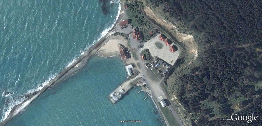
An aerial photo of the harbour area is shown on Page 3
There are in excess of 65 Projects that are to be undertaken in the harbour over the next decade for circa $4
million with $1.3 million of these projects to be undertaken in 2011/12. These projects, identified with the
year (1 to 10) proposed for the work to be undertaken, follow. Proposals separately support every project.
186.2.1. Freezer building and north of stream
Enhancing the surrounds of the Freezer building provides
an opportunity to expand the waterfront and give
understanding of the importance of meat industry to the
Waitaki district. Whilst Council is not seeking to restore
this industrial building it will encourage opportunities for
the private sector to preserve it, preferably for a tourist
or port aligned industrial use.
No Project Purpose Yr 1-10
FN Freezer building and north of stream *
FN1 Tidy wasteland north of creek - To tidy up the Northern side of Oamaru Creek so that weeds 1
restrict parking so that it is and trash are removed and plantings tidied sufficient for an
open tidy space and extends industrial feel from the creek to the Freezer Building
harbour
FN2 Secure access to freezer To tidy up and make safe the Freezer Building (particularly 1
building, tidy site and restrict to external elements). Limiting access to the inside of the building
pedestrians / cycles to prevent vandalism
FN3 Waterproof freezer building To minimise the ravages of weather damage to the Freezer 2
roof, add story boards about building whilst alternative use or ownership is explored. Also
freezing industry history and to add historic information and seating so that the Freezer
seating Industry story is told in situ at the harbour
4FN Demolish building on original To enable an unrestricted vista down the harbour to the 2/9
Oamaru historic site at River historic Freezer Building. Also to enable development of the
north in near freezer building original site of the first town building at the creek mouth.
FN5 Demolish tin building in front of To enable an unrestricted vista down the harbour to the 2
freezer building (Willetts historic Freezer Building. To demolish the 'tin shed' before it
tenants) becomes unfit for purpose and dangerous
FN6 Pursue a new owner for To determine how the Freezer Building can be preserved for 1
Freezer building and sell or its historic value whilst maximising return to Council and
lease land and buildings reducing exposure to development risk.
FN7 Enable extended rail journey to Provide non financial support from Council to enable the 3
Railway Station and further Historic Rail Journey north to (at least) the Oamaru Railway
north Station. This will recognise the value of Rail to Oamaru‟s
history and attract tourism to the precinct.
197.2.2. Rail to Ocean foreshore
A substantial tidy up is to be undertaken along the
walkway from the foreshore south of the Oamaru
Stream to Wansbeck Street. The aim is to highlight the
industrial history of the harbour, enable a pleasant walk
along the foreshore and improve the safety of the site.
This also presents an opportunity to rationalise land
holdings in accord with the original decision to buy
former Railway land.
RO Rail to Ocean foreshore Project Purpose * Yr 1-10
RO1 Railway bridge restoration (by To restore the historic Oamaru rail footbridge utilising volunteers 1
volunteers) and donations
RO2 Fleurs herb garden To enable the placement of a raised herb garden near the rail bridge 1
at Itchen St utilising volunteers and Fleur‟s contractors
RO3 Steam Rail / Railway Park - To enable the building by volunteers of a white picket fence around 1
white picket fence the rail building housing trains. This fence will utilise materials
provided by Council and labour co-ordinated by Steam and Rail and
will enhance the safety of the cycle track.
RO4 Exhibition space / Steam Punk Provide for a series of well placed sites with external power and 1
rotating exhibitions lighting for use for events and exhibitions. These sites to have pads
sufficient to support stages for entertainment or the placement of
heavy items for exhibition. Create areas near these sites as rentable
event spaces.
RO5 Railway to ocean and To maintain the site and grass around the 'Rail park' area so that it 1
Wansbeck maintain grass has an industrial / wilderness feel
RO6 Railway art display To turn the rusting Steam junk into 'Steam Art' so that items are in 1
situ on old rail lines or set up with rocks / plantings in manner
befitting these artefacts
RO7 Rail to Harbour land Identification of land needed for the harbour development and 4
development potential for land rationalisation or further commercial leasing. This
includes consultation and negotiation to ensure that land can be
legally used as proposed.
207.2.3 Friendly Bay surrounds – Child friendly
7.
7.
A substantial number of activities within the harbour aim to increase the use of the port by visitors, families
and especially children, all of which will mean increased foot traffic. This in turn provides opportunities for
economic development and also for Council to lease its land in the area.
In accord with the Playground Strategy a destination playground is to be built at the harbour. The uniqueness
of the playground will be enhanced by some key „artistic‟ pieces. Alignment with the popular Steam Punk art
movement is one possibility to create a uniqueness that appeals to children, adults and tourists alike. The
improvement of the beach and overall access will further augment enjoyment of the space.
The playground and its surrounds will rely considerably on the goodwill of volunteers and donations over time
to build up the area with plants and further elements of fantasy. Initially key pieces will be provided by Council
with any volunteer elements supervised by a Council-hired project manager following the landscape plan.
Some innovative use of current space will help curtail initial costs. These could include using the helicopter
landing zone as a „learn to ride‟ space for children, laying the playground out sympathetically with the proposed
privately provided tearooms and utilising an interim refit of a toilet in the existing Te Mahi building.
The waterfront and Friendly Bay surrounds including Marine Parade are all receiving a face lift. Work is
progressing with current Council leases to establish the best use for the waterfront land and buildings.
21CF Child Friendly – surrounds and Friendly Bay Yr 1-10
*
CF1 Sight lines/view shafts to be To ensure that individual developments and projects within the 1
retained - Esplanade Harbour do not inappropriately impact on the view shafts
Redevelopment extending
Carnival Site
CF2 Friendly Bay steps and sanding To ensure that Friendly Bay beach is accessible and attractive to 1
users including families with children.
CF3 Floating Pontoon and or „child To provide children and the young at heart with a simple durable 1
ferry‟ platform in the water near Friendly Bay beach
CF4 Walkway - Play to clay / within Enable a personalised area for clay pavers or such like created by 1
playground area local children to be incorporated into park landscaping
CF5 Cycle Learning Zone To provide young children with a dedicated area for bikes / trikes 1
where they can learn to ride safely
CF6 Enable the private reinstating Enable the current consented Friendly Bay Tearooms to progress 1
of Friendly Bay tearooms and align playground equipment placement in a coherent way
with the outdoor elements and equipment servicing the tea
rooms
CF7 Enable establishment of To provide assistance of a non financial nature to progress any 4
additional attractions for rail proposals for interactive rail services within the precinct to
attract children and others
CF8 Establish activities picnic areas To establish activities within the harbour precinct that encourage 3
/ volley ball family interaction and physical activity
CF9 Set up playscapes with local To provide within the wider precinct and the Friendly Bay 1
themed items within any Carnival park some areas of landscaping that encourage play
playgrounds within the environment
CF10 Steam Punk / Carnival To provide a destination playground within the Harbour Precinct 1
playground – a destination not at Friendly Bay with sufficient striking pieces to be 'artistic', a
just a playground visitor magnet and great play experience
CF11 Te Mahi Site Development - The use of the Te Mahi site to provide a toilet in support of the 1
interim divide site and make carnival playground site development. Provision of space for
toilet a paraplegic one and use volunteers doing work in the harbour
site for volunteers working on
park and harbour
CF12 Te Mahi Site Development Take active steps to ensure that the Te Mahi Site will have the 2
identify a compatible best opportunity for future development and ensure that legal
development opportunity steps are taken to remove any impediments to use
CF13 Rowing club opportunities / Take active steps to ensure that the Rowing Club lease site will 2
development / building have the best opportunity for future development
purchase
CF14 McKeown Site - Long Term Take active steps to ensure that the McKeown lease site will have 2
view of McKeown site usage / the best opportunity for future development. Also to cease the
strategy use of trucks and petroleum storage / sales from the esplanade
and waterfront road to enable safer pedestrian beach access and
enhanced road space.
227.2.4 Railgoods yard area
The area surrounding the Railway Goods shed has a
substantial amount of land available in the medium
term that can be used to increase the vibrancy of both
the Historic Precinct and Harbour. As the building
currently provides an income it is intended to keep
this as a short term commercial rental proposition.
Longer term it is recognized that the building is not in
keeping with the wider area and when next painted it
will become more sympathetic to its surrounds. The
provision of central car parking space for harbour
visitors and the buildings light industrial tenant is also
seen as an on going use for this space until a better
use can be found.
RGYD Railgoods yard area *Yr 1-10
RGYD1 Railway Goods Shed Upgrade To enable the Railgoods shed to better reflect the heritage 4
in situ aspects of the precinct with sympathetic colour and landscaping
until a better use can be found
RGYD2 Farmers Market enabled To enable a Farmers Market within the Port at the Railgoods 1
shed
RGYD3 A2O terminus facilities To identify the requirements for facilities in support of the A20 2
and enable these to be provided within the area
RGYD4 Penny farthing bike area To enable the set up of a Penny Farthing Cycle area within the 1
Port at the Railgoods shed (following a successful trial of this
arrangement over Christmas 2010)
RGYD5 Parking substantially To set up centralised and satellite parking 3
centralised reduce road traffic
to Penguin Colony
RGYD6 Public Toilets Build toilets in support of the playground, harbour and the 2
historic precinct, possibly with additional toilet, shower and
locker facilities for A2O
237.2.5 Harbour, related services and structures
Substantial effort is being made to improve the facilities in the harbour for commercial and recreational users.
There are also erosion control issues that need to be managed for the safety of the town. Additionally,
priority will be given to redecking wharves if the Council receives hardwood from the Hakataramea bridge
replacement. A future possibility is that Sumpter Wharf could be made pedestrian safe and volunteer effort
will be directed in this area if it is practical.
HS Harbour, related services and structures *Yr 1-10
HS Heritage aspects / HPT Historic To ensure that all elements of heritage protection required 1
Area Classifications for HPT approval and management of the harbour are met
HS Restore Sumpter Wharf - To enable pedestrian access to Sumpter Wharf for 2
Pedestrian safe recreation purposes, if feasible
HS1 Restore Holmes Wharf to To enable access and use of Holmes Wharf for light 1
commercial use standard commercial and recreation purposes whilst seeking to
restore and retain historic where practical
HS2 Improve wharf amenities i.e fish To enable better use of the wharves by adding amenities for 2
stations, shelter access etc recreational fishermen and pedestrians
HS3 Promote fresh fish sales & To seek opportunities for private enterprise to increase the 1
smokehouse on wharves (private vibrancy and use of the wharves by locals and visitors
sector) through the sale of fish and sea produce
HS4 Access improved, with new ramp To enable small boats and recreational users to launch in 4
near McKeown‟s site corner safe water near the corner of Esplanade and Waterfront
Road
HS5 Rockwall Oamaru Creek to To prevent erosion from the sea from Oamaru Creek to 2
Holmes wharf Holmes Wharf by reinstatement of the rockwall
HS6 Breakwater maintenance To maintain the integrity of the breakwater to protect the 1/5
Harbour and town
HS7 Develop slipway To upgrade and develop the harbour slipway 4
HS8 Dredge Harbour To dredge the harbour for light commercial use and entry yearly
and egress of recreational boats
HS9 Encourage chandlery and shipyard To seek opportunities for private enterprise to provide 5
services (private sector) chandlery and shipyard services within the harbour precinct
in support of commercial and recreational boats
247.2.6 Accommodation
Whilst the harbour is to be made an attractive place for commercial and residential development, Council
itself is not intending to undertake the role of builder/developer. The harbour works undertaken by Council
will be supported by an active approach to finding the right leasees and accommodation providers for the area.
Council will seek to improve rental returns and also rationalise land holdings.
ACC Accommodation residential /commercial / land use *Yr 1-10
ACC1 Rationalise land held through To work with appropriate parties to identify land use and 1
Harbour - ultimately seek to rationalise Council land holdings in the
harbour with a view to maximise the endowment earnings
for lands held in the precinct
ACC2 Harbourside Village (Commercial To seek opportunities for private enterprise to progress the 5
Waterfront usage) harbour village concept for commercial development into a
vibrant, business and people friendly destination
ACC3 Residential accommodation To enable limited infill development of residential elements 3
enabled in the harbour precinct
ACC4 Cormorants Development To progress Council requirements in regards to the 2
Cormorant Apartments Development in accord with the
current Resource Consent.
ACC5 Accommodation – Promote high To identify and advertise opportunities for successful tourist 2
end Tourist Accommodation accommodation providers and hoteliers to access harbour
land and build accommodation in the harbour. This will
maximise the earnings for endowment land and also grow
high end tourism
ACC6 Enable Campervan park To progress Council requirements in regards to enabling the 1
establishment of a Campervan Park within the precinct. This
will increase Council‟s return on investment for the lease
257.2.7 Roads / Access
The construction of new roads will be limited due to changes
in NZTA funding. A key element is to seal Itchen St and
enable better use of this space for parking in support of the
area.
Some road alignment may be needed in the south east of the
harbour as plans develop.
Road Roads / Access *Yr 1-10
Road Oamaru Esplanade developed, To enable ready access to the Friendly Bay water‟s edge QW 1
planted, traffic slowed and without crossing roads by creating a grass park buffer
turnaround provided at edge and vehicle turnaround at the edge of the old Friendly
of rowing club Bay Carnival Site
Road1 Develop service lanes for To re-grade Itchen St from the Elevator building. 1
commercial precinct (Itchen to Provide chip seal at the Wansbeck Street end of Itchen
Wansbeck) Street ensuring an 'access road' alternative to the
Harbour precinct with loading zones and parking
Road2 Harbour St loading zone and To enable Harbour St to be a shared space for vehicle 1
reduced speed traffic only and pedestrians with slow speed, loading zones and
limited parking
267.2.8 Street furniture / artefacts / vegetation (per park bench)
This provides for landscaping, vegetation and the creation of areas of interest with the provision of seating,
the placement of artefacts and the use of storyboards. This is to encourage visitors to explore a landscape
with a sense of history, place and wildness.
No Street furniture / artefacts / vegetation Yr 1-10
SFAL1 Tourist walking trail The harbour will be part of the Tourist walking trail 1
SFAL2 Interpretive panels / story Panels and story boards placed at key points will tell the history 1
boards of the harbour
SFAL3 Stone Capping Lights along The top of the Stone lights along the Esplanade will be capped 3
Marine Parade
SFAL4 Shelters A range of well designed shelters will be provided in the 1
harbour precinct
SFAL5 Street furniture and planting Durable low maintenance landscaping will provide connectivity 1
for unified theme to and a sense of place within the Harbour with planting,
harbourside welcoming spaces and historic references
SFAL6 Other Landscaping A distinct beautification project for funding by a trust or 1
volunteer group will be developed within the Harbour Precinct
SFAL7 Group plantings To create a series of low maintenance landscapes / plantings 1
that complement placement of storyboards and artefacts
SFAL8 Trees on waterfront road (& To provide for shade and softening of the harbour landscape 1
plant bank) throughout the Harbour Precinct. Once funding is identified,
trees will be appropriately placed
SFAL Artefacts To provide for pieces of historic interest or connectivity to the 1
9 - 13
wider community within the landscape
277.2.9 Portside beach
The beach at Macandrews wharf will be made accessible
again.
PSB Portside beach *Yr 1-10
PSB1 Access to beach Re-establish people friendly access to Portside Beach 1
PSB2 Beach / play equipment Put in place child playscapes to encourage the use of the 3
Macandrew wharf beach and immediate land
7.2.10 Eastern tip of Harbour
Works at the top of the harbour include those to enhance the penguin tourism
experience and to cater for the recreational and commercial small boat user. The Alps
to Ocean finish line work is expected to be paid for by A2O. The final design and use for
the quarry area is yet to be determined and it is expected that this area will be leased to
support light commercial, chandlery and other development.
EAST Eastern tip of Harbour * Yr 1-10
EAST1 Penguin Colony attractions (WDB Provide infrastructure and signage to support the Penguin
or WTB funded) Colony development planning for increase in tourism traffic
and the effects of this on the harbour environment
EAST2 Penguin safety issues (WDB or Provide appropriate infrastructure and signage to support 1
WTB funded) penguin safety and access to habitat within the harbour
EAST3 Alps to Ocean finish line (ALPs to Provide infrastructure and signage in alignment with the 1
Ocean funded) requirements of the A2O finish line requirements
EAST4 Harbour area leases Facilitate finalisation of leases within the harbour, including 1
the Yacht Club lease
EAST5 Charging for ramp Provide infrastructure and collection boxes to enable 1
charging a fee for ramp use
EAST6 Boat Parking review Evaluate and provide for boat parking and storage within the
harbour on a user pays basis
EAST7 Quarry area - progress Work with appropriate parties to identify land in or near the
opportunities for utilising this area Harbour Quarry with a view to maximizing earnings
288 Revenue Streams for the Harbour and Precinct
The revenue streams for the Harbour are discussed below.
Fees and Charges
Council‟s Revenue and Financing policy requires that some elements of activity undertaken are funded by
„Other Income‟ with the amount set considering the following matters:
Is the benefit identifiable to individuals?
Are any particular individuals contributing to the need to undertake the activity?
Legislative constraints
Is there a practicable way of charging and collecting user charges?
At what level should charges be set, considering the effect of charges on changes in demand or
behaviour ?
Fees and charges within the harbour include:
Holmes wharf berths
Harbour moorings
Fish Case levy per case
Slipway Fees - Winch
Slipway Fees – Daily Charge
Ramp Fees (all of Waitaki Council ramps)
Daily rate
Rentals
In accord with Council‟s rental policy, harbour properties should be paying a market rent. To date this has
not been the case which needs to be addressed. There may be an opportunity for volunteer and service clubs
to provide an element of service in the harbour to offset rental due and this may require a policy change.
The Funding policy also enables rates to be used recognising use of the harbour amenity for economic
development and public good and an extract from the Funding policy in the LTP is noted.
Description Funding Policy
Port Operations (This includes the harbour channel, operational Other income 20%
wharves, moorings and slipways). Rates 80%
Rating Basis:
30% General Rate – Land Value
Property Activity
Activities to maintain buildings and aligned infrastructure 70% Targeted Rate Oamaru
Urban Area – Capital Value
100% user pays based on market
rates.
Oamaru Port (This activity only covers part of the total undertakings
Other income 0%
in the Oamaru Harbour area.) Other activities that take place in this
general area including roading, walkways and reserves are covered Rates 100%
under those activities.
Rating Basis:
Coastal Protection (Including breakwaters and similar structures, 20% Targeted Rate Capital Value
and historic wharves and other structures.) District Services
80% Targeted Rate Capital Value
Oamaru Urban Area
29You can also read