Phase II Environmental Site Assessment - 85 York Road West, Yorkton, Saskatchewan
←
→
Page content transcription
If your browser does not render page correctly, please read the page content below
Phase II Environmental Site
Assessment
85 York Road West,
Yorkton, Saskatchewan

                        Prepared for:

                        Alvarez & Marsal Canada
                        Inc., in its capacity as Monitor
                        of Contour Realty Inc.

                        Suite 1110, 250 6th Avenue SW
                        Calgary, Alberta T2P 3H7
                        January 8, 2021

                        Pinchin File: 284505.001

                                                   © 2021 Pinchin Ltd.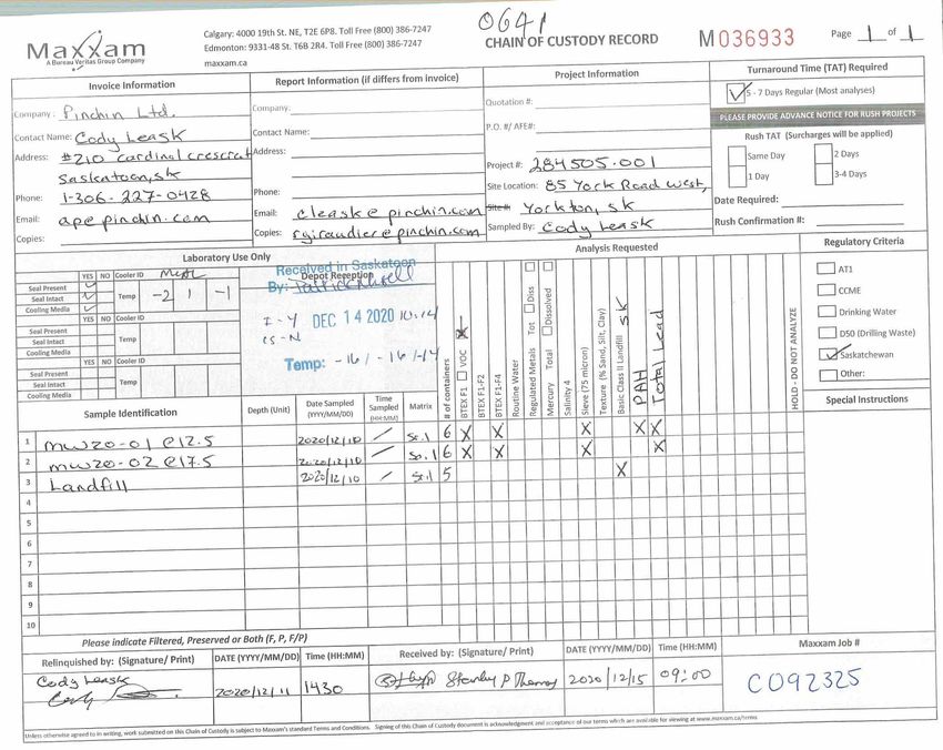
---                  phase ll Environmental site Assessment                                                   January 8, 2021
/ Pl NC H lN      '    85 York Road West, , Yorkton, Saskatchewan                                       Pinchin File: 284505.001
\-/                    Alvarez & Marsat Canada lnc., in iG capacity as Monitor of Contour Reatty lnc.

         lssued To:                           Alvarez & Marsal Canada lne., in its capacity as Monitor of
                                              Contour Realty lnc.
         lssued On:                           January 8,2021
         Pinchin File:                        284505.001
         lssuing Office:                      Regina, SK

        Author:                             Cody Leask, Dipl. Env., EP
                                            Project Coordinator
                                            306.500.3022
                                            cleask@pinchin.com

        Reviewer:                           Reese Giraudier, Dipl" (ENV), A.Sc,T.
                                            Project Manager
                                            639.739.0114
                                            rqiraudier@pinchin.com

                                                 l2-                             J./-PJ>

        Reviewer:                           Timothy J. Jaques, B. Sc.,          . Geo.
                                            Senior Technical Advisor
                                            403.543.1945
                                            tjaques@pinchin.com
Phase II Environmental Site Assessment                                                     January 8, 2021
             85 York Road West, Yorkton, Saskatchewan                                           Pinchin File: 284505.001
             Alvarez & Marsal Canada Inc., in its capacity as Monitor of Contour Realty Inc.

EXECUTIVE SUMMARY

Pinchin Ltd. (Pinchin) was retained through an Authorization to Proceed, Limitation of Liability and Terms
of Engagement signed by Alvarez & Marsal Canada Inc., in its capacity as Monitor of 101098672
Saskatchewan Ltd., Morris Industries Lt., Morris Sales and Service Ltd., Contour Realty Inc., and Morris
Industries (US) Inc., and not its personal or corporate capacity (Client) to conduct a Phase II
Environmental Site Assessment (ESA) of the property located at 85 York Road West, in Yorkton,
Saskatchewan (hereafter referred to as the Site).

The Site is developed with a single-storey industrial building with a second-storey office space, a
materials/storage yard and employee parking areas, occupied by Morris Industries Ltd.

The purpose of this Phase II ESA was to address potential issues of environmental concern identified
during a 2004 Phase II ESA and 2019 Phase I ESA Update completed by P. Machibroda Engineering Ltd.
(PMEL) to facilitate the potential divestiture of the Site.

Pinchin reviewed the PMEL reports which identified the following area of potential environmental concern
(APEC):

         •            A fueling station, equipped with underground and aboveground storage tanks and a
                      pump island, were historically located approximately 30 metres east of the Site on the
                      adjacent former Dairy Producers Co-operative Ltd. property located at 41 York Road
                      West. To evaluate this APEC, the 2004 PMEL Phase II ESA involved the drilling and
                      installation of a borehole/monitoring well on-Site to determine if the off-Site fueling station
                      had affected soil and groundwater quality at the Site. Although the soil and groundwater
                      analytical results were found to be compliant with the regulatory guidelines in place at the
                      time of the assessment, the 2019 PMEL Phase I ESA Update indicated that
                      concentrations of benzene in a groundwater sample collected from the monitoring well
                      exceeded the present day Saskatchewan Ministry of Environment (MOE), Saskatchewan
                      Environmental Quality Standards, dated June 2015, specifically those standards for
                      industrial land use and a fine-grained soil profile (hereafter referred to as the Tier 1
                      SEQS).

Based on the above-mentioned finding, Pinchin recommended that a Phase II ESA be conducted at the
Site to determine if the above-noted APEC had affected Site soil or groundwater quality.

The Phase II ESA was completed at the Site by Pinchin between December 10 and 14, 2020, and
consisted of the advancement of two boreholes, both of which were completed as groundwater
monitoring wells.

© 2021 Pinchin Ltd.                                                                                              Page ii
Phase II Environmental Site Assessment                                                    January 8, 2021
             85 York Road West, Yorkton, Saskatchewan                                          Pinchin File: 284505.001
             Alvarez & Marsal Canada Inc., in its capacity as Monitor of Contour Realty Inc.

Select “worst case” soil samples collected during the borehole drilling program were submitted for
laboratory analysis of benzene, toluene, ethylbenzene and xylenes (collectively referred to as BTEX),
petroleum hydrocarbons in the F1 to F4 fraction ranges (PHC F1 to F4), volatile organic compounds
(VOCs), polycyclic aromatic hydrocarbons (PAHs) and total lead. Groundwater samples collected from
the newly installed monitoring wells were submitted for laboratory analysis of BTEX, PHC F1 and F2,
VOCs, PAHs and total lead.

A review of available water well records did not identify any potable water wells located within 500 m of
the Site and the Site and surrounding properties are located within city limits and supplied with treated
potable water supplied by the City of Yorkton. There were also no surface water bodies identified within
500 metres of the Site. Based on this information, Site and surrounding land use, and underlying fine-
grained soil profile, the soil and groundwater quality at the Site were assessed based on the MOE Tier 2
SEQS, specifically those standards for industrial land use and a fine-grained soil profile, with freshwater
aquatic life and potable groundwater excluded from consideration as applicable exposure pathways
(hereafter referred to as the Tier 2 SEQS).

The reported concentrations of BTEX, PHC F1 to F4, VOCs, PAHs and total lead in the soil samples
submitted for analysis were all compliant with the Tier 2 SEQS. The reported concentrations of BTEX,
PHC F1 and F2, VOCs, PAHs and total lead in the groundwater samples submitted for analysis were also
found to be compliant with the Tier 2 SEQS.

Based on the findings of this Phase II ESA, it is Pinchin’s opinion that no further subsurface investigation
is required for the Site in relation to the findings of the previous investigations at this time.

It should be noted that benzene and/or toluene concentrations in the groundwater samples submitted for
laboratory analysis exceeded the MOE Discharge and Discovery Reporting Standards, dated October 1,
2017 (DDRS) and as stated in the DDRS, any concentrations exceeding these limits will need to be
reported to the MOE.

Pinchin will submit a historical discovery report to the MOE under separate cover. Pinchin recommends
that the adjacent property owner to the east be notified of the MOE DDRS exceedances which appear to
have resulted from the former fueling station that was located on this property.

 This Executive Summary is subject to the same standard limitations as contained in the report and must be read in
 conjunction with the entire report.

© 2021 Pinchin Ltd.                                                                                            Page iii
Phase II Environmental Site Assessment January 8, 2021
85 York Road West, Yorkton, Saskatchewan Pinchin File: 284505.001
Alvarez & Marsal Canada Inc., in its capacity as Monitor of Contour Realty Inc.
TABLE OF CONTENTS
1.0 INTRODUCTION.............................................................................................................................. 1
1.1 Background........................................................................................................................... 1
1.2 Scope of Work ...................................................................................................................... 2
2.0 METHODOLOGY ............................................................................................................................. 3
2.1 Borehole Investigation .......................................................................................................... 3
2.2 Monitoring Well Installation................................................................................................... 3
2.3 Groundwater Monitoring ....................................................................................................... 4
2.4 Sampling and Laboratory Analysis ....................................................................................... 4
2.4.1 Soil ......................................................................................................................... 4
2.4.2 Groundwater .......................................................................................................... 4
2.4.3 Analytical Laboratory ............................................................................................. 5
2.5 QA/QC Protocols .................................................................................................................. 5
2.6 Regulatory Criteria ................................................................................................................ 6
3.0 RESULTS ......................................................................................................................................... 8
3.1 Site Geology and Hydrogeology ........................................................................................... 8
3.2 Soil Headspace Vapour Concentrations .............................................................................. 8
3.3 Field Observations ................................................................................................................ 9
3.4 Analytical .............................................................................................................................. 9
3.4.1 Soil ......................................................................................................................... 9
3.4.2 Groundwater .......................................................................................................... 9
4.0 FINDINGS AND CONCLUSIONS .................................................................................................... 9
5.0 TERMS AND LIMITATIONS .......................................................................................................... 11
© 2021 Pinchin Ltd. Page ivPhase II Environmental Site Assessment January 8, 2021
85 York Road West, Yorkton, Saskatchewan Pinchin File: 284505.001
Alvarez & Marsal Canada Inc., in its capacity as Monitor of Contour Realty Inc.
APPENDICES
APPENDIX I
   Figures
APPENDIX II Borehole Logs
APPENDIX III Summary Tables
APPENDIX IV Laboratory Certificates of Analysis
APPENDIX V Water Well Reports
FIGURES
Figure 1 - Key Map
Figure 2 - Site Plan with New Monitoring Well Locations
Figure 3 – Borehole and Monitoring Well Location Plan
TABLES
Table 1 - Monitoring Well Construction and Groundwater Monitoring Details
Table 2 - Samples Submitted for Laboratory Analysis and Particle Size Analysis
Table 3 - BTEX, Petroleum Hydrocarbon and Total Lead Analysis for Soil
Table 4 - Volatile Organic Compound Analysis for Soil
Table 5 - Polycyclic Aromatic Hydrocarbon Analysis for Soil
Table 6 - Landfill Characterization for Soil
Table 7 - BTEX, Petroleum Hydrocarbon and Total Lead Analysis for Groundwater
Table 8 - Volatile Organic Compound Analysis for Groundwater
Table 9 - Polycyclic Aromatic Hydrocarbon Analysis for Groundwater
© 2021 Pinchin Ltd. Page vPhase II Environmental Site Assessment January 8, 2021
85 York Road West, Yorkton, Saskatchewan Pinchin File: 284505.001
Alvarez & Marsal Canada Inc., in its capacity as Monitor of Contour Realty Inc.
1.0 INTRODUCTION
Pinchin Ltd. (Pinchin) was retained through an Authorization to Proceed, Limitation of Liability and Terms
of Engagement signed by Alvarez & Marsal Canada Inc., in its capacity as Monitor of 101098672
Saskatchewan Ltd., Morris Industries Lt., Morris Sales and Service Ltd., Contour Realty Inc., and Morris
Industries (US) Inc., and not its personal or corporate capacity (Client) to conduct a Phase II
Environmental Site Assessment (ESA) of the property located at 85 York Road West, in Yorkton,
Saskatchewan (hereafter referred to as the Site).
The Site is developed with a single-storey industrial building with a second-storey office space, a
materials/storage yard and employee parking areas, occupied by Morris Industries Ltd.
The purpose of this Phase II ESA was to address potential issues of environmental concern identified
during 2004 Phase II ESA and 2019 Phase I ESA Update reports prepared by P. Machibroda Engineering
Ltd. (PMEL) to facilitate the potential divestiture of the Site.
This Phase II ESA was completed in general accordance with the Canadian Standards Association
document entitled Phase II Environmental Site Assessment, CSA Standard Z769-00 (R2018), dated 2000
and reaffirmed in 2018.
1.1 Background
Pinchin reviewed the following documents that were provided to Pinchin by the Client:
• Phase II Environmental Site Assessment, Morris Industries Ltd, Main Manufacturing
Plant, 85 York Road, Yorkton, Saskatchewan, prepared by PMEL for Morris Industries
Ltd. and dated March 31, 2004 (2004 PMEL Phase II ESA Report); and
• Phase I Environmental Site Assessment – Update, 85 York Road, Yorkton,
Saskatchewan, completed by PMEL for Morris Industries and dated August 21, 2019
(2019 PMEL Phase I ESA Update Report).
Based on Pinchin’s review of the above-referenced reports, the following area of potential environmental
concern (APECs) was identified that could give rise to potential subsurface impacts in connection with the
Site:
• A fueling station equipped with underground and aboveground storage tanks and a pump
island was historically located approximately 30 m east of the Site on the adjacent former
Dairy Producers Co-operative Ltd. property located at 41 York Road West. To evaluate
this APEC, the 2004 PMEL Phase II ESA involved the drilling and installation of a
borehole/monitoring well on-Site to determine if the off-Site fueling station had affected
© 2021 Pinchin Ltd. Page 1 of 12Phase II Environmental Site Assessment January 8, 2021
85 York Road West, Yorkton, Saskatchewan Pinchin File: 284505.001
Alvarez & Marsal Canada Inc., in its capacity as Monitor of Contour Realty Inc.
soil and groundwater quality at the Site. Although the soil and groundwater analytical
results were found to be compliant with the regulatory guidelines in place at the time of
the assessment, the 2019 PMEL Phase I ESA Update indicated that concentrations of
benzene in a groundwater sample collected from the monitoring well exceeded the
present day Saskatchewan Ministry of Environment (MOE), Saskatchewan
Environmental Quality Standards, dated June 2015, specifically those standards for
industrial land use and a fine-grained soil profile (hereafter referred to as the Tier 1
SEQS); and
• It should be noted that the appendices, including drawings, borehole logs and the
laboratory report from the 2004 PMEL Phase II ESA Report were not provided for
Pinchin’s review.
Based on the findings noted above, Pinchin recommended that a Phase II ESA be completed at the Site
to determine if the above-noted APEC had affected Site soil and/or groundwater quality.
1.2 Scope of Work
The scope of work completed by Pinchin, as outlined in the Pinchin proposal entitled Proposal for Phase
II Environmental Site Assessment, 85 Yorkton Road West, Yorkton, Saskatchewan, submitted to the
Client on November 24, 2020, included the following tasks:
• Advancement of two boreholes following the clearance of underground services, both of
which were instrumented with a monitoring well;
• Submission of select “worst case” soil samples for laboratory analysis of benzene,
toluene, ethylbenzene and xylenes (collectively referred to as BTEX), petroleum
hydrocarbons in the F1 to F4 fraction ranges (PHC F1 to F4), volatile organic compounds
(VOCs), polycyclic aromatic hydrocarbons (PAHs) and/or lead;
• Collection of groundwater samples from each of the newly installed monitoring wells,
following well development and purging, for laboratory analysis of BTEX, PHC F1 and F2,
VOCs, PAHs and/or total lead;
• Comparison of the soil and groundwater laboratory analytical results to the applicable
regulatory criteria; and
• Preparation of a factual report detailing the findings of the Phase II ESA complete with
recommendations.
© 2021 Pinchin Ltd. Page 2 of 12Phase II Environmental Site Assessment January 8, 2021
85 York Road West, Yorkton, Saskatchewan Pinchin File: 284505.001
Alvarez & Marsal Canada Inc., in its capacity as Monitor of Contour Realty Inc.
2.0 METHODOLOGY
The investigation methodology was conducted in general accordance with Pinchin standard operating
procedures (SOPs).
2.1 Borehole Investigation
Pinchin retained Maple Leaf Drilling Ltd. to complete the borehole drilling program at the Site on
December 10, 2020 following the clearance of underground services in the vicinity of the work area by
public utility locators and a private utility locator retained by Pinchin.
The boreholes MW20-01 and MW20-02 were advanced to a maximum depth of 6.10 metres below
ground surface (mbgs) using a track-mounted drill rig. Soil samples were collected at regular 0.75 m
intervals from the auger flights. Discrete soil samples were collected from the auger flights and
containerized in laboratory-supplied containers with preservatives added where required.
Subsurface soil conditions were logged on-Site by Pinchin personnel at the time of drilling. Soil samples
were examined for visual and olfactory evidence of impact and a portion of each sample was field-
screened for VOC and PHC-derived vapour concentrations in soil headspace using a RKI Eagle II field
detector equipped with photoionization and combustible vapour detection capabilities calibrated to
isobutylene and hexane standards respectively with the methane elimination switch enabled.
The locations of the boreholes are shown on Figures 2 and 3, and a description of the soil profile
encountered during the drilling program is documented in the borehole logs included in Appendix II.
2.2 Monitoring Well Installation
Groundwater monitoring wells were installed in boreholes MW20-01 and MW20-02 to enable groundwater
monitoring and sampling. The monitoring wells were constructed with 5.08 centimetre (cm) (2 inch) inner
diameter (ID) flush-threaded Schedule 40 polyvinyl chloride (PVC) risers, followed by a length of 5.08 cm
ID No. 10 slot PVC screen that intersected the suspected static groundwater level.
Each well screen was sealed at the bottom using a threaded cap and each riser was sealed at the top
with a lockable J-plug cap. Silica sand was placed around and above the screened interval to form a filter
pack around the well screen. A layer of bentonite was placed above the silica sand and was extended to
the ground surface. Protective aboveground monument casings were installed at the ground surface over
riser pipes and tamped in place.
The locations of the monitoring wells are shown on Figures 2 and 3. The monitoring well construction
details are shown on the borehole logs included in Appendix II and on Table 1 in Appendix III (all Tables
are provided within Appendix III).
© 2021 Pinchin Ltd. Page 3 of 12Phase II Environmental Site Assessment January 8, 2021
85 York Road West, Yorkton, Saskatchewan Pinchin File: 284505.001
Alvarez & Marsal Canada Inc., in its capacity as Monitor of Contour Realty Inc.
2.3 Groundwater Monitoring
The water levels within the monitoring wells were measured on December 14, 2020 using an interface
probe. The presence/absence of non-aqueous phase liquid (NAPL) was also assessed during
groundwater monitoring using the interface probe.
2.4 Sampling and Laboratory Analysis
2.4.1 Soil
The most apparent “worst case” soil sample from each borehole (two samples total), based on vapour
concentrations as well as visual and/or olfactory considerations, groundwater depths and contaminant
characteristics, were submitted for laboratory analysis of BTEX, PHC F1 to F4, VOCs, PAHs and/or total
lead.
In addition, representative soil samples were submitted for particle size analysis (PSA) for regulatory
classification purposes. A composite sample of the excess soil generated by the borehole drilling program
was also submitted for landfill characterization analysis (leachable benzene, total toluene, ethylbenzene
and xylenes, leachable metals, paint filter, pH and flashpoint) in accordance with Transport Canada’s
Transportation of Dangerous Goods Act, 1992, current to December 2020, (hereafter referred to as the
TDG) to characterize the soil cuttings for possible off-Site disposal purposes.
The borehole locations are shown on Figures 2 and 3.
2.4.2 Groundwater
On December 11, 2020, the newly installed groundwater monitoring well (MW20-02) was developed by
purging groundwater until dry in accordance with Pinchin SOPs. Pinchin notes the other newly installed
groundwater monitoring well (MW20-01) had insufficient groundwater volume to develop, and therefore
could not be developed on December 11, 2020.
As a result of slow groundwater recovery and Client time restrictions, on December 14, 2020, the
groundwater monitoring wells MW20-01 and MW20-02 were sampled prior to purging until dry, and
submitted for laboratory analysis of BTEX, PHC F1 and F2, VOCs, PAHs and/or total lead.
All monitoring well development, purging and sampling activities were conducted using dedicated inertial
pumps comprised of Waterra polyethylene tubing and foot valves to draw groundwater to the surface.
The monitoring well locations are shown on Figure 2 and 3. Table 2 provides a summary of the
groundwater samples submitted for laboratory analysis.
© 2021 Pinchin Ltd. Page 4 of 12Phase II Environmental Site Assessment January 8, 2021
85 York Road West, Yorkton, Saskatchewan Pinchin File: 284505.001
Alvarez & Marsal Canada Inc., in its capacity as Monitor of Contour Realty Inc.
2.4.3 Analytical Laboratory
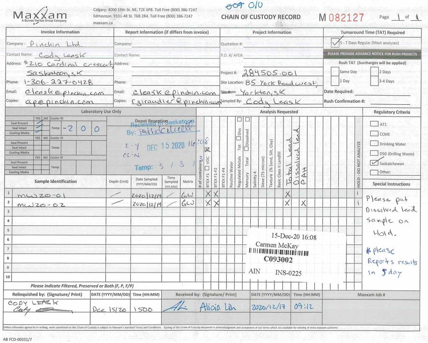
Selected soil and groundwater were delivered to Bureau Veritas Laboratories (BV Labs) in Calgary,
Alberta for analysis. BV Labs is an independent laboratory accredited by the Standards Council of
Canada and the Canadian Association for Laboratory Accreditation. Formal chain of custody records of
the sample submissions were maintained between Pinchin and BV Labs.
2.5 QA/QC Protocols
Various quality assurance/quality control (QA/QC) protocols were followed during the Phase II ESA to
ensure that representative samples were obtained and that representative analytical data was reported by
the laboratory.
Field QA/QC protocols that were employed by Pinchin included the following:
• Care was exercised not to obtain soil samples that were in direct contact with the drilling
equipment or that had been smeared along the edge of the borehole;
• Soil and groundwater samples were placed in laboratory-supplied containers with
preservatives added where required;
• The monitoring wells were developed, when possible, following installation. Dedicated
purging and sampling equipment was used for monitoring well development and
sampling to minimize the potential for cross-contamination;
• Soil and groundwater samples were placed in ice chilled coolers ice immediately upon
collection, with appropriate sample temperatures maintained prior to submission to the
laboratory;
• Dedicated and disposable nitrile gloves were used for sample handling;
• Non-dedicated monitoring and sampling equipment (e.g. interface probe, putty knife, etc.)
was cleaned before initial use and between uses to minimize the potential for cross-
contamination by washing with an Alconox™/potable water mixture followed by a
deionized water rinse; and
• Sample collection and handling procedures were performed in general accordance with
Pinchin SOPs utilized for Phase II ESAs.
BV Labs’ internal laboratory QA/QC consisted of the analysis of laboratory duplicate, method blank,
matrix spike and spiked blank samples, an evaluation of relative percent difference calculations for
laboratory duplicate samples, and an evaluation of surrogate recoveries.
© 2021 Pinchin Ltd. Page 5 of 12Phase II Environmental Site Assessment January 8, 2021
85 York Road West, Yorkton, Saskatchewan Pinchin File: 284505.001
Alvarez & Marsal Canada Inc., in its capacity as Monitor of Contour Realty Inc.
2.6 Regulatory Criteria
Environmental matters pertaining to contaminated sites in Saskatchewan fall under the jurisdiction of the
Saskatchewan Ministry of Environment (MOE). Therefore, the Site is subject to the MOE Saskatchewan
Environmental Quality Standards, dated 2015 (SEQS). In order to assess sites in Saskatchewan, the
MOE utilizes tiered endpoints, which are intended to be protective of human health and the environment.
The Tier 1 SEQS represent the lowest criteria value for any given constituent of concern with all receptors
and exposure pathways applicable to the Site and surrounding land use taken into consideration.
Consequently, the generic Tier 1 SEQS are applicable for all sites.
The Tier 2 SEQS is specific to intended exposure scenarios and includes the exclusion of specific
receptors and exposure pathways deemed inapplicable to Site and surrounding land use while the Tier 3
SEQS includes risk assessment or the development of site-specific guidelines.
For landfill waste characterization purposes, analytical results were compared to the TDG. Although the
TDG has been repealed and amended, the waste characterization limits specific to the 2002 version of
the TDG remain in use for Saskatchewan-based disposal facilities in determining the acceptance of waste
soils.
A land use and exposure pathway assessment was completed for the Site in order to utilize the most
appropriate regulatory criteria. This assessment included an evaluation of land use for the Site and
surrounding properties, receptors at risk, exposure pathways and soil texture. The following table
summarizes the results of the land use assessment:
Background Information Description
Registered Owner Contour Realty Inc.
Site Description Civic Address: 85 York Road West, Yorkton, Saskatchewan.
Legal Land Location: Blk/Par Z-Plan 67Y09629 Ext 0, Lots 15 and 16-
Blk/Par 9-Plan 00Y00664 Ext 0.
Area: 4.6 hectares (11.37 acres).
On-site Infrastructure A large single-storey industrial building with a second-storey office
space.
Land Use and Zoning Industrial.
Surrounding Land Use North – Railway line/spur lines and vacant land followed by light
(within 30 metres of all industrial development.
property lines of Site) South – York Road West followed by residential development.
West – Industrial Avenue followed by light industrial development.
East – Vacant industrial.
© 2021 Pinchin Ltd. Page 6 of 12Phase II Environmental Site Assessment January 8, 2021
85 York Road West, Yorkton, Saskatchewan Pinchin File: 284505.001
Alvarez & Marsal Canada Inc., in its capacity as Monitor of Contour Realty Inc.
Background Information Description
Subsurface Materials PSA analysis on two soil samples from the Site indicated that the soil
profile at the Site is predominantly fine-grained.
Surface Water Not applicable: The nearest surface water body is a large pond located
approximately 900 metres southwest of the Site. As there are no surface
water bodies located within 500 metres of the Site, the freshwater
aquatic life exposure pathway can be excluded.
Groundwater Not applicable: According to the Water Security Agency’s (WSA) online
database, there are no groundwater wells used for domestic potable use
within 500 m of the Site. In addition, the Site and surrounding properties
are located within city limits with potable water supplied by the City of
Yorkton via the municipal water service. A water well registered for
“domestic withdrawal” is located approximately 450 m west of the Site;
however, based on a telephone conservation with an employee at the
commercial property (McMunn & Yates Building Supplies) where the
water well is located, groundwater from the well is not used for domestic
uses, rather the well is used to lower the water level in a nearby dugout
and the surrounding groundwater table to mitigate surficial wet/soft soil
conditions on the property. The recovered groundwater is transferred for
discharge into the municipal sewer service. The WSA database search
also provided record of a water test hole that was not completed as a
well. Copies of the water well reports are included in Appendix V.
Vapour Inhalation Potential Applicable: Potential vapour migration through potential future building
slabs.
Ecological Soil Contact Applicable: In the event of excavation activities on-Site and potential off-
Site migration of soil and/or dust.
Soil Ingestion Applicable: In the event of excavation activities on-Site.
Dermal Contact Applicable: In the event of excavation activities on-Site.
Off-Site Migration Potential Applicable: Impacts appear to have migrated on-Site from the
neighboring property to the east.
Other Environmental Not applicable.
Considerations
Future Land Use Unchanged based on zoning.
Two soil samples collected from different borehole locations and depths of 3.81 and 5.33 mbgs were
submitted for PSA. The PSA results indicated that between 43% and 1.1% of the soil by weight was
retained on a 75 micron sieve, indicating the soil profile encountered on-Site was predominantly fine-
grained.
© 2021 Pinchin Ltd. Page 7 of 12Phase II Environmental Site Assessment January 8, 2021
85 York Road West, Yorkton, Saskatchewan Pinchin File: 284505.001
Alvarez & Marsal Canada Inc., in its capacity as Monitor of Contour Realty Inc.
Soil and groundwater at the Site was evaluated from a Tier 2 SEQS perspective, where each receptor
and exposure pathway was evaluated to determine their applicability/inapplicability to the Site and off-Site
property. As there are no water bodies or suspected domestic/municipal water wells within 500 m of the
Site, the Site and surrounding area are within the municipal boundaries of Yorkton and are supplied with
treated drinking water supplied by the municipal water service, the freshwater aquatic life and potable
groundwater exposure pathways were determined to be inapplicable to the Site.
Based on the Site and surrounding land use, proximity to water bodies, nearby water well use and
underlying fine-grained soil profile, the soil and groundwater quality at the Site was compared to the Tier
2 SEQS, specifically those standards for industrial land use and a fine-grained soil profile, with freshwater
aquatic life and potable groundwater excluded from consideration as applicable exposure pathways
(hereafter referred to as the Tier 2 SEQS).
3.0 RESULTS
3.1 Site Geology and Hydrogeology
Based on the soil samples recovered during the borehole drilling program, the soil profile at the drilling
locations generally consists of topsoil to depths of approximately 0.38 and 0.46 mbgs, followed by native
silt, clay, silty clay and silty clay till that extended to the maximum borehole completion depth of 6.10
mbgs. Wet soil conditions were generally observed between 1.8 and 4.6 mbgs.
A detailed description of the soil profile encountered during borehole advancement is documented in the
borehole logs located in Appendix II.
The water level information obtained during groundwater monitoring is presented in Table 1 and on the
borehole logs in Appendix II. On December 14, 2020, the depth to groundwater measured within the
monitoring wells ranged from 3.85 mbgs at monitoring well MW20-02 to 4.06 mbgs at monitoring well
MW20-01.
Pinchin notes that two previously installed monitoring wells installed by PMEL were observed to be
damaged and were not viable to collect groundwater samples from. The locations of the pre-existing
monitoring wells are shown in Figure 3.
A large pond is located approximately 900 m southwest of the Site. Based on this observation, Pinchin
infers that groundwater flow at the Site is towards the southwest.
3.2 Soil Headspace Vapour Concentrations
The vapour concentrations measured in the headspace of soil samples collected and field-screened
during the drilling investigation are presented on the borehole logs in Appendix II. The VOC derived
© 2021 Pinchin Ltd. Page 8 of 12Phase II Environmental Site Assessment January 8, 2021
85 York Road West, Yorkton, Saskatchewan Pinchin File: 284505.001
Alvarez & Marsal Canada Inc., in its capacity as Monitor of Contour Realty Inc.
concentration were all 0 parts per million by volume (ppmv). The PHC derived vapour concentrations
ranged from a minimum concentration of 25 ppmv in soil sample MW20-02 @ 5, collected from borehole
MW20-02 at a depth of 1.52 mbgs to a maximum concentration of 990 ppmv measured in soil sample
MW20-01 @ 12.5 collected from borehole MW20-01 at a depth of 3.81 mbgs.
3.3 Field Observations
No odours or staining were observed in the soil samples collected during the borehole drilling program.
No odours or evidence of NAPL were observed during groundwater monitoring and sampling.
3.4 Analytical
3.4.1 Soil
As indicated in Tables 3 through 5, the reported concentrations of BTEX, PHC F1 to F4, VOCs, PAHs
and total lead in the soil samples submitted for analysis were compliant with the Tier 2 SEQS.
The analytical results of the sample analyzed for landfill characterisation parameters are summarised in
Table 6. The parameters were below the applicable regulatory criteria and the soil cuttings were classified
as non-hazardous and suitable for transport and disposal at a Class II landfill facility.
The laboratory Certificate of Analysis for the soil samples is provided in Appendix IV.
3.4.2 Groundwater
As indicated in Tables 7 through 9, the reported concentrations of BTEX, PHC F1 and F2, VOCs, PAHs
and total lead in the groundwater samples submitted for analysis were compliant with the Tier 2 SEQS.
It should be noted that benzene and/or toluene concentrations in the groundwater samples submitted for
laboratory analysis exceeded the MOE Discharge and Discovery Reporting Standards, dated October 1,
2017 (DDRS) and as stated in the DDRS, any concentrations exceeding these limits will need to be
reported to the MOE.
The laboratory Certificate of Analysis for the groundwater samples is provided in Appendix IV.
4.0 FINDINGS AND CONCLUSIONS
Based on the work completed, the following is a summary of the activities and findings of this Phase II
ESA:
• Pinchin retained Maple Leaf Drilling Ltd. to advance two boreholes (MW20-01 and
MW20-02) at the Site on December 10, 2020. The boreholes were advanced to a
© 2021 Pinchin Ltd. Page 9 of 12Phase II Environmental Site Assessment January 8, 2021
85 York Road West, Yorkton, Saskatchewan Pinchin File: 284505.001
Alvarez & Marsal Canada Inc., in its capacity as Monitor of Contour Realty Inc.
maximum depth of 6.10 mbgs using a track-mounted drill rig. Both of the boreholes were
instrumented with monitoring wells to enable groundwater monitoring and sampling.
• The soil profile at the drilling locations generally consists of topsoil to depths of
approximately 0.38 and 0.46 mbgs, followed by native silt, clay, silty clay and silty clay till
that extended to the maximum borehole completion depth of 6.10 mbgs. Wet soil
conditions were generally observed between 1.8 and 4.6 mbgs.
• On December 14, 2020, the depth to groundwater measured within the monitoring wells
ranged from 3.85 mbgs at monitoring well MW20-02 to 4.06 mbgs at monitoring well
MW20-01. A large pond is located approximately 900 m southwest of the Site. Based on
this observation, Pinchin infers that groundwater flow at the Site is towards the
southwest.
• The “worst case” soil samples collected from each borehole were submitted for laboratory
analysis BTEX, PHC F1 to F4, VOCs, PAHs and/or total lead. Groundwater samples
collected from the newly installed monitoring wells were submitted for laboratory analysis
of BTEX, PHC F1 and F2, VOCs, PAHs and/or total lead.
• Based on the Site and surrounding land use, proximity to water bodies, nearby water well
use and underlying fine-grained soil profile, the soil and groundwater quality at the Site
was compared to the Tier 2 SEQS, specifically those standards for industrial land use
and a fine-grained soil profile, with freshwater aquatic life and potable groundwater
excluded from consideration as applicable exposure pathways (hereafter referred to as
the Tier 2 SEQS).
• The reported concentrations of BTEX, PHC F1 to F4, VOCs, PAHs and total lead in the
soil samples submitted for analysis were all compliant with the Tier 2 SEQS. The
reported concentrations of BTEX, PHC F1 and F2, VOCs, PAHs and total lead in the
groundwater samples submitted for analysis were also found to be compliant with the
Tier 2 SEQS.
Based on the findings of this Phase II ESA, it is Pinchin’s opinion that no further subsurface investigation
is required for the Site in relation to the findings of the previous investigations at this time.
It should be noted that benzene and/or toluene concentrations in the groundwater samples submitted for
laboratory analysis exceeded the MOE DDRS and as stated in the DDRS, any concentrations exceeding
these limits will need to be reported to the MOE.
© 2021 Pinchin Ltd. Page 10 of 12Phase II Environmental Site Assessment January 8, 2021
85 York Road West, Yorkton, Saskatchewan Pinchin File: 284505.001
Alvarez & Marsal Canada Inc., in its capacity as Monitor of Contour Realty Inc.
Pinchin will submit a historical discovery report to the MOE under separate cover. Pinchin recommends
that the adjacent property owner to the east be notified of the MOE DDRS exceedances which appear to
have resulted from the former fueling station that was located on this property.
5.0 TERMS AND LIMITATIONS
This Phase II ESA was performed for Alvarez & Marsal Canada Inc., in its capacity as Monitor of
101098672 Saskatchewan Ltd., Morris Industries Lt., Morris Sales and Service Ltd., Contour Realty Inc.,
and Morris Industries (US) Inc., and not its personal or corporate capacity (Client) in order to investigate
potential environmental impacts at 85 York Road West, in Yorkton, Saskatchewan (Site). The term
recognized environmental condition means the presence or likely presence of any hazardous substance
on a property under conditions that indicate an existing release, past release, or a material threat of a
release of a hazardous substance into structures on the property or into the ground, groundwater, or
surface water of the property. This Phase II ESA does not quantify the extent of the current and/or
recognized environmental condition or the cost of any remediation.
Conclusions derived are specific to the immediate area of study and cannot be extrapolated extensively
away from sample locations. Samples have been analyzed for a limited number of contaminants that are
expected to be present at the Site, and the absence of information relating to a specific contaminant does
not indicate that it is not present.
No environmental site assessment can wholly eliminate uncertainty regarding the potential for recognized
environmental conditions on a property. Performance of this Phase II ESA to the standards established
by Pinchin is intended to reduce, but not eliminate, uncertainty regarding the potential for recognized
environmental conditions on the Site and recognizes reasonable limits on time and cost.
This Phase II ESA was performed in general compliance with currently acceptable practices for
environmental site investigations, and specific Client requests, as applicable to this Site. The scope of
work completed by Pinchin, as part of this Phase II ESA, is not sufficient (in and of itself) to meet the
provincial requirements for a Phase II ESA. If the report is expected to be sent to the MOE, or is sent to
the MOE through any other means, further consultation and/or work will be required.
This report was prepared for the exclusive use of the Client, subject to the terms, conditions and
limitations contained within the duly authorized proposal for this project. Any use which a third party
makes of this report, or any reliance on or decisions to be made based on it, is the sole responsibility of
such third parties. Pinchin accepts no responsibility for damages suffered by any third party as a result of
decisions made or actions conducted.
© 2021 Pinchin Ltd. Page 11 of 12Phase II Environmental Site Assessment January 8, 2021
85 York Road West, Yorkton, Saskatchewan Pinchin File: 284505.001
Alvarez & Marsal Canada Inc., in its capacity as Monitor of Contour Realty Inc.
If additional parties require reliance on this report, written authorization from Pinchin will be required.
Pinchin disclaims responsibility of consequential financial effects on transactions or property values, or
requirements for follow-up actions and costs. No other warranties are implied or expressed. Furthermore,
this report should not be construed as legal advice. Pinchin will not provide results or information to any
party unless disclosure by Pinchin is required by law.
Pinchin makes no other representations whatsoever, including those concerning the legal significance of
its findings, or as to other legal matters touched on in this report, including, but not limited to, ownership
of any property, or the application of any law to the facts set forth herein. With respect to regulatory
compliance issues, regulatory statutes are subject to interpretation and these interpretations may change
over time.
\\fsrmd\job\284000s\0284505.000 Alvarez&Marsal;85YorkRd,Yorkton;EDR;PhI\0284505.001 Alvarez&Marsal;85YorkRd,Yorkton;EDR,PhII\Deliverables\284505.001 Phase II
ESA Report 85 York Rd West Yorkton SK_A&M_January 8, 2021.docx
Template: Master Report for Phase II ESA - Stage 2 PSI, EDR, August 20, 2020
© 2021 Pinchin Ltd. Page 12 of 12APPENDIX I Figures
´

                                               0     1
                                                     00       2
                                                              00   3
                                                                   00   4
                                                                        00   5
                                                                             00   6
                                                                                  00   7
                                                                                       00   8
                                                                                            00

                                                                        m
P
R O
  JECTN
      AME
        :
                                  P
                                  H A
                                    SEIIE
                                        N V
                                          IRON
                                             M E
                                               N T
                                                 A LS
                                                    ITEA
                                                       SSE
                                                         SSME
                                                            N T
C
LIE
  N TN
     AME
       :
                                         ALVAREZ & MARSAL CANADA INC.
P
R O
  JECTL
      O C
        ATIO
           N:
                                8
                                5YOR
                                   KROA
                                      DWE
                                        ST,Y
                                           O R
                                             KTON
                                                ,SA
                                                  SKA
                                                    TCH
                                                      EWA
                                                        N
F
IGU
  REN
    AME
      :                                                                             F
                                                                                    IGU
                                                                                      REN
                                                                                        UMB
                                                                                          ER
                                                    K
                                                    EYM
                                                      AP
P
R O
  JECTN
      UMB
        ER:     S
                C A
                  LE:           D
                                RAWNB
                                    Y:             R
                                                   EVIE
                                                      W E
                                                        DBY
                                                          :         D
                                                                    ATE:                       1
    2
    845
      05.0
         01             1
                        :20
                          ,00
                            0            E
                                         K                C
                                                          L             J
                                                                        A N
                                                                          UARY2
                                                                              021
N
LEGEND
SITE BOUNDARY
SITE BUILDING
MONITORING WELL
AREA OF POTENTIAL
ENVIRONMENTAL CONCERN (APEC)
LIGHT
INDUSTRIAL RAILWAY LINE
INDUSTRIAL AVENUE
MW20-01
MW20-02
OLD
FUELING
AREA
VACANT
INDUSTRIAL
LIGHT
INDUSTRIAL
LEGEND IS COLOUR DEPENDENT
NON-COLOUR COPIES SHOULD NOT BE
USED FOR INTERPRETATION
PROJECT NAME:
PHASE II ENVIRONMENTAL
SITE ASSESSMENT
CLIENT NAME:
YORK ROAD WEST YORK ROAD WEST ALVAREZ & MARSAL
CANADA INC.
PROJECT LOCATION:
85 YORK ROAD WEST
YORKTON, SASKATCHEWAN
FIGURE NAME:
SITE PLAN WITH NEW
RES RES MONITORING WELL LOCATIONS
PROJECT NUMBER: SCALE:
284505.001 AS SHOWN
DRAWN BY: REVIEWED BY:
INFERRED E.KOURNOSSOV C.LEASK
0 20 40 80m
GROUNDWATER DATE: FIGURE NUMBER:
©Google Maps contributors FLOW DIRECTION
JANUARY 2021 2N
LEGEND
SITE BOUNDARY
DAMAGED MONITORING WELL
MONITORING WELL
AREA OF POTENTIAL
ENVIRONMENTAL CONCERN (APEC)
RAILWAY LINE
MW20-01
MW20-02
OLD FUELING
AREA
VACANT
INDUSTRIAL
LEGEND IS COLOUR DEPENDENT
NON-COLOUR COPIES SHOULD NOT BE
USED FOR INTERPRETATION
PROJECT NAME:
PHASE II ENVIRONMENTAL
SITE ASSESSMENT
CLIENT NAME:
ALVAREZ & MARSAL
CANADA INC.
PROJECT LOCATION:
85 YORK ROAD WEST
YORKTON, SASKATCHEWAN
FIGURE NAME:
BOREHOLE AND MONITORING
WELL LOCATION PLAN
PROJECT NUMBER: SCALE:
284505.001 AS SHOWN
DRAWN BY: REVIEWED BY:
E.KOURNOSSOV C.LEASK
0 5 10 20m
DATE: FIGURE NUMBER:
©Google Maps contributors JANUARY 2021 3APPENDIX II Borehole Logs
Log of Borehole: MW20-01
Proj ect #: 284505.001 Logged By: Cody Leask
Proj ect: Phase II Environmental Site Assessment
Client: Alvarez & Marsal Canada Inc.
Location: 85 York Road West, Yorkton, Saskatchewan
Drill Date: December 10, 2020
SUBSURFACE PROFILE SAMPLE
Concentration
Recovery (%)
Well Details
Soil Vapour
Laboratory
Sample ID
Monitoring
Depth (m)
Measured
Description
CGI/PID
Analysis
Symbol
Depth
(ppm)
ft m
Protective Stick-Up
Silica Sand
Ground Surface 0.00
0 0
Topsoil
1 Light Black TOPSOIL, some organics, 0.46
2 moist, firm
100 35/0
3 Silt
Bentonite
1
4 Brown SILT, trace clay, moist, firm
@ 1.15 mbgs - some clay, very moist,
Riser
5 soft 100 30/0
1.83
6
2 Clay
7 Brown CLAY, some silt, trace coal, 100 40/0
Silica Sand
8 slightly wet, soft
2.74
9
Silty Clay
10 3 100 30/0
Brown SILTY CLAY (TILL) trace coal,
11 oxides and pebbles, slightly wet, firm
12 @ 3.05 mbgs - moist BTEX, PHC F1
MW20-01
Screen
100 990/0 to F4, VOCs
13 4 @ 12.5
@ 3.96 to 4.57 mbgs - sand and and Total Lead
14 pebble lenses, wet
Water Level
15 100 35/0
@ 4.57 mbgs - grey, hard
16
5
17
100 540/0
18
Bentonite
19
6 6.10 100 310/0
20
End of Borehole
21
22 Soil vapour concentrations measured using
a RKI Eagle 2 equipped with a
23 7 photoionization detector (PID) and a
combustible gas indicator (CGI).
24
Contractor: Maple Leaf Drilling Grade Elevation: N/A
Drilling Method: Solid Stem Top of Casing Elevation: N/A
Well Casing Size: 5.08 cm Sheet: 1 of 1Log of Borehole: MW20-02
Proj ect #: 284505.001 Logged By: Cody Leask
Proj ect: Phase II Environmental Site Assessment
Client: Alvarez & Marsal Canada Inc.
Location: 85 York Road West, Yorkton, Saskatchewan
Drill Date: December 10, 2020
SUBSURFACE PROFILE SAMPLE
Concentration
Recovery (%)
Well Details
Soil Vapour
Laboratory
Sample ID
Monitoring
Depth (m)
Measured
Description
CGI/PID
Analysis
Symbol
Depth
(ppm)
ft m
Protective Stick-Up
Silica Sand
Ground Surface 0.00
0 0
TopSoil 0.38
1 Light Black TOPSOIL, some organics,
2 moist, firm
100 45/0
3 1 Silt
Bentonite
4 Brown SILT, trace clay, coal and
5 oxides, grey mottling, moist, firm 100 25/0
@ 1.14 mbgs - some clay, trace
Riser
6
2 pebbles
7 @ 1.67 mbgs - no trace pebbles 100 115/0
8 @ 2.43 mbgs - very moist, soft
9
Silica Sand
Screen
10 3 100 60/0
11
3.66
12
Silty Clay 100 370/0
13 4
Water Level
Brown SILTY CLAY, trace sand, coal
14 and pebbles, very moist, soft
15 @ 3.96 mbgs - sand lenses, wet 100 145/0
@ 4.42 mbgs - light brown, trace 4.88
16 BTEX, PHC F1
5 oxides, very moist, firm, no trace coal
17 and pebbles MW20-02 to F4, PAHs,
100 480/0
18 @ 17.5 VOCs and Total
Silty Clay Lead
19 Brown SILTY CLAY, grey mottling,
6 6.10 100 130/0
Bentonite
20 moist, stiff
21 @ 5.48 mbgs - hard
22 End of Borehole
23 7
Soil vapour concentrations measured using
24 a RKI Eagle 2 equipped with a
25 photoionization detector (PID) and a
combustible gas indicator (CGI).
26 8
Contractor: Maple Leaf Drilling Grade Elevation: N/A
Drilling Method: Solid Stem Top of Casing Elevation: N/A
Well Casing Size: 5.08 cm Sheet: 1 of 1APPENDIX III Summary Tables
TABLE 1
                           MONITORING WELL CONSTRUCTION AND GROUNDWATER MONITORING DETAILS
                                                 Alvarez & Marsal Canada Inc.
                                          85 York Road West, Yorkton, Saskatchewan
  0.848
                                                                                                                   Distance
                                                                                                                   Between
                                             Date Groundwater           NAPL Level             Water Level          Ground      Total Depth                  Depth to
                                                Monitoring             Measurement            Measurement         Surface and   of Well from   Length of   Groundwater
                        Date Drilled            Completed                from TOC               from TOC             TOC a          TOC         Screen     Below-Grade
   Well Number        (dd-mmm-yyyy)           (dd-mmm-yyyy)                 (m)                    (m)                (m)           (m)           (m)        (mbgs)

         MW20-01         10-Dec-20                14-Dec-20                   ND                    5.08             -1.02         5.870         3.05          4.06
         MW20-02         10-Dec-20                14-Dec-20                   ND                    4.77             -0.92         6.045         3.05          3.85

Notes:
             NAPL   Non-Aqueous Phase Liquid
             TOC    Top of casing
              m     Metres
             mbgs   Metres below ground surface
               a    Positive number indicate a TOC below-grade, and negative numbers indicate a TOC above-grade
              ND    Not detected

                                                                                                                                                   Pinchin File: 284505.001
TABLE 2
SAMPLES SUBMITTED FOR LABORATORY ANALYSIS AND PARTICLE SIZE ANALYSIS
Alvarez & Marsal Canada Inc.
85 York Road West, Yorkton, Saskatchewan
Samples Parameters
Class II Landfill
PHCs (F1-F4) &
PHCs (F1-F2) &
Sieve - #200
(>0.075mm)
Sample
GROUNDWATER SAMPLES
Grain Size
Total Lead
Total Lead
Grain Size
Borehole / Depth
Analysis
SOIL TEXTURE (PSA)
Monitoring Range
VOCs
VOCs
BTEX
BTEX
PAHs
PAHs
SOIL SAMPLES
Well ID Sample ID (mbgs)
MW20-01 NA ● ● ●
MW20-01
MW20-01 @ 12.5 3.81 ● ● ● ● ● 43 F
MW20-02 NA ● ● ● ●
MW20-02
MW20-02 @ 17.5 5.33 ● ● ● ● 1.1 F
N/A Landfill Composite ●
Notes:
● Sample was submitted for laboratory analysis of the indicated parameter
PHCs (F1-F4) Petroleum hydrocarbon fractions: F1 (C6 – C10), F2 (C>10 – C16), F3 (C>16 – C34), and F4 (C>34)
PHCs (F1-F2) Petroleum hydrocarbon fractions: F1 (C6 – C10), F2 (C>10 – C16)
BTEX Benzene, Toluene, Ethylbenzene, and Xylenes
VOCs Volatile Organic Compounds
PAHs Polycyclic Aromatic Hydrocarbons
mbgs Metres below ground surface
NA Not applicable
Pinchin File: 284505.001TABLE 3
BTEX, PETROLEUM HYDROCARBON AND TOTAL LEAD ANALYSIS FOR SOIL
Alvarez & Marsal Canada ULC
85 York Road West, Saskatoon, Saskatchewan
Sample Designation
Sample Collection Date (dd-mm-yyyy)
Sample Depth (mbgs) a
Parameter Tier 2 SEQS a DDRS
MW20-01 @ 12.5 MW20-02 @ 17.5
10-Dec-20 10-Dec-20
3.81 5.33
Benzene 11 0.046TABLE 4
VOLATILE ORGANIC COMPOUND ANALYSIS FOR SOIL
Alvarez & Marsal Canada Inc.
85 York Road West, Yorkton, Saskatchewan
Sample Designation
Sample Collection Date (dd/mmm/yy)
Parameter Tier 2 SEQS DDRS Sample Depth (mbgs)
MW20-01 @ 12.5 MW20-02 @ 17.5
10-Dec-20 10-Dec-20
3.81 5.33
Bromodichloromethane NS NSTABLE 5
POLYCYCLIC AROMATIC HYDROCARBON ANALYSIS FOR SOIL
Alvarez & Marsal Canada Inc.
85 York Road West, Yorkton, Saskatchewan
Sample Designation
Sample Collection Date (dd-mmm-yy)
Sample Depth (mbgs)
Parameter Tier 2 SEQS DDRS
MW20-01 @ 12.5
10-Dec-20
3.81
NON-CARCINOGENIC PAHs
Acenaphthene 75000 NSTABLE 6
LANDFILL CHARACTERIZATION FOR SOIL
Alvarez & Marsal Canada Inc.
85 York Road West, Yorkton, Saskatchewan
Sample Designation
Sample Collection Date (dd-mmm-yy)
Parameter Criteria a
Landfill
10-Dec-20
LEACHABLE METALS
Antimony NSTABLE 7
BTEX, PETROLEUM HYDROCARBON AND TOTAL LEAD ANALYSIS FOR GROUNDWATER
Alvarez & Marsal Canada Inc.
85 York Road West, Yorkton, Saskatchewan
Sample Designation
Sample Collection Date (dd-mmm-yy)
Parameter Tier 2 SEQS DDRS
MW20-01 MW20-02
14-Dec-20 14-Dec-20
Benzene 19 0.005 0.019TABLE 8
VOLATILE ORGANIC COMPOUND ANALYSIS FOR GROUNDWATER
Alvarez & Marsal Canada Inc.
85 York Road West, Yorkton, Saskatchewan
Sample Designation
Parameter Tier 2 SEQS DDRS Sample Collection Date (dd/mmm/yy)
MW20-01 MW20-02
14-Dec-20 14-Dec-20
Total Trihalomethanes NS NSTABLE 9
POLYCYCLIC AROMATIC HYDROCARBON ANALYSIS FOR GROUNDWATER
Alvarez & Marsal Canada Inc.
85 York Road West, Yorkton, Saskatchewan
Sample Designation
Sample Collection Date (dd-mmm-yy)
Parameter Tier 2 SEQS DDRS
MW20-02
14-Dec-20
NON-CARCINOGENIC PAH
Acenaphthene NS NSAPPENDIX IV Laboratory Certificates of Analysis
Your Project #: 284505.001
                                                                                                                     Site Location: 85 YORK ROAD WEST, YORKTON, SK
                                                                                                                     Your C.O.C. #: M036933
                  Attention: CODY LEASK
                  Pinchin Ltd.
                  210 CARDINAL CRESCENT
                  SASKATOON, SK
                  CANADA       S7L 6H8
                                                                                                                                                             Report Date: 2020/12/22
                                                                                                                                                                  Report #: R2970232
                                                                                                                                                                     Version: 1 - Final

                                                                      CERTIFICATE OF ANALYSIS
BV LABS JOB #: C092325
Received: 2020/12/14, 10:14
Sample Matrix: Soil
# Samples Received: 3
                                                                                               Date               Date
Analyses                                                                        Quantity       Extracted          Analyzed         Laboratory Method      Analytical Method
BTEX/F1 by HS GC/MS/FID (MeOH extract) (1)                                         3           N/A                2020/12/16       AB SOP-00039           CCME CWS/EPA 8260d m
F1-BTEX                                                                            3           N/A                2020/12/17                              Auto Calc
BTEX in Leachates by HS GC/MS/FID (2)                                              1           2020/12/18         2020/12/19       AB SOP-00039           EPA 8260d m
CCME Hydrocarbons (F2-F4 in soil) (3)                                              2           2020/12/17         2020/12/17       AB SOP-00036           CCME PHC-CWS m
Flash Point                                                                        1           N/A                2020/12/16       AB SOP-00062           ASTM D3828-16a/ A m
ICPMS Metals on TCLP Leachate (2)                                                  1           2020/12/17         2020/12/18       AB SOP-00043           EPA 6020b R2 m
Moisture                                                                           3           N/A                2020/12/17       AB SOP-00002           CCME PHC-CWS m
Index of Additive Cancer Risk (4)                                                  1           N/A                2020/12/18                              Auto Calc
Benzo[a]pyrene Equivalency                                                         1           N/A                2020/12/18                              Auto Calc
PAH in Soil by GC/MS                                                               1           2020/12/17         2020/12/18       AB SOP-00036 / AB SOP- EPA 3540C/8270E m
                                                                                                                                   00003
Free Liquid (Paint filter)                                                            1        N/A        2020/12/16               AB SOP-00047           EPA 9095B R2 m
Lead                                                                                  2        2020/12/21 2020/12/21               AB SOP-00001 / AB SOP- EPA 6020b R2 m
                                                                                                                                   00043
TCLP pH Measurements                                                                  1        2020/12/17 2020/12/18               AB SOP-00006           SM 23 4500 H+B m
pH @25C (1:1 extract, solid waste)                                                    1        2020/12/18 2020/12/18               AB SOP-00033 / AB SOP- SM 23 4500 H+B m
                                                                                                                                   00006
Particle Size by Sieve (75 micron)                                                    2        N/A                2020/12/18                              Auto Calc
Particle Size by Sieve                                                                2        N/A                2020/12/18       AB SOP-00022           ASTM D6913-17 m
VOCs in Soil by HS GC/MS (Std List) (1)                                               2        N/A                2020/12/16       AB SOP-00056           EPA 5021a/8260d m

Remarks:
Bureau Veritas Laboratories are accredited to ISO/IEC 17025 for specific parameters on scopes of accreditation. Unless otherwise noted, procedures used
by BV Labs are based upon recognized Provincial, Federal or US method compendia such as CCME, MELCC, EPA, APHA.

All work recorded herein has been done in accordance with procedures and practices ordinarily exercised by professionals in BV Labs profession using
accepted testing methodologies, quality assurance and quality control procedures (except where otherwise agreed by the client and BV Labs in writing). All
data is in statistical control and has met quality control and method performance criteria unless otherwise noted. All method blanks are reported; unless
indicated otherwise, associated sample data are not blank corrected. Where applicable, unless otherwise noted, Measurement Uncertainty has not been
accounted for when stating conformity to the referenced standard.

BV Labs liability is limited to the actual cost of the requested analyses, unless otherwise agreed in writing. There is no other warranty expressed or implied.
BV Labs has been retained to provide analysis of samples provided by the Client using the testing methodology referenced in this report. Interpretation and
use of test results are the sole responsibility of the Client and are not within the scope of services provided by BV Labs, unless otherwise agreed in writing.

                                                                                          Page 1 of 24
                                      Bureau Veritas Laboratories Calgary: 2021 - 41st Avenue N.E. T2E 6P2   Telephone (403) 291-3077   Fax (403) 291-9468
Your Project #: 284505.001
Site Location: 85 YORK ROAD WEST, YORKTON, SK
Your C.O.C. #: M036933
Attention: CODY LEASK
Pinchin Ltd.
210 CARDINAL CRESCENT
SASKATOON, SK
CANADA S7L 6H8
Report Date: 2020/12/22
Report #: R2970232
Version: 1 - Final
CERTIFICATE OF ANALYSIS
BV LABS JOB #: C092325
Received: 2020/12/14, 10:14
BV Labs is not responsible for the accuracy or any data impacts, that result from the information provided by the customer or their agent.
Solid sample results, except biota, are based on dry weight unless otherwise indicated. Organic analyses are not recovery corrected except for isotope
dilution methods.
Results relate to samples tested. When sampling is not conducted by BV Labs, results relate to the supplied samples tested.
This Certificate shall not be reproduced except in full, without the written approval of the laboratory.
Reference Method suffix “m” indicates test methods incorporate validated modifications from specific reference methods to improve performance.
* RPDs calculated using raw data. The rounding of final results may result in the apparent difference.
(1) No lab extraction date is given for F1BTEX & VOC samples that are field preserved with methanol. Extraction date is date sampled unless otherwise stated.
(2) Samples were extracted as per EPA 1311 unless otherwise noted in the report.
(3) All CCME results met required criteria unless otherwise stated in the report. The CWS PHC methods employed by Bureau Veritas Laboratories conform to all prescribed elements
of the reference method and performance based elements have been validated. All modifications have been validated and proven equivalent following Alberta Environment’s
Interpretation of the Reference Method for the Canada-Wide Standard for Petroleum Hydrocarbons in Soil, Validation of Performance-Based Alternative Methods September 2003.
Documentation is available upon request. Modifications from Reference Method for the Canada-wide Standard for Petroleum Hydrocarbons in Soil-Tier 1 Method: F2/F3/F4 data
reported using validated cold solvent extraction instead of Soxhlet extraction.
(4) Index of Additive Cancer Risk, (C) denotes coarse, (F) denotes fine.
Encryption Key
Please direct all questions regarding this Certificate of Analysis to your Project Manager.
Carmen McKay, Key Account Specialist
Email: Carmen.MCKAY@bvlabs.com
Phone# (403)219-3683
====================================================================
This report has been generated and distributed using a secure automated process.
BV Labs has procedures in place to guard against improper use of the electronic signature and have the required "signatories", as per ISO/IEC 17025, signing the reports. For
Service Group specific validation please refer to the Validation Signature Page.
Total Cover Pages : 2
Page 2 of 24
Bureau Veritas Laboratories Calgary: 2021 - 41st Avenue N.E. T2E 6P2 Telephone (403) 291-3077 Fax (403) 291-9468You can also read