Republic of the Union of Myanmar Ministry of Transport and Communications Department of Meteorology and Hydrology
←
→
Page content transcription
If your browser does not render page correctly, please read the page content below
Republic of the Union of Myanmar
        Ministry of Transport and Communications
        Department of Meteorology and Hydrology

Joint Workshop on Strengthening Multi-Hazard Early Warning Systems and
                     Early Actions in Southeast Asia
                             Myanmar

                          Ms. Myo Myo Aye

      18th October to 20th February, 2020 ,Thailand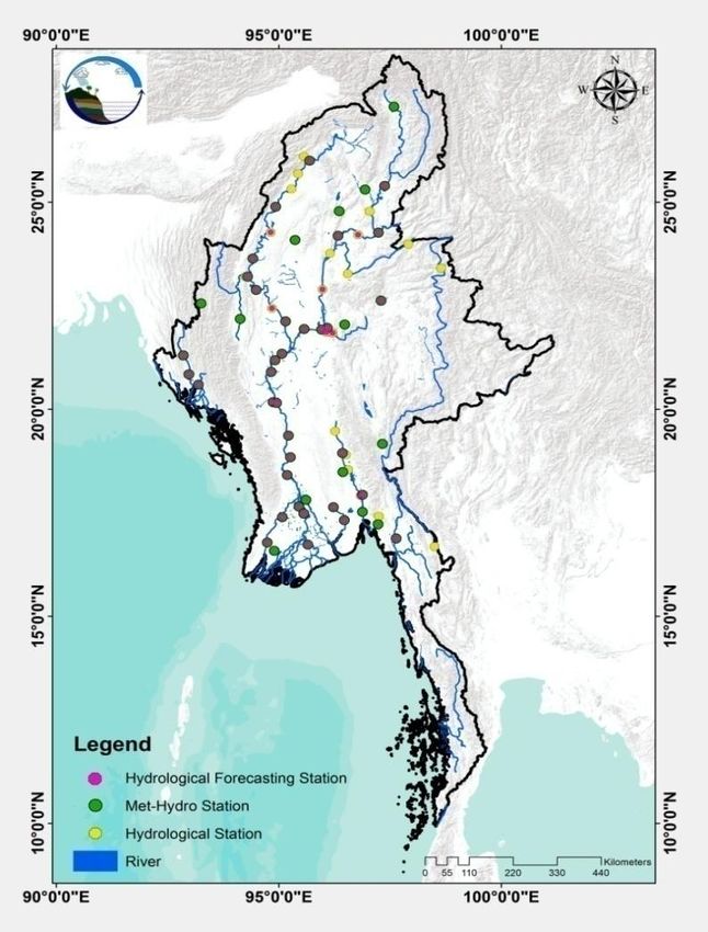
Outline

1. Background

2. Hazard /Riskmap and Assessment

3. Observation & monitoring network

4. ICT (data transmission, hub and processors)

5. Models and Forecasts

6. Requirements & Future Plans
Meteorological Hazards Calendar
  Hazards      Jan   Feb   Mar   Apr   May   Jun   Jul   Aug   Sep   Oct   Nov   Dec

  Cyclone
   High
Temperature
   Low
Temperature
  Drought
                                        1
  Squalls&
Thunderstorm

   Flood

 Heavy Rain
 Monsoon
 Depression
    Hail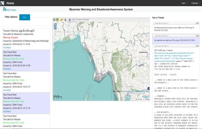
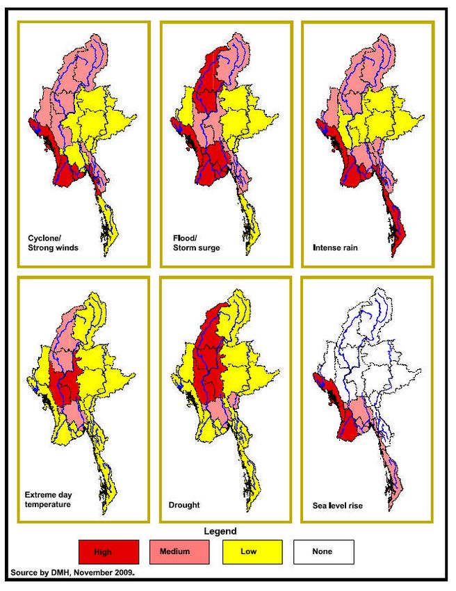
Vulnerability map or risk map of the disaster in Myanmar
Hydrological Hazard/Risk Maps and Assessments
▪ We develop the flood hazard maps with different return
periods for some city using different models such as
HEC RAS 1D, 2D Model and RRI
▪ the flood hazard maps have already developed with
different return periods for about more than 10 cities.
▪ We shared those maps to the water related disaster
management Departments and organizations.
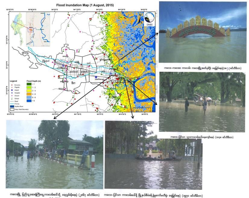
Flood Inundation Map (1 August 2015)
Flood Hazard Map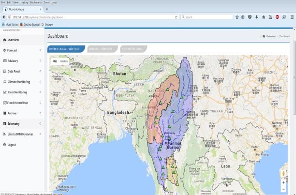
Skill Manpower of Daily Weather Forecasting and Long Range
                                 forecasting Division
                                    (Nay Pyi Taw)
                           DIRECTOR

                          Deputy Director
                                              Assistant Director
                                              (Weather Section)

  Climate Group           Daily Duty                                 (3) Shift Duty(24/7)

    (2)Forecasters           (1)Forecaster
                                                                        For each group
                                                                         (1)Forecaster
(1)Assistant Forecaster      (4) SO and JO                          (1)Assistant Forecaster
    (5) SO and JO                                                      (2-3) SO and JO

• Climate Modeling             • Management                    • Plotting

• Seasonal Forecast            • Meeting / Workshop            • Analysis of Weather chart

• Monthly Forecast                 Training                    • Weather forecasting

• 10 Days Forecast             • Data collection               • Sending Fax (dissemination)

• Research                     • Administration                • To issue Warning/News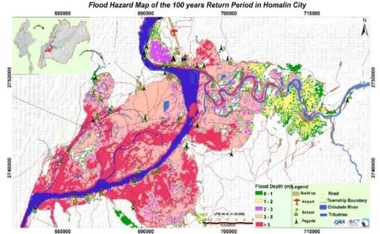
AWOS Meteorological Observation Network
                          •(51) WMO Register Stations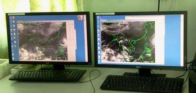
Hydrological Observation and Monitoring Network

76 Hydrological Monitoring Stations
                                      ▪ DMH only issue the daily water level forecasts for
                                         45 hydrological forecasting stations along 14 major
                                         rivers in Myanmar.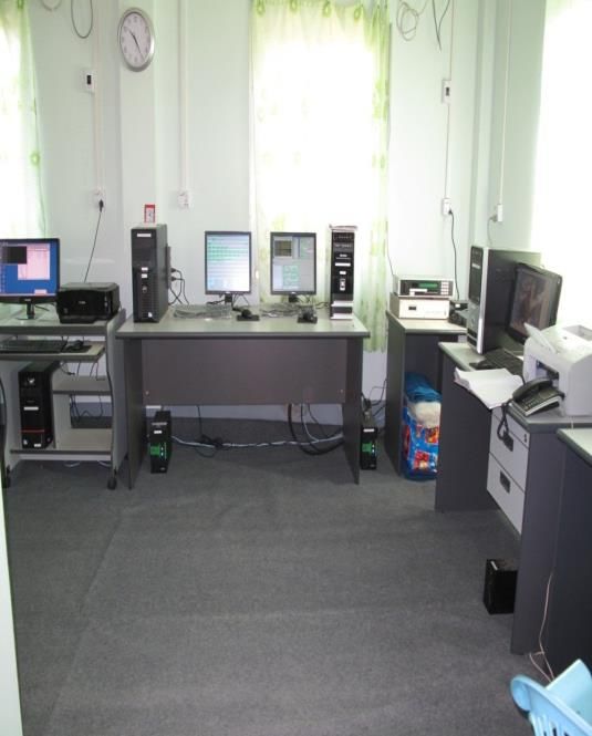
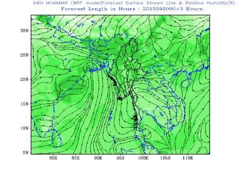
30km and 9 km

WRF Output
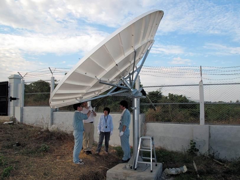
Installation of MTSAT and SATAID

     MTSAT/HRIT Direct                    MTSAT/HRIT Data Processing
     Receiving Antenna                    System in DMH, Nay Pyi Taw
   Installation of MTSAT and SATAID are started from 2010 December, donated
   by JICA.
•Upgrade- Evtery 10 minutes observations (Himawari-8 , 14th December, 2015)
Type of Forecast Time of Issuance Forecast Validity
7:00Am/12:00noom/2:00pm/
Daily Weather Forecast
4:00pm/7:00pm
Sea Route Forecast/
10:30 Am/1:30Pm 24 hours
Compound
As per request and weather
Special weather forecast Depend on duration
conditions
Cyclone/surge 24-36 Hr before -
Untimely Rainfall Weather disturbance.... -
Strong Wind Warning March (15)(31)/April(1) Pre Monsoon Period
significant day & night
If necessary(2 days ahead) -
temperature
Heavy Rainfall/
If necessary(2 days ahead) -
Scarcity Rainfall Warning
New Records
when new record occur.. -
(Rainfall/Max/Min)Bay of Bengal & Its Portions COLOUR CODING FOR
THE STORM
Doesn’t depend on storm ‘s intensity
(ie, whatever it is TD, TC or CS), it means
only for RISK of the storm.
I
N Bay
88. 5 °E
18. 5°N
II III • Whatever the storm is TC or CS , which is
WC BayEC Bay not expected to move towards Myanmar
13 °N
Stage 1: coast by the present.
VI
IV V Anda
• Whatever the storm is TC or CS, which is
93 °E
SW Bay SE Bayman
86 °E
leading to Myanmar coast by the present.
Sea Stage 2:
• Whatever the storm is TS or CS, which may
cross to Myanmar coast within next (12)hrs.
Stage 3:
• Whatever the storm is TS or CS, which is
Stage 4: crossing to Myanmar coast by the present.
• Whatever the storm is TS or CS, which has
crossed to Myanmar coast & free from
Stage 5: storm risk.Hydrological Forecasting System
▪ DMH have already developed the different hydrological models such as (HBV
Model, HEC HMS model and so on.
▪ However, DMH cannot apply this model to our flood forecasting system directly,
because of accuracy. Currently, we use this model for reference only, especially for
our forecaster.
▪ All models are still needed to improve the accuracy of model output.
Precipitation
forecast from
www.yr.no
HEC HMS Model for
Ayeyarwady and
Sittong River
basins
HBV Model for Chindwin
RiverEarly Warning Dissemination System
President
office
Myanmar Disaster
Preparedness www.dmh.gov.mm
Agency
Chief Ministries
States& Regions
Early
Warning
MSWRR
Television
Related
Ministries
Radio/ FM
Media
EOC Website/
newspaper
Call Center
Phone SSB Local DMH offices NGO
FaxHydrological Projects
1. Development and Implementation
Lack of
hydro-met
information
Need to
establish
Hydro-met
stationsRecent Activities •The installation of Meteorological (3)Radar System and (30)AWOS with Japan Gov. •UNESCAP- RIMES Project on reducing risks of tsunami, Drought, Capacity Building for NWP •Establishment of End to End Early Warning System for Natural Disaster (Connection between MRTV & DMH HQ with cable link ) •Modernization of Meteorological Observation System in Myanmar (KMA/KMI Grant Aid) (40 ASOS) •Immediate Response Mechanism (World Bank) (88-AWOS) •Project for Enhancing Capacity of Weather Observation, Forecasting and Warning in Myanmar (JICA) (Grant Aid) Three radar and (30 AWOS)
Current Activities and Ongoing Projects
•(Met.no) Norway Norwegian Meteorological Institute (Met.no)
Capacity Building
•Ayeyarwady Integrate River Basin Management (AIRBM) Component-2
Hydromet Observation and Information System

•Modernization (World Bank Loan) (AWOS 66) stations

•Wisdom project with JICA (training for 3 days and five days forecast using
guidance by using GPV data and GRADs, Radar Forecasting and Satellite
Forecasting)
•Staff gauge installation already finished at 41 stations according to the
Ayeyarwady Integrate River Basin Management (AIRBM) Component-2
•Flood hazard mapping for Ayeyarwady division using SOBEK 1D2D model
by collaborated with ADB and Climate Hazard Project Team
•Development and Implementation of Flash Flood Guidance System (FFGS)
and Trying to issue the Warning / Forecasts and develop the flood prone area
using FFGS and outputs (Ongoing project)
Future plans
1. To promote of Numerical weather Prediction System
2. To Substitute conventional instruments to advanced instruments.
3. To install modernize weather radars to cover the coastal regions.
4. To upgrade DMH’s Data collection and processing system with automation.
5. To enhance Climate Services, Application and Modeling Dense Meteorological
   observational networks
6. To extend Automatic Weather Station (AWS),Upper air observation facilities
   (Pilot balloon, wind, moisture, etc)
7. More instruments to observed radiation, evaporation, sun shine, ozone, upper
   air, wind and temperature
8. High gust anemometer for coastal station.
Thank you very much
You can also read