Rural land use in the Cairngorms National Park: conflict and resolution - National 4/5 and Higher Geography
←
→
Page content transcription
If your browser does not render page correctly, please read the page content below
Rural land use in the
Cairngorms National
Park: conflict and
resolution
National 4/5 and Higher Geography
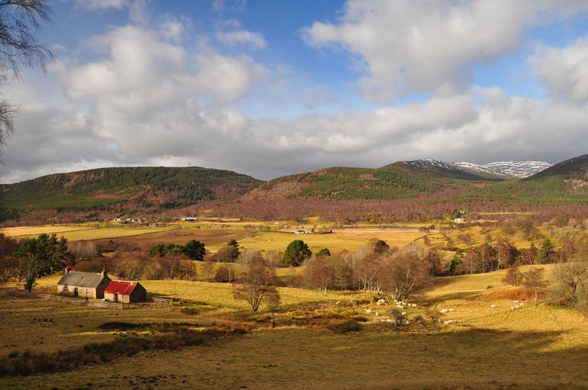
Dee Valley
Copyright Press and Journal
1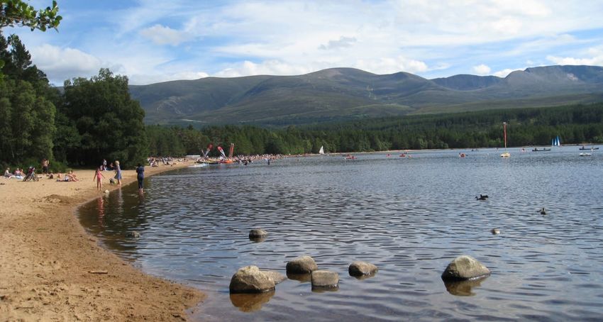
Contents
1. Introduction to this resource
2. Curriculum links: SQA Outcomes and Assessments Standards
3. Background to Cairngorms National Park
National Parks in Scotland
Cairngorms National Park
Cairngorms National Park Fact File
History of Scottish National Parks
Aims of Scottish National Parks
Cairngorms National Park Authority
4. Glaciated landscapes in the Cairngorms National Park
5. Land Use in the Cairngorms National Park
6. Conflict and resolution: case studies
Case Study 1: Deer and woodland expansion
Case Study 2: Dogs and capercaillie
Case Study 3: Anglers and other water users
Case Study 4: Housing development and conservation
Case Study 5: Hydropower schemes and landscape
Case Study 6: Funicular Railway and Cairngorm mountain
7. Other resources to support field visits to the Park
2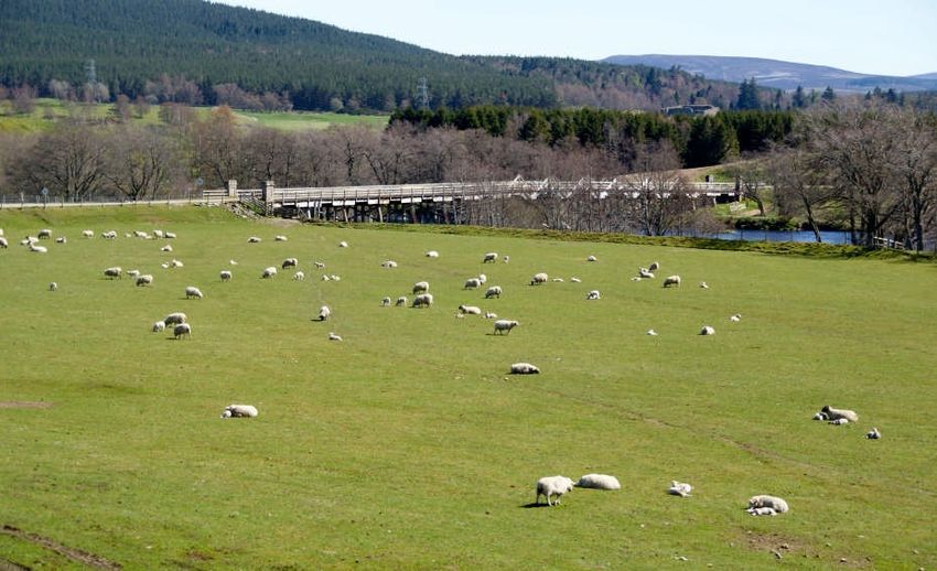
Copyright CNPA
      Loch Morlich

1. Introduction to this resource
This resource ‘Land use in the Cairngorms National Park: conflict and resolution’ has been
developed to support the Geography curriculum:

National 4/5 - Added value assignment
National 4/5 - Physical environments – land use conflict in a mountain environment
Higher - Case study on the Cairngorms National Park

It contains background information on the Cairngorms National Park, its special qualities, the
main land uses, and provides examples of land use conflict, highlighting the role of the National
Park Authority in mitigating conflicts.

Each case study provides additional references, web links and video clips to encourage further
reading and research, and makes suggestions for field visits to the National Park.

The final section highlights other resources available to support learning and visits to the
Cairngorms National Park.

The resource can be used by both educators and by students.

This resource has been developed by Cairngorms National Park Authority in
partnership with Education Scotland

For any queries about this resource please email learning@cairngorms.co.uk

March 2015 (revised October 2015)

                                                 3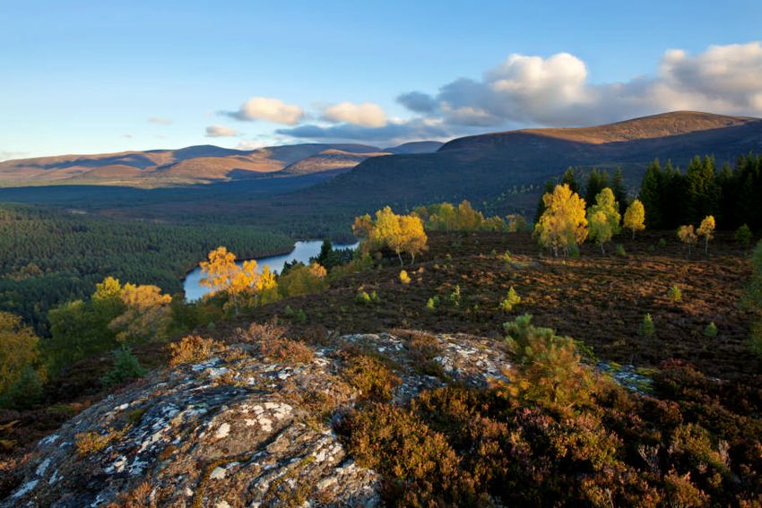
2. Curriculum Links
SQA Outcomes and Assessment Standards
National 4 Physical Environments
Outcome 2: Draw on straightforward knowledge and understanding of physical environments
and weather in the United Kingdom by:
2.1 Describing key features of one landscape type in the United Kingdom
2.2 Giving brief descriptions of the formation of one landscape type in the United Kingdom
2.3 Giving brief descriptions and brief explanations of factors affecting weather conditions and
weather systems in the United Kingdom
2.4 Giving brief descriptions of the possible land uses and brief explanations of a landscape
management issue for one landscape type in the United Kingdom
National 5 Physical Environments
Outcome 2: Draw on a detailed knowledge and understanding of physical environments and
weather in the United Kingdom by:
2.1 Describing, in detail, key features of one landscape type in the United Kingdom
2.2 Giving detailed explanations of the formation of one landscape type in the United Kingdom
2.3 Giving descriptions and detailed explanations of factors affecting weather conditions and
weather systems in the United Kingdom
2.4 Giving detailed descriptions of the possible land uses and detailed explanations of a
landscape management issue for one landscape type in the United Kingdom
Higher Physical Environments
Outcome 1: Use a range of mapping skills and techniques in physical environment contexts by:
1.1 Interpreting complex geographical information from at least two sources
1.2 Annotating a geographical source
1.3 Presenting complex geographical information
1.4 Analysing geographical information
Outcome2: Draw on and apply knowledge and understanding of the processes and interactions
at work within physical environments on a local, regional or global scale by:
2.1 Giving detailed descriptions and detailed explanations of a process/interaction at work in
physical landscapes
2.2 giving detailed descriptions and detailed explanations of the impact of weather systems and
climate on a physical environment
2.3 giving detailed descriptions and detailed explanations of a complex management issue in a
physical environment
At Higher, National Parks will fall into the “Lithosphere” unit;
Formation of erosional and depositional features in glaciated and coastal landscapes
Rural land use conflicts and their management related to an upland or coastal
environment within the developed world
It can be seen from the SQA information outlined above that a Case Study of a National Park is
an important aspect of the new qualifications in Geography. This unit of work will concentrate
on land use rather than the actual formation of the landscape.
4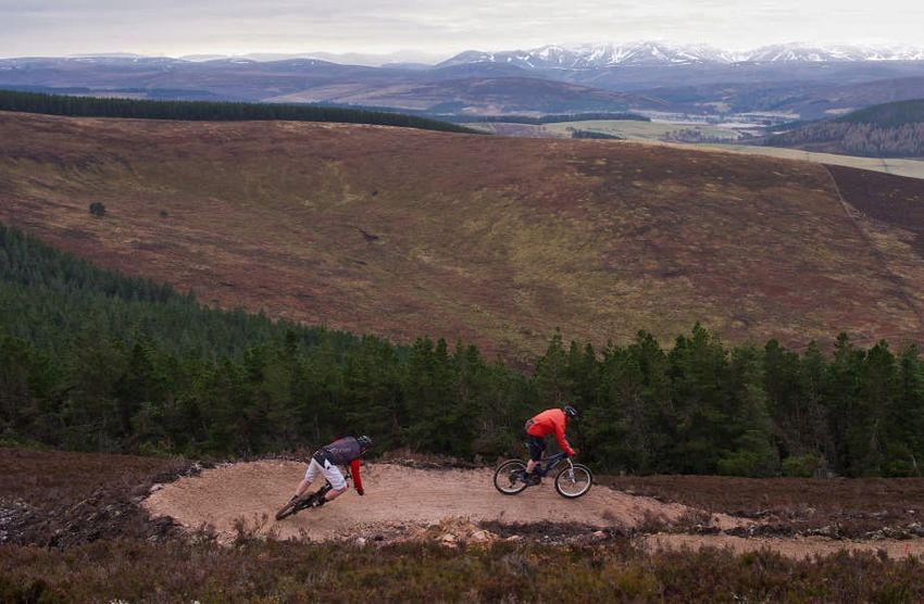
3. Background to Cairngorms National Park

National Parks in Scotland

In Scotland, National Parks are extensive areas of the very highest value to the nation for their
scenery, wildlife and cultural heritage.

They provide an integrated approach to management and sustainable development to safeguard
the special qualities of these areas for the long term.

They also provide opportunities for the public to enjoy the special natural and cultural heritage.

There are two National Parks – Cairngorms and Loch Lomond & The Trossachs. For more
information visit the official National Park websites:
www.cairngorms.co.uk
www.lochlomond-trossachs.org

                                                5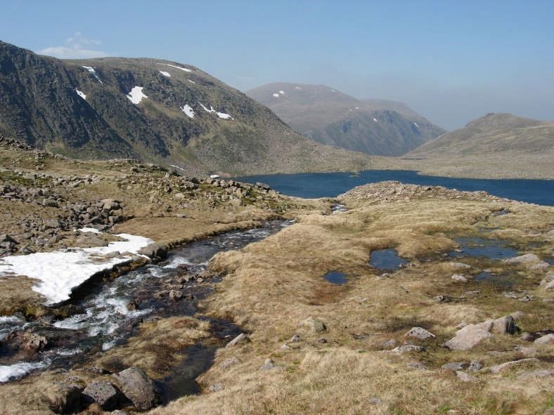
Cairngorms National Park
The Cairngorms National Park is Britain’s largest National Park (4,582 km2) and contains a
unique range of landscapes, wildlife, habitats and people.
Nearly 50% of the Park is designated as important for its nature and landscapes and one
quarter is of European importance.
It has five of Scotland’s six highest mountains and impressive landscapes and landforms sculpted
by ice age glaciers. The central mountain area supports a unique collection of plants and animals
including golden eagle and dotterel, while the interaction between people and nature has
produced the rich diversity found in the heather moorlands. The Park also contains the largest
continuous area of natural and semi-natural woodlands in the UK.
Capercaillie, wildcat and twinflower are found in the pinewoods. While the clean waters of the
Spey, Dee and Don support wildlife like salmon, rare lampreys and endangered freshwater
pearl mussels. These river valleys also provide livelihoods for local communities.
The National Park is home to around 18,000 people and tourism is an important part of the
economy with at least 1.4 million people visiting the Cairngorms each year.

                                               6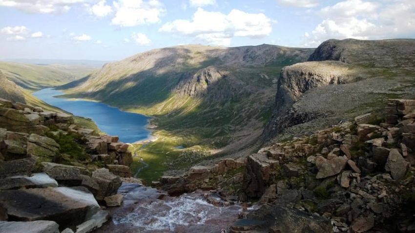
Cairngorms National Park Fact File
Designated in 2003
4,528 square kilometres in area
Five of Scotland’s six highest mountains are in the Park
The National Park is home to over 18,000 people. The population, including 18-24 year
olds, has been growing steadily since 2001.
The National Park is home to 25% of the UK’s threatened bird, animal and plant species
Unique mountainous wilderness, moorlands, forests, rivers, lochs and glens
Half of the area of the National Park is designated as being of European importance for
nature conservation.
Tourism-related businesses account for about 30% of the economy
http://cairngorms.co.uk/the-park/facts-figures/
History of Scottish National Parks - Timeline
Some of the key dates for designation of National Parks in the UK and Scotland:
1949: National Parks designated in England and Wales
2000: National Parks (Scotland) Act passed
2002: Loch Lomond and the Trossachs National Park opened
2003: Cairngorms National Park opened
2010: Cairngorms National Park boundary extended to include Blair Atholl
A more detailed breakdown of dates can be found on the Learning Zone website.
http://cairngormslearningzone.co.uk/
Aims of Scottish National Parks
As set out in the National Parks (Scotland) Act 2000:
To conserve and enhance the natural and cultural heritage of the Park
To promote sustainable use of the natural resources of the area
To promote enjoyment and understanding of the special qualities of the Park
To promote sustainable economic and social development of the Park’s communities
7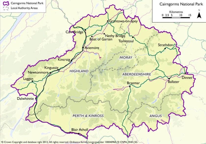
Cairngorms National Park Authority

“ The Cairngorms National Park Authority works together with others to ensure that the
unique aspects of the Cairngorms National Park - the natural environment, the cultural
heritage, the local communities - are cared for, sustained and enhanced.”
http://cairngorms.co.uk/park-authority/

The National Park Authority is responsible for preparing the National Park Partnership Plan
and coordinating its delivery with other partners. This Plan sets out the vision and overarching
strategy for managing the Park, showing how the four aims of the National Park can be
achieved together, benefiting people and place.
http://cairngorms.co.uk/authority/publication/299/

The challenge in managing a successful National Park is that of delivering all four aims together.
The National Park combines an internationally important environment with a fragile rural
economy and a renowned visitor destination. This brings inevitable tensions. All of the above
can result in problems/conflicts within the Park area. The Cairngorms National Park Authority
has a role to play in minimising this conflict and providing a resolution through bringing key
partners together; increasing dialogue between them; developing policy / guidance to guide the
future management of the Park.

Where there appears to be a conflict between the aims of the Park eg conservation versus
economic development, the National Parks (Scotland) Act 2000 will give greater weight to
conserving and enhancing the natural and cultural heritage. This is called the Sandford principle.

                                                          Copyright Will Boyd wallis

                                                8
4. Glaciated landscapes in the Cairngorms National Park

                                                                             The Loch Avon basin is a deep
                                                                             cleft in the Cairngorm plateau
                                                                             between Cairngorm itself to the
                                                                             north and Beinn Mheadhoin to
                                                                             the south. The Loch is bounded by
                                                                             famous Cairngorm crags such as
                                                                             Stag Rocks (on the left), Hell’s
                                                                             Lum , the Shelter Stone Crag and
                                                                             behind and above Carn
                                                                             Etchachan

  Loch Avon Feith Buidhe Waterfall                    Copyright Lee Haxton

This dramatic landscape is typical of the Cairngorms – deep u-shaped valleys, high snow-topped
peaks and plateaus, a legacy of the last ice age 10,000 years ago and pre-glacial times.
Cairngorms National Park contains one of the finest collections of landforms on the planet,
rarely seen outside arctic Canada. The high granite plateaux, steep-sided glens and deep corries
make the Cairngorms one of the most renowned and distinctive mountain landscapes in
Britain, redolent of the Arctic in terms of their landforms, weather and plants. These
mountains are on a grand scale, wide expansive landscapes, with large tracts of the higher land
having survived from before the Ice Age, next to deeply eroded glens and corries cut by the
glaciers.
Remnants of the pre-glacial landscape include the broad, sweeping plateaux which epitomise
the Cairngorms, with their dome-shaped summits, sometimes capped with tors, and shallow
river valleys such as Coire Domhain and the valleys of the Feith Buidhe and Caochan Dubh
between Cairn Gorm and Ben Macdui. Locally, also, on the plateaux, pockets of weathered
bedrock have survived glacial erosion, as in Coire Raibert where the decomposed granite can
be crumbled in the hand. The Cairngorms tors are the finest in Scotland. These distinctive
upstanding masses of granite are best seen on Beinn Mheadhoin, Ben Avon and Bynack More,
where the Barns of Bynack reach a towering height of 30 metres.
While the broad outlines of the Cairngorms today reflect the character of the geology and the
pre-glacial relief, the Ice Age has also left a distinctive imprint on the landscape. This is evident
in a variety of landforms produced by glaciers. Glaciations have produced a series of deeply
eroded glens and troughs, with steep cliffs, cutting through the gently rolling pre-glacial plateau
surfaces; Glen Avon and Gleann Einich are particularly striking examples. In places, the
powerful glaciers also carved through the pre-existing watersheds to form a series of
spectacular glacial breaches – the Lairig Ghru, Ryvoan, upper Glen Feshie, Inchrory and the
Lairig an Laoigh. These breaches also diverted the pre-glacial headwaters of the River Feshie
and the River Avon.
Other features of glacial erosion include truncated spurs, such as the Devil’s Point, where the
pre-glacial glens were straightened by the glaciers.

                                                  9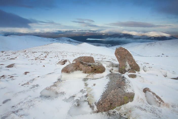
The contrast between the preservation of the rolling plateau landscape and the deeply eroded,
steep-sided glens and corries is quite remarkable. Together they form an outstanding example
of a landscape of selective glacial erosion, which is a valuable scientific, educational and
environmental resource. The international significance of the geodiversity of the Cairngorm
Mountains is recognised by their inclusion in the UK Tentative List of World Heritage sites for
their exceptional physical features.
Glacial deposition – the main type are moraines deposited by the glacier as it melted. Also
drumlins.
Deglacial landforms - kames, eskers, kettle holes, meltwater channels/breaches
Other glaciation features
Corrie glaciers :     Corrie Fee, NNR in Glen Doll, Angus
                      Coire Ardair, Creag Meagaidh NNR, Kinlochlaggan
Truncated spur:       Creag Dhu, Newtonmore
Glacial meltwater / pothole: Burn O’Vat, Dinnet
                             Braes of Abernethy
Roche Moutonee (glacial erosion and abrasion):                    Dulnain Bridge
Many more features of the glaciated landscape and sites of examples can be found on the
Cairngorms Learning Zone website:
http://cairngormslearningzone.co.uk/landscape-geology/ice-age-times

                                                                     Loch Etchachan is an exceedingly
                                                                     remote freshwater loch set deep
                                                                     within the central Cairngorms plateau.
                                                                     It is the highest waterbody of its size
                                                                     in the UK, the surface being 927
                                                                     metres (3,041 ft) above sea level.

                                     Copyright Will Boyd Wallis

                                                      10
5. Land Use in the Cairngorms National Park
A variety of land uses can be found in the National Park
Scattered birch and
pine woodland at
Rothiemurchus, by
Aviemore
Copyright Mark Hamblin/2020VISION/CNPA
Mountain biking at
Glenlivet Estate
Copyright Crown Estate
Sheep Farming
Copyright Wee Epics
11Most land within the Park is owned and managed by private individuals or businesses. The
management of the land shapes the landscapes, the habitats and species and special qualities, as
well as being an integral part of the economy and employment opportunity in the Park.
Figure 3.2 Area (Ha) of land within different ownership categories and proportion of this land occurring
within the CNPA
*NB this data is from a 2013 survey of landowners accounting for 66% of land area of CNP
The major land uses in the Park include
Managed moorland (including for field sports)
Farming (rough grazing)
Conservation
Forestry
Recreation
*
Figure 3.3 Total area of primary land use on respondent landholdings
*NB this data is from a 2013 survey of landowners accounting for 66% of land area of CNP
12There are over 100 land owners across the CNP with varied land management objectives.
Figure 3.4 Numbers of respondents ranking key objectives/activities on their landholdings in terms of
inmportance (low, medium or high)
*NB this data is from a 2013 survey of landowners accounting for 66% of land area of CNP
The most prevalent objectives of high importance were sporting land uses, agriculture,
conservation and forestry, followed by residential property, tourism and leisure, access and
interpretation and renewables.
* This data is based on a 2013 survey of landowners in the National Park, accounting for 66% of
the land area. It contains information on the economic, social and environmental role of
landowners in the Park and their future aspirations. The full survey report can be found at
http://cairngorms.co.uk/survey-of-land-owners-in-cairngorms-national-park/
Summary
There are many and varied land uses and aspirations for managing land across the National
Park. Combined with a growing desire for people to live in and visit the National Park for
recreation, and the environmental pressures this imposes on an internationally important area,
it is not surprising that some tensions can arise between land uses and land users.
Some examples of conflict between land uses and how the National Park Authority manages
them are provided in this resource.
136. Conflict and resolution case studies
Case Study 1: Field sports vs conservation
Deer stalking and woodland expansion
Because deer are free ranging, it’s impossible to give an exact figure, but there are over 30,000
red deer occurring in woodlands and on moorlands across the National Park, and they are an
essential part of the Park's biodiversity. They are free-ranging, herding animals that don’t have
any natural predators to manage their numbers.
Copyright Will Boyd Wallis
Deer also contribute to the economy of the Park by sustaining local employment through deer
stalking; supporting wildlife tourism and providing a supply of venison. Deer underpin the social
fabric of some communities in the Park where deer stalking is the way of life.
Deer can also impact on upland habitats by browsing, grazing and trampling, which can lead to
damage to fragile habitats if numbers are not checked
Problems can arise when deer numbers reach densities above the habitat carrying capacity and
where landowners have different management objectives and aspirations on deer densities. For
example where landowners’ objectives are for conservation and woodland expansion, deer
numbers are kept low, as grazing pressure of deer can limit the natural regeneration of the
forest. On the other hand, where landowners manage their land for sporting purposes ie deer
stalking, numbers of deer are kept higher.
Therefore, ensuring deer populations are managed effectively can be complex, especially when
neighbouring landholdings have different land management objectives.
Conflicting NP aims:
To conserve and enhance the natural and cultural heritage of the Park
To promote sustainable economic and social development of the Park’s communities.
14Resolution and role of CNPA
Due to the significant impacts deer can have on the natural heritage, there is a particular need
to address the complex issues facing deer management in the Cairngorms. CNPA has helped to
tackle these in line with Scottish Government’s approach to sustainable deer management,
involving Deer Management Groups (DMGs) as key partners.
There are six DMGs in and around the National Park, of which the Cairngorms Speyside Deer
Management Group is wholly contained in the Park. Their role includes:
Developing deer management plans
promoting compromise and collaboration between estates and across DMG boundaries,
who may have different policies for deer management and different views on deer
densities.
CNPA is helping to resolve these conflicts by:
working with individual estates and deer management groups to help reach agreements
and resolve specific issues
facilitating and supporting the Cairngorms Deer Advisory Group whose key roles are
to promote better communication between all DMGs and key interest groups, and to
advise CNPA on deer management. http://cairngorms.co.uk/working-
partnership/working-groups-advisory-forums/deer-advisory-forum/
Developing local policy and guidance to guide the future management of deer in the
National Park through the ‘Deer Framework for the Cairngorms National Park’ .
http://cairngorms.co.uk/working-partnership/national-park-strategies/deer-framework/
Promoting awareness and understanding of the role deer management plays in the local
economy and management of important habitats.
Further reading
Cairngorms Speyside Deer Management Group http://www.csdmg.co.uk/
Association of Deer Management Groups http://www.deer-management.co.uk/
Video clip
Cairngorms Nature red deer clip (David Frew NTS)
15Case Study 2: Recreation vs conservation
Dogs disturbing capercaillie and ground nesting birds during the breeding season.
The National Park is a fantastic recreation resource, with many opportunities for different
physical activities in a spectacular place – from winter sports and water sports, hill walking to
dog-walking. As the popularity of the National Park increases as a visitor destination and a
place to live, this can also bring with it pressures on sensitive environments.
The National Park is Scotland’s largest protected landscape, with over half the area designated
through the Natura 2000 network as being of European importance for nature conservation
interests. It contains rare habitats such as Caledonian pine woodland and arctic-alpine habitats,
and several rare and threatened species within them, like capercaillie, Scottish wildcat,
twinflower and freshwater pearl mussel.
Copyright Luke Massey/2020VISION/CNPA Copyright Will Boyd Wallis
There are estimated to be only around 1,200 capercaillie left in Scotland, with 80% of them in
the woodlands of the Cairngorms National Park. The breeding success of these magnificent
birds is threatened by several factors including loss of woodland habitat, predators, wet spring
weather when chicks are young, flying into deer fences as well as human disturbance during the
breeding season.
Problems can arise if visitors are unmanaged in these sensitive areas, leading to impacts on the
survival of these birds.
It is known that dogs that are not under control and ranging off paths can have a devastating
impact on the survival of young chicks. It is also known that capercaillie avoid good habitat near
well used paths and tracks thus reducing the amount of forest that they can live in. So whilst
the National Park ‘promotes the enjoyment of the area through recreation’ it must do this in a
way whereby visitors do not damage the very environment they value and come to visit.
Conflicting NP aims:
To promote enjoyment and understanding of the special qualities of the Park
To conserve and enhance the natural and cultural heritage of the Park
16Resolution and role of CNPA
CNPA helps to address these issues in various ways:
As the Access Authority, CNPA provides advice to land managers and the public on
access rights, and promotes responsible behaviour in the countryside.
http://cairngorms.co.uk/caring-future/developing-park-access/
CNPA supports ranger services in the Park to promote Scottish Outdoor Access Code
and responsible dog walking in sensitive areas, eg Boat of Garten woods.
Under the Land Reform (Scotland) Act 2003, CNPA must prepare a Core Paths Plan
which sets out a network of routes for visitors and residents to enjoy the special
qualities of the National Park. Core paths have an important role to play in ensuring
that people can easily get around and enjoy the Park in a way that minimises the
potential for conflict with people who manage the land. This includes keeping paths
away from sensitive capercaillie sites.
http://cairngorms.co.uk/working-partnership/national-park-strategies/core-paths-plan/
CNPA have led the production of a Capercaillie Framework which includes measures to
specifically resolve situations where access and recreation may impact on capercaillie
breeding success. For the full framework including the list of recommended actions see:
http://cairngormsnature.co.uk/capercaillie-framework
Further reading
Scottish Outdoor Access code – responsible behaviour by users and land managers
http://www.outdooraccess-scotland.com/Practical-guide/public/dog-walking
People and dogs in the outdoors - http://cairngorms.co.uk/discover-explore/planning-a-
visit/enjoying-the-park-responsibly/
Video clips
Cairngorms Nature capercaillie clip
Cairngorms Nature ptarmigan clip
Mountain biking clip (Ronan Taylor)
Site Visits
Boat of Garten Woods- NH938189
Anagach Woods – NJ035275
Glenmore Forest – NN974098
Glen Tanar- NO481965
17Case Study 3: Fieldsports vs recreation
Anglers and other water users in conflict over the use of the River Spey
The River Spey is very important to the area for many reasons, in particular environmentally,
economically and for recreation. The Spey is one of Scotland’s finest salmon fishing rivers, due
in part to the excellent quality of the water and its naturalness, which is vital in supporting a
rich biodiversity of plant and animal life including salmon.
Angling on the Spey contributes over £12 million each year to the local economy and provides
367 full-time-equivalent jobs. The River Spey is also one of the most popular rivers in the
country for paddle-sports which embraces canoeing, kayaking and rafting. The River Spey is
navigable throughout its length and provides opportunities for a variety of craft and range of
abilities.
Copyright CNPA Copyright Niall Benvie
The main issue raised by both anglers and estates who let the fishing, is that more paddlers on
the Spey could lead to a further disturbance of fish and angling. They are concerned that this
disturbance means less people will come fishing which will have a big impact on businesses that
rely on fishermen. Whilst not proven they also have concerns that more paddlers will disturb
salmon resting in pools and damage the reed beds where young salmon (alevins) hatch and
grow.
Conflicting NP aims:
To promote enjoyment and understanding of the special qualities of the Park
To promote sustainable economic and social development of the Park’s communities.
To conserve and enhance the natural and cultural heritage of the Park
Resolution and role of CNPA
Code of conduct agreed between river users eg on River Spey
http://www.speyfisheryboard.com/access/
A Spey Guide for paddlers promoting responsible behaviour
A Spey Users Group has been set up: a group made of paddling, fishing and public
agency interests that meets to discuss and resolve issues
Cairngorms Local Outdoor Access Forum to advise on access rights
http://cairngorms.co.uk/park-authority/outdoor/local-outdoor-access-forum/
18Further reading
Spey catchment initiative - http://www.speyfisheryboard.com/
Video clip
Canoeing on the River Spey (Dave Craig)
Site Visits
Loch Insh, Kincrag- NN835052
Grantown Beach- NJ028266
19Case Study 4: Development vs conservation
Housing development and environmentally important habitats
The Cairngorms National Park is home to around 18,000 people, most of who live in its main
valleys and straths. Most live in the twenty or so towns and villages that lie within these, with
Aviemore, the National Park’s largest settlement, being home to around 3,000 people.
Much of the National Park’s population is employed within its boundary, with the key industries
of tourism, food and agriculture, public sector and service sector offering most jobs. This is
similar to most of Scotland’s rural areas, and like most rural areas this economy combined with
its high quality natural environment, creates some significant challenges for the National Park
Authority to deal with. Average wages are typically low compared to the national average,
while many jobs are seasonal or part time. These problems are compounded by relatively high
house prices compared to local incomes, though issues around the affordability of housing are
common throughout the United Kingdom.
Yet, the Cairngorms National Park experiences certain characteristics that are not typical of
other comparable rural areas. Unlike much of rural Scotland, the National Park has
experienced a growing population over the past 10 years, with individuals and families moving
or returning to the area. Many moving to the area are retired or nearing the end of their
working life and overall the Park’s population is an aging one. However, a significant proportion
of this population movement has also come from younger age cohorts, often drawn by the
opportunity of working in the tourism and outdoor recreation industries. As a result, this has
meant the number of young adults and children living within the park has stayed relatively high
compared to other parts of rural Scotland.
Naturally, this growing population and its age structure results in certain needs which have
implications for the planning system, such as providing land for housing and employment.
Housing is often raised as an important issue, with the increasing population, falling household
sizes, competition from the buy-to-let market and demand for second and holiday homes
generating additional housing need and pushing up property prices.
Copyright Wee Epics Copyright CNPA
The development of further housing is therefore essential to accommodate this need and to
facilitate a sustainable economy and thriving communities. In particular, the provision of
affordable housing, available to those on low to average incomes is vital, as this need can never
be adequately met through the existing housing stock. To guide the location and nature of this
development, the Cairngorms National Park Authority uses its Local Development Plan (2015),
20which identifies locations in the Park where development, including housing development, is
most suitable.
The Local Development Plan must carefully balance many competing objectives, including those
relating to the need for development with those relating to natural heritage. With over 50% of
its land area protected by some form of nature designation, most of which contain rare species
such as capercaille, otter, red squirrel and fresh water pearl mussel, the Local Development
Plan must take great care that development does not have any significant adverse impacts on
these features. Sites are therefore chosen where they are likely to have the least impact and
when approving applications, planning conditions are used to ensure that any potentially
adverse effects are avoided or mitigated.
Inevitably, the need for balance often results in conflict between developers, conservation
groups, local communities and the National Park Authority itself. So in choosing sites and
determining planning applications, planning officers must carefully consider the arguments being
presented. Challenges are rarely easy to resolve and it is usually the case that compromises
must be made by all sides.
The twinflower is
one of Scotland’s
Natural most endangered
and iconic
woodland
wildflowers
Copyright Mark Hamblin/2020VISION/CNPA Copyright Mark Hamblin/2020VISION/CNPA
Conflicting NP aims
To promote sustainable economic and social development of the Park’s communities.
To conserve and enhance the natural and cultural heritage of the Park
Resolution and role of CNPA
CNPA is the Planning Authority for the Park with partial powers ie those planning
applications which are significant to the four aims of the National Park are ‘called in’ and
determined by the Planning Committee ie the CNPA Board.
http://cairngorms.co.uk/park-authority/planning/making-an-application/
http://cairngorms.co.uk/resource/docs/publications/30042015/CNPA.Paper.
CNPA must prepare and deliver the Cairngorms Local Development Plan which sets out
where, when and how good development should happen in the right places in the National
Park to support the economy, communities and special qualities of the Park.
http://cairngorms.co.uk/park-authority/planning/role-of-local-dev-plan/
Promoting best practice in design, including how to take environmental considerations into
account through the whole process from design through to construction.
21 Developer and Community Forums where the National Park Authority discuss planning
relating matters with those in the development sector as well as members of the Parks’
communities.
Example of conflict resolution
In 2012, plans for 72 new houses in Boat of Garten were initially turned down by the CNPA
planning committee due to concerns that capercaillie, a European Protected species, would be
disturbed by the development ie. through increased use of the surrounding woods by residents
living in the development. Through consultation and bringing the key interests together, a
solution was worked up that would include a smaller development of 32 houses and measures
to mitigate human impact on local capercailllie. This included employing a seasonal ranger who
would monitor and improve behaviour of dog walkers in the woods and screening some of the
paths in the woods using native trees and shrubs to reduce the potential for capercaillie
disturbance by people walking along certain paths. http://www.bbc.co.uk/news/uk-scotland-
highlands-islands-17182545
Further reading
Economy of the Park http://cairngorms.co.uk/caring-future/local-economy/
22Case Study 5: Development vs conservation
The impact of Hydropower schemes on the landscape
Water at a height holds energy, so given the geography of the Cairngorms National Park this
means that in places there is potential for hydroelectric power generation within the Park.
Historically there have been a number of small hydro schemes within the Park generating
power for estates and communities.
Scotland’s 3rd National Planning Framework states “we want to meet at least 30% of overall
energy demand from renewables by 2020” Strong policy drivers, attractive incentives and
increasing costs of fossil fuel mean that we are seeing increasing numbers of applications for
small hydro schemes in the National Park to provide power for estates, businesses,
communities and for income generation.
The Cairngorms National Park Partnership Plan supports the development of a sustainable
economy and a low carbon economy. Increasing renewable energy generation, especially
biomass and hydro that is compatible with conserving the special qualities of the National Park,
is a key policy objective (NPPP 1.3). These special landscape qualities are the basis of
the National Park’s appeal, its designation and tourism economy.
http://www.snh.org.uk/pdfs/publications/commissioned_reports/375.pdf
Hydro developments consist of a number of different component parts; the intake(s), pipeline,
turbine house and tracks. Sometimes these elements are widely separated and can affect
different landscape character areas and different special landscape qualities. For example a
scheme that has a perfect site for an intake and a perfect site for a turbine house may be
compromised by the potential impact of the pipeline, and modifying the scheme may result in
reduced energy generation. This can result in contention between the applicant and the
planning authority.
Copyright CNPA
The challenge is finding the right location and scale of development that doesn’t threaten the
special qualities of the Park, the outstanding environment that makes it special.
Conflicting NP aims
To promote sustainable economic and social development of the Park’s communities.
To conserve and enhance the natural and cultural heritage of the Park
23Resolution and role of CNPA
CNPA is the Planning Authority for the Park with partial powers ie those planning
applications which are significant to the four aims of the National Park are ‘called in’ and
determined by the Planning Committee ie the CNPA Board. http://cairngorms.co.uk/park-
authority/planning/how-it-works/
CNPA must prepare and deliver the Cairngorms Local Development Plan which sets out
where, when and how good development should happen in the right places in the National
Park to support the economy, communities and special qualities of the Park.
http://cairngorms.co.uk/park-authority/planning/role-of-local-dev-plan/
In the Landscape Toolkit, CNPA provides information to flag up areas where the landscape
may be particularly sensitive to this form of development and help ensure potential
applicants are considering landscape issues from the outset.
Further Guidance
Scottish Natural Heritage
Aiding the Hydro-scheme development process
Hydroelectric schemes and the natural heritage
Landscape assessment toolkit http://cairngorms.co.uk/landscape-toolkit/
Potential site visits
There are several hydro scheme sites in the Park, including at Kingussie, Glen Esk and
Strathdon. For more details contact learning@cairngorms.co,uk
24Case Study 6: Development vs conservation
Funicular Railway and Cairngorm Mountain
Top of Cairngorm
Mountain
Copyright Mark Hamblin/2020VISION/CNPA
The high altitude Cairngorm Plateau is severely exposed to weather extremes and under snow
for much of the year. Despite these extreme conditions, the thin soils on the plateau support a
unique assemblage of mosses, lichens, grasses, sedges, rushes, fungi, flowering plants and rare
shrubs. On top of that, this habitat supports breeding populations of other rare birds such as
dotterel, snow bunting and ptarmigan. Even the snowy owl, more usually found in arctic
Norway has been known to make itself at home on the plateau. The vegetation is highly
vulnerable to trampling and other wildlife is vulnerable to disturbance. Much of the plateau is
protected by the European conservation designation: Special Area of Conservation in order to
ensure vulnerable habitats and species are not harmed.
Conflict grew from the very outset when the funicular was first proposed in the 1990s. A
mixture of celebration from skiers pleased to see better access to skiing areas and an outcry
from conservationists concerned about increased impacts on the fragile plateau wildlife during
the short summer breeding season.
Resolution
The conflict was addressed following the issuing of planning permission to the funicular
company who proposed a ‘closed system’ during the snow free summer months. This system
has ensured that the funicular has not led to a dramatic increase in disturbance to the plateau.
Funicular passengers are not permitted to exit the top station to go onto the mountain unless
they are booked on a guided walk or a guided mountain bike descent or to undertake
snowsports during the winter.
Role of CNPA
The funicular railway on Cairngorm opened in 2001, pre-dating the designation of the National
Park in 2003. The CNPA therefore did not play a role in its development. However lessons
can be learned from it, in terms of planning for the future tourism without detriment to the
environment.
The potential benefits of tourism and the potential problems of unmanaged visitors to the Park
are recognised and planned for through the Cairngorms Sustainable Tourism Strategy 2011 –
2016. This has been led by CNPA.
A new Cairngorms Tourism Partnership is currently being set up, bringing together key
industry players and public sector representatives to oversee delivery of the national tourism
25strategy at a local level. This will carry on the work of the previous Sustainable Tourism Forum
to ensure that tourism develops sustainably, contributing to a strong local economy whilst also
managing the potential impacts of visitors to the Park to keep it a special place.
Cairngorm Funicular
and ski area
Copyright Stewart Grant Copyright Stewart Grant
References:
Cairngorm Funicular railway
http://www.cairngormmountain.org/funicularrailway/
History of funicular railway http://en.wikipedia.org/wiki/Cairngorm_Mountain_Railway
Protected areas, including designated sites such as Natura sites, Special Areas of Conservation,
Sites of Special Scientific Interest, and how they work
http://www.snh.gov.uk/protecting-scotlands-nature/protected-areas/
267. Other resources to support field visits to the National Park
Resource packs
Two education packs are available for Abernethy and Muir of Dinnet National Nature
Reserves. They provide guidance and activities for schools and groups that help deliver
Curriculum for Excellence. Download the packs from
http://cairngorms.co.uk/caring-future/education-learning/projects-for-schools/learning-
resources/
‘Getting into National Parks and National Nature Reserves’ contains advice and guidance for
teachers and group leaders on planning a visit to National Parks and NNRs. It also contains
information sheets and case studies of various groups’ experiences of visiting the Parks.
Download the pack from http://cairngorms.co.uk/authority/publication/248/
Websites
For lots of information on the Cairngorms National Park and the work of the National Park
Authority www.cairngorms.co.uk
Cairngorms Learning Zone is a web-based learning resource for teachers, students but will
appeal to anyone who wants to find out more about the Cairngorms. Use it for your pre and
post visits to the Park! http://cairngormslearningzone.co.uk/
Education Scotland’s on-line resource provides a wealth of information, guidance, advice and
resources for taking learning outdoors.
www.educationscotland.gov.uk/learningteachingandassessment/approaches/outdoorlearning/ind
ex.asp
Ranger Services
Make use of one of the 12 ranger services in the Park, to enrich your learning experience. A list
of ranger services can be found at http://cairngorms.co.uk/caring-future/rangers-services/
National Nature Reserves
There are nine NNRs in the Park which protect an amazing range of wildlife and landscapes,
where you can base your visit and learning experience. Find these NNRs at www.nnr-
scotland.org.uk
Forests and woodlands
Discover the sights, sounds and experiences of the forest at Forestry Commission Scotland
sites in the Park, including Glenmore, Inshriach, Laggan, Glen Doll, Cambus O’May, See
www.forestry.gov.uk/website/fchomepages.nsf/hp/seee
John Muir Award
Your visit to the Park may well fit in with gaining a John Muir Award, an environmental award
scheme that focuses on wild places such as the National Park. Find out more at
http://cairngorms.co.uk/caring-future/education-learning/projects-for-schools/john-muir-award/
27Travel Grant
A travel grant scheme is available to support schools and groups to make educational visits to
the Park, offering up to £200 or 75% of transport costs. Download the application form and
guidance from http://cairngorms.co.uk/park-authority/funding/travel-grant-scheme/
For more information and ideas about visiting the National Park, go to
www.cairngorms.co.uk
www.visitcairngorms.com
Email: learning@cairngorms.co.uk
28You can also read