High Nature Value Farmlands Case Study Report Iveragh Peninsula, South Kerry 2010
←
→
Page content transcription
If your browser does not render page correctly, please read the page content below
High Nature Value Farmlands
     Case Study Report

Iveragh Peninsula, South Kerry

            2010

                                 1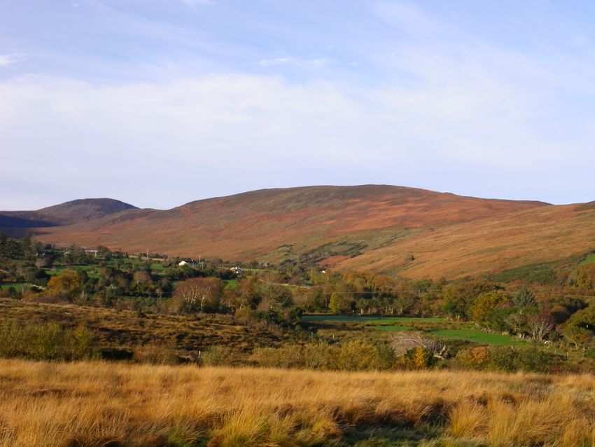
Status of the Report

This report has been prepared for the Heritage Council by the European Forum for
Nature Conservation and Pastoralism (EFNCP). Please note that this report does not
necessarily constitute the views of the Heritage Council, but will be considered by the
Heritage Council as it develops its work on High Nature Value farming and may
inform future Heritage Council Policy on this and other related matters.

                                                                                     2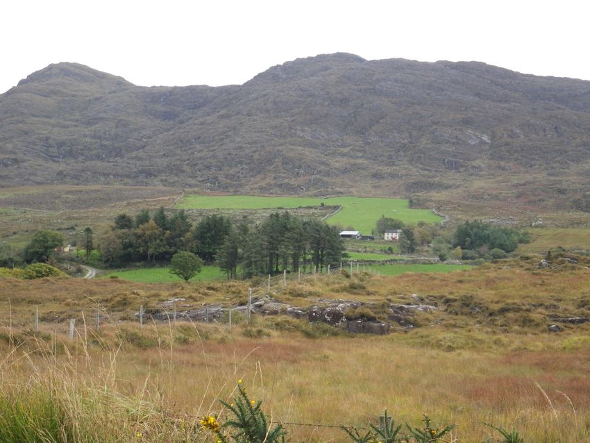
HNV FARMLAND CASE STUDY FOR SOUTH KERRY

Introduction

Kerry is a county in the Southwest of Ireland in the province of Munster (Figure 1).
The county has an area of 4,746km2 and a population of around 140,000 people. The
landscape of the county varies from the lowland plains and rolling hills of North
Kerry, the lakes of Killarney to the mountainous regions of the Beara, Iveragh and
Dingle peninsulas. This landscape has greatly shaped the agricultural systems present
in the county. Forty-six percent of the land area is made up of crops and pasture and a
further 12 percent is under forestry, native and planted.

Figure 1. The Iveragh Peninsula in Kerry and its location within Ireland (inset).

Introduction to the Iveragh Peninsula Case Study.

The Iveragh peninsula forms part of the Kerry uplands with over 65 percent of its area
classed as uplands, compared with only 22 percent nationally. The range of
mountains known as the Magillycuddy’s Reeks contains Ireland’s highest mountain,
Carrauntoohill (1041m). This is the most mountainous part of Ireland, featuring
cliffs, deep pockets, exposed rock, glens and narrow passes (Crowley and Sheehan,
2009). The underlying geology is almost entirely Old Red Sandstone but with
outcroppings of Carboniferous Limestone and Valencia Slate Formation. The area
has an oceanic climate, heavily influenced by the Gulf Stream. It experiences mild
winters 6oC (February Average, Killarney National Park) and cool summers (15oC
July average, Killarney National Park). The mean average rainfall is 1,263
millimetres (49.7 in) per year, with 223 days in the year typically having more than 1
millimetre (0.039 in) precipitation. In the elevated areas, rainfall can increase to
3000mm. As a result of the high rainfall, poor agricultural soils and the mountainous
topography, the area is designated as severely handicapped under the European Less
Farvoured Areas Directive (Regulation 950/97).
                                                                                     3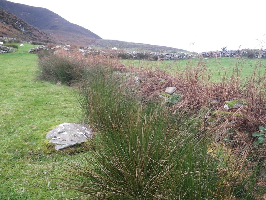
Population of the Iveragh in 2006 was 18,362, giving a population density of 11
people per km2. Whilst the towns of Killarney and Kenmare on the eastern part of the
peninsula are major towns, the interior of the peninsula remain relatively isolated with
a dispersed pattern of settlement characteristic of pastoralist traditions in Ireland
(Plate 1).

Plate 1. An isolated farmhouse on the Iveragh peninsula with its green in-bye land
reclaimed from the mountain.

The Farming System

Agriculture in the west of Ireland has developed at a different pace to the east. Lower
rainfall, better drained soils and closer proximity to markets in the east have led to a
more intensive agricultural system. Conversely, in the west, higher rainfall, poor
draining soils and remoteness to the market all have led to extensive farming systems.
Changes to land through reclamation, drainage and reseeding have occurred in many
areas of the west but in the more marginal areas, like the Iveragh Peninsula, an
extensive farming system is still prevalent. Small areas of green land, called in-bye
land, exist around the dwelling house. Historically, these formed part of a cropping
rotation with the production of potatoes and corn to ensure self-sufficiency for the
farm. This practice is now rare but the in-bye land plays an important role in
determining the stocking capacity of the farm. Throughout the area, there is evidence
of land reclamation to increase the percentage of in-bye land of the farm holding.

A detailed survey of 80 farmers in the Iveragh Peninsula was undertaken in 2007-
2008 as part of a three year research project funded by Science Foundation Ireland
(SFI) to acquire a knowledge of the farming systems, ecology and people of the
Peninsula (Kramm et al. 2010). Just over half the people surveyed (54.2 percent)
operated a mixed farming system, combining cattle with sheep farming, whilst a
further 33.3 percent and 5.6 percent were specialist sheep and specialist beef
                                                                                 4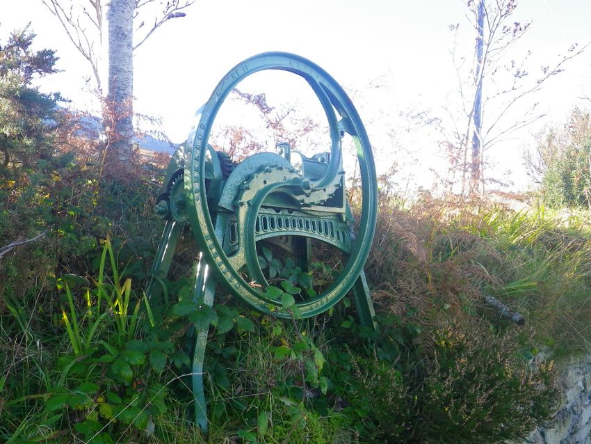
producers respectively. There were no specialised dairy farmers in the area although
7 percent of households combined a small scale dairying operation with an average of
3.39 dairy cows along with another enterprise. Suckler cows were the most popular
beef production system with an average herd of 11 cows. Sheep farming centred
mainly on the production of store lambs, although one third of farmers did finish
lambs. The average sheep flock was 216 ewes with a weaning success of 0.86
lambs/ewe.

Plate 2 and 3. On the left: mixed grazing of cattle and sheep on a Kerry farm. On the
right: sheep grazing in the uplands.

The traditional sheep system has been recorded by O’Rourke and Kramm (2009).
The sheep remained outdoors all year round, being bought to the green land around
the lambing period, at the end of March or in early April. They remained there until
strong enough to follow their mothers up the hills for summer grazing, around early
June. Store lambs were traditionally sold in the autumn (August/September) to
lowland producers for fattening. Some cattle were also kept on the farm and were put
to the hill during the summer. The Kerry cow, a traditional breed of cow, was
common (Plate 4). Some of the green land was used for the production of hay to feed
the cattle in the winter period which were often housed in small byres. The cattle
manure produced was an important source of nutrients for the potato crop.

Plate 4 and 5. Right photo shows a traditional Kerry cow outwintered on the
lowlands; left photo shows the traditional blackface ewe found in the uplands,
although brought down to the in-bye land at different times of the year.

Within the area, there are still some farmers operating this basic system but over the
years, there have been changes. Changes in agricultural subsidies led to a dramatic
                                                                                     5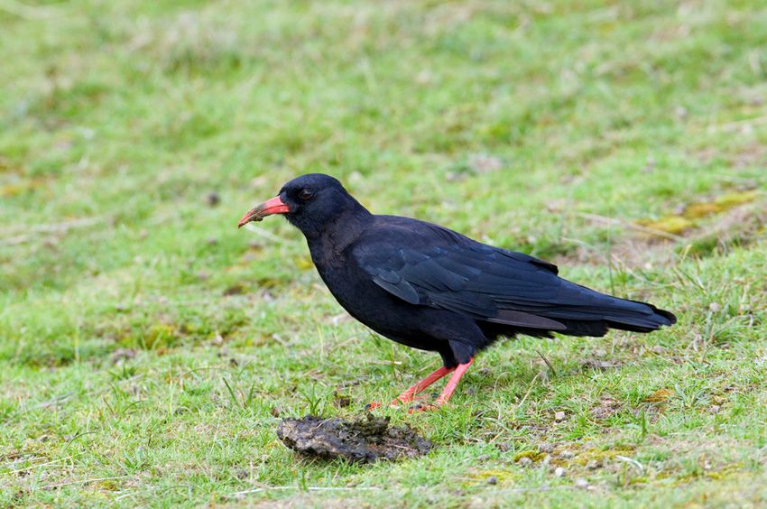
increase in sheep numbers in the 1980s and 1990s and now the Iveragh uplands are
exclusively associated with sheep production. Cattle production in the form of
suckler cows still exists in the lowland farms of the Peninsula. On many farms, sheep
are bought down from the hills during the lambing period to the in-bye land and/or
housed. Supplementary feeding with hay and concentrate form the bulk of the sheeps
diet. The sheep are also moved down to the in-bye land at mating time, a process
known as flushing, which increases the number of twin lambs.

Commonage

A feature on many of the Iveragh farms is that much of the upland is not owned but
grazing rights are shared between two or more farmers, and the areas involved are
known as commonage. Traditionally, a farmer’s portion of the commons was
calculated in terms of a “collop” which was the grazing equivalent of one cow. These
commonages form an integral part of the farm as they are the main grazing area for
the sheep. The majority of the commonage resource in the Republic of Ireland is
concentrated along the western seaboard. In total, 4 western counties Mayo, Galway,
Donegal and Kerry account for over 70 per cent of the commonage in the Republic of
Ireland (Buckley et al., 2008). The total commonage area in the Republic of Ireland
stands at 441,125 hectares. The Census of Agriculture in 2000 indicated that there
were 11,837 farms (8 percent nationally) using commonage for agricultural activity
(Central Statistics Office, 2000). The majority of commonage (approximately 80
percent) is mountain or hill commonage and is traditionally associated with extensive
livestock grazing. The majority of farmers have commonage grazing rights of less
than 30 hectares, however about one-third of the total commonage area in Ireland is
shared among 200 farmers. Based on the survey by Kramm et al. (2010) on the
Iveragh Peninsula, commonage made up 52 percent of the farm area, thus highlighting
the importance of commonage to the farming system. Commonages are also widely
recognized as being of exceptional conservation value and recreational appeal.
Commonage land on the Iveragh peninsula is shown in Figure 2.

                                                                                   6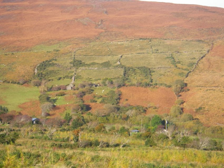
Figure 2. Map of the Iveragh Peninsula showing commonage areas (Source: National
Parks and Wildlife Service-NPWS)
Commonages suffered from overgrazing in the 1980s when livestock premia schemes
were introduced in the form of headage payments with the introduction of the
European Mountain Lamb and Hoggett Ewe Scheme in the 1970s (Directive 75/268
and the introduction of the European Ewe premium in 1980 (Regulation 1837/80).
This naturally led to an expansion in sheep numbers. O’Rourke and Kramm (2009)
stated that, according to local farmers, the average mountain stocking density went
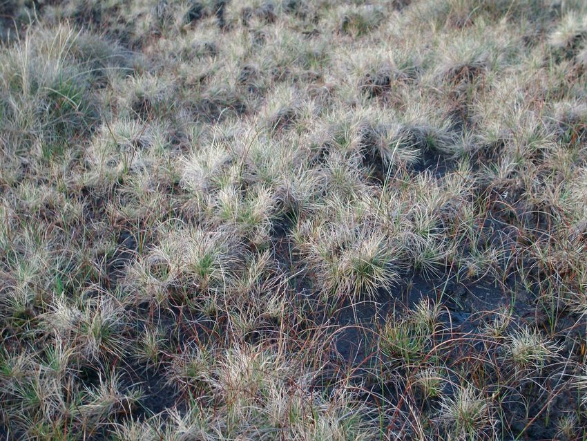
from one sheep per 0.40ha to more than 2 sheep per 0.40ha. Overgrazing had a
severe effect on the hills with the disappearance of dwarf shrubs such as heather and
bilberry and the dominance of a grass and sedge species poor vegetation (Plate 6).
The overgrazing problems led the government to introduce the Commanage
Framework Plan (CFP) in 1998 which bought about a compulsory destocking on all
commonages. On inspection by a team of experts, the destocking levels could be
raised by up to 100 percent. The farmers were compensated for all animals destocked
through the Rural Environmental Protection Scheme (REPS) or by Dúchas- the
Heritage Service. The Dúchas Scheme paid compensation on the basis of proven loss
of income, while REPS payments were fixed and were area-based.
Plate 6. A sward dominated with Mat grass (Nardus Stricta) as a result of
overgrazing
Present Farm Structure
In total, there are 2,023 on the Iveragh peninsula, the majority of which are under 30
ha in size (O’Rourke and Kramm, 2009). From the sample of 80 farms surveyed by
Kramm et al. (2010), the mean farm size was 114ha for commonage land and 176ha
on private land. However, there was considerable variation within these figures. The
mean sheep flock size was 212 ewes on the commonage farms and 225 on private
holdings resulting in an overall stocking rate of 0.38LU/ha and 0.29LU/ha
respectively. Stocking rates were similar in the more upland areas, calculated as 0.29
LU/ha on commonage and 0.28LU/ha on private land. However, stocking densities
were higher on commonage during the shorter grazing season than on private land,
0.55LU/ha compared to 0.36LU/ha.
7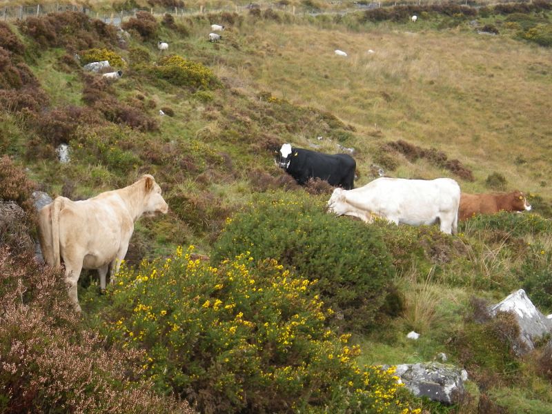
Case study Farms

A. Coastal Farm

This farm is situated on the coast but rises up into the adjacent higher mountain land.
The farm contains 20 hectares of green in-bye land and an adjacent 38 hectares of
commonage. The total area of the commonage is 270ha with 10 different farmers
owning a share. However, only two of the farmers presently graze the commonage
and, as a result, the farmer thinks it is badly under grazed. Prior to compulsory
destocking, the farmer had around 200 ewes and 6 suckler cows. Stock numbers are
now down to 100 blackface and 1 store beef animal, which will be slaughtered for
home consumption. The sheep are taken off the mountain prior to lambing in March
and remain on the green land during the summer. All lambs are sold as stores with
most of the ewes going back to the mountain in August/September. Hay is no longer
made on the farm but purchased from other farmers as a supplementary feed during
the winter.

B. Mountain farm

This farm is situated inland in the heart of Macgillycuddy’s Reeks. The in-bye land is
approximately 20ha, much of which was reclaimed from the mountain in the 1980s.
The remainder of the farm is commonage, a 53-hectare share of a total of 308
hectares. Six different farmers all have rights on the commonage and all are actively
farming it. The present stock on the farm includes 250 ewes and 1 cow and calf. Prior
to compulsory destocking, there was approximately 380 ewes and 11 cows. The
farmer has no plans to farm cattle again. This is a feature on many farms and the one
cow this farmer owns is now the only cow left in his local area. The resulting decline
in cattle is thought to be associated with the spread of less desirable vegetation such
as bracken (Pteridium aquilinum) and gorse (Ulex europaeus). On this farm, the
sheep graze the mountain during the summer coming down to in-bye land in October
and only the ewe lambs are returned to the mountain during the winter. The farm has
some purpose-built sheep housing, so the ewes are housed for about six weeks during
the winter and go back to the mountain after lambing in the spring. In the past, an
area of the farm was closed off for hay but now fodder is purchased from other parts
of Ireland. The lambs are all sold for slaughter through the Ring of Kerry Quality
Lamb Group, a recently formed marketing group promoting and selling quality lamb
from the area.

Nature Value of the Iveragh Peninsula

The traditional farming systems associated with the uplands of Ireland have created
the present landscape. The maintenance of this landscape is dependent on the
retention of these farming systems within the area. The ecological interest of the area
is reflected in the high percentage of the land area designated under Natura 2000 sites.
This includes the Killarney National Park, MacGillycuddy’s Reeks and Caragh River
Catchment SAC, part of Castlemaine Harbour SAC, Kenmare River SAC, Killarney
National Park and Iveragh Peninsula SPA (Figure 3).

                                                                                      8
Figure 3. Designated land sites on the Iveragh Peninsula (NPWS).

Based on distribution maps from the National Parks and Wildlife Service, of the total
59 recognised Annex I habitat types in Ireland, 49 can be found within the Iveragh
Peninsula, making it one of the major hotspots for biodiversity in Ireland. Of these 49
sites, at least 8 are dependent on a sensitive agricultural system for their survival.
These also form the main area of designated land. Factors such as undergrazing,
overgrazing, nutrient enrichment drainage and reclamation will all have adverse
effects on these sensitive habitats. The main farmed habitat types found on farms on
the peninsula are shown in Table 1.

Table 1. Annex I habitat sites dependent on a agricultural system for their survival.
   No.               Habitat            Distribution        Relevance to HNV farmland
   1330     Atlantic Salt meadows    Located around the   Sensitive to overgrazing,
                                     coast of the         management depends on
                                     peninsula            whether they have historically
                                                          been grazed. The cessation of
                                                          grazing on sites previously
                                                          grazed can led to overgrown
                                                          species-poor swards.
   1410     Mediterranean salt       Located around the   Sensitive to overgrazing,
            meadows                  coast of the         management depends on if they
                                     peninsula            have historically been grazed.
                                                          The cessation of grazing on sites
                                                          previously grazed can led to
                                                          overgrown species-poor swards.
   4010     Wet heath                Widespread           Sustainable stocking levels
                                     throughout the       required to prevent degradation.
                                     upland areas         Also under threat from
                                                          reclamation and afforestation.
                                                          Abandonment will lead to scrub
                                                          invasion.
   4030     Dry heath                Located throughout   Sustainable grazing levels
                                     the peninsula on     required. Main threats are
                                     more free draining   agricultural improvement and
                                     acid soils           abandonment of pastoral
                                                          systems.
   4060     Alpine and subalpine     Mostly confined      Sensitive to grazing
            heath                    to the summits and   management. Abandonment on

                                                                                              9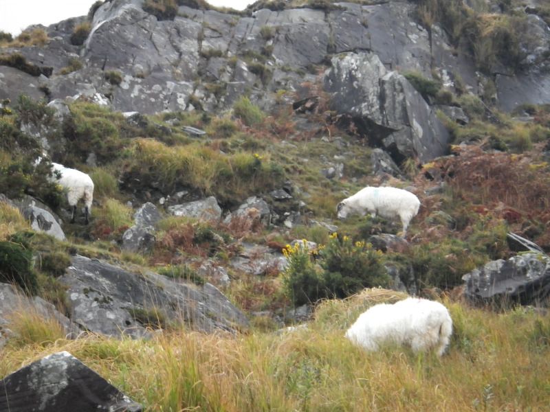
slopes of the         some alpine heaths may lead to
                                    mountains above       scrub invasion.
                                    350m
   6230    Species rich Nardus      Found mainly in the   Under threat from agricultural
           upland grasslands        central band of the   intensification (overgrazing or
                                    peninsula on slopes   the application of fertiliser and
                                    between improved      reseeding), also to agricultural
                                    grassland and         abandonment (undergrazing,
                                    heaths                leading to invasion by scrub,
                                                          bracken and heathland) and
                                                          afforestation.
   6410    Molinia meadows          Found throughout      Under threat from agricultural
                                    the peninsula on      improvement and abandonment
                                    heavy acid soils      (undergrazing leading to scrub
                                                          invasion particularly gorse (Ulex
                                                          europaeus)). An important
                                                          habitat for the Annex II butterfly
                                                          species Marsh Fritillary
                                                          (Euphydryas aurina).
   7130    Blanket Bog Active       Throughout the        Overstocking with sheep is the
                                    peninsula on upland   main damaging activity affecting
                                    areas with flat or    blanket bogs. Total
                                    sloping surfaces      abandonment can lead to
                                    with poor drainage    invasion of damaging species
                                                          particularly Rhododendron
                                                          (Rhododendron ponticum).

Fauna of Iveragh

The European Habitats Directive also lists species that must be protected. Excluding
marine species, 22 are listed under Annex II of the directive and so require protection
through the designation of SACs. Thirteen of these species can be found on the
Iveragh Peninsula. Many of these survive in the area because of the low level of
agricultural intensity and a change in the farming system has a negative impact on
their distribution. Species present include the Kerry Slug (Geomalacus maculosus),
found only in south west Ireland and on the Iberian Peninsula. In Kerry, it is found in
two habitat types: oak dominated woodland and open moor or blanket bog. One
species found on the peninsula which is declining throughout Europe is the Marsh
Fritillary butterfly (Euphydryas aurinia) (Plate 7). It is found on damp grassland
containing sufficient densities of its food plant, Devil’s bit Scabious (Succisa
pratensis). The species disappeared from Killarney National Park but was
reintroduced in 2006 with stock gathered elsewhere in Kerry (Harding 2008). The
correct agricultural management of its habitat is vital to prevent scrub encroachment
and to maintain the required density of Devil’s bit Scabious.

                                                                                               10
Plate 7 and 8. The Marsh Fritillary butterfly, an Annex II species on the EU Habitats
Directive with its feed source, Devil’s Bit Scabious, on the right.
Another important species found in Kerry is the Natterjack Toad (Bufo calamita). Its
natural range is confined to a small number of coastal sites on the Dingle and Iveragh
Peninsulas. Historically, the species has been recorded right along this Kerry coastal
strip. The NPWS have been active in recent years encouraging the creation of new
ponds to extend their range and allow migration between breeding sites (Plate 9). The
continued survival of the Natterjack toad is dependant on the farming community.
Plate 9. A photo from the NPWS information leaflet highlighting the importance of
grazing around the ponds to provide forage areas for the Natterjack Toad (Source:
NPWS).
Birds of Iveragh
The European Union Birds Directive (79/409/EEC) identifies species of birds which
are rare, in danger of extinction or vulnerable to changes in habitat and require
protection. Three Special Protection Areas (SPAS) have been designated in the area,
Castle Maine Harbour SPA, Killarney National Park SPA and Iveragh Peninsula SPA.
Castlemaine Harbour Spa is predominantly sea based with a small section of
coastline. It was declared an SPA for a range of bird species, including 5 species
listed on the Annex I list and 16 species with national importance. Killarney National
Park SPA includes the most southerly site in Ireland for the Greenland White Fronted
Goose population. It also contains Peregrines, Merlin, Red Grouse and Ring Ouzel.
The Iveragh Peninsula SPA encompasses the high coast and sea cliff sections of the
peninsula. The site is of special conservation interest for the Chough, Peregrine,
Guillemot, Fulmar, and Kittiwake. The Chough is particularly relevant to High
Nature Value farming. Choughs largely feed on soil invertebrates and grazing by
domestic livestock helps provide the variety of year round feeding opportunities
needed. Short swards and exposed soils facilitate access to food sources. Table 2
shows the Chough counts for three different areas in Ireland and highlights the
importance of the Iveragh peninsula as Chough site.
Table 2. The number of breeding pairs of choughs in three areas of Ireland.
Area 1982 1992 2002
Iveragh Peninsula SPA 109 88
Aran Islands 36 21 19
N.Ireland (Antrim coast) 10 2 1
11The decline in Chough numbers on the Antrim coast is thought to have been due to
the loss of semi-natural grasslands and coastal heaths through intensification of
grazing management, increased housing of cattle in the winter and improved
veterinary products (DOE, 2000), while on the Aran Islands, a fall in numbers on Inis
Mόr may be linked to a decline in grazing on the island (Gray et al., 2003).
Plate 10. The Chough thrives where low intensity faming systems occur close to
suitable nesting sites. The Iveragh Peninsula is an important European nesting site for
the Chough. (Photo© RSPB)
Other Natural Resources
The Iveragh Peninsula contains “the Ring of Kerry”, one of the top Irish tourist
destinations and designated as an Area of Outstanding Natural Beauty (AONB). The
179km route that winds past pristine beaches, the island-dotted Atlantic coast,
medieval ruins, mountains and lakes attracts an estimated 1.8 million visitors every
year. The mountains of the peninsula are an important outdoor attraction, containing
the highest peaks in Ireland and regarded as having the most spectacular ridge walks
in Ireland. The area also contains some of Ireland’s best whitewater kayaking on the
Carragh, Gaddagh and the Flesk rivers. The network of lakes and rivers are also
prime fishing areas for salmon and sea trout.
Policy issues
Whilst the majority of the Iveragh Peninsula is farmed extensively, there are some
areas consisting mainly of intensively managed improved grassland. The bulk of this
grassland type is situated in the lowlands but it can also be found in the more upland
areas where reclamation has occurred. Whilst these farms suffer many agricultural
disadvantages due to factors such as climate, distances from markets, their improved
agricultural state means higher stocking rates are possible. They are also usually
outside of the designated areas and so have less statutory restrictions. Farms on the
peninsula with large areas of improved grassland would not be classed as HNV
farmland. On many farms, these improved grassland areas are part of a mosaic of
semi-natural grassland and heather moorland with the different habitat types being an
integral part of the farm system. This farmland would fit into Type 2 of HNV
12farmland. Along the coast, some of the tightly-grazed grasslands are important
feeding sites for the Chough, an Annex II species under the habitats directive;
therefore, there may also be some Type 3 HNV farmland on the peninsula.
The Iveragh Peninsula faces the same problems faced by other marginal agricultural
areas across Ireland and Europe, due to the low agricultural returns of the farming
system. On the peninsula, this is leading to intensification of both mountain and
lowland areas and undermanagement on many areas leading to scrub encroachment.
The large area of land designated as SAC does prevent further intensification, which
is evident outside the SAC areas but the range of stocking rates considered favourable
to the conservation of these habitats may be lower than the stocking densities
considered as economic for the farmer. This has been partially addressed by REPS
and NPWS scheme but both schemes are presently closed for new applicants. The
Bio-Up Farm Management Survey 2007-2008 shows that just under 70 percent of the
farm income is composed of direct subsidies, Single Farm Payment (SFP) and agri-
environmental schemes (REPS), highlighting the importance of subsidised support in
maintaining farming in these marginal areas.
In addition to the challenging economic conditions for farming in the area, there are
other factors affecting the overall situation.
• Lack of alternative employment in the area, particularly since the decline in
the construction industry. The Bio-Up survey found that construction
constituted 20 percent of the surveyed farmers off-farm employment.
• Lack of potential successors to carry on the farming tradition with over 50
percent of farmers surveyed under the Bio-Up project having no definite
successor.
• Isolation of many farm houses. The structure of Irish agriculture with the farm
house being situated in the centre or base of the farm is very evident on the
Iveragh Peninsula with houses dotted throughout the peninsula.
As a result of the factors mentioned, the main threats in maintaining the high nature
value of the area are intensification and undergrazing as a result of lower management
inputs. The level of afforestation in the area is lower than other marginal areas due to
the high area of land designated as SAC and SPAs and a high proportion of the
peninsula is classed as an acid sensitive area which also has restrictions on forestry
planting.
Agricultural Intensification
Agricultural intensification has been an ongoing process on the peninsula since
mankind arrived. As stated previously, many of the habitats present are as a result of
agricultural processes. The green in-bye land on most mountain farms has been as a
result of reclamation, cropping and eventually grassland. This reclaimed part of the
farm is an intregal part of the farming system and often dictates the number of
livestock kept on the farm. The demand for food after the Second World War led to a
push for a more intensive type of agriculture and this has dominated agriculture policy
until recently. The detrimental effects of agricultural intensification on wildlife are
well documented (Fuller, 1987; Smith, 1994; Bignal & McCracken, 1996; Robinson
& Sutherland, 2002). However at a farm level, it still offers potential for higher
13stocking rates, improved forage quality and a simpler management system. Therefore
where funds are available, there is still a strong desire in the farming community to
reclaim areas of semi-natural vegetation. The Directive on Environmental Impact
Assessment (EIA) (85/337/EEC as amended) requires that the impacts of intensive
agriculture on semi-natural areas should be subject to environmental assessment
(annex 2 (1) (b)). However, there is a 100ha threshold before an EIA is required, so
the ongoing reclamation falls below this threshold.
Plates 11 and 12. Examples of present day reclamation encroaching into the
mountain vegetation on the Iveragh Peninsula.
In addition to direct intensification through reclamation and reseeding, the effects of
indirect intensification are evident throughout the peninsula. Indirect intensification
is where the changes in management over the years have resulted in a change of
vegetation from semi-natural to semi-improved grassland, which leads to a reduction
in plant species number. This has been as a result of increased fertilisation and higher
stocking rates. Field studies have shown that, in general, plant diversity is
significantly reduced even for fertiliser levels which are low in comparison to normal
application rates in intensive grassland. For nitrogen, a reduction of half of the total
number of plant species can be observed for fertilisations between 20 and
50kg/ha/year and the average number of species is very low where nitrogen inputs
exceed 75kg N/ha/year (Plantureux et al. 2005).
Increased grazing levels on grasslands also lead to reduced plant diversity (Olff &
Ritchie, 1998). Heavy grazing produces short dense swards that generate little seed
resource and offer limited foraging and shelter oppurtunities for many invertebrates
(Morris 2000). This reflects the work carried out by Kramm et al. (2010) on the
Iveragh Peninsula which showed that higher stocking levels did lead to reduced plant
diversity.
Undergrazing
The survey by Kramm et al. (2010) found that, in spite of the widespread hypotheses
about land abandonment, there was little evidence of abandonment either taking place
or being likely to happen in the near future. However, they did find
undermanagement being an issue on some hills. Baudry (1991) describes
abandonment as a change towards a less intensive pattern in land concerned or where
the soil stops being managed and used. The complete abandonment of land on the
peninsula is unlikely due to present land values and it is also possible for a
14neighbouring farm to use the land for an agreed rent, a process known as conacre.
The strong Irish tradition of the family farming passing on from generation to
generation is evident on the Iveragh Peninsula as quoted by Kramm et al (2010).
However, the change towards a less intensive land use is evident throughout the
peninsula. This has resulted in invasion of scrub and trees leading to a loss of farm
habitats. Such losses of High Nature Value (HNV) farming has serious consequences
on wildlife living in farm habitats, both in terms of abundance and species
composition (Reif et al., 2008; Russo, 2007).
Plates 12 and 13. An example of undermanagement in the uplands. On the left, a
once active farm now slowly being engulfed with Gorse (Ulex europaeus) and right
Rhododendron (Rhododendron ponticum) starting to spread in the mountains.
Plates 13 and 14: An example of undermanagement in the lowlands. On the left, a
former lowland haymeadow now overgrown with bracken (Pteridium aquilinum) and
Montbretia (Crocosmia x crocosmiiflora). On the right, the fields in the foreground
are still actively managed whilst the adjacent farm is no longer managed and scrub is
taking over.
Whilst most of the increase in scrub is associated with reduced stocking levels, many
traditional practices are no longer maintained due to the poor economics of farming in
these areas and the changes that have occurred in farming systems. Traditional gorse
(Ulex europaeus) was kept under control by hand cutting and was used as a source of
protein, particularly for horses. Plate 15 shows a gorse grinder on a farm in the area
which the owner once used. Rushes (Juncus effusus) and bracken (Pteridium
aquilinum) also had a value as they were used for bedding and in the storage of
potatoes. Once this use ceased, the economics of controlling these species became
15prohibitive. This highlights how small changes in the agricultural system can have a
negative environmental effect.
Plate 15 and 16. On the left, a machine used to grind gorse for use as a livestock feed
on a farm in Kerry. On the right, the spread of soft rush and bracken presently
confined to the boundaries as a result of active management.
Kramm et al. (2010) found that the higher the percentage of scrub on a site, the lower
the plant diversity. An intermediate level of litter resulted in the highest plant
diversity. This is in accordance with the work of Morris (2000) who showed that too-
low stocking rates produce patches of tall rank vegetation and that the accumulation
of dead vegetation and litter are depressive for plant seed germination. Although this
is favourable for some invertebrate species like spiders, at a very low stocking rate the
density of the sward and litter layer means that invertebrates are generally not really
accessible to foraging birds so an intermediate stocking rate seems to be optimal for
foraging birds as well.
Future Recommendations
The importance of the Iveragh Peninsula as an area of High Nature Value farmland
needs to be fully recognised by the farming community and its representatives. The
area offers a range of services, other than food production, that are not always
recognised in present policies. Livestock production on its own is insufficient to
maintain farming families in the area. This is leading to two different dynamics:
- intensification in an attempt to increase agricultural output or
- abandonment where the land is not farmed or farmed at very low stocking levels.
Both of these dynamics are leading to an overall loss in biodiversity in the area. To
address requires targeted agricultural and agri-environment support that encourages
the appropriate low-intensity farming systems and will deliver both food production
and ensure the maintenance of the farmland biodiversity value associated with the
area. Achieving this will be difficult and will require conservationists and
agriculturists to work in partnership with local communities to trial, research and
monitor a number of possible solutions for the sustainable management of the areas.
Similar approaches have been successful within Europe and include BurrenLIFE, now
managed as the Burren Farming for Conservation Programme (BFCP) which worked
closely with farmers and other experts to produce a blueprint for farming in the
Burren (see http://www.burrenlife.com/). Funding was obtained for BurrenLIFE
16through the European LIFE Nature fund and for the BFCP from Article 68 of EU
Regulation 73/2009. Under Article 68 support can be paid by the member state to
specific types of farming which are important for the protection of the environment.
A similar approach was previously adopted on the Baltic Island of Öland in Southern
Sweden (Emanuelsson, 2004). The Öland method, as championed by Urban
Emanuelsson, also dealt with the agri-environmental management of semi-natural
pasture in a limestone landscape, the Stora Alvaret.
The issues that needed to be targeted include:
Grasslands: Whilst the peninsula is primarily known for its upland mountain
vegetation, it still contains significant areas of semi-natural grassland, some listed
under Annex I of the European Habitats Directive. To prevent further loss of semi-
natural grassland, some areas need to brought back into sustainable management.
Removal of some unwanted vegetation (Plates 13 and 14) will help in the restoration
of these previously species-rich grasslands and limit the intensification on other areas.
However, to remove this vegetation sensitively without excessive damage to the
underlying sward will require investment which is currently unavailable. At present,
only semi-natural grasslands within a designated area or over 100ha in size (EIA
threshold level) have protection. Therefore, their survival is dependent on their being
managed under low fertility and low agricultural stocking rates. This agricultural
system cannot presently compete with a more intensive productive sward, therefore
the basis of a targeted scheme should recognise this.
Uplands: Much of the privately-owned mountain land within the peninsula is
designated under the EU Habitats Directive. Maintaining these sites in favourable
conservation status is one of the central purposes of the Habitats Directive. However,
the range of stocking densities considered most favourable to the conservation of the
habitat may be lower than the stocking densities considered as agriculturally optimal.
This has been recognised by schemes such as REPS and the National Parks and
Wildlife Service Farm Plan Scheme. However budget constraints have curtailed the
activities of these schemes. A targeted scheme could address this by supporting
farming for food and conservation.
Commonage: The commonage suffers similar problems to the privately-owned
upland areas. However, as they are not in private ownership, they have suffered more
with overgrazing, resulting in the implementation of the Commonage Framework
Plan (CFP) that bought about a compulsory destocking on all commonages. There is
a perception among farmers that understocking is now a threat. Some of the farmers
with commonage rights no longer keep sheep on the mountain, a fact highlighted in
the farm case study quoted previously. To maintain these areas in a favourable
condition, consideration should be given to developing a total grazing allocation for
individual commonages. The total allocation of sheep numbers could be utilized by
the farmers actually farming the commonage and not the total shareholders. This will
require agreement among the shareholders and sufficient financial support to make it
feasible. To determine a correct grazing allocation, information will be required on
the types and area of land cover within the commonage areas.
Education: For any targeted scheme to be successful, all the participants must be
fully aware of what the scheme is aiming to achieve. In the case of the farming
community, this will require an understanding of why their area is so important and
17why the correct management is crucial to survival of many habitats. Therefore, there
will be a need for targeted training on HNV farmland covering the species present
(rare and harmful) and the best practices for combining farming and conservation.
For government bodies, there is the need to see the potential of farmers in managing
the countryside both for conservation and for farming.
Marketing: Whilst marketing is outside the scope of this case study, the success of
the Ring of Kerry Quality Lamb Group (see http://www.ringofkerryqualitylamb.ie/)
indicates that the area presents a marketable brand for food production. Pro-active
marketing of produce based on the High Nature Value concept can help make farming
in the area more financially feasible. Recent advertisements by Bord Bia (Irish Food
Board) showing the potential of Irish agriculture display High Nature Value farmland,
highlighting the importance of HNV areas to the whole Irish food sector.
References
Baudry, J. (1991). Ecological consequences of grazing extensification and land
abandonment: Role of interactions between environment, society and techniques.
Options Méditerranéennes (15), 13-19.
Bignal, E.M. & McCracken, D. (1996). Low-intensity farming systems in the
conservation of the countryside. Journal of Applied Ecology. 33, 413-424.
Buckley C, & van Rensberg T. M., Hynes S. (2008). Farming on Commonage: Is it a
constraint to recreational access. Available at:
http://www.economics.nuig.ie/resrch/pdf/paper_0130.pdf
Accessed 1st December 2010.
Central Statistics Office (CSO). (2000). Census of Agriculture. Cork, Ireland.
Crowley J. & Sheehan J. (eds). (2009). The Iveragh Peninsula. A Cultural Atlas of
the Ring of Kerry. Cork University Press. Cork.
Department of the Environment. (2000). Northern Ireland Species Action Plans:
Chough. Available at:
http://www.ni-environment.gov.uk/chough_ni_sap_09__2_.pdf.
Accessed 10 December 2010.
Emanuellson, U. (2004). The Öland Method-What is it? ISBN 91-506-1704-4.
Fuller, F.M. (1987). The changing extent and conservation interest of lowland
grasslands in England and Wales. A review of grassland surveys 1930-1984,
Biological Conservation, 40, 281-300.
Gray, N., Thomas, G., Trewby, M. & Newton, S.F. (2003). The status and
distribution of Choughs Pyrrhocorax pyrrhocorax in the Republic of Ireland,
2002/2003. Irish Birds 7 (2): 147-56.
Harding, J.M. (2008). Discovering Irish Butterflies and their Habitats. Jesmond
Harding. ISBN 978-0-9560546-0-9.
18Kramm, N., Anderson, R., O’Rourke, E., Emmerson, M., O’Halloran, J., Chrisholm,
N. (2010). Farming in the Iveragh Uplands: A tale of humans and nature. University
College Cork. Cork.
Morris, M.G. (2000). The effects of structure and its dynamics on the ecology of
arthropods in British grasslands. Biology Conservation 95, 129-142
Plantureux, S., Peeters, A. & McCracken, D. (2005). Biodiversity in intensive
grasslands: Effects of management, improvements and challenges. Agronomy
Research, 3(2), 153-164.
Olff H., & Ritchie M.E. (1998). Effects of herbivores on grassland plant diversity.
Trends in Ecology and evolution. 13 (7), 261-165.
O’Rourke, E., & Kramm, N. (2009). Changes in the Management of Irish Uplands: A
case-study from the Iveragh peninsula. European Countryside. 1, 53-69
Reif, J. Vorisek P., Stastny K., Bejeck V. & Petr J. (2008). Agricultural
intensification and farmland birds: new insights from a central European
country. Ibis. 150 (3): 596-605.
Robinson, R.A. & Sutherland, W.J. (2002). Changes in arable farming and
biodiversity in Great Britain. Journal of Applied Ecology, 39, 157-176.
Russo, D. (2007). Effects of land abandonment on animal species in Europe:
conservation and management implications. Integrated Assessment of vulnerable
ecosystems under global change in the European Union. European Commission,
Directorate – General for Research Environment, pp. 53, Luxembourg: Office for
Official Publications of the European Communities.
Smith, R.S. (1994). Effects of Fertilisers on Plant Species Composition and
Conservation interest in UK grassland. In: Grassland Management for Nature
Conservation, Eds. R.J. Haggard & S. Peel, British Grassland Society Occ. Symp. No.
28 edn, British Grassland Society, Reading, 64-73.
19You can also read