TEXAS FIRE POTENTIAL UPDATE - FEBRUARY 22ND - FEBRUARY 28TH 2021 PREDICTIVE SERVICES DEPARTMENT
←
→
Page content transcription
If your browser does not render page correctly, please read the page content below
1

TEXAS FIRE POTENTIAL UPDATE
FEBRUARY 22ND – FEBRUARY 28TH 2021
   PREDICTIVE SERVICES DEPARTMENT

   Link to Fire Danger Products
Fire Potential Notes
2
Initial attack potential in cured grasses will be low to moderate through Wednesday across the state
due to short term drying and increased wind speeds surrounding a cold front forecast to move into
the state mid-week. Pre-frontal conditions Tuesday may produce elevated to near critical fire
weather across the Western Plains.
Behind the cold front, a cool and moist fire environment will limit the availability of cured grasses
Thursday and Friday, resulting in low initial attack potential. A new cold front will move through the
state over the weekend and may produce elevated fire weather in the Trans Pecos and Western
Plains by Sunday, resulting in low to moderate initial attack potential in cured grasses.
A warm and dry fire environment will produce moderate drying potential statewide through
Wednesday. Drying potential will be low Thursday through the weekend along and East of I-35.
Drying potential may increase back to moderate west of I-35 this weekend.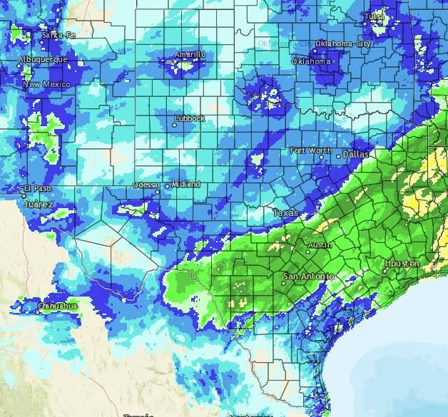
Reported fire activity was low over the past week due to the prolonged winter weather event
      that impacted the entire state last week. Low to moderate initial attack potential will be
                            present through Wednesday in cured grasses.
3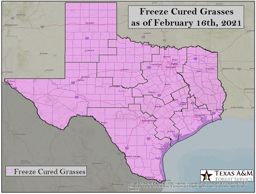
A significant hard freeze occurred statewide on February 16th. Freeze cured grasses are now present across the
    entire state. Freeze cured grasses are the catalyst for dormant fire season, requiring less drying and moderate
                                     fire weather for initial attack activity to occur.

4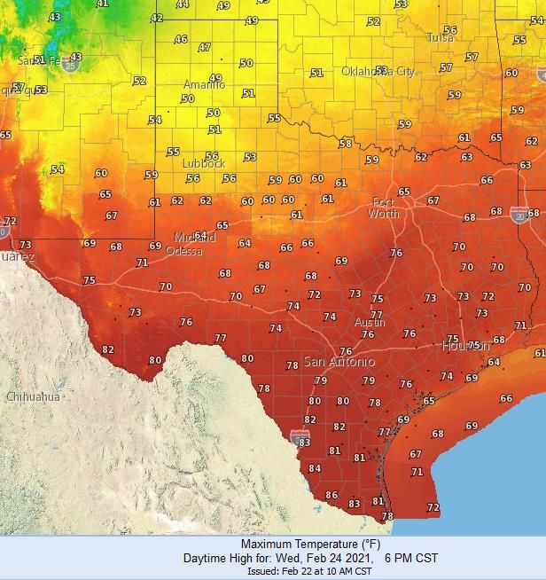
Radar estimated rainfall maps over the past 7 and 14 days are based on mostly frozen precipitation that began impacting
    the state on February 11th. Liquid equivalency of the frozen precipitation produced a general 1-2 inch region from Del Rio
       northeast into East Texas. Snowfall amounts have generally resulted in less than 0.5 inch of rainfall across West Texas.

       7-Day Radar                                                        14-Day Radar
5   Estimated Rainfall                                                  Estimated Rainfall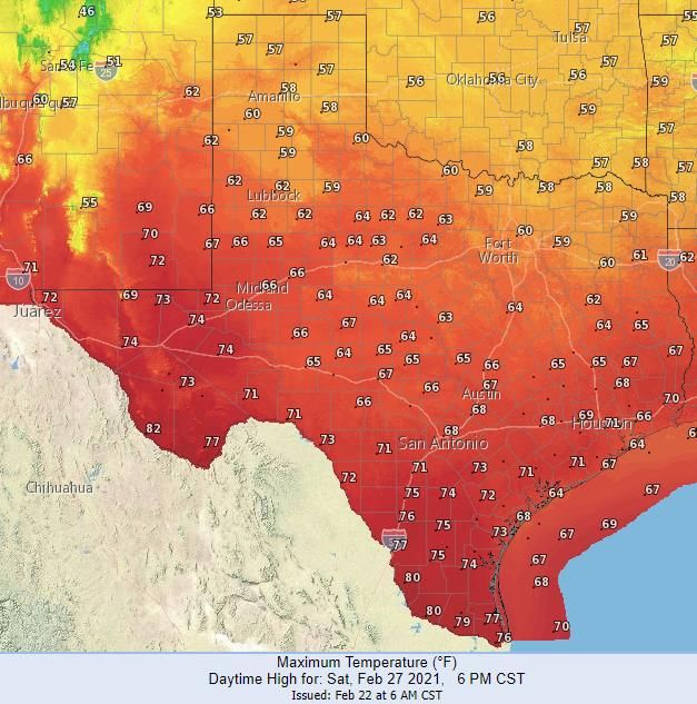
Emerging dryness over the past 30 days is expanding in the Rolling Plains and North Central Texas as 25% or
    less than normal rainfall deficits are present. Persistent dryness remains in South Texas where both the 30 and
                60 day percent or normal rainfall maps highlight regions at or below 25% or normal.

        30 Day                                                     60 Day
6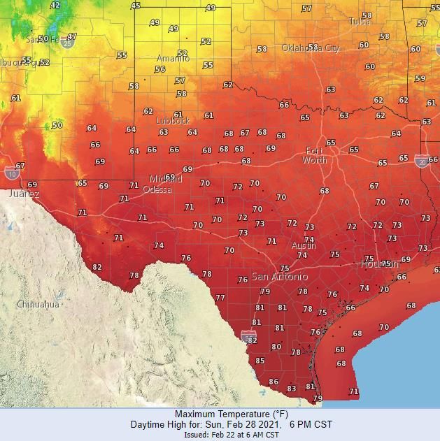
A warm and dry fire environment will decrease1-hr fuel moisture through Wednesday, increasing the availability of cured grasses.
  The forecast 1-hr fuel moisture map can provide guidance daily where cured grasses are receptive to burning when 1-hr fuel
        moisture is low. Normal to above normal fuel moisture is forecast this week, keeping significant fire potential low.

7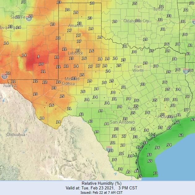
Warm and dry conditions are forecast Monday through Wednesday across the state. On Tuesday, pre-frontal
           conditions are forecast ahead a cold front forecast to move into the state on Wednesday.

            Surface Forecast Tuesday Afternoon                     Surface Forecast Wednesday Morning

8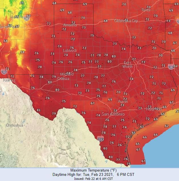
Temperatures will be above normal for most of the state by Tuesday in the pre-frontal environment. Temperatures
      will cool behind cold front passage Wednesday for the High Plains and Rolling Plains while most of the state
          remains above normal. The above normal temperatures will promote moderate drying in surface fuel.

                 Maximum Temperatures Tuesday                           Maximum Temperatures Wednesday

9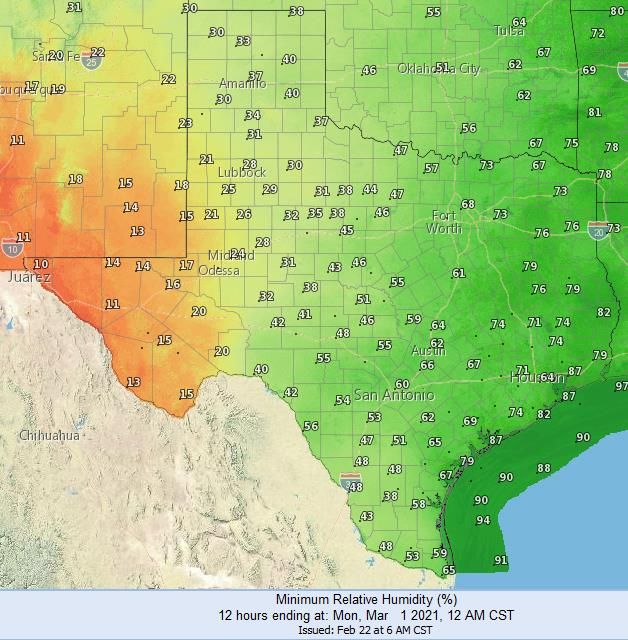
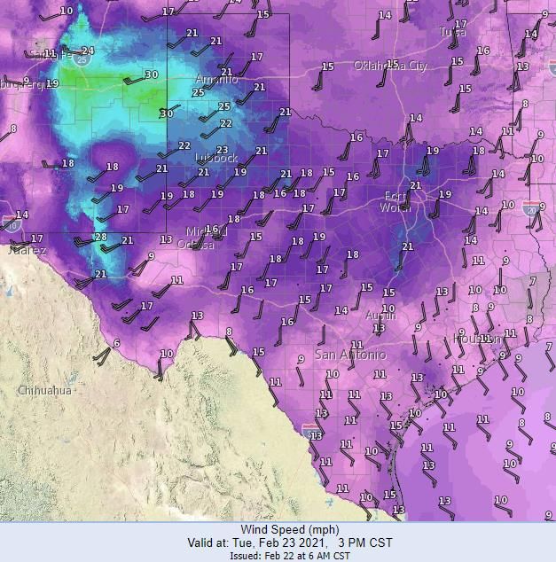
Elevated to near critical fire weather is likely across the Western Plains and into the Trans Pecos Tuesday. The combination
of short term drying, above normal temperatures, and increased fire weather will produce low to moderate initial attack
potential in cured grasses.
Forecast 3 PM Wind Forecast Min RH
Tuesday Tuesday
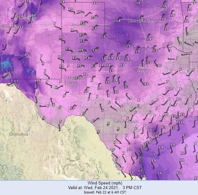
10Depending on the timing of the frontal passage Wednesday, low to moderate initial attack activity will persist
where the warmest temperatures and highest wind speeds intersect.
Forecast 3 PM Wind Forecast Min RH
Wednesday Wednesday
11By Thursday, the cold front is forecast to be through most of the state, except for far South Texas. Thursday and Friday will
likely be cool and moist with higher relative humidity, cloud cover, and increased rainfall chances for North and East Texas.
Initial attack potential will decrease to low for the eastern 2/3rd of the state as increasing 1-hr fuel moisture will decrease
the availability of cured grasses. Some light snow is possible for the High Plains on Thursday.
Two Day Precipitation Forecast Thursday and Friday
Surface Forecast Thursday Afternoon
12Over the weekend, a cold front may enter the state Sunday. Timing of this frontal passage is still uncertain and
may be delayed until early next week. Periods of rain are forecast Saturday and Sunday across East Texas.
Two Day Precipitation Forecast Saturday and Sunday
Surface Forecast Sunday Afternoon
13Temperatures are forecast to warm over the weekend ahead of the Sunday’s cold front passage. Areas west of
I-35 will likely have moderate drying potential due to the warm and dry environment.
Maximum Temperatures Saturday Maximum Temperatures Sunday
14Pre-frontal conditions are possible Sunday across the Western Plains where some localized elevated fire weather
may develop resulting in low to moderate initial attack in cured grasses. As the timing of the frontal passage
become more clear this week, the strength of the fire weather may increase or decrease.
15ERC values are increasing for most PSA after the below normal temperatures and winter precipitation observed
last week. Moderate drying through Wednesday may increase ERC values back to near normal for many PSA.
PSA Observed
High Plains Below Normal
Southern Plains Below Normal
Trans Pecos Below Normal
Western Hill Country Below Normal
Rolling Plains Below Normal
Eastern Hill Country Below Normal
Cross Timbers Near Normal
Central Texas Below Normal
North Texas Below Normal
Western Pineywoods Near Normal
Northeast Texas Below Normal
Southeast Texas Near Normal
South Texas Below Normal
Gulf Coast Above Normal
16 Link to ERC Seasonal GraphsThe return of near normal temperatures and drier air has resulted in the increase of ERC values for the entire
state. The low water equivalency of recent snowfall in the High and Rolling Plains only provided a short duration
effect of keeping ERC low as values have been increasing over the weekend.
17The Climate Prediction Center released the March temperature and precipitation outlook February 18th.
The current forecast for Texas is warmer and drier than normal which is consistent with the current La Niña
pattern. March is normally the peak period for fire activity during the dormant fire season.
March Temperature Outlook March Precipitation Outlook
18The Seasonal Drought Outlook was updated on the 18th forecasting drought development to expand in
the state through May and is consistent with the warmer and drier conditions associated with La Niña.
19You can also read