Wetlands Australia 2018 - Department of the Environment and Energy
←
→
Page content transcription
If your browser does not render page correctly, please read the page content below
Wetlands Australia 2018
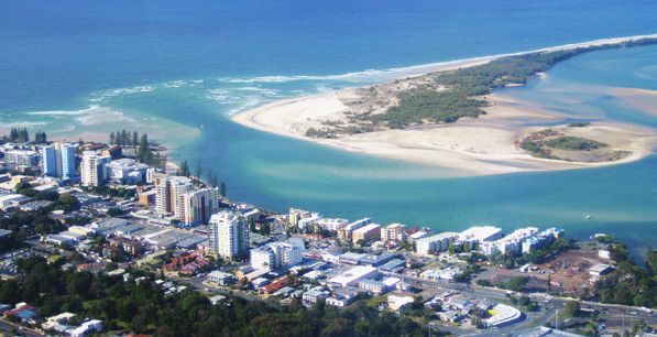
© Commonwealth of Australia, 2018.

Wetlands Australia 2018 is licensed by the Commonwealth of Australia for use under a Creative Commons
Attribution 4.0 International licence with the exception of the Coat of Arms of the Commonwealth of Australia,
the logo of the agency responsible for publishing the report, content supplied by third parties, and any images
depicting people. For licence conditions see: http://creativecommons.org/licenses/by/4.0/au/

This report should be attributed as ‘Wetlands Australia 2018, Commonwealth of Australia 2018’.

The Commonwealth of Australia has made all reasonable efforts to identify content supplied by third parties using
the following format ‘© Copyright, [name of third party] ’.

Disclaimer
The views and opinions expressed in this publication are those of the authors and do not necessarily reflect those of
the Australian Government or the Minister for the Environment and Energy.

Front cover: City of Caloundra near Pumicestone Passage, Moreton Bay Ramsar wetland (Jim Mollison)

Back cover: The blue fairy orchid, Pheladenia deformis and the carnivorous Drosera menziesii growing together in
the Alison Baird Reserve (André Arruda)

ii / Wetlands Australia
Contents
Introduction1
Wetlands for a sustainable urban future                                                                 3
    Creating wetlands to treat stormwater—keeping city gardens alive and Gulf St Vincent clean!         4
    Restoring the Fotheringham Reserve Billabong                                                        6
    Darwin’s urban wetland revival                                                                      8
    Engaging the community in a water-smart project to capture stormwater for biodiversity              9
    Conserving the Greater Brixton Street Wetlands and Yule Brook: iconic wetlands within
    an industrial area                                                                                 11
    Wetlands for treating greywater                                                                    13
Wetland restoration for biodiversity and carbon storage                                                15
    Restoration of the Fleurieu Peninsula Swamps                                                       16
    Working together to get the wet into wetlands and Wingillie Station                                18
    Murray wetland rehabilitation leaves a lasting legacy for local communities                        20
    Restoring Paiwalla wetland                                                                         22
    Restoring Vasse Wonnerup Ramsar Wetlands: a 10-year partnership                                    24
    Restoring wetland function at Spotswood Lagoon in the Lower Burdekin                               26
    Space tech helps expose water weeds in Gwydir wetlands                                             28
    Coordinated, inter-agency feral pig control preserving NSW wetland environments                    29
    Unlocking the potential of wetlands in South-East NSW                                              30
    Big Plans for Clybucca Wetlands                                                                    31
Information underpinning wetland protection                                                            33
    Tracking carbon in Australia’s wetlands                                                            34
    Global tourists flock to the Peel-Yalgorup Ramsar site                                             36
    ‘Walking the Landscape’ to improve catchment understanding in Queensland                           38
    NGO preparations for Ramsar COP 13                                                                 40
Focus on communities                                                                                   41
    Thomas Lagoon and Arding Landcare: finding their future together                                   42
    Hunter Local Land Services helps revive internationally-recognised wetlands                        44
    Gladstone Myco Restoration Project—an innovative approach to community engagement                  46
    Ballina Wetland Restoration Education Pilot Project—a successful partnership                       48
    Ramsar wetland infotainment                                                                        50
    Scout Group does regular beach clean-up at Cobourg Peninsula Ramsar Wetland, Northern Territory    52

iii / Wetlands Australia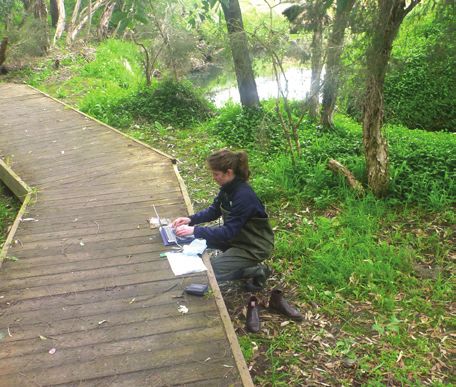
iv / Wetlands Australia
Introduction
Wetlands Australia 2018 brings together a collection of inspiring stories of
amazing wetland places and the people who are passionate about looking
after them. This edition highlights Wetlands for a sustainable urban future, the
theme for World Wetlands Day 2018.

Urban wetlands provide refuges for wildlife as well as        We hope you enjoy this edition of Wetlands Australia.
welcome retreats for city dwellers and their families from
                                                              If you would like to contribute to future editions
the hustle and bustle of city life. Some urban wetlands,
                                                              of Wetlands Australia, please contact
including constructed wetlands, can remove sediment
                                                              wetlandsmail@environment.gov.au.
and pollutants from urban runoff—providing clean
water that can also be used for irrigating sporting fields,   You can also to subscribe to Wetlands Australia to
watering gardens and preventing pollutants entering           receive new editions by going to our web page and
rivers and estuaries.                                         signing up: http://www.environment.gov.au/water/
                                                              wetlands/publications/wetlands-australia
This edition also features articles about
internationally-significant Ramsar wetlands,                  Fact sheets highlighting the importance of wetlands
habitat restoration in coastal and inland settings,           are also available.
community engagement and innovative approaches
to wetland management.

1 / Wetlands Australia
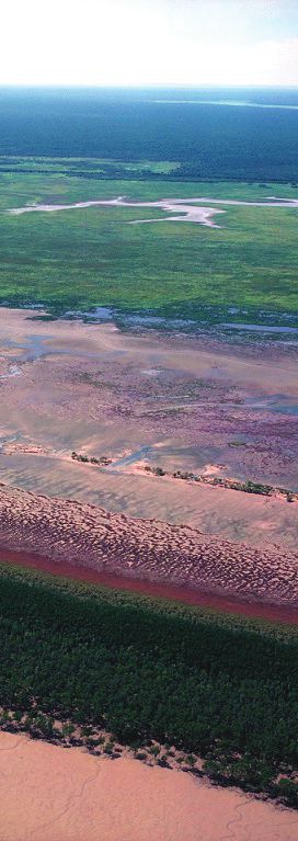
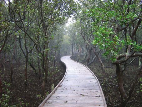
Mangroves in Kakadu (Allan Fox)

2 / Wetlands Australia
Wetlands for a sustainable
urban future

3 / Wetlands Australia
Creating wetlands to treat stormwater—
keeping city gardens alive and Gulf St
Vincent clean!
Mark Hannan, Strategic Planner—Open Space Environmental Management
Shannon Watkins, Co-ordinator—Recycled Water
City of Charles Sturt

The ‘Waterproofing the West’ project captures and treats up to 2400 million
litres of stormwater from local urban catchments, as well as stormwater
flowing into the urban section of the River Torrens, each year. The project
created wetlands along Old Port Road, Cooke Reserve, West Lakes Golf Course
and the former Cheltenham Racecourse site. In a major stormwater use
project, City of Charles Sturt is now harvesting, treating and storing this water
in aquifers for use in irrigation and for flushing toilets, watering gardens,
washing cars and paving, and filling ornamental ponds and water features.

The Charles Sturt city council’s recycled water               Water entering each of the constructed wetland
operations consists of a large number of individual           treatment systems flows through gross pollutant traps
components working together as one stormwater                 to remove large debris before entering one or more
harvesting and reuse scheme.                                  sedimentation basins where many of the pollutants
                                                              settle and are eventually removed by dredging. The
Stormwater, a combination of rainwater and roof water,
                                                              sedimentation basins are mainly open water with
is captured within two of the council’s surface water
                                                              aquatic vegetation on the edges.
catchment areas—the Torrens Road catchment, an
area of approximately 460 hectares, and the Port Road
catchment, an area of approximately 590 hectares.
Water is also extracted from the River Torrens.

Original (pre-construction) site condition showing concrete   Construction phase once concrete channel drain had been
drain (City of Charles Sturt)                                 removed (City of Charles Sturt)

4 / Wetlands Australia
The next stages are wetlands comprising large and small    The wetlands are preventing stormwater-borne pollutants
open bodies of water with deep pools and shallow areas     from being discharged into the marine environment
with a selection of aquatic plants for a natural water     of Gulf St Vincent. Pollutants including manganese,
treatment process. Water becomes cleaner as it travels     molybdenum, dissolved and suspended solids, nitrogen,
through each stage of the system. The resulting clean      phosphorus and zinc were shown in laboratory tests to have
water is injected into local aquifers for storage and is   decreased after treatment in the wetland systems.
available for later extraction.
                                                           Between 2014 and 2017 the total volume of potentially
Council has used extracted water to irrigate open space    polluted stormwater prevented from being discharged
or to top up the wetlands, where required.                 to the gulf, and thus protecting the fragile marine
                                                           environment per annum has been estimated to be
The past two years have been quite wet—during both
                                                           1704 megalitres.
winter and summer—leading to increased volumes of
water being injected but little water being extracted as
                                                             For further information visit our website:
it was not needed for irrigation and other uses such as
                                                             www.charlessturt.sa.gov.au or contact:
topping up ponds.
                                                             mhannan@charlessturt.sa.gov.au, or
In drier times, the stored water will become a               swatkins@charlesturt.sa.gov.au
highly-valued resource.

Post-construction, landscaped and operational              Close up of water body and macrophytes (City of Charles Sturt)
(City of Charles Sturt)

5 / Wetlands Australia
Restoring the Fotheringham
Reserve Billabong
Bertrand Salmi—Water Technology, and Matthew McClymont, Jack Chittenden and Maree Keenan—City of
Greater Dandenong

Water stress is believed to be a key contributor to the declining health of
fragmented ecosystems in urban areas. This is thought to be the case for
Fotheringham Reserve—16 hectares of public open space in the City of
Greater Dandenong, Victoria.

Fotheringham Reserve hosts one of the largest intact,         Due to the high value of the billabong, the council
remnant river red gum (Eucalyptus camaldulensis)              wants to protect and enhance its ecological condition
woodlands in Dandenong and benefits from an active            and function. Water Technology is currently
‘friends’ group’ that assists the Greater Dandenong City      undertaking year-long hydrological monitoring,
Council in its management.                                    funded by Melbourne Water’s Living Rivers program,
                                                              and quarterly vegetation surveys to determine whether
The bushland reserve features a revegetated billabong
                                                              water levels in the billabong could be manipulated to
system and is dependent on the Yarraman Creek for its
                                                              protect its ecosystem.
water and survival. The billabong is a treasured asset,
highly valued by both the council and community.              Despite anecdotal evidence from council officers and
                                                              the community that, since the construction of the
The reserve is adjacent to EastLink; a major motorway.
                                                              EastLink, the billabong areas no longer ‘flood’ during
The Yarraman Creek was realigned to allow for the new
                                                              the winter season; four ‘flood’ events were recorded
road in 2006, but the health of the riparian vegetation
                                                              between December 2016 and September 2017 showing
in the billabong has since declined. Billabongs are
                                                              floodwater entering the billabong.
ephemeral systems and further decline may reduce the
long-term viability of the wetland vegetation, facilitating
a transition to a terrestrial ecosystem.

The Billabong, Fotheringham Reserve (Water Technology)

6 / Wetlands Australia
Monitoring data was used to calibrate a hydraulic model
For more details on Water Technology activities,
of the Yarraman Creek and the billabong. The model
see our website at www.watertech.com.au.
showed that while the billabong received water from
the creek during these events; plant litter, debris and For more information on how the City of Greater
sediment may have partially filled it, thereby reducing Dandenong is managing urban wetlands, see our
its capacity to retain sufficient water to sustain water website at www.greaterdandenong.com.
plants between flood events.
For more information on the Living Rivers
The long-term hydrological water regime of the billabong program and how Melbourne Water assist
will continue to be monitored. Possible measures to restore local government on water quality and wetland
the billabong to health over the next ten years are being projects, see https://www.melbournewater.com.au/
identified. Measures could include artificially triggering livingrivers.
inundation periods. This study will also provide council
with well-informed, context-specific management options
for the billabong which aren’t available through broader
best-practice management plans.
Monthly flow monitoring regime: checking the Yarraman Creek flow logger at Fotheringham Reserve (Amelia Leavesley)
7 / Wetlands AustraliaDarwin’s urban wetland revival
Nick Fewster, Regional Coordinator Darwin, Conservation Volunteers Australia
The Revive Darwin’s Wetlands project aims to raise awareness and foster
community action at two, lesser-known Darwin wetlands. Knuckey and
McMinns lagoons are within an hour’s drive of Darwin and are part of
Directory of Important Wetlands in Australia listed sites. However, many Darwin
locals and tourists have never visited the wetlands or are unaware of their
conservation significance.
This project, delivered through Conservation McMinns Lagoon also hosts the black-footed tree rat
Volunteers Australia and supported by the Northern (Mesembriomys gouldii), recently captured on night
Territory Government, aims to activate interest in camera and which is listed as endangered under the
these wetlands and contribute to their conservation by Environment Protection and Biodiversity Conservation
developing education resources, holding community Act 1999.
events and supporting local communities in planning
It is expected thousands of volunteer hours will be
and on-ground environmental management and
invested in improving the health of Darwin’s local
monitoring activities.
wetlands over dozens of on-ground community
A key element of this project is a partnership with volunteering days. The activities undertaken will
Landcare NT to boost newly-formed and existing include managing pest plants and animals, undertaking
Landcare groups, so that strong community connections tree planting, removing litter and monitoring flora
with these wetlands can be sustained well beyond the and fauna.
project’s 12-month timeframe.
For further information contact Louise Duff,
Both lagoons contain water long after the wet season
Program Manager—Wetlands Catchment Coasts,
has passed, providing an important habitat for
CVA. M: 0432 688775; E: lduff@cva.org.au
native wildlife, particularly magpie geese (Anseranas
semipalmata), the little curlew (Numenius minutus),
egrets (Ardea ibis, Ardea alba, Egretta intermedia, Egretta
garzetta), and the long-necked turtle (Chelodina rugosa),
as they wait out the dry season.
McMinns Lagoon, Darwin (B McWilliam)
8 / Wetlands AustraliaEngaging the community in a
water-smart project to capture
stormwater for biodiversity
Louise Duff, Program Manager Wetlands Catchments Coasts, Conservation Volunteers Australia
Newcastle is a wetland city. Encompassing the Hunter Estuary Ramsar site,
it is a key stopover for migratory shorebirds on the East Asian-Australasian
Flyway. Managing urban waterways to protect water quality and biodiversity
is a priority for land managers across the city. Engaging the community
to understand the issues, help manage natural resources and practise
sustainable behaviours should benefit the habitat.
Conservation Volunteers Australia (CVA) recently CVA partnered with the university, the Newcastle City
completed construction of a water-smart wetland Council and the Soil Conservation Service to complete
at Allowah Reserve in Newcastle that shows how the project, using innovative design and practicality. The
community engagement can be incorporated into a project was designed through a collaborative process
major project for maximum impact. run by the university’s Tom Farrell Institute (TFI) for
the Environment.
Allowah Reserve is in the Ironbark Creek catchment,
which feeds into the Hunter Wetlands Centre; part of An on-site workshop gave participants the opportunity
the Ramsar site. Our goal was to capture run-off from to assess the reserve and identify objectives, issues and
a sportsfield, store it in the soil and use it to create a solutions. A consultant from Soil Conservation Service
biodiverse open woodland. The project reduces peak translated TFI’s concept design into detailed drawings.
flows, stops erosion, filters pollutants and creates a Newcastle City Council was a partner throughout—
tranquil walkway to the University of Newcastle. authorising the site, participating in the design phase
and approving the project.
Allowah Reserve before the works began (Conservation Volunteers Australia)
9 / Wetlands AustraliaAllowah Reserve during remediation works (Conservation Volunteers Australia)
Work commenced with construction of contour banks, The project was funded by the Australian Government
swales and ponds. CVA engaged local community through the National Landcare Program. It was one of
volunteers and professional bush regenerators to plant 14 sites in Newcastle Wetland Connections, a four-year
10,900 local natives from 25 species. A community program to improve the upstream catchment of the
planting day enabled neighbours to participate. Hunter Wetlands Centre. CVA is keen to replicate
these activities in other locations through its Revive our
Asked about the day in an evaluation survey, one of
Wetlands program.
the participants wrote: “A wonderful activity for all
community members. It raised awareness of the importance
Find out more by visiting http://
of caring for our local environment, and brought us back to
conservationvolunteers.com.au/what-we-do/
earth.” The benefits of this approach could be seen when
revive-our-wetlands/newcastle-wetland-connections/
the project manager was inspecting the site months later
and came upon a neighbour hand-weeding the new trees To discuss Revive Our Wetlands opportunities in
on her day off, nurturing the wetland habitat. your area email lduff@cva.org.au
Allowah Reserve after the works were completed (Conservation Volunteers Australia)
10 / Wetlands AustraliaConserving the Greater Brixton Street
Wetlands and Yule Brook: iconic wetlands
within an industrial area
Katy Evans—Curtin University
Hans Lambers and André Arruda—University of Western Australia
Patricia Harris—Murdoch University
The Greater Brixton Street Wetlands (GBSW) provide an irreplaceable
rarity repository of floristic biodiversity in the Perth Metropolitan Region.
The 143 hectares, located less than 15 kilometres from central Perth, host
an extraordinary total of over 558 flora taxa, some found nowhere else.
The wetlands are home to 11 listed threatened flora Flora and geomorphic studies suggest that the adjacent
species (eight listed under the Commonwealth Yule Brook was vital in the development of the
Environment Protection and Biodiversity Conservation Act complex habitats that nurture the floristic biodiversity
1999 (EPBC Act) and three under Western Australia’s of the GBSW. Yule Brook and the GBSW form a
Biodiversity Act 2016; three EPBC Act-listed threatened ‘Falls to Floodplain’ corridor that connects the intact
fauna species; four EPBC Act-listed threatened native forest of the Darling Plateau, the botanically
ecological communities, including the critically hyper-diverse GBSW, and the Canning River Regional
endangered ‘Claypans of the Swan Coastal Plain’; and Park—a haven for water birds and other native
more carnivorous plant species than the European fauna. In Indigenous creation lore, the brook marks
continent. There are also 27 priority flora species listed the journey of the Wagyl (a snake-like dreamtime
by the WA Department of Biodiversity, Conservation creature) between the ancient ceremonial site (Jerban)
and Attractions. at Lesmurdie Falls through Indigenous sites in and
around the GBSW, to the Canning River.
Alison Baird Floral Reserve, part of the Greater Brixton Street Wetlands (André Arruda)
11 / Wetlands AustraliaThe blue fairy orchid, Pheladenia deformis and the carnivorous Drosera menziesii growing together in the
Alison Baird Reserve (André Arruda)
The GBSW and Yule Brook lie within the resistivity imaging for sub-surface imaging and transport
Maddington-Kenwick Strategic Industrial area, planning. A new guided fieldtrip around the GBSW,
which has been earmarked for industrial development designed for the phone app, CurTerra and developed by
for the last two decades. While the GBSW are Curtin University, was released.
protected under the Bush Forever state government
It is hoped that the knowledge transfer at the
policy, environmental challenges associated with
symposium will contribute to preservation of an
development remain.
outstanding natural asset in this biodiverse capital city.
To showcase the environmental values of the wetlands
and explore best practice for industrial development Further information can be found at
in such sensitive areas, a symposium was held on https://thebeeliargroup.com/
17 October 2017. The symposium, entitled “Rich and
Rare: Knowing and Caring for the Greater Brixton
Street Wetlands and Yule Brook” was organised by the
The Beeliar Group—Professors for Environmental
Responsibility, the City of Gosnells, and SERCUL
(South East Regional Centre for Urban Landcare).
The symposium attracted a capacity crowd with more
than 100 registered attendees. After a summary of the
history of planning for the area, a multidisciplinary
suite of talks addressed topics ranging from new results
identifying the source nutrients for flora in the different
threatened ecological communities to hydrogeology,
best practice techniques for source control storm
water management, regional ecological connectivity,
applications of ground penetrating radar and electrical
Participants of the Rich and Rare field trip with leader
Cate Tauss (Katy Evans)
12 / Wetlands AustraliaWetlands for treating greywater
Professor Max Finlayson, Institute for Land, Water and Society, Charles Sturt University
For more than 50 years constructed wetlands have been in use across the
world to treat polluted water. Initial efforts in Australia were led through the
CSIRO research station that existed in Griffith, NSW, with many wetland systems
of different sizes now fully operational and delivering benefits to their local
communities. One of the more integrated systems was established at the
Charles Sturt University facilities in Thurgoona on the outskirts of Albury, NSW.
Now known as the David Mitchell Wetlands—in
honour of Professor David Mitchell and his immense
contributions to the evidence-based management of
Australia’s aquatic ecosystems—these systems were
constructed as part of the development of a new
campus, providing a marvellous opportunity to design
an environmentally-efficient, on-site water management
system in a “green field” site.
Three root-zone treatment, gravel-based wetland
systems were constructed in 1989 for treating greywater
from the university buildings. Slotted agricultural
piping was buried in the gravel to make it possible
to inject air into the system if needed to combat
deoxygenation. Two primary systems are planted with
the emergent aquatic plant, Schoenoplectus validus,
leading to a third secondary system planted with the
reed Phragmites australis. Greywater flows into one of
the primary systems until the level rises to within about
5 cm of the gravel surface. The water is retained while
the other primary system fills to the same level, and is
then emptied into the secondary wetland system where
it is retained while the first fills again. This sequence
continues indefinitely. The plants in the systems grow
vigorously and while they need maintenance, they do
not need regular cropping.
As there was no firm evidence at the time of
construction that this design would produce an
effluent of acceptable quality, it was augmented
by an evaporating mound planted with the sedge,
Carex appressa. An ephemeral wetland was constructed
adjacent to the evaporating mound to retain water not
lost through evaporation.
David Mitchell, whose pioneering work contributed to
effective on-site greywater treatment systems (Max Finlayson)
13 / Wetlands AustraliaThe David Mitchell greywater treatment wetlands—plan (Max Finlayson)
The principal criterion for judging the suitability The contributions of David Mitchell to the use of
of treated greywater for re-use is the count of wetland plants to treat wastewater are just a part of
thermo-tolerant coliform bacteria, as this is an his tremendous legacy. His leadership has been widely
indication of faecal contamination. On this basis, the recognised and his willingness to spend time advising
David Mitchell wetland system has performed well and and supporting others is an example to all.
provides evidence that individual units of this nature
are effective—they can treat greywater and meet the
initial expectations and specifications. As such the
David Mitchell Wetlands serve as a demonstration of
sustainable practice.
The following articles provide more detailed information:
Mitchell, D.S., Chick, A.J., and Raisin, G.W., 1995. The use of wetlands for water pollution control in Australia:
An ecological perspective. Water Science and Technology, 32: 365–375.
Mitchell, D.S., Croft, I., Harrison, T., and Webster-Mannison, M. 2001. Water management on the
Thurgoona campus of Charles Sturt University. In: R.A. Patterson and M.J. Jones, Proceedings of
On-site ’01 Conference: Advancing On-site Wastewater Systems. pp. 287–294.
14 / Wetlands AustraliaWetland restoration for biodiversity and carbon storage 15 / Wetlands Australia
Restoration of the Fleurieu Peninsula Swamps
Mark Bachmann, Nature Glenelg Trust

The first project to address artificial drainage of Fleurieu Peninsula Swamps is
up and running at Stipiturus Conservation Park.

Glenshera Swamp, situated six kilometres west of              A restoration options report, completed by Nature Glenelg
Mount Compass, South Australia, was first surveyed in         Trust, in March 2016 comprehensively described the history
February 1899. When the first aerial photograph was           of change that led to the current modified condition of
taken 50 years later in April 1949, the main change           the site. The report defined the location, past purpose and
observed was the diversion of surface flows away from         impact of the artificial drains across the entire wetland
the swamp.                                                    for the first time and proposed six actions to address key
                                                              elements of the hydrological regime. Four of these were
Today a sizeable portion of the former extent of
                                                              implemented in the autumn of 2017.
Glenshera Swamp is located within Stipiturus
Conservation Park and is widely considered one of             In April 2017, Nature Glenelg Trust completed the
the most important remaining swamps of the Fleurieu           construction of a series of seven restoration structures
Peninsula, a nationally-threatened ecological community.      along the main drain in the park with the support of
The site retains a suite of important biodiversity values     a range of volunteers, including Conservation Volunteers
despite efforts over several decades (up to its reservation   Australia Green Army Team, the Youth and Community
in 2003) to make the area more suitable for agricultural      in Conservation Action group and a range of
production through artificial drainage, as well as            other helpers.
clearance and grazing activities.

                                                                              Top left: Structure #5—the point where
                                                                              flows are now diverted north, back to the
                                                                              swamp—before works (Nature Glenelg Trust)
                                                                              Top right: Structure #5—autumn works
                                                                              complete (Nature Glenelg Trust)
                                                                              Bottom: Structure #5—winter diversion
                                                                              towards the swamp (Nature Glenelg Trust)

16 / Wetlands Australia
Despite a dry June, the works have been fully
For more information on the progress of the
operational since July 2017 when the catchment started
Fleurieu Swamps eco-hydrology project or other
to generate sufficient runoff to reactivate the former
Nature Glenelg Trust projects, please visit the
creek channel and a narrow band of adjacent floodplain
Trust’s website www.natureglenelg.org.au or email
and restore all low-moderate creek flows towards the
info@natureglenelg.org.au.
main swamp for the first time in seven decades.
As a result of the early success at Glenshera Swamp,
Nature Glenelg Trust has recently assessed the
restoration feasibility of Fleurieu swamps in the nearby
Tookayerta catchment, south east of Mount Compass.
The Trust is looking at opportunities to initiate similar
projects there, including at Hesperilla Conservation
Park. Given the extensive array of drains across the
valleys of the Fleurieu Peninsula, there is significant
potential to replicate this type of restoration and
improve the overall condition and resilience of the
swamps of the Fleurieu Peninsula ecological community.
Top: Structure #5—NGT and the Green Army team (Nature Glenelg Trust)
Bottom: Stucture 6—Youth and Community in Conservation Action group (Nature Glenelg Trust)
17 / Wetlands AustraliaWorking together to get the wet into
wetlands and Wingillie Station
Cathryn Thiris and Richard Mintern, Commonwealth Environmental Water Office
Ken Warren looks out across an inundated lignum flat listening to the sounds
of southern bell frogs. “It’s bloody marvellous!” he says as environmental
water flows through recently reinstated irrigation infrastructure originally
established in 1930.
Ken is the manager of Wingillie Station, a not-for-profit River regulation and infrastructure has resulted in a
private conservation reserve on an old sheep station near decrease in the frequency, magnitude and duration
Wentworth in the far west of New South Wales. The of flood events along the River Murray. Before the
property is being transformed through the application 2016 natural flood event, the majority of wetlands
of environmental water and an innovative collaboration in this region had not received water for many years,
of partners. resulting in a deterioration of ecological health. Natural
flooding in spring 2016 resulted in an improvement
The Commonwealth Environmental Water Office
in vegetation health and breeding opportunities for
(CEWO) is working in partnership with the NSW
native fauna, and the recent managed environmental
Office of Environment and Heritage (OEH) and the
watering activity seeks to capitalise on and enhance
Murray-Darling Wetlands Working Group (MDWWG)
this rejuvenation.
to deliver environmental water to six wetland complexes
on Wingillie Station and Lucerne Day property. The success of this environmental watering event is built
These semi-permanent and intermittent wetlands on the important working relationships between the
support a range of native flora and fauna, including CEWO, NSW OEH, and the MDWWG. In particular,
waterbirds and the nationally endangered southern bell the MDWWG is responsible for the coordination
frog, which has been heard calling in all six wetlands of Commonwealth environmental water delivery
following inundation. and project management, including liaison with key
stakeholders and monitoring.
Wetland 793 on Lucerne Day (Department of the Environment and Energy)
18 / Wetlands AustraliaThe MDWWG worked with landholders, particularly Ken Warren who, with a small cohort of volunteers, was responsible for the restoration of block banks, re-licensing of an old irrigation inlet and daily management and maintenance of water pumps. The MDWWG conducted regular monitoring throughout the event, including recording canopy health, lignum shrub land condition, the number and extent of flora species, and frog and waterbird surveys. Spotted crake were reported using the lignum swamps, while a common greenshank (a northern hemisphere migrant) was observed feeding in a creek line. Regent parrots were also sighted and are thought to be nesting nearby. Local Traditional Owners from the neighbouring Tar-Ru Lands have also participated in the monitoring. Ken Warren takes a detour as we head back from the Lucerne Day wetland across a wide saltbush plain to a broad depression long deprived of water. Kangaroos look on as Ken points out a nearby old irrigation channel, long since retired. He turns to me and grins. “What do you reckon?” he says, and there’s a gleam in his eye. To see drone footage of the Wingillie Station wetlands visit https://www.facebook.com/pg/ envirogov/videos Top: Ken Warren watching environmental water (Department of the Environment and Energy) Bottom: Wetland 451 on Wingillie Station at outflow point (Department of the Environment and Energy) 19 / Wetlands Australia
Murray wetland rehabilitation leaves
a lasting legacy for local communities
Murray Darling Wetlands Working Group Ltd and Murray Local Land Services

A six-year project aimed at improving carbon storage and biodiversity in
wetlands has had a big impact on inland NSW communities.

The Murray Wetland Carbon Storage Project, which          The approach to implementing the project proved to
completed its final year in 2017, has successfully        be a success. The overall aim of the project was to deliver
implemented a program that:                               2000 hectares of rehabilitated wetlands. This target was
•   invested staff time to build relationships with       far exceeded, with a total of 3750 hectares of wetlands
    landholders and community groups rather than          rehabilitated. Activities included fencing and revegetation
    making management payments                            at private properties, and signage and visitor facilities such
                                                          as bird hides at wetlands on public land.
•   used contractors to deliver on-ground works to free
    up landholder’s time
•   allowed for the development of management actions
    that integrated farming activities and biodiversity
    and carbon storage interests.

Murray Wetland—Doodle Comer (Jim Ridley)

20 / Wetlands Australia
Murray Wetland—Doodle Comer (Bernard Clark)
Case Study: Doodle Comer Swamp The installation of bird hides by the Wagirra Indigenous
Nature Reserve Works Crew (from Albury City Council’s Aboriginal
employment and training program) and signage has also
Doodle Comer Swamp Nature Reserve is a 1098 hectare improved the visitor experience. An investigation of the
ephemeral swamp near Henty, in southern NSW. vegetation community at the site was also completed to
When full, the wetland attracts large numbers of support future management activities.
water birds, including brolga, Latham’s snipe, and
the white-bellied sea eagle. The swamp is the largest The health and diversity of the wetland and woodland
wetland of its type in southern NSW and is listed in the vegetation at Doodle Comer Swamp will continue to be
Australian Government’s Directory of Important Wetlands improved through ongoing management and monitoring,
in Australia. as will the other 39 project sites under the Murray
Wetland Carbon Storage Project.
In 2015, the Murray Wetland Carbon Storage Project
began working with NSW National Parks and Wildlife The project leaves a lasting legacy for local
Service (who manage the reserve) to increase carbon communities to build on and enjoy the benefits
retention and improve biodiversity by planting more wetlands have to offer.
than 10,000 local woodland plants.
For more information:
Susanne Watkins
Murray Wetland Carbon Storage Project Officer
susanne.watkins@lls.nsw.gov.au
21 / Wetlands AustraliaRestoring Paiwalla wetland
Paiwalla Wetland Habitats Trust
Paiwalla is a wetland on the eastern floodplain of the River Murray between
Mannum and Murray Bridge in South Australia, in the Lower Murray section of
the Murray-Darling Basin.
Paiwalla is owned by the Wetland Habitats Trust The rehabilitation of Paiwalla wetland has seen
(Paiwalla) and is managed by the Wetland Habitats significant progress and success in furthering the Trust’s
(Paiwalla) Association Inc. The association was objectives. Surveys at the site have recorded:
established in 2000 by a group of like-minded people, • 174 bird species present, up from the 90 species
with the objective to acquire areas previously claimed recorded prior to rehabilitation. Fifty five bird
from the river for the purposes of farming, and to species breeding at the site, including six of
restore them to managed wetlands. conservation significance, and a further 12 species
of conservation significance that do not breed at
The initial purchase comprised a 64-hectare site
the site
reclaimed from river swamps in 1967 for agricultural
purposes—beef farming, vegetable growing • 10 frog species present and breeding, including the
and dairying. vulnerable southern bell frog
• all three River Murray turtles present and breeding,
The wetland is a significant site for the protection of
including the vulnerable broad-shelled species
native flora and fauna and is listed in the Directory of
• seven species of native fish present and breeding
Important Wetlands in Australia.
• 10 species of bat, including the uncommon
large-footed bat.
Paiwalla wetland, Paiwalla (Wetland Habitats Trust)
22 / Wetlands AustraliaPaiwalla plays a significant role in generating scientific This behaviour allows the birds to roost in relative safety
knowledge through research at the community level. from their main night-time predators—water rats, red
In particular, knowledge previously not documented fox and feral cats.
relating to bird behaviour has been acquired
and publicised. Find out more about Paiwalla and how you
can help us to continue our work on our website:
For example, we may have the first record of ‘defensive
www.paiwalla.org.au
circle’ roosting behaviour in black-tailed native-hens
(Gallinula ventralis).The photograph below shows
approximately thirty-five hens congregated in a
defensive circle in water approximately 40mm in depth.
Black-tail native hen defensive circle, Paiwalla (Wetland Habitats Trust)
23 / Wetlands AustraliaRestoring Vasse Wonnerup Ramsar
Wetlands: a 10-year partnership
Christine Fleay, Department of Biodiversity, Conservation and Attractions (WA) and Pip Marshall, South West
Catchments Council
2017 marked a milestone—celebrating the 10-year partnership between
South West Catchments Council (SWCC) and the Parks and Wildlife Service
of the Department of Biodiversity Conservation and Attractions on the Vasse
Wonnerup Restoration project.
The project aims to protect and enhance the ecological Reflecting its Ramsar status, regular bird surveys
values of the internationally significant, Ramsar-listed have recorded over 37,000 waterbirds using the
Vasse Wonnerup Wetland system, near Busselton, wetlands on a single day including over 30 species of
Western Australia. Since 2007, the project has restored migratory shorebirds.
more than 42 hectares of fringing habitat surrounding
Only a few minutes’ drive from Busselton, a major
the Vasse Wonnerup wetland through fencing,
urban centre, the wetlands have a long history
weed and pest animal control, stock management
of disturbance through extensive clearing and
and revegetation.
fragmentation, inflow river diversions, drains and
The Vasse Wonnerup is a dynamic ecological system manipulated water levels, invasive weed species and
of 1115 hectares, regularly supporting more than stock grazing. This disturbance has resulted in the
90 species of birds, including Western Australia’s largest surrounding riparian vegetation becoming degraded and
regular breeding aggregation of black swans—with drastically simplified in composition and structure.
about 1000 returning to the wetland each spring
to breed.
Vasse Wonnerup wetlands restoration map
24 / Wetlands AustraliaWater birds, raptors and other species rely on this
fringing vegetation for breeding and foraging. Large
eucalypts along the river corridors and in the adjoining
Tuart Forest National Park provide essential nest hollows
and roost sites for species such as ducks, spoonbills and
birds of prey such as white-bellied sea eagles and swamp
harriers. There has been a notable absence of natural
recruitment in these aging roost trees and decline in
canopy health and vegetation cover. Without intervention
this will become a major issue for future water bird use.
This project aims to replace essential nesting and Revegetation at Vasse Wonnerup wetlands (South West
Catchments Council)
roosting trees and improve the habitat quality of the
fringing vegetation for usage by birds and other fauna
including bandicoots (Isoodon obesulus fusciventer) So far over 270,000 native seedlings have been planted
and the nationally threatened western ringtail possum across 11 sites. The sites have also provided many
(Pseudocheirus occidentalis). revegetation challenges such as extreme flood events,
highly variable patterns of inundation, vigorous weed
A further aim is to establish a vegetated wildlife corridor species relict from the agricultural history of the area,
between the wetlands and the adjacent Tuart Forest and swans grazing on newly planted sedges.
National Park, enhancing the broader landscape
habitat values. Lessons learned from site preparation and soil
improvement trials are continuing to improve best
practice for rehabilitation not only at Vasse Wonnerup
but throughout other South West Australian wetlands.
This project is supported by SWCC through funding
from the Australian Government’s National Landcare
Program and the Government of Western Australia.
For further information visit: www.swccnrm.org.au
Top: Revegetation at Vasse Wonnerup wetlands (South West Catchments Council) Bottom: Over 90 species of birds including
30 species of migratory shorebirds can be observed at the Vasse Wonnerup wetland system (Kim Williams)
25 / Wetlands AustraliaRestoring wetland function at Spotswood
Lagoon in the Lower Burdekin
NQ Dry Tropics
The Lower Burdekin region in north Queensland is home to the
Townsville-Burdekin wetland aggregation—one of the largest clusters of
wetlands on the east coast of Australia. It is a stopover point for migratory
waterbirds on the East Asian-Australasian Flyway, and its waters flow into the
Great Barrier Reef through the Ramsar wetlands of Bowling Green Bay.
The Townsville-Burdekin wetland aggregation faces Since 2013, we have been running two projects
threats including declining water quality, loss of native concurrently at Spotswood Lagoon near Home Hill.
habitat, introduced pest species and weed chokes. The This 100-hectare shallow, coastal wetland is a haven
integrated coastal wetland management program of for migratory and resident wader birds, including
NQ Dry Tropics, delivers projects that aim to restore the endangered Australian painted snipe.
health and natural function to these wetland ecosystems.
For many years excess irrigation water delivered
Our projects, which align with the Reef 2050 Plan, to downstream cane farms had been entering
draft Reef 2050 Water Quality Improvement Plan Spotswood Lagoon, altering its natural seasonal
2017–2022 and the 2017 Scientific Consensus wetting and drying cycle, and leaving it
Statement, are delivered in partnership with key permanently wet.
regional stakeholders and land managers through
funding from the Australian and Queensland
governments. We maximise funding through significant
co-contributions from our partners and strategic
alignments with other projects.
Gary Spotswood co-invested in a recycle pump which is capturing and reusing excess water (NQ Dry Tropics)
26 / Wetlands AustraliaThe lagoon is a haven for waders—Australian painted snipe is a resident of Spotswood lagoon (L Ezzy)
About half the lagoon was covered with thick weeds, Gary was amazed by the water monitoring results:
in particular Typha spp., a bulrush species commonly “I had no idea how much water I was losing to runoff,”
known as cumbungi. The birds were no longer present, he said. “Any water and nutrient lost to the downstream
and fish couldn’t swim through the dense weed thickets. environment is money lost—I want to keep it on my
Nutrient-rich water entering from the cane paddocks, property, and if I’m wasting any I want to know so I can
combined with low oxygen levels caused by the weeds, do something about it!”
threatened downstream seagrasses, turtles and coral
whenever the lagoon overflowed during floods. Visit our website for more information
https://www.nqdrytropics.com.au/projects/waterw
The Reef Rescue Systems Repair project funded
ays-wetlands-and-coasts-program/
through the Australian government’s reef program, has
successfully worked with landowner Gary Spotswood
to minimise water entering the wetland, so it could dry
out seasonally and control the weeds. Gary also signed
up to our Queensland Government-funded Landscape
Resilience project, which monitored the volume and
quality of water leaving his farm.
27 / Wetlands AustraliaSpace tech helps expose water weeds in
Gwydir wetlands
North West Local Land Services
Drones and images from space are being used to bring large-scale weed
management back to earth in the Gwydir Wetlands State Conservation Area.
North West Local Land Services and the University Over large landscapes or difficult-to-access terrain,
of NSW have joined forces to embark on a low-cost ongoing satellite surveillance continues to play a key
mission to exterminate water hyacinth in the area. role in controlling and eradicating water hyacinth by
building knowledge about the spatial and temporal
Water hyacinth is an invasive weed that continues to
behaviour of vegetation.
be a risk to the health of the sometimes-inaccessible
Gwydir wetlands ecosystems of north-west NSW. North West Local Land Services is a member of
the Water Hyacinth Taskforce, a group made up of
Combining Landsat images—in use since the 1970s—
NSW Department of Primary Industries, Office of
with the latest drone technology, researchers have
Environment and Heritage, Moree Plains Shire Council,
identified the potential to significantly reduce the cost
National Parks and Wildlife Service and private
of surveillance, such as helicopter and labour costs, by
landholders working together to manage and contain
targeting and prioritising weed incursion areas.
water hyacinth in the Gingham watercourse area.
The two-stage approach informs future practice by
identifying water hyacinth distribution and changes For more information contact:
over time to improve efficiency in identifying, targeting Raj Shilpakar, GIS and Data Modelling Officer,
and tracking control efforts, while also reducing the North West Local Land Services
ecological and economic toll in the area. Raj.shilpakar@lls.nsw.gov.au
Left: Gwydir wetlands (North West Local Land Services) Right: Water hyacinth at Gwydir Wetlands (North West Local Land Services)
28 / Wetlands AustraliaCoordinated, inter-agency feral pig control
preserving NSW wetland environments
Riverina Local Land Services
An on-going project funded by the Australian Government is using a
multi-agency approach to achieve a large-scale reduction in feral pig numbers
in western NSW.
The Western Riverina Pig Program covers over Aerial surveillance is being undertaken using an
1.3 million hectares and includes the Lowbidgee infra-red camera to measure the success of the program.
Floodplain, Great Cumbung Swamp and Booligal The survey follows a replicated experimental design and
wetlands. These wetlands are listed in the Directory of uses a helicopter to follow east-west transects spaced
Important Wetlands in Australia. Feral pigs have been two kilometres apart at a set height. The first survey was
identified as a threat to the wetlands. Predation, habitat completed in 2016, just before the first aerial shoot.
degradation and disease transmission by feral pigs is A second survey was completed in July 2017 and a
a key threatening process under the Commonwealth comparison of the data is helping to determine where
Environmental Protection and Biodiversity Conservation control efforts should target future control work.
Act 1999 (EPBC Act) and the NSW Threatened Species
Conservation Act 1995. For more information contact:
Suzie Holbery
In western NSW, the core distribution of feral pigs is
Project Coordinator , Riverina Local Land Services
closely related to the location of permanent river systems
Suzie.holbery@lls.nsw.gov.au
and floodplain habitat. Land managers consider the
project’s target area a primary breeding ground for feral
pigs and the river systems extending from the area have
offered safe passage for pigs to spread and establish in
new locations.
The feral pig control program is run by a steering
committee of representatives from three Local
Land Services regions, National Parks and Wildlife
Service, Crown Lands and Water, Department of
Primary Industries—Invasive Plants and Animals
Unit, and Office of Environment and Heritage
(environmental water management). The committee
addresses control strategies, increasing participation
of private land managers and communication and
coordination strategies.
Coordinated activities have included aerial shooting,
which removed 5901 pigs in the first 12 months
of the project. To follow up on aerial programs,
ground baiting, trapping and shooting are also being
implemented. The project is also supporting private
land managers with control programs that tie in to the
wider-scale activities. Top: Infra-red thermal camera comparison of 14 pigs
(Riverina Local Land Services) Bottom: Wetland environment is the
perfect pig habitat in the Lowbidgee (Riverina Local Land Services)
29 / Wetlands AustraliaUnlocking the potential of wetlands in
South-East NSW
South East Local Land Services
For the past four years, South East Local Land Services has been running the
Realise the Potential of Wetlands program along the south eastern coast of NSW.
Funding from the Australian Government has allowed • control weeds across 1700 hectares of wetlands
the program to implement large-scale protection and • protect 600 hectares of wetlands, including
restoration of priority coastal wetland complexes. endangered ecological communities, such as coastal
saltmarsh and swamp oak forest, from the impact of
With the south east region making up 40 per cent of the
stock and vehicles.
NSW coast, the project makes a significant contribution
to building the resilience and health of coastal wetland A special mention needs to be made of local Aboriginal
habitats to store and sequester blue carbon. The project Land Councils who have been key collaborators on
has also helped build the capacity of local communities the project. Aboriginal ranger work crews undertook
to manage these unique ecosystems within the much of the on-ground work, gaining vital workplace
wider landscape. experience and having the opportunity to connect
with Country.
Community members have reassessed the place wetlands
hold in their community and can now take action to As many wetlands occur on private property, working
ensure their future. with land managers to integrate wetland protection into
their specific land management systems has been key to
By late 2017, nearly 4000 volunteers had worked with
supporting conservation on private land.
South East Local Land Services to:
• protect and preserve cultural heritage sites on the
For more information contact:
Tomaga River
Kirsti Sampson
• eradicate the wetland weed Juncus acutus from South East Local Land Services
40 hectares on the Moruya River floodplain Kirsti.sampson@lls.nsw.gov.au
• reconnect priority wetlands to coastal floodplain
and riparian communities through planting
70,000 wetland species across 100 hectares
Grazing impacts being managed via revegetation and fencing work at Coila Creek (South East Local Land Services)
30 / Wetlands AustraliaBig plans for Clybucca Wetland M. Osborne, North Coast Local Land Services, Kempsey, NSW The Clybucca Wetland is located on the Macleay River’s coastal floodplain near Kempsey and is one of the biggest contiguous backswamp systems in NSW. It includes Mayes and Doughboy swamps that have sections below sea level. These swamps, once permanently wet swamps, are now dry due to over-drainage and drought. Tidal restricting barriers, flood gates and extensive North Coast Local Land Services (LLS) has been drainage networks have lowered groundwater levels working with key government agencies, academics and exposed naturally-occurring acid sulfate soils and the University of New South Wales (UNSW) to oxygen—resulting in the acidification of topsoil, Water Research Laboratory to investigate hydrological groundwater, in-drain water and, ultimately, the management options to deliver better outcomes for Macleay estuary. landholders and the environment. Over-drainage has allowed flood-intolerant grass species Having recently secured funding through the NSW to dominate where previously only wetland-adapted Department of Primary Industries (Fisheries) Flagship species thrived. During floods, these grasses are Fish Habitat Rehabilitation Grant program, the North inundated for several days. They die and rot—depleting Coast LLS will now commission an ‘implementation the floodwater of oxygen. This hypoxic (no oxygen) ready’ plan, complete with engineering designs blackwater then drains into the Macleay estuary, which to improve the health of the Clybucca Creek and damages the aquatic ecosystem. approximately 1800 hectares of surrounding wetlands. Improved hydrological management of the lowest sections of the Clybucca backswamps would reduce the amount of sulfuric acid being generated, as well as the frequency and intensity of blackwater events. Unsustainable farming practices to give way to wetland rehabilitation, Mayes Swamp (Max Osborne) 31 / Wetlands Australia
As a first step, the UNSW Water Research Laboratory           The Clybucca Wetlands may become healthy
will gather and use environmental data to model               once again. Watch this space!
responses to proposed hydrological management
actions. This will then be considered by the local              For further information on the Clybucca Wetland
community and their input incorporated into the final           Project, please contact:
plan. The plan is intended to deliver the best outcomes         Max Osborne, North Coast Local Land Services
for traditional Dunghutti custodians, landowners,               Phone: 1300 795 299
community, industry and the environment.                        Email: max.osborne@lls.nsw.gov.au

Further investment will be required to undertake any
recommended on-ground engineering works such as
decommissioning old floodgates to reintroduce tidal
exchange. To this end, North Coast LLS is working
with government partners to source funding to provide
landholders with financial incentives for changing land
use across this site.

Top: Access denied to Clybucca Wetlands for thousands of juvenile prawns at the “floodgates of hell” (Max Osborne)
Middle: Menarcobrinni Floodgates on Clybucca Creek—The end or the new beginning of the Macleay Estuary? (Max Osborne)
Bottom: Tea Tree in Doughboy Swamp showing how Acid Sulfate Soil can impact this landscape (Max Osborne)

32 / Wetlands Australia
Information underpinning
wetland protection

33 / Wetlands Australia
Tracking carbon in Australia’s wetlands
Dr Tertius de Kluyver, Department of the Environment and Energy, Land Inventory Section.

In 2017, Australia was one of the first countries to voluntarily report human-
induced greenhouse gas emissions and removals in coastal wetlands as part of
its National Greenhouse Accounts. The Department of the Environment and
Energy compiles these accounts annually and reports to the United Nations’
Framework Convention on Climate Change (UNFCCC).

Coastal wetlands are among the most carbon-dense            Australia’s National Inventory Report, submitted
environments on Earth. Recent international interest        annually to the UNFCCC, outlines net emissions
in ‘blue carbon’ includes a focus on the coastal wetland    resulting from human activities across agriculture,
habitats of mangrove, tidal marsh and seagrass meadows.     industry, energy waste and land sectors. Within the
Australia has extensive areas of all three habitats along   land sector, activities that can degrade wetland habitat
one of the longest national coastlines in the world.        include building a canal estate or undertaking capital
                                                            dredging to establish a new shipping channel.
Research estimates that Australian coastal wetlands
occupy less than one per cent of the national area          Activities that can improve wetland habitat include
but account for five per cent of carbon stored across       removing a bund or tidal barrier to re-establish a coastal
Australian ecosystems (soil and biomass).                   wetland’s hydrological cycle or reinstating the natural
                                                            hydrological regime of freshwater systems.
Protecting and enhancing the carbon-dense
environment of our wetlands can assist greenhouse gas
mitigation efforts. The inclusion of a wetlands account
in our national inventory enables us to quantify how
these mitigation initiatives may contribute to meeting
our international commitments.

Shark Bay seagrass (Nick Rains)

34 / Wetlands Australia
Models developed for the wetlands account are
informed by current and historical Australian wetlands
research. This research provides the basis for developing
regionally-appropriate parameter values, such as
soil-carbon content, above and below ground biomass
of the major species present, and other local habitat
characteristics useful to the modelling effort.
Satellite-based imagery is used to estimate the extent of
vegetation cover change across Australia’s landscapes.
For the wetlands account, this includes estimating
changes to mangrove forest extent. The wetlands
account will continue to be extended and enhanced in
the coming years.
Through this ongoing work, Australia is demonstrating
leadership and commitment to continuously
improving our greenhouse gas emissions accounting
systems that underpin national climate policy and
the international reporting of progress towards our
emissions commitments.
Australia’s National Inventory Reports are published
annually and can be viewed at:
http://www.environment.gov.au/climate-change/
climate-science-data/greenhouse-gas-measurement/
publications#national
Mangroves in Kakadu (Allan Fox)
35 / Wetlands AustraliaYou can also read