A brief history of Auckland's urban form - He hītori mō te hanga ā-tāone o Tāmaki Makaurau - Knowledge Auckland
←
→
Page content transcription
If your browser does not render page correctly, please read the page content below
He hītori mō te hanga ā-tāone o Tāmaki Makaurau

A brief history
of Auckland’s urban form
December 2019
Rārangi upoko
                                                                                                                              Contents

                                                                                                                              Hei tīmata                                                                                     4
                                                                                                                              Introduction
                                                                                                                              Tēnei tānga                                                                                    7
                                                                                                                              This publication
                                                                                                                              I mua atu i te tau 1839: Tāmaki-makau-rau                                                      9
                                                                                                                              Tāmaki-desired-by-many
                                                                                                                              1840-1859: Ngā tau tōmua                                                                       13
                                                                                                                                         The inaugural years
                                                                                                                              1860-1879: Ngā pakanga whenua me te whanaketanga o ngā ara rerewē                              19
                                                                                                                                         Land wars and development of rail lines
                                                                                                                              1880-1899: Te whakawhānuitanga ā-ōhanga                                                        25
                                                                                                                                         Economic expansion
                                                                                                                              1900-1929: Te hurihanga hei tāone nui                                                          29
                                                                                                                                         Turning into a city
Approved for Auckland Council publication by:
                                                                                                                              1930-1949: Te aranga ake o te kaupapa whare kāwanatanga                                        35
Name:             Eva McLaren
Position:         Manager, Research and Evaluation (RIMU)
                                                                                                                                         Emergence of state housing provision
Name:             Regan Solomon
                                                                                                                              1950-1969: He whakataunga matua                                                                39
Position:         Team Manager
                                                                                                                                         Major decisions
                  Land Use and Infrastructure Research and Evaluation, RIMU
Date:             December 2019                                                                                               1970-1979: Te horapa tonutanga                                                                 49
                                                                                                                                         Continued outward growth
Recommended citation: Hoffman, L., (2019). A brief history of Auckland’s urban form. Auckland Council.                        1980-1989: Te whakakīkī mā ngā whare āpiti                                                     51
This publication is based on secondary research and does not reflect the opinion of the author or Auckland Council.                      Intensification through infill housing
Acknowledgements: The Social and Economic Research and Monitoring Team at Auckland Regional Council (2010)
who produced the original report, much of which remains unchanged in this publication; the Auckland Design Office             1990-1999: He rautaki whakawhānui                                                              55
Māori Design rōpū; Shane Ta’ala, Senior Advisor Te Tiriti o Waitangi and Māori Responsiveness, RIMU, Auckland Council;
Keith Giles, Photograph Collections Librarian, Sir George Grey Special Collections, Auckland Central Library; Tony Edhouse,
                                                                                                                                         Strategies for growth
Research Information Advisor, RIMU, Auckland Council.
© 2019 Auckland Council                                                                                                       2000-2009: Te manotau hōu                                                                      61
Auckland Council disclaims any liability whatsoever in connection with any action taken in reliance of this document for                 The new millennium
any error, deficiency, flaw or omission contained in it.
This document is licensed for re-use under the Creative Commons Attribution 4.0 International licence.                        2009-2018: Te whakawhānuitanga ā-tōpū                                                          65
In summary, you are free to copy, distribute and adapt the material, as long as you attribute it to Auckland Council                     Amalgamated growth
and abide by the other licence terms.
                                                                                                                              Te aro ki anamata                                                                              71
ISBN 978-0-9951279-8-2 (Print)
                                                                                                                              Looking ahead
ISBN 978-0-9951279-9-9 (PDF)
                                                                                                                              Hei pānuitanga atu anō                                                                         74
Front cover image: Auckland CBD from Devonport (2013), B Gaszikowski – Mychillybin 101515_451.                                Suggested further reading

                                                                                                                                                                                                  A brief history of Auckland’s urban form   3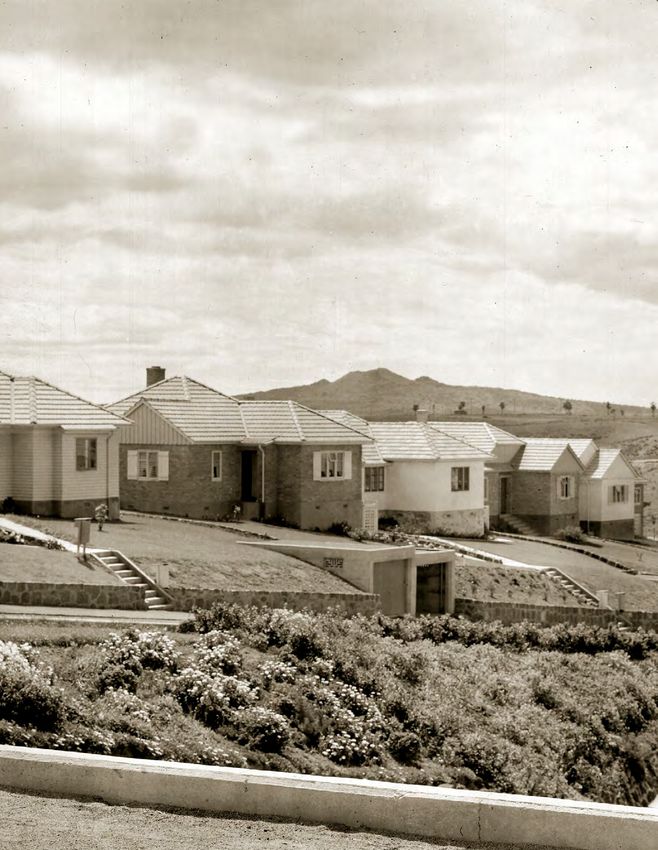
Wellsford
!
!
Omaha Auckland’s urban area
! Matakana
!
Key
Sandspit
Hei tīmata Warkworth !
! Urbanised area 2018
Motorway 2019
Introduction Glorit
!
Rail 2019
Mahurangi
!
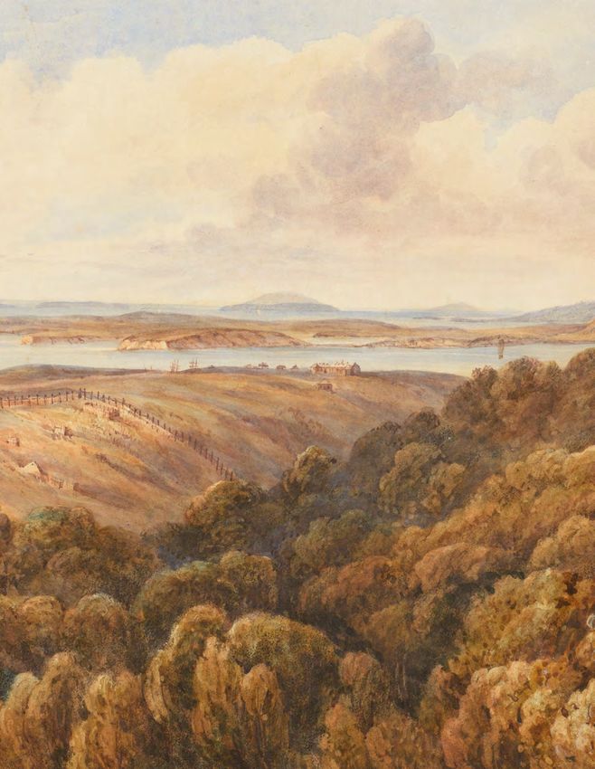
The main feature of human settlement in the Tāmaki Makaurau / Auckland
region has been the development of a substantial urban area (the largest in
Aotearoa / New Zealand) in which approximately 90 per cent of the regional Waiwera
!
population live. This metropolitan area is located on and around the central Hatfields
Beach
isthmus and occupies around 10 per cent of the regional land mass. Home to !
Orewa
over 1.6 million people, Auckland is a vibrant centre for trade, commerce, !
Army Bay
culture and employment. Kaukapakapa
! Silverdale
!
!
Whangaparaoa
The shape and nature of Auckland’s urban form has been influenced by several !
Stillwater
!
dominant geographic factors: Parakai
!
Helensville Dairy Flat
!
• The Waitematā Harbour to the east, and Manukau Harbour to the west, !
Torbay
are separated by a thin isthmus no more than one kilometre across at its !
Coatesville
narrowest point. During early European settlement, physical developments !
Albany
originated around the ports and jetties of the harbours, giving rise to a fledging ! Mairangi Bay
Riverhead !
transport network and urban form that has spread north, south and west ! Sunnynook
Waimauku !
with time. ! Huapai ! Milford
! Kumeu Whenuapai Glenfield!
! Takapuna Oneroa
• The presence of a large volcanic field scattered across the isthmus – the resultant ! Hobsonville
!
!
Northcote
!
Ostend !
Onetangi
! !
cones, lakes, lagoons, caldera, islands and depressions have influenced the shape West Harbour
Birkenhead
! ! Bayswater
!
Muriwai ! Te Atatu
of urban development. !
Massey Peninsula
Northcote Devonport
Point !
! !
• The Auckland urban area is bordered by two mountain ranges – the Waitākere Te Henga
Swanson Ranui
!
!
Ponsonby Orakei
!
!
Ranges to the north-west and the Hunua Ranges to the south-east. These are (Bethells Remuera
Mount Albert Mount!Eden !
Eastern Beach
Beachlands
Beach) Glendene ! Tamaki
both catchments that supply water to the region. ! !
! Greenlane
! Mount !Panmure Howick ! !
Maraetai
New Lynn Mount Roskill
! !
! Wellington! Botany Downs
Oratia ! ! Maungakiekie / ! !
These constraints have informed much of the development of Auckland’s urban ! Glen Eden One Tree Hill Onehunga
!
form, as have central and local government policies and plans, and their translation Titirangi
!
Westfield
! Otahuhu
! East Tamaki
by developers and consumers. Laingholm
!
Otara Kawakawa Ba
!
!
! Mangere
! Papatoetoe Flat Bush
Historically, the development of Auckland’s urban form has been characterised !
Karekare
! !
Manukau
Huia Clevedon
by growth in suburbs, sprawl and low-density development, accompanied by ! Cornwallis
! !
a dependency on private motor vehicles to get around. Since the turn of the !
Manurewa!
twenty first century however, there has been growth in the proportion of new !
Whatipu ! East
Manurewa
Takanini
housing developments that are medium density and apartments, particularly Grahams Beach
!
Weymouth !
!
in the Auckland City Centre, but also in fringe areas, as the urban limits are reached !
Papakura
Awhitu
and the benefits of mixed-use and intensified development are realised ! Hunua
!
by residents and developers. Matakawau
Karaka
! !
Drury
!
Kingseat
!
Ramarama
!
Patumahoe
! Bombay
Pukekohe !
Glenbrook !
!
4 He hītori mō te hanga ā-tāone o Tāmaki Makaurau
Waiuku
!
Tēnei tānga
                                                                                                               This publication
                                                                                                               This publication outlines the development of Tāmaki Makaurau / Auckland’s
                                                                                                               urban form, from pre-colonial Māori settlement to the modern Auckland
                                                                                                               metropolis. It attempts to capture the context and main drivers behind the growth
                                                                                                               of the city, including infrastructure provision, housing development, and in later
                                                                                                               decades, town planning.
                                                                                                               The analysis is chronological and discussion is divided into one or two decades
                                                                                                               at a time.
                                                                                                               Each section (with the exception of the 1880-1899 and 1990-1999 periods)
                                                                                                               includes a map that shows growth over time in the built-up areas, as well as
                                                                                                               the development of the rail and motorway systems. These maps replicate,
                                                                                                               and continue, a series of maps first included in a 1967 article by G. T. Bloomfield
                                                                                                               titled The Growth of Auckland 1840-1966.
                                                                                                               The maps presented in this publication were first prepared by the Social and Economic
                                                                                                               Research and Monitoring team at the Auckland Regional Council, using previous maps
                                                                                                               and aerial photos, and have been continued by the Land Use and Infrastructure team
                                                                                                               at Auckland Council’s Research and Evaluation Unit (RIMU). All maps are drawn
                                                                                                               at a 1:380,000 scale and are oriented north.
                                                                                                               Each section also includes a population figure and an estimated figure for the
                                                                                                               built-up area (in hectares), for a given year within that time period. The estimated
                                                                                                               built area land measurements were calculated by using the growth maps
                                                                                                               mentioned above.
                                                                                                               Research for this publication has drawn upon many excellent local histories from
                                                                                                               numerous sources. A list of selected references and suggested reading is included
                                                                                                               at the end of this publication.
                                                                                                               Those looking for further information about the Māori history of Tāmaki Makaurau
                                                                                                               are encouraged to seek out the many knowledges provided by the area’s local iwi.

                                                      City at dawn (2018), Jay Farnworth – Auckland Council.

6   He hītori mō te hanga ā-tāone o Tāmaki Makaurau                                                                                                                              A brief history of Auckland’s urban form   7
9

                                                                                                                                  I mua atu i te tau 1839:
                                                                                                                                  Tāmaki-makau-rau
                                                                                                                                  Pre-1839: Tāmaki-desired-by-many
                                                                                                                                  Tēnā koe, e Tāmaki!
                                                                                                                                  Tēnā koe, Tēnā koe:
                                                                                                                                  Tāmaki-makau-rau-e!
                                                                                                                                  Greetings, oh Tāmaki!
                                                                                                                                  Greetings, greetings to thee,
                                                                                                                                  Oh! Tāmaki of numerous lovers.*

                                                                                                                                  We had not taken long to decide that Waipeha’s praises of the Waitemata were not
                                                                                                                                  exaggerated, and on no more fitting shores could a township be located. And it
                                                                                                                                  appeared to us on that bright and lovely morning that no town could lie on a more
                                                                                                                                  beautiful spot than the slopes of that shore. As we gained the summit of the ridge
                                                                                                                                  and turned to look seaward we stood entranced at the panorama revealed--stood
                                                                                                                                  entranced in mute amazement at the wonderful beauty of the glorious landscape.

                                                                                                                                                                                               John Logan Campbell, Poenamo, 1881.

                                                                                                                                  The story of Tāmaki Makaurau / Auckland prior to European colonisation
                                                                                                                                  is a complex fabric of interwoven peoples, histories and perspectives. From what
                                                                                                                                  is known, Tāmaki Makaurau was an important site of trade and passage connecting
                                                                                                                                  Te Tai Tokerau / Northland with the rest of Aotearoa / New Zealand, as well as
                                                                                                                                  a place defined by tribal occupation, intermixing, contestation and movement.
                                                                                                                                  Throughout the early 18th century until the early 19th century the isthmus
                                                                                                                                  underwent shifts of inhabitancy and displacement. Settlements were seasonal as
                                                                                                                                  resources were pursued throughout and around the isthmus; many communities
                                                                                                                                  were surrounded by large cultivations of agriculturally developed land. To defend
                                                                                                                                  settlements, pā were built upon the maunga (volcanic cones) of Tāmaki Makaurau,
                                                                                                                                  each sheltering many hundred to several thousand people. It is believed that
                                                                                                                                  between 1740 and 1750 the population of the Tāmaki Makaurau isthmus
                                                                                                                                  numbered between 10 to 30 thousand inhabitants.

                                                        Toki – Auckland War Memorial Museum Tāmaki Paenga Hira 1969.179, 42549.   *Quoted in R.C.J. Stone’s 2013 book From Tamaki-Makau-Rau to Auckland

8 8   He hītori mō te hanga ā-tāone o Tāmaki Makaurau                                                                                                                                                           A brief history of Auckland’s urban form   9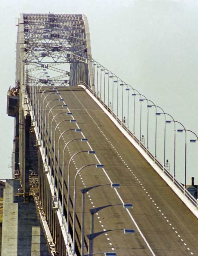
Evidence of Māori activity
                                                                                                  Key

             Settlements were also numerous throughout the land surrounding the Tāmaki              Māori activity
             Makaurau isthmus; the Waitākere Ranges are known to have been one of the most
             densely settled parts of the area, while tribal occupancies were many throughout           Portages
             the Waitematā Harbour and as far south as the Waihou River.
             While good relations between groups found the area at peace in the early 19th
             century, musket trade led to increased conflict across the Tāmaki Makaurau
             isthmus beginning around 1820. For 15 years, war would ravage the land between
             the Whau and Tāmaki Rivers, resulting in the loss of many lives and the evacuation
             of settlements. Many retreated south into the Waikato Region. During this
             time, despite short respites from fighting, records detail the isthmus as almost
             completely depopulated.
             From the mid-1830s, tribes of Tāmaki Makaurau had begun a cautious return to
             the region. New settlements were made and old occupancies were re-established.
             Records note settlements at Māngere and Onehunga from 1838, and in 1839 land
             cultivation began within the area now known as Britomart.

             Patu aruhe – Auckland War Memorial Museum Tāmaki Paenga Hira 1950.6, 31074.1.

10   He hītori mō te hanga ā-tāone o Tāmaki Makaurau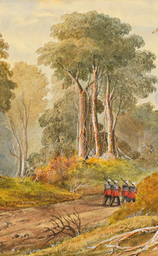
1840-1859:
                                                                                                                                                        Ngā tau tōmua
                                                                                                                                                        The inaugural years
                                                                                                                                                        Tāmaki Makaurau / Auckland was founded as a colonial settlement on 18 September
                                                                                                                                                        1840 by the British naval officer William Hobson, who had been appointed Lieutenant
                                                                                                                                                        Governor of New Zealand a year prior and had overseen and administered the Treaty
                                                                                                                                                        of Waitangi.
                                                                                                                                                        Following an agreement with local rangatira which saw them provided with money
                                                                                                                                                        and trade resources, Hobson gained access to 3000 acres of land and commenced
                                                                                                                                                        settlement. The boundaries set out in the original Deed of Purchase (20 October
                                                                                                                                                        1840) included the coastline from Cox’s Creek (Opoututeka) in Westmere to where
                                                                                                                                                        Brighton Road in Parnell meets the waterfront, inland to the summit of
                                                                                                                                                        Maungawhau / Mount Eden and back to Cox’s Creek. It included Maungawhau, the
                                                                                                                                                        highest volcanic cone (196 metres) on the isthmus. It is important to note that, for
                                                                                                                                                        Māori, the agreement with Hobson was a tuku rangatira – an agreement between
                                                                                                                                                        chiefs that differed in principle from a Western deed of sale. Auckland replaced
                                                                                                                                                        Kororāreka / Russell as New Zealand’s capital in 1841.
                                                                                                                                                        Rapid settlement was made following the legal foundation of the city, with a strong
                                                                                                                                                        reliance upon Māori trade relationships and amenities (such as the Waipapa and
                                                                                                                                                        Onehunga hostels). Felton Mathew, the Surveyor General, drew up a plan for the
                                                                                                                                                        capital and the first land sales were held in April 1841, only six months after the first
                                                                                                                                                        landing at Te Rerenga Ora Iti (Point Britomart). While Mathew’s original plan laid
                                                                                                                                                        out roads in a concentric ring pattern, Auckland’s streets ended up following a more
                                                                                                                                                        traditional grid pattern due to the ease of building and subdivision.

                                                                                                                                                        No. 2, Auckland, New Zealand (from Smale’s Point) (1852), Patrick Hogan – Auckland Art Gallery Toi o Tāmaki,
                                             Grafton Gully (1843), John Milford – Auckland Art Gallery Toi o Tāmaki, gift of Lt Col RM Rendell, 1942.   gift of Dr Thomson W Leys, 1915.
12   He hītori mō te hanga ā-tāone o Tāmaki Makaurau                                                                                                                                                                                       A brief history of Auckland’s urban form   13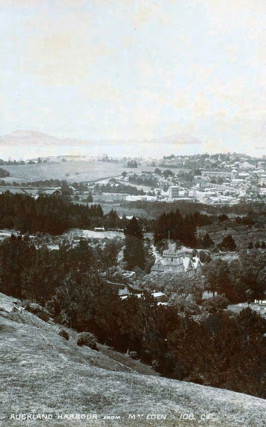
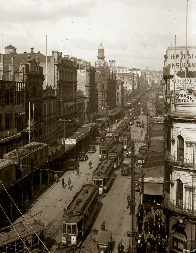
After land sales started in 1841, people began to live by lower Queen Street – what was
             then referred to as Commercial Bay (Horotiu Bay).
             This area served as the prime source of livelihood, directly or indirectly, for the majority
             of dwellers. Commercial activities were located to the east of Queen Street along
             Shortland Crescent (now known as Shortland Street) to Point Britomart, the original
             shoreline of Horotiu Bay.
             Over the next two decades the areas of Freemans Bay (Wai Kōkota) and Mechanics Bay
             (Te Toangaroa) became established. Land reclamation began in 1859 from Shortland
             Street to the foot of Franklin Road in Freemans Bay.
             By the late 1840s, road infrastructure had been laid over most of the isthmus,
             but elsewhere navigable waterways, assisted by the portages at Riverhead (Pītoitoi),
             Ōtāhuhu and Waiuku, remained the most important links between Auckland
             and its outlying settlements.
             In 1841, New Zealand’s first British fort was established on the former site of the pā
             at Te Rerenga Ora Iti. It was named Fort Britomart and was established to control
             Auckland’s harbour entrance and bring order to the growing settlement. In the
             1860s, during the New Zealand Wars, the barracks at Fort Britomart were used to house
             10,000 troops.
             Militaristic intentions were similarly enmeshed in the establishment of the villages
             of Howick, Panmure, Onehunga and Ōtāhuhu in 1847. Responding to concerns over
             possible Māori attack from the south, these settlements were established to defend
             Auckland if necessary. They were settled by retired British soldiers of the Royal New
             Zealand Fencible Corps who were offered free passage to New Zealand, along with                Commercial Bay (1844), Lieutenant T Godfrey – Auckland Art Gallery Toi o Tāmaki, gift of Mr Henry Brett, 1916.

             a cottage on an acre of land, in exchange for a service of seven years. Howick was the
             largest of the four Fencible settlements, with 804 people in three companies by 1848.
             In all, 2500 Fencibles and their families arrived between 1847 and 1854, nearly doubling
             the population of Auckland. In addition to the Fencible Corps, in 1848 Governor Grey gave
             land at Māngere to Pōtatau Te Wherowhero, a leading chief from Waikato, in exchange for
             military protection for the city from the northern tribes.                                     1842
             During these early decades of Auckland’s founding, Māori retained customary titles over
             their land. Titles to Māori land could only be transferred to the Crown under a system         Te taupori
             of exclusive purchasing known as pre-emption. Pre-emption was lifted in 1844 allowing          Population                               2895 people
             Māori to sell their land to private settlers. However, in 1846 Governor Grey
             re-established pre-emption, holding enquiry into the European land claims. Although
             many fraudulent claims were revoked or altered, the land was not returned to Māori and         Te wāhi hanganga
             instead remained under ownership of the Crown. By 1855 most of the land on the isthmus         Built area                               33.2 hectares
             was held by the Crown or private settlers. All that was left under Māori ownership was a
             280 hectare area known as the Ōrākei Block.

                                                                                                            Te kiatotanga
                                                                                                            Density                             87 people per hectare

14   He hītori mō te hanga ā-tāone o Tāmaki Makaurau                                                                                                                                              A brief history of Auckland’s urban form   15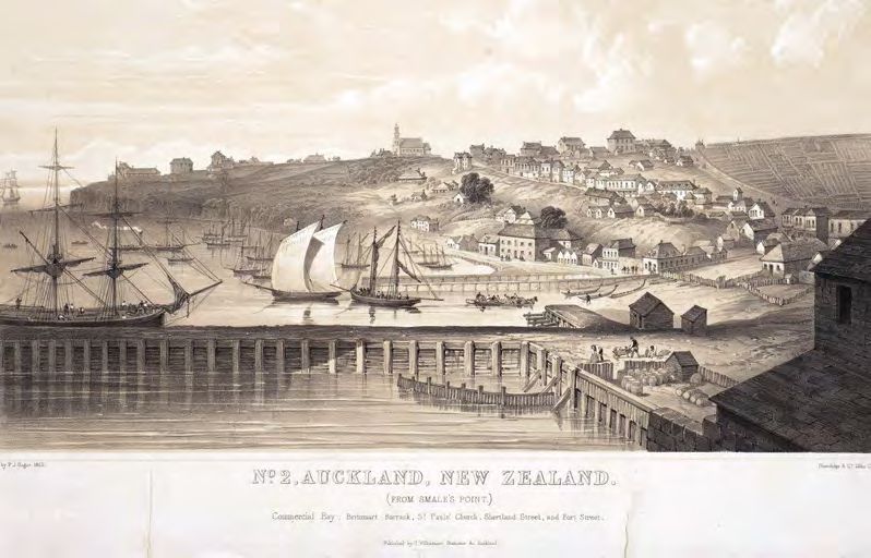
Urbanised area 1842
                                                                                                                        Key

                                                                                                                          Urbanised area 1842

             Matthew Felton’s original plan for Auckland (1841), M. Felton – Auckland Libraries Heritage Collections
             NZ Map 2664.

             Auckland waterfront, east from Point Britomart (1850s), James D Richardson – Auckland Libraries Heritage
             Collections 4-1039.

16   He hītori mō te hanga ā-tāone o Tāmaki Makaurau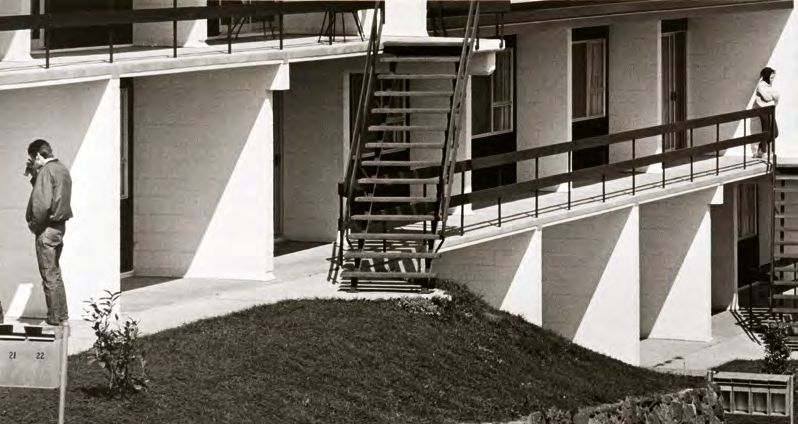
1860-1879:
                                                                                                                                                 Ngā pakanga whenua me te whana-
                                                                                                                                                 ketanga o ngā ara rerewē
                                                                                                                                                 Land wars and development of rail lines
                                                                                                                                                 By the early 1860s, Māori had grown resentful and hostile over losses of land.
                                                                                                                                                 With Pākehā harbouring fear about the vulnerability of Auckland to attacks
                                                                                                                                                 from the Waikato, 12,500 further British troops and military settlers were
                                                                                                                                                 added to the city’s battalion. Preparations for war began with the construction of
                                                                                                                                                 the Great South Road and a chain of military redoubts through Franklin – later
                                                                                                                                                 the foundation of farming communities. On July 11, 1863, Governor Grey issued a
                                                                                                                                                 proclamation to Tāmaki Makaurau and Waikato tribes stating that any ‘natives’ found
                                                                                                                                                 to be armed would lose their rights to land. The following day troops from Auckland
                                                                                                                                                 entered into the Waikato and the war had begun.
                                                                                                                                                 In 1862 the Crown established the Native Lands Act which recognised Māori legal
                                                                                                                                                 rights to uncultivated land but only by way of official certificate of title. The act
                                                                                                                                                 was updated in both 1865 and 1873, fragmenting Māori land ownership further.
                                                                                                                                                 Critics note that the Native Lands Act acted to alienate Māori from their land by
                                                                                                                                                 individualising (maximum of 10 owners) communal ownership and encouraging sales.
                                                                                                                                                 In 1863, in response to organisation around the Kīngitanga movement (The Māori
                                                                                                                                                 King Movement), and to punish ‘rebellious’ Māori, further land was confiscated under
                                                                                                                                                 the New Zealand Settlements Act.
                                                                                                                                                 Development of the southern part of the region continued once the hostilities settled
                                                                                                                                                 in 1864. By that time the electric telegraph had been introduced and regular horsebus
                                                                                                                                                 and coach services were operative. This facilitated growth in the outlying settlements
                                                                                                                                                 beyond the isthmus, such as the townships of Pukekohe, Bombay and Tūākau.
                                                                                                                                                 There were major flows of settlers from the British Isles to the colony during
                                                                                                                                                 this time, encouraged by an active recruitment drive that included free or assisted
                                                                                                                                                 passage. While some settled in the township, many set to work clearing sections
                                                                                                                                                 and helping to establish new outlying townships and farming areas. For example,
                                                                                                                                                 the Bombay Hills area received its name in 1866 from its settlement by immigrants
                                                                                                                                                 who arrived on the ‘Bombay’ ship.

                                  View of Devonport from Smale’s Point, Auckland (1860) – Auckland Libraries Heritage Collections D_GVDC_0035.

18   He hītori mō te hanga ā-tāone o Tāmaki Makaurau                                                                                                                                                              A brief history of Auckland’s urban form   19
After a period of economic decline following the resolution of the Waikato Land
Wars and the loss of capital status to Te Whanganui-a-Tara / Wellington in 1865,
Auckland’s economy boomed again from 1870. This was primarily due to the
discovery of gold at Thames (Pārāwai) and Waihī, but also to a booming timber
export industry flowing through the ports of Auckland. Auckland’s agricultural base
also strengthened and the economy became based on industries such as timber
milling, gum digging and brick-making. The city grew as a commercial centre and
housing continued to be developed around the city centre.
From 1870, railway links were laid to Onehunga, Te Awaroa / Helensville and
Waikato, and the first train ran in Auckland in 1872 on the Auckland-Mercer line.
In 1869, water began being piped from the Auckland Domain springs into the town to
facilitate growth, and settlement continued south towards Maungawhau / Mount Eden,
Ōtāhuhu and Panmure.
1864
Te taupori
Population
12,423 people
1871
Te wāhi hanganga
Built area
565 hectares
Te kiatotanga
Density 22 people per hectare
Auckland Harbour from Mt Eden, (c.1898), George Valentine – Auckland Art Gallery Toi o Tāmaki, the Ilene and
Luarence Dakin Bequest, purchased 1999.
20 He hītori mō te hanga ā-tāone o Tāmaki Makaurau A brief history of Auckland’s urban form 21Urbanised area 1871
Key
Urbanised area 1842
Growth 1842 - 1871
The Great South Road near Shepherd’s Bush, Scene of the attack on the escort (1863), John Hoyte – Auckland Art
Gallery Toi o Tāmaki, purchaed 1952.
22 He hītori mō te hanga ā-tāone o Tāmaki Makaurau1880-1899:
Te whakawhānuitanga ā-ōhanga
Economic expansion
Growth in the commercial services sector as well as large-scale manufacturing
broadened the region’s economy during this period. Residential developments
formed around commercial activity and available transport links. Working-class
settlements grew on the town fringes to serve new industries, such as the railway
workshops in Newmarket (Te Tī Tūtahi) and brickworks and potteries in
Te Rewarewa / New Lynn.
The main forms of public transport consisted of rail, horse-drawn trams and ferries.
These transport innovations permitted a closer integration of the more outlying
townships with the centre.
In 1884, the first horse-drawn tram operated between Queen Street and Ponsonby.
Horse-drawn trams became a common form of public transport and an extensive
network radiated along major roads such as Dominion, Mount Eden and Manukau
Roads.
The rail line also fostered the growth of smaller outlying towns of Onehunga, Ōtāhuhu
and small settlements to the south such as Papakura and Pukekohe. To the west, rail
links encouraged settlements beside the line at Te Kōpua / Henderson, Te Rewarewa
and Glen Eden (Waikomiti).
At this time, the main built area comprised of what is now the Auckland City Centre
and the adjacent suburbs of Karangahape, Grafton, Eden Terrace, Newmarket,
as well as parts of Ponsonby and Parnell.
Plan of the Auckland Waterworks engine house, Western Springs (1878) – Auckland Libraries Heritage Collections 7-A11782.
2424 He hītori mō te hanga ā-tāone o Tāmaki Makaurau A brief history of Auckland’s urban form 25During the 1870s and 1880s the city began to expand into the Waitematā Harbour
as Point Britomart was quarried in order to produce fill for land reclamation around
Mechanics Bay.
By 1890, new residential areas of Surrey Hills, Grey Lynn, Ōwairaka / Mount Albert,
Mount Eden and Remuera had been subdivided; however, many of the vacant
sections were not built on until the early 1920s.
The provision of a regular steam ferry service across the Waitematā Harbour by the
Devonport Steam Ferry Company in 1881 encouraged suburban growth in Devonport,
Takapuna, Northcote and Birkenhead, as well as the development of a road north.
The establishment of the Colonial Sugar Refining Company in 1884 also boosted
suburban growth in the Birkenhead / Northcote area.
Onehunga was the largest outlying settlement followed by Ōtāhuhu and Papakura
in the south and Howick to the east. Several smaller settlements were located close
to the railway at Avondale (Te Whau), Ōwairaka and Panmure. Further to the south,
Papatoetoe, Manurewa and Papakura developed along Great South Road.
Water supply continued to be sourced locally from private springs, until demand
exceeded supply. In 1877, Western Springs (Te Wai Ōrea) began supplying water to the
town while Lake Pupuke supplied Devonport and Te Raki Paewhenua / the North Shore
from 1894.
Paddle steamer Britannia, Devonport Ferry Company (1900-1919) – Auckland Libraries Heritage Collections 37-313.
In 1886, using the Public Works Act 1882, the Crown took ownership of 13 acres of the
Ōrākei Block to build a defensive military fort at Takaparawhā / Bastion Point.
Although the land was declared as inalienable (i.e. unable to be sold or leased) by
the Native Court in 1869, in 1898, recognising the Ōrākei Block as a large portion of
undeveloped land, the Native Land Court partitioned out the block to individual owners,
disestablishing communal ownership among Ngāti Whātua Ōrākei. After persuading
individual Māori owners to sell their shares, the Crown then used their majority holdings
to force any remaining Māori owners to sell theirs.
1896
Te taupori
Population 57,616 people
Freemans Bay and reclaimed land from Franklin Rd to Wellesley Street West (1880-1899), James D Richardson –
Auckland Libraries Heritage Collections 4-632.
26 He hītori mō te hanga ā-tāone o Tāmaki Makaurau A brief history of Auckland’s urban form 271900-1929:
Te hurihanga hei tāone nui
Turning into a city
The Tāmaki Makaurau / Auckland urban form changed dramatically in the first three
decades of the 20th century.
By the turn of the century, dairy farming had become the new source of
wealth in New Zealand, and Auckland thrived as dairying expanded throughout
the periphery. Meat and dairy produce was processed in factories at Penrose
and Ōtāhuhu, and then exported from the ports of Onehunga and Commercial Bay.
Auckland became New Zealand’s largest industrial centre by the end of the first
decade. Brick and tile manufacturing was clustered around Te Rewarewa / New Lynn,
and the areas around Te Kōpua / Henderson, Oratia and Glen Eden (Waikomiti)
were orchards and vineyards. During this period of economic growth, the
Railways Department issued ‘workmen’s tickets’ at low rates to stimulate
settlements in the outer suburbs served by the railway north, west and south
of the town centre.
Construction of an electric tramway system began in 1901 which became the
main instrument for Auckland’s metropolitan expansion into the early 1920s.
Electric tramways serviced major routes such as New North, Dominion, Mount
Eden and Manukau Roads, and led to significant growth in those suburbs serviced
by the tramlines. Motorcars and buses also started to emerge in the first decade of
the 20th century, but were not as popular as rail, tram and ferry links, due to cost
and availability.
Replacing two previous pedestrian bridges, the Grafton Bridge opened to the
public in 1910, crossing what was then known as Cemetery Gully and connecting
the Auckland Domain with Karangahape Road. At the time of its opening Grafton
Bridge was the largest concrete arch bridge in the world.
Water supply was a localised service with the supply areas being close to the demand.
Western Springs (Te Wai Ōrea) provided water for the city from 1877 to 1906; Lake
Pupuke provided Devonport and the North Shore from 1894 to 1941, and springs
elsewhere provided local supplies until the growth of demand exceeded supplies or when
pollution from nearby settlements (as in Newton Gully) rendered the water unsafe.
The Waitākere Ranges were first developed as a catchment area in 1902, and gradually
replaced all the nearer sources.
Looking south up Queen Street, Auckland Central (1910-1919), Frederick George Radcliffe –
Auckland Libraries Heritage Collections 35-R17.
28 He hītori mō te hanga ā-tāone o Tāmaki Makaurau A brief history of Auckland’s urban form 29A growing city also required sewage infrastructure. After 11 years of planning and
construction, the Ōrākei Scheme opened in 1914; a 13,500 metre sewer pipe
running from Avondale (Te Whau) to (and across the shoreline of) Ōkahu Bay where
untreated sewage was released daily into the outgoing tide. This served to pollute the
waters and shellfish beds used by Ngāti Whātua Ōrākei, and by 1920 it was apparent to
the government that the waters surrounding the outfall posed a significant health risk.
Over the next several decades debate surged over an alternative discharge scheme, with
the most attention focused upon shifting the discharge outfall to Motukorea / Browns
Island – a scheme which was ultimately dismissed.
During this time, middle-class families left the run-down and crowded inner city districts
for new, more spacious neighbourhoods on the edge of town. The more affluent headed
for the inner eastern suburbs of Epsom and Remuera, as well as the North Shore;
middleclass earners built new suburbs to the south and west, such as Ōwairaka / Mount
Albert. The poor remained in the central city.
Subdivided land within the isthmus became very popular. For example, the suburb
of Ōwairaka grew from a population of 2,085 in 1901 to 17,516 people by 1926,
and Remuera grew from 2,186 people to 10,433 people during the same period.
Other areas that developed during this period include Point Chevalier (Rangi Mata
Rau) and Westmere.
Looking north-north west over Kingsland and Grey Lynn (1924), James D Richardson – Auckland Libraries
Housing was predominantly standalone homes, situated on varying sized lots Heritage Collections 4-4476.
depending on individual affluence or the style of home. Villas were a common
aspect of this period, although Californian style bungalows and Spanish mission style
housing became popular during the 1920s.
1916
Te taupori
Population 133,712 people
1915
Te wāhi hanganga
Built area
5039 hectares
Te kiatotanga
Density 27 people per hectare
Grafton Bridge (1919), Henry Winkelmann – Auckland Libraries Heritage Collections 1-W1685.
30 He hītori mō te hanga ā-tāone o Tāmaki Makaurau A brief history of Auckland’s urban form 31Urbanised area 1915
Key
Growth 1871-1915
Urbanised area 1871
Electric tram 1915
Rail 1915
Bungalow homes in Auckland (1920), Auckland Weekly News – Auckland Libraries Heritage Collections
AWNS-19200408-37-1.
32 He hītori mō te hanga ā-tāone o Tāmaki Makaurau1930-1949: Te aranga ake o te
kaupapa whare kāwanatanga
Emergence of state housing provision
This period includes the national and international watershed events of the
economic depression of the 1930s (following the boom of the 1920s), subsequent
renewal and growth, as well as the Second World War (1939 to 1945). Tāmaki
Makaurau / Auckland’s population growth slowed during the Great Depression as
large scale urban-rural drift took place but the growth rate sharply increased again
as the direct effects of the economic depression started to wear off.
During the 1930s the construction of new roads, tramlines and infrastructure, as
well as increased state intervention in the provision of housing led to increased
suburbanisation across much of the Auckland area.
This was especially seen in a wide arc across the isthmus from Point Chevalier (Rangi
Mata Rau) and Westmere in the west to Meadowbank in the east. The opening of Tāmaki
Drive in 1932 encouraged growth in Kohimarama and Saint Heliers. These were joined
by expansions in Papatoetoe, Te Kōpua / Henderson and Takapuna. These new suburbs
were accessible by car and electric tram and as they grew, so did the establishment of
new suburban shopping centres along the main roads.
Car ownership and the construction of all-weather bitumen highways became a
significant factor of the suburban expansion during 1930s. Most of the main highways
had been surfaced by the 1930s, making road access in and out of Auckland much easier.
While this period can be identified by significant suburban development, it is also
marked by high levels of post-WW2 rural-urban migration among Māori who tended
to settle in the increasingly run down and overcrowded inner city suburbs, such as
Ponsonby and Freemans Bay (Wai Kōtota), that had been left behind by those shifting
to the city’s peripheries. Between 1926 and 1986 the percentage of Māori living in urban
centres grew from 16 to almost 80 per cent.
During the Great Depression, relief workers (state workers on a small wage) helped to
build Auckland’s infrastructure including Scenic Drive in the Waitākere Ranges.
Four new houses and Rangitoto (1940s), Clifton Firth – Auckland Libraries Heritage Collections 34-BON-1.
34 He hītori mō te hanga ā-tāone o Tāmaki Makaurau A brief history of Auckland’s urban form 35Urbanised area 1945
Key
Holiday settlements also began popping up in the Waitākere Ranges, along the shores Growth 1915-1945
of the Manukau Harbour, and around the Hauraki Gulf. Orewa and the Whangaparāoa
Urbanised area 1915
Peninsula were also developed as tourist centres during this period.
Electric tram 1945
A new type of suburban growth, which began in the mid-1930s, was the development
Rail 1945
of the state housing areas. The reduction in new house building after 1929, due to lack
of loan finances during the Great Depression, together with the deteriorating condition
of many inner city properties, especially in Freemans Bay, meant that active steps by
the government were required to improve living conditions. State houses were first
established at a model estate in Ōrākei (1937) and continued to be built in an increasing
scale in Meadowbank (1939), Waterview (1944-7) and Pukewīwī / Mount Roskill (1945).
Inner city apartment blocks were developed in the 1940s, including flats on Symonds
Street and Greys Avenue. However the main focus of the first Labour Government’s
state housing programme was directed towards the construction of single-unit suburban
homes, which were considered more suitable for families.
Restrictions on imports encouraged local manufacturing and new industries were being
developed (for example tyre manufacturing). Manufacturing industries relocated
outwards into suburban locations in the 1930s, particularly around Penrose, Ōtāhuhu
and Maungarei / Mount Wellington, which quickly transformed into an industrial area
due to its proximity to rail and main roads.
Electricity generation was a significant development for this period. Previously, electricity
had been limited to the thermal stations at Kings Wharf and a small plant in Devonport,
with supply constrained to commercial use and tramways. By the late 1940s, electricity
was being generated mostly at hydroelectric stations situated along the Waikato River
and was being consumed throughout the Auckland area.
1945
Te taupori
Population 251,667 people
Te wāhi hanganga
Built area 13,642 hectares
Te kiatotanga
Density
18 people per hectare
36 He hītori mō te hanga ā-tāone o Tāmaki Makaurau1950-1969:
He whakataunga matua
Major decisions
The 1950s were a period of major decision-making, as Tāmaki Makaurau / Auckland
committed itself to being a large city. Of significance was the favouring of private (car)
rather than public transport infrastructure development. This decision to base Auckland’s
transport system on motorways (rather than the development of a comprehensive
public transport system) would become a fundamental influence on the shape and
the nature of the urban area.
The increasing reliance on personal vehicles, along with lenient government lending
policies, allowed people to fulfil their desire of detached houses on large lots leading
to rapid suburban expansion and a dispersed urban form.
A regional planning decision of significance was the development of
a motorway system. The Master Transportation Plan for Metropolitan Auckland,
prepared by the Auckland Regional Planning Authority in 1955, proposed developing
a radial motorway system (largely based on American models) to service the already
dispersed nature of activities in the region, stating that it would provide greater
benefits than the alternatives. The technical advisory board asserted:
“The form and structure of metropolitan Auckland through the years has been largely
determined by developments in urban areas and suburban transportation. During the
last 25 years, the overall effects of motor transportation has so radically changed the
pattern that Auckland is one of the most dispersed cities in the world. The individual
has been freed from absolute dependence on tramways and railways with their fixed
inflexible routes. Local transport of goods has become fast, cheap, and flexible.
A common motor transportation system has integrated outer areas and extended
the radius of influence of Auckland.”
Construction began on the Auckland motorway network in the early 1950s and was
extended after 1955 as increased funding became available through the National Roads
Board. The first section to be completed was the 2.25 mile stretch between Ellerslie and
Maungarei / Mount Wellington in July 1953. At the same time, work was underway on a
five mile section of the Northwestern Motorway between Point Chevalier (Rangi Mata
Rau) and Lincoln Bridge (Henderson). By 1955, the five mile section of the Northwestern
Motorway and a further six miles of the Southern Motorway from Maungarei to Wiri
were also opened.
Auckland Harbour Bridge (1959), Geoff Fairfield – Auckland Libraries Heritage Collections 654-29.
38 He hītori mō te hanga ā-tāone o Tāmaki Makaurau A brief history of Auckland’s urban form 39Such connectedness meant that all sectors of the urban area experienced significant
suburban development including Te Atatū, Ōtāra and Manurewa. The rapid expansion
of the motorway network, combined with a lack of emphasis placed on public transport,
was the beginning of a soon-to-be-dispersed urban area. Furthermore, patterns of
development changed from rectangular street networks and linear shopping centres
with a pedestrian focus to crescents and cul-de-sacs, oriented towards the private
motor vehicle.
Another significant event during this time was the opening of the Harbour Bridge in 1959
(built entirely for motor vehicular travel, and with no provision for pedestrians, cyclists
or trains). New suburbs emerged on Te Raki Paewhenua / the North Shore through the
1960s such as Birkdale, Beachhaven and Te Wairau / Glenfield. This high growth of the
North Shore caused traffic chaos and congestion on the small section of the motorway
between Fanshawe Street and Northcote Road, and the four lane harbour bridge soon
became inadequate to support the traffic flow. Four new lanes were added in 1969.
In addition to transport decisions, the government continued to build settlements Flats and Couple, Panmure, Auckland (1969), John Fields – Auckland Art Gallery Toi o Tāmaki, purchased with assistance
from the Queen Elizabeth II Arts Council of New Zealand, 1976.
(e.g. Tāmaki) and offered loans which encouraged further development in the
outer suburbs. Another state initiative was the Group Building Scheme whereby the
government guaranteed to buy houses not sold by private builders. This initiative gave rise For example, Fletcher Trust helped construct the new suburb of Pakuranga where 1000
to a number of housing firms in the 1960s and encouraged further urban development. residential sections were developed in 1964.
The Pakuranga-Howick area experienced high growth in the 1950s and 1960s.
Between 1950 and 1955, Panmure transformed from a small village with three or four
shops and a hotel into a busy suburban shopping centre as the West Tāmaki housing
estate was developed. Glen Innes (1959-60), Te Rewarewa / New Lynn (1963), and
Pakuranga (1965) were examples of new regional shopping centres at the time.
While Auckland’s population grew, much of this growth was concentrated in the
outer parts of the urban area, and by the early 1960s the central city area had suffered
considerable decline. Dilapidated conditions found in the inner city, the outward
movement of businesses and industries, and the emergence of the motorway network
facilitated this movement. Factories moved from the inner city to cheaper land in west
and south Auckland, and suburban shopping malls brought the closure of downtown
department stores.
Growth of infrastructure was necessary in order to service the needs of a growing
population. Two dams in the Hunua Ranges (Cossey’s Creek Dam 1955, Mangatawhiri
Dam 1965) were commissioned in order to support the Waitākere Ranges catchment.
Electricity generation was improved to meet the increasing demands of the city,
which were only being met partially by hydroelectric dams along the Waikato River.
Expansion included a coal fired station at Meremere.
Māori shacks go up in smoke (1951), New Zealand Herald – Sir George Grey Special Collections,
Auckland Libraries 7-A14286A.
40 He hītori mō te hanga ā-tāone o Tāmaki Makaurau A brief history of Auckland’s urban form 41After decades of debate around sewerage, 1960 saw the main sewerage outfall shift from
Ōrākei to a new treatment plant at Māngere, which included a 500 hectare oxidation
pond. This was supported by a second treatment plant constructed in Otehā / Albany in
1962. Unfortunately, while the Māngere treatment plant enabled the diversion of water
pollutants away from the Waitematā Harbour, it also contaminated the traditional
seafood resources of local iwi.
Plans to consolidate urban growth emerged at this time. The concept of an ‘urban fence’
was introduced in 1951 through the Outline Development Plan for Auckland, prepared by
the Auckland Metropolitan Planning Organisation. The plan also proposed a green belt
of five mile depth from the boundary of the main urban area, consisting of Okura, Otehā,
Greenhithe to the north and Pakuranga, Wiri and East Tāmaki to the south.
1952 saw the Crown confiscation of Ngāti Whātua Ōrākei’s remaining five hectares of
land within the Ōrākei Block. The marae and other buildings including people’s homes
were burned to the ground to make way for a public park. All that remained was the
chapel and cemetery, while the inhabitants of the village were moved up the hill into
state houses. The removal of the Māori village was also in preparation for the Queen’s
visit the following year, the village considered ‘a dreadful eyesore and potential disease
centre.’ In 1959 the land at Ōkahu Bay was intended to be used by the Crown to
establish a national marae, however this was never realised.
The 1961 Regional Development Plan: Regional Growth prepared by the Auckland
Regional Planning Authority envisaged the creation of an “orderly, coherent,
decentralised metropolitan region comprising a main or parent area surrounded
by a cluster of communities. Each of these parent units and cluster communities would
have, to varying degrees, its own decentralised functions and would rely on the one
metropolitan core for the true metropolitan functions and services”. Key points of this
‘cluster’ urban form were:
• controlling growth on the urban fringe within a determined long-term boundary
• providing for further growth in urban units physically and permanently separated
from the main city centre.
In 1967, as a part of the Regional Master Plan Preliminary Report series prepared by the
Auckland Regional Authority, two plans were prepared for the purpose of looking at
the future direction, scale and form of the urban area to accommodate the projected
population increases in the next 20-30 years. The Regional Master Plan which followed
the preliminary report envisaged the development of Orewa, Okura / Long Bay,
Waimauku, Kumeu, Whitford and Beachlands within a 20 to 30-year timeframe.
Construction of the Auckland Harbour Bridge (c.1959), Les Downey – Auckland Libraries Heritage Collections
314-A16414.
42 He hītori mō te hanga ā-tāone o Tāmaki Makaurau A brief history of Auckland’s urban form 43Urbanised area 1964
Key
Growth 1945-1964
Urbanised area 1945
Motorway 1964
Rail 1964
Aerial view of Auckland (1950s), National Publicity Studios – Sir George Grey Special Collections, Auckland Libraries,
895-A65400.
1966
Te taupori
Population 535,167 people
1964
Te wāhi hanganga
Built area
26,793 hectares
Te kiatotanga
Density 20 people per hectare
44 He hītori mō te hanga ā-tāone o Tāmaki Makaurau1970-1979:
Te horapa tonutanga
Continued outward growth
Tāmaki Makaurau / Auckland now had an extensive motorway network which facilitated
growth to the west, north and south. Work began on the Central Junction (known
colloquially as Spaghetti Junction) in the 1970s and construction continued on the
motorway system which, combined with continued state housing development fostered the
development of new suburbs and industrial areas.
New housing developments appeared in East Tāmaki, Massey East, Te Atatū, Torbay and Te
Wairau / Glenfield, a direct result of the recently completed motorway network. Orewa and
Whangaparāoa Peninsula also experienced considerable growth during this period.
State housing had a strong influence on growth of the urban form, especially in south
Auckland. In the early 1970s, the proportion of state houses in Otara was over 40 per cent –
by 1983 over 5000 houses had been built in the suburb. Other state housing developments
were located at Māngere Bridge and Papatoetoe. The 1970s also saw the end of policies
which sought to intersperse Māori among Pākehā in state housing. This led to high
concentrations of Māori in suburbs with many state houses, such as Glen Innes, Manurewa
and Mangere. While critics have portrayed this as ghettoisation, these concentrations also
assisted in Māori urban community building through amenities such as the urban marae.
Concurrent to this diffuse metropolitan growth town planners had become aware of
the problems of urban sprawl, and regional planning focused on developing a compact
urban form. The first Regional Planning Scheme for Auckland became operative in 1974. This
provided a broad-scale vision of the distribution of different activities throughout
the region, while detailed planning was left to local councils. The main proposal of the
scheme was that:
“The direction of urban growth is to be guided in such a way that an urban form following
a ‘multi-linear’ pattern evolves – that is growth will be related to the main transportation
corridors and coastlines”.
The next year, in 1975 a report conduted by the Auckland Regional Authority
concluded that:
• further urban development was tightly constrained in the south-west and south
• land to the east of south Auckland, the north, and the west was the least constrained
• on the grounds of physical constraints, a redirection of Auckland’s growth away from the
south and to the north and west was necessary
• even with the best intentions of concentrating growth more in the future there would have
to be major compromises. Continuing development of Auckland must not cause further
loss of land that is valued highly for at least one purpose other than urban development.
Occupation of Bastion Point (1978), Robin Morrison – Auckland War Memorial Museum Tāmaki Paenga Hira PH-1992-5-N10-1.
46 He hītori mō te hanga ā-tāone o Tāmaki Makaurau A brief history of Auckland’s urban form 47Urbanised area 1975
Key
A number of future developments were identified within the proposed urban limit, Growth 1964-1975
including Hibiscus Coast, Okura / Long Bay, Otehā / Albany, Massey, Hobsonville,
Urbanised area 1964
Birdwood, Waiwhauwhau / Swanson, Weymouth, Manurewa East, East Tāmaki, Flat
Bush, Greenhithe, Te Kōpua / Henderson, and south Titirangi. These areas, along with the Motorway 1975
existing urban development, were estimated to accommodate a projected population in Rail 1975
excess of 1.1 million by the mid-1990s.
Intensifying urban development in order to make transport and infrastructure operate
more efficiently had been an objective of regional consolidation strategies since
the 1950s. However, there was significant opposition to this resulting from the 1960s
experience of infill, including poorly designed ‘sausage flats’ (single storey flats situated
on cross-leased sections with common driveways) and houses on cross-leased sections.
Concerns around monotony, lack of privacy, parking, noise, the loss of trees and urban
amenity led to the continued desire by many residents to live in peripheral areas.
Housing and parkland development was also appointed for the last of the undeveloped
24 hectares of land within the Ōrākei Block – land that until 1976 Ngāti Whātua Ōrākei
had hoped that they might be returned. In 1977, organised as the Ōrākei Māori Action
Committee, some members of Ngāti Whātua Ōrākei responded to this by occupying
the undeveloped land at Takaparawhā / Bastion Point. The occupancy lasted for 506
days until, on the 25th of May 1978, a combined force of police and army evicted the
protesters, arresting 222. The buildings and gardens used during the occupancy were
burned to the ground.
In 1978 Ngāti Whātua Ōrākei and the Crown reached a settlement which saw the crown
returning a portion of the Ōrākei Block which had been confiscated under the
Public Works Act, at a cost of $200,000 to Ngāti Whātua Ōrākei. This settlement set
a precedent for mana whenua involvement and engagement in Auckland’s future
urban development.
1976
Te taupori
Population 707,607 people
1975
Te wāhi hanganga
Built area 37,000 hectares
Te kiatotanga
Density 19 people per hectare
48 He hītori mō te hanga ā-tāone o Tāmaki Makaurau1980-1989:
Te whakakīkī mā ngā whare āpiti
Intensification through infill housing
During this decade New Zealand experienced broad economic deregulation,
significant changes to the welfare system, local government reform, a recession
following the international share market crash of 1987, as well as ongoing
population growth – all of which affected the shape of urban development in the
Tāmaki Makaurau / Auckland region.
Enabled by the reliance on private transport and the motorway system, the trend
of growth outside of central Auckland continued into the 1980s. This was especially
notable for the increasing number of urban Māori, with large numbers living west
and south of central Auckland – by 1986 almost 80 per cent of Māori lived in urban
areas. This growth was accompanied by the increased presence of amenties and
services for Māori, such as the Hoani Waititi Marae and Te Whānau o Waipareira.
Growth in housing emerged from infill as well as the development of available land.
There was substantial infill in the eastern suburbs of Remuera, Kohimarama,
Mission Bay and Saint Heliers with a dominance of units/flats.
This trend was not the case elsewhere, and major new subdivisions were developed in
Chatswood, Highbury, Meadowbank, Saint Johns and Rosebank with a dominance of
houses instead of units/flats. High growth was also experienced in the Wiri area in the
south (refer to growth map 1987).
The development of the Otara area continued through the 1980s and 1990s with the
construction of medium and high cost housing at Redoubt North.
By the mid-1980s, Auckland was already facing a traffic dilemma, particularly on the main
routes in and out of the CBD.
Towards the end of the decade, the CBD began to show signs of revitalisation.
Changing lifestyle patterns and household composition played a role in the demand for
inner city apartments but the economy and employment factors were also influential.
The economic reforms of the 1980s marked the start of a period of growth for industries
that are commonly located in the CBD. Finance and insurance sectors saw significant
growth, while property and business service industries created new employment
opportunities in the central city. In line with this, the demand for inner city housing
grew. In addition, the 1987 stock market crash had left many inner city office buildings
underutilised which forced developers to look for alternative uses for their properties.
Many converted their office blocks into apartments, and empty lots where office buildings
were planned became open-air car parks.
Traffic problems on the Southern Motorway (1985), Stuff Ltd – Auckland Libraries Heritage Collections Footprints 00586.
50 He hītori mō te hanga ā-tāone o Tāmaki Makaurau A brief history of Auckland’s urban form 51Urbanised area 1987
Key
Direct state intervention in the housing market diminished in the 1980s and began to take Growth 1975-1987
shape as welfare policy. This created a shift away from housing allocation policy based on
the two-parent working family to a policy of providing for those with the greatest need. Urbanised area 1975
Motorway 1987
It had been recognised by planners in the 1970s that continued expansion was
Rail 1987
likely to lead to increasing inefficiencies and continuing damage to Auckland’s natural
resources and that a more coordinated response was necessary. In response to these
considerations, the Auckland Regional Planning Scheme (approved in 1988) brought into
effect limits to contain the expansion of urban Auckland, and requirements for sequencing
and structure planning of future urban expansion areas.
1986
Te taupori
Population
754,845 people
1987
Te wāhi hanganga
Built area
40,022 hectares
Te kiatotanga
Density 19 people per hectare
52 He hītori mō te hanga ā-tāone o Tāmaki Makaurau54
1990-1999:
He rautaki whakawhānui
Strategies for growth
Tāmaki Makaurau / Auckland experienced considerable population increase during
the 1990s, driven in large part by a change in national immigration policy that
allowed new migrants to enter New Zealand based on skills. Three quarters
(76 per cent) of the nation’s growth between 1991 and 2001 occurred in the
Auckland region, which had reached one million residents by the 1996 census.
As the region’s population and economy continued to increase, pressures
intensified on transport, housing and infrastructure. The removal of tariffs
on imported vehicles in the early 1990s resulted in a flood of cheap imported cars
on the market, which were eagerly snapped up and contributed further to the
traffic dilemma. Public transport patronage was decreasing and traffic congestion
was increasing. Much of the region’s infrastructure (water supply, wastewater
treatment, stormwater systems, refuse disposal, transport, power, gas and
telecommunication networks) was already reaching design capacity and needed
upgrading to meet higher environmental standards as well as increasing demand.
In 1995 and 1998, Auckland experienced water and power supply crises.
During the 1990s, the highest population growth was observed in Rodney
District followed by Manukau City and Franklin District indicating a continued
trend of peripheral growth. Some of this increase in residential development was
enabled through rezoning of land around the city outskirts e.g. Okura / Long Bay,
Hobsonville, Flat Bush, Takanini and Hingaia.
Between 1991 and 2001, hundreds of business building consents were issued
along the southern corridor in Manukau, Takanini, Papakura, East Tāmaki, as
well as the CBD, Ōtāhuhu, Onehunga, Te Rewarewa / New Lynn, and Rosebank
area along with clusters around Otehā / Albany on the North Shore.
At the same time, clusters of residential building consents were issued
around Hobsonville, Te Kōpua / Henderson, Otehā, East Tāmaki, Flat Bush and
Manurewa. A significant number of new residential building consents were also
issued throughout the region’s developed areas, suggesting continued infill.
Mixed housing typologies in Grey Lynn (1990s), Auckland Regional Council.
54 He hītori mō te hanga ā-tāone o Tāmaki Makaurau A brief history of Auckland’s urban form 55While the outer suburbs absorbed a large proportion of growth in the 1990s, the In 1998 the Auckland Regional Growth Forum was established, following
inner areas and the CBD also accommodated a growing number of new residential population growth and capacity concerns, as well as a number of inter-council
developments towards the end of the decade. During the 1991-2001 period, Environment Court cases. The Forum’s objective was to develop a Regional Growth
between 52 and 62 per cent of annual metropolitan residential growth took place Strategy, which was released in 1999. It provided a vision for what Auckland could
in existing urbanised areas (middle/inner/CBD) as opposed to 38-48 per cent be like in 50 years with a population of two million. The purpose of the Regional
greenfields development in the outer zones. Growth Strategy was to ensure growth is accommodated in a way that meets
the best interests of the inhabitants of the Auckland region. Key principles of the
Some consolidation started to occur throughout the urban area during the 1990s strategy included:
with the construction of high density mixed-use developments in the CBD, and
medium density terrace and apartment developments being built in diverse areas • A compact urban form, with most growth within existing metropolitan area
such as Ellerslie, One Tree Hill, Te Rewarewa, Waterview, Papatoetoe and Otehā, focused around town centres and major transport routes to create higher density
as well as Takapuna, Parnell and Newmarket (Te Tī Tūtahi). communities;
• Focus on a variety of housing and mixed use activities to provide for
Despite rapid population growth the metropolitan urban limits had moved little employment, services and recreation;
since the 1950s. The region had absorbed over 300,000 more people since the
late 1970s without significantly extending the urban limits. Most of the areas that • Limited managed expansion into greenfield areas outside of current Metropolitan
experienced growth had been identified as future growth areas by the regional Urban Limits (MUL) where environmental quality, accessibility and infrastructure
planning documents of the time. development criteria can be met;
• Protection of the coast and surrounding natural environment.
This decade also provided a significant legal milestone for Māori land tenure in Auckland
with the passing of the 1991 Ōrākei Act which acknowledged Treaty of Waitangi
grievances against Ngāti Whātua Ōrākei. The passing of the act helped to usher in a new
co-governance agreement for the benefit of Auckland, and enabled the hapū to return
to the CBD as a land owner through the purchase of 20 hectares of former railway land
at Quay Park in 1996. This land is now owned by Ngāti Whātua Ōrākei in perpetuity and
has subsequently become the site of several leasehold developments including Spark
Arena and a number of residential apartments.
1996
Te taupori
Population
997,940 people
Te wāhi hanganga
Built area 45,114 hectares
Te kiatotanga
Density 22 people per hectare
Auckland Central Business District (1990s), Rob Tucker – Auckland Libraries Heritage Collections 1423-94.
56 He hītori mō te hanga ā-tāone o Tāmaki Makaurau A brief history of Auckland’s urban form 57You can also read