ENVIRONMENTAL IMPACT STATEMENT - Mahwah ...
←
→
Page content transcription
If your browser does not render page correctly, please read the page content below
ENVIRONMENTAL IMPACT STATEMENT

                    Prepared for:

            Russo Acqusitions, LLC

              1000 MacArthur Boulevard
                 Block 135.01; Lot 65
                 Township of Mahwah
              Bergen County, New Jersey

                    Prepared by:

              30 Independence Boulevard
                   Warren, NJ 07059
                     908-668-8300

     _________________________________________
               Benjamin S. Crowder, P.E.
            New Jersey Professional Engineer
                  License No. 52263

                     May 2021
                  BENJ #: J 210516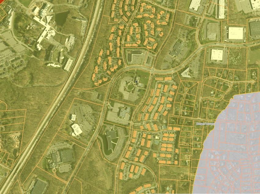
Table of Contents

1   INTRODUCTION ................................................................................................................... 3
2   SITE DESCRIPTION & INVENTORY .................................................................................... 4
  2.1    Existing Land Use ........................................................................................................... 4
  2.2    Topography .................................................................................................................... 5
  2.3    Geology .......................................................................................................................... 5
  2.4    Soils ................................................................................................................................ 6
  2.5    Groundwater Resources ................................................................................................. 6
  2.6    Surface Water Resources .............................................................................................. 7
    2.6.1     Surface Waters & Water Quality ............................................................................. 7
    2.6.2     Floodplains .............................................................................................................. 7
    2.6.3     Freshwater Wetlands .............................................................................................. 8
  2.7    Vegetation ...................................................................................................................... 8
  2.8    Wildlife Habitat ................................................................................................................ 9
  2.9    Threatened & Endangered Species ............................................................................. 11
  2.10 Aquatic Habitats ........................................................................................................... 12
  2.11 Historical Resources ..................................................................................................... 12
  2.12 Air Quality ..................................................................................................................... 12
  2.13 Noise Levels ................................................................................................................. 13
3 SITE LOCATION ................................................................................................................. 13
4 PROJECT DESCRIPTION .................................................................................................. 13
  4.1    Purpose and Scope ...................................................................................................... 13
  4.2    Alteration of the Site ..................................................................................................... 14
  4.3    Suitability of Site ........................................................................................................... 15
5 PROJECT IMPACTS & PROTECTIVE MEASURES .......................................................... 16
  5.1    Impacts to Topography ................................................................................................. 16
  5.2    Soil Erosion and Sediment Control ............................................................................... 17
  5.3    Impacts to Geology ....................................................................................................... 18
  5.4    Impacts to Surface Waters and Degradation of Water Quality ..................................... 18
  5.5    Surface Drainage .......................................................................................................... 19
  5.6    Flooding or Floodplain Disruption ................................................................................. 20
  5.7    Groundwater Pollution .................................................................................................. 21
  5.8    Water Supply & Reduction of Groundwater Capabilities .............................................. 21
  5.9    Wastewater Management ............................................................................................. 21
  5.10 Vegetation Destruction ................................................................................................. 22
  5.11 Disruption of Wildlife Habitat ........................................................................................ 23
  5.12 Threatened & Endangered Species ............................................................................. 23
  5.13 Solid Waste Disposal .................................................................................................... 23
  5.14 Air Quality Degradation ................................................................................................ 23
  5.15 Noise Level Increases .................................................................................................. 24
  5.16 Destruction or Degradation of Historic Resources ....................................................... 24
  5.17 Demography ................................................................................................................. 25
  5.18 Impacts to Aesthetics ................................................................................................... 25
6 LIST OF UNAVOIDABLE ADVERSE IMPACTS ................................................................. 26
7 LIST OF ENVIRONMENTAL PROTECTION MEASURES ................................................. 27
8 ANTICIPATED REQURIED LICENSES, PERMITS AND APPROVALS ............................. 28
9 SUMMARY .......................................................................................................................... 29
10 REFERENCES .................................................................................................................... 30

                                                                       i
APPENDIX
A.   Site Location Maps
B.   Site Photographes
C.   Natural Heritage Response Submission Request
D.   New Jersey and National Register of Historical Places

                                      ii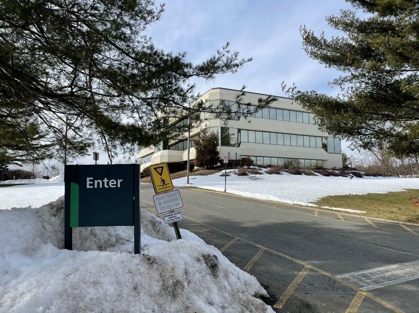
1    INTRODUCTION

       According to the Township of Mahwah Ordinance Section 22-5.3, within fifteen days
of receipt of an application, the Environmental Commission shall notify the applicant as to
whether an Environmental Impact Statement (EIS) is required. As a proactive measure, the
applicant is submitting an EIS concurrently with the application.

       The EIS provides all the information necessary indicated in Section 22-5.3 for a
proper evaluation of the effects of the proposed project upon the environment. Section 2
below identifies environmental conditions and critical areas such as topography, geology,
soils, water resources, vegetation, wildlife, and air quality.      In addition, Section 2 also
identifies anthropogenic conditions such as land use, aesthetics, noise, demography,
employment, taxes, health, safety, welfare, history and archaeological resources.
Anticipated impacts and minimization measures are identified in Section 2. Proposed facility
details including water consumption, sewage needs, and solid waste handling are
summarized within Section 3 below. Section 4 details all required approvals and their status
required for the proposed project. An alternative analysis is located in Section 5.

1.1    Site Location

       The site is located at the southwest corner of the intersection between MacArthur
Boulevard and Ridge Road within the Township of Mahwah, Bergen County, New Jersey.
The site is identified as Block 135.01, Lot 65 on the Township of Mahwah Tax Map Sheet 59
and it encompasses approximately 696,001 SF (15.978 Acres). The property is currently
occupied by a three-story office building occupied by TD Bank NA.

       The site is bordered to the north by MacArthur Boulevard and a commercial strip mall
with residential areas beyond; to the south by a multi-story office building with additional
office uses beyond; to the west by MacArthur Boulevard with residential uses beyond; and to
the east by Ridge Road with residential uses beyond. Small grass/vegetated areas and
asphalt lots are located adjacent to the building and along the perimeter of the project
boundary.

                                               3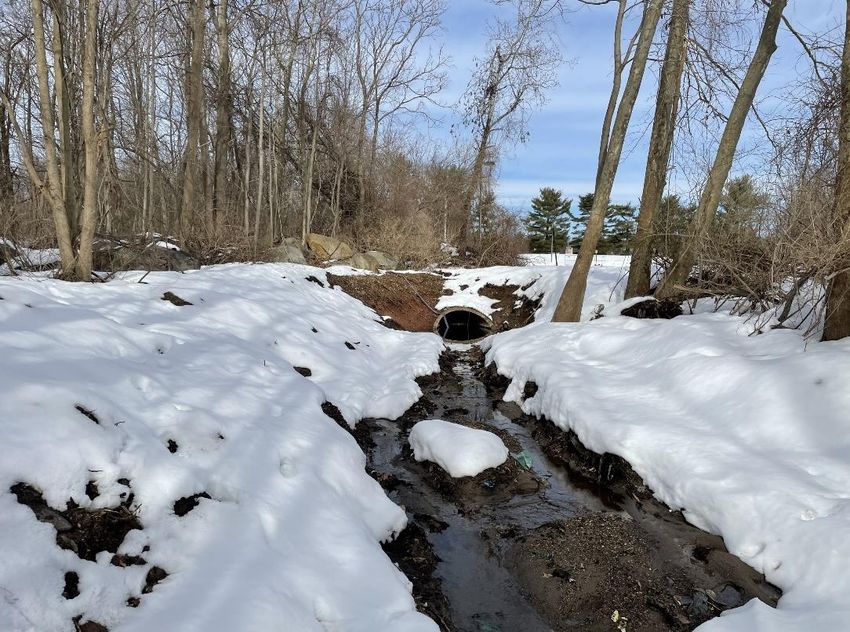
1.2     Scope of Work

        The project includes the demolition of the existing building and surrounding asphalt
parking areas.

        Improvements include the construction of a 208,345 SF Industrial Building, which is
inclusive of tenant office space, 32 loading dock bays, 26 trailer storage spaces, along with
parking/circulation areas, stormwater management facilities, landscaping, and several
modular block retaining walls. Access to the site is proposed via three (3) driveways: one (1)
existing full-movement driveway off of Ridge Road; one (1) existing right-in/right-out driveway
off of MacArthur Boulevard to be utilized primarily by passenger cars; and one (1) proposed
full-movement truck access driveway off of MacArthur Boulevard. The proposed full-
movement driveway off of MacArthur will have posted signage restricting left-turns for WB-67
sized trucks. In addition to the proposed on-site improvements, modifications are proposed
to the center lane median within MacArthur boulevard to accommodate a left-turn lane into
the site.

                          2    SITE DESCRIPTION & INVENTORY

        The following section is an inventory of the present land use and environmental
conditions at the Site including features such as topography, geology, soils, water resources,
vegetation, wildlife, threatened and endangered species, air quality, noise levels and
historical, scenic and historical features. This inventory will establish a baseline to which the
proposed Project can be analyzed and compared to ascertain potential environmental
impacts.

2.1     Existing Land Use

        The property is known as Lot 65 of Block 135.01 as identified on the Township of
Mahwah Tax Map Sheet 59 and it encompasses approximately 696,001 SF (15.978 Ac.).
The property is currently occupied by three-story office building occupied by TD Bank NA.

                                               4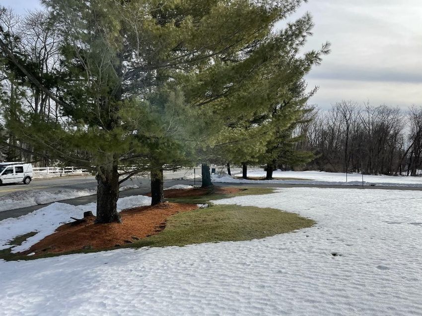
2.2    Topography

       The subject Site on an average is sloping in a southerly direction from a high point of
approximately 457-feet above mean sea level (msl) at the northern driveway off of MacArthur
Boulevard to a low point in the southwest corner of the Site at approximately 419-feet msl.
Based on visual observation, inspection of the Site-specific topographical survey, and NJ
Highlands Council Interactive GIS, some areas of severely constrained steep slope areas
exist onsite. These areas are primarily located along the western property frontage and in an
area of an existing ditch along the eastern property frontage. In the proposed condition,
these areas are being maintained and fall outside of any anticipated disturbance. Refer to the
USGS map (Appendix B) and the ALTA/NSPS Land Title Survey prepared by Control Point
Associates, Inc. dated 03/10/2021, last revised 04/02/2021, for more detailed information.

2.3    Geology

       New Jersey is divided into four regions, known as physiographic provinces, which are
areas with similar rock types, geologic structures and a common geologic history. The
subject Site is situated within the Piedmont Physiographic province of New Jersey. The
Piedmont Physiographic Province consists of approximately 1,600 acres occupying all or
parts of Bergen, Essex, Hudson, Hunterdon, Mercer, Middlesex, Morris, Somerset, and
Hunterdon counties and extends from the Highlands in northwest New Jersey to the Coastal
Plain in central and southern New Jersey. Landforms generally consist of low rolling plains
and gently sloping hills divided by a series of higher ridges.        Underlying formations
predominately include partially folded and faulted sedimentary rocks dating to the Triassic
and Jurassic periods (240 – 140 million years ago). Sedimentary classes of rock include
siltstone, shale, sandstone, mudstone, and conglomerates.

       Specifically, according to New Jersey Department of Environmental Protection
(NJDEP) NJ GeoWeb Geographic Information Systems (GIS) mapping, the Site is underlain
by the Passaic Formation with Quartzite-clast Conglomerate facies.

                                              5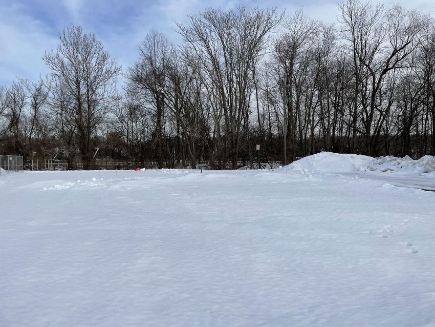
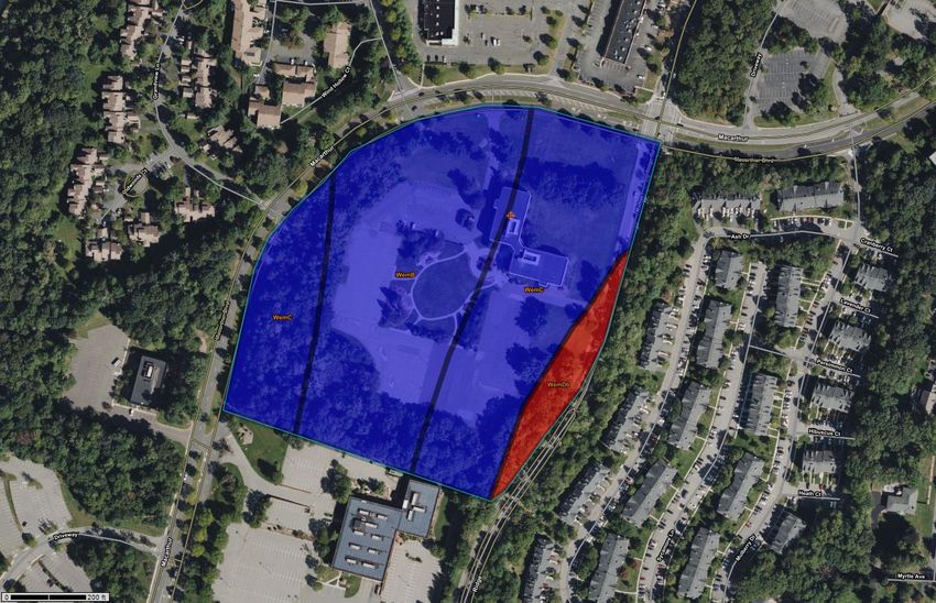
2.4    Soils

       According to the Natural Resource Conservation Service’s Web Soil Survey
(Appendix B), the dominant onsite soils are representative of the Wethersfield gravelly loam
series 3-8% slopes (WemB), the Wethersfield gravelly loam series 8-15% (WemC) and the
Wethersfield gravelly loam series 15-25%, very stony (WemDb). The Wethersfield gravelly
loam series, which dominates the site by is classified as a Coarse-loamy ablation till derived
from sandstone and shale.

The soil is classified as well-drained and part of Hydrologic Soil Group C. Depth to seasonal
high groundwater is listed to occur at depths greater than 6 feet. Depth to bedrock is listed
to occur at depths greater than 5 feet.

       The NJ Highlands Council Interactive GIS indicates that the Site is located within a
prime farmland area of statewide importance.

2.5    Groundwater Resources

       Underlying groundwater sources are known as aquifers. Aquifers are geologic units
that are fractured, porous, or permeable enough to hold or allow water to flow through.
According to the NJ Highlands Council Interactive GIS, the Site is not located within a prime
groundwater recharge area. The site is underlain by the Brunswick aquifer conglomerate
(Bac) bedrock aquifer system, which covers a small portion of Bergen County. This system
has an aquifer rank of “C”.

       According to the NJDEP NJ GeoWeb, existing groundwater recharge into the aquifer
at the Site is ranked at levels “D” and “L”, with recharge into the underlying aquifer rated at 5
inches per year and 0 inches per year (hydric soils), respectively.

       Wellhead Protection Areas (WHPAs) are areas delineated to graphically represent an
area from which the well draws its water over a specific period of time. The WHPAs are
delineated to prevent potential groundwater contamination sources or identify/cleanup
existing contamination areas that may impact drinking water wells.        No community water
supply wells are located onsite or within 500 feet.

                                               6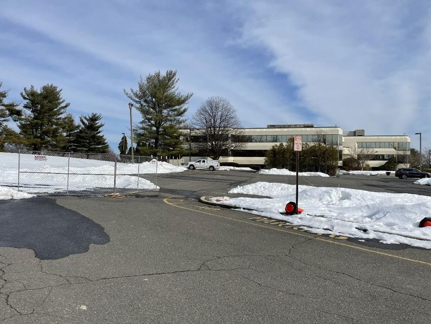
Based on NJDEP NJ GeoWeb GIS mapping the Site is not located within WHPA for water
supply wells.

2.6    Surface Water Resources

        2.6.1    Surface Waters & Water Quality

                The Site is located within the Pompton, Pequannock, Wanaque, Ramapo
        Watershed Management Area, within the Ramapo River watershed, and more
        specifically within the Ramapo River (above Fyke Brook) (HUC-14 sub-watershed).
        The NJ Highlands Council Interactive GIS identifies areas that are of critical
        importance to the Ramapo Watershed. The Site is designated as having a high
        critical importance value. The closest watercourse to the Site includes Darlington
        Brook, which is located approximately 1,500 feet to the southeast of the Site and
        Masonicus Brook tributary, which is located approximately 2,000 -feet to the east.

                Under existing conditions, the surface drainage pattern for the Site generally
        follows existing topography and flows in a southwesterly direction. Onsite pavement
        and landscape surfaces sheet flow to various onsite landscaped areas and inlets.

                The headwaters of Darlington Brook originate to the southeast of the site in a
        wooded area and flows in a southerly direction, before eventually draining into
        tributaries to the Ramapo River. The headwaters of Masonicus Brook originate to the
        northeast near the border with New York State and flows in a southerly direction just
        south of the Site, where it eventually drains to the Mahwah and Ramapo River.
        Darlington Brook, Masonicus Brook, Mahwah River and Ramapo River have a State
        Surface Water Quality Classification of freshwater non-trout (FW2-NT). Pursuant to
        the Flood Hazard Area Control Act Rules at N.J.A.C 7:13, these watercourses will
        have a 50-foot riparian buffer/stream corridor area. Due to their distance from Site,
        the Site is not located within a riparian zone or stream corridor area.

        2.6.2     Floodplains

                 According to the National Flood Insurance Program’s Flood Insurance Rate
        Map FEMA Panel #34003C0058H, the Site is not located within a flood zone. A
        copy of the FEMA map depicting the Site location is included within Appendix B.

                                               7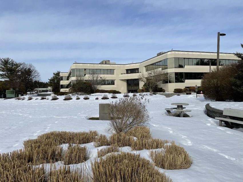
2.6.3    Freshwater Wetlands

                A field investigation and review of the parcel was previously conducted by
        an experienced and certified wetlands specialist to identify potential areas that could
        be considered regulated features as defined in the New Jersey Freshwater
        Protection Act Rules (NJAC 7:7A) including freshwater wetlands, State open waters,
        transition areas, and certain ditches and swales. The presence of wetlands was
        determined utilizing the three parameter approach as set forth in the Federal
        Interagency Manual for Identifying and Delineating Jurisdictional Wetlands – 1989, in
        which those areas containing hydric soils, positive hydrologic indicators, and a
        prevalence of hydrophytic vegetation are generally classified as wetlands. Based on
        the previously conducted Site investigation, freshwater wetlands of Ordinary
        Resource Value were identified in the southwestern corner of the subject Site, in the
        area of a lawfully existing man-made aboveground stormwater basin. The current
        Owner secured an approved NJDEP FWW GP1 Permit #0233-20-0006.1
        LUP200001, dated 9/9/2020, for basin maintenance inclusive of mowing existing
        vegetation, providing new topsoil, and laying wet seed mix, in order to restore its
        functionality. It is anticipated upon completion that the functionality will be improved
        and return once again to a stormwater management basin. The industrial
        development proposes to modify & relocate the limits of the existing basin while
        providing a similar storage volume to handle the off-site runoff that discharges to this
        basin. No disturbance to wetlands or wetland buffers is anticipated by these
        proposed modifications.

2.7    Vegetation

       The majority of the Site is disturbed and characterized by mowed lawn and
landscaped areas throughout the parking lot. A portion of the site is scattered with pockets of
narrow woods and shrubs along the eastern and southern property lines. The western
frontage of the property contains a slightly more densely wooded area. Pursuant to the NJ
Highlands Council Interactive GIS, a critical wildlife habitat of deciduous forest is mapped in
in the wooded areas along the western and southern property lines, an area which generally
overlaps a township dedicated open space easement. No significant natural areas are
mapped for the subject Site.

                                               8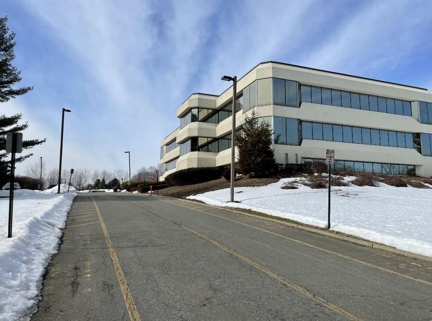
Overall, no significant undisturbed vegetative communities are present on or directly
adjacent to the Site. Areas of pervious surfaces include maintained lawn and landscaped
areas. The following is a listing of some of the existing species found onsite: White Pine
(Pinus Strobus), Red Maple (Acer Rubrum), Tree-of-Heaven (Ailanthus Altissima), Black
Cherry (Prunus Serotina), Platanus occidentalis (American Sycamore) and Norway Spruce
(Picea Abies).

2.8     Wildlife Habitat

        The Site is mostly disturbed and contains mostly significant areas of native vegetative
communities, with some invasive species. The NJ Highlands Council Interactive GIS
indicates the presence of a critical wildlife habitat – deciduous forest – that is mapped in the
wooded areas along the eastern and southern property lines. The Site may contain limited
wildlife habitat within the maintained lawn, landscaped areas and the wooded perimeter
strips to the east, west and south. This habitat is anticipated to be restricted to foraging,
resting, and limited breeding habitat for avian, reptilian, and small mammalian species that
are not sensitive to human disturbance.

        Potential avian species that may utilize onsite vegetation for foraging and resting
habitat may include common birds such as:

      Scientific Name                       Common name

      Cardinalis cardinalis                 Northern cardinal

      Carpodacus mexicanus                  house finch

      Cathartes aura                        turkey vulture

      Corvus brachyrhynchos                 American crow

      Cyanocitta cristata                   blue jay

      Dumetella carolinensis                gray catbird

      Mimus polyglottos                     mocking bird

      Parus atricapillus                    black capped chickadee

      Parus bicolor                         tufted titmouse

      Passer domesticus                     house sparrow

                                               9
Poecile carolinensis Carolina chickadee
Quiscalus quiscula common grackle
Spizella pusilla field sparrow
Sturnus vulgaris European starling
Toxostoma rufum brown thrasher
Troglodytes aedon house wren
Turdus migratorius American robin
Zenaida macroura mourning dove
Buteo lineatus Red shouldered hawk
Small mammals may utilize the Site for habitat and may include:
Scientific Name Common name
Blarina brevicauda shorttail shrew
Marmota monax ground hog
Mephitis mephitis striped skunk
Peromyscus leucopus white footed mouse
Peromyscus maniculatus deer mouse
Procyon lotor raccoon
Scalopus aquaticus Eastern mole
Sciurus carolinensis gray squirrel
Sylvilagus floridanus Eastern cottontail
Tamias striatus Eastern chipmunk
10Potential reptilian species that may be present include:
Scientific Name Common name
Diadophis punctatus ringneck snake
Terrapene carolina Eastern box turtle
Thamnophis sirtalis Eastern garter snake
Coluber constrictor black racer
Heterodon platirhinos Eastern hognose snake
Lampropeltis triangulum milk snake
Sceloporus undulatus hyacinthinus Northern fence lizard
Crotalus horridus Timber rattle snake
Due to the lack of any streams, ponds, or wetlands on or adjacent to the Site, no
suitable habitat for amphibian species is anticipated to be present onsite, with the exception
for the American toad (Bufo americanus), which is generally an upland species.
2.9 Threatened & Endangered Species
According to the NJDEP Landscape Project Maps on NJ GeoWeb GIS mapping for
the site (Appendix B), suitable habitat for red-shouldered hawk and timber rattlesnake, both
Rank 4 threatened and endangered species, have been noted to occur onsite. According to
the NJ Highlands Council Interactive GIS, critical wildlife habitat is documented along the
western and southern areas of the site, including areas of the existing man-made basin.
These areas are located within an existing township open space easement, which the
development proposes to maintain in size, but modify & relocate to more suitable perimeter
areas of the site. However, based on discussions with the Highlands Council, the habitat
area does not appear suitable given the surrounding land context.
A Natural Heritage Program (NHP) request has been submitted. Confirmation is
provided under Appendix C, and upon receipt, the letter will be included in the final EIS
document.
11The Site is previously disturbed and located within a developed area. Suitable
habitat for threatened and/or endangered species are not anticipated to be present onsite.
2.10 Aquatic Habitats
As stated above, no watercourses, waterbodies, or naturally occurring freshwater
wetlands will be present onsite following the completion of the previously approved FWW
GP1 basin maintenance work discussed in Section 2.6.3. above; therefore, no aquatic
habitats or aquatic biota are present.
2.11 Historical Resources
The Site is currently occupied by a TD Bank office building. According to the New
Jersey and National Register of Historical Places (Appendix D), there are no State or
Federally listed or potentially eligible historic resources on or adjacent to the Site. The NJ
Highlands Council Interactive GIS does not reference any historical or cultural resources
within the immediate vicinity of the Site. The closest named historic resource to the Site
includes the Thomas Hennion House (ID#562) located at 770 Darlington Avenue and lies
approximately 3,200 feet to southwest of the Site.
As with any excavation within largely undisturbed soils, there is the potential for
archeological resources, although the Site’s location within a previously disturbed area and
not along a watercourse diminishes the likelihood for archeological resources to be present
onsite.
2.12 Air Quality
Ambient air quality in the vicinity is tracked by the NJDEP. The Site lies within the
Northern Metropolitan Region, consisting of Bergen and Passaic Counties. At the time of the
preparation of this report, the NJDEP was reporting “good” air quality for this region with low
levels of pollutants such as carbon monoxide, nitrogen dioxide, ozone, particulates, and
sulfur dioxide. According to the most recent NJDEP Air Quality Index Summary, the State
averages “good” air quality (162) days a year, “moderate” air quality (190) days a year,
“unhealthy for sensitive groups” (13) days a year, “unhealthy” (0) days a year, and “very
unhealthy (0) days a year.
12Currently, air quality at the Site is anticipated to be primarily impacted by vehicular
traffic along MacArthur Boulevard and Ridge Road, as well as limited impacts from existing
vehicular access to the site.
2.13 Noise Levels
Currently, noise levels at the Site are anticipated to be impacted by vehicular and
mechanical operations in conjunction with the existing business onsite. In addition, vehicular
traffic along MacArthur Boulevard and Ridge Road also results in noise impacts under
existing conditions.
3 SITE LOCATION
The Project Site is identified on the Township Tax Maps as Block 135.01; Lot 65
within the Township of Mahwah, Bergen County, New Jersey. The Site consists of
approximately 15.978 Acres of land. Pursuant to the Township Zoning Map, the Site is
located within the ORP 200 Office Research Park Zone. Additionally, the Site is located
within the Highlands Planning Area (PA-14). Under existing conditions, the Site is disturbed
and occupied by an office building. Asphalt driveways, parking areas, mowed lawn,
landscape and wooded areas are located onsite.
The site is bordered to the north by MacArthur Boulevard and a commercial strip mall
with residential areas beyond; to the south by a multi-story office building with additional
office uses beyond; to the west by MacArthur Boulevard with residential uses beyond; and to
the east by Ridge Road with residential uses beyond. Please refer to the Site Location Maps
in Appendix A for more information.
4 PROJECT DESCRIPTION
4.1 Purpose and Scope
Improvements include the construction of a 208,345 SF Industrial Building, which is
inclusive of tenant office space, 32 loading dock bays, 26 trailer storage spaces, along with
13parking/circulation areas, stormwater management facilities, landscaping, and several
modular block retaining walls. Access to the site is proposed via three (3) driveways: one (1)
existing full-movement driveway off of Ridge Road; one (1) existing right-in/right-out driveway
off of MacArthur Boulevard to be utilized primarily by passenger cars; and one (1) proposed
full-movement truck access driveway off of MacArthur Boulevard. Related site improvements
include trash/recycling enclosures, utilities, stormwater management, lighting, signage and
landscaping.
Total Limit of disturbance for the proposed activities is approximately 14-acres. The
site improvements result in an overall impervious cover of approximately 9.6-acres. Please
refer to the Site Plan Document Set for more detailed information.
4.2 Alteration of the Site
Construction of the proposed industrial building will require grading activities
necessary to construct the building pad, access drives, parking area pads, and associated
improvements. Moderate tree clearing and vegetation removal will be required around the
perimeter of the Site to allow for the installation of stormwater management basins,
compliant with the NJDEP’s latest GI regulations.
The following is the proposed sequence of construction for the Project:
Phase 1: Install stone anti-tracking pad and other soil erosion sediment control
measures including down slope perimeter hay bales and silt fencing (1 week)
Phase 2: Demolish existing office building and surrounding improvements in
accordance with the demolition plan and demolition permit secured from
Mahwah (1 month)
Phase 3: Clear and rough grade the site in accordance with the grading plan for parking
facilities, building pad, and surrounding access drives (3 weeks)
Phase 4: Install site retaining walls - as necessary, in order to rough grade site (3
weeks)
Phase 5: Excavate for above-ground and underground small scale infiltration/detention
basins (1 month)
Phase 6: Excavate and install underground utilities including storm conveyance piping,
14green infrastructure, sanitary sewer systems, water services, and dry utility
conduits (2 months)
Phase 7: Prep building pad and construct building with surrounding site improvements
including curbing, sidewalks, and utility connections (6 months)
Phase 8: Complete final grading on site (1 week)
Phase 9: Install site paving, loading dock concrete, and final landscaping (14 days)
4.3 Suitability of Site
The Site is highly suitable for the proposed industrial development as it is a previously
disturbed Site centrally located between Interstate Route 287 and New Jersey State Highway
Route 17, both major arterial routes within the Township and region. Sufficient public
infrastructure is present within the vicinity of the Site including utilities and roadways.
Utilization of a previously disturbed Site within a relatively developed area allows for
the protection and preservation of undeveloped, wooded, or agricultural lands elsewhere in
the Township and region. The proposed Project has been designed to be compatible with
the permitted uses in this area of Town. According to NJ Highlands Council Interactive GIS
mapping and the NJ GeoWeb GIS mapping of the subject site is not designated as
municipal, State, or Federal open space.
The proposed Project is also in conformity with the general goals of the State
Development and Redevelopment Plan. According to the State Plan Policy Map, the Site is
located within the Highlands Planning Area (PA-14). The State Plan’s focus for PA-14 is to
preserve open space and protect the state's greatest diversity of natural resources including
the precious water resources that supply drinking water to more than half of New Jersey's
families, yielding approximately 379 million gallons of water daily. In addition to water
resources, the Highlands Region contains exceptional natural resources such as contiguous
forest lands, wetlands, pristine watersheds and plant and wildlife species habitats. The
region contains many sites of historic significance and provides abundant recreational
opportunities. Approximately 110,000 acres of agricultural lands are in active production in
the Highlands region. In addition, the NJ Highlands Council Interactive GIS mapping
indicates that the site is primarily located within an existing community zone, furtherance that
the Township is slating this corridor area for revitalization and redevelopment. A portion of
the property along the western and southern property lines is within an environmentally
sensitive subzone. Per the Highlands Act, goals of the PA-14 are to have a de minimus
impact on water resources that would not cause or contribute to a significant degradation of
15surface or ground waters, including regenerative capacity of aquifers or other surface/ground
water supplies, increase in stormwater generated, increases in impervious surfaces,
increases in stormwater pollutant loading, changes in land use and changes in vegetative
cover; cause the minimum feasible interference with the natural functioning of natural
resources at the site and surrounding area; result in the minimum feasible alteration of the
aquatic ecosystem; not jeopardize the continued existence of threatened/endangered
species; not be located to endanger human life, property, or impair public health, safety and
welfare; and result in the minimum practicable degradation of unique or irreplaceable land
types, historical or archaeological areas and existing public scenic attributes at the site and
within the surrounding areas. The State Plan encourages development, redevelopment and
economic growth in locations that are well situated with respect to present or anticipated
public services or facilities and discourages development that would impact or destroy
natural features or resources. Additionally, the plan focuses to reduce sprawl, promote
development and redevelopment in a manner consistent with sound planning and where
infrastructure can be provided with private or little public expense.
The proposed Project is consistent with these goals as it will be providing services for
surrounding businesses and residents. Its location in a central location is consistent with the
goal of integrating development and avoiding inconsistent and fragmented development.
5 PROJECT IMPACTS & PROTECTIVE MEASURES
As with any development activity, the proposed Project will have some impact on the
natural environment in some fashion. Below is a discussion of the potential Project impacts
on the Site, surrounding area, and environment that may occur as a result of the proposed
site improvements. A discussion of potential mitigation measures and best management
practices (BMPs) that may be employed before, during, and after construction to minimize
potential impacts of the proposed Project has also been included. These measures will
serve to reduce and/or eliminate potential adverse impacts to the surrounding area, and
environment so that the overall environmental impact of the Project may be reduced.
5.1 Impacts to Topography
As depicted on the “Grading Plan” of the Site Plan Document Set, impacts to
topography for the proposed Project will include significant grading for leveling. Under
16proposed conditions, the general topography of the Site will remain as sloping in a southerly
and southwesterly direction. The proposed access point from Ridge Road and northerly
access point from MacArthur Boulevard are maintained at their current locations. A new
access point is proposed from MacArthur Boulevard from the western side of the property.
The proposed high point on the Site will be at approximately 457-feet above mean sea level
(msl) at the existing northern driveway off of MacArthur Boulevard. The low point of the Site
will occur at the southwestern corner of the Site at approximately 419-feet above msl.
Based on visual observation, inspection of the Site-specific topographical survey, and NJ
Highlands Council Interactive GIS, some areas of severely constrained steep slope areas
exist onsite. These areas are primarily located along the western property frontage and in an
area of an existing ditch along the eastern property frontage. In the proposed condition,
these areas are being maintained and fall outside of any anticipated disturbance.
5.2 Soil Erosion and Sediment Control
Soil erosion and sedimentation can occur both during the construction and
operational phases of the Project. During the construction phase, stormwater runoff and
wind may result in the movement of soils and sediments from unsterilized materials. This
impact can be controlled during construction through the implementation of an approved Soil
Erosion and Sediment Control Plan by the Bergen Soil Conservation District as well as by
careful adherence to the sequence of construction described in Section 4.2 above. As
depicted on the “Soil Erosion & Sediment Control Plan” of the Site Plan Document Set, the
following structural and non-structural soil erosion BMPs will be implemented during
construction:
Placement of silt fencing around the limit of disturbance
Temporary soil stockpiles surrounded with silt fencing or haybales
Inlet filter covers over all existing and proposed inlets & trench drains
Stabilized anti-tracking construction entrance along MacArthur Boulevard
Temporary vegetative cover and/or stabilization standards
Soil management factors that prevent erosion hazards and minimize the creation of
airborne particulate and dust will be monitored by the onsite inspector for the proposed
construction.
17Clean suitable fill material will be imported to the site to fill the southern portion of the
site in order to allow for installation of several underground stormwater basins, as well as to
match existing grades in the eastern and western portions of the sites along the existing
roadways.
Following completion of construction, soil erosion and sediment control will be able to
continue to be controlled through measures such as the implementation and maintenance of
the stormwater management system, inlet filter grates, permanent vegetative cover,
stabilized stormwater outfall structures, regular property maintenance, and curbing.
5.3 Impacts to Geology
Excavations will be required for the placement of the underground utility lines,
underground stormwater management system, and construction of the building foundation.
According to a geotechnical site investigation performed by SESI Consulting Engineers, on
various dates and detailed in their report entitled “Geotechnical Investigation Report”, dated
May 12, 2021, surficial geology generally consists of silty sand to sandy silt with pebbles,
cobbles and boulders. Rock coring was not performed in SESI’s investigation; however, split
spoon refusal was encountered on very dense natural soil, boulders, or bedrock. Please refer
to the detailed SESI report for further subsurface information and detailed soil boring logs.
Based upon subsurface investigations, adverse impacts to the geology of the Site and
surrounding area are not expected to occur as a result of the proposed Project.
5.4 Impacts to Surface Waters and Degradation of Water Quality
No surface waters or naturally occurring freshwater wetlands will be located on or
directly adjacent to the Site following the completion of the FWW GP1 Basin Maintenance
work discussed in Section 2.6.3 above; therefore no direct disturbances to surface water
resources are proposed including stream corridors, steep banks, springs, wetlands, or
streamside vegetation.
During construction, the proposed soil erosion and sediment control measures
discussed in Section 5.2 above will be implemented in an effort to prevent any soils or
sediments from reaching downstream areas, including Darlington Brook, which could
increase suspended solids and turbidity. Specifically, these measures include: placement of
18silt fencing around the limit of disturbance, temporary soil stockpiles surrounded with
haybales, temporary vegetative cover standards, inlet filter covers over all existing and
proposed stormwater inlets, and an anti-tracking stabilized construction entrance along
MacArthur Boulevard.
As discussed in further detail within Section 5.5 below, the Project has been designed
to meet applicable federal, State, and local water quality requirements, which are specifically
outlined within the Stormwater Management Rules at N.J.A.C. 7:8 and the Township
Ordinance. Water quality measures implemented into the proposed design include several
NJDEP BMP sub-surface and aboveground infiltration basins.
No septic disposal fields are proposed. Therefore, potential sources for surface water
quality degradation is anticipated to be resultant of non-point sources such as proposed
access drives, loading areas and parking areas. Mitigation to reduce non-point pollutants
include pre-treatment of stormwater runoff via several Filterra HC units (certified by NJDEP
as GI for 80% TSS removal).
The proposed Project is not anticipated to result in any significant adverse impacts to
surface waters or water quality.
5.5 Surface Drainage
In New Jersey, projects resulting in over 1 acre of land disturbance or 0.25 acres of
new impervious surfaces are required to comply with the NJDEP’s Stormwater Management
Rules at N.J.A.C. 7:8. As required by the regulations, municipal entities are responsible to
ensure projects meet the required or applicable standards for stormwater runoff including
quantity control, quality control, and groundwater recharge. Land disturbance exceeds 1
acre and new impervious surfaces exceed 0.25-acres; therefore, stormwater quantity control,
quality control and groundwater recharge are required.
As evident from inspection of the “Drainage Plan” of the Site Plan Document Set, the
naturally occurring drainage patterns have been maintained to prevent alterations to
hydrology in the area.
To meet the required NJDEP & Township stormwater criteria, including the most
recent green infrastructure requirements, seven (7) stormwater management basins are
19proposed throughout the industrial development. Stormwater runoff from the onsite building,
pavement and landscaped areas will be collected through a series of inlets/drains and
conveyed through storm pipe. One (1) aboveground detention basin (AG Basin #4) is
proposed as a modification and shifted relocation to the existing aboveground detention
basin in the western portion of the site. This basin will continue to receive stormwater runoff
from offsite areas within the Glassmere Road ROW. Two (2) underground basins (UG Basin
#1 & #3) will receive clean stormwater runoff from the building roof area, before discharging
to a common downstream point where two (2) additional aboveground basins (AG Basin #1
& #2), which will receive stormwater runoff from the eastern pavement portions of the site,
will also discharge. On the western portion of the property, an aboveground basin (AG Basin
#3) will receive stormwater runoff from the loading dock areas, which will be pre-treated
using a Cascade manufactured treatment device. Additional loading dock areas will first drain
to a grass swale along the western-most curbline via curb-cuts, before being pre-treated in a
Filterra HC units (certified by NJDEP as GI for 80% TSS removal), then discharged to an
underground basin (UG Basin #2). The basins are designed to store and release stormwater
at a controlled rate to meet NJDEP water quantity reductions for the 2, 10 and 100-year
storms to 50%, 75% and 80% of the pre-development peak flows. Stormwater from the
basin will be released a controlled rate to the MacArthur Boulevard drainage system, and the
adjacent Lot 61.01 drainage system, by two (2) proposed precast concrete outlet control
structures. The onsite stormwater management facilities will be designed to achieve the
following in accordance with NJDEP and Township stormwater management regulations:
Decrease in peak rate of onsite storm runoff storm runoff being discharged
from the property. This will be achieved by collecting onsite runoff and
routing stormwater to several onsite stormwater basins.
Stormwater Pollutant TSS Removal
Please refer to the Stormwater Management Report prepared by our office for
additional and more detailed information.
5.6 Flooding or Floodplain Disruption
Impacts to flooding or floodplain disruption can occur by filling of lands located within
a floodplain, alteration of stream flow characteristics, or lack of an adequate stormwater
management system. Based on the respective FEMA Flood Panel Map the Site is not
20located within a floodplain. Adverse impacts to the floodplain or disruption of the floodplain
will not result from the proposed Site improvements. The proposed stormwater
management system will incorporate measures to control the volume and rate of stormwater
runoff leaving the Site in compliance with State and local requirements. Impacts to adjacent
properties are not anticipated to result.
5.7 Groundwater Pollution
Primary sources for groundwater pollution include infiltration of contaminated
stormwater, malfunctioning septic systems, and uncontrolled discharges of industrial
manufacturing wastes. It is anticipated that the proposed development will utilize the
Township of Mahwah to collect, convey, and treat all domestic sewage generated at the Site;
therefore, no septic systems are proposed.
The proposed stormwater management design will include methods to safely collect
and treat stormwater runoff from high pollutant loading areas such as the loading dock area
of the Site. Runoff from this area will be collected via curb cuts in a grass swale, before
being pre-treated by Filterra HC units (certified by NJDEP as GI for 80% TSS removal), then
entering the underground detention basin. Runoff from this high pollutant loading area will
be infiltrated to an NJDEP approved media, prior to recharging groundwater.
5.8 Water Supply & Reduction of Groundwater Capabilities
Potable water will be supplied to the Site by the Township of Mahwah via proposed
connections to existing water mains located along MacArthur Boulevard and Ridge Road.
Estimated water demand for the proposed Project is 11,927 gallons per day (GPD), which
will be used primarily for typical domestic uses such as restrooms and wash stations. No
potable wells are proposed for the Project; therefore, there will be no additional demands or
withdrawals on groundwater at the Site.
5.9 Wastewater Management
Domestic sewage and wastewater generated from the proposed development will be
collected, conveyed, and treated by the Township of Mahwah Department of Public Works.
Wastewater leaving the Site will be conveyed to the sewer main located on-site, which
21connects to the downstream sewer main within Ridge Road. Estimated wastewater flow for
the proposed development is 11,432 gallons per day (GPD). No underground septic
systems are proposed. This method of sewage disposal is not anticipated to result in
groundwater pollution. Based on preliminary assessments, the local sewage treatment plant
has adequate capacity for the proposed development.
Types of wastewater include sanitary wastes and typical domestic water wastes. No
potentially hazardous quantities of materials will be discharged into the public system. The
proposed wastewater flows will not require any amendments to the applicable wastewater
management plan.
5.10 Vegetation Destruction
Generally, the most visible impact associated with development is the removal of
vegetation. As discussed above, the majority of the Site is previously disturbed and only
contains areas of vegetation along the western and southern property lines. Clearing of
portions of the onsite vegetation is required for the proposed construction, however
significant supplemental landscaping is proposed in areas adjacent to those disturbed. No
disturbance to significant vegetative communities is proposed.
Landscaping is proposed to be implemented to provide additional vegetation,
supplement existing vegetation proposed to remain, screening, and for aesthetic purposes.
Tree protection fencing will surround all areas of vegetation to remain undisturbed to prevent
inadvertent damage or destruction. Proposed plantings will be concentrated along the
perimeter of the Site, along the perimeter of the proposed buildings, and within landscaped
islands. All remaining areas will be seeded and serve as lawn areas. Proposed plantings
include species of shade trees, evergreen trees, evergreen shrubs, deciduous shrubs,
ground covers, and ornamental grasses that are common or well adapted to the region.
Significant species shall include Red Maple (Acer rubrum), Redmond American Linden (Tilia
Americana ‘Redmond’), Red Osier Dogwood (Cornus sericea), Inkberry Holly (Ilex glabra),
Arrowwood Viburnum (Viburnum Dentatum), and Switchgrass (Panicum virgatum). Please
refer to the “Landscape Plan” of the Site Plan Document Set for the exact location, species,
quantity, and size of plantings proposed.
225.11 Disruption of Wildlife Habitat
As discussed above, limited wildlife habitat is present onsite. During construction,
wildlife species utilizing the Site for habitat will likely be displaced into adjacent areas,
including the wooded area to the west along MacArthur Boulevard. Upon completion of
construction, although the quantity of overall habitat will be reduced, some of these species
that are not sensitive to human disturbance may return to the Site. Avian and small
mammalian species, such as rabbits and squirrels, are anticipated to utilize the remaining
pervious areas of the site for resting and foraging. Overall, minor impacts to wildlife or
wildlife habitat will occur as a result of the proposed site improvements.
5.12 Threatened & Endangered Species
As discussed in section 2.8 and 2.9 above, the Site is identified as a habitat with
characteristics for species of concern. These areas are generally located within an existing
township open space easement, which the development proposes to maintain in size, but
modify and relocation to more suitable perimeter areas of the site.
5.13 Solid Waste Disposal
During construction, construction wastes and materials will be collected, transported,
and disposed of offsite by a private contractor. All wastes will be exported offsite to
appropriate collection facilities based on the type and quantity of materials. Burning or
dumping of onsite debris will not be permitted.
Upon completion of construction, operational wastes will be stored onsite in
dumpsters located within a trash enclosure and collected by a private hauler for proper
disposal and/or recycling. Solid waste disposal will be performed in accordance with all
applicable local, county, and State standards and regulations. Solid wastes from the
proposed building will include paper, cardboard, packaging materials, glass, and plastics.
5.14 Air Quality Degradation
During construction, all possible measures to reduce air pollution from construction
equipment emissions and control of dust will be taken.
23During operation, it is anticipated that the proposed building will have not have any
major adverse impacts to air quality on or offsite. Impacts to air quality at the Site associated
with the development are anticipated to result from vehicular traffic from truck traffic,
employees and visitors. Impacts to air quality are anticipated to be negligible.
5.15 Noise Level Increases
The State of New Jersey regulates noise under the New Jersey Noise Control Act,
N.J.A.C. 7:29. This Act contains both protocols for assessing noise impacts as well as the
allowable noise levels. Allowable noise levels differ for residential properties and
industrial/commercial zoned areas. The regulations are as follows:
Residential:
7:00 AM – 10:00 PM 65 DBA at the nearest property line
10:00 PM – 7:00 AM 50 DBA at the nearest property line
Industrial/Commercial: 65 DBA at the nearest property lines at all times.
During the construction phase, the noise levels will be slightly elevated as a result of
construction activities. These disturbances will be limited to the site construction time period
and normal working hours.
After completion of the Project, the noise level will be reduced to normal
industrial/warehouse levels. Noise generating operations that will occur onsite include
vehicular traffic, pedestrian activities, mechanical equipment (air conditioners, etc.), and truck
delivery activities. Noise levels are anticipated to be at levels in compliance with State
regulations. The noise levels of the proposed development are anticipated to slightly
increase from the existing condition.
5.16 Destruction or Degradation of Historic Resources
As discussed in Section 2.11 above, The Site and immediately surrounding area is
not known to contain documented historic features or resources. Destruction or degradation
of historic features is not anticipated to occur as a result of the proposed site improvements.
24As the Site is previously disturbed, and no watercourses are immediately adjacent,
there is a low probability for the existence of any archeological resources that would be
potentially disturbed during construction. Should any archeological resources or remains be
encountered during construction, all construction activities will immediately cease, the proper
authorities will be notified, and the matter will be handled in accordance will all applicable
laws, regulations, and standard operating procedures.
5.17 Demography
Population increase will not occur as a result of the proposed development as it will
not be providing additional residences. No people will be displaced as a result of the Project.
The property owner runs the existing office building, which is anticipated to close as the
owner is selling the parcel to Russo Acquisitions, LLC.
There is no projected need for any increase in municipal services such as schools,
police, or fire. In compliance with local zoning and the Master Plan, the proposed Project is
consistent with surrounding land uses and will not result in undesirable land use patterns.
Overall, the proposed Project includes the utilization of a previously disturbed Site along a
municipal roadway within a designated office research park zone. In addition, the
development of the Site will provide the Township with additional tax revenue and retables.
In summary, the community is anticipated to benefit from the resultant tax revenue
increase and new job availability. The proposed Project is anticipated to provide economic
sustenance for community and regional growth.
5.18 Impacts to Aesthetics
The redevelopment of the previously disturbed Site is not anticipated to have
significant adverse impacts on aesthetics. Although permanent buildings and impervious
surfaces will be constructed, many will appreciate the services the proposed Project will
provide. Vegetation to remain and proposed additional landscaping will serve as screening
and buffer areas and preserved open space has been implemented to mitigate impacts to
existing aesthetics.
256 LIST OF UNAVOIDABLE ADVERSE IMPACTS
Criteria Short Term Impacts Long Term Impacts Reversible Impacts Irreversible Impacts
Topography Grading Grading None Alteration of topography
Excavations for underground
Geology None anticipated None anticipated None anticipated
utilities, and foundations.
Potential soil erosion impact
Land clearing, potential soil
during construction –
Soils erosion – preventive measures Grading, fill None
preventive measures
proposed.
proposed.
Potential soil erosion impact
Potential soil erosion impact None anticipated – stormwater None anticipated – stormwater
Surface during construction –
during construction - mitigation volume, rate & water quality volume, rate & water quality
Water preventive measures
proposed controls provided. controls provided.
proposed.
Wetlands None anticipated None anticipated None anticipated None anticipated
None anticipated – stormwater
None anticipated – stormwater
Groundwater None anticipated None anticipated recharge & water quality
recharge & water quality provided.
provided.
Clearing – mitigation
Vegetation Clearing Clearing – mitigation proposed Clearing – mitigation proposed
proposed
Temporary disturbance to limited
Wildlife None None None
habitat during construction
Minor related to dust generation Construction related impacts
Slight increased emissions from Slight increased emissions from
Air Quality & increased emissions during will dissipate post
existing conditions existing conditions
construction construction
Increased noise levels during Slight increase from existing Increased noise levels during Slight increase from existing
Noise Levels
construction conditions construction conditions
Historic
None anticipated None anticipated None anticipated None anticipated
Resources
Change in use. Landscaping Change in use. Landscaping Change in use. Landscaping
Aesthetics Decrease during construction
provided in enhance project. provided in enhance project. provided in enhance project.
Demography None anticipated None anticipated None anticipated None anticipated
267 LIST OF ENVIRONMENTAL PROTECTION MEASURES
The following is a listing of environmental protection and mitigation measures within
the site design to be employed during site construction and operation.
Minimizing impervious surfaces onsite
Preservation of some quantities of existing trees/vegetation
Placement of tree protection fencing around vegetation to remain
Placement of silt fencing around the limit of disturbance
Temporary soil stockpile with silt fencing
Existing & proposed inlet filter & trench drain covers
Stabilized anti-tracking construction entrance
Proposed landscaping including native species
Low maintenance landscaping and native species shall be planted as feasible
Lawn areas and potential use of fertilizers and pesticides has been minimized.
Vegetated planting & screening buffers
Stormwater management infiltration basins meeting all recent NJDEP Green
Infrastructure initiatives
Stormwater Pollutant Removal of 80% TSS
Overall, the proposed Project is not anticipated to require the irreversible and
irretrievable commitment of any natural resources by utilizing a previously disturbed Site
along a major roadway. Specifically, the utilization of a Site lacking any significant vegetative
communities or wildlife habitat prevents the destruction of these resources elsewhere in the
community. As listed above, various environmental protection measures and considerations
have been implemented into the design of this Project. The proposed scope and layout of
the Project has been reached through proper engineering and planning to be in compliance
with local zoning and in consideration of neighboring properties and safety along the
adjacent roadways. It is not anticipated that any significant alternatives to the Project design
exist. The no-build alternative would leave a highly valuable property in a prime location,
undeveloped. As the proposed Project is not anticipated to result in any significant adverse
impacts to the environment or natural resources, the no-build alternative does not appear to
be reasonable.
27You can also read