Facts in alberta about Water
←
→
Page content transcription
If your browser does not render page correctly, please read the page content below

Facts
about Water
 in Alberta

              water for life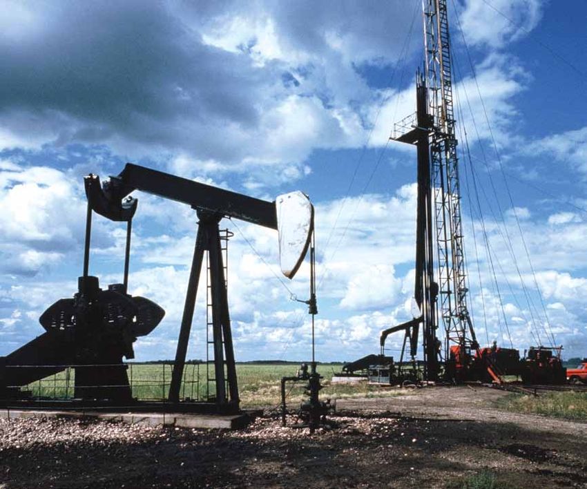
If you require additional copies of this publication or need
further information about Alberta’s water, please contact:

Alberta Environment Information Centre
Main Floor, 9820-106 Street
Edmonton, Alberta
T5K 2J6

Phone:         780-427-2700 (toll-free, dial 310-0000)
Fax:           780-422-4086
Email:         env.infocent@gov.ab.ca
Website:       www.environment.alberta.ca

Note:	This is a revised edition of a publication entitled:
       Water for Life: Facts and Information on Water
       in Alberta 2002

Pub #:	I/107
ISBN:    978-0-7785-8969-3 (Printed Version)
ISBN:    978-0-7785-8970-9 (On-line Version)
Printed: December 2010

Front Cover Image: Lesser Slave Lake Provincial Park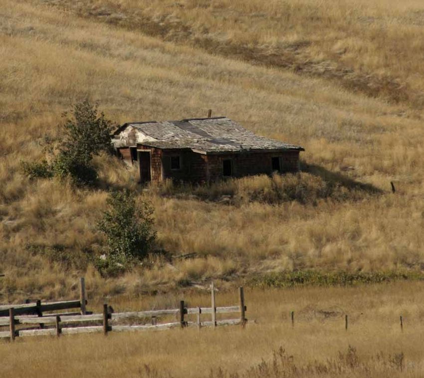
table of contents

1.0 Background                                        4
    1.1 Water for Life                                4

2.0 Water Sources                                     5
     2.1	Surface Water                                6
    		   2.1a	Rivers                                  7
    		   2.1b	River Basins                            9
   		    2.1c	Lakes                                  13
    		   2.1d Wetlands                               16
    		   2.1e	Springs                                21
     2.2 Groundwater                                 22
     2.3 Fluctuations in Water Resources             25

3.0 Water Quality                                    28
     3.1 Monitoring                                  32

4.0 Water Allocation & Water Users                   34
     4.1	Agriculture                                 40
     4.2	Industrial (Oil and Gas)                    42
    		    4.2a Power Generation (non-hydro)          44
     4.3 Hydroelectric Dams and Reservoirs           45
     4.4 Municipal Water Supply - Drinking Water     47

5.0 Water Management                                 53
    5.1 Who is Responsible?                          57
    5.2 Protection - Water Conservation Objectives   58
    5.3	Conservation, Efficiency, and Productivity   60
    5.4 Partnerships                                 63

6.0 Current and Future Challenges                    65

                                                      3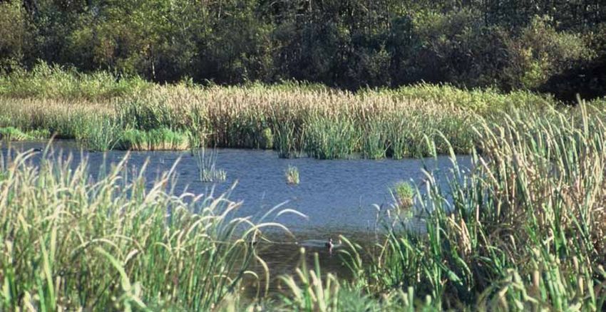
1.0      Background

Alberta Environment developed this book to help inform Albertans about the
province’s water, and some of the current challenges facing our water resources.
Facts about Water in Alberta outlines where our water comes from, who uses
water in the province, and how water quality and quantity is managed. Through
increased awareness and understanding, Albertans can act as stewards to protect
and conserve our water resources ensuring the goals of Water for Life: Alberta’s
Strategy for Sustainability are realized.

1.1      Water for Life

Water is not only a resource, it is a life source. We all share the responsibility
to ensure a healthy, secure, and sustainable water supply for our communities,
environment, and economy – our quality of life depends on it.

In November 2009 The Government of Alberta released the Water for Life action
plan, the roadmap that the government and its partners will follow over the next
10 years. The action plan supports the goals and directions in Alberta’s renewed
Water for Life strategy.

The renewed strategy reflects the population increase and economic growth Alberta
has seen over recent years, and Albertans’ changing water needs. Like the original,
the renewed Water for Life strategy has three main goals:

    safe, secure drinking water;
    healthy aquatic ecosystems; and
    reliable, quality water supplies for a sustainable economy.

These goals will be met through knowledge and research, partnerships, and
water conservation. The renewed strategy and corresponding action plan reaffirms
Alberta’s commitment to the Water for Life approach: the wise management of
our province’s water resources for the benefit of all Albertans.

Did you know?
More than 80 per cent of Alberta’s water supply is found in the northern
part of the province, while 80 per cent of the demand is in the south.

4
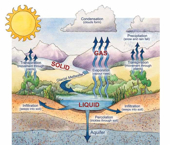
Credit: Bow Habitat Station                                   Water Cycle

2.0     Water Sources
Despite the water cycle’s ability to replenish water sources, the quantity of
water available for human use is finite. As Alberta’s population and economy
grows, the demands we put on our limited water resources increase.

Canada is considered to be a water-rich country and is estimated to have
20 per cent of the world’s freshwater. Alberta in turn, holds approximately
2.2 per cent of Canada’s freshwater. Although Alberta has a good supply of water,
variations in geography, climate, and the hydrologic cycle create regions and
periods of water scarcity. In northern Alberta there are large rivers and numerous
lakes while southern Alberta has rivers with lower volumes and fewer natural
lakes. Large quantities of groundwater also exist in many different aquifers and
buried channels within Alberta. Environmental events such as droughts and
flooding add to the variability of water quantity throughout Alberta.

                                                                                5
Distribution of Water in Alberta

                                                          North-flowing / 86.6% to the Arctic Ocean
                                                          East-flowing / 13.3% to Hudson Bay
                                                          South-flowing / 0.1% to Gulf of Mexico

2.1     Surface Water

Surface water refers to water found on the surface of the earth. Water collecting
on the ground or in a river, lake, or wetland, are all examples of surface water.
This water is “renewed” each year by precipitation (rain and snow) and naturally
lost through evapotranspiration (moisture loss by plants) and sub-surface recharge
into the groundwater. Groundwater seepage returning back to the surface is also
a supply for wetlands and base flow in streams.

The majority of Alberta’s population and industries get their water from surface
water sources. This valuable resource provides us with drinking water, and supports
industry, agriculture, and recreational activities. A clean abundant supply of surface
water supports the health of humans, our economy, and the aquatic ecosystem.

Water in rivers, lakes, and wetlands is known as
surface water.

6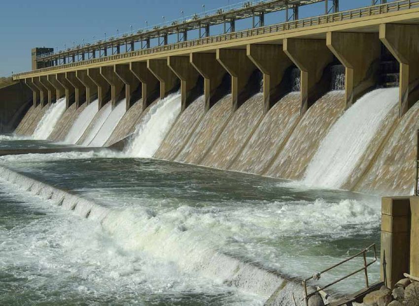
2.1a      Rivers

Most of the major rivers in Western Canada originate from glaciers and high
elevation snowpacks in the Rocky Mountains. In Alberta, there are several major
rivers that start from glaciers in Banff and Jasper National Parks. Snow melt is
the largest contributor to the annual flows in these rivers, followed by rainfall.

The amount of runoff contributing to river flow varies both seasonally and
from year to year. As snowpacks dwindle in the summer, rivers become more
dependent on rainfall, and groundwater base flow. Glacial melt water peaks in
late summer, and becomes particularly important in dry years when rainfall is
minimal. In winter, most of the water observed in streams can be attributed to
groundwater base flow, as most surface water is frozen and not contributing
much to river flows.

Situations of water scarcity can arise at times during the year, or in lower flow
years, when water demand accounts for a larger percentage of the supply. During
times of water scarcity, it is particularly important for Albertans to conserve water
and use it as efficiently and productively as possible.

There are seven major river basins or watersheds,
in Alberta: Hay, Peace/Slave, Athabasca, Beaver,
North Saskatchewan, South Saskatchewan, and Milk.

                                                                                   7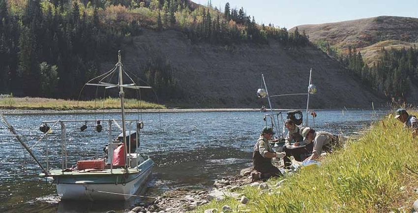
Alberta’s Major River Basins

Hay River Basin
Plus Great Slave Basins

Peace / Slave River Basin

Athabasca River Basin

Beaver River Basin

North Saskatchewan River Basin

South Saskatchewan River Basin

Milk River Basin

8
2.1b        River Basins

A basin or watershed is an area of land that catches precipitation and drains
it to a water body such as a marsh, lake, stream, or river. Healthy, functioning
watersheds can provide clean and abundant water resources to agricultural,
municipal, industrial, and recreational users; help maintain healthy crops and
crop yields; support wildlife habitat; and regulate natural processes such as soil
erosion and sedimentation. Healthy watersheds contribute greatly to the overall
health of the environment and to the quality of life of Albertans. Watersheds
can range in size from a few hectares to many thousands of square kilometres.

Credit: Bow Habitat Station                                         Watershed

Hay River Basin • The Hay River Basin is located in the northwest portion of
the province. The Hay River originates in British Columbia’s Rocky Mountains,
flows through the Hay River basin, and eventually makes its way to the Arctic
Ocean. The basin has a drainage area of 47,900 square kilometres (km2) and
a mean annual discharge of 3,630,000,000 cubic metres (m3) at the Alberta-
Northwest Territories border. The sub-basins within the Hay River Basin include
the Chinchaga and the Little Hay. Zama Lake and Hay Lake are two lakes in the
basin that are recognized for their importance to wildlife.

                                                                                9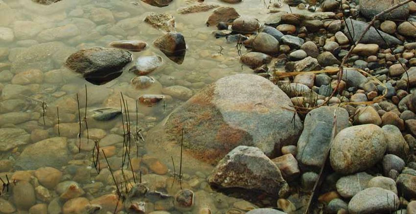
Peace / Slave River Basin • The Peace River begins in the mountains of British
Columbia and is Alberta’s largest river with the highest flow volume. Influenced
by the W.A.C. Bennett Dam in British Columbia, the river flows northeast across
Alberta through the town of Peace River, empties into the Slave River, and
eventually flows into the Arctic Ocean through the Mackenzie River. At Peace
Point (in Wood Buffalo National Park), the Peace River has a mean annual discharge
of 68,200,000,000 m3 and a drainage area of 293,000 km2. The Peace/Slave
River Basin includes the Wapiti, Smoky, Little Smoky, and Wabasca Rivers.
Major urban centres within the basin include: Grande Prairie, Peace River, High
Level, and Grand Cache.

Athabasca River Basin • The Athabasca River originates in the Rocky Mountains
of Alberta. The river flows northeast through the province, past the urban centres
of Jasper, Hinton, Whitecourt, Athabasca, and Fort McMurray prior to emptying
into Lake Athabasca. The flows from the Athabasca and Peace Rivers combine to
form the Slave River and eventually make their way to the Arctic Ocean. At Jasper,
Athabasca, and Fort McMurray the mean annual discharge is 2,790,000,000 m3,
13,600,000,000 m3, and 20,860,000,000 m3, respectively. The coinciding drainage
areas are 3,880 km2, 74,600 km2, and 133,000 km2 respectively. The Athabasca
River Basin includes the McLeod, Pembina, Lesser Slave, and Clearwater Rivers and
covers an area of approximately 159,000 km2. The Peace River and Athabasca
River merge to form the Peace Athabasca Delta. This delta is one of the world’s
largest inland freshwater deltas and is a wetland of international significance. It
includes some of the largest undisturbed grass and sedge meadows in North
America, providing habitat for large populations of waterfowl, muskrat, beaver,
and wood bison.

Did you know?
The mean annual discharge, (the average total volume of water flowing
in a river in one year) of the Athabasca River at Fort McMurray is enough
to fill Sylvan Lake (43 km2) about 50 times in one year.

10
Beaver River Basin • The Beaver River Basin is one of the smaller basins in
the province with a catchment area of about 14,500 km2. The basin and river
extend east, across the provinces of Saskatchewan and Manitoba, emptying
into Hudson Bay as the Churchill River. The Beaver River begins at Beaver
Lake, and then flows through the urban centres of Bonnyville, Cold Lake, and
Grand Centre. The mean annual discharge of the Beaver River at the Alberta-
Saskatchewan border is 653,000,000 m3. The Cold Lake Area Weapons Range
comprises the majority of the northern part of the basin. The basin is characterized
by many meandering streams and rivers that flow through lakes such as: Cold,
Moose, Muriel, Ethel, and Wolf Lake.

North Saskatchewan River Basin • The North Saskatchewan River Basin
covers about 80,000 km2 of the province. The basin begins in the icefields of
Banff and Jasper National Parks and generally flows in an eastward direction
to the Alberta-Saskatchewan border. The Brazeau, Nordegg, Ram, Clearwater,
Sturgeon, and Vermilion rivers flow into the North Saskatchewan River within
Alberta. The Battle River also forms part of the North Saskatchewan basin and
joins with the North Saskatchewan River in Saskatchewan. There are two large
dams located in the basin. The Bighorn Dam on the North Saskatchewan River
creates Lake Abraham. The Brazeau Reservoir is created by the Brazeau Dam,
located on the Brazeau River. Major centres within the basin include Rocky
Mountain House, Drayton Valley, Edmonton, Fort Saskatchewan, and
Lloydminster. The mean annual discharge from the basin in Alberta into
Saskatchewan is 7,160,000,000 m3.

South Saskatchewan River Basin • The South Saskatchewan River Basin
includes the sub-basins of the Bow, Red Deer, Oldman, and South Saskatchewan
River basins. All of the sub-basins begin in the Rocky Mountains, generally flowing
eastward through the foothills and prairie. The combined area of the sub-basins is
121,095 km2, of which 41 per cent comes from the Red Deer, 22 per cent the
Oldman, 21 per cent the Bow, and 16 per cent the South Saskatchewan. Major
urban centres in the basin include Calgary, Lethbridge, Red Deer, and Medicine Hat.
All of the province’s thirteen irrigation districts are found in the South Saskatchewan
River Basin. The mean annual discharge from the basin into Saskatchewan is
9,280,000,000 m3.

Milk River Basin • The Milk River Basin is the smallest of the province’s major
river basins encompassing an area of about 6,500 km2. The river is a northern
tributary of the Missouri-Mississippi River Basin. The Milk River enters Alberta
from Montana, flows eastward through the southern portion of the province prior
to looping back to Montana. Mean annual flows entering Alberta is 106,000,000 m3
and leaving Alberta is 167,000,000 m3. Milk River is one of the few towns in
the basin.

                                                                                   11
Mean Annual Natural River Discharges
To Arctic Ocean
via Mackenzie River
3,564,000,000 m3 1,327,000,000 m3 107,726,000,000 m3
952,000,000 m3
13,773,000,000 m3
697,000,000 m3
2,290,000,000 m3
50,458,000,000 m3
To Hudson Bay
1,349,000,000 m3
via Churchill River
613,000,000 m3
7,277,000,000 m3
Edmonton
278,000,000 m3
Total Outflow To Hudson Bay
131,159,000,000 m3 via Nelson River
Total Inflow
70,227,000,000 m3 Calgary 1,837,000,000 m3
7,425,000,000 m3
Inflow and outflow values represent
the estimated long-term annual natural
flow volumes.
Based on available data to 2001.
(m3 ÷ 1233.48 = ac-ft)
766,000,000 m3
792,000,000 m3 102,000,000 m 160,000,000 m
3 3
To Gulf of Mexico
via Missouri River
122.1c Lakes
Alberta’s lakes are numerous and varied. They are important natural features that
reflect Alberta’s physical setting and climate. Most of the lakes formed approximately
10,000-12,000 years ago when the glaciers retreated, and left a number of
depressions where water pooled.
Lakes are relatively abundant in the northern half of the province. In southern
Alberta there are few natural lakes. Where nature has not provided lakes,
reservoirs have been built to support irrigation, municipalities, and industries in
addition to hydropower production. In most cases, reservoirs are used for other
purposes such as recreation, sport fishing, and maintaining environmental flows.
Water levels in lakes and rivers throughout the province fluctuate in response to
the local weather and overall climate. Lake levels across the province have been
affected by drought conditions in some years.
Alberta’s Biggest Lakes
Lake Athabasca 7,770 km 2
Lake Claire 1,436 km 2
Lesser Slave Lake 1,160 km 2
Bistcho Lake 413 km 2
Cold Lake 373 km 2
Utikuma Lake 288 km 2
Lac La Biche 234 km 2
Beaverhill Lake 139 km 2
Calling Lake 138 km 2
Pigeon Lake 98 km 2
Buffalo Lake 94 km 2
Wabamun Lake 83 km 2
13Lakes by Natural Region
Lake water quality, nutrient levels and colour vary across the province.
The following map and general descriptions of Alberta’s lakes illustrate
and describe the different regions in Alberta and where they are found.
C
B
P
F
Edmonton P
R
B Boreal Forest
C Canadian Shield
P Parkland Calgary
F Foothills
G
R Rocky Mountain
G Grassland
14B Boreal forest
The boreal forest has higher precipitation and lower evaporation rates compared
to grasslands and parkland. Lakes here are influenced by vast peatlands. The
dark brown color of many boreal rivers and lakes is often caused by dissolved
organic carbon from peatlands. These lakes tend to be less alkaline (lower pH)
than lakes in other regions of the province and can be susceptible to acidification
from acid deposition (rain and snow).
C Canadian Shield
Water colour and quality is influenced by the underlying rock. Shield lakes often
appear dark because of the colour of the granite. Underlying granite bedrock is
not easily dissolved and is naturally low in nutrients. Shield lakes are often neutral
to slightly alkaline and low in dissolved nutrients (oligotrophic, meaning nutrient
poor) and hence, support little biological productivity or growth.
P Parkland
Parkland lakes are numerous, shallow, and warm. Due to surrounding fertile lands,
these lakes are rich in nutrients (eutrophic) and minerals. This can cause frequent
natural blooms of algae and large aquatic plants. Lake levels fluctuate due to
their position between the moist boreal (northern) forest and the dry grasslands
in the south.
Some lakes, especially in east central Alberta, are experiencing a net loss of
water through evaporation and thus have become highly saline (salty). These
lakes are unable to support freshwater aquatic life but may contain a few salt
tolerant species. A good example of this is Oliva Lake near Viking. It is two to
three times more saline than seawater.
R Rocky Mountains
Due to the lack of deep, rich soils surrounding them, lakes in the Rocky Mountains
are oligotrophic (nutrient-poor). These lakes have very low concentrations of
nutrients and low algal abundance, so the water is clear. Lower average water
temperatures also limit the growth of aquatic organisms in these surface waters.
G Grasslands
There are few natural lakes in the grasslands. Constructed reservoirs are used
for irrigation. These water bodies are warm and can be eutrophic from nutrient-
rich agricultural runoff. Though precipitation is lower and evaporation is higher in
this region, water levels are usually augmented via diversions from larger rivers.
152.1d Wetlands Wetlands are natural areas where water and land meet. They provide food, habitat, and shelter for nearly 300 species of wildlife in Alberta. Wetlands are a critical part of much larger systems known as watersheds that move water across the land. Types of Wetlands There are five major wetland types in Alberta. These wetlands differ in terms of water saturation and permanence (hydrology), and the types of plant and animal communities that they support. Alberta’s five wetland types can be divided into two main categories: peatlands (also known as muskeg) and non-peatlands (sloughs). Peatlands: Central & Northern Alberta Bogs form in cool wet areas where drainage is poor. Precipitation supplies most of the water to a bog, which is why bogs are low in nutrients. They are strongly acidic (pH around 4.5) and are dominated by spongy carpets of moss species like Sphagnum. Bogs can be open or forested. Low shrubs and trees like larch and black spruce can often be found in bogs. Bogs are characterized by a high accumulation of peat (greater than 40 centimetres). 16
Bogs and Fens: What is the difference?
Precipitation (rain and snow) are the primary sources of
water for bogs. Fens receive water from drainage and
groundwater. Fens are less acidic and more nutrient-rich
than bogs.

Fens receive most of their water from groundwater. The water is less acidic and
contains more nutrients than bogs. Like bogs, fens also have a high accumulation
of peat (greater than 40 centimetres), but because they are less acidic, they can
accommodate different vegetation, like sedges, grasses, and wildflowers. Fens
can look like open, grassy fields or can be wooded.

Non-Peatlands

Marshes, often called sloughs, form in depressions in the landscape where
water collects as standing pools. Emergent plants such as cattails, rushes,
and sedges are the dominant vegetation cover. Small marshes between the
rolling hills of the prairies are known as potholes.

                                                                              17
Non-Peatlands Shallow Water Wetlands are wide, flat basins of standing water that receive water from rain, snow, and groundwater sources. Water is two metres deep or less. In mid-summer there is often open water in these wetlands, but they may dry out in late summer. Swamps are forests that are flooded seasonally by standing or slow-moving water, and are dominated by trees and shrubs. Swamps are not common in Alberta and are usually confined to the transition zone between peatlands and upland forests. Swamps have a dense cover of both deciduous (leafy) and coniferous (needle) trees and are sometimes called forested wetlands. 18
Benefits of Wetlands

Wetlands are among the most fertile, complex, and productive ecosystems on
earth. They play an important role in improving the quality and quantity of our
water supplies in addition to providing valuable wildlife habitat. Wetlands are
recognized and appreciated for their contribution to the health and wellness of
Alberta’s environment because they:

Filter surface water
Wetlands improve water quality through filtration. Often called “nature’s kidneys”,
wetlands trap sediment, absorb nutrients, and remove chemical residues. As
water passes through a wetland, impurities are removed.
Recharge groundwater
Wetlands recharge groundwater supplies by soaking up surface water and
letting some of it seep back into the ground where it is filtered even further.
Moderate climate change
Wetland plants take carbon dioxide from the air and “sequester” the carbon in
the soil, removing a potentially harmful greenhouse gas from the atmosphere,
and replacing it with life-giving oxygen.
Reduce the effects of drought
Wetlands can provide a valuable source of water for wildlife during times
of drought.
Reduce the effects of flooding
Wetlands help reduce the effects of flooding and soil erosion by storing runoff
water and releasing it slowly downstream.
Are important to the economy
Wetlands provide opportunities for tourism, canoeing, bird watching, nature
photography, hunting, fishing, and other activities.
Support biodiversity
Wetlands support biodiversity and provide food, water, and habitat for plants,
birds, mammals, and fish.

                                                                                  19
Wetland Issues Alberta’s wetlands are under pressure from land development. Industrial development and human settlement have altered local ecosystems where wetlands have been drained, paved over, or farmed. Although we are more aware than ever of the importance of wetlands, their loss continues in Alberta. Approximately 64 per cent of the wetlands in the settled area of Alberta no longer exist. Public education, improved stewardship, and careful land management are required to ensure protection of our wetlands. It is important that landowners and land users are knowledgeable and involved in making decisions regarding wetlands to benefit both people and nature. For more information on wetlands in Alberta visit: www.wetlandsalberta.ca Did you know? All water in Alberta is owned by the Crown and managed by the province, regardless of whether it occurs on public or private land. Activities impacting water in wetlands are regulated under the Water Act. Before any activity within a wetland is initiated, such as the creation of drainage ditches, infilling or alteration, Alberta Environment must be contacted for approval. 20
2.1e      Springs

A spring is any natural occurrence where water discharges on to the surface of
the earth from below the surface. Springs are frequently found at break points
in slopes. Some springs flow from pools like the “Ink Pots” of Banff National
Park. Other springs flow from the bottom of lakes, such as the Blue-hole spring
of Maligne Lake. The most common type of spring in Alberta is the contact spring,
which is found mainly in the interior plains. They are found at the contact between
two layers of material with sharply contrasting permeability. The consistently cool
water of a spring may harbor species such as certain types of trout and frogs that
are otherwise ill-suited to large temperature fluctuations. Other types of springs are:

  Seepage or filtration springs (a variety of contact spring). The term seepage
  refers to springs with small flow rates.
  Fracture springs discharge from faults, joints, or fissures in the earth where
  springs have followed a natural course of voids or weaknesses in the bedrock.
  These types of springs are mainly found in the Rocky Mountain and Foothills
  Natural Regions of Alberta.
  Karst springs are landforms produced as a result of solution removal of
  mineral rocks, which could lead to underground channels or cave systems.

In Alberta, many small springs are used by farmers for their own water supply.
Medium to large-size springs are used for commercial purposes. Many businesses,
such as Miette Hot Springs and Banff Sulfur Hot Springs feature mineral springs
as key tourism attractions around which commercial assets have been developed.

                                                                                   21
2.2 Groundwater
The expression “out of sight - out of mind” is often accurate when considering
groundwater. Until water reaches the surface or a well is drilled, we do not see
groundwater. It is estimated that more than 90 per cent of rural Albertans depend
on wells for their water supply. Water wells are used to supply groundwater to
domestic, agricultural, municipal, industrial, and other users in the province. Water
wells were first drilled in Alberta in the late 1800’s. Of the 400,000 reported wells
drilled, approximately 215,000 wells are presently active, and about 4,000 are
added each year.
Of all the water licensed for use in Alberta in 2009, approximately 3.0 per cent of the
volume is from groundwater sources. Groundwater licences make up 26 per cent
of all licences issued. This does not include the domestic water wells used by
Albertans for which licences are not required under the Water Act.
Generally, a licence is required under the Water Act to divert and use groundwater
(or surface water) for non-household purposes. Drillers must obtain appropriate
approvals from Alberta Environment before they can drill water wells.
What is groundwater?
Contrary to common perception, groundwater in Alberta is not found in underground
rivers or massive open spaces. Groundwater is found beneath the earth’s surface
in gaps and pore spaces between material that may be unconsolidated (loose)
such as sand and gravel, or consolidated (hardened) such as sandstone and
conglomerate. These underground water bearing materials are called aquifers.
Aquifers are recharged when water from the surface percolates into the ground.
Did you know?
Alberta is estimated to have more groundwater than surface water. However,
only 0.01 per cent of this groundwater is thought to be recoverable.
22Where does it come from?
Groundwater begins as precipitation (rain, snow, sleet, or hail). Precipitation soaks
into, or infiltrates, the layers of soil just below ground. In this unsaturated zone,
water and air share the spaces between soil and rock creating moist soil conditions
for plants.
Some water continues to percolate downward, sometimes hundreds of metres
below the surface. Eventually, the small spaces in these areas become saturated
with groundwater. This is known as the saturated zone. The upper level of the
saturated zone is referred to as the water table. The level of the water table will
rise and fall depending on the amount of precipitation occurring in an area.
Where is it located?
Groundwater is found in nearly every area of the province. However, for groundwater
to be a recoverable resource, it must exist in an aquifer. An aquifer is a geological
formation that can provide sufficient water to support a specified use, such as
a household well. Aquifers differ in size; some can support only a single home
while others provide water for an entire town.
Like surface water, groundwater supplies are not evenly distributed across the
province. Aquifer depths, volume, and water quality also vary. If groundwater is
withdrawn faster than it can be recharged, or quality is impacted, the aquifer may
cease to be a reliable source.
Generally speaking:
In the southern half of Alberta, the Paskapoo aquifer is the most used aquifer
system. Of the 200,000 water wells drilled in it, approximately 70,000 are
presently active, making this an important aquifer in western Canada. Water
quality is variable within the Paskapoo Formation. While it may be more alkaline
in the west, it tends to be fresher than groundwater supplies to the east which
are more mineralized (i.e., more saline) and not as aesthetically pleasing
(e.g., rotten egg smell).
Did you know?
In general, only groundwater within 150 metres of the surface is potable (suitable
for household consumption). Although there are exceptions, wells drilled at greater
depths run the risk of encountering saline groundwater. Whenever possible,
industrial water users look for alternatives to potable water, such as deeper
saline groundwater.
23In central Alberta, shallow sand and gravel aquifers are able to yield up to 100 cubic metres/day (m3/d). Most notable are aquifers such as the Buried Red Deer Valley where yields of more than 654 m³/day (100 imperial gallons per minute (igpm)) are expected. Water quality in these aquifers is generally good. In the Peace River area, the main groundwater source is the Grimshaw Gravels aquifer, capable of yields in excess of 655 m3/day (100 igpm) and sandstone lenses of the Dunvegan Formation, capable of yields ranging from approximately 165 - 655 m3/day (25 - 100 igpm). Water quality is generally good within the Grimshaw Gravels and more variable within the Dunvegan Formation. What are some of the issues surrounding groundwater wells? Quantity Issues Competition amongst users and the number of wells drawing water from an aquifer put an increased demand on our groundwater resources. Unsustainable pumping rates will cause groundwater levels to decline over time as aquifers are depleted. Quality Issues Wells that draw water from multiple aquifers can cause groundwater to drain from one aquifer to another, even when these wells are not in use. Cross-contamination can occur if the draining aquifer has groundwater of a different or lesser quality. Water wells that have not been properly constructed or maintained, or wells that are inactive or abandoned, pose a significant threat to groundwater resources as they provide a direct channel for surface contamination to reach aquifers. 24
2.3     Fluctuations in Water Resources

Variability in water resources is a natural phenomenon. Groundwater levels in
aquifers undergo natural fluctuations in response to the rate of recharge (speed
at which water moves downward from surface water to groundwater). These natural
changes in groundwater levels have repercussions at discharge areas, such as
groundwater-fed lakes, rivers, or springs. It is not uncommon to see high discharge
springs go dry during certain periods of the year. Similarly, fluctuations in surface
water levels and discharge occur naturally. Some ecosystems are even dependent
on these fluctuations. Floods wash over flood plains, covering them with mineral
and nutrient-rich sediment, providing nourishment for vegetation and other
organisms. Minor to moderate droughts are also part of normal cyclical conditions.
Vegetation, wildlife, and aquatic ecosystems can adapt to both floods and droughts.

Floods

A flood occurs when water accumulates at a greater rate than it is drained. The
accumulated water can spill over the banks of the river, lake, or wetland, flooding
the surrounding land. Different factors may cause flooding including rainfall
exceeding the water basin’s drainage capacity, or a blockage in the flow of a
river caused by ice or logs. Floods can vary in severity, and can result in damage
ranging from the loss of vegetation to the loss of animal or human life. Damage
can be very costly, and it can take communities years to recover from flooding.

In most cases flooding is a regular and natural event; however, it becomes a greater
concern when development or communities occupy a flood plain. A flood plain
is low-lying dry land next to a water body. As they are adjacent to water, flood
plains are the first to be affected by overflowing waters.

Sixty-six communities in Alberta have development within a flood plain. Some of
those communities have built structures to help protect them from flooding, such
as the diversion canals in Slave Lake or the dykes in Drumheller and Peace River.

Alberta Environment works with communities across the province to improve flood
mapping in high risk communities. Mapping helps us better understand possible
impacts of flooding on these communities. It can also assist communities with
land use planning.

Did you know?
The cottonwood tree species is dependent on flooding for regeneration.
Common in river valleys, the seed of this tree will only sprout in flood-like
conditions.

                                                                                  25
Droughts Droughts are a natural event in many areas of Alberta, and occur because of a prolonged lack of precipitation in a region. Water scarcity can result in the degradation or death of vegetation and wildlife. It can also lead to economic losses in agriculture and associated industries. Farmers in Alberta face drought conditions from time to time. Drought occurs frequently in southern Alberta, leading farmers to rely on irrigation works, instead of rain, to deliver water to their crops. During a drought, there may be insufficient water available to meet the total demand from all users. In some cases, water users may not be able to withdraw water without increasing the risk of impacting the aquatic environment. In times of drought where supply is unable to meet all demands, water diversion priority is given to the users with the longest standing water licences. 26
Climate change

The impact of climate change on water supply is becoming an important issue
for Alberta. While potential impacts are uncertain, there is agreement that climate
change will cause the water cycle to become more dynamic, leading to an increase
of extreme events like floods, droughts, and blizzards. Extreme events are also
unfavorable for groundwater recharge conditions. For example, when rainfall intensity
increases, it generates bigger, wetter storms, which quickly translate into runoff
and a loss for recharge. Some of the impacts that may be seen in Alberta are:

  changes in location, duration, and intensity of precipitation;
  decreases in snow accumulation and shorter, warmer winters;
  increases in evapotranspiration (moisture loss by plants) due
  to a longer growing season;
  increases in glacier melt;
  overall decreases in river flows; and
  changes in the timing of peak river flows.

The potential for scarcity of water, especially in southern Alberta, is an ongoing
issue. Climate change may make this a more pressing issue. As the climate changes,
there will be a need to adjust how we manage water and increase conservation.
The Government of Alberta is addressing climate change through a long-term strategy
that focuses on carbon capture and storage, energy efficiency and conservation,
and greener energy production. To learn more about Alberta’s Climate Change
Strategy visit: www.environment.alberta.ca

Climate Change Impacts
                   population growth increases municipal
                   water demand on stream water resource
                                              lower water         longer, hotter summers,
                                              levels in dugouts   increased envirotranspiration
                                                                  shorter, milder winters
                                                                  with less snowfall
      melting glaciers
                                                              lower reservoir level

   reduced                 Calgary
   stream flow                                             increased
                                      increased            agricultural
                                      evaporation          demands
                             closed
        increased demand     basin          water table
        for groundwater

                             groundwater source

Credit: Natural Resources Canada                                                              27
3.0 Water Quality Surface water quality varies naturally throughout Alberta according to local conditions such as climate, geology, and vegetation, and is also subject to human influence. There are three major factors that affect water quality: Water Quantity • The amount of water available affects its quality. Major rains and high-flow events typically wash sediment, nutrients, pesticides, bacteria, and other substances off the land and into rivers, thereby lowering water quality. Conversely, the less water there is, the lower the capacity of a water body to dilute and assimilate wastes. Climate change, fluctuating groundwater supply, and increased consumptive demands may therefore affect water quality in the future. These factors could also influence the timing of river flows, which could impact the suitability of habitat for aquatic life. Point Source Contamination • “End-of-pipe” sources of contaminants known as effluents are a result of human activities. Because these sources are easily identified, they are fairly easy to monitor and regulate. The greatest impacts are usually from point sources associated with the discharge of treated wastewater from municipalities and industries. In recent decades, significant and ongoing improvements to wastewater treatment technology have reduced the impact of point source pollution in Alberta rivers. Non-point Source Contamination • These are sources of contaminants that cannot be easily traced. For example, rain and snowmelt can move materials from the land surface into nearby watercourses. Therefore, extensive land-use activities like logging, agriculture, mining, and urban development can impact water quality. This non-point source pollution can include sediment, nutrients, and toxic contaminants. In an urban environment, non-point source pollutants enter waterbodies through storm-drain networks. These pollutants typically include sediment and hydrocarbons from paved areas and pesticides and fertilizers from lawns and parks. Did you know? In many cities, storm drains flow directly to a local water body. This means water running off lawns, driveways, sidewalks, and streets into storm drains is not treated at a sewage treatment plant. Rain can wash fertilizers, oil, salt, and soap directly into local rivers and streams. These wastes can impact aquatic ecosystems and water quality. 28
Certain pollutants originating from urban, industrial, and agricultural activities
can also be transported long distances by atmospheric processes, and deposited
directly onto land and waterbodies. Acid rain is one example of this type of impact.
This long-range transport can include soil minerals, nutrients, and numerous
manmade chemicals. One example is the discovery of persistent pesticides and
polychlorinated biphenyls (PCBs) in water and aquatic life of mountain lakes
in Alberta.

Each of the above factors represents an opportunity for water quality
management. In Alberta, surface water quality guidelines have been
established to protect:

  aquatic life;
  agricultural uses (stock watering and irrigation); and
  recreational and aesthetic purposes.

Water quality is usually deemed to be acceptable when the values are within
the guidelines. These guidelines are not intended to be used as a “pollute up
to” limit.

Did you know?
The water in lakes and rivers within the oil sands regions will continue to
be protected throughout oil sands development. The Alberta government has
a zero discharge policy for all process-affected water, it must be contained on
site. The provincial and federal governments, industry, and community groups
collect thousands of samples every year in the Athabasca region to monitor
water quality and to identify effects related to oil sands development.

                                                                                29
Phosphorus: friend and foe Over 40 years ago, phosphorus was big news. Phosphorus, then a common ingredient in household laundry detergents, was identified as the culprit responsible for the excessive growth of algae and aquatic plants in lakes and rivers. Too much phosphorus can fuel the excessive growth of algae and weeds. Not only is the resulting green scum an unpleasant sight, but as the algae blooms die-off, their decomposition uses up dissolved oxygen in the water. Low levels of dissolved oxygen in water can lead to the death of fish and other aquatic animals. Some types of algae can also produce deadly toxins. When this problem was recognized, most manufacturers reduced the phosphorus (phosphate) content in their detergents. However, phosphorus is also a naturally occurring element. It is abundant in Alberta soils, and small amounts are a necessary part of the aquatic food chain supporting algae consumed by small animals. In Alberta, the amount of phosphorus that municipalities and industries discharge into water bodies is regulated under the Alberta Environmental Protection and Enhancement Act. Through pollution prevention strategies, and by applying the latest technologies, municipalities and industries can significantly reduce the amount of phosphorus in wastewater. Some municipalities in Alberta have implemented a phosphorus reduction program that has greatly reduced phosphorus discharged to water bodies. Limiting phosphorus-laden runoff from lawns and agricultural land continues to require careful management of fertilizers, as well as the adoption of beneficial management practices. 30
What Drains into our Rivers?
                                                                            dust

                                                 forest
 rain & snow

                              cottages
                                sewage                    agriculture
                       dust
                                           diffuse

                                                       streams

                                                              groundwater

                sediments

Tips for Reducing Phosphorus Pollution from your Home

 Use appropriate fertilizers and apply to areas according to product
 instructions. Prior to fertilizing, test lawns and gardens to ensure you
 are applying what your soil needs.
 Do not over fertilize. Excess fertilizer can run off and pollute nearby
 water bodies.
 Pick up pet waste and dispose of it properly.
 Protect riverbanks and shorelines. Keep soil covered with vegetation
 to minimize erosion.
 Compost kitchen scraps rather than use a garburator. Some types
 of food are high in phosphorus and may be great for your garden,
 but need to be kept out of the wastewater system.

                                                                              31
3.1 Monitoring As Alberta’s population increases, the impacts of municipal, domestic, industrial, and agricultural water use on water quality also increase. Continued monitoring and an increased understanding of water quality is essential if we are going to manage water resources in an adaptive and sustainable manner. Scientists use data, collected in extensive monitoring and research programs to assess the condition of surface water. Alberta Environment uses this information to establish policy and legislation that protects water quality for aquatic ecosystems and provides sufficient water resources for a sustainable economy. Water quality measurements fall into three broad categories and can be used together to describe the overall quality or “health” of aquatic ecosystems: Physical characteristics such as temperature, colour, suspended solids, and turbidity. Chemical characteristics such as nutrients, minerals, metals, dissolved oxygen, organic compounds, and a wide range of pollutants (e.g., pesticides, hydrocarbons, pharmaceuticals, PCBs). Biological characteristics such as the types and quantities of bacteria, protozoan parasites, algae, invertebrates, plants, and other animals in water. An important indicator of water quality is its ability to support different types of life. Many aquatic organisms need specific conditions to live, such as a high concentration of dissolved oxygen or cool temperatures. The number and type of aquatic invertebrates and fish within a stream or lake can be a good indicator of water quality in the system. Generally, a high dissolved oxygen level indicates good water quality. 32
Monitoring Programs - Groundwater

Alberta Environment oversees a network of over 250 wells spread across
the province known as the Groundwater Observation Well Network (GOWN).
Approximately 200 of these wells are used to measure groundwater levels, and
160 are used for water quality sampling purposes. These wells vary in depth from
a few metres to over 100 metres, and are completed over a wide range of aquifer
types (e.g., bedrock, surficial, buried valleys, confined, unconfined). Groundwater
monitoring results can be found on AENV’s website at www.environment.
alberta.ca/apps/GOWN/Default.aspx and on the State of the Environment
webpage at www.environment.alberta.ca/3716.html

Monitoring Programs - Surface Water

Surface waters in Alberta are monitored by several government, industry, and
stakeholder groups. Monitoring generates the data required to evaluate water
quality and aquatic ecosystem conditions over a broad area of the province.
Monitoring also supports the shared responsibility to manage cumulative effects
and protect water quality and aquatic ecosystems.

To support these efforts, Alberta Environment conducts extensive water
quality monitoring, reporting, and evaluation. Surface water quality data collected
by the Alberta government and its partners are stored in an electronic database.
For example, the Long-Term River Network (LTRN) generates information to
calculate the River Watch Quality Index (RWQI). This information provides a general
assessment of water quality at the 24 LTRN sites on the province’s major river
systems. In most cases, the sites represent the conditions upstream and
downstream of areas of significant human activity.
Visit: www.environment.alberta.ca/01275.html

Index ratings reflect the volume of river flow, climatic conditions, local geology,
the degree of development along rivers, non-point sources of runoff (such
as livestock grazing), and point sources of effluent that discharge into rivers.
A number of natural and human factors can influence these index values.
Alberta’s Water for Life strategy, intends that all these factors will be considered
in the protection of water quality and aquatic ecosystems. In keeping with
this approach, continuous improvements to river water quality are being made,
through upgrades to municipal wastewater treatment facilities and infrastructure,
and enhanced land use practices.

Lakes are also monitored with support from partnerships with Alberta Tourism
Parks and Recreation, Alberta Lake Management Society, and the Regional
Aquatics Monitoring Program. In north-east Alberta water stewardship groups
use information generated by lake monitoring when developing watershed
and lake management plans.

                                                                                 33
4.0 Water Allocation & Water Users
In Alberta, water diversions are managed primarily through a system of water
licences issued by Alberta Environment under the Water Act. Municipalities,
private companies, individuals, and others can apply for a licence to divert water.
Diverted water is the amount of water a licence holder is permitted to withdraw
from a water source in one year. It is usually expressed as an “allocation” consisting
of a volume (e.g., cubic metres, acre-feet), a maximum pump rate, and timing
when a licencee is allowed to pump. The total withdrawal over the year cannot
exceed the volume of water specified in a licence.
Examples of diverted water uses include:
agriculture;
industry;
commercial (e.g., golf courses, gravel pit operations); and
municipal.
Total Water Allocations in Alberta*
by Source (2009)
Surface Water 97.0%
Groundwater 3.0%
Total Licensed Volumes: 9,891,606,000 m3
(9,591,071,000 m3 from Surface Water and
300,535,000 m3 Groundwater)
Of all the water licensed in Alberta in 2009 (9.89 billion m³):
97 per cent (9.59 billion m³) of the volume is from surface water sources; and
3 per cent (301 million m³) of the volume is from groundwater sources.
Water is allocated to 187,551 licence holders:
49,376 (~26 per cent) are groundwater licence holders: and
138,175 (~74 per cent) are surface water licence holders.
* Based on allocations, users are legally entitled to divert these amounts annually, but the
actual amounts used each year may vary. Depending on the purpose, some or all of the
water originally diverted may be returned to the source.
34Water Allocations in Alberta*
by Specfic Purpose (2009)
Other
Water Mgmt.
Surface Water
Fish / Wildlife
Groundwater
Habitat
Recreation
Municipal
Injection
Drilling
Industrial (Oil, Gas)
Cooling
Commercial
Irrigation
Agricultural
0.0 0.5 1.0 1.5 2.0 2.5 3.0 3.5 4.0 4.5
Allocated Volume (billions of cubic metres)
Water Allocations in Alberta*
by Specfic Purpose (2009)
Ag - Agriculture 1.8%
Ag - Irrigation 42.5%
Com - Commercial 6.0%
Com - Cooling 23.5%
Ind - Industrial (Oil, Gas) 6.2%
Ind - Drilling 0.07%
Ind - Injection 2.2%
Mun - Municipal 11.3%
Othr - Recreation 0.22%
Othr - Habitat 1.4%
Othr - Fish / Wildlife 0.92%
Othr - Water Mgmt. 3.5%
Othr - Other 0.53%
Total Licensed Volumes: 9,891,606,000 m3
(9,591,071,000 m3 Surface Water;
300,535,000 m3 Groundwater)
* Based on allocations, users are legally entitled to divert these amounts annually, but the
actual amounts used each year may vary. Depending on the purpose, some or all of the
water originally diverted may be returned to the source.
35Groundwater Allocations in Alberta*
by Specific Use (2009)
Ag - Agriculture 22.3%
Ag - Irrigation 0.22%
Com - Commercial 9.2%
Com - Cooling 0.72%
Ind - Industrial (Oil, Gas) 22.4%
Ind - Drilling 0.36%
Ind - Injection 18.9%
Mun - Municipal 19.6%
Othr - Recreation 1.7%
Othr - Habitat 0.03%
Othr - Fish / Wildlife 3.1%
Othr - Water Mgmt. 0.03%
Othr - Other 1.51%
Total Licensed Groundwater Volumes: 300,535,000 m3
Surface Water Allocations in Alberta*
by Specific Use (2009)
Ag - Agriculture 1.1%
Ag - Irrigation 43.8%
Com - Commercial 5.9%
Com - Cooling 24.2%
Ind - Industrial (Oil, Gas) 5.7%
Ind - Drilling 0.06%
Ind - Injection 1.6%
Mun - Municipal 11.0%
Othr - Recreation 0.17%
Othr - Habitat 1.4%
Othr - Fish / Wildlife 0.85%
Othr - Water Mgmt. 3.6%
Othr - Other 0.50%
Total Licensed Surface Water Volumes: 9,591,071,000 m3
* Based on allocations, users are legally entitled to divert these amounts annually, but the
actual amounts used each year may vary. Depending on the purpose, some or all of the
water originally diverted may be returned to the source.
36Surface water and groundwater allocations vary by sector or industry. The
sectors with the largest allocations of surface water are irrigation, cooling uses
for thermal power generation, and municipal water supply. In contrast, the sectors
with the largest allocations of groundwater are oil and gas (enhanced oil recovery
and processing), agricultural use (non-irrigation), and municipal water supply.
Water allocations also vary from watershed to watershed. In 2009 Alberta
Environment allocated from the Bow River Basin a total of 2.74 billion m3 of water.
73 per cent was used for irrigation; and
17 per cent was for municipal water use in the City of Calgary.
In 2009 Alberta Environment allocated from the North Saskatchewan River Basin
a total of 2.01 billion m3 of water.
79 per cent was for thermal power plants; and
7 per cent was for municipal water use in the City of Edmonton.
37Water allocations do not directly reflect actual use or consumption of water. Rather, an allocation volume represents the maximum amount of water granted for use on an annual basis. The allocation volume (or maximum annual diversion) is made up of three components in a license: consumption; losses; and return flow. Actual water diversion information is important to determine how much water Albertans are using overall. Large water users are generally required to report how much water they have diverted, consumed, and returned each year. The reason being, the majority of water volume used and consumed can be accounted for by a relatively small number of large licences. This is particularly the case in the south, where the irrigation districts account for a major portion of the allocated water. However there are years when an entire allocation is not required. For example, irrigation’s use of water is typically lower during wet years because of higher than expected rainfall and surface runoff. Many water users will return some or most of their diverted water back to the source following its use. For instance, thermal power plants withdraw large volumes of water for cooling purposes, however much of that diverted water is cycled through the operation and returned back to the source. Similarly, municipalities tend to return upwards of 80 to 90 per cent of their original water diversion after use and treatment. Water license applications are carefully reviewed to ensure that the amount of water allocated is reasonable for the intended use. To properly manage our water resources, Alberta Environment must have as clear a picture as possible of how much water is allocated, diverted, consumed, and returned. 38
Water Allocation: The maximum amount of water that a user can
legally take from a water source on an annual basis.

Water Licence: The legal document issued under the Water Act
giving a user the right to divert at a maximum rate, and for a
specific maximum quantity of water per year, at a specific location,
for a particular purpose.

Water Diversion: The amount of water a user actually takes from
a water source, usually expressed as a volume (e.g., cubic metres,
acre-feet) over time (e.g., per week, per year etc.).

Water Use (consumptive use): Water use is equal to water diverted
minus return flow component. Consumptive uses also include
water lost through evaporation or through leakage.

Did you know?
Alberta Environment’s Water Use Reporting System allows water licencees to
report their water diversions online. Licencees may enter the data on a daily,
monthly, or annual basis depending on the reporting requirement of their licence.
Visit: www.environment.alberta.ca/01301.html

                                                                             39
4.1 Agriculture Whether managing a livestock operation, growing grain or supporting a farmhouse, water is a necessary component of any agricultural operation. Water allocations for the agricultural sector include licences issued for non-irrigation uses such as stock watering and feedlots, and irrigation uses. Depending on the location in the province and type of use, a farm may need surface water, groundwater, or both. As of 2009: Non-irrigation agricultural use accounted for 22.3 per cent of the province’s total allocation from groundwater sources. Irrigation accounted for 43.8 per cent of the province’s total allocation from surface water sources. However in the South Saskatchewan River basin where irrigation is most prevalent, irrigation accounted for 72 per cent of the total allocation. Irrigation is one of the primary methods for improving agricultural productivity and crop diversification in the warm, semi-arid regions of the province. In southern Alberta, more than 505,000 hectares of land are serviced by 13 irrigation districts. The irrigation districts have networks of reservoirs and water delivery infrastructure that are used to support agricultural production. Additionally, water is supplied by the districts to nearly 50 communities for municipal use. Where do the irrigation districts get their water? The majority of the water used by irrigation districts in Alberta comes from rivers in the South Saskatchewan River Basin including the St. Mary, Bow, Oldman, and their major tributaries. A relatively smaller supply comes from the Milk River, a tributary of the Missouri-Mississippi River system. 40
Alberta’s Irrigation Districts

                     Calgary
                                   12

                                                                  13

                                                         11
                                                                            Medicine Hat
                                                                                           10

                                                                                 9
                                               7
                                                              8
                                                     9                 9

                                        Lethbridge
                                                          6

                               4               5
                                    2
                                          3

1. Mountain View   4. United            7. Lethbridge Northern             10. Ross Creek
2. Leavitt         5. Magrath           8. Taber                           11. Bow River
3. Aetna           6. Raymond           9. St. Mary River                  12. Western
                                                                           13. Eastern

Irrigation district: An organization that owns and manages
a water delivery system for a given region, usually for
agricultural purposes.

The Government of Alberta owns and operates more than
200 water management systems. For example, the Carseland
Weir southeast of Calgary diverts water from the Bow River
mainly for irrigation.
                                                                                                41
4.2 Industrial (Oil and Gas) Water is essential to recover and process Alberta’s extensive petroleum and natural gas reserves. For example: Drilling rigs are used to reach the oil and gas, heavy oil, or in situ oil sands. Rigs use water to make a special fluid called “mud.” The mud helps bring rock chips to the surface and keeps the drill bit cool from friction against the rock. Surface water is usually used for drilling, but groundwater may also be used. Enhanced recovery of conventional oil reserves requires water (or another fluid, like carbon dioxide) to displace oil in a formation for extraction. This requirement is to maintain pressure in the oil reservoir. Surface water or fresh groundwater is normally used but industry has been steadily increasing its use of saline groundwater (under the Water Conservation and Allocation Guidelines for Oilfield Injection), which is not normally usable for other purposes. In situ oil sand areas are normally too deep to mine; therefore water is used to make steam that is injected into the oil formation. The injected steam heats the oil sands and allows crude oil to flow to the surface. The average in situ project uses roughly half a barrel of freshwater to produce a barrel of oil. In situ projects must investigate use of deep-well salt water as an alternative to freshwater under the Water Conservation and Allocation Guideline for Oilfield Injection. Freshwater that is used usually comes from groundwater sources. Oil sands mining operations use water as part of the process to separate oil from sand. The average oil sands surface mine uses between two and five barrels of freshwater to produce a barrel of oil. These mines get most of their water from the Athabasca River, with strict limits on how much water they can remove. All current and approved oil sand mines are restricted to 15 per cent or less of the available river flow on a weekly basis and to less than three per cent of the average annual river flow. This ensures that the allowable withdrawal is smaller when flows are naturally lower. Oil sands producers are committed to further reducing water use and continuing to increase the use of recycled and non-potable water. 42
You can also read