IGARSS 2020 Virtual Symposium: Impressions From the First Days - eLib
←
→
Page content transcription
If your browser does not render page correctly, please read the page content below
CONFERENCE REPORTS
                                          ALBERTO MOREIRA, JASMEET JUDGE, FRANCESCA BOVOLO, AND ANTONIO PLAZA

                                                            IGARSS 2020 Virtual Symposium:
                                                              Impressions From the First Days

      S   ince the great success of the 2000 IEEE Interna-
          tional Geoscience and Remote Sensing Symposium
      (IGARSS), it has been a tradition of the IEEE Geosci-
                                                                           planned events and activities during IGARSS 2020 week.
                                                                           The main theme of the 2020 symposium was “Remote
                                                                           Sensing: Global Perspectives for Local Solutions,” which
      ence and Remote Sensing Society (GRSS) to organize                   was well reflected in the symposium’s plenary session.
      the IGARSS Symposium every 10 years in Hawaii. Be-                       The conference turned out to be a huge success, at-
      fore the COVID-19 pandemic started, IGARSS 2020                      tracting more than 2,500 attendees with 1,800 video
      was planned to be held on the Big Island of Hawaii.                  presentations in 20 parallel sessions, offering, as always,
      The 4,000-mi 2 island has, since 1983, been home to                  unique perspectives, discussions, research, solutions,
      the world’s longest-running and largest active volca-                and an opportunity to network in a virtual format. A
      no (Mauna Loa) and also 10 of the world’s 14 climate                 novelty was that nonpresenting attendees were able to
      zones. Just imagine the tropical gardens and rain forests,           register for a nominal fee of US$10 and have access to all
      wildlife, Asian and Polynesian art, black- and white-                of the presentations and papers; in this way, the virtual
      sand beaches, saltwater lagoons, waterfalls, dolphins,               conference was affordable for the entire geoscience and
      sea turtles, and much more.                                          remote sensing community.
         Due to the COVID-19 pandemic, it was decided in                       The following are some highlights from the IGARSS
      June 2020 by the GRSS Administrative Committee (Ad-                  2020 opening and plenary sessions, held on Monday, 28
      Com) to move IGARSS 2020 to a completely online and                  September. Well before the start of IGARSS 2020, video
      virtual symposium (see Figure 1). The expectations were              recordings of the plenary speakers’ talks and the pre-
      high due to the huge effort required in reorganizing                 senting authors were recorded to ensure a professional
      the conference setting, technical program, and all the               and trouble-free flow of sessions throughout the week
                                                                           of the symposium. All participants have access to all the
      Digital Object Identifier 10.1109/MGRS.2020.3039316                  presentations and recorded sessions at the symposium’s
      Date of current version: 8 March 2021
                                                                           website: www.igarss2020.org.

                                                                           WELCOME ADDRESSES AT THE OPENING SESSION
                                                                           The opening ceremony of IGARSS 2020 started on Mon-
                                                                           day with introductory remarks by Prof. William J. Emery
                                                                           (general cochair of the conference), who was born and
                                                                           raised in Honolulu on the Big Island of Hawaii and was
                                                                           therefore able to share many things he loves about the is-
                                                                           land (see Figure 2). After that, he introduced the keynote
                                                                           speakers and explained the course of the conference.
                                                                               Prof. Toshio Fukuda (2020 IEEE president and
                                                                           chief executive officer) gave a warm welcome address
      FIGURE 1. The IGARSS 2020 Symposium. The website was                 to all attendees (see Figure 3). He emphasized the im-
      adapted to the virtual format of the symposium. In a prere-          portance of attracting new members within industry,
      corded video, Paolo Gamba, GRSS president and IGARSS 2020            young professionals, women in engineering, entrepre-
      technical cochair, explained the virtual format of the conference.   neurs, and students. His vision of IEEE is to engage

8                                                                          IEEE GEOSCIENCE AND REMOTE SENSING MAGAZINE     MARCH 2021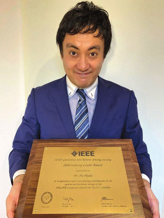
FIGURE 2. William J. Emery gives his opening remarks. Adriano       FIGURE 3. 2020 IEEE President and Chief Executive Officer Toshio
Camps and Emery served as general cochairs of IGARSS 2020.          Fukuda offers his opening remarks.

globally but also empower locally
at the same time. For this, IEEE
needs new ways to engage through
networking and (lifelong) learning
opportunities. The aim is to provide
more value for present and future
members and, through a coopera-
tive environment, increase the value
of an IEEE membership.                                             (a)                                         (b)
    Next, Prof. Paolo Gamba (2019–
2020 GRSS president) extended a
                                           FIGURE 4. (a) Paolo Gamba, 2019–2020 GRSS president, gives his opening remarks. (b) Dur-
strong invitation to join the GRSS.
                                           ing his talk, Gamba presented his vision for the GRSS: a community of communities, acting as
He explained the many benefits of
                                           a global player in the international remote sensing and geoscience community.
membership, which include techni-
cal committees, educational services,
journals, chapters, awards, young professional activities,                  St. Germain started her lecture by remembering her pre-
and conferences, to name just a few [see Figure 4(a)]. Gamba            decessor, Dr. Michael Freilich (1954–2020), who sadly passed
presented his vision for the GRSS: a community of commu-                away in August 2020. After sharing her memories in photos
nities, acting as a global player in the international remote           and kind words, St. Germain spoke about the role and impact
sensing and geoscience community [see Figure 4(b)]. There               the global science community is having on global prosperity
are four communities within the GRSS, and practically ev-               and well-being, providing insights for decision makers [see
erybody in remote sensing could find his or her place within            Figure 5(a)]. The challenge is greater than one agency, country,
the industrial, student, young professional, or global re-              or nation could manage, but
search communities and be able to share and promote ideas,              the science community is not
systems, and data sets and to meet with other communities               alone. The World Economic
                                                                                                             ST. GERMAIN SPOKE ABOUT
and gain from their perspectives, build collaborations, learn           Forum, which fosters inter-
from each other, and come together at conferences.                      national cooperation among           THE ROLE AND IMPACT THE
                                                                        business, government, and            GLOBAL SCIENCE COMMU-
KEYNOTE SPEECHES AT THE PLENARY SESSION                                 nonprofit leaders, stated that       NITY IS HAVING ON GLOBAL
After the welcome addresses, the plenary session started                risk to our environment is the       PROSPERITY AND WELL-
with presentations by three distinguished plenary speakers:             greatest danger to our future        BEING, PROVIDING
1) “Earth System Science: Understanding and Adapting to                 health, security, and well-          INSIGHTS FOR DECISION
    Our Changing Planet,” by Dr. Karen St. Germain, direc-              being. The greatest impact is
                                                                                                             MAKERS.
    tor NASA’s Earth Science Division                                   caused by extreme weather
2) “Digital Earth: Big Data for Sustainable Development,”               events, biodiversity loss, eco-
    by Dr. Stuart Minchin, director general, the South Pa-              system collapse, and human-
    cific Commission (SPC)                                              made environmental disasters, which are mostly driven or
3) “Voyaging to Our Kupuna Islands: What Do They Tell Us                worsened by global climate change.
    About Climate Change?,” by Dr. Haunani Hi´ilani Kane,                   The challenges for all of us are ensuring safe and ample
    researcher at the University of Hawaii at Mānoa.                   drinking water supplies, protecting our communities from

MARCH 2021   IEEE GEOSCIENCE AND REMOTE SENSING MAGAZINE                                                                                   9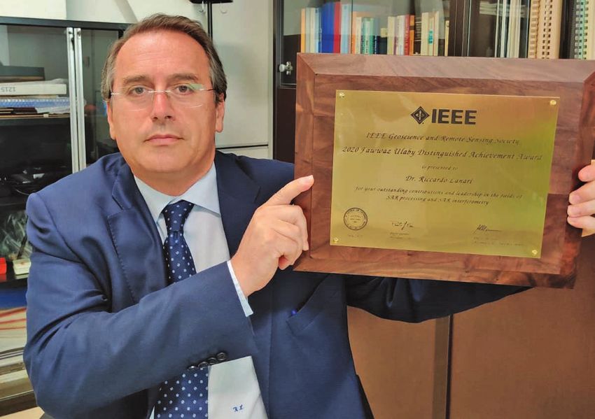
(a)                                                              (b)

     FIGURE 5. (a) Karen St. Germain, director of NASA’s Earth Science Division, presents her plenary session speech “Earth System Science:
     Understanding and Adapting to Our Changing Planet.” (b) The international NASA partnership for different space missions.

     wildfires, securing food supplies, and protecting the low-              ◗◗ We must integrate observations and models into sci-
     lying communities of homes, businesses, and critical infra-                entific and information frameworks, which span time
     structure from sea-level rise, increased flooding, and hurri-              scales from minutes to decades to advance our under-
     cane-force winds. Policy makers, planners, and emergency                   standing of the whole Earth system.
     responders need course-reliable scientific information, but             ◗◗ We must accelerate the uptake of this scientific under-
                                      St. Germain can also see new              standing and deliver it in ways that inform not just pub-
                                      possibilities opening up for              lic policy makers but also decision makers at every level,
                                      the scientific communit y;                every day.
EARTH OBSERVATION, IF
                                      these are advances in technol-            This will mean working closely with partner agencies,
APPLIED IN THE CORRECT                ogy, more observations, and           for-profit and nonprofit partners, and international partners
WAY, HAS HUGE POTENTIAL               more compute power, and               of all types. Therefore, St. Germain expressed the hope that
TO TRANSFORM AND                      there are more advances in re-        IGARSS 2020 could inspire and energize its participants to
IMPROVE ECONOMIC                      mote sensing on the horizon           join forces across disciplines and international boundaries
GROWTH.                               as well.                              to contribute to the global challenge [see Figure 5(b)]. In her
                                          St. Germain substantiated         words, “The last 20 years were about understanding if the
                                      her points with interesting           Earth is changing and how. The next 20 years will be about
                                      examples illustrated by pho-          using that understanding in real time to make smarter, sci-
     tos, charts, animations, and videos and emphasized that                ence informed decisions.”
     we must accelerate our learning and the uptake of that                     In the next plenary session address, Minchin, who is di-
     learning in three key areas:                                           rector general of the Pacific Community (formally called
      ◗◗ We have to increase the pace of advancement in our                 the SPC), first explained how operational Earth observa-
         ability to see the Earth system by investing in innovative         tion can benefit the economy and environment of whole
         technologies and the scientific method.                            regions and even entire continents. There is great value in
                                                                            Earth and marine observation: a 2019 study found that the
                                                                            current value is US$372 billion globally and growing; it will
                                                                            be US$1.35 trillion by 2030. Earth observation, if applied
                                                                            in the correct way, has huge potential to transform and im-
                                                                            prove economic growth.
                                                                                Data have been collected for the last 40 years, but to
                                                                            make use of this information, pictures from space have to
                                                                            be turned into analysis-ready data, which requires consid-
                                                                            erable prework. Minchin told about how this was done for
                                                                            Australia. Using Landsat data, regular overpasses of satel-
                                                                            lites were turned into comparable measurements that can
                                                                            be used to create decision-ready products (see Figure 6).
                                                                                The first such product was Australia’s water map for the
     FIGURE 6. Stuart Minchin, director general of the Pacific Commu-       last 40 years. There are, for example, 295,902 mapped wa-
     nity, gives his plenary session speech “Digital Earth: Big Data for    terbodies (larger than an Olympic-size swimming pool)
     Sustainable Development.”                                              across Australia. Minchin and his colleagues created a

10                                                                             IEEE GEOSCIENCE AND REMOTE SENSING MAGAZINE          MARCH 2021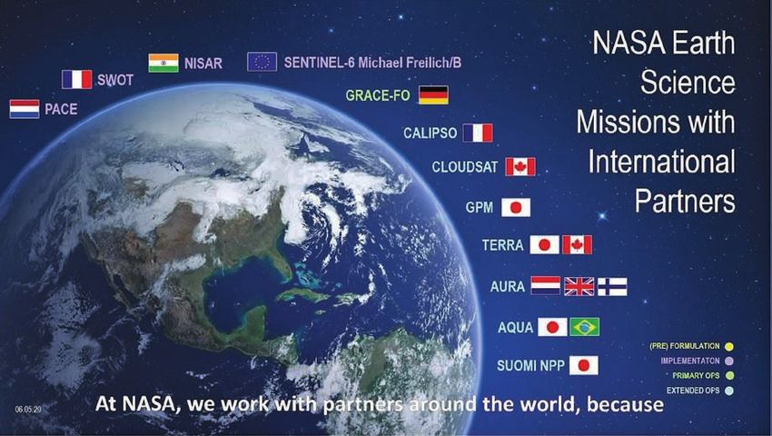
webserver using these data, where
you can look at the history of every
waterbody over the last 40 years.
    With the data, they also do lo-
cal-scale water quality monitoring,
vegetation mapping, and coastal
change tracking. Digital Earth Aus-
tralia turns observations into analy-
sis-ready data and delivers decision-
ready products. The data are a part                            (a)                                         (b)
of a globally available source code
(open data cube), and the group is FIGURE 7. Haunani Hi´ilani Kane, a researcher at the University of Hawaii at Mānoa, pre-
building a growing network of com- sented the plenary session address “Voyaging to Our Kupuna Islands: What Do They Tell Us
patible, free, and open data cubes all About Climate Change?” (a) and (b) Hi´ilani Kane’s expedition on a traditional Hawaiian boat.
over the world.
    Digital Earth Africa is the next big milestone. Here,          question for Hi´ilani Kane, as a scientist, is how to develop
products for the whole continent are being created coun-           the same relationship in her research. In Hawaii, there is a
trywise. Minchin explained through the example of Ghana            growing movement to create a more inclusive process that
how the mapping of illegal gold mining pockmarks on the            recognizes places and communities (natural and cultural
landscape is helping the economy of the country benefit            resources) as teachers.
by US$900 million (while reducing illegal gold mining by               In a second video, Hi´ilani Kane highlighted another re-
only 10%).                                                         search project on one of the islands known as Lalo, which
    Digital Earth Pacific is the next big challenge. Minchin       are difficult and not easily accessible. The team analyzed
showed through the example of the pilot project Vanuatu            fossils and sediment to get an idea of the age and evolu-
that the project can detect vegetation, coastal, and water         tion of the islands and were able to develop a history of
quality changes as they occur and also monitor fishing.            them. This site is a natural World Heritage Site, but within
They are now creating an observation platform for the blue         30 years, as current science tells us, the islands will become
Pacific to provide decision-ready products for every mem-          uninhabitable, and they may be completely beneath sea
ber nation for their economy, environment, and the man-            level in the next 80 years. Hi´ilani Kane and her colleagues
agement of precious national resources across the region.          looked at the relationship between low-lying atoll reef is-
    The third plenary speaker, Hi´ilani Kane, is a researcher      lands and the Lalo reefs. The islands had once been a coral
at the University of Hawaii at Mānoa and one of the next          reef, and the resiliency of the islands is dependent upon the
generation of voyagers on Hokule’a, where she serves as            health of the reefs. The scientists created models that can be
an assistant navigator and science coordinator [see Fig-           used to teach students and communities about reef habitats
ure 7(a)]. Forty-five years ago, on 8 March 1975, Hokule’a,        and ecosystems and their changes over time.
a traditional Hawaiian boat, was launched to find out how              Finally, Hi´ilani Kane showed the example of category 3
the islands could be populated by the ancestors of Hawaii          hurricane Walaka in October 2018, which had a large and
[see Figure 7(b)]. The common belief at the time was that          devastating impact on the islands. Using satellite imagery,
the first inhabitants must have been drifters because Ha-          Hi´ilani Kane and her colleagues observed how, in the
waiians were not believed to be able to navigate. This belief,     meantime, the island has recovered approximately 70% of
however, was in conflict with traditional Hawaiian stories.        its area. The next direction of their research is how species
The Hokule’a covered a distance of more than 2,000 mi              adapt to this recovery process.
from Hawaii to Tahiti, and it was navigated using only tra-
ditional methods.                                                  MAJOR AWARDS CEREMONY
    In an impressive video, Hi´ilani Kane explained the Ha-        Following the plenary speeches for IGARSS 2020, Prof. Al-
waiian way of observation. Navigators are taught to keep           berto Moreira, chair of the GRSS Major Awards Committee,
track of their own course but also where they come from:           opened the IGARSS 2020 awards ceremony. As in the past,
“If you know where home is, you will never be lost.” When          the opening and plenary sessions of IGARSS 2020 were
navigating, the most important times are sunrise and sun-          chosen as the venue for recognizing IEEE GRSS members
set, but navigators also use the moon and the stars, which         elevated to the grade of IEEE Fellow and of the four GRSS
tell direction and latitude. Because of weather conditions,        major awards recipients. For each award, Paolo Gamba pre-
a navigator might change course but keeps track of the             sented the recognitions and congratulated the awardees.
changes in his or her mind. Navigators are taught to feel
and read the wind with their bodies. As young navigators,          IEEE FELLOW AWARDS
they also learn to read and see the elements and to develop        The title of Fellow recognizes an individual’s unusual distinc-
a relationship with the place in which they are. The biggest       tion in the profession and is conferred only by invitation of

MARCH 2021   IEEE GEOSCIENCE AND REMOTE SENSING MAGAZINE                                                                               11
the IEEE Board of Directors to a person of outstanding and       MENGDAO XING
     extraordinary qualifications and experience in IEEE-desig-                             Mengdao Xing received his Fellow award
     nated fields. The IEEE bylaws limit the number of Members                              with the citation “for contributions to
     who can be advanced to Fellow grade in any one year to one                             radar imaging and motion compensa-
     per 1,000 of the IEEE Membership, exclusive of students                                tion algorithms.” He received his B.S.
     and affiliates. To qualify, the candidate must be a Senior                             and Ph.D. degrees in 1997 and 2002,
     Member and nominated by an individual familiar with his                                respectively, from Xidian University,
     or her achievements. Endorsements are required from at                                 China, where he is currently a profes-
     least five IEEE Fellows and an IEEE Society best qualified       sor with the National Laboratory of Radar Signal Process-
     to judge. The GRSS Society Fellow Committee completes            ing. He holds the appointment of associate dean of the
     the first ranking of the nominees. After this, members of        Academy of Advanced Interdisciplinary Research. His cur-
     the IEEE Fellow Committee, composed of approximately             rent research interests are synthetic aperture radar (SAR),
     50 IEEE Fellows, carefully evaluate all nominations (taking      inversed SAR, sparse signal processing, and microwave re-
     note of the Society rankings) and present a list of recom-       mote sensing. He has written or cowritten more than 200
     mended candidates to the IEEE Board of Directors for the         refereed scientific journal papers. He also has authored or
     final election.                                                  coauthored two books about SAR signal processing. The to-
         The GRSS performs above the average with respect to          tal number of citations of his research are greater than
     the number of elected Fellows every year. Following are the      9,200. He was rated as a Most Cited Chinese Researcher by
     GRSS members elevated to Fellow status, effective 1 Janu-        Elsevier. He has achieved more than 40 authorized China
     ary 2020:                                                        patents. Xing’s research has been supported by various
      ◗◗ Bing Zhang, Institute of Remote Sensing and Digital          funding programs, including the National Science Fund for
         Earth (RADI), Chinese Academy of Sciences (CAS), Bei-        Distinguished Young Scholars. Currently, he serves as as-
         jing, China                                                  sociate editor for radar remote sensing of IEEE Transactions
      ◗◗ Mengdao Xing, National Laboratory of Radar Signal            on Geoscience and Remote Sensing (TGRS).
         Processing, Xidian University, China
      ◗◗ Xiaofeng Li, Institute of Oceanology, CAS, Beijing, China.   XIAOFENG LI
                                                                                           The Fellow Award recognition for Xiaofeng
     BING ZHANG                                                                             Li carried the citation “for contributions
                           Bing Zhang received his Fellow award                             to the application of synthetic aper-
                            with the citation “for contributions to                         ture radar for ocean remote sensing.”
                            hyperspectral image acquisition and                             Li received his B.S. degree in optical
                            processing.” He received his B.S. de-                           engineering from Zhejiang Universi-
                            gree in geography from Peking Univer-                           ty, China, in 1985; his M.S. degree in
                            sity, Beijing, China, and his M.S. and    oceanography from the First Institute of Oceanography,
                            Ph.D. degrees in remote sensing from      Ministry of Natural Resources, China, in 1992; and his
     the Institute of Remote Sensing Applications, CAS, Beijing,      Ph.D. degree in oceanography from North Carolina State
     China. Currently, he is a full professor and the deputy direc-   University, Raleigh, USA, in 1997. He was with the National
     tor of RADI at CAS. He has led many of the key scientific        Ocean and Atmospheric Administration (NOAA) between
     projects of hyperspectral remote sensing for more than 25        1997 and 2019, where he was involved in developing many
     years. His research interests include the development of         operational satellite ocean remote sensing products. He is
     mathematical and physical models and image processing            now with the Institute of Oceanology at CAS, Beijing, Chi-
     software for the analysis of hyperspectral remote sensing        na. He has authored more than 200 publications and edited
     data in many applications. He has authored more than 300         five books and 12 special journal issues. His research inter-
     publications, including more than 200 journal papers. He         ests include SAR applications in oceanography and ma-
     currently serves as the associate editor for IEEE Journal of     rine meteorolog y, artificial intelligence oceanography,
     Selected Topics in Applied Earth Observations and Remote Sens-   big data, and satellite image processing. Li received the
     ing (JSTARS). He has been a guest editor of special issues of    Outstanding Science and Research Employee of the Year
     IEEE JSTARS, IEEE Geoscience and Remote Sensing Letters, Pro-    Award from the U.S. Department of Commerce (2015), the
     ceedings of the IEEE, Pattern Recognition Letters, and others.   NOAA Technology Group Award for “developing a remark-
     He also has served as a Technical Committee member of            able and cutting-edge enterprise software system” (2015),
     the IEEE Workshop on Hyperspectral Image and Signal              the U.K.’s Len Curtis Award from the Remote Sensing and
     Processing since 2011, as president of the Hyperspectral Re-     Photogrammetry Society, and the Overseas Expert Title
     mote Sensing Committee of the China National Commit-             from the CAS. His research was featured on the NASA
     tee of International Society for Digital Earth since 2012,       Earthdata website in 2016, reported by Nature as a feature
     and as the standing director of the Chinese Society of Space     story in 2002, and appeared on 12 journal covers, including
     Research since 2016.                                             IEEE GRSS journals. He is an associate editor of TGRS

12                                                                      IEEE GEOSCIENCE AND REMOTE SENSING MAGAZINE        MARCH 2021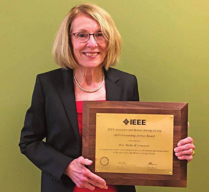
and International Journal of Remote Sensing and an editorial
board member of International Journal of Digital Earth and
Big Earth Data. He is the vice president of the GRSS Wash-
ington, D.C., and Shanghai Chapters and an active IGARSS
Technical Program Committee member, and he taught a
training course at IGARSS 2016.

GRSS MAJOR AWARDS
The Society posts its call for nominations for the GRSS
Education Award, GRSS Outstanding Ser vice Award,
GRSS Industrial Leader Award, and GRSS Distinguished
Achievement Award on its website and announces the
call in its newsletter. Nomination forms are available
at http://www.grss-ieee.org/about/awards/. Any member,         FIGURE 8. Jón Atli Benediktsson, recipient of the 2020 GRSS
with the exception of those on the GRSS AdCom, can             Education Award.
submit nominations. Typically, three to five people are
nominated every year. An independent Major Awards
Committee makes the selection, which is approved by the        son is a Highly Cited Researcher (since 2018). He was
GRSS president and AdCom. The following Major Awards           2011–2012 GRSS president. He served as editor-in-chief
were presented:                                                of TGRS from 2003 to 2008 and is currently on many
 ◗◗ GRSS Education Award                                       editorial boards. Benediktsson is a cofounder of the bio-
 ◗◗ GRSS Outstanding Service Award                             medical start-up company Oxymap (www.oxymap.com).
 ◗◗ GRSS Industry Leader Award                                 He is a Fellow of IEEE and of the Society of Photo-Optical
 ◗◗ GRSS Distinguished Achievement Award.                      Instrumentation Engineers. Benediktsson has received
                                                               many awards for his research. He is on the board of the
IEEE GRSS EDUCATION AWARD                                      Aurora University Network.
The Education Award was established to recognize an indi-
vidual who has made significant educational contributions      IEEE GRSS OUTSTANDING SERVICE AWARD
to the field of geoscience and remote sensing. In selecting    The GRSS Outstanding Service Award was established to rec-
an individual, factors considered are the significance and     ognize an individual who has given service for the benefit
innovativeness of the educational contribution and the         and advancement of the Society. The award is considered
extent of its overall impact. The contribution can be made     annually but is not presented unless a suitable candidate
at any level, including K–12, undergraduate and graduate       is identified. The following factors are suggested for
teaching, professional development, and public outreach.       consideration: leadership innovation, activity, service
It can also be in any form (e.g., textbooks, curriculum de-    duration, breadth of participation, and cooperation. GRSS
velopment, or education program initiatives). GRSS mem-        membership is required. The
bership or affiliation is required. The awardee receives a     awardee receives a certificate
certificate and plaque.                                        and plaque.
                                                                                                  THE GRSS OUTSTANDING
    The 2020 GRSS Education Award was presented to                 The 2020 GRSS Outstand-
Prof. Jón Atli Benediktsson (Figure 8), University of Ice-     ing Service Award was pre-         SERVICE AWARD WAS
land, Reykjavik, with the citation “in recognition of          sented to Dr. Melba M. Craw-       ESTABLISHED TO RECOG-
significant educational contributions to geoscience and        ford (Figure 9) from Purdue        NIZE AN INDIVIDUAL WHO
remote sensing.”                                               University, West Lafayette,        HAS GIVEN SERVICE FOR
    Benediktsson has been the president and rector of          Indiana, USA, with the ci-         THE BENEFIT AND
the University of Iceland since 1 July 2015. From 2009         t ation “in recognition of         ADVANCEMENT OF
to 2015, he was the pro rector of science and academic         outstanding service for the
                                                                                                  THE SOCIETY.
affairs, and since 1991 he has been a professor of elec-       benefit and advancement of
trical and computer engineering at the same university.        the Geoscience and Remote
Benediktsson received his Cand.Sci. degree in electrical       Sensing Society.” Crawford
engineering from the University of Iceland in 1984 and         is the Nancy Uridil and Francis Bossu Professor of Civil En-
his M.S.E.E. and Ph.D. degrees in electrical engineering       gineering at Purdue, where she is a professor in the Schools
from Purdue University, West Lafayette, Indiana, USA, in       of Civil Engineering and Electrical and Computer Engineer-
1987 and 1990, respectively. His research interests are in     ing and the Department of Agronomy. Previously, she was
remote sensing, biomedical analysis of signals, pattern        an Engineering Foundation Endowed Professor at the Uni-
recognition, image processing, and signal processing, and      versity of Texas at Austin, USA, where she founded an
he has published extensively in those fields. Benedikts-       interdisciplinary research and applications development

MARCH 2021   IEEE GEOSCIENCE AND REMOTE SENSING MAGAZINE                                                                      13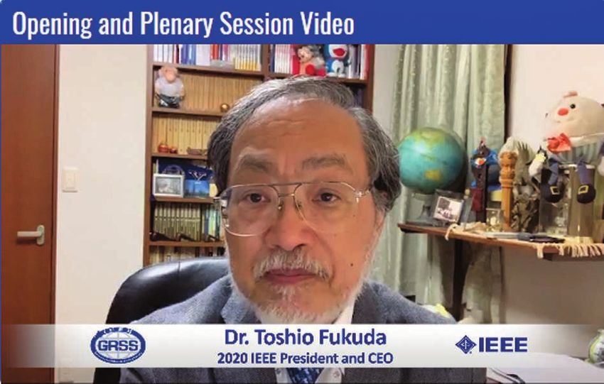
program in space-based and airborne remote sensing. Her           tween the Purdue Colleges of Agriculture and Engineering
     research interests focus on advanced methods for image            in the development of advanced sensing technologies, data
     analysis, including dimensionality reduction, active learn-       acquisition and analysis, and predictive modeling for plant-
     ing, deep learning for classification and prediction, and         breeding pipelines and for forest health.
     the applications of these methods to hyperspectral and                Crawford is a Fellow of IEEE, past president of the
     lidar data. She is currently coleading joint initiatives be-      GRSS, a past IEEE GRSS Distinguished Lecturer, and the
                                                                       current treasurer of the IEEE Technical Activities Board.
                                                                       She was a member of the NASA EO-1 Science Validation
                                                                       team and served on the NASA Earth System Science and
                                                                       Applications Advisory Committee and on the advisory
                                                                       committee to the NASA Socioeconomic Applications and
                                                                       Data Center.

                                                                       GRSS INDUSTRY LEADER AWARD
                                                                       The GRSS Industry Leader Award was established to recog-
                                                                       nize an individual who has made significant contributions
                                                                       to the industrial and/or commercial remote sensing disci-
                                                                       pline over a sustained period. Individuals are considered if
                                                                       they 1) are a GRSS member, 2) contribute to remote sensing
                                                                       system engineering, science, and/or technology, 3) contrib-
                                                                       ute to the dissemination and commercialization of remote
                                                                       sensing products, and 4) demonstrate leadership to pro-
                                                                       mote remote sensing science and technology. The selection
                                                                       criteria are significance, quality and impact of activities and
                                                                       contributions, and achievements. The award is presented
     FIGURE 9. Melba M. Crawford, recipient of the 2020 GRSS Out-      annually if a qualified candidate can be identified.
     standing Service Award.                                               The 2020 GRSS Industry Leader Award was presented to
                                                                       Dr. Yu Okada (Figure 10) from Mitsubishi Electric Corpora-
                                                                       tion, Japan, with the citation “in recognition of contributions
                                                                       to the hardware design of PALSAR-2 onboard and ALOS-2.”
                                                                       Okada received his B.S. degree in physics from Kyoto Uni-
                                                                       versity, Japan, in 2000 and his master’s degree in physics and
                                                                       Ph.D. degree in observational study of astrophysics from the
                                                                       University of Tokyo, Japan, in 2002 and 2005, respectively.
                                                                       He joined Mitsubishi Electric Corporation in 2005 and de-
                                                                       veloped Ku-/X-band airborne and spaceborne SAR systems,
                                                                       such as ALOS-2, ASNARO-2, and ALOS-4.
                                                                           Okada has contributed to the system design of SAR,
                                                                       hardware developments, algorithm development of SAR
                                                                       data compression, and signal processing for SAR raw
                                                                       and image data. His expertise in SAR system design has
                                                                       contributed significantly toward implementing Japanese
                                                                       SARs: the ALOS-2/PALSAR-2 X-band SAR mission system
                                                                       onboard ASNARO-2. He also contributed to the design of
                                                                       a basic concept and system architecture of the ALOS-4 in
                                                                       carrying the PALSAR-3 with highly improved sensor sys-
                                                                       tems performances.
                                                                           For ALOS-2/PALSAR-2, Okada supported the Japan Aero-
                                                                       space Exploration Agency (JAXA) from the early concept-
                                                                       study phase-up to the final in-orbit calibration. As the devel-
                                                                       opment leader of PALSAR-2, he introduced state-of-the-art
                                                                       technologies, such as the first gallium nitride high-power
                                                                       amplifier in space, an SAR antenna with excellent polari-
                                                                       metric isolation (>30 dB), a novel algorithm for SAR raw
     FIGURE 10. Yu Okada, recipient of the 2020 GRSS Industry Leader   data compression, and the dual-receiving channel system
     Award.                                                            for wide swath (>50 km) with high resolution (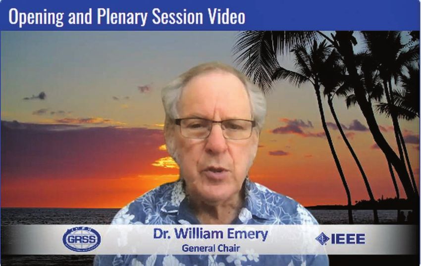
and his PALSAR-2 team at Mitsubishi Electric Corporation,
in strong collaboration with Dr. M. Shimada and JAXA proj-
ect members, successfully achieved a short-term develop-
ment of ALOS-2/PALSAR-2, launched in 2014. The satellite
still operates accurately, exceeding the lifetime of five years
and providing excellent data sets for various applications all
over the world, such as disaster monitoring, flooding, land-
slides, earthquakes, and so on. This L-band SAR contributed
significantly to microwave remote sensing of Earth.
    In addition to his leadership on state-of-the-art Japanese
SAR missions, Okada contributed to the development of
airborne SAR and the signal processing of data compression
of SAR raw data and phase unwrap algorithms for interfero-
metric SAR. He has contributed to the development of Ku-
                                                                   FIGURE 11. Riccardo Lanari, recipient of the GRSS Distinguished
band interferometric SAR for highly accurate digital surface
                                                                   Achievement Award.
model reconstruction, coherent change detection, 10-cm
high-resolution SAR, moving-target indication, bistatic
SAR, and superresolution. He has managed development of            and efficient algorithms for the digital processing of SAR
airborne SAR hardware and has developed an algorithm for           raw data acquired through different operating modes and
SAR data, such as phase unwrapping and superresolution.            of the Small BAseline Subset technique, which is a current
                                                                   reference InSAR method for surface deformation time-series
GRSS DISTINGUISHED ACHIEVEMENT AWARD                               generation from sequences of SAR acquisitions. This tech-
The GRSS Distinguished Achievement Award was estab-                nique has had a great impact on InSAR technical advances
lished to recognize an individual who has made significant         and on follow-up applications in several fields of the geosci-
technical contributions within the scope of the GRSS, usu-         ences (tectonics, volcanoes, and landslides).
ally over a sustained period. In selecting an individual, the          Lanari has wide international scientific experience, gained
factors considered are quality, significance, and impact of the    as a visiting scientist at different foreign research institutions,
contributions; the quantity of the contributions; the dura-        including the Institute of Space and Astronautical Science, Ja-
tion of significant activity; papers published in archival jour-   pan (1993); the German Aerospace Research Establishment,
nals; papers presented at conferences and symposia; patents        Germany (1991 and 1994); and the Jet Propulsion Laborato-
granted; and advancement of the profession. IEEE Member-           ry (JPL), California, USA (1997, 2004, and 2008). At the JPL,
ship is preferable but not required. The award is considered       he received from NASA a Recognition (1999) for the creative
annually and presented only if a suitable candidate is identi-     development of the technical innovation scan SAR interfero-
fied. The awardee receives a plaque and a certificate.             metric processing using the chirp-Z transform and a NASA
    The 2020 IEEE GRSS Distinguished Achievement Award             Group Achievement Award (2001) for the Shuttle Radar To-
was presented to Dr. Riccardo Lanari (Figure 11), with the         pography mission algorithm. Lanari is the recipient of two
citation “for outstanding contributions and leadership in          national scientific habilitations as a full professor of telecom-
the fields of SAR processing and SAR interferometry.” La-          munications (December 2013) and of geophysics (February
nari graduated summa cum laude in electronic engineering           2014), and he is a member (from 2017) of the Commissione
from the University of Napoli, Federico II, Italy, in 1989. In     Nazionale Grandi Rischi. He was elevated to IEEE Fellow in
the same year, he joined the Instituto Ricerca Elettromagne-       2013 for his contribution to the development of algorithms
tismo Componenti Elettronici (IRECE), later the Instituto          for the digital processing of SAR data; the Guido Dorso Prize
per il Rilevamento Elettromagnetico dell’Ambiente (IREA),          (2015) for the special section “Research,” held under the pa-
a research institute of the Italian National Council of Re-        tronage of the Senate of the Italian Republic; and the Chris-
search (CNR), Italy, of which he has been the director since       tiaan Huygens Medal (2017) of the European Geosciences
December 2010.                                                     Union for significant progress in the area of “geosciences in-
    Lanari has carried out 30 years of research activities in      strumentation and data systems.”
the remote sensing field, particularly on space-borne SAR
and SAR interferometry (InSAR) data processing methods             SYMPOSIUM INTRODUCTION AND
and their applications in the geosciences. On these topics,        TECHNICAL PROGRAM
he holds two patents and has authored 436 publications,            Reflecting the main theme of IGARSS 2020, “Remote Sens-
including one book and 125 peer-reviewed publications              ing: Global Perspectives for Local Solutions,” the IGARSS
for ISI journals, with 12,000 citations (H-index=52, Google        2020 technical program included the following special
Scholar source). In particular, he has coauthored the book         scientific themes:
Synthetic Aperture Radar Processing (1999, CRC Press) and           ◗◗ “Monitoring and Damage Assessment of Volcanoes and
has made key contributions to the development of precise               Other Natural Disasters”

MARCH 2021   IEEE GEOSCIENCE AND REMOTE SENSING MAGAZINE                                                                                 15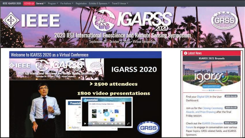
TABLE 1. THE TOTAL NUMBER OF PAPER SUBMISSIONS AND REGISTRATIONS FOR IGARSS 2020.
PRESENTATIONS AND ATTENDANCE
Total number of papers Total number of papers Total number of papers Total number Total number Total number Total number
submitted (15 January 2020) accepted (March 2020) withdrawn (July 2020) of papers of sessions of registrants of students
2,484 2,251 449 1,809 175 3,121 869
FIGURE 12. The members of the IGARSS 2020 organizing and sup-
porting team during the closing ceremony.
◗◗ “Monitoring and Preservation of Natural Reserves”
◗◗ “Coastal Environment, Its Change and the Impact of
Rising Sea Levels”
◗◗ “The Great Pacific Garbage Patch; New Space in Remote
Sensing”
◗◗ “Artificial Intelligence in Remote Sensors”
◗◗ “Remote Sensing Parameters and Models for Radiation
Energy Budget.” FIGURE 13. The digital gift presented during the closing ceremony
Table 1 lists some information regarding the number of is a photo of the participants of the virtual IGARSS 2020—a com-
paper submissions and registrants. In 2020, the most pa- munity of communities. The photo represents the Big Island of
pers were submitted from China (in Region 10), followed Hawaii, the high-resolution version of which can be downloaded at
by the U.S. and Canada (Regions 1–7) and Europe, the the symposium’s website: www.igarss2020.org.
Middle East, and Africa (Region 8).
The technical program was organized in 20 parallel ses- ◗◗ IGARSS 2024: Athens, Greece, 7–12 July.
sions. Technology, Industry, and Education events were re- You are cordially invited to participate in future IGARSS
focused and took place as part of the ad hoc webinar series. symposia. The main theme of IGARSS 2021 is “Crossing
As the conference was a virtual symposium, each session Borders,” and we look forward to meeting all of you in Brus-
required a session manager. Three-hundred young profes- sels, either in person or virtually!
sionals and Ph.D. students volunteered, 80 of whom had The IEEE GRSS AdCom conducts three meetings per
been preselected. The hard work of the IGARSS organizers year around the world; this year, all of the meetings were or-
(see Figure 12) and volunteers involved in the conference ganized in a virtual format. The AdCom’s task is to promote
organization made the symposium a great success! the position of remote sensing in IEEE and in the overall
scientific community; to perform the organizational tasks
FUTURE IGARSS SYMPOSIA needed to run the Society, its publications, conferences,
The GRSS AdCom met in July 2020 before IGARSS 2020. At and many other programs; and to develop the vision of re-
this meeting, all of the Society’s operational and technical mote sensing. It is a tradition to show a photo of AdCom
issues are discussed and main decisions are taken. The site members every year to recognize the dedicated volunteer
for IGARSS 2024 was selected, and the road map for future work of more than 50 GRSS members. This year, a photo
IGARSS conferences was confirmed: could not be taken. Instead, we show a photo of the Digi-
◗◗ IGARSS 2021: Brussels, Belgium, 11–16 July tal Gift presented to all IGARSS 2020 participants at the
◗◗ IGARSS 2022: Kuala Lumpur, Malaysia, 17–22 July closing ceremony (see Figure 13). Indeed, a community
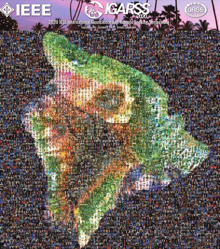
◗◗ IGARSS 2023: Pasadena, California, USA, 16–21 July of communities!GRS
16 IEEE GEOSCIENCE AND REMOTE SENSING MAGAZINE MARCH 2021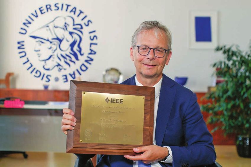
You can also read