MIRES ON THE MOORS Science and Evidence Report 2020 - University of Exeter

 
CONTINUE READING
MIRES ON THE MOORS Science and Evidence Report 2020 - University of Exeter
MIRES ON THE MOORS
Science and Evidence Report 2020
MIRES ON THE MOORS Science and Evidence Report 2020 - University of Exeter
University of Exeter             Acknowledgements
                                                                                                             Mires On The Moors Project
    Prof Karen Anderson              This project received its core funding from
    Josie Ashe                       South West Water, without which none of                                           Science and Evidence Report 2020
    Dr Pia Benaud                    the science described here would have been
    Prof Richard E Brazier           delivered. We are also incredibly grateful for
    Dr Donna Carless                 the funding and support we have received
    Dr Guy Freeman                   from our external project partners including
    Prof Angela Gallego-Sala         the Environment Agency, Natural England,                        South West Water’s Upstream Thinking Programme, working with a multitude of
    Dr Naomi Gatis                   Historic England, Dartmoor National Park and                  stakeholders, has restored a total of 24.8 km2 (2480 ha) of peatland across Exmoor
    Dr Emilie Grand-Clement          Exmoor National Park.                                             and Dartmoor since 2010 as it became apparent that much of the peatlands
    Anne Hand                        Additionally, we would like to thank numerous                   we rely on for vital ecosystem services were in a degraded and worsening state.
    Prof Iain P Hartley              farmers, Commoners and landowners on                          Research has been central to the restoration programme; to better understand the
    Dr David J Luscombe              Dartmoor and Exmoor for granting access for                    current state of these peatlands, design appropriate restoration plans and evaluate
    Dr Edward Malone                 restoration and monitoring work.                                     the success of restoration, our findings are outlined within this report.
    South West Water                 Thanks are also due to the previous members
    Morag Angus                      of the University of Exeter research team,
                                                                                                        This document should be cited as Brazier, R.E., Angus, M., Benaud, P., Gatis, N., Luscombe,
    Conrad Barrowclough              the South West Peatland Partnership, and the
                                                                                                         D.J., Anderson, K., Ashe, J., Barrowclough, C., Carless, D., Freeman, G., Gillard, M., Grand-
    Dr David Smith                   numerous volunteers that have been involved                        Clement, E., Hand, A., Malone, E., McAleer, A. and Smith, D. (2020) Mires on the Moors:
                                     with the delivery of the project.                                             Science and Evidence Report 2020, University of Exeter, Exeter, UK.
    Exmoor National Park Authority
    Dr Martin Gillard
    University of Bristol
    Prof Edward Hornibrook
    Dr Adam McAleer

2                                                                   Mires On The Moors   Science and Evidence Report                                                                                     3
MIRES ON THE MOORS Science and Evidence Report 2020 - University of Exeter
Foreword and Introduction to this Report

    T
           he degraded state of UK peatlands has been recognised as a critical problem that should be tackled with
           some urgency if the UK is to meet its targets of carbon storage and Greenhouse Gas Removal. The South
           West peatlands of Dartmoor, Exmoor and Bodmin Moor are potentially huge carbon stores, with equal
    potential to store water at times of heavy rainfall and release cleaner water during times of drought. However, over
    a decade ago, pilot work funded by South West Water identified that these peatlands were heavily modified – due
    to drainage for agricultural purposes, removal of peat for fuel, historical overgrazing and practices such as burning    EXECUTIVE
                                                                                                                             SUMMARY
    or moorland swaling to regenerate vegetation for grazing. Consequently, research began in 2010 to understand
    the way in which the South West peatlands are structured, how they function and furthermore how they
    might respond to restoration practices which could restore some of the ‘natural’ functioning of these degraded
    ecosystems. In addition, given their southerly location, it was hypothesised that these peatlands may be the first in
    the UK to respond to changes in climate and thus could be ‘canaries in the coalmine’ to educate us about how the                                      § Up to January 2020, 27.8 km2 (2780 ha) of peatland have been restored following
    more extensive, northerly peatlands might respond in decades to come.                                                                                   methods specifically developed for Exmoor and Dartmoor. Page 12.

    The following report describes the outcomes of the last 5 years of research into peatland restoration. The report                                     § In shallow peats, water table responses to restoration are complex. In the driest areas,
                                                                                                                                                            where drainage had the greatest effect pre-restoration, water tables rose by as much as
    is supplemented by a number of peer-reviewed scientific papers which are appendicised and will be updated as                                            4 cm. Overall, however, water tables remain statistically similar post-restoration. Page 16.
    more of the research is published in years to come. These reports and papers can be found here:
                                                                                                                                                          § In deeper peats, restoration increased the permanent deep water storage in the soil by
    www.exeter.ac.uk/creww/research/casestudies/miresproject                                                                                                7.3 cm and increased average water tables by 2.45 cm. Page 20.
    Ongoing work over the next 5                                                                                                                          § Restoration can significantly alter rainfall runoff regimes in restored catchments; within
    years will continue to monitor the                                                                                                                      deeper peat, gully flow was reduced by around 66 %. In shallow peatlands the flow
    structure and function of South                                                                                                                         response was more complex with storm generated discharge reduced by up to 32 %
    West peatlands, building on the                                                                                                                         in some catchments. Pages 16 and 20.
    short-term, post-restoration story                                                                                                                    § In shallow peats, restoration has not significantly changed water quality, suggesting that
    told here, to develop understanding                                                                                                                     there has not been a significant change in the ecohydrological function of the peatland
                                                                                                                                                            to-date. Page 24.
    of how peatlands can provide a
    wide range of ecosystem services                                                                                                                      § Post-restoration, the total load of dissolved organic carbon leaving the study site on
    to society, if they are managed in                                                                                                                      Dartmoor during storm events was approximately 1/3 of the pre-restoration loads due
                                                                                                                                                            to a significant decrease in runoff. Page 28.
    an environmentally progressive
    manner, which considers all users                                                                                                                     § Population densities of the sheep tick, a vector of economically important livestock
                                                                                                                                                            diseases, are significantly lower in mires than in drier habitats on the same sites.
    and beneficiaries of these common                                                                                                                       Page 32.
    resources.
                                                                                                                                                          § Bog asphodel (Narthecium ossifragum), a potentially toxic plant, contributes up to 20 %
                                                                                                                                                            forage value in a transitional bog community and continues to survive but has not
    Richard Brazier                                                                                                                                         spread significantly post-restoration. Page 34.
    Professor of Earth Surface                                                                                                                            § In shallow peats, restoration did not significantly alter (heterotrophic) respiration of
    Processes and Director of                                                                                                                               the peat soil or increase methane fluxes (even after 7 years), illustrating how degraded
    the Centre for Resilience in                                                                                                                            these peatlands were and how much intervention is required to restore ecosystem
    Environment,Water and Waste.                                                                                                                            functionality. Page 35 and 36.
                                                                                                                                                          § In deeper peats, raised water tables significantly reduced (heterotrophic) respiration of
                                                                                                                                                            the peat store and initially increased methane emissions; both processes are indicative
                                                                                                                                                            of a return to more natural functioning in the longer term. Page 40.
                                                                                                                                                          § Dartmoor National Park is estimated to have 158 ±101 km2 (15800 ha) of peat
                                                                                                                                                            >0.4 m deep storing 13.1 megatonnes of carbon. Page 42.
                                                                                                                                                          § Functionally intact blanket bog covers just 3.6 km2 (360 ha) of Dartmoor, however it is
                                                                                                                                                            fragmented and often surrounded by ecohydrologically degraded peat which covers an
                                                                                                                                                            area of 29 km2 (2900 ha). Page 42.

4                                                                                                      Mires On The Moors   Science and Evidence Report                                                                                                    5
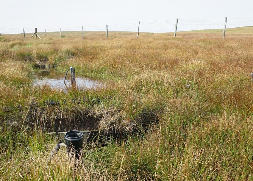
MIRES ON THE MOORS Science and Evidence Report 2020 - University of Exeter
BACKGROUND
                                                                         AND CONTEXT
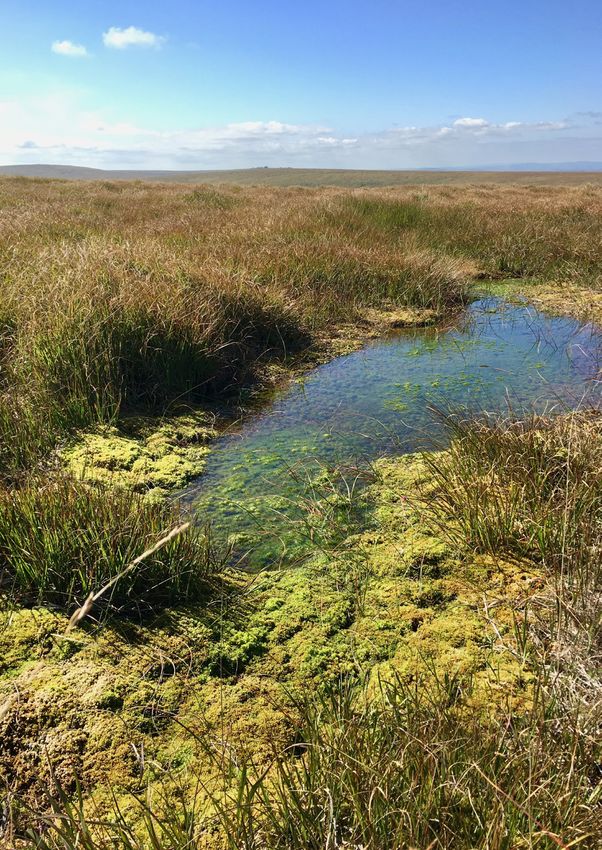
                            Typical peatland                                                                        Adder (Vipera berus)
                            vegetation in the                                                                    sunning itself on Exmoor.
                              South West of
                          England underlain
                               by a carpet of
                          Sphagnum mosses.
                                                                                                                                                                                                                   Rivers sourced on peatlands provide 70 % of all UK drinking water.

                                                                                                                                                globally, they include drainage, peat    Exmoor in 2006 as it became                    for the Environment, Food and
                                                                                                                                                extraction, over-grazing, burning,       apparent that many of the peatlands            Rural Affairs recognises the need to
                                                                                                                                                disturbance from military use, climate   we rely on for vital ecosystem                 restore and protect our peatlands4,
                                                                                                                                                change and nutrient deposition.          services were in a degraded and                funding the South West Peatland
                                                                                                                                                These pressures have altered the         worsening state. South West Water’s            Partnership project to restore

P
                                                                                                                                                natural feedback cycles which            Upstream Thinking Programme,                   16.8 km2 (1680 ha) of peatland
         eatlands are now recognised            of carbon which,                                                                                maintain these ecosystems, leaving       working with a multitude of                    across Bodmin Moor, Exmoor and
         nationally and internationally as      if not safeguarded,                                                                             them increasingly vulnerable to          stakeholders, has restored a total             Dartmoor by 2020.
         providing many essential and           could be released                                                                               erosion and ecological/hydrological      of 24.8 km2 (2480 ha) of peatland
    valuable ecosystem services; they           into the atmosphere                                                                                                                                                                     Research has been central to the
                                                                                                                                                degradation.                             across Exmoor and Dartmoor
    play an important role in water             worsening the                                                                                                                                                                           restoration programme; to better
                                                                                                                                                                                         since 2010. As part of their 25-year
    management, act as carbon stores,           climate emergency                                                                               Peatland restoration started on                                                         understand the current state of
                                                                                                                                                                                         environment plan the Department
    preserve archaeology, and are rare          or washed into                                                                                                                                                                          these peatlands, design appropriate
    and important habitats with unique          rivers which rise                                                                                                                                                                       restoration plans and evaluate the
    flora and fauna1. In 2011, the IUCN         upon the moors                                                                                                                                                                          success of restoration. The following
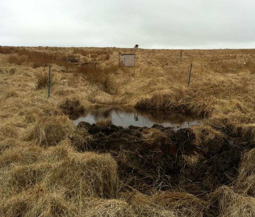
    identified these landscapes as the          reducing water                                                                                                                                                     Restoration at       document outlines our findings since
    single most important terrestrial           quality downstream.                                                                                                                                                Hangingstone
                                                                                                                                                                                                                                        2010 working within Dartmoor and
                                                                                                                                                                                                              Hill, Dartmoor has
    carbon store in the UK and that             The water leaving                                                                                                                                             left pools of water       Exmoor National Parks.
    around 70 % of all UK drinking              the uplands not                                                                                                                                                where there were
    water comes from upland, peatland           only supports                                                                                                                                                    erosional pans.
    catchments2.                                aquatic ecosystems
                                                downstream but is
    Peatlands form where waterlogged            the main drinking
    conditions limit decomposition to           water source for
    such an extent that dead vegetation         many people living
    accumulates as peat soil. The uplands       in the South West.
    of the South West have a specific           Furthermore,                          Ecosystem services provided by a functioning peatland.
    type of peatland called blanket bog         functioning peatlands                                                                                                                                                                    REFERENCES
    which develop in cool and wet               regulate water
    conditions, forming predominately           supply, slowing the                                                                                                                                                                        The appendices are available to view
                                                                                                                                                                                                                                           at www.exeter.ac.uk/creww/research/
    from Sphagnum mosses. Although              flow of water from                                                                                                                                                                         casestudies/miresproject
    blanket bog is extensive across             the uplands during
    the moors of the South West, it is          rainfall and gradually                                                                                                                                                                   1. Grand-Clement, E. et al. Evaluating
                                                                                                                                                                                                                                            ecosystem goods and services
    globally rare, consequently these           releasing water                                                                                                                                                   Pools of water            after restoration of marginal upland
    areas are internationally important         during dry spells.                                                                                                                                             form behind peat             peatlands in South-West England. J. Appl.
    ecosystems, with many designated                                                                                                                                                                          dams, Lanacombe,              Ecol. 50, (2013).
                                                The peatlands of
    as Sites of Special Scientific                                                                                                                                                                                Exmoor 2014.
                                                the South West of                                                                                                                                                                        2. Bain, C. G., Bonn, A. & Chapman, R.
    Interest and/or Special Areas of
                                                England lie at the                                 Erosion at Hangingstone Hill, Dartmoor.                                                                                                  IUCN UK Commission of inquiry on
    Conservation.                                                                                                                                                                                                                           Peatlands. IUCN UK Peatland Programme
                                                most southerly and                                                                                                                                                                          (2011). doi:ISBN 978-0-9570572-1-0
    Peat accumulates slowly, mm’s-cm’s          westerly limit of the
    per year over thousands of years.           bio-climatic envelope                         indicators of what may happen to                                                                                                           3. Gallego-Sala, A. V. et al. Bioclimatic
                                                                                                                                                                                                                                            envelope model of climate change
    These gradually accumulated deposits        of peat-forming ecosystems3 (i.e.             other more northerly peatlands, in                                                                                                            impacts on blanket peatland
    hold a precious record of past climate,     areas with suitable temperature               the UK and elsewhere, as the climate                                                                                                          distribution in Great Britain. Clim. Res.
    land use and ecology as well as             and precipitation conditions).                warms and rainfall patterns change.                                                                                                           45, 151–162 (2010).
    preserving rare organic archaeological      Consequently, these bogs are                  Natural and anthropogenic pressures                                                                                                        4. Department for Environment Food
    remains such as the Whitehorse Hill         vulnerable ecosystems that must be            on the peatlands of the South                                                                                                                 and Rural Affairs. A Green Future:
    cist.They also store huge amounts           protected. They are also invaluable           West are typical of those occurring
                                                                                                                                                                                                                                            Our 25 Year Plan to Improve the
                                                                                                                                                                                                                                            Environment. (2018).

6                                                                                                                   Mires On The Moors         Science and Evidence Report                                                                                                              7
MIRES ON THE MOORS Science and Evidence Report 2020 - University of Exeter
EXMOOR                                      SHALLOW PEAT LOCATION INFORMATION
    Exmoor: a Shallow Peatland

S
         ince the last ice-age, humans
         have been using and altering
         the moorlands of Exmoor. Peat
    cutting by hand has been practised
    on Exmoor since medieval times, and
    features indicate that large amounts
    of peat have been removed for
    domestic use1. From the 1820s the
    Knight family constructed a dense
    network (approximately every 20 m)
    of hand dug ditches (about 0.5 m
    wide by 0.5 m deep) (Figure 1) to
    reclaim the high moors for arable
    production2 resulting in 618 km
    of drainage ditches3 (Figure 2).
    Additional larger ditches (>1.5 m                                           Figure 2 Exmoor National Park showing the fragmented
    wide) were machine dug between                                              moorland areas (yellow) and mapped drainage features (blue).
    the 1960s and 1980s to drain
    specific areas such as springs4. The
    moorlands have also been subject
    to burning, in a further attempt                                                          Peat cutting on Brendon Common in the 1990s.
    to improve pasture for grazing.                                                                      Image courtesy of Rob Wilson-North.
    Collectively, these management
    practices led to a drying out of the
    peatlands and an increase in the                                                                                                                       Figure 3 Summer in the
    dominance of purple moor grass                                                                                                                         Aclands catchment with a                                    REFERENCES
                                                                                                                                                                                          Figure 5 Post-restoration,
    (Molinia caerulea).                                                                                                                                    greenhouse gas monitoring
                                                                                                                                                                                          peat dams create pools of      The appendices are available to view
                                                                                                                                                           (GHG) location in the                                         at www.exeter.ac.uk/creww/research/
                                                                                                                                                                                                 water at Spooners.
                                                                                                                                                           foreground and water level                                    casestudies/miresproject
                                                                                                                                                           and water quality monitoring
                                                                                                                                                           across small (left), large                                  1. Riley, H. Turf cutting on Exmoor: an
                                                                                                                                                           (middle) and medium (right)                                    archaeological and historical study. Exmoor
                                                                                                                                                           ditches in the background.                                     Mires Project. (2014).
                                                                                                                                                                                                                       2. Hegarty, C. & Toms, K. Exmoor National
                                                                                                                                                                                                                          Park national mapping programme
                                                                                                                                                                                                                          managment and summary report.
                                                                                                                                                                                                                          (Exmoor National Park Authority, 2009).
                                                                                                                                                                                                                       3. Anderson, K. & Cowley, A. Initial project
                                                The cool (minimum of 2 °C in                   of mire and wet heath communities,                                                                                         report : Exmoor Mires-on- the-Moors
                                                February, rising to 18 °C in July5) and        such as Sphagnum spp. and cotton                Figure 4 Unmanned Aerial                                                   Project for LiDAR Analysis. (2011).
                                                                                                                                               Vehicle borne imagery of
                                                wet (1353 mm per year) conditions              grasses (Eriophorum spp.) but are               the dry purple moor grass
                                                                                                                                                                                                                       4. Mills, J. et al. Review of the Exmoor Mires
                                                on the uplands of Exmoor enable                dominated by purple moor grass                                                                                             Restoration Project. (Countryside and
                                                                                                                                               (Molinia caerulea) dominated
                                                peat to form. However, peat across             (Molinia caerulea). The catchments                                                                                         Community Research Institute, 2010).
                                                                                                                                               Spooners catchment, post-
                                                Exmoor is relatively thin, with 53 km2         are currently in use as rough grazing.          restoration.                                                            5. Met Office (2019): Met Office
                                                (5300 ha) of the 65 km2 (6500 ha) of                                                                                                                                      MIDAS Open: UK Land Surface
                                                                                               Aclands and Spooners were                                                                                                  Stations Data (1853-current).
                                                blanket bog less than 30 cm thick6,7.
                                                                                               restored, by ditch blocking with peat                                                                                      Centre for Environmental Data
                                                Monitoring the effects of restoration          and wooden dams, in spring 2013                                                                                            Analysis, 10/12/2019. Available
                                                has focused on two small headwater             and 2014 respectively (Figure 5).                                                                                          at: http://catalogue.ceda.ac.uk/
                                                                                                                                                                                                                          uuid/dbd451271eb04662
                                                catchments of the River Barle,
                                                                                               Additional monitoring occurred at                                                                                          beade68da43546e1. (Accessed: 10th
                                                within North Exmoor Site of Special                                                                                                                                       December 2019)
                                                                                               Long Holcombe along a gradient
                     Figure 1 Photograph        Scientific Interest. They are located
                                                                                               between wet bog vegetation                                                                                              6. Merryfield, D. L. Palynological and
                     from an Unmanned
                                                between 380 and 465 m above sea                                                                                                                                           Stratigraphical studies on Exmoor. Kings
                     Aerial Vehicle showing                                                    (Sphagnum spp. and cotton grasses
                                                level. These catchments, Aclands                                                                                                                                          College Unpublished, (Kings College,
                     the closely spaced hand-                                                  (Eriophorum spp.)) with peat depths
                                                (Figure 3) and Spooners (Figure 4),                                                                                                                                       1977).
                     dug drainage features
                                                                                               in excess of 0.5 m, to dry purple
                     typical of Exmoor and      were chosen to be representative                                                                                                                                       7. Bowes, A. C. Exmoor Blanket bog
                                                                                               moor grass (Molinia caerulea)
                     water quality and water    of the general peatland conditions                                                                                                                                        Inventory and restoration plan for
                                                                                               dominated grassland with peat
                     table depth monitoring
                                                found across Exmoor. Both                                                                                                                                                 English Nature. University of Calgary MSc,
                     locations at Aclands.                                                     depths of less than 0.2 m.                                                                                                 (University of Calgary, 2006).
                                                catchments contain vegetation typical

8                                                                                                                    Mires On The Moors        Science and Evidence Report                                                                                              9
MIRES ON THE MOORS Science and Evidence Report 2020 - University of Exeter
DARTMOOR                 DEEP PEAT LOCATION INFORMATION
                 Figure 6 Extent
                     of peatland                             Dartmoor: a Deep Peatland

                                                             T
                    degradation
                          across                                     he uplands of Dartmoor have                 A pilot study into the effectiveness              thick3, which is above the average
                      Dartmoor.
                                                                     also been shaped by human                   of restoration was established in                 for Dartmoor (0.81 m)4. Where
                                                                     hand since the last ice-age. The            2013 in an area of degraded blanket               vegetated, Flat Tor Pan has vegetation
                                                             uses have been varied and included                  bog on the north moor: Flat Tor Pan.              typical of blanket mire (including
                                                             domestic and commercial peat                        The site was chosen as typical of                 Sphagnum spp. hare’s-tail cotton grass
                                                             cutting, tin and china clay extraction,             the extensive areas of blanket bog                (Eriophorum vaginatum), purple moor
                                                             granite quarrying, drainage for                     with a pattern of erosional peat pans             grass (Molinia caerulea) and deer
                                                             agricultural improvement, grazing                   (generally
MIRES ON THE MOORS Science and Evidence Report 2020 - University of Exeter
BODMIN MOOR, EXMOOR                                                                            RESTORATION
                                AND DARTMOOR                                                                                                                                             Reprofiling steep erosional
                                                                                                                                                                                             slopes at Flat Tor Pan,
                                                                                                                                                                                         Dartmoor, December 2019.

                                    Restoration planning,                     of the slope, the volume of water
                                                                              that flows down the ditch and the

                                    P
                                    methods and outcomes                      landscape impact2. Blocks installed
                                         eatland restoration represents an    in the ditches can comprise a
                                         opportunity to make a significant    combination of peat, wood, stone,
                                         difference to the degrading          bales (made out of purple moor                                                                                                               Restoration in progress within
                                    peatlands of the South West of            grass (Molinia caerulea)) or grey                                                                                                            the Spooners monitoring
                                    England.The South West Peatland           willow (Sambucus nigra). The wood                                                                                                            catchment, Spooners, Exmoor.
                                    Partnership is the umbrella name          for the blocks comes from local
                                    that brings together the local delivery   plantations, which is then planked to
                                    of peatland restoration across the        our requirements and left untreated.
                                    three moors of Bodmin Moor,                                                                                                                                                           Peat blocks along a drainage ditch showing water
                                    Dartmoor and Exmoor. Its aim is to        Before any restoration takes place,                                                                                                      stored behind the blocks, Great Buscombe, Exmoor.
                                    work together with a wide range of        the mires staff carry out a variety
                                    partners (see back cover) to restore      of in-depth planning, assessment,
                                    these peatlands and bring about           research and consultation in order
                                    sustainable hydrological management       to compile a Restoration Plan for
                                    in upland river catchments.The            each site representing a best practice            Willow faggot dam in a steep gully,
                                                                                                                                Hoar Moor, Exmoor, February 2019.
                                    Exmoor Mires Partnership is the           approach to peatland restoration.                 Willow was used in this situation to
                                    culmination of several projects that      Each plan assesses the positive and               slow flows, trap sediments and create
                                    have run from 1998-to date, whilst        negative impacts of the restoration               small areas of wet willow woodland. It
                                    the Dartmoor Mires Partnership has        on the ecology, historic environment,             was part of wider works to reinstate
                                    had two phases of restoration; a pilot    landscape, access arrangements,                   the River Quarme back into its original
                                                                                                                                course, having been diverted in the
                                    project (2010-2015) and the current       land management practices, and                    early twentieth century.
                                    phase (2018-2021).The Bodmin              estimates the costs associated of
                                    Moor Peatland Partnership has been        carrying out the restoration works.         damaged peatland has had initial                restoration and monitoring works,                  in the hydrology and ecological
                                    running since 2018.                       All appropriate government bodies,          ditch blocking works carried out – a            and indirectly through the effects                 functioning of the peatland.
                                                                              landowners, commoners, graziers,            total of 25,607 blocks installed in             of restoration e.g. payments for
                                                                                                                                                                                                                             Vegetation monitoring on Exmoor
                                    Restoration work                          tenants and farmers have input              250 km of drainage ditches. A further           ecosystem services provided by
                                                                                                                                                                                                                             (28 sites) shows an expansion in
                                    The overall aim of restoration is to      into the plans and therefore the            7.5 km2 (760 ha) is considered                  the peatland generating income to
                                                                                                                                                                                                                             the distribution of Sphagnum 3
                                    raise water tables, decrease peak         restoration that happens on the             unsuitable for restoration. On                  farmers via Higher Level Stewardship
                                                                                                                                                                                                                             years post-restoration. This increase
                                    flows from storms and increase base       ground.                                     Dartmoor 1.8 km2 (180 ha) of                    schemes for moorland maintenance,
                                                                                                                                                                                                                             is significant (p
MIRES ON THE MOORS Science and Evidence Report 2020 - University of Exeter
RESTORATION

                                                                                             Vegetation monitoring
                                                                                             along a transect,
                                                                                             Squallacombe, Exmoor.            A Mesolithic (7000 to    Pre-restoration 2006.                                Post-restoration 2006.                               Post-restoration 2019.
                                                                                                                              4000 BCE) hammer
                                                                                                                              stone found at Horsen
                                                                                                                              Farm, Exmoor during
                                                                                                                              mire restoration
                                                                                                                              field work.

                                                                                                                                                      Figure 10 Fixed point photography from Roostichen, Exmoor; pre-restoration (2006), immediately post-restoration (2006) and 13 years post-restoration (2019).
     Type                                                            Exmoor        Dartmoor
     Site surveys (combined walkover and desk-based assessment)          18              7                                                             peat. One such study identified                      at up to centimetre accuracy. These                  Volunteers are actively involved in
     Palaeoenvironmental Assessments                                     8               3                                                             tephra – volcanic dust deposits that                 surveys clarify features such as                     a wide range of activities within the
     Watching Briefs                                                     2               5                                                             can precisely date peat deposits                     individual peat cuttings (Figure 11)                 project including running, leading
                                                                                                                                                       and the evidence of environmental                    which are often hard to distinguish                  and organising educational walks,
     Landscape Studies                                                   2
                                                                                                                                                       change held within them – for the                    by human eye on the ground.                          talks and events; practical work
     Geophysical Surveys                                                 7                                                                             first time in the South West9.                                                                            such as small-scale ditch blocking;
     Measured, earthwork Surveys                                         9                                                                                                                                  Communication and                                    survey and research; publicity work
     Excavations                                                         7                                                                             Landscape                                            Education                                            and office work. Over 1000 days of
                                                                         5               2                                                             Peatland restoration aims to bring                                                                        volunteering have been carried out
     Research Reports                                                                                                                                                                                       Communicating all the work and
                                                                                                                                                       about landscape change. In order to                                                                       on the project.
     Additional HER entry reports                                        10              6                                                                                                                  research undertaken is a vital
                                                                                                                                                       demonstrate and monitor landscape                    element of the partnership, as is
 Number and type of historic environment assessments carried out as part of peatland restoration
                                                                                                                                                       change associated with restoration                   learning from those who manage
 been observed at two restoration                   and mitigate                                                                                       fixed point photography is used                      and work on the peatlands. Involving
 sites which previously had none5,6.                the impact                                                                                         (Figure 10). There are now over 60                   local individuals, community groups,                  REFERENCES
 In the context of there being only                 of mire
                                                                         Figure 11 Peat cuttings on                                                    pre- and post-restoration locations                  the farmers who manage the
                                                                         Exmoor recorded using
 eight breeding snipe locations on                  restoration on       processed airborne LiDAR.
                                                                                                                                                       across Exmoor and Dartmoor.                          land and partner organisations                           The appendices are available to view
                                                                                                                                                                                                                                                                     at www.exeter.ac.uk/creww/research/
 Exmoor in 2011, this is a notable                  the historic                                                                                       Comparing aerial imagery dating                      has enabled successful landscape                         casestudies/miresproject
 result. Whilst on Dartmoor, snipe                  environment                                                                                        from the 1940s to present day                        peatland conservation to happen
                                                                                                                                                                                                                                                                  1. Thom, T. et al. Conserving Bogs the
 (Gallinago gallinago) have increased               we combine                                                                                         images enables us to map and                         on the ground. A programme of                            Managment Handbook. (Stationery
 considerably and dunlin (Calidris                  information                                                                                        analyse how that landscape was, is,                  education, events and publications                       Office, UK, for Scottish Natural Heritage,
 alpine) increased, particularly in the             from walkover                                                                                      and has changed through time. At                     have been delivered in order that                        1997).
 areas that have been restored e.g.                 surveys and                                                                                        the same time, this captures modern                  the numerous people who work in                       2. Grand-Clement, E. et al. New
 Winney’s Down and Cowsic Head7.                    desk-based                                                                                         day archaeology in the form of our                   and visit these landscapes can gain a                    approaches to the restoration of
                                                    assessments                                                                                        restoration work. Airborne LiDAR                     greater understanding and experience                     shallow marginal peatlands. J. Environ.
 The Exehead/ Blackpitts (Exmoor)                                                                                                                                                                                                                                    Mange. 161, 417-430 (2015).
 restored sites have become the best                of existing                                                                                        (Light Detection and Ranging) and                    of peatlands. For example, the
 sites in Somerset for black darter                 knowledge                                                                                          Unmanned Aerial Vehicle (UAV)                        ‘Bogtastic’ CLOWNS Play Bus and                       3. Hand, A. Analysis of Botanical Survey Data
                                                    into site plans.                                                                                   photogrammetric surveys record                       the ‘Bogtastic’ Summer Festival, has                     2018 Exmoor Mires Partnership. (2019).
 (Sympetrum danae) and common
 hawker (Aeshna juncea) dragonflies,                Where thought                                                                                      our landscapes in another dimension                  engaged with over 4000 people.                        4. Lunt, P. Dartmoor Mires Project Vegetation
                                                    necessary,                                                                                                                                                                                                       Survey Data Analysis 2018. (2018).
 both upland species which require                                                                       trackways and Second World War
 open water. This success is due to                 additional work is carried out to                                                                                                                                                                             5. Boyce, D. C. A survey of waders and other
                                                                                                         military training features. This data
 the pools created by the restoration               ensure the historic environment                                                                                                                          Enjoying the ‘Bogstacle Course’ at Bogtastic.           birds on mires in Exmoor National Park,
                                                                                                         has allowed the existing Historic                                                                                                                           2011-12. RSPB South-west Region Report
 in 2007 – prior to this there was no               is both well-recorded and
                                                                                                         Environment Records (HER) to be                                                                                                                             to South West Water. (2012).
 surface water on the site8.                        understood. Such work includes
                                                                                                         expanded and enhanced.                                                                                                                                   6. Ballance, D. K. Exmoor bird monitoring
                                                    palaeoenvironmental studies,
 Historic Environment                                                                                                                                                                                                                                                project. (2016).
                                                    geophysical and earthwork surveys,                   In some cases, we have carried
 Exmoor and Dartmoor contain                        excavations and watching briefs.                     out additional case studies that go                                                                                                                      7. Townend C., R., E. & Booker H. Dartmoor
 a wide range of historic sites                     Many previously unrecorded                           beyond individual sites and represent                                                                                                                       Mires Project breeding bird survey 2018:
                                                                                                                                                                                                                                                                     Distribution and Population Breeding of
 and features that often survive                    archaeological features and sites have               new research into aspects of the                                                                                                                            Dunlin and other bird species on Dartmoor
 well thanks to the less intensive                  consequently been identified as a                    historic environment that may be                                                                                                                            Blanket Bog. (2018).
 agriculture and development                        consequence of peatland restoration                  impacted by mire restoration. This                                                                                                                       8. Boyce, D.C. Inveterate Survey and
 compared to lowland areas. The peat                (over 300 on Exmoor), ranging in                     includes investigations into domestic                                                                                                                       Monitoring on Exmoor Mire Project
 itself often covers archaeological                 date from around 6000BC to the                       and industrial peat cutting on both                                                                                                                         Restoration Sites, 2009-2014. (2015).
 sites and deposits, preserving                     20th century. The new evidence has                   moors, the form and dating of                                                                                                                            9. Bray, L. S. The Past and The Peat:
 organic materials and environmental                included prehistoric standing stones                 deserted field systems on Codsend                                                                                                                           Archaeology and peatland restoration
 evidence that does not survive in                  and cairns, nineteenth-century                       Moor (Exmoor) and the soils of                                                                                                                              on Exmoor. (Exmoor National Park
 drier conditions. To further inform                mining works, networks of medieval                   Exmoor before the formation of                                                                                                                              Authority, 2015).

14                                                                                                                          Mires On The Moors        Science and Evidence Report                                                                                                                                 15
MIRES ON THE MOORS Science and Evidence Report 2020 - University of Exeter
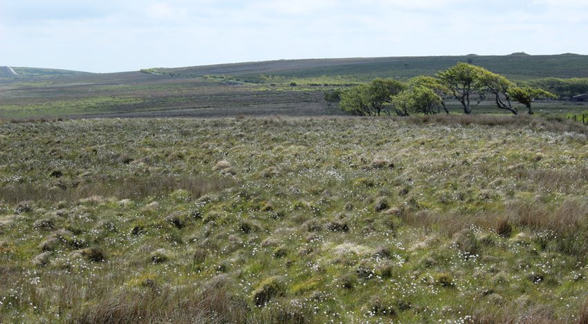
EXMOOR                                                       SHALLOW PEAT HYDROLOGY
 How does the restoration of a shallow peatland affect water
 tables, runoff and water storage?

                                                                                                            I
                                                                                                              n an intact state, peatland landscapes                                                                                                                         Figure 12 Illustration
  § Restoration can significantly alter rainfall runoff regimes in restored                                   form as wetlands with water at or                                                                                                                              of a dipwell array
                                                                                                                                                                                                                               Radio connection for
    catchments.                                                                                               near the ground surface for most                                                                                 remote data retrieval
                                                                                                                                                                                                                                                                             surrounding a restored
                                                                                                                                                                                   Dip well measuring                                                                        drainage ditch in
  § Peak runoff from comparable rainfall events can be reduced by as much                                   of the year. These areas are home to                                   water table depth                                                                         Spooners catchment.
    as 21 %.                                                                                                specialist plant species adapted to                                    below surface

                                                                                                            grow in waterlogged ecosystems. The                                                                         Ditch in cross-section
  § Total runoff generated from comparable rainfall events can be reduced                                   storage and release of water from
    by as much as 32 %, as water leaves the restored catchment more slowly,                                 such landscapes is inherently linked to
    increasing catchment baseflow between rainfall events.                                                  the way the ecosystem functions as a
  § Rainfall runoff response is catchment specific, smaller rainfall events can                             store of carbon and regulator of river
    result in a limited increase in storm runoff.                                                           flow. Peatland restoration aims to
                                                                                                            re-establish more natural hydrological
  § In the short term (
MIRES ON THE MOORS Science and Evidence Report 2020 - University of Exeter
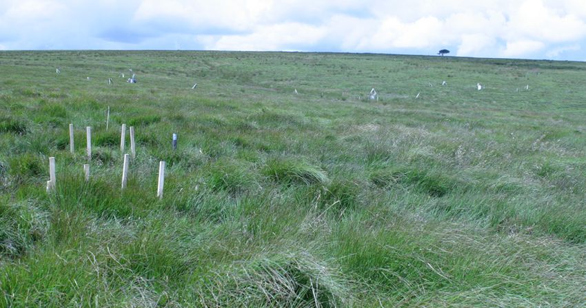
EXMOOR: SHALLOW PEAT HYDROLOGY

                           2000                   1,901                                                                                                                                                                                            Monitoring equipment in pools formed
                                                                                                                                                                                                                                                     behind blocks following restoration.
                           1800
                           1600
                                          1,367           1,383
     Anual Rainfall (mm)

                           1400                                             1,289
                           1200   1,050                           1,098                1,108
                                                                                                  958     958
                           1000
                            800
                            600
                            400
                            200
                              0                                                                                         Figure 15 Annual rainfall totals for
                                                                                                                        Spooners catchment from 2010
                                  2010    2011    2012    2013     2014      2015      2016       2017    2018          to 2018; restoration occurred in
                                                                                                                        2013. The atypical pre-restoration
                                                                   Year                                                 rainfall of 2012 is notable at nearly
                                                                                                                        double that of 2017.

                                                                                                           restoration has provided significant
                                                                   Restoration in progress at Spooners.    short-term buffering of rainfall
                                                                                                           runoff at Spooners, particularly for
                                                                                                           small rainfall events that do not
                                                                                                           overwhelm the temporary surface
                                                                                                           storage created behind peat dams.
                                                                                                           Aclands Catchment Runoff
                                                                                                           The restoration response within
                                                                                                           the smaller catchment (Aclands)
                                                                                                           was less pronounced. For larger
                                                                                                           rainfall events (>10 mm), total event
                                                                                                           quickflow and peak event discharge
                                                                                                           were not significantly different                                                100,000
                                                                                                           (p>0.05). Contrastingly, for smaller                                                              Pre-                                                       32% Reduction
                                                                                                           rainfall events (100 % at p
DARTMOOR                                                   DEEP PEAT HYDROLOGY
 How does the restoration of a deep peatland affect storm runoff
 and water storage?

                                                                                          P
                                                                                                 eatlands form as wetland
 § Average (spatially and temporally) water table depths have increased                          landscapes with water at or near            Pre-Restoration                                                                                           Post-Restoration
                                                                                                                                                                                                     Distance from peat pan (m)                                                                                 Distance from peat pan (m)
   post-restoration, they are now 2.45 cm nearer to the surface.                                 the ground surface and plant
                                                                                                                                                                             0                       1                 2                      3                                       0                     1                  2                   3
 § Pre-restoration, maximum water table drawdown (i.e. depth during dry                    species adapted to grow in such                                             30                                                                                                       30
   weather) was between 22 and 48 cm below the surface. Post-restoration                   an environment. The way peatland                                                      Edge of
   this reduced to between 17 and 37 cm, indicating an average additional                  landscapes store and release water                                                    peat pan

                                                                                                                                                                                                                                                       Vertical position (cm)
                                                                                                                                              Vertical position (cm)
                                                                                                                                                                       20                                                                                                       20
   7.3 cm of permanent deep water storage in the peat soil.                                is inherently linked to the way they
                                                                                           function as stores of carbon and                                                                                                                                                                                       Maximum water level
 § Restoration removed permanently dry areas next to peat pans, which                      regulators of river flows. Peatland                                         10                                                                                                       10
                                                                                                                                                                                                                                                                                                                     above surface
   now exhibit water levels >10 cm above the surface during periods of                     restoration aims to re-establish more
                                                                                                                                                                                                         Permanently dry
                                                                                                                                                                                                            edge zone
   high rainfall.                                                                          natural hydrological processes in                                            0                                                                                                        0
 § Diffuse overland flow and deep subsurface flow outside of the main gully,               drained or damaged areas, leading
   dominate total runoff post-restoration. Runoff through the monitored                    to more secure carbon storage (or                                           -10                                                                                                      -10                                       2.45 cm increase in
   gully reduced by approximately 66 % post-restoration.                                   accumulation) and reduced variation                                                                                                                                                                                            average water table
                                                                                           in downstream river flows. The                                                                                                                                                       -20
 § The average in-gully pooled water storage increased by 32 cm post-                      monitoring design at Flat Tor Pan
                                                                                                                                                                       -20
                                                                                                                                                                                                                                                                                                                            7.3 cm of extra,
   restoration. Minimum pooled water within the gully also increased by                    measured spatial patterns of water                                                                                                                                                                                            permanent deep storage
   around 4 cm post-restoration.                                                           table depth and runoff from a single                                        -30                                                                                                      -30
                                                                                                                                                                                   Surface Profile                         Mean Water Table Depth                                         Surface Profile                      Mean Water Table Depth

                                                                                                                                                                                   Minimum Water Table Depth               Maximum Water Table Depth                                      Minimum Water Table Depth            Maximum Water Table Depth

                                                                                                                                             gully and its associated drainage                                             Figure 19 Minimum, mean and maximum depth to water table (cm), pre- and post-restoration, relative
                                                                                                                                             area. Water tables, measured as the                                           to the average soil surface level for each of the distance classes measured. The black line ilistrates the
                                                                                                                                                                                                                           spatialy averaged soil surface height for each of the measured distance classes.
                                                                                                                                             depth of water below the ground
                                                                                                                                             surface, were monitored within
                                                                                                                                             and surrounding dendritic drainage
                                                                                                                                             features, using a network of dipwells                                                                                                                                              Sphagnum growth over
                                                                                                                                             extending 2 metres below the peat                                                                                                                                                  monitoring equipment.
                                                                                                                                             surface
                                                                                                                                             Water Storage
                                                                                                                                             Pre-restoration, gully runoff was
                                                                                                                                             characterised by flashy flows, an
                                                                                                                                             ephemerally dry gully and dendritic
                                                                                                                                             erosional “pan” features (Figure 18).
                                                                                                                                             Average water table depths pre-
                                                                                                                                             restoration were ca. 20 cm below
                                                                                                                                             the surface in vegetated areas, but
                                                                                                                                             fell to >40 cm below the soil surface
                                                                                                                                             during dry periods. The pan features
                                                                                                                                             rarely supported water tables
                                                                                                                                             above the surface; only during the
                                                                                                                                             wettest conditions (Figure 19). In
                                                                                                                                             the vegetated areas closest to the
                                                                                                                                             bare peat pans (0 to1 m from the
                                                                                                                                             edge), water tables never rose to
                                                                                                                                             within ca. 5 cm of the surface (Figure
                                                                                                                                             19) which would be considered
                                                                                                                                             normal in a healthy peat bog.
                                                                                                                                             Consequently, the areas of vegetated
                                                                                                                                             peat immediately surrounding the
                                                                                                                                             bare peat pans were permanently
                                                         Figure 18 Photos and ilistration of how restoration has altered the hydrological
                                                         connectivity of the monitored dendritic landforms from pre-restoration (left) to    dry, causing peat collapse and the
                                                         immediately post-restoration (right).                                               expansion of the dendritic pan/gully

20                                                                                                                Mires On The Moors        Science and Evidence Report                                                                                                                                                                                 21
DARTMOOR: DEEP PEAT HYDROLOGY                                                                                                                                                                                                                        DARTMOOR: DEEP PEAT HYDROLOGY

                                                                                                                                                                             4500                                                                      Figure 21 Total daily
                                                                                                                                                                                        Pre-restoration                                                rainfall vs total daily
                                                                                                                                                                                                                                                       discarge leaving the
                                                                                                                                                                             4000
                                                                                                                                                                                        Post-restoration                 R² = 0.5355
                                                                                                                                                                                                                                                       monitored drainage/gully
                                                                                                                                                                                                                                                       area on Flat Tot Pan. Post-
                                                                                                                                                                             3500                                                                      restoration, the reduction
                                                                                                                                                                                                                                                       in total daily runoff for
                                                                                                                                                                                                                                                       a similar given rainfall

                                                                                                                                                Total Daily Discharge (m3)
                                                                                                                                                                             3000                                                                      is aproximatly 66 %, as
                                                                                                                                                                                                                                                       illustrated by the arrow.

                                                                                                                                                                             2500
                                                                                                                                                                                                                                66% Reduction
                                                                                                                                                                                                                                in runoff
                                                                                                                                                                             2000

                                                                                                                                                                             1500

                                                                                                                                                                             1000

                                                                                                                                                                                                                              R² = 0.5354
                                                                                                                                                                              500

                                                                                                                                                                                0
                                                                                                                                                                                    0           20               40            60               80
                                                                                                                                                                                                     Total Daily Rainfall (mm)

                                                                                                                                                      Runoff
                                                                                                                                                      Post-restoration, runoff production
                                                                                                                                                      through the gully was significantly
                                                                                                                                                      reduced by ca. 66 % (Figure 21)
                                                                                                                                                      and in channel storage (i.e. pooled
                                                                                                                                                      water within the gully) increased
                                                                                                                                                      by an average of 32 cm. However,
                                                                                                                                                      it is important to note that these
                                                                                                                                                      changes reflect both increased
                                                                                                                                                      temporary storage in the peat soil/
                                                                                                                                                      surface pools, and a switch to diffuse
                                                                                                                                                      surface flow dominating storm
Figure 20 Conceptual diagram of mechanisims driving dendritic landform expansion across Flat Tor Pan.                                                 runoff, post-restoration. This does
                                                                                                                                                      not mean that less water is leaving
 areas (Figure 20). This suggests that               dry pan areas exhibiting an average                well above the surface during                 the moorland, just that it now leaves
 areas of bare peat/vegetated haggs                  of 10.8 cm of additional standing                  periods of high rainfall (Figure 19),         via multiple pathways and much
 are active systems that may continue                water depth. Similarly, mean water                 potentially reducing the oxidation            more slowly. Diffuse surface flow
 to expand without intervention via                  tables have risen by 2.45 cm and                   and expansion of these regions                leaving the site outside of the gully is
 peatland restoration.                               maximum water table drawdown                       and providing more suitable habitat           not measured here, but this type of
                                                     has reduced, providing an average                  for Sphagnum colonisation. These              flow is slower than channel flow and
 Restoration has had a profound
                                                     of 7.3 cm of permanent, deep water                 changes represent a step change               will, therefore, contribute to flood
 effect across the monitored
                                                     storage in the peat soil.                          in the hydrological function of the           risk reduction and reduced peatland
 locations. Hydrological connectivity
                                                                                                        monitored area post-restoration               erosion.
 has largely been removed by drain                   The areas of permanently dry soil
                                                                                                        which, in the longer term, would be           The appendices are available to
 blocking, resulting in previously                   immediately adjacent to the peat
                                                                                                        expected to benefit peat forming              view at www.exeter.ac.uk/creww/
 sparsely vegetated and ephemerally                  pans now exhibit water tables
                                                                                                        plant species and ecology.                    research/casestudies/miresproject

22                                                                                                                         Mires On The Moors   Science and Evidence Report                                                                                                          23
EXMOOR                                    SHALLOW PEAT WATER QUALITY
 Understanding water quality in runoff from degraded, shallow
 peatlands on Exmoor and the short-term impacts of restoration

                                                                              T
                                                                                     he quality of the water running        for water treatment as removing
 § Pre-restoration, low water tables were linked to elevated dissolved               off Exmoor’s peatlands impacts         DOC from water is complicated,
   organic carbon concentrations.                                                    on aquatic life and drinking           costly and can result in carcinogenic
 § Restoration has not had a statistically significant impact on any of the   water management downstream.                  by-products.
   water quality parameters studied.                                          Due to the carbon-rich nature                 Prior to this study little was known
                                                                              of peaty soils, the degradation of            about the processes controlling the
 § Average DOC concentrations during runoff events pre-restoration range      peatland function has been linked to
   from 4.8 to 14.3 mg L-1 and post-restoration (3.5 to 13 mg L-1).                                                         quality of water leaving Exmoor’s
                                                                              elevated dissolved organic carbon             peatlands and assumptions about the
 § Water discolouration has not changed significantly post-restoration, and   (DOC) concentrations in the water             effects of peatland restoration on
   remains above EC standards (Abs400 of 1.5 Au m-1).                         leaving peatland catchments in                water quality were largely based on
                                                                              recent decades. DOC enrichment                results from the deeper peatlands
 § Greater improvements to the ecohydrological function, particularly
                                                                              in water leaving upland catchments            of northern England. Rainfall event
   vegetation change are needed before significant changes in water quality
                                                                              represents an important pathway               based monitoring of water quality
   can be detected following restoration, such as the reduction in carbon
                                                                              of carbon loss. DOC also discolours           at Aclands and Spooners pre-
   loads which is only just becoming evident in the Spooners catchment.
                                                                              water and therefore has implications          restoration demonstrated that
                                                                                                                            increased DOC concentrations
                                                                                                                            occurred following warmer periods
                                                                                          Water held back by a peat dam     with deeper water tables, likely
                                                                                          post-restoration on one of the
                                                                                         monitored ditches at Spooners.
                                                                                                                            to be due to the aeration of the
                                                                                                                            peat and stimulation of microbial
                                                                                                                            decomposition2. This suggests
                                                                                                                            that encouraging water table
                                                                                                                            depths to levels more typical of
                                                                                                                            peatland environments (at or near
                                                                                                                            the surface) could reduce DOC
                                                                                                                            concentrations.
                                                                                                                            Pre-restoration, DOC concentrations
                                                                                                                            leaving the catchments (4.8 to
                                                                                                                            14.3 mg L-1) were lower than the
                                                                                                                            national average (31 mg L-1)1, but
                                                                                                                            were frequently in excess of the
                                                                                                                            target of 5 mg L-1(Figure 22A). Up
                                                                                                                            to 4.5 years post-restoration there
                                                                                                                            has not been a statistically significant
                                                                                                                            change in DOC concentrations
                                                                                                                            (3.5 to 13 mg L-1) leaving either
                                                                                                                            catchment (Figure 22A), though
                                                                                                                            mean concentrations have slightly
                                                                                                                            lowered at both locations.
                                                                                                                            The amount of carbon lost from the         Figure 22 Observations at
                                                                                                                                                                       the flumes during monitored
                                                                                                                            catchment (carbon load) is related         rainfall events A) flow-
                                                                                                                            to DOC concentrations and the              weighted mean dissolved
                                                                                                                            total amount of runoff generated           organic carbon (DOC)
                                                                                                                            by rainfall events. Pre-restoration,       concentrations B) total mass
                                                                                                                            carbon loads ranged between                of DOC exported rainfall
                                                                                                                                                                       event, and C) Normalised
                                                                                                                            3 and 264 kg in the monitored              (Log10) relationship between
                                                                                                                            events, where average loads were           DOC Load and rainfall to
                                                                                                                            30.6 and 76.4 kg at Aclands and            account for differences
                                                                                                                            Spooners, respectively (Figure 22B).       in rainfall pre and post-
                                                                                                                            The reduction in rainfall in the years     restoration. ‘x’ marks the
                                                                                                                                                                       average (mean) value, ‘o’
                                                                                                                            monitored post-restoration (as             indicates observations that
                                                                                                                            described in the Exmoor hydrology          are considered outliers.

24                                                                                               Mires On The Moors        Science and Evidence Report                                           25
EXMOOR: SHALLOW PEAT WATER QUALITY                                                                                                                                         EXMOOR: SHALLOW PEAT WATER QUALITY

                                                                                                     Looking downstream                                                                          Figure 24 Discharge monitoring at
                                                                                                      from Aclands flume                                                                                      Spooners catchment.
                                                                                                   towards the River Barle.

                                                                                                                                                            Figure 23 A) average
                                                                                                                                                            water discolouration
                                                                                                                                                            (Abs400), B) average
                                                                                                                                                            Colour per unit Carbon
                                                                                                                                                            relation (ColourAbs400/
                                                                                                                                                            CarbonDOC), and
                                                                                                                                                            C) Specific Ultra-
                                                                                                                                                            violet Absorbance
                                                                                                                                                            (SUVA – Abs254nm/
                                                                                                                                                            DOC), observed
                                                                                                                                                            during monitored
                                                                                                                                                            rainfall events at the
                                                                                                                                                            flumes pre- and post-     changes observed at Aclands more
                                                                                                                                                            restoration. ‘x’ marks
                                                                                                                                                                                      robustly, which could be linked to the
                                                                                                                                                            the average (mean)
                                                                                                                                                            value, ‘o’ indicates      disturbances caused by restoration
                                                                                                                                                            observations that are     efforts, a change in the source of the
                                                                                                                                                            considered outliers.      DOC, or alterations to flow routing
                                                                                                                                                                                      through the catchment.
                                                                                                                                                                                      If the vegetation communities change
                                                                                                                                                                                      in response to restoration works,
                                                                                                                                                                                      as is likely if higher and more stable
                                                                                                                                                                                      water tables can be achieved and/or
                                                                                                                                                                                      through Sphagnum re-introduction
                                                                                                                                                                                      programs, it is expected that the
                                                                                                                                                                                      amount and chemical characteristics
                                                                                                                                                                                      of the DOC will change; DOC
                                                                                                                                                                                      would be sourced from fresher
 section, Figure 15) means that           restoration period is needed to see     characteristics of the DOC, which                                                                   material, as seen on Dartmoor (see
 a significant decrease in DOC            if reductions in DOC concentrations     can then be used to i​nfer the type                                                                 next section). Importantly, this should
 loads at Aclands (p=0.04), and a         can be achieved in these degraded       of carbon being lost (e.g. from the                                                                 also result in changes to the colour
 non-significant (p=0.15) decrease        moorlands.                              decomposition of fresh plant material                                                               of the water leaving the catchments.
 at Spooners (Figure 22B) were                                                    over that from more humified peat).
                                          In the short-term restoration has
 observed, with average post-                                                     Neither changed significantly post-
                                          not had a statistically significant
 restoration loads of 48.9 and 13.2                                               restoration at Spooners (Figure
                                          effect on the colour of the water (as                                                                                                       REFERENCES
 kg, respectively. This change becomes                                            23B and C). In contrast, there was a
                                          measured by UV-Vis spectrometry                                                                                                               The appendices are available to view
 non-significant at both Aclands and                                              significant change in both parameters
                                          at 400 nm) leaving the catchments                                                                                                             at www.exeter.ac.uk/creww/research/
 Spooners when normalised for                                                     in the Aclands catchment post-
                                          (Figure 23A). Both catchments                                                                                                                 casestudies/miresproject
 total event rainfall (Figure 22C).                                               restoration. The results suggest
                                          discharge water colour which                                                                                                                1. Armstrong, A. et al. The impact of
 Normalising for rainfall allows the                                              that post-restoration the more
                                          remains above the European                                                                                                                     peatland drain-blocking on dissolved
 changes in load to be considered                                                 humified peat (i.e. old peat) remains
                                          Commission standards (Abs400 of                                                                                                                organic carbon loss and discolouration
 irrespective of the variation in                                                 the primary source of the DOC                                                                          of water; results from a national survey. J.
                                          1.5 Au m-1)2.
 rainfall for pre- and post-restoration                                           leaving the catchments during rainfall                                                                 Hydrol. 381, 112–120 (2010).
 monitored events. Positively, this       The colour to carbon ratio              events, rather than a shift towards                                                                 2. Grand-Clement, E. et al. Antecedent
 indicates that restoration activities    (ColourAbs400/CarbonDOC) and the        DOC arising from fresh material                                                                        conditions control carbon loss and
 have not contributed to a significant    Specific Ultra-Violet Absorbance        as observed on Dartmoor (see                                                                           downstream water quality from shallow,
 increase in DOC loads. However, it       (SUVA -Abs254/DOC) are useful           next section). Further research is                                                                     damaged peatlands. Sci. Total Environ. 493,
 does illustrate that a longer post-      tools for understanding the chemical    needed to attribute the significant                                                                    961–973 (2014).

26                                                                                                   Mires On The Moors       Science and Evidence Report                                                                               27
DARTMOOR                                        DEEP PEAT WATER QUALITY
 How does restoration effect dissolved organic carbon run-off
 from a deep, eroding blanket bog?

                                                                                          R
                                                                                                ain falling on peatlands and                                                             in Specific ultra-violet absorbance
 § Post-restoration, the total load of dissolved organic carbon leaving                         flowing into rivers is a vital                                                           (Abs254/DOC)) (Figure 25 middle)
   the mire during monitored storm events was roughly 1/3 of the pre-                            drinking water source. In their                                                         suggesting a shift towards carbon
   restoration loads.                                                                     current state, organic carbon is                                                               from fresh plant litter, as opposed to
 § Restoration had no statistically significant effect on dissolved organic               being flushed from peatlands                                                                   release of deeper and older carbon
   carbon concentrations or water colour.                                                 and carried downstream. As this                                                                within the peat soil (Figure 27).
                                                                                          dissolved organic carbon reacts with
 § Chemical characteristics of the water (CAbs400/CDOC, SUVA) changed                                                                                                                    The change in dissolved organic
                                                                                          disinfectants to produce carcinogenic
   significantly post-restoration suggesting a shift in the source of dissolved                                                                                                          carbon concentration over time
                                                                                          by-products, South West Water has
   organic carbon to fresher organic matter.                                                                                                                                             during a storm event (hysteresis
                                                                                          a statutory duty to remove organic
                                                                                                                                                                                         index)4 suggests a step-change in
 § Restoration caused a step-change in hydrological connectivity; post-                   carbon in drinking water1 at the
                                                                                                                                                                                         the hydrological connectivity (Figure
   restoration, dissolved organic carbon took longer to reach the sampler                 Water Treatment Works. Restoration
                                                                                                                                                                                         28). In a degraded mire, at the onset
   as either sources were further away, transport was slower and/or                       aims to improve ecological
                                                                                                                                                                                         of rain, rapid surface/subsurface
   pathways more tortuous.                                                                functioning of the peatlands; reducing
                                                                                                                                                                                         flow transports carbon from the
                                                                                          the production of dissolved organic
                                                                                                                                                                                         degraded peat into the gully. As
                                                                                          carbon at the source and therefore
                                                                                                                                                                                         the rainfall continues these sources
                                                                                          the total volumes reaching Water
                                                                                                                                                                                         are depleted leading to dilution.
                                                                                          Treatment Works.
                                                                                                                                                                                         Post-restoration dissolved organic
                                                                                          Water samples collected during                                                                 carbon concentration increased
                                                                                          storm events pre-restoration                                                                   over the storm, suggesting carbon
                                                                                          had dissolved organic carbon                                                                   sources were more distant, pathways
                                                                                          concentrations from 6.2 to                                                                     were longer or transport slower.
                                                                                          23.1 mg L-1. This was similar to                                                               Post-restoration rainfall raised the
                                                                                          concentrations found on Exmoor                             Figure 27 A change in               water level in the pools until they
                                                                                          (4 to 21 mg L-1)2 but lower than                           water chemistry suggests            overflowed (Figure 29). This overland
                                                                                          more northerly peatlands                                   a shift in the dissolved            flow, together with slower subsurface
                                                                                                                                                     organic carbon source
                                                                                          (20 - 62 mg L-1)3 heightened levels                        post-restoration to
                                                                                                                                                                                         flow transported dissolved organic
                                                                                          of degradation in response to                              paler, more hydrophilic,            carbon to the gully later in the storm.
                                                                                          environmental change have resulted                         fresher organic material.
                                                                                          in an increased loss of dissolved
                                                                                          organic carbon (DOC).
                                                                                          Up to 3-years post-restoration there                                                   Figure 29 Slower overland flow occurring above
                                                                                          was no significant decrease                                                            the water quality monitoring location (at base of
                                                                                                                                                                                 the tube in the foreground) post-restoration. A
                                                                                          (p=0.694) in dissolved organic                                                         wooden dam is visible in the foreground.
                                                                                          carbon concentrations (6.9 to
                                                                                          24.9 mg L-1)4 (Figure 25 top).
                                                                                          Although the carbon concentration
                                                                                          did not change post-restoration, the
                                                                                          volume of water flowing though
                                                                                          the gully decreased (Figure 25
                                                                                          middle) and therefore the total
                                                                                          load of carbon being exported
                                                                                          during monitored storm events was
          Figure 25 Despite no                            Figure 26 Restoration
           significant effect of                          had no effect on water          significantly (p=0.001) lower (Figure
    restoration on dissolved                              colour (p=0.522) (top) but      25 bottom).
               organic carbon                             significantly decreased
   concentrations (p=0.694)                               specific ultra-violet
                                                                                          Restoration had no significant effect
(top), a significant reduction                            absorbance (p=0.011)            (p=0.522) on water colour (Abs400)
       in total sampled event                             (middle) and carbon             (Figure 26 top), however, the carbon
  discharge (middle) results                              discolouration (p=0.048)        in the water was significantly paler
    in a significant decrease                             (bottom) suggesting a fresher   (p=0.048) (decrease in C Abs400/
(p=0.001) in total cumulative                             source of organic carbon
        carbon load (bottom).                             post-restoration.
                                                                                          CDOC) (Figure 26 bottom) and more
                                                                                          hydrophilic (p=0.011) (decrease

28                                                                                                           Mires On The Moors    Science and Evidence Report                                                                       29
DARTMOOR: DEEP PEAT WATER QUALITY                                                                                                                     DARTMOOR: DEEP PEAT WATER QUALITY

                                                                     Figure 4 Conceptual
                                                                     model of dissolved
                                                                     organic carbon
                                                                     production and transport
                                                                     pre- and post- restoration

                                                                     Figure 5 Slower overland
                                                                     flow occurring above the
                                                                     water quality monitoring
                                                                     location (at base of the
                                                                     tube in the foreground)
                                                                     post-restoration. A
                                                                     wooden dam is visible in
                                                                     the foreground.

Figure 28 Conceptual model
of dissolved organic carbon
production and transport pre-       REFERENCES
and post- restoration.
                                      The appendices are available to view at www.exeter.ac.uk/creww/
                                      research/casestudies/miresproject
                                    1. UK Statutory Instruments. The Water Supply (Water Quality) (Amendment)
                                       Regulations 2018 No 706. (2018).
                                    2. Grand-Clement, E. et al. Antecedent conditions control carbon loss and
                                       downstream water quality from shallow, damaged peatlands. Sci. Total
                                       Environ. 493, 961–973 (2014).
                                    3. Wallage, Z. E., Holden, J. & McDonald, A. T. Drain blocking: An effective
                                       treatment for reducing dissolved organic carbon loss and water
                                       discolouration in a drained peatland. Sci. Total Environ. 367, 811–821 (2006).
                                    4. Gatis, N. et al. Evaluating the effects of peatland restoration on storm event
                                       DOC export. In prep.

30                                                                                             Mires On The Moors       Science and Evidence Report                                  31
EXMOOR                                      SHALLOW PEAT AGRICULTURAL
 The grazing value of mires: How might restoration affect                                                                                PRODUCTIVITY
 agricultural productivity?

 § The nutritional quality of purple moor grass (Molinia caerulea) declines
   between spring and autumn whereas species characteristic of intact
   mires (bilberry (Vaccinium myrtillus), heather (Calluna vulgaris) and bog
   asphodel (Narthecium ossifragum)) maintain relatively high nutritional
   quality.
 § Population densities of the sheep tick, a vector of economically important
   livestock diseases, are significantly lower in mires than in drier habitats on
   the same sites.
 § Cattle spend little time in either degraded or restored mires, and so
   restoration should have a negligible effect on the area used for grazing.
 § Restoration should have a minimal impact on the overall grazing value of
   a site.

R
       estoration is expected to
       drive change in the vegetation
       communities of Exmoor’s mires,
 and as these lie within areas used for
 grazing it is important to establish
 what effect these changes might
 have on the productivity of livestock
 farming.
 This study1 assessed the grazing
 value of degraded and restored
 mires, as well as other typical
                                                                                                                                       Figure 31 Number of ticks found within grouped habitat types and                Figure 32 Number of cattle dungs, a proxy for level of use by cattle of each
 upland vegetation communities,                                                                                                        proportion of the surveyed area assigned to each habitat type, where            grouped habitat types and proportion of the surveyed area assigned to each
 such as rush pasture and bracken-                                                                                                     ‘Mire’ consists of transitional and blanket bog, ‘Degraded Mire’ for areas      habitat type, where ‘Mire’ consists of transitional and blanket bog, ‘Degraded
 dominated valley sides. The value of                                                                                                  dominated by purple moor grass (Molinia caerulea), and Non-Mire for             Mire’ for areas dominated by purple moor grass (Molinia caerulea), and Non-
 each vegetation type was based on                                                                                                     areas including bracken, dry grassland and rush.                                Mire for areas including bracken, dry grassland and rush.
 three key factors: nutritional quality,
 prevalence of sheep ticks (vectors of                                                                                                  showed a sharp decline between                         avoided areas of mire and instead
 livestock disease) and level of use by                                                                                                 spring and autumn. In contrast, the                    showed a strong preference for drier,
 grazing cattle.                                                                                                                        quality of species such as bilberry                    partially improved grasslands (Figure
 The nutritional quality of a plant is                                                                                                  (Vaccinium myrtillus), common                          32), although the value of these
 determined by a number of different                                                                                                    heather (Calluna vulgaris) and bog                     was diminished by the fact that they
 measures, but particularly important                                                                                                   asphodel (Narthecium ossifragum),                      support far higher densities of sheep
 from a grazing perspective are crude                                                                                                   which are characteristic of                            ticks than areas of mire (Figure 31).
 protein and digestibility, which affect,                                                                                               recovering and intact mire, remained                   However, as the effects of rewetting
 among other things, how rapidly                                                                                                        relatively high in both seasons. This                  are concentrated on areas of
 an animal can gain weight. Levels of                                                                                                   suggests that rewetting areas of mire                  degraded mire, these findings would
 crude protein and digestibility were                                                                                                   could increase the value of a site for                 suggest that restoration will have a
 measured in 17 species of moorland                                                                                                     livestock, as the associated increase                  minimal impact on the overall grazing
 plants associated with habitats of
                                                                                    Figure 30 Changes in digestibility and crude        in plant diversity ensures that the                    value of a site.
 varying wetness (Figure 30). There
                                                                                    protein (%), measures of nutritional quality, in    animals have access to vegetation
                                                                                    the spring and autumn for a range of moorland
 was little difference in the overall                                               plants grazed by livestock.
                                                                                                                                        of acceptably high nutritional quality                  REFERENCES
 nutritional quality of habitats, but                                                                                                   throughout the grazing season.
                                                                                                                                                                                                  The appendices are available to view
 there were seasonal changes in the                                                                                                     Neither prevalence of sheep ticks                         at www.exeter.ac.uk/creww/research/
 relative quality of individual plant                                                                                                   (Figure 31) nor level of use by cattle                    casestudies/miresproject
 species, including purple moor-grass                                                                                                   (Figure 32) differed significantly                      1. Freeman, G. Assessing changes in the
 (Molinia caerulea) – the dominant                                                                                                      between degraded and restored                              agricultural productivity of upland
 species of degraded mire – which                                                                                                       mires. Grazing cattle generally                            systems in the light of peatland
                                                                                                                                                                                                   restoration. (University of Exeter, 2017).

32                                                                                                           Mires On The Moors        Science and Evidence Report                                                                                                                                33
EXMOOR SHALLOW PEAT TOXIC FLORA                                                                                                                           EXMOOR SHALLOW PEAT
 Bog asphodel distribution following peatland                                                                                                                     METHANE EMISSIONS
 restoration on Exmoor                                                                                                                                      How does restoration age, vegetation and water
                                                                                                                                                            depth impact methane (CH4) emissions from
                                                                                                                                                            restored mires within Exmoor National Park?

                                                                                                                                                                                                                                                       T
 § Post-restoration bog asphodel (Narthecium ossifragum) continues to
   survive but has not spread significantly.                                                                                                                                                                                                                   his study1 investigated the gaseous
 § Bog asphodel contributes up to 20 % forage value in transitional bog
                                                                                                      Figure 33 A cluster of bog asphodel (Narthecium        § Re-establishment of mire vegetation associated with wetter conditions                           carbon (C) balance of restored
                                                                                                      ossifragum) flowers on Aclands July 2017.                serves as a useful indicator for increased CH4 emissions, which in turn
   habitats.                                                                                                                                                                                                                                                   mires in Exmoor National Park
                                                                                                                                                               indicates that restored mires on Exmoor are returning to a more natural                 using a restoration age sequence of

B
                                                                                                                                                               state.                                                                                  sites (from 6 months to ~7 years post-
       og asphodel (Narthecium               of transitional blanket bog habitat,                                                                            § Annual CH4 emissions from restored sites on Exmoor are low, even                        restoration), as well as unrestored and
       ossifragum) is a common               comprising up to 18 % of forage                                                                                   after ~7 years post-restoration, suggesting that the timeline for mire                  semi-natural sites.
       component of blanket bog              value (Figure 35). This contribution                                                                              restoration to a more natural state is likely to exceed 10 years.                       Increased cover of plants associated with
 vegetation, seen as patches of bright       may continue throughout the season,                                                                                                                                                                       wetter conditions (e.g., Sphagnum moss)
 green fleshy leaves growing from            and its contribution to habitat crude                                                                                                                                                                     and higher mean annual water levels
 patches of rhizomes (underground            protein value may even increase in                                                                                                                                                         were linked to increased methane (CH4) emissions
 stems), with conspicuous yellow             the autumn.                                                                                                                                                                                and site restoration status (Figure 36 and 37). Higher
 flowers in early summer1(Figure                                                                                                                                                                                                        CH4 fluxes indicate the presence of anaerobic (oxygen
 33). The leaves and especially the         Figure 35 Bog asphodel (Narthecium                                                                                                                                                          deficient) microbial communities where microbial CH4
 flowers are readily eaten by grazing       ossifragum) forage quality at Aclands
                                                                                                                                                                                                                                        generation (methanogenesis) occurs as a biproduct
 livestock but contain toxins that can      and Roosthitchen. Aclands (70 %
                                                                                                                                                                                                                                        in the breakdown of organic matter. Therefore, CH4
 cause acute photosensitization and         bog asphodel cover) shows a steady
                                            15-17 % contribution on 5 measures                                                                                                                                                          emissions, and thus methanogenesis, is an indicator that
 fatal liver and kidney disease in lambs    of quality, in both seasons. There was                                                                                                                                                      anaerobic conditions are becoming more dominant
 and calves2,3. This research aimed to      less bog asphodel at Roosthitchen                                Figure 34 Post-restoration change in
                                                                                                                                                                                                                                        within the peat soil due to increased water saturation.
 address concerns that restoration          (18 - 30 %) and this contributes 5 –                             spread of bog asphodel (Narthecium
 would increase the occurrence of           10 % on 5 measures of quality, less in                           ossifragum) over 18 sites on Exmoor. The                                                                                   Restoration activities on Exmoor seek to increase
                                                                                                             x represents mean change (4.5±33.8 % 6
 bog asphodel and consequently              autumn than spring. Energy represents
                                                                                                             to 11 years post-restoration).
                                                                                                                                                                                                                                        water saturation levels within the peat soils, and
                                            metabolisable energy (MJ).
 livestock fatalities.                                                                                                                                                                                                                  therefore CH4 emissions can be viewed as a sign of
                                                                                                                                                                                                                                        restoration success. Figure 37 shows that vegetation
 The plant height varies from 10 to                                                                                                                                                                                                     data, particularly percentage cover of mire species
 40 cm depending on the density                                                                                                                                                                                                         associated with wetter habitats, could provide a
 of the surrounding vegetation and                                                                                                                                                                                                      valuable tool for assessing CH4 emissions and site
 possibly on early season grazing.                                                                                                                                                                                                      conditions of restored mires.
 Growth and flowering rates vary                                                                                                                               Figure 36 Mean annual water table position and percentage cover of
 significantly year on year and may                                                                                                                            Sphagnum moss for study sites ranging from unrestored and newly          Semi-natural sites (those with little or no impact from
 account for the annual variations in                                                                                                                          restored (yellow) through to semi-natural sites/wet controls (blue).     drainage and peat cutting) from this study showed
 toxicity seen in northern UK and                                                                                                                                                                                                       similar properties (i.e. gas emission balance, depth
 Scandinavia.                                                                                                                                                                                                                           profiles of dissolved gases and stable C isotope
                                                                                                                                                                                                                                        analysis) to natural peat soils elsewhere in Europe
 Bog asphodel has a life history                                                                                                                                                                                                        and North America. However, the semi-natural sites
 strategy that enables it to thrive in                                                                                                                                                                                                  from this study are likely still in a state of transition,
 conditions intolerable to many plants                                                                                                                                                                                                  also supported by vegetation survey data. Recovering
 i.e. very wet, acidic and nutrient                                                                                                                                                                                                     peat soils can transition through a stage of higher
 poor soils4. It spreads only slowly                                                                                                                                                                                                    CH4 emissions before lowering as the coverage of gas
 by rhizoidal growth and does not                                                                                                                                                                                                       conductive (aerenchymatous) plant species (e.g. cotton
 rely on seed dispersal for survival. It                                                                                                                                                                                                grasses (Eriophorum spp.)) decreases, and conditions
 does however persist in the most             REFERENCES
                                                                                                                                                                                                                                        within the peat soil stabilise.
 challenging conditions. Analysis of             The appendices are available to view at www.exeter.ac.uk/creww/research/casestudies/
 its distribution at individual sites and        miresproject
 over 18 restored sites on Exmoor             1. Summerfield RJ. (1974). Narthecium ossifragum(L.)Huds. J. Ecol. 62(1), 325–339.
 suggests it continues to survive             2. Angell, J., & Ross, T. (2011). Suspected bog asphodel (Narthecium ossifragum) toxicity in cattle                                                                                                          REFERENCES
 following peatland restoration, but             in North Wales. Veterinary Record, 169(4).
 has not spread significantly in the                                                                                                                                                                                                                         The appendices are available to view
                                              3. Pollock, M. L., Wishart, H., Holland, J. P., Malone, F. E., & Waterhouse, A. (2015). Photosensitisation
                                                                                                                                                                                                                                                             at www.exeter.ac.uk/creww/research/
 short-term (
You can also read