Strengthening episode in Kilauea's marathon eruption - VisioTerra
←
→
Page content transcription
If your browser does not render page correctly, please read the page content below
Sentinel Vision
     EVT-239           Strengthening episode in Kilauea's marathon eruption
   10 May 2018
                       Sentinel-2 MSI acquired on 24 December 2017 at 20:59:29 UTC
                       ...
                       Sentinel-1 CSAR IW acquired on 23 April 2018 at 16:15:25 UTC
                       Sentinel-1 CSAR IW acquired on 02 May 2018 from 04:30:28 to 04:30:53 UTC
                       Sentinel-1 CSAR IW acquired on 08 May 2018 at 04:29:48 UTC
                       Author(s): Sentinel Vision team, VisioTerra, France - svp@visioterra.fr
  2D Layerstack
                       Keyword(s): Geohazards, emergency, natural disaster, island, geology, volcano, hotspot, eruption, lava flow, Hawaii, USA
Fig. 1 - S2 (07 & 24.12.2017 & 13.01.2018) - 12,8,2 colour composite - Usual activity near Kilauea cones (lava shows in pink-red).   2D view 3D view

Fig. 2 - View of the Hawaiian - Emperor seamount chain, it extends to the edge of the Aleutian Trench                                            2D view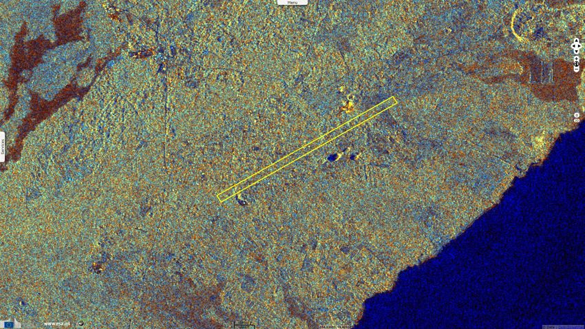
Hawaii plume is responsible for the creation of the Hawaiian – Emperor seamount chain, a 5800km-long chain of over 80 identified undersea
volcanoes. Four of these volcanoes are active, two are dormant, and more than 123 are extinct, many having since been ground beneath the waves
by erosion as seamounts and atolls. The chain extends from the Aleutian Trench in the far northwest Pacific to the Loʻihi seamount, the youngest
volcano in the chain, which lies about 35km southeast of the Island of Hawaiʻi. Closest to the Aleutian Trench, the oldest and most heavily eroded
part of the chain are the Emperor seamounts, which are 39 to 85 million years old.
Kilauea has been erupting continuously since 1983, it is the current eruptive center of the Hawaiian–Emperor seamount chain. It is still dwarfed by
its neighbour Mauna Loa which rises 9170m from base to summit, hiding most of its volume under sea.
Fig. 3 - S2 (24.12.2017) - 12,11,8 colour composite - The "colour" of a lava flow is indicative of its weathering & its age.                2D view

   2014 map showing the age of the top lava flow since Kilauea's continual eruption in 1983 - source: USGS, archived by Smithsonian Institution.
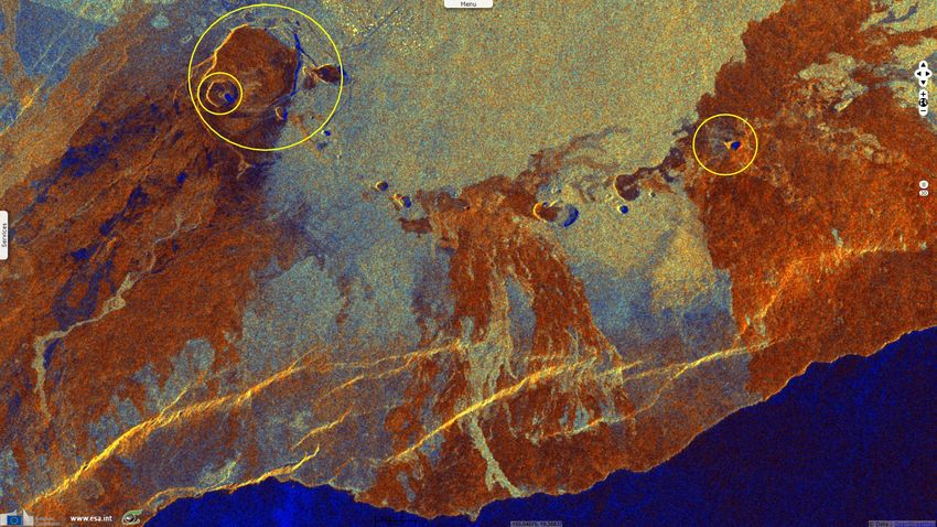
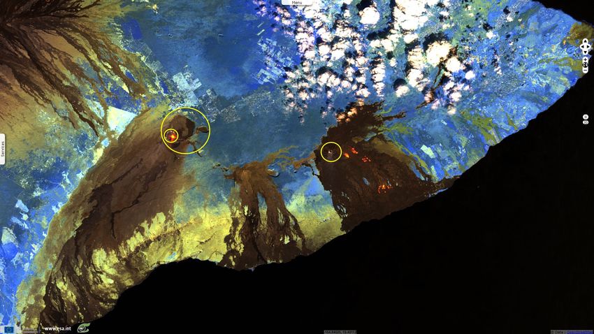
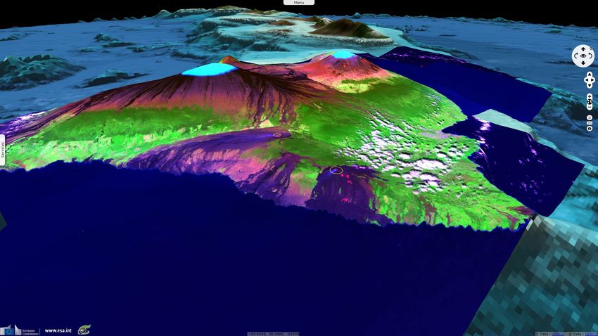
Fig. 4 - S1 (23.04.2018) - vv,vh,ndi(vh,vv) colour composite - Kilauea shown with its lava lakes at the highest level. 2D view
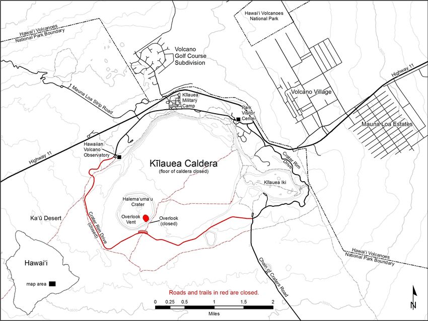
Map of the Kilauea's main caldera - source: USGS - Hawaiian Volcano Observatory (HVO).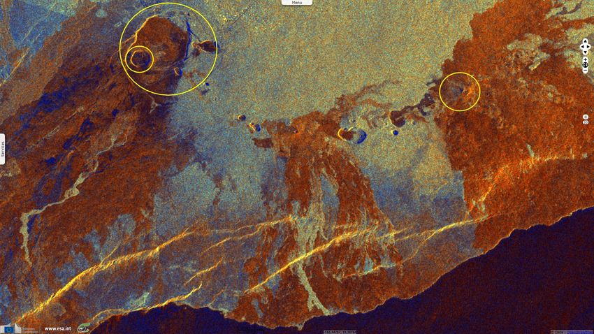
HVO listed several event that can be observed or derived from Sentinel-1 data:

        "May 1, 2018, 14:54 UTC: Between about 2:00 and 4:30 pm on Monday, April 30, following weeks of uplift and increasing lava levels within
        the cone, the crater floor at Pu'u 'Ō'ō on Kīlauea Volcano's East Rift Zone collapsed. A collapse of the Puʻu ʻŌʻō crater floor Monday afternoon
        on Kīlauea Volcano's East Rift Zone has prompted increases in seismicity and deformation along a large section of the rift zone.
        May 2, 2018, 05:56 UTC: The increase in seismicity and deformation recorded since Monday afternoon at Kīlauea Volcano's East Rift Zone
        east of the Pu'u 'Ō'ō vent is continuing this evening. The activity is associated with the intrusion of magma eastward from the Pu'u 'Ō'ō
        magma system. Since this morning, seismicity rates in the lower East Rift Zone east of Highway 130 have increased. An outbreak of lava in
        a new location remains a possible outcome of the continued unrest. At this time it is not possible to say with certainty if or where such an
        outbreak may occur, but the area along the East Rift Zone downrift (east) of Pu'u 'Ō'ō remains the most likely location.
        May 3, 2018, 18:48 UTC: Earthquakes and deformation of the ground related to intrusion of magma into the lower East Rift Zone of Kilauea
        continue. Deflationary tilt at the summit of the volcano has been accompanied by a drop in the level of the lava lake in Halema'uma'u."

Fig. 5 - S1 (05.05.2018) - After the eruption strengthening, the level of lava lakes quickly decreased.                                       2D view

                                                   Left: Map of the M6.9 earthquake - source: USGS.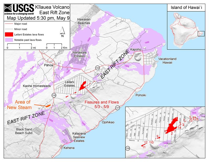
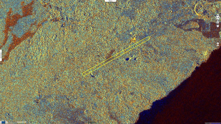
Fig. 6 - S1 (02.05.2018) - Leilani Estates before the lava flow.                                                              2D view

                          Sentinel-1 interferogram of this earthquake between 01 & 07.05.2018 - source: Pablo J. González.
Regarding the level of the lava Lake in Overlook crater, within the main caldera, HVO noted:

           "On 3 May the intensity of the ERZ seismicity decreased slightly, and the eastward migration of hypocenters slowed or ceased; deformation
           continued. The lava level in Overlook crater dropped over 30m, though spattering in the lake continued."
           "Based on satellite InSAR data, the summit caldera floor subsided about 10cm during 23 April-5 May. Corresponding to this deflationary
           trend, the summit lava lake in Overlook crater had dropped to about 128m below the crater rim since 30 April."
           "The level of the summit lava lake continued to drop, and by 7 May was 220m below the crater rim."

Fig. 7 - S1 (08.05.2018) - A lava flow caused the evacuation of 1700 residents & destroyed ~30 houses in Leilani Estates.                   2D animation 2D view

         Left: 60m high fountains fed massive flows that consumed homes and covered property in Leilani Estates - source: Paradise Helicopters
                                          Right: Map of fissures & flows as of 09.05.2018 - source: USGS - HVO.
              The views expressed herein can in no way be taken to reflect the official opinion of the European Space Agency or the European Union.

More on European Commission space:

More on ESA:                                                       S-1 website             S-2 website             S-3 website

More on Copernicus program:                                        Scihub portal          Cophub portal            Inthub portal    Colhub portal

More on VisioTerra:                                            Sentinel Vision Portal   Envisat+ERS portal      Swarm+GOCE portal   CryoSat portal   Proba-V portal

                                                             Funded by the EU and ESA                     EVT-239-SentinelVision              powered by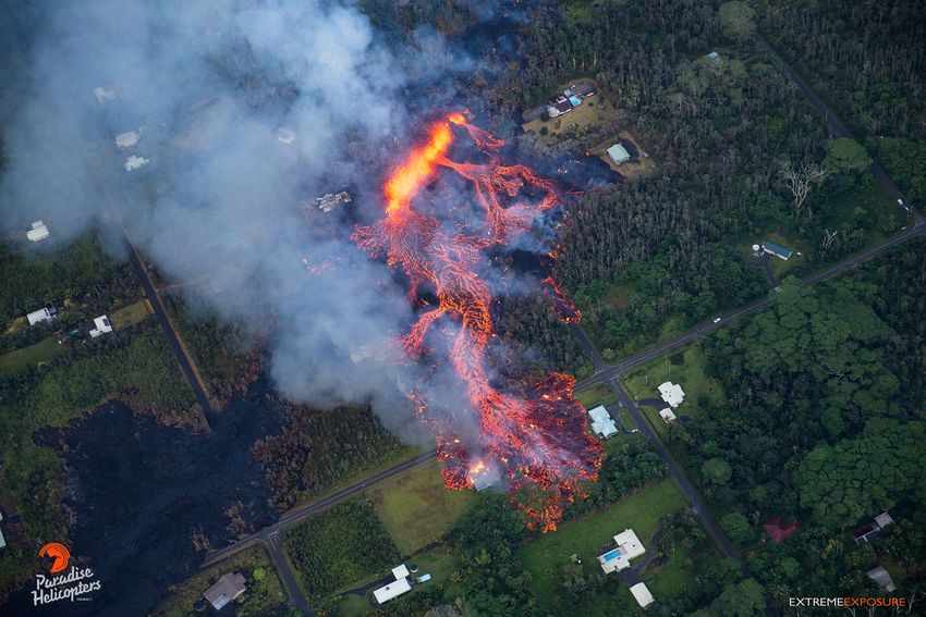
You can also read