Assessing Disease Exposure Risk with Location Data: A Proposal for Cryptographic Preservation of Privacy
←
→
Page content transcription
If your browser does not render page correctly, please read the page content below
Assessing Disease Exposure Risk with Location Data: A
                                               Proposal for Cryptographic Preservation of Privacy
                                            Alex Berke1 , Michiel Bakker1,2 , Praneeth Vepakomma1 , Kent Larson1 , and Alex
                                                                           ‘Sandy’ Pentland1,2
arXiv:2003.14412v2 [cs.CR] 8 Apr 2020

                                                                     1
                                                                     MIT Media Lab, Cambridge, MA, USA
                                                              2
                                                                  MIT Connection Science, Cambridge, MA, USA

                                                            {aberke,bakker,vepakom,kll,pentland}@mit.edu

                                                                                      March 2020

                                                                                        Abstract
                                                 Governments and researchers around the world are implementing digital contact tracing so-
                                             lutions to stem the spread of infectious disease, namely COVID-19. Many of these solutions
                                             threaten individual rights and privacy. Our goal is to break past the false dichotomy of effective
                                             versus privacy-preserving contact tracing. We offer an alternative approach to assess and com-
                                             municate users’ risk of exposure to an infectious disease while preserving individual privacy. Our
                                             proposal uses recent GPS location histories, which are transformed and encrypted, and a private
                                             set intersection protocol to interface with a semi-trusted authority.
                                                 There have been other recent proposals for privacy-preserving contact tracing, based on Blue-
                                             tooth and decentralization, that could further eliminate the need for trust in authority. However,
                                             solutions with Bluetooth are currently limited to certain devices and contexts while decentral-
                                             ization adds complexity. The goal of this work is two-fold: we aim to propose a location-based
                                             system that is more privacy-preserving than what is currently being adopted by governments
                                             around the world, and that is also practical to implement with the immediacy needed to stem a
                                             viral outbreak.

                                        1    Introduction
                                        This is a proposed design for how a system can identify and notify users who may have come in contact
                                        with diagnosed disease carriers about their risk while respecting individual’ privacy. It is common
                                        practice for healthcare workers to interview individuals diagnosed with a communicable disease about
                                        their recent movements in order to identify and alert others who they may have come in contact
                                        with. This process is referred to as contact tracing and is crucial as health entities, communities
                                        and governments attempt to contain viral outbreaks. Manually performing contact tracing is highly
                                        resource-intensive, intrusive and time-consuming. Yet the ubiquitous use of personal digital devices
                                        provides access to detailed location histories that are collected automatically, enabling a system that
                                        could conduct this process at scale. The objective of this paper is to describe such a system in the
                                        face of the COVID-19 pandemic that better preserves the privacy of its users than the systems we see
                                        governments adopting.

                                                                                             1
1.1 Contact tracing & privacy
There currently are digital approaches to contact tracing that use location histories1 but many operate
on a skewed trade-off between privacy and effectiveness [4]. Some rely on general public broadcasting of
information that introduces uncertainty in the information disseminated.2 Other alternatives resort to
the usage of technologies that risk violating individual rights against stigmatization and surveillance3
(see [4] for a discussion).
Even when systems do attempt to use location data while respecting individual privacy, their
methods are often insufficient: simply anonymizing user location histories by replacing users’ identifiers
with random new ones fails to achieve privacy in a meaningful way. Secondary data that is not
anonymized can be used to re-identify users by matching data points across the datasets. For example,
a study using credit cards records has shown that only four data points from a user’s location history
are enough to uniquely re-identify 90% of individuals [12].
This work breaks past the dichotomy of privacy versus effectiveness established by previous digital
contact tracing approaches. We propose a technology-based solution for contact tracing and dissem-
inating information on the state of infections while protecting the privacy rights of both diagnosed
infected carriers and other citizens.
1.2 Trust & privacy principles
The privacy and trust principles central to the design of this work are summarized below:
• Keep location data private. Locations visited are kept private for all users including those
who are diagnosed disease carriers.
• Avoid surveillance. The system can detect points of contact between users without precise
location histories being exposed.
• Only allow one-way private data publication. Only diagnosed carriers ever publish data,
but this data remains encrypted and private, and their identities remain protected. Other users
can check if they came in contact with carriers without sharing their location histories.
Any privacy-preserving contact tracing framework should be considered a “best effort” and avoid
promising to be perfectly private. Our primary contribution to the space of existing frameworks
and digital tools is the degree to which our cryptographic approach can preserve user privacy while
providing highly useful and accurate information through individuals GPS location histories.
We present our proposal in response to current events where we see an increase in surveillance and
a forfeit of privacy due to contact tracing efforts designed to contain the spread of COVID-19. We
intend to show that effective contact tracing is possible without further forfeiting privacy.
1.3 A useful first step
A simple first version of a system that provides exposure risk information is one that collects,
anonymizes, and aggregates the recent GPS location histories of diagnosed carriers. This information
allows the creation of a spatiotemporal heatmap representing large geographic regions where diagnosed
carriers spent time and when.
1 There are also digital contact tracings solutions that use Bluetooth technology to detect points of contact between
individuals without using location histories directly [1, 2, 3]. We will discuss these in Section 2.
2 Information about where diagnosed COVID-19 carriers have visited has been publicly broadcasted in different ways.
Singapore updates a map and lists details about the identities about each COVID-19 case [5]. South Korea sends text
messages to citizens containing personal information about diagnosed carriers [6]. In the US, location information about
diagnosed patients has been published through media outlets and university and government websites [7, 8, 9].
3 Israel employs cellphone tracking for coronavirus patients [10]. China requires use of an COVID-19 mobile applica-
tion to effectively surveil citizens and dictate quarantines [11].
2Individuals’ data and areas visited must be aggregated and obfuscated in a way that minimizes
what can be learned about individual people or places visited in the dataset. This is done in order
to protect people and businesses from potential stigmatization or any other threat. This aggregated
view can provide helpful information about infection risk across different areas, types of places, and
time periods for both health authorities and the general public. This aggregated data can be further
analyzed to better understand the flow and trends of disease transmission.
1.4 Contributions
In the current paper we build upon this first step and discuss the potential use of a private set
intersection protocol to provide more precise risk assessments to individual users based on points of
contact with individuals who were later diagnosed as disease carriers. Our approach partitions the
space of fine-grained GPS location and time data into discrete spatiotemporal points that represent
location histories. This combination of a partition scheme and private set intersection protocol allows
the system to detect when a user came in contact (e.g. was in close proximity) with diagnosed carriers
to assess and inform them of their risk, while preserving the privacy of individuals.
2 A Short Survey of Alternative Solutions
Clever approaches to privacy-preserving systems for contact tracing that rely on Bluetooth rather
than GPS have been proposed and implemented as smartphone applications, such as TraceTogether
[2], which was created by the government of Singapore, and the open source projects COVID Watch
[3] and CoEpi [1]. Instead of recording user location histories, these systems record when users come
in proximity of one another. A user’s smartphone application generates, and periodically updates,
a random identifier called a “contact event number” (CEN). The user’s device broadcasts this CEN
using Bluetooth Low Energy and receives and locally records CENs broadcast by other users’ devices.
Users who later fall ill then share their CENs, which can be matched against the CENs recorded locally
by other users to identify points of contact between diagnosed users and the other users. The different
implementations vary in the privacy and security they provide their users. For example, the Singapore
government requires users of its TraceTogether app to share their phone numbers and identities with
a central authority that maintains a database of recorded CENs. This authority contacts users whose
recorded CENs match against diagnosed users’ CENs to alert them of their exposure. This system
provides users with no privacy from the central authority but does protect users from having their
identities exposed to other users. In contrast, the COVID-Watch and CoEpi projects place more trust
in users rather than in a central authority.4 With their designs, diagnosed users’ CENs are stored in
a database that is either made public for other users’ apps to download or made available for them
to poll [13, 14]. These models are not perfectly privacy-preserving either, as they are susceptible to
privacy attacks from other users, as described by Cho et al. [15].
These systems use Bluetooth to directly detect whether users come in proximity of one another,
which GPS cannot provide. With Bluetooth, proximity can be approximated by signal strength that is
reduced by obstructions like walls; therefore, it more accurately reflects functional proximity in high-
risk environments for close contact, such as within buildings and vehicles, or in underground transit.
These Bluetooth features can benefit our proposed system as well, as the installation of Bluetooth
beacons could mark locations with higher levels of accuracy than what would otherwise be marked
only with GPS coordinates.
We note that applications that detect users’ exposure risk by relying on users to come into Blue-
tooth proximity may not be sufficient, given that in addition to human-to-human transmission, coro-
4 The CoEpi project allows users to self-diagnose and share their CENs without a health official verifying their
diagnosis and data. This can result in false reporting and invites spam attacks from malicious users, which can result
in other users seeing false positives which, in turn, could cause panic or simply distrust of the system. This issue has
been acknowledged by CoEpi’s technical leadership and they have invited solutions from researchers [13].
3naviruses can transmit through commonly touched surfaces or environments [16]. In contrast, our
proposed system can be extended to handle this kind of exposure risk by checking adjacent time
periods to accommodate when two users may have occupied the same space one after another.
Another issue with purely Bluetooth-based systems is that they require people to use a special
application that could suffer from slower or limited adoption, limiting the ability to capture a large
enough base of users before they are diagnosed, and therefore limiting their potential to be useful.
With GPS based approaches we might leverage the fact that the applications on users’ phones are
already collecting their GPS location histories, and develop a technology as a plugin to interface with
these apps, to more quickly roll out our system as a life-saving contact tracing technology.
3 A GPS-based privacy-preserving scheme
In what follows, we describe what type of information our proposed system provides before showing
a high-level system overview. We then explain the trust and privacy model it is designed for, and
finally provide a more technical description with details on how the system could be built in practice.
3.1 Probabilistic risk assessment
The proposed system provides a probabilistic measure of disease exposure risk for a user, based on
the time they have spent in spaces shared with users who were later diagnosed as disease carriers.
More time spent in such shared spaces indicates higher levels of risk, but this risk is also dependent
on where those spaces are.
Any technological system should be wary of claiming to precisely determine exposure risk, due to
the limitations of the technologies used for detection, and the ambiguity over what types of interactions
between people, shared spaces, or common surfaces, most elevate risk. Our proposed system uses GPS
points collected from users’ devices and can be extended to use Bluetooth to indicate locations visited
as well. It is worth noting that GPS has limited accuracy, especially in dense urban environments or
multi-story buildings. But even detecting whether a user spent sustained time in a crowd or multi-
story building with a diagnosed carrier may be useful, due to the heightened likelihood of sharing not
only space but surfaces such as door handles or elevator buttons, which help a virus spread [16]. For
this reason, we propose a probabilistic risk assessment based on the amount of time and number of
places that a user shared with a disease carrier, which we call “points of contact”.
3.2 System overview
Below we provide a high-level overview of our system and walk through an illustrated example.
Our proposed system follows four (4) steps, namely (1) data collection, (2) redaction and transfor-
mation of data, (3) secure data exchange, and (4) risk assessment and notification. We expand upon
these steps below (see Figure 1).
Step 1: Data collection. An application (app), installed on the mobile device of the user, collects
timestamped GPS points throughout the user’s day, every t minutes. The sequence of points
represents their location history.
Step 2: Redaction and transformation of data. All collected location histories are redacted,
transformed, and encrypted before leaving the device, to protect user privacy. In the case that
a user is diagnosed, their points are transformed and shared with the server in a way that
maintains their privacy. Collected points are deleted from both devices and servers d days after
they were collected, where d is the period of possible disease transmission informed by medical
experts.
4Figure 1: High-level schematic showing the major steps in the system’s process for privacy-preserving
contact tracing: (1) data collection, (2) redaction and transformation of data, (3) secure data exchange,
and (4) individualized risk assessment and notification, as well as the distribution of aggregated data
to create a ‘heatmap’ to inform the public of more general risk. A more detailed description of
the process includes usage of discrete spatiotemporal ‘point intervals’ and ‘a private set intersection
protocol and is described later on in this paper.
Step 3: Secure data exchange. In this phase, using the agreed secure data exchange mechanism,
the mobile app (acting as the client) establishes a secure channel with the designated server.
Within this secure channel, the mobile application requests the server for the ‘point interval’
data of known infected carriers for a chosen duration of time (e.g. the last 2 weeks) for a given
region (e.g. Boston).
The infected carriers’ data in the server’s possession is anonymized and has already under-
gone redaction and transformation to remove sensitive information to limit the risk for re-
identification, and contains no personally-identifying information (PII).
Users’ apps can check whether they came in contact with carrier users, and how often, while
preserving privacy. This is done with a cryptographically secure “private set intersection” (PSI)
protocol to find matches between encrypted ‘point intervals’ for carriers and other users.
Step 4: Risk assessment and notification. The app assesses risk for its user based on the points
of contact it found via (3) and can notify users of risk. Users whose apps find them at risk due
to contact with carriers can then be encouraged to get tested or self-quarantine. The app can
optionally show the user where and when the points of contact occurred.
This process is also illustrated above in Figure 1. We expand upon the steps 2 and 3 in the
following section.
3.2.1 Storing and sharing GPS histories
As GPS points are collected by a user’s device, sensitive areas are removed through either automatic
redaction or manually by the user. Redaction is an important privacy step, as knowledge about where
someone was when, or where they commonly spend time, such as their home area, can be used to
re-identify pseudo-anonymized users [17, 18].
The system provides two methods of redaction: automatic and manual. Home areas can be easily
inferred by the app based on where users spend time in the nighttime, and these can be automatically
5redacted. In addition, the app can provide the user with an interface to mark additional sensitive
areas for redaction. Any GPS point collected within an area marked for redaction is deleted and
not shared. To further protect the user’s privacy, this redaction happens on the user’s device and the
remaining points are then transformed or obfuscated before they are stored. Redacting and modifying
GPS points on the device, rather than after points are shared, is an important privacy measure to
prevent users from being coerced into providing information on where they have been.
If a mobile app user is diagnosed as a carrier (e.g. by professional medical personnel), the proposed
system provides two different ways for that user to anonymously share their GPS points to provide
important information to healthcare professionals, other system users, and the general public.
The two GPS transformations that support these different use cases are:
(a) GPS points are replaced by larger geographic areas that contain them to represent the areas
where carriers spent time and when, without representing precise locations.
(b) Precise timestamped GPS points are transformed into “point intervals” and obfuscated using a
one-way hash function (e.g. NIST standard SHA256 hash algorithm).
The first way (a) is used for the aggregated view of data that we previously described as a motivat-
ing first step. The granularity level can be dialed-up or dialed-down depending on the circumstances.
The more fine-grain granularity means an increase in likelihood that the user can be re-identified.
The second way (b) is used for contact tracing. This use case is where we make a new contribution
with our approach to finding points of contact while preserving privacy.
The two different use cases that (a) and (b) serve are both central to this work as they will both be
invaluable to containing the spread of infectious disease such as COVID-19. However the remainder
of this document focuses on (b), as it is our main contribution and requires explanation.
3.3 Trust and privacy model
The proposed system is designed around a model that assumes there is a semi-trusted authority main-
taining the server with diagnosed carriers’ redacted location histories. Such semi-trusted authorities
could be local hospitals or local government agencies chartered and regulated to hold citizen data
and maintain data privacy. We believe that a common goal – one that would make the proposed
system usable while preserving individual privacy – is to minimize the amount of information from a
diagnosed carrier that is exposed to other users and to the semi-trusted authority.
The proposed system is designed to minimize the amount of diagnosed carriers’ information that
is exposed, and to maximize the privacy for all other users of the system. These other users need
not share any of their location data in order to find points of contact with diagnosed users. However,
diagnosed users do risk forfeiting some privacy when they share their location histories with the
authority managing the server 5 . Even though they only share their redacted and encrypted location
data, given enough computational resources and malicious intent, the managing authority can attempt
to circumvent these measures and reconstruct location history data and re-identify users6 .
There is a clear need for a governance model regarding this data collection and use. For example,
data should be deleted d days after it was shared, where d is the number of days the diagnosed user
could have transmitted the virus before sharing their location history. There also needs to be a legal
5 Even systems designed to be opt-in on the part of users sharing data can be abused and made compulsory by
authorities once they are built. In Singapore, people contacted by health authorities are required by law to assist in the
activity mapping of their movements and interactions [2, 19].
6 The authority managing the server with redacted and encrypted user data can attempt a grid search (brute force)
attack over all possible encrypted point intervals in order to find hash collisions and reverse the one-way hash function
that encrypted the point intervals, thereby exposing the underlying data. They can then attempt to reconstruct location
histories based on the spatiotemporal correlation between data points or re-identify users due to the unique nature of
location histories [12].
6framework in place to end the practice of collecting data in this way once the health crisis is under
control7 .
That said, we must also acknowledge that governments already have access to the massive amounts
of location data that our proposed system would collect. Location histories are already collected by
apps on users’ smartphones, and the cellular towers they connect to, and through credit card purchases.
4 Technical description
Our proposed system broadly involves data collection followed by a method to deterministically con-
struct hashed spatiotemporal intervals that discrete points in users’ location histories are mapped to.
These intervals are then used with a private set intersection protocol to inform users when points in
their location histories match the points in the location histories of diagnosed carriers. We discuss
these steps in the following sections.
1. Collecting and Representing GPS points
2. Detecting Points of Contact Using Private Set Intersection
3. Assessing Risk and Notifying Users
4.1 Collecting and representing GPS points
Timestamped GPS points are collected within user devices as they move throughout their day. These
points are collected as tuples of latitude, longitude, and time: (latitude, longitude, time). A user’s app
checks for matches between their collected points and the points shared by users who were diagnosed
as carriers in order to identify points of contact.
4.1.1 Partition space and time into intervals
For privacy purposes, GPS points are never directly compared in order to find these matches. Times-
tamped GPS points are instead first mapped to a 3-dimensional grid, where two dimensions are
for geographic space (latitude and longitude), and the third dimension is time. We call these 3-
dimensional grid cells ‘point intervals’. The point intervals are then obfuscated with a deterministic
one-way hash function. Identifying points of contact becomes a matter of matching hashed point
intervals. Transforming GPS histories in this way to map (latitude, longitude, time) points that occur
within a continuous spatiotemporal space into discrete ‘point intervals’ makes comparing obfuscated
GPS histories possible. It also makes sense for our use case of finding (short) time intervals where
users occupied the same spatial area8 .
There are established ways to partition a geographic space, such as with geohashes9 for square
grid cells or with the hexagonal global geospatial indexing system of H3 grid10 .
Similarly, time can be partitioned into intervals. For example, if an interval size is 2 minutes,
then an interval boundary can always fall on the hour, and on the 2nd minute of the hour, and so
7 We have examples to be wary of regarding measures taken in times of crisis that extend indefinitely. Israel declared
a state of emergency during its 1948 War of Independence, justifying a range of “temporary” measures that removed
individual freedoms. They won the War of Independence but never declared their state of emergency over, and many of
the “temporary” measures are ongoing [20]. Israel recently approved cellphone tracking for its COVID-19 patients [21].
Similarly COVID-19 surveillance innovations in China are likely to be used by China’s counterterrorism forces beyond
the pandemic to further monitor and regulate the movement of its people. Consider the Uighur people. The Chinese
government has categorized this ethnic group as terrorists and has subjected many of them to forced labor [22].
8 Phones collect GPS data with limited accuracy and therefore trying to match users across spatial areas with radii
too small will miss points of contact.
9 https://en.wikipedia.org/wiki/Geohash
10 https://h3geo.org/
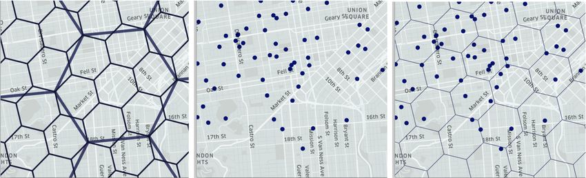
7Figure 2: A geographic area partitioned by a hexagonal H3 grid. Points are mapped to an index
corresponding to their containing grid cell.
on. The 3-dimensional grid of point intervals is an underlying system parameter (or logical “map”)
that is agreed-upon and shared across all user devices in the system. The specific partition scheme
and interval sizes used are implementation details. What matters more is that the chosen partition
scheme and the geographic and temporal resolution used are consistent across devices.
We note that when collecting GPS points there is a trade-off between accuracy in detecting points
of contact and the amount of data that must be then stored and processed. For example, if data is
collected more frequently, the system is more likely to detect when users spend little time near each
other, such as sharing a bus ride. However, this requires collecting and storing more data, and hence
more compute resources. We also note that the geographic partition of space can be expanded to
include specific locations. For example, a bus line might install Bluetooth beacons on its buses with
unique identifiers to serve as the geographic portion of point intervals, allowing users with an app that
supports this functionality to later detect if they shared a bus ride with a diagnosed carrier.
4.1.2 Checking for matches across obfuscated GPS histories
Since the point intervals are transformed with a one-way hash function, they cannot be easily reversed
to expose underlying location histories of users.
Yet, since this transformation is deterministic, users’ apps can still check for points of contact
with diagnosed users by checking for matches between their transformed point intervals and those
returned by a server. Verifying whether two individuals came into contact becomes a matter of
comparing whether the transformed point intervals that were constructed from timestamped GPS
points (latitude, longitude, time) collected by their devices coincide with any of the transformed point
intervals provided by the server (as well as adjacent point intervals).11
4.2 Detecting points of contact using private set intersection
We now describe the protocol that facilitates the private detection of matches across users’ GPS
histories. We assume that there is a semi-trusted authority (e.g. a local health agency) operating
a server. When a patient is diagnosed as a disease carrier, they share their redacted, anonymized,
hashed point intervals to the central server. Other users’ apps periodically exchange information
about their own hashed point intervals with the server to detect if their hashed point intervals match
against those shared by diagnosed carriers. They do so with a private set intersection protocol.
11 Technical note about matching against adjacent intervals: Since the partition of geographic space into intervals was
predetermined, two points may be close together in space but fall into different intervals. For this reason a user’s app
checks each of their collected point intervals, as well as the spatially adjacent intervals against the diagnosed carriers’
shared point intervals. That is, if we use a spatial grid of hexagons (like H3), a user’s collected point falls within a grid
cell and that grid cell is used as an interval. We must check that interval as well as the surrounding 6 hexagons in the
grid against each data point shared by diagnosed carriers. This adds some complexity in terms of processing power to
make the comparisons 7Nu × NI rather than just Nu × NI .
8Private set intersection (PSI) enables two parties to compute the intersection of their data in a
privacy-preserving way, such that only the common data values are revealed. It has applications in
a variety of privacy sensitive settings, from measuring conversion rates for online advertising [23] to
securely testing sequenced human genomes [24].
In our case, the two parties involved are the server storing the hashed point intervals shared by
diagnosed carriers, and another users’ device - the client. Their data are their respective hashed point
intervals. We can leverage PSI in a way so that only the user learns about the intersection of their
data - the server does not learn whether it shares any point intervals in common with the user, while
the users’ app does learn this. Therefore, our use of PSI is designed to maximize the privacy for users
who may be wary of surveillance or who do not fully trust the entities that maintain the server.
There are many PSI schemes that would fit our needs. These different schemes vary in their com-
putational complexity, speed, and accuracy. Researchers have developed fast PSI protocols optimized
for a client-server model, including those where the client is a smartphone app [25] and where the
server’s dataset is significantly larger than the client’s [26], which is the case for our system12 . A good
overview and comparison of PSI protocols can be found in [23].
To aid the reader in understanding how PSI supports our privacy goals, we provide a simple scheme
using the Diffie-Hellman protocol [27, 28] in Appendix A.
4.2.1 PSI benefits and implementation notes
The use of a PSI protocol adds an extra layer of privacy protection for both the diagnosed carriers
and the other users, beyond just the redaction and obfuscation of data13 .
Other users only ever learn points shared by diagnosed carriers that their own points matched
with (the intersection PI ∩ PU ). This further protects the privacy of diagnosed carriers. Moreover,
the server need not learn whether any points match; only the other user learns the intersection of PI
and PU . This further protects the privacy of undiagnosed users who may be wary of their location
histories leaving their device, or being shared with an authority.
There are implementation details that further enhance privacy and efficiency. For example, servers
can hold data for their local geographic regions, so that users with location histories specific to an
area (e.g. the Boston area) need not interact with servers holding data specific to a far away region
(e.g. the Bay Area in California). This helps subset the data so as to run PSI on a much smaller
dataset, thereby helping computational efficiency. In addition, data shared by diagnosed carriers to
servers should be deleted after d days, as both a privacy and efficiency measure.
The server should also limit the amount of data that a user’s client device can exchange with
it. It is only relevant to compare recent location histories (i.e. from the past d days). Since points
are partitioned into consistent time intervals, there is therefore an upper bound on the number of
points, N, that any app needs to check against the server’s set of points, PI . The server can limit the
exchanges with any client to N points per exchange, and limit the number of queries per day. This
limitation is important for preventing privacy attacks where an adversary might attempt querying
over the entire spatiotemporal grid to reconstruct the location histories of diagnosed carriers. It also
reduces the computational burden for servers.
4.3 Assessing risk and notifying users
A user’s app can assess their risk of infection based on the comparison (performed on the user’s device)
between the point intervals on the user’s device with those received from the server. Users whose apps
find them at reasonable risk can then be encouraged to get tested or self quarantine.
12 However many of these PSI protocols achieve their improved efficiency at the cost of accuracy, allowing a small
number of false positives, such as by employing bloom filters. This may not be an acceptable trade-off for a disease
contact tracing system where false positives can lead to panic or the wrong people seeking scarce medical resources.
13 When other users send their point intervals to the server, their point intervals are effectively encrypted twice. First
with the deterministic hash function (H) that encrypts all point intervals in the same way. Second by the PSI protocol.
9The implementation of our system can differ to either allow the app to learn just the number
of points of contact that occured, or where and when points of contact occurred. These different
implementations have different implications for the privacy and utility that our system can offer to
its users.
The number of detected points of contact is related to how likely a user was to have spent sustained
time in spaces shared with diagnosed users, so the number of detected points of contact is commensu-
rate with risk and can be used to provide a risk assessment. When the locations of points of contact
are known, the risk assessment can leverage context about these locations, such as whether they are
confined spaces with few people versus multi-story office buildings versus outdoor parks. Future work
can further incorporate intelligence into the risk assessment.
5 Intermediary implementation
Given the urgency of the COVID-19 pandemic, we note that intermediary steps can be taken to
implement the system we describe. Even before a secure server is set up to perform the private set
intersection (PSI) protocol, hashed point intervals for diagnosed carriers can be published to a flat
data file for other users to download. While this would speed up implementation, privacy guarantees
would be diminished in this case, as attackers can attempt to create points representing every potential
point interval to check for matches. Attackers could then attempt to reconstruct location histories of
users diagnosed as carriers and possibly re-identify them from their shared anonymized data. While
the redaction step would decrease the likelihood of an attacker’s success, some privacy risk remains.
Finally, this intermediary implementation with a flat data file can then be subsequently transitioned
to the more secure implementation using a PSI protocol.
6 Discussion
We proposed a technical design to address the problem of assessing users’ risk of disease exposure
with location histories. Our proposal is in response to existing digital contact tracing technologies,
with an approach that better preserves the privacy of individuals.
We are encouraged by other recent privacy-sensitive proposals for contact tracing [29, 15, 1, 3].
Some of these even extend our notions of privacy by removing the need for trust in authorities who
might abuse their access to diagnosed patients’ encrypted data and violate their privacy. However,
these systems are more complex and require more infrastructure and coordination, making them more
difficult to implement. Our goal is to propose a system that is more privacy-preserving than the
contact tracing technologies that we see governments around the world adopting, but that can also
be practically implemented with the immediacy needed to both stem the spread of disease and stem
the adoption of privacy-violating technologies.
Importantly, any implemented system, based on Bluetooth or GPS, should be opt-in, and clearly
communicate to users how it collects, retains, and uses data, to provide users the opportunity to weigh
the trade-off between their individual privacy risk posed by sharing information with the system and
the ongoing risk the pandemic poses.
In addition to the trade-offs between privacy, effectiveness, and the speed of implementation for
these technologies, we must consider adoption. None of these systems can have widespread impact
without extensive adoption. To expand system adoption, the proposed app’s technology can be devel-
oped as an SDK (software development kit) and integrated into partnering applications that already
collect user location histories, such as Google Maps. These partner applications can then ask the user
for the extra permissions and consent for this system’s use case. There are many such applications
that already collect user location histories in the background. They often use this information to serve
the user more relevant advertisements and content. This data is used to improve the user experience
but more often serves private profit. Now, in the face of the COVID-19 pandemic, is the time for
10industry and researchers to come together and for the ubiquitous collection of location data to serve
the public good. At the same time, we must avoid building any new surveillance systems to serve as
short-term emergency measures that can last beyond a time of crisis.
7 Acknowledgements
We thank Thomas Hardjono, Dan Calacci, Ethan Zuckerman, and Robert Obryk for contributing their
ideas and critiques, and we thank Connection Science and Media Lab sponsors for their support.
References
[1] Dana M. Lewis et al. Coepi: Community epidemiology in action. https://github.com/Co-Epi,
note = Accessed: 2020-03-30, 2020.
[2] Government Digital Services and Blue Trace. Tracetogether. https://www.tracetogether.gov.
sg/, note = Accessed: 2020-03-30, 2020.
[3] Rhys Fenwick, Mike Hittle, Mark Ingle, Oliver Nash, Victoria Nguyen, James Petrie, Jeff
Schwaber, Zsombor Szabo, Akhil Veeraghanta, Mikhail Voloshin, Sydney Von Arx, and Tina
White. Covid watch. https://www.covid-watch.org/, note = Accessed: 2020-03-30, 2020.
[4] Ramesh Raskar, Isabel Schunemann, Rachel Barbar, Kristen Vilcans, Jim Gray, Praneeth
Vepakomma, Suraj Kapa, Andrea Nuzzo, Rajiv Gupta, Alex Berke, et al. Apps gone rogue:
Maintaining personal privacy in an epidemic. arXiv preprint arXiv:2003.08567, 2020.
[5] Government Digital Services. Covid-19: Cases in singapore. https://www.gov.sg/article/
covid-19-cases-in-singapore, note = Accessed: 2020-03-30, 2020.
[6] M Zastrow. South korea is reporting intimate details of covid-19 cases: has it helped? Nature,
2020.
[7] The New York Times. Coronavirus in the u.s.: Latest map and case count. https://www.
nytimes.com/interactive/2020/us/coronavirus-us-cases.html, note = Accessed: 2020-03-
30, 2020.
[8] John Hopkins University and Medicine. Coronavirus covid-19 global cases. https://
coronavirus.jhu.edu/map.html, note = Accessed: 2020-03-30, 2020.
[9] Nebraska Department of Health and Human Services. Coronavirus disease 2019 (covid-19). http:
//dhhs.ne.gov/Pages/Coronavirus.aspx, note = Accessed: 2020-03-30, 2020.
[10] Haaretz. Israel approves cellphone tracking for coronavirus pa-
tients as cases rise to 213. https://www.haaretz.com/israel-news/
.premium-israel-approves-cellphone-tracking-for-coronavirus-patients-as-cases-rise-to-213-1.
8678361, note = Accessed: 2020-03-30, 2020.
[11] The New York Times. In coronavirus fight, china gives citizens a color code, with red flags. https:
//www.nytimes.com/2020/03/01/business/china-coronavirus-surveillance.html, note =
Accessed: 2020-03-30, 2020.
[12] Yves-Alexandre De Montjoye, Laura Radaelli, Vivek Kumar Singh, et al. Unique in the shopping
mall: On the reidentifiability of credit card metadata. Science, 347(6221):536–539, 2015.
11[13] Sourabh Niyogi, James Petrie, Scott Leibrand, Jack Gallagher, Hamish, Manu Eder, Zsombor
Szabo, and George Danezis. Cen proposals for privacy-preserving distributed contact tracing.
https://docs.google.com/document/d/1f65V3PI214-uYfZLUZtm55kdVwoazIMqGJrxcYNI4eg,
note = Accessed: 2020-03-30, 2020.
[14] Sourabh Niyogi, Scott Leibrand, and Dana M. Lewis. Cen proposals for privacy-preserving
distributed contact tracing. https://github.com/Co-Epi/coepi-backend-go, note = Accessed:
2020-03-30, 2020.
[15] Hyunghoon Cho, Daphne Ippolito, and Yun William Yu. Contact tracing mobile apps for covid-
19: Privacy considerations and related trade-offs. arXiv preprint arXiv:2003.11511, 2020.
[16] Günter Kampf, Daniel Todt, Stephanie Pfaender, and Eike Steinmann. Persistence of coron-
aviruses on inanimate surfaces and its inactivation with biocidal agents. Journal of Hospital
Infection, 2020.
[17] Philippe Golle and Kurt Partridge. On the anonymity of home/work location pairs. In Interna-
tional Conference on Pervasive Computing, pages 390–397. Springer, 2009.
[18] John Krumm. Inference attacks on location tracks. In International Conference on Pervasive
Computing, pages 127–143. Springer, 2007.
[19] Team Trace Together. Can i say no to uploading my tracetogether data when contacted
by the ministry of health? https://tracetogether.zendesk.com/hc/en-sg/articles/
360044860414-Can-I-say-no-to-uploading-my-TraceTogether-data-when-contacted-by-the-Ministry-of-H
note = Accessed: 2020-03-30, 2020.
[20] Yuval Noah Harari. The world after coronavirus. Financial Times, March 2020.
[21] Oliver Holmes. Israel to track mobile phones of suspected coronavirus cases. The Guardian,
March 2020.
[22] Shui-yin Sharon Yam. Coronavirus and surveillance tech: how far will gov’ts go and will they
stay when they get there? Hong Kong Free Press, March 2020.
[23] Benny Pinkas, Thomas Schneider, Gil Segev, and Michael Zohner. Phasing: Private set inter-
section using permutation-based hashing. In 24th {USENIX} Security Symposium ({USENIX}
Security 15), pages 515–530, 2015.
[24] Pierre Baldi, Roberta Baronio, Emiliano De Cristofaro, Paolo Gasti, and Gene Tsudik. Counter-
ing gattaca: Efficient and secure testing of fully-sequenced human genomes (full version). arXiv
preprint arXiv:1110.2478, 2011.
[25] Daniel Kales, Christian Rechberger, Thomas Schneider, Matthias Senker, and Christian Weinert.
Mobile private contact discovery at scale. In 28th {USENIX} Security Symposium ({USENIX}
Security 19), pages 1447–1464, 2019.
[26] Ágnes Kiss, Jian Liu, Thomas Schneider, N Asokan, and Benny Pinkas. Private set intersection
for unequal set sizes with mobile applications. Proceedings on Privacy Enhancing Technologies,
2017(4):177–197, 2017.
[27] Whitfield Diffie and Martin Hellman. New directions in cryptography. IEEE transactions on
Information Theory, 22(6):644–654, 1976.
[28] Bernardo A Huberman, Matt Franklin, and Tad Hogg. Enhancing privacy and trust in electronic
communities. In Proceedings of the 1st ACM conference on Electronic commerce, pages 78–86,
1999.
12[29] Ran Canetti, Ari Trachtenberg, and Mayank Varia. Anonymous collocation discovery:taming the
coronavirus while preserving privacy, 2020.
[30] Hao Chen, Kim Laine, and Peter Rindal. Fast private set intersection from homomorphic encryp-
tion. In Proceedings of the 2017 ACM SIGSAC Conference on Computer and Communications
Security, pages 1243–1255, 2017.
13A An example private set intersection protocol using Diffie-
Hellman
Below we outline an example of how our system would work with a simple Diffie-Hellman PSI protocol.
Note that the actual implementation may differ from this example. Our description assumes familiarity
with Diffie-Hellman, modular arithmetic and concepts from cryptography such as the discrete log
problem. Readers can otherwise skip this section to the PSI protocol summary below.
Before we walk through this PSI protocol, we clarify the problem and notation.
Notation and Problem Statement: We call a point interval p, and a collected sequence of point
intervals P = [p1 , p2 , ...]. We call the users’ point intervals that are collected by their device PU . We
call the point intervals collected for diagnosed carriers and later shared with the server PI .
As we noted earlier, each point interval is encrypted by a commonly shared deterministic hash func-
tion, which we call H. This means that a user’s phone really stores H(PU ) = [H(pU 1 ), H(pU 1 ), ...H(pU n )],
and the server stores
H(PI ) = [H(pI1 ), H(pI1 ), ...H(pIm )].
If a user has a point interval matching one shared by a diagnosed carrier, i.e. pU i = pIj for
some pU i in PU collected by the user’s device, and some pIj in PI collected by a diagnosed carriers’
device and later shared to the server, then the encrypted hashes of these point intervals match as well.
H(pU i ) = H(pIj ).
Consider H(PU ) as a set which is stored on the user’s device, and H(PI ) as a set stored on the
server. The problem is then to allow the user’s app to learn the set intersection of H(PU ) and H(PI ).
Protocol: Our described use of Diffie-Hellman is written with the multiplicative group of integers
modulo p, where p is prime, and g is a primitive root modulo p.
Setup: The server and the client user’s device have an agreed upon modulus, p, and base of the
multiplicative group, g. The server and client each generate secret private keys, a and b, respectively.
1. The client encrypts the user’s hashed point intervals, H(PU ), with a and sends this data to the
server.
Client → Server : H(PU )a = [H(pU 1 )a , H(pU 1 )a , ..., H(pU n )a ] mod p
2. The server encrypts its stored hashed point intervals, H(PI ), with b and sends this data to the
client.
Server → Client : H(PI )b = [H(pI1 )b , H(pI1 )b , ...H(pIm )b ]modp
3. Upon receiving the encrypted hashed point intervals sent by the client H(PU )a , the server further
encrypts this data with its key b and sends the result back to the client.
Server → Client : H(PU )ab = [H(pU 1 )ab , H(pU 1 )ab , ..., H(pU n )ab ] mod p
4. The client receives both H(PI )b and H(PU )ab . The client then further encrypts H(PI )b with its
key a to create
H(PI )ba = [H(pI1 )ba , H(pI1 )ba , ..., H(pIm )ba ] mod p.
5. The client can then compute the set intersection by comparing the elements of H(PU )ab and
H(PI )ba .
Due to the multiplicative properties of the group, any matching H(pU ) and H(I ) values will have
matching H(pU )ab and H(pI )ba values. This means that if the client has any point intervals that
match point intervals shared to the server, pU = pI , then H(pU )ab = H(pI )ba , and these matches will
be detected by the client.
14Figure A.1: This figure shows our private set intersection (PSI) protocol based on Diffie-Hellman key
exchange. The intersection is done on encrypted point intervals corresponding to the client’s and
carrier’s location traces. The encrypted point intervals from diagnosed carriers are stored in a server.
Only the client device learns the intersection of data, where the intersection is the set of point intervals
it has in common with the point intervals on the server (PU ∩ PI ). Points in (PU ∩ PI ) are represented
in (H(PU )ab ∩ H(PI )ba ).
This protocol allows for flexibility in terms of whether it allows a client to learn which of its
points have matches versus how many of its points have matches. At step (3) of the protocol the
server further encrypts the data received from the client, H(PU)a, and returns H(PU)ab. If the server
maintains the order in the sequence of points intervals, then the client can then learn exactly which
hashed point intervals in the sequence it sent to the server, H(PU )a = [H(pU 1 )a , H(pU 1 )a , ...H(pU n )a ]
match against items in the server’s encrypted data, H(PI )ba . If the server instead shuffles the sequence
before returning it in step (3), then the client can learn how many of its point intervals match against
the server’s data, but not which ones do.
We described a simple protocol in order to more easily explain how our system can operate.
Optimizations can be made for efficiency. For example, the server can reuse its private key, b, and
set of encrypted data across multiple interactions with different clients. It can refresh this key and
re-encrypt its data periodically, or as new data is shared by diagnosed carriers or deleted as it becomes
old. Decreasing how often the server encrypts its data can increase its efficiency. Faster PSI protocols
have been developed, including those that optimize for the exchange of information between a server
and client, particularly where the server has a much larger set of data than the client, such as in our
use case [30, 26].
15You can also read