Assessment of Seascape, Landscape, and Visual Impacts of Offshore Wind Energy Developments on the Outer Continental Shelf of the United States
←
→
Page content transcription
If your browser does not render page correctly, please read the page content below
OCS Study
                                      BOEM 2021-032

Assessment of Seascape, Landscape,
and Visual Impacts of Offshore Wind
Energy Developments on the Outer
Continental Shelf of the United States

US Department of the Interior
Bureau of Ocean Energy Management
Office of Renewable Energy Programs
This page intentionally left blank.
OCS Study
                                                                                BOEM 2021-032

Assessment of Seascape, Landscape,
and Visual Impacts of Offshore Wind
Energy Developments on the Outer
Continental Shelf of the United States

April 2021

Author:
Robert G. Sullivan

Prepared under Interagency Agreement M17PG00043 with the Department of Energy
By
Argonne National Laboratory
9700 South Cass Avenue
Lemont, IL 60439

US Department of the Interior
Bureau of Ocean Energy Management
Office of Renewable Energy Programs
This page intentionally left blank.
DISCLAIMER
This study was funded, in part, by the U.S. Department of the Interior, Bureau of Ocean Energy
Management (BOEM), Environmental Studies Program, Washington, DC, through Interagency
Agreement Number M17PG00043 with the U.S .Department of Energy. This report has been technically
reviewed by BOEM, and it has been approved for publication. The views and conclusions contained in
this document are those of the author and should not be interpreted as representing the opinions or
policies of the U.S. Government, nor does mention of trade names or commercial products constitute
endorsement or recommendation for use.
REPORT AVAILABILITY
To download a PDF file of this report, go to the U.S. Department of the Interior, Bureau of Ocean Energy
Management Data and Information Systems webpage (http://www.boem.gov/Environmental-Studies-
EnvData/), click on the link for the Environmental Studies Program Information System (ESPIS), and
search on BOEM 2021-032. The report is also available at the National Technical Reports Library at
https://ntrl.ntis.gov/NTRL/.
CITATION
Sullivan RG. 2021. Methodology for Assessment of Seascape, Landscape, and Visual Impacts of
Offshore Wind Energy Developments on the Outer Continental Shelf of the United States.
Washington (DC): U.S. Department of the Interior, Bureau of Ocean Energy Management. OCS
Study BOEM 2021-032.78 p.
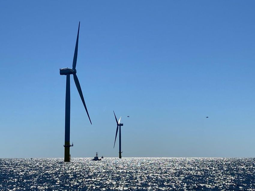
ABOUT THE COVER
Cover photo by Justin J. Bedard.
On June 26, 2020, installation was completed on the first wind turbines installed in U.S. Federal waters.
The offshore wind project went into full operation in autumn, 2020.
The Coastal Virginia Offshore Wind pilot project is designed to demonstrate a grid-connected,
12-megawatt (MW) offshore wind test facility (two 6 MW wind turbines) on the Outer Continental Shelf
about 27 miles off the coast of Virginia Beach. The site is leased by the Commonwealth of Virginia’s
Department of Mines Minerals and Energy. Dominion Energy was designated as the lease operator,
Ørsted Energy constructed the offshore wind energy generation facilities, and L.E. Myers Company
designed and constructed the onshore electrical facilities.
Justin Bedard of the Bureau of Ocean Energy Management took the photo while participating in a U.S.
Coast Guard drill conducting a mock rescue of an injured maintenance worker stranded on top of the
wind turbine’s nacelle. The U.S. Coast Guard helicopters and water vessels seen in the photo were part of
the drill.ACKNOWLEDGMENTS
The author acknowledges the following individuals who contributed to this publication.
Within the U. S. Department of the Interior Bureau of Ocean Energy Management (BOEM) Office of
Renewable Energy, support and administrative assistance was provided by:
Dr. Mary Boatman, Science Coordinator
Michelle Morin, Chief, Environmental Branch for Renewable Energy
David Ball, Pacific Region Historic Preservation Officer
BOEM's in-agency staff provided critical review and comments:
• John McCarty, Landscape Architect
• Brian Krevor, Environmental Protection Specialist
• Brandi Carrier, Deputy Federal Preservation Officer for BOEM
• William Hoffman, Archaeologist
• Sara Guiltinan, Leasing Specialist and Pacific Regional Tribal Liaison Officer
• Jean Thurston-Keller, Renewable Energy Specialist
• Dr. Ian Slayton, Physical Scientist
• Connie Barnett, Architectural Historian
The following individuals provided peer review and comments:
• Carys Swanwick, Professor Emeritus, University of Sheffield
• James Palmer, Principal, Scenic Quality Consultants
• Christian Achermann, Landscape Planner, Urland Aps
The author thanks all of the reviewers for their thorough and thoughtful comments and suggestions.
Finally, the author thanks the authors of the third edition of Guidelines for Landscape and Visual Impact
Assessment (GLVIA3): The impact assessment methodology described in this publication is based on the
GLVIA3.Contents
List of Figures ............................................................................................................................................... iv
List of Tables ................................................................................................................................................ iv
List of Abbreviations and Acronyms.............................................................................................................. v
Executive Summary ..................................................................................................................................... vi
1 Introduction ........................................................................................................................................... 1
1.1 Need and Purpose for Document .................................................................................................. 1
1.2 Context: Legislative and Policy Direction ...................................................................................... 1
1.3 SLVIA and the Project Planning and Approval Process ............................................................... 1
1.4 Document Scope ........................................................................................................................... 2
1.5 Intended Use and Users................................................................................................................ 2
1.6 Organization of this Document ...................................................................................................... 2
2 Impact Assessment Methodology Principles and Goals ....................................................................... 3
2.1 Introduction .................................................................................................................................... 3
2.2 What Is SLVIA? ............................................................................................................................. 3
2.3 Relationship of SLIA to VIA ........................................................................................................... 5
2.4 Goals and Requirements of the SLVIA Methodology ................................................................... 6
2.5 Scope of SLVIA for Offshore Wind Facilities on the OCS ............................................................. 8
2.6 Design Envelope and Phased Development Considerations in SLVIA ........................................ 8
2.7 Involving Stakeholders in the SLVIA Process ............................................................................... 9
3 Impact Assessment Process Overview ................................................................................................ 9
3.1 Major Phases of the Impact Assessment Process ........................................................................ 9
3.2 Project and Alternatives Description ........................................................................................... 10
3.3 Determination of Geographic Scope of Potential Impacts .......................................................... 11
3.4 Impact Receptor Identification and Description .......................................................................... 11
3.5 Impact Identification and Description .......................................................................................... 12
3.6 Judging the Level of Impact ........................................................................................................ 13
3.7 Assessing Impacts of Reasonably Foreseeable Planned Actions .............................................. 14
3.8 Additional Mitigation Measures ................................................................................................... 15
4 Project and Alternatives Description ................................................................................................... 15
4.1 Introduction .................................................................................................................................. 15
4.2 Proposed Project Description ...................................................................................................... 15
4.3 Incorporation of Project Phases in the Impact Assessment........................................................ 16
i4.4 Incorporating PDEs and Phased Development into the Impact Assessment ............................. 16
4.5 Incorporation of Mitigation in the Impact Analysis ....................................................................... 17
5 Determination of Geographic Scope of Potential Impacts .................................................................. 17
5.1 Introduction .................................................................................................................................. 17
5.2 Relevant Factors in Determination of Geographic Scope of Impact Analysis ............................ 17
5.3 Project Visibility Factors .............................................................................................................. 18
5.4 Viewshed Analysis and Zone of Theoretical Visibility ................................................................. 20
5.5 Bounding the Outer Limit of Impact Analysis .............................................................................. 20
6 Seascape and Landscape Impact Assessment .................................................................................. 22
6.1 Introduction and Summary .......................................................................................................... 22
6.1.1 Seascape and Landscape Character Assessment .............................................................. 23
6.1.2 Seascape and Landscape Impact Assessment ................................................................... 23
6.2 Affected Environment Description and Impact Receptor Identification ....................................... 25
6.2.1 Seascape and Landscape Character Assessment .............................................................. 25
6.2.2 Seascape and Landscape Impact Receptors ...................................................................... 27
6.2.3 Applicable Laws, Ordinances, and Regulations ................................................................... 27
6.3 Identification and Description of Potential Seascape and Landscape Impacts .......................... 27
6.3.1 Introduction ........................................................................................................................... 27
6.3.2 Impacts Included in SLIA...................................................................................................... 28
6.3.3 Describing Impacts in the Assessment ................................................................................ 28
6.4 Evaluation of Impacts .................................................................................................................. 29
6.4.1 Introduction ........................................................................................................................... 29
6.4.2 Sensitivity of Seascape/Landscape Receptors .................................................................... 30
6.4.3 Magnitude of Seascape/Landscape Impacts ....................................................................... 30
6.4.4 Combining Components to Determine Sensitivity and Magnitude Factors.......................... 32
6.4.5 Combining Sensitivity and Magnitude Factors to Determine Impact Level.......................... 32
6.4.6 Summarizing Impacts for Multiple SCAs and LCAs ............................................................. 34
7 Visual Impact Assessment .................................................................................................................. 34
7.1 Introduction and Summary .......................................................................................................... 34
7.2 Visual Impact ............................................................................................................................... 36
7.3 Affected Environment Description and Impact Receptor Identification ....................................... 37
7.3.1 Project Area Description....................................................................................................... 37
7.3.2 Visual Impact Receptors ...................................................................................................... 38
7.3.3 KOP Selection and Description ............................................................................................ 38
7.3.4 Laws, Ordinances, and Regulations .................................................................................... 40
ii7.4 Identification and Description of Potential Visual Contrasts and Impacts ................................... 40
7.4.1 Introduction ........................................................................................................................... 40
7.4.2 Impacts Included in VIA........................................................................................................ 40
7.4.3 Describing Visual Impacts in the Assessment ..................................................................... 40
7.4.4 The Use of Visual Simulations to Determine Potential Visual Contrasts ............................. 41
7.4.5 Identification of Visual Contrasts .......................................................................................... 42
7.4.6 Flexibility for Inclusion of Simulations in Assessment .......................................................... 43
7.4.7 Discussion of Weather and Visibility .................................................................................... 43
7.5 Evaluation of Impact Levels ........................................................................................................ 43
7.5.1 Introduction ........................................................................................................................... 43
7.5.2 Sensitivity of Visual Receptors ............................................................................................. 44
7.5.3 Magnitude of Visual Impacts ................................................................................................ 45
7.5.4 Combining Components, Factors, and Impacts on Multiple KOPs ...................................... 47
8 Assessing Effects of Reasonably Foreseeable Planned Actions ....................................................... 49
8.1 Introduction .................................................................................................................................. 49
8.2 Scope of the RFPA Effects Assessment ..................................................................................... 51
8.2.1 Types of RFPA Effects ......................................................................................................... 51
8.2.2 RFPA Effects Associated with a Proposed Offshore Wind Project ...................................... 51
8.2.3 Geographic Extent of the RFPA Effects Assessment .......................................................... 51
8.2.4 Temporal Limits of the RFPA Effects Assessment .............................................................. 52
8.2.5 Types of Projects/Activities Included in the RFPA Effects Assessment .............................. 52
8.3 RFPA Effects Assessment for the SLIA ...................................................................................... 53
8.3.1 Geographic Scope of the SLIA RFPA Effects Assessment ................................................. 53
8.3.2 Seascape and Landscape Description for RFPA Effects Assessment ................................ 53
8.3.3 Identification of Seascape/Landscape RFPA Effects ........................................................... 53
8.3.4 Determination of Seascape/Landscape RFPA Impact Levels ............................................. 54
8.4 RFPA Effects Assessment for the VIA ........................................................................................ 54
8.4.1 Geographic Scope of VIA RFPA Effects Assessment ......................................................... 54
8.4.2 Affected Environment for VIA RFPA Effects Assessment ................................................... 55
8.4.3 Identification of Visual RFPA Effects.................................................................................... 55
8.4.4 Determination of Visual RFPA Impact Levels ...................................................................... 56
9 References .......................................................................................................................................... 56
10 Glossary .............................................................................................................................................. 59
Appendix A: Viewshed Analysis .................................................................................................................. 68
Appendix B: Mitigation of Seascape/Landscape and Visual Impacts from Offshore Wind Facilities ......... 70
iiiList of Figures
Figure 2.2-1. Both seascape/landscape impacts and visual impacts are assessed in SLVIA. .................... 4
Figure 3.6-1. Generalized impact assessment process .............................................................................. 14
Figure 5.3-1. Schematic diagram of visibility factors in the landscape ....................................................... 19
Figure 6.1-1. SLIA impact assessment process ......................................................................................... 24
Figure 7.1-1. VIA process (after LI and IEMA 2013, 99) ............................................................................. 35
Figure 8.1-1. SLVIA RFPA effects assessment process ............................................................................ 50
List of Tables
Table 6-1. Impact rating factors, components, and importance levels ....................................................... 29
Table 6.4-1. Matrix for combining sensitivity components .......................................................................... 32
Table 6.4-2. Matrix for combining magnitude components ......................................................................... 32
Table 6.4-3. Matrix for combining sensitivity and magnitude to identify impact level ................................. 33
Table 6.4-4. Example impact matrix for a hypothetical SCA: Cape Oceanview SCA ................................ 33
Table 7.5-1. Example visual impact matrix for a hypothetical KOP: KOP 1, Cape Oceanview
Lighthouse ................................................................................................................................................... 48
ivList of Abbreviations and Acronyms
AOL aviation obstruction lighting
BLM Bureau of Land Management
BMP Best Management Practice
BOEM Bureau of Ocean Energy Management
CEQ Council on Environmental Quality
CFR Code of Federal Regulations
COP Construction and Operations Plan
DOI U.S. Department of the Interior
DTT Department of Trade and Industry
EIS Environmental Impact Statement
EPAct Energy Policy Act of 2005
ft foot (feet)
GIS Geographic Information System
GLVIA3 Guidelines for Landscape and Visual Impact Assessment, 3rd edition
IEAA Institute of Environmental Management & Assessment
in. inch(es)
km kilometer(s)
KOP key observation point
LCA landscape character area
LI Landscape Institute
LORs laws, ordinances, and regulations
m meter(s)
mi mile(s)
MNL marine navigational lighting
MW megawatt(s)
MWh megawatt-hour(s)
NEPA National Environmental Policy Act of 1969
NHPA National Historic Preservation Act
nm nautical mile(s)
NPS National Park Service
NHRP National Register of Historic Places
OCA Ocean Character Area
OCS Outer Continental Shelf
OCSLA Outer Continental Shelf Lands Act
PDE Project Design Envelope
RFPA Reasonably Foreseeable Planned Action
SCA seascape character area
SLIA Seascape/Landscape Impact Assessment
SLVIA Seascape/Landscape and Visual Impact Assessment
USFS U.S. Forest Service
VIA Visual Impact Assessment
ZTV Zone of Theoretical Visibility
vExecutive Summary
As the United States begins large-scale deployment of offshore wind energy facilities, an important
challenge for developers and regulators is the assessment of potential seascape, landscape, and visual
impacts on important coastal scenic, historic, and recreational resources; Native American tribal
properties and treasured seascapes; commercial interests dependent on tourism; and the private property
of coastal residents. This document describes the methodology for seascape, landscape, and visual impact
assessment (SLVIA) that the U.S. Department of the Interior (DOI) Bureau of Ocean Energy
Management (BOEM) uses to identify the potential impacts of offshore wind energy developments in
Federal waters on the Outer Continental Shelf (OCS) of the United States. This methodology document
describes what is considered in the SLVIAs submitted by offshore wind project developers to BOEM and
how decisions about expected impacts of offshore wind developments are made. This SLVIA
methodology applies to any offshore wind energy development proposed for the OCS and considered by
BOEM, as directed by the Energy Policy Act of 2005 and in compliance with the Outer Continental Shelf
Lands Act and the National Environmental Policy Act of 1969 (NEPA).
The SLVIA has two parts: seascape and landscape impact assessment (SLIA) and visual impact
assessment (VIA). SLIA analyzes and evaluates impacts on both the physical elements and features that
make up a landscape or seascape and the aesthetic, perceptual, and experiential aspects of the landscape
or seascape that make it distinctive. These impacts affect the “feel,” “character,” or “sense of place” of an
area of landscape or seascape, rather than the composition of a view from a particular place. In SLIA, the
impact receptors (the entities that are potentially affected by the proposed project) are the
seascape/landscape itself and its components, both its physical features and its distinctive character.
Visual impact assessment (VIA) analyzes and evaluates the impacts on people of adding the proposed
development to views from selected viewpoints. VIA evaluates the change to the composition of the view
itself and assesses how the people who are likely to be at that viewpoint may be affected by the change to
the view. Enjoyment of a particular view is dependent on the viewer, and in VIA, the impact receptors are
people. The inclusion of both SLIA and VIA in the BOEM SLVIA methodology is consistent with
NEPA’s objective of providing Americans with aesthetically and culturally pleasing surroundings and its
requirement to consider all potentially significant impacts of development.
The BOEM SLVIA methodology is modeled on the methodology in use in the United Kingdom. It
considers SLIA and VIA as two closely related but separate impact assessments: Both use similar impact
assessment processes, and the majority of potential impacts for both the SLIA and the VIA are associated
with the visibility of the offshore and onshore wind project components. However, the SLIA impact
receptors and types of potential impacts differ from those in the VIA, leading to different conclusions
about the ultimate effects of the project on seascape/landscape (assessed in SLIA) and on people
(assessed in VIA).
The SLVIA process includes six major phases:
1. The proponent provides the construction and operation plan (COP) that describes the project in
detail, any alternatives under consideration, and the project design envelope (PDE), if the PDE
approach is being used. Best management practices (BMPs) for mitigating the seascape,
landscape, and visual impacts of the project that are incorporated into the project design and
included in the COP are assumed to be implemented for purposes of the SLVIA.
2. The geographic scopes of the SLIA and the VIA—that is, the areas within which impacts will be
assessed—are identified.
vi3. Descriptions of impact receptors and existing conditions for use in the SLIA and the VIA are
prepared:
a. For the SLIA, this step includes describing the seascape/landscape character and the
contributing elements of the potentially affected seascape/landscape character areas
(SCAs/LCAs).
b. For the VIA, this step includes describing the important views, the potentially affected
viewers, the viewpoints where the viewers are located, and the existing conditions at and
around the viewpoints.
c. Applicable laws, ordinances, and regulations (LORs) are also reviewed for applicability
to the SLIA and VIA.
4. The potential impacts of all phases of the proposed project and alternatives, including the PDE (if
applicable), are identified and described, and the impact levels determined. Potential seascape and
landscape impacts are identified separately from visual impacts. The assessment of visual impacts
is based, in part, on the use of visual simulations of the proposed project and alternatives, and
simulations may also be used for assessment of seascape and landscape impacts. After the nature
and extent of the impacts have been identified, the levels of the potential impacts are determined.
This requires combining judgments about the sensitivity of the seascape/landscape and visual
impact receptors and the magnitude of the impacts, and then combining the sensitivity and
magnitude judgments to determine the overall level of the impacts. Although the evaluation of
impact level is ultimately a professional judgment, as are the evaluations of the individual criteria,
the method by which the evaluation is made is systematic, based on accepted criteria, and clearly
documented.
5. Assessment of impacts from reasonably foreseeable planned actions for both seascape/landscape
and visual resources are conducted. After the nature and extent of these impacts have been
identified, the impact levels are evaluated.
6. Additional recommended mitigation measures beyond those included in the COP may be
identified. These could include mitigation required by BOEM as a condition for approval of the
project or other mitigation actions agreed to by the developer.
The project proponent engages and involves stakeholders throughout the SLVIA process. Stakeholders
are consulted early in the project design process for the following input:
• Provide information about their concerns and sensitivity to seascape, landscape, and visual
impacts;
• Identify visually and culturally important areas and identify potential key observation points
(KOPs);
• Evaluate potential project designs;
• Review the impact analysis and simulations; and
• Suggest and evaluate mitigation measures.
BOEM will engage stakeholders as part of the public involvement process required by NEPA.
viiThis page intentionally left blank.
viii1 Introduction
This document describes the methodology for seascape, landscape, and visual impact assessment
(SLVIA) that the U.S. Department of the Interior (DOI) Bureau of Ocean Energy Management (BOEM)
uses to identify the potential impacts of proposed offshore wind energy developments in Federal waters
on the Outer Continental Shelf (OCS) of the United States.
1.1 Need and Purpose for Document
Wind turbines have been installed offshore in a number of countries to harness the energy of the wind
moving over the oceans and convert it to electricity. The potential seascape, landscape, and visual impacts
of offshore wind energy development on coastal lands and waters have emerged as concerns in the
development of offshore wind facilities in the United States and elsewhere. As the United States begins
large-scale deployment of offshore wind energy facilities, an important challenge for developers and
regulators is to minimize potential seascape, landscape, and visual impacts on important coastal scenic,
historic, and recreational resources; Native American tribal resources and treasured seascapes;
commercial interests dependent on tourism; and the private property of coastal residents. This document
provides a methodology for assessing the potential seascape, landscape, and visual impacts of proposed
offshore wind energy developments situated in Federal waters on the OCS that is consistent with the
requirements of the National Environmental Policy Act of 1969 as amended (NEPA).
1.2 Context: Legislative and Policy Direction
In 2009, the DOI announced the final regulations for the OCS Renewable Energy Program, which was
authorized by the Energy Policy Act of 2005 (EPAct). These regulations provide a framework for issuing
leases, easements, and rights-of-way for OCS activities that support production and transmission of
energy from sources other than oil and natural gas. BOEM is responsible for overseeing offshore
renewable energy development in Federal waters. The authority derives from amendments to subsection 8
of the Outer Continental Shelf Lands Act (OCSLA) (43 U.S.C. 1337), as set forth in section 388(a) of the
EPAct. The Secretary of the Interior delegated to BOEM the authority to regulate activities under
section 388(a) of the EPAct. Since the regulations were enacted, BOEM has worked diligently to oversee
responsible renewable energy development in an environmentally sound manner.
1.3 SLVIA and the Project Planning and Approval Process
Title 30 of the Code of Federal Regulations (CFR) Part 585, Subpart F, Plans and Information
Requirements, provides guidance on survey requirements, project-specific information, and information
to meet the requirements of OCSLA, NEPA, and other applicable laws and regulations. It specifies the
various plans that must be submitted and related activities that must be undertaken to obtain approval
from BOEM to develop and operate an offshore wind facility on a lease or grant on the OCS. It also
specifies that in order to comply with NEPA and other relevant laws, the construction and operation plan
(COP) for a proposed development must include a detailed description of those resources, conditions, and
related activities that could be affected by the proposed project and related activities, including visual
resources and various social and economic resources that would be addressed in an SLVIA.
Subpart F also states that after determining whether the submitted COP is complete and sufficient to
conduct BOEM's technical and environmental reviews and notifying the developer when the submitted
1COP lacks any necessary information, BOEM prepares an appropriate NEPA analysis. Upon completion
of BOEM’s technical and environmental reviews and other reviews required by Federal law, BOEM may
approve the COP, disapprove it, or approve it with modifications.
In order for BOEM to consider a COP complete and sufficient pursuant to 30 CFR 585, the developer
must submit a SLVIA with its COP. BOEM then independently analyzes the submitted SLVIA as part of
its NEPA review. The NEPA review serves as a partial basis for BOEM’s decision to approve, deny, or
request modifications to the COP.
1.4 Document Scope
This document provides a method for assessing the potential seascape, landscape, and visual impacts for
proposed utility-scale offshore wind energy developments on the OCS approved by BOEM. It discusses
BOEM’s approach for determining the scope of the assessment; defines seascape, landscape, and visual
impacts; identifies which impacts are included in the assessment; and identifies how impacts are assessed
and described and how the nature, magnitude, and impact level of potential impacts are determined. It
also presents the rationale and scientific basis for the impact assessment approach proposed.
1.5 Intended Use and Users
This document provides the methodology to be used for assessing the potential seascape, landscape, and
visual impacts of proposed offshore wind energy developments on the OCS under BOEM’s authority. It
is intended primarily for use by landscape professionals who are preparing a SLVIA for a wind energy
development evaluated by BOEM, by BOEM staff reviewing the SLVIA for offshore wind developments,
and by other project stakeholders who are interested in how impacts are assessed by BOEM. Its use will
help ensure that a consistent, defensible, and documented approach to the assessment of seascape,
landscape, and visual impacts of offshore wind projects is employed by the various offshore wind project
proponents and by BOEM. The methodology is specific to offshore wind energy developments under
BOEM’s approval authority but may be useful for other purposes and readers.
Note that while the information gathered to conduct the SLVIA and parts of the SLVIA itself may be
useful to the process of cultural resource impact analysis conducted for offshore wind projects under
NEPA, the SLVIA is not a substitute for, nor does it assess the same type of impacts as, a cultural
resource impact assessment (see Section 2.2, and Sullivan, Meyer, and O’Rourke 2018).
1.6 Organization of this Document
The remainder of this document is divided into nine sections. Chapter 2, Impact Assessment
Methodology Principles and Goals, discusses key principles and goals of the SLVIA methodology.
Chapter 3, Impact Assessment Process Overview, provides brief descriptions of the various steps in the
SLVIA process. Chapter 4, Project and Alternatives Description, provides details of the purpose, nature,
and content of the project description and alternatives. Chapter 5, Determination of Geographic Scope of
Potential Impacts, describes how the geographic scopes of the two impact assessments
(seascape/landscape and visual) are determined. Chapter 6, Seascape and Landscape Impact Assessment,
describes the seascape and landscape impact assessment (SLIA) process in detail. Chapter 7, Visual
Impact Assessment, describes the visual impact assessment (VIA) process in detail. Chapter 8, Assessing
Effects of Reasonably Foreseeable Actions (RFPA), describes the RFPA impact assessment process for
both seascape/landscape impacts and visual impacts. Chapter 9, References, lists cited references.
Chapter 10, Glossary, provides definitions of technical terms.
2Two appendices provide supplementary material. Appendix A, Viewshed Analysis, specifies the protocol
for viewshed analyses conducted for the SLVIA. Appendix B, Mitigation of Seascape/Landscape and
Visual Impacts from Offshore Wind Facilities, describes best management practices (BMPs) for
mitigating seascape, landscape, and visual impacts from both the offshore and onshore components of
offshore wind energy projects.
2 Impact Assessment Methodology Principles and Goals
This chapter defines and discusses key terms and principles generally related to the assessment of
seascape, landscape, and visual impacts as well as key goals and issues specifically related to the
SLVIA methodology presented in this document.
2.1 Introduction
The methodology for the BOEM SLVIA process is modeled on the SLVIA methodology used for
offshore wind developments in the United Kingdom, as described in the Landscape Institute and Institute
of Environmental Management & Assessment’s Guidelines for Landscape and Visual Impact Assessment,
third edition (GLVIA3) (LI and IEMA 2013). For many readers, including many VIA professionals
practicing in the United States, SLIA is an unfamiliar term and concept, primarily because most
environmental impact assessments in the United States contain only VIAs, which are different from, but
closely related to, SLIAs. This chapter defines seascape and landscape impacts and visual impacts,
explains the differences between them, describes at a summary level how a SLIA differs from a VIA, and
explains why both types of impact assessment are appropriate to incorporate into the SLVIA methodology
BOEM uses for offshore wind developments on the OCS.
This chapter also examines key goals and principles specific to the BOEM SLVIA methodology. These
can be thought of as the specifications for developing the methodology, such as the types and magnitudes
of impacts and impact receptors assessed, the need for flexibility in assessing impacts that may change as
the design of the proposed facility evolves, and the need to include the public and other potentially
affected stakeholders in the SLVIA process.
2.2 What Is SLVIA?
As defined by GLVIA3 (LI and IEMA 2013), SLVIA is an impact assessment tool for identifying and
evaluating the likely significance of the effects of change resulting from development on both seascapes
and landscapes as environmental resources in their own right, and on the people who experience
particular views that they value (see Figure 2.2-1). With respect to the BOEM SLVIA methodology,
landscape and seascape are defined as follows:
• Landscape is an “area, as perceived by people, the character of which is the result of the action
and interaction of natural and/or human factors” (LI and IEMA 2013).
• Seascape is “a discrete area within which there is shared inter-visibility between land and sea.
Every seascape therefore has three defined components:
o An area of sea (the seaward component);
o A length of coastline (the coastline component); and
o An area of land (the landward component).” (DTI 2005).
3Figure 2.2-1. Both seascape/landscape impacts and visual impacts are assessed in SLVIA.
For the purposes of the BOEM SLVIA methodology, seascape and landscape as "resources in their own
right" refers primarily to seascape and landscape character. As noted in GLVIA3 (LI and IEMA 2013),
“landscape results from the interplay of the physical, natural and cultural components of our
surroundings. Different combinations of these elements and their spatial distribution create the distinctive
character of landscapes in different places, allowing different landscapes to be mapped, analyzed and
described. Character is not just about the physical elements and features that make up a landscape, but
also embraces the aesthetic, perceptual and experiential aspects of the landscape that make different
places distinctive.” Assessing seascape and landscape impacts thus means assessing impacts on seascape
and landscape character, including the following:
1. The physical elements and features that make up a landscape or seascape area; and
2. The aesthetic, perceptual, and experiential aspects of the landscape or seascape area that make it
distinctive.
The inclusion of “aesthetic, perceptual, and experiential aspects” in the impact analysis implies more than
simply assessing the effects of development on a view from a particular place or places. “Aesthetic,
perceptual, and experiential aspects” are clearly not limited to visual experience. They could include other
sense modalities, such as sound, smell, or touch, but they also involve how people think about (perceive)
and experience a seascape or landscape, which includes the meaning that humans assign to the
seascape/landscape, such as historic or cultural associations, wilderness values, tranquility, or what is
often referred to as “sense of place.” Because of offshore wind developments’ distance from shore,
sounds and smells are not likely to be affected. However, note that while much of an area’s character is
identifiable to people based on its visual qualities, the perceptual and experiential aspects of landscapes
and seascapes are clearly not limited exclusively to their visual qualities.
VIA in the BOEM SLVIA methodology assesses the impacts of a proposed offshore wind development
on people who would see the project from particular viewpoints. VIA evaluates how the addition of the
visible elements of the proposed project to the view (or the associated removal or change to existing
visual elements) would change the composition of the views, and how those changes would affect
people’s experience of the view.
The SLVIA is not a substitute for a cultural resource impact assessment conducted for offshore wind
projects under NEPA or historic property visual effects assessment under the National Historic
Preservation Act (NHPA). Section 106 of NHPA requires Federal agencies to consider the effects,
including visual effects, of their undertakings on the ability of historic properties to convey their historic
significance. Visual impacts of Federal agency actions must also be considered under NEPA for their
4potential to affect cultural resources, scenic resources present in the landscape, and the scenic experiences
of people who view the landscape. There are important differences between the VIA under Section 106
and the SLVIA under NEPA. In essence, the VIA under Section 106 looks at impacts on properties, while
a NEPA SLVIA includes impacts on the people at those places and on the larger and broader environment
within which historic properties exist. The SLVIA does not assess effects on the integrity of historic
properties listed or eligible for listing on the National Register of Historic Places (NRHP), or their ability
to convey their historical significance. Where there are potential visual impacts on both scenic values and
historic properties, VIAs under both NEPA and Section 106 must be conducted (Sullivan, Meyer, and
O’Rourke 2018).
2.3 Relationship of SLIA to VIA
In the United States, in many cases, environmental reviews conducted under NEPA (typically
environmental impact statements, or EISs) do not formally include the SLIA; that is, they do not consider
the effects of change resulting from development on seascapes and landscapes separately from the effects
on viewers. However, seascapes and landscapes are clearly resources with values other than the scenic
quality of views to and from them. In the United States, EISs are typically limited to the VIA, that is,
effects of development on people’s experience of particular views. Elements of a SLIA are sometimes
incorporated into a VIA, but not formally or completely (Sullivan, Meyer, and O’Rourke 2018).
However, consideration of all potentially significant impacts is required by NEPA and discussed in case
law (NHCRP 2013, 14–15). In the BOEM SLVIA methodology, SLIA is a formal process performed
separately from the VIA in order to more completely assess the impacts of the proposed development.
Together, SLIA and VIA form the SLVIA.
It is very important to understand the difference between SLIA and VIA and why both types of
assessments are appropriate to include in the BOEM SLVIA methodology. As noted above, SLIAs assess
impacts on the physical elements and features that make up a landscape or seascape and the aesthetic,
perceptual, and experiential aspects of that landscape or seascape that make it distinctive. These impacts
affect the “feel,” “character,” or “sense of place” of an area of landscape or seascape, rather than the
composition of a view from a particular place. Landscape and seascape effects, in essence, are a measure
of the degree of compatibility of the character of the development, which might be, for example,
“industrial,” with the character of the landscape or seascape it is in or is visible from, say, “wilderness” or
“tranquil.” The impact receptor is the potentially affected landscape or seascape.
In contrast, VIAs assess impacts on viewers caused by adding the proposed development to views from
selected viewpoints, as seen by particular people. Examples include a view of the development from a
residential area where it will be seen by residents, a view from a popular beach where it will be seen by
people engaged in recreational activities, or a view from the battlements of a historic fort where it will be
seen by heritage tourists. VIAs analyze the change to the view itself caused by the addition of the
development. It also analyzes how the change will affect the visual experience of people who are likely to
be at the viewpoint, and how they are likely to respond to the change. The effect of seeing the facility on
viewer experience depends in part on what the viewers are doing when viewing the facility, and their
response depends in part on who they are and how much they value the view. Enjoyment of a particular
view is dependent on the viewers, and in VIA, the impact receptors are people, not the landscape or
seascape.
It is important that the BOEM SLVIA include both SLIA and VIA. Seascape and landscape character is
only partly visual in nature, but visibility of an offshore wind development could significantly affect this
fundamental and sometimes highly valued quality of landscapes and seascapes that contributes to
character. VIA is limited to assessing the likely effects of the proposed project on the qualities of the
5visual experience of valued views, and it is not capable of fully capturing impacts on seascape and
landscape character. SLIA is the appropriate tool for assessing impacts on the seascape and landscape
themselves, and the aesthetic, perceptual and experiential aspects of seascapes and landscapes that
contribute to their distinctive character. However, stakeholders often are also very concerned about
changes to valued views, for example, the view from their home or a favorite scenic overlook in a
National Park. They may be personally affected by changes to a particular view. SLIA does not assess the
effects on viewers of the changes in views from particular viewpoints. VIA is the appropriate tool for
assessing impacts on people’s enjoyment of views. Therefore, both SLIA and VIA are needed to fully
assess the impacts of visibility of an offshore wind development.
2.4 Goals and Requirements of the SLVIA Methodology
The following major goals were considered in the design and development of the BOEM SLVIA
methodology:
1. The methodology must be consistent with the requirements of NEPA. A stated purpose of NEPA
is to “assure for all Americans safe, healthful, productive, and aesthetically and culturally
pleasing surroundings” (NEPA 1994). NEPA requires Federal agencies to assess the
environmental effects of their proposed actions prior to making decisions, including decisions on
permit applications and the adoption of federal land management actions (EPA 2017).
2. The methodology must be systematic. The SLVIA methodology must use a prescribed and
structured approach for assessing impacts that may be applied consistently from project to
project.
3. The methodology must be based on accepted professional practices. The SLVIA methodology
must be based on sound, documented, and accepted professional practices.
4. The methodology must support documentation of its application. The SLVIA methodology must
utilize an approach that can be documented, so that BOEM and other stakeholders can review the
assessment and clearly understand the information used and the evidence and logic supporting the
assessment’s findings.
5. The methodology must be comprehensive with respect to assessing all important potential
impacts resulting from the visibility of offshore wind developments. The SLVIA methodology
must include procedures for assessing all important impacts arising from the visual presence of
offshore wind developments.
6. The methodology must be flexible enough to accommodate changes in facility design that might
occur during the approval process. The SLVIA methodology must accommodate a phased
approach to offshore wind development, using “project design envelope” (PDE, also referred to
as the Rochdale Design Envelope) concepts and procedures described in Phased Approaches to
Offshore Wind Developments and Use of the Project Design Envelope (BOEM 2017) and Draft
Guidance Regarding the Use of a Project Design Envelope in a Construction and Operations
Plan (BOEM 2018). See Sections 2.6 and 4.4 for further discussion of design envelope
considerations.
7. The methodology must be flexible enough to accommodate the imprecise nature of determining
the magnitude and significance of potential impacts. The SLVIA methodology must avoid relying
solely on “automated,” “formula-based” findings of magnitude and significance of impacts,
because judging the magnitude and significance of aesthetic impacts and effects on
landscape/seascape character integrity involves multiple complex factors, some of which are
inherently qualitative. Formulaic methods could fail to capture important considerations for
project-specific issues and could also “force” findings of magnitude and significance that are not
justified because of imprecision in the contributing variables.
6Based on these goals, the following requirements were incorporated into the design and development of
the BOEM SLVIA methodology:
1. The methodology includes both SLIA and VIA. The inclusion of both SLIA and VIA in the BOEM
SLVIA methodology is consistent with NEPA’s objective of providing Americans with
aesthetically and culturally pleasing surroundings and its requirement to consider all potentially
significant impacts of a proposed action. It is also consistent with accepted best professional
practice in the United Kingdom, where offshore wind energy developments are common and
where seascape and landscape impacts of development are routinely considered for offshore wind
developments.
2. The methodology assesses all non-negligible impacts. Visibility of an offshore wind project does
not necessarily indicate that there will be non-negligible seascape, landscape, or visual impacts.
While impacts are sometimes of insufficient magnitude to be considered significant, the
methodology is designed to disclose all impacts that may be non-negligible. Offshore wind
facilities have been shown to be visible for distances exceeding 25 mi (40 km) (Sullivan et al.
2013a), and while impacts at longer distances might be found to be minor or negligible in
magnitude, they could potentially affect several thousand square miles of seascape/landscape.
Given the sensitivity of seascapes and landscapes along the U.S. coast and the very large
populations within some of these areas, it is appropriate to disclose these potential impacts.
3. The methodology relies on professional judgment for evaluating impact levels. Issues surrounding
the evaluation of landscape and visual impacts are discussed at length in GLVIA3 (LI and IEMA
2013), and VIA methods in use in the United States are reviewed in NCHRP (2013). GLVIA3
states the following: “While there is some scope for quantitative measurement of some relatively
objective matters, for example, the number of trees lost to construction of a new mine, much of
the assessment must rely on qualitative judgments, for example, about what effect the
introduction of a new development or land use change may have on visual amenity, or about the
significance of change in the character of the landscape and whether it is positive or negative.”
GLVIA3 goes on to say, “In all cases there is a need for the judgments that are made to be
reasonable and based on clear and transparent methods so that the reasoning applied at different
stages can be traced and examined by others.” Clarity and transparency in documenting the
decisions are essential as a basis for the public and other stakeholders to provide informed
opinions about the final decisions that BOEM will make when evaluating the SLVIA. GLVIA3
notes that using multiple evaluators to make determinations about impact levels can reduce
problems associated with individual bias.
Based on these goals and requirements, BOEM has determined that a SLVIA approach modeled on the
methodology for landscape and visual impact assessment presented in GLVIA3 (LI and IEMA 2013),
with modifications required to include seascape assessment, is consistent with NEPA, and can otherwise
be adapted for use with offshore wind energy developments in the United States.
Beyond meeting the goals and requirements BOEM set for the SLVIA, basing the methodology on
GLVIA3 provides additional advantages:
1. The GLVIA was written and revised by highly qualified landscape professionals and extensively
peer reviewed. The United Kingdom is a world leader in offshore and onshore wind energy
development and has a long history of concern for and dedicated effort towards seascape,
landscape, and aesthetic resource management.
2. The GLVIA has been in use for more than 25 years and is now in its third edition. It has been
subjected to much legal and professional scrutiny. The last revision was made in 2013, so it
reflects relatively recent academic progress on approaches to seascape, landscape, and visual
impact assessment.
73. GLVIA3 has been applied to dozens of offshore wind projects, and numerous environmental
assessments from real-world projects are available that provide a rich body of literature for
examining how a SLVIA is conducted in practice.
In short, GLVIA3 provides a proven approach to the SLVIA process that has been refined based on
repeated application and extensive input from a wide range of stakeholders.
2.5 Scope of SLVIA for Offshore Wind Facilities on the OCS
The BOEM SLVIA methodology is intended to assess the potential seascape, landscape, and visual
impacts of construction, operation and maintenance, and decommissioning of proposed utility-scale
offshore wind energy developments on the OCS of the United States, as well as any residual impacts that
may remain after decommissioning. Temporary impacts from site testing and evaluation, construction,
and decommissioning as well as long-term impacts from operation are assessed. Impact sources included
in BOEM SLVIAs include all above-waterline offshore project components, including wind turbines,
electrical service platforms, turbine lighting, and boat and helicopter traffic during all phases of
development. Onshore impact sources include substations built as a direct result of the proposed project,
transmission lines, cable landfalls, and other components associated with the construction, operation, and
decommissioning of the wind facility, but not fabrication projects or expanded port facilities. The
methodology assesses impacts for daytime and nighttime viewing conditions separately and assesses
impacts on both offshore and onshore receptors, including landscapes and seascapes for the SLIA portion
of the assessment and people—on both land and sea (recreational boaters, fishers, ferry passengers,
Native American tribal members engaged in cultural practices, and the like)—for the VIA portion of the
assessment. Impacts on crews of cargo ships and other commercial/working vessels, e.g., fishing boats,
are not included in the assessment.
The geographic scopes of the seascape/landscape and the visual impact assessments include all areas of
land and sea from which the components included in the assessments are visible, as indicated by
viewshed analysis, to a distance that varies depending on the size of the wind turbines or other project
components proposed for the project. The geographic scope of the SLIA and the VIA may not be
identical, although they generally are similar. See Chapter 5 for information on determining the
geographic scope of a SLIA and VIA for a particular project.
2.6 Design Envelope and Phased Development Considerations in SLVIA
In January 2018, BOEM issued Draft Guidance Regarding the Use of a Project Design Envelope in a
Construction and Operations Plan. (BOEM 2018). The guidance describes BOEM’s plans to allow wind
developers to use a PDE approach. A PDE approach allows offshore wind project proponents to identify
in their COP a reasonable range of potential project design parameters for certain key components of a
development, including, for example, type and number of turbines, foundation type, location of the export
cable route, location of an onshore substation, location of the grid connection point, and construction
methods and timing. BOEM then uses the PDE approach to assess potential impacts on key resources,
focusing on the design parameters that represent the greatest potential impact on each resource—referred
to in the guidance document as the “maximum design scenario.” BOEM’s assessment may result in the
approval of a project constructed within that range. If BOEM approves a COP that used a PDE approach
and the project proponent’s final design does not stay within the approved range of design parameters in
the COP, BOEM conducts further review before allowing construction to begin. The PDE approach is
also a mechanism through which phased development may be presented, interpreted, and assessed. See
Section 4.4 for additional information on use of the PDE approach.
8You can also read