Citizen Science and Volunteer Monitoring - Resource Pack 2016
←
→
Page content transcription
If your browser does not render page correctly, please read the page content below
Citizen Science and
Volunteer Monitoring
 Resource Pack 2016
This guide has been produced by The Rivers Trust with assistance from the Defra & Environment Agency
       Catchment Partnership Fund and the EU LIFE Programme as part of the WaterLIFE project.

WaterLIFE aims to help local communities engage with River Basin Management Plans and to deliver on-
   the-ground improvements that support accelerated delivery of the Water Framework Directive.

        Find out more about Catchment-Based Approach: www.catchmentbasedapproach.org

                     Find out more about the WaterLIFE project: waterlife.org.uk

                                        Published May 2016

                  Cover photos: © Jiri Rezac, WWF UK, Thames21, Keep Britain Tidy.
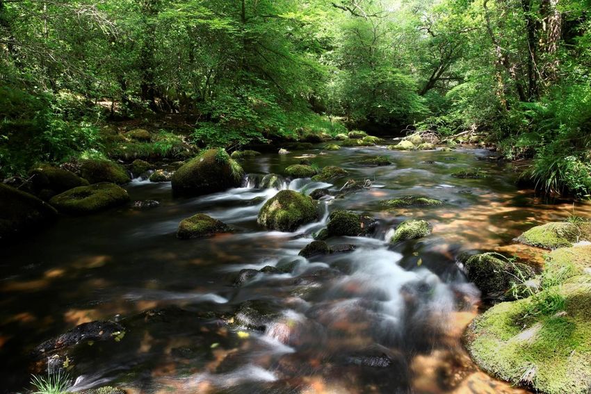
Environmental monitoring by the voluntary sector is fundamental to the success of the
Catchment-Based Approach (CaBA), helping to fill important knowledge gaps and engaging all
sectors of society in identifying water management issues, and delivering solutions to protect
and enhance the freshwater environment

Many catchment partnerships are developing monitoring programmes, which involve
volunteers, members of the public and a wide range of community groups in collecting,
reporting and analysing monitoring data. This resource pack seeks to share the experience
gained by many of the partnerships by signposting useful guidance, tools, equipment and case
studies. The pack also includes details of more specialist equipment and techniques for use
by experts, as the most successful monitoring programmes typically combine crowd-sourced
data covering large spatial areas with localised hi-spec monitoring and modelling.

The resource pack was first published in 2015 and has now been updated for 2016 with
additional equipment and case studies. It is also hosted on the CaBA website where it will be
updated regularly: www.catchmentbasedapproach.org/volunteer-monitoring.

If you have something to add or would like to know more…
     get in touch: info@catchmentbasedapproach.org
     post on the CaBA Forum: www.catchmentbasedapproach.org/discussions
     contact the CaBA partnerships: www.catchmentbasedapproach.org/catchment.

  Contents
  Guidance and Useful Links…………………………………………………………………………………….2
  Monitoring Equipment………………………………………………………………………………………….3
  Mobile Apps and Maps for Data Capture………………………………………………………………13
  Case Studies………………………………………………………………………………………………………….29

       Citizen Science and Volunteer Monitoring Resource Pack 2016   www.catchmentbasedapproach.org   1
Guidance and Useful Links
             CEH / SEPA - Choosing and Using Citizen Science
                         www.ceh.ac.uk/citizen-science-best-practice-guide
    Excellent guide to help you decide if citizen science is right for you, and
    the full project report has two water related case studies showing how
           the decision tree methodology can be used to plan a monitoring
                                                                       scheme.

                            UK Environment Observation Framework -Citizen Science Guide
                            www.ukeof.org.uk/documents/guide-to-citizen-science
                            practical guidance on developing citizen science programmes.

  The River Restoration Centre - Practical River Restoration Appraisal
                        Guidance for Monitoring Options (PRAGMO)
                                                  www.therrc.co.uk/monitoring-guidance
      Guidance on monitoring protocols, and how to plan the right things to monitor to
demonstrate success for river restoration projects. Includes monitoring planner template.
                       RRC also run associated training courses – see website for details.

                           The Rivers Trust - Managing Volunteers and Health & Safety Guidance
                           http://www.theriverstrust.org/trust_support/index.htm
                           Information pack for rivers trusts including templates and legal guidance
                           Outdoor Emergency First Aid and River Safety Course
                           http://www.theriverstrust.org/news/index.htm Suitable for volunteer coordinators and
                           monitoring teams. Contact The Rivers Trust for future course dates.

 British Ecological Society – Citizen Science Special Interest Group
          http://www.britishecologicalsociety.org/getting-involved/special-interest-
                                                            groups/citizen-science/

                    Environment Agency – Volunteer Monitoring Action Plan
                    http://www.catchmentbasedapproach.org/images/PDFS/EA_Action_Plan_Volunteer_Monitoring_
                    October_2012_final.pdf
                    Sets out how the EA intend to support volunteer monitoring

 US Environmental Protection Agency – The Volunteer Monitor Project
                                      http://water.epa.gov/type/rsl/monitoring/issues.cfm
                     Newsletter archive for the volunteer monitoring community in the USA

                 Foundation for Water Research – Community Involvement in UK Catchment
                 Management
                 http://www.fwr.org/Catchment/frr0021.pdf Review of current knowledge with case studies

      Citizen Science and Volunteer Monitoring Resource Pack 2016   www.catchmentbasedapproach.org         2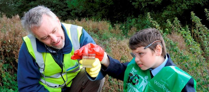
Monitoring Equipment
This section contains details of a range of monitoring kit and supplies used by catchment partnerships for
monitoring water quality, biology and hydro morphology. This is a representative sample of monitoring
equipment spanning a wide range of budgets, from high-spec kit suitable for experts, right through to
single-use sampling kit and simple dip-test monitoring approaches suitable for multiple volunteers.
However, bear in mind that even basic tests require some training and Q&A to ensure consistency and
validity of results. Relative accuracy of water quality kit in particular is something that a number of groups
are looking at – we will flag up any published studies on the CaBA forum.

Under each product, the organisations that use it are listed, with comments, contact details and supplier
details where known. Equipment is listed in descending purchase price order and a rough indication of cost
is provided, where known. Some equipment is single-use, so bear this in mind when scaling up to
catchment-wide monitoring programmes

                                                       INDEX
with multiple volunteers.

Indicative Cost Key:                                   EA National WQ Instrumentation Service           4
                                                       Wet Weather Sampling & Lab Analysis              4
££££ = Very High (> £3,000)                            INW Smart Sensor CT2X                            5
                                                       RSHydro Manta 2 Water Quality Sonde              5
£££= High (> £1,000)                                   Hach DR900 Multi-parameter Colorimeter           5
                                                       Palintest 7100 Multi-parameter Photometer        5
££ = Med (£100-£1000)
                                                       Lovibond MD 600 Photometer                       6
£ = Low (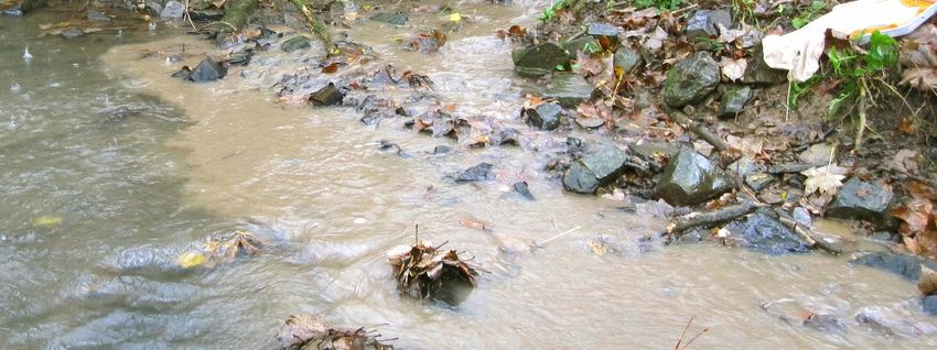
EA National Water Quality Instrumentation Service
                                       The Environment Agency’s National Water Quality Instrumentation
                                        Service (NWQIS) is part of the National Laboratory Service (NLS) and
                                        offers a wide range of high resolution monitoring solutions to Agency
                                        staff, and are now exploring options for hiring out monitoring kit to
                                        Catchment Partnerships. Hand held units provide instant readings of
                                        Conductivity/Salinity, Temperature, pH, Dissolved Oxygen and Ammonium.

                               Continuous monitoring units return
                               data, in real-time to any web
                               enabled device and the following
                               range of parameters are available:
  Hand Held Pro Plus Series
  Sonde                       Conductivity (Derived Salinity),
                             Temperature, pH, Dissolved Oxygen,
Ammonium (Derived Ammonia), Chlorophyll and Turbidity.

Indicative Cost: £££ = High – Med. Available to hire from NWQIS
                                                                                        Real Time Monitoring Unit ESNET
which includes full calibration, tech support and delivery.

Used by: Trent Rivers Trust in partnership with the
Environment Agency and University of Nottingham for
source apportionment of urban pollution in the
Alfreton Brook, Nottinghamshire.

             For more information, contact: -
     Matthew.loewenthal@environment-agency.gov.uk
              June.Jones@environment-agency.gov.uk
                                                                        Real time data output available to any web enabled
                                                                        device

Wet Weather Water Sampling and Lab Analysis
                         Automatic water samplers can be deployed in advance of a heavy rainfall runoff
                         event and can be set to fill a sample bottle at regular intervals –Samples must then
                         be retrieved and couriered rapidly to an accredited laboratory service for analysis,
                         Indicative Cost: £££ = High - Med (If you can hire an auto-sampler, the main cost is
                         the lab analysis – contact Natlabs.co.uk or local university for pricing)
Used by: Bristol Avon Rivers Trust to identify sediment and nutrient pollution load on the By Brook.
http://www.catchmentbasedapproach.org/images/PDFS/BristolAvon/Sediment_and_nutrient_pollution_on
_the_Lid_Brook.pdf
Aire Rivers Trust used volunteers to manually collect samples which were then sent for analysis to Sheffield
University. https://bradfordbeckdotorg.files.wordpress.com/2013/02/bradford-beck-wq-appendix.pdf

         Citizen Science and Volunteer Monitoring Resource Pack 2016   www.catchmentbasedapproach.org              4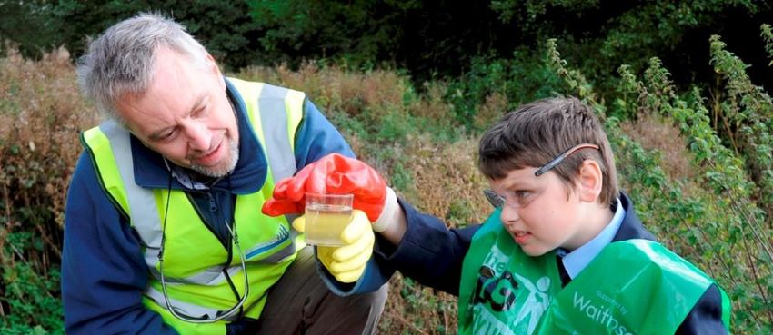
INW Smart Sensor – CT2X
                      Measures conductivity, total dissolved solids, and temperature with optional pressure
                      (depth) and various data logging options including real-time telemetry. Other sensor
                      options available including dissolved oxygen and pH.
                      Indicative Cost: £££ High

                      More info: http://inwusa.com/products/smart-sensors/

Used by: Westcountry Rivers Trust. Contact Simon Browning (simon@wrt.org.uk)

RSHydro Manta 2 Water Quality Sonde
                                   Measures conductivity, temperature, dissolved oxygen, total dissolved
                                   solids, turbidity, pH, phosphate, ammonium, nitrate, depth, level and blue
                                   green algae. Can be used as an unattended logger, spot sampler or wireless
                                   telemetry system with the purchase of additional kit.
                                   Indicative Cost: £££ High (Individual sensors range from ££ to ££££, but
                                   rental options are available)
More info: http://www.rshydro.co.uk/water-quality-monitoring-equipment/water-quality-testing-
equipment/multiparameter-water-quality-sonde/manta-2-multi-parameter-water-quality-sonde/
Used by: Centre for Ecology and Hydrology. Contact Mike Hutchins (mihu@ceh.ac.uk)

Hach DR900 multi-parameter colorimeter
                     Measures phosphate, total suspended solids, turbidity and colour nitrate ammonia, a
                     number of metals and and numerous other parameters, some of which may involve
                     additional equipment.

                     Indicative Cost: £££ High (In the region of £1.3k incl. VAT).

                     More info: http://www.coleparmer.co.uk/Category/Hach_DR_900_Colorimeter/64171

                     Used by: Westcountry Rivers Trust. Contact Simon Browning (simon@wrt.org.uk)

Palintest 7100 multi-parameter Photometer
                            Measures over 50 parameters including phosphate, nitrate, dissolved oxygen,
                            alkalinity, ammonia, calcium hardness, chlorine, nitrate, pH, total hardness and
                            zinc. Tests take ca. 10 minutes
                            Indicative Cost: ££ High (ca £700 + VAT) Reagents required for each parameter
                            measured. (ca. £10 per 50 sachets)
                            More info: http://www.camlab.co.uk/palintest-7100-photometer-p18776.aspx

                            Used by: Trent Rivers Trust. Julie Wozniczka projects@trentriverstrust.org

        Citizen Science and Volunteer Monitoring Resource Pack 2016   www.catchmentbasedapproach.org      5
Lovibond MD 600 Photometer
                                 Portable multi-parameter photometer measuring most key WQ parameters
                                 (120 methods) including phosphate, total suspended solids, turbidity, nitrite,
                                 nitrate, ammonia, a number of metals. AquaLX app for iOS and Android
                                 allows Bluetooth data transfer to mobile devices.
                                 Indicative Cost: ££ Med (ca. £500 for unit, £10-120 per pack for reagents
                                 depending on type – Vacu-vials are more expensive but reduce error)
More info: http://www.delagua.org/products/details/12651-Lovibond-MD600-MaxiDirect-Complete-
Photometer
Used by: Action for the River Kennett (contact Josie.McSherry@delagua.org)

ChemCatcher
                      Passive pesticide, herbicide and pharmaceutical samplers – being developed and
                      trialled by Portsmouth University, Southwest Water and Westcountry Rivers Trust.
                      Indicative Cost: ££ Med for actual disposables and analysis, but £££ = High for setup
                      costs of housing units.
More info: http://wrt.org.uk/project/passive-sampling/            Used by: Westcountry Rivers Trust

Hach Pocket Colorimeter (phosphate and more)
                                     Calibrated for single parameter – most commonly Orthophosphate, but
                                     also available calibrated for dissolved oxygen, nitrate, ammonia, a
                                     number of metals and numerous other parameters. Tests take ca. 10
                                     minutes

                                     Indicative Cost: ££ Med (In the region of £500 for Orthophosphate
                                     unit). Replacement re-agent sachets are £ Low cost.
                                     More info: http://www.hach.com/pocket-colorimeter-ii-
                                     orthophosphate-reactive/product?id=7640442984
Used by: Bristol Avon Rivers Trust and Westcountry Rivers Trust. Simon Browning (simon@wrt.org.uk)

Hach POCKET PRO+ Handheld multiparameter tester
                      Measures temperature, electrical conductivity, pH and total dissolved solids.
                     Indicative Cost: ££ Med (In the region of £200.

                     More info: http://uk.hach.com/pocket-pro-sup-sup-handheld-multi-parameter-tester-
                     2-for-field-analysis/product?id=24929266900&callback=pf
                     Used by: Westcountry Rivers Trust. Simon Browning (simon@wrt.org.uk) says: “I’m
                     very impressed with this device – easy to use and to calibrate, high build quality too.”

        Citizen Science and Volunteer Monitoring Resource Pack 2016   www.catchmentbasedapproach.org       6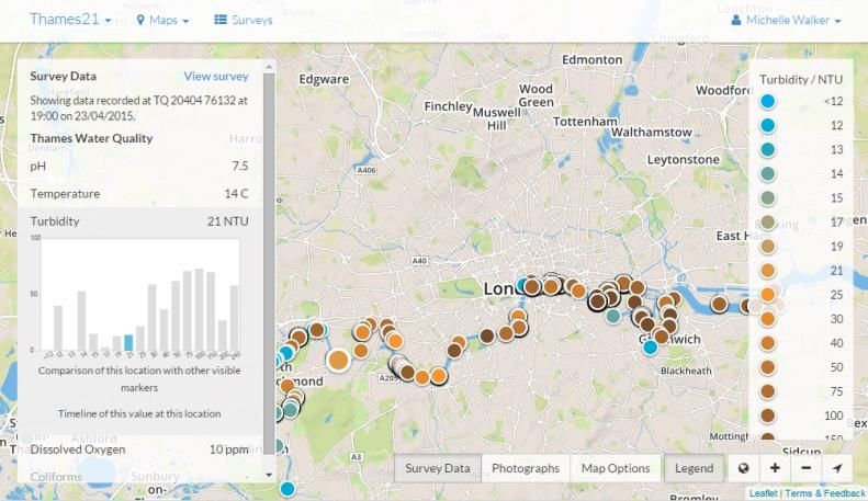
Myron Ultrapen PT5 dissolved oxygen tester
                  Fast and simple to use.
                  Indicative Cost: ££ Med (ca. £250).

                  More info: http://www.camlab.co.uk/myron-l-ultrapen-pt5-dissolved-oxygen-tester-
                  p33525.aspx
                  Used by: Westcountry Rivers Trust. Simon Browning (simon@wrt.org.uk) says: “despite
                  difficulties changing the membrane without trapping air in behind (there seems to be no
                  way to avoid this!) – it does seem to be giving decent results.”

Geopacks Advanced Flowmeter
                  Measures water velocity in units of metres per second or mph and has an inbuilt logger
                  function that allows you to choose between manual logging and auto logging. Readings
                  stored in CSV file that can easily be downloaded to your PC via the mini USB cable
                  provided.
                  Indicative Cost: ££ Med (ca. £200)

                  More info: http://www.mapmarketing.com/geography-resources-fieldwork-
                  equipment/geopacks-advanced-flowmeter_ct302pd224.htm
Used by: Tyne Rivers Trust.

Riverfly Partnership Monitoring Kit
                               Standard size net, trays, bucket, pipettes and guide for invertebrate kick-
                               sampling.
                               Indicative Cost: ££ Med (ca. £100 per kit plus cost of training).

                               More info: http://www.riverflies.org/armi-equipment-list-and-suppliers

                               Used by: Hundreds of riverfly monitors working with dozens of Catchment
                               Partnerships http://www.riverflies.org/england
Suppliers: EFE & GB Nets http://efe-uk.com/product/riverfly-partnership-approved-kit-2

Geopacks Waterproof Probe Thermometer
                       Handheld digital thermometer, waterproof to IP67 (up to 1m).
                       Range -50 - 300 °C; Resolution 0.1 °C; Accuracy ± 0.5 °C.
                       Data hold function and min/max display.
                       Indicative Cost: £ Low (ca. £85)

                       More info: http://www.mapmarketing.com/geography-resources-fieldwork-
                       equipment/ip-67-waterproof-folding-probe-thermometer_ct302pd1072.htm
                       Used by: Tyne Rivers Trust.

        Citizen Science and Volunteer Monitoring Resource Pack 2016   www.catchmentbasedapproach.org         7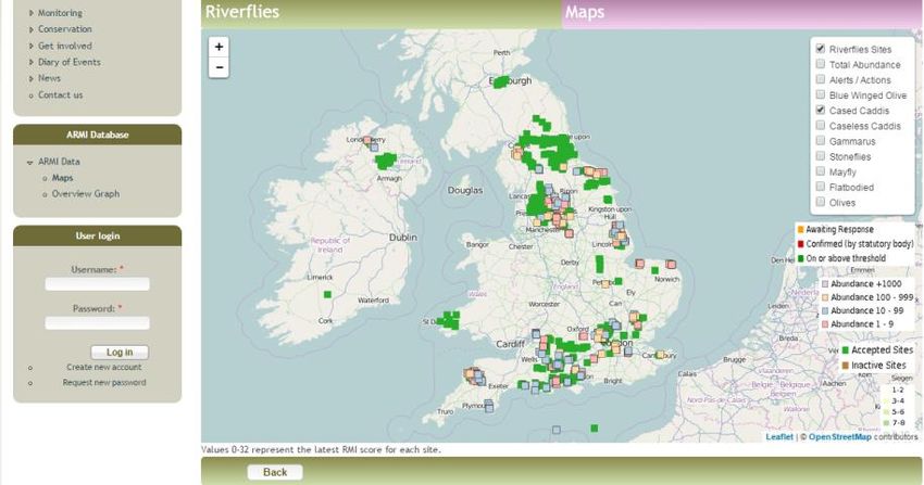
Hanna HI-98300 DIST 1 TDS Tester
              Measures total dissolved solids with simple calibration function.
              Indicative Cost: £ Low (ca. £65) + calibration solution

              More info: http://www.hannainstruments.co.uk/dist-r1-tds-tester.html

              Used by: Tyne Rivers Trust

Hanna HI-713 Phosphate Pocket Checker
                      Measures temperature, electrical conductivity, pH and total dissolved solids.
                      Indicative Cost: £ Low (ca. £50 + VAT, reagent packs ca. £10 + VAT for 25).

                      More info: http://www.hannainstruments.co.uk/pocket-checker-for-phosphate-
                      testing.html http://www.advancedaquarist.com/2011/8/review
                      Used by: Waterside Care (Contact lee.copplestone@keepbritaintidy.org) and
                     Westcountry Rivers Trust. Simon Browning (simon@wrt.org.uk) says: “I have taken it
out alongside the Hach DR900 – results were generally comparable. It is a little more fiddly as the reagent
powder seems finer (more easily wind-blown!) and the aperture in the test vial is smaller.”

Omega PHH-5012 pH Tester
              Handheld digital pH meter.
              Range 0-14 pH; Resolution 0.02 pH; Accuracy ± 0.01 pH at 25 °C
              Indicative Cost: £ Low (ca. £30)
              More info: http://www.omega.co.uk/pptst/CDH5021.html
              Used by: Tyne Rivers Trust.

HM Digital EC-3 (EC) Conductivity Meter
             Handheld digital conductivity meter with built in thermometer.
             Indicative Cost: £ Low (ca. £20)
             More info: https://www.amazon.co.uk/HM-Digital-EC-3-Conductivity-
             Testing/dp/B007GP70UU
             Used by: Tyne Rivers Trust.

Lovibond CheckIt comparator
                            Portable colorimetric unit with continuous colour scales for more accurate visual
                            assessment of a range of parameters, including phosphate, ammonia, pH,
                            aluminium, iron and copper.
                            Indicative Cost: £ Low (ca. £40-60 for compactor + discs + 30 reagents)

                            More info: http://dl.lovibond.com/cat/en/cat_checkitcomparator_pool.pdf

Used by: Action for the River Kennett (contact Josie.McSherry@delagua.org)

        Citizen Science and Volunteer Monitoring Resource Pack 2016   www.catchmentbasedapproach.org     8
JBL O2 Oxygen Test Set
Simple test for oxygen levels using liquid drops and colour charts for visual assessment.
Indicative Cost: £ Low (ca. £15 for 50 tests).
More info: http://charterhouse-aquatics.com/shop/aquatics/aquarium-maintenance/jbl-test-
kits/jbl-o2-oxygen-test-set
Used By: Thames21 (Thames River Watch).
LaMotte Total Coliform Test Kit
Simple test for presence/absence of coliform bacteria. Requires incubation at
room temperature for 48 hours.
Indicative Cost: £ Low (£60 for 44 tests).
More info: http://www.lamotte.com/en/education/water-
monitoring/5850.html
Used By: Thames21 (Thames River Watch).
Suppliers: LaMotte Europe – tel . 01926 498 203
Kyoritsu Chemical Kits (Phosphorus and Nitrate)
The phosphate test takes 5 minutes and measures phosphate in the range
of 0.02 to 1 mg/l; the nitrate test takes 3 minutes and has a range of 0.2
to 10 mg/l. These kits work well for multiple volunteers across multiple
sites.
FreshWaterWatch use these in their WQ monitoring kits. However, these
are only available to members of the FreshWater Watch platform, which
includes a full water quality testing method and kit, training, an online
platform and app and support for community groups to explore scientific problems and protect their local
waters. If you would like to know more you can visit the FreshWater Watch website for the latest
information. https://freshwaterwatch.thewaterhub.org/
Freshwater Habitats Trust have undertaken extensive lab testing of their effectiveness – and you can find
more details at https://freshwaterhabitats.org.uk/wp-
content/uploads/2015/10/CWfWTechnicalDocumentFINAL.pdf .
Indicative Cost: £ Low (ca. £1 per single use test when purchased in bulk).
Used By: FreshWaterWatch, River Thame Conservation Trust, Wild Oxfordshire, Totally Thames Blitz,
Freshwater Habitats Trust.
Suppliers: Kyoritsu https://en.kyoritsu-lab.co.jp/
Citizen Science and Volunteer Monitoring Resource Pack 2016 www.catchmentbasedapproach.org 9LaMotte TesTabs (Phosphate, Nitrate, Ph, DO + more)
Quick and simple dip tests for Phosphate, Nitrate, Ammonia, pH, Dissolved Oxygen/BOD
and several other metals and parameters. These low cost tests are suitable for multiple
volunteers across multiple sites. LaMotte are keen to support citizen science in the UK as
they do in the USA so do contact them for more info.
Indicative Cost: £ Low (Water Quality Monitoring Project Inventory
Thames21 and Keep Britain Tidy have kindly provided an inventory of equipment used on their Thames
River Watch, Love the Lea and Waterside Care projects with contact details for more information.
Project Name & Organisation Contact
WatersideCare Lee Copplestone, WatersideCare Project Officer
(Keep Britain Tidy) lee.copplestone@keepbritaintidy.org
http://www.keepbritaintidy.org/watersidecare/689 07918 616907
Thames River Watch Alice Hall, Thames River Watch Programmes Coordinator
(Thames21) alice.hall@thames21.org.uk
www.thames21.org.uk/project/thames-river-watch/ 07554402772
Love the Lea Elle Von Benzon, Salmons Brook Healthy River Challenge Project
(Thames21) Manager
www.thames21.org.uk/project/lovethelea/ info@thames21.org.uk
020 7248 7171
Water Quality Monitoring Supplies
Cost per Information
Parameter Product name Product Code Supplier
test provided by
Ammonia Ammonia test strip packs 27553-25 Hach Lange £10.60 WatersideCare
lollipop thermometer FB502605 11785853 Metlab Supplies Ltd £24.65 ex WatersideCare
vat
Temperature
Low Toxicity Laboratory Thermometer 069309 Consortium £2.69 Thames River
- 155mm each Watch
4.5-10ph range test strip packs (100) FB33011 Metlab Supplies Ltd £12.65 WatersideCare
Hanna HI-009 (III) Pocket pH/Temp Digital Meters (but £34.00 ex WatersideCare
meter no longer listed) vat
pH
JBL pH 3.0 - 10.0 Test Set Charterhouse £0.11 Thames River
Aquatics Watch
pH TesTabs LM6459A-J LaMotte £0.29 Love the Lea
JBL O2 Oxygen Test Set Charterhouse £0.28 Thames River
Aquatics Watch
Dissolved
EZ DO Dissolved Oxygen meter 7031 Electronic Healing £149.00 WatersideCare
Oxygen
kit (currently offline inc vat
May 2016)
tube 52.6mmID x 443mm long and CTR52.6G443TTH MOCAP £1.89 Thames River
poly plug to fit 52.6mmID, natural N and Watch
IPP52.6CRN
Turbidity
4.5cm circular matt vinyl Secchi sticker Diginate £1.44 Thames River
and 2cmx49cm clear vinyl stickers for Watch
side of tube
Coliform Total Coliform Test Kit - Recreational 5850 LaMotte £2.59 Thames River
bacteria Water Watch
Phosphate TesTabs LM5422A-J LaMotte £0.33 Love the Lea
Hanna HI-713 Phosphate Pocket Hanna £49.85 ex WatersideCare
Phosphate Checker vat
Hanna HI-713-25 reagent Hanna £9.50 ex WatersideCare
vat
Nitrate 1 and Nitrate 2 TesTabs LM2799A-J and LaMotte £0.48 Love the Lea
Nitrate
LM3703A-J
Citizen Science and Volunteer Monitoring Resource Pack 2016 www.catchmentbasedapproach.org 11Health and Safety and Ancillary Supplies
Product name Product code Supplier Cost per Information
Other
unit provided by
materials
www.FirstAid4Less.c £6.45 per
Marigolds Gloves (Pack of 12) FL0480 o.uk pack WatersideCare
Marigold G25B Blue Nitrile Gloves –
Gloves
Large 1442100 Arco WatersideCare
Thames River
Nitrile gloves 1490000 Arco £0.14 Watch
Uvex i-vo Safety Spectacles – clear
Safety lenses 3U0100 Arco WatersideCare
glasses
Montana Safety Glasses, clear lens Tudor Environmental £3.37 WatersideCare
Lewis Medical
12 pack of eyewash tubes Supplies WatersideCare
Eye wash
www.FirstAid4Less.c £4.75 per
Sterile Eyewash Pods 20ml(packs of 25) o.uk pack WatersideCare
Sampling 1.2m standard sampling poles (standard
poles handles) HO1 EM Supplies £16.00 WatersideCare
polythene containers – 500ml HP02 EM Supplies £20.00 WatersideCare
pack of 10 specimen containers – 200ml
Sampling jars snap lid Azlon Pack 10 Metlab Supplies Ltd £23.44 WatersideCare
Thames River
500ml wide neck heavy duty bottle 10370025 Fisher Scientific £2.96 Watch
Robert Dyas and
Toolboxes Stanley 16 Wickes £6.99 WatersideCare
Containers £7.00 +
for test kits Toolboxes Stanley 16 (offer) Halfords vat WatersideCare
Thames River
Carp Rig System 564 Sporting Wholesale £6.12 Watch
Handgel pump bottle 500ml Tudor Environmental £4.85 WatersideCare
Thames River
Pipette
3ml Pipette 350110 Consortium £0.04 Watch
Thames River
Stopwatch
Value stopwatch 012413 Consortium £3.74 Watch
Thames River
Test tube
Square plastic 10ml test tube with cap LM0106 Lamotte £4.54 Watch
Suppliers
Supplier name Phone Email Website
Arco www.arco.co.uk
Charterhouse Aquatics 0870 850 6138 www.charterhouse-aquatics.co.uk/home
Consortium 0845 330 7780 www.educationsupplies.co.uk
Diginate sales@diginate.com
Digital Meters www.digital-meters.com
Electronic Healing *Currently offline May 2016* www.electronichealing.co.uk
EM Supplies 01300 348088 Emsuk@aol.com
Fisher Scientific 01509 2311166 fsuk.sales@thermofisher.com
Hach Lange 0161 872 1487 Darren.Metcalfe@hach-lange.co.uk
Hanna www.hannainstruments.co.uk
Lamotte 01926 498 203 t.schofield@lamotte-europe.com www.lamotte.com/en/
Lewis Medical Supplies 0161 480 6797
Metlab Supplies Ltd 01244 526300 www.metlab.co.uk/
MOCAP 01952 670 247 sales@mocap.co.uk
Sporting Wholesale 0845 124 2929 www.sportingwholesale.com
Tudor Environmental www.tudorenvironmental.co.uk
FirstAid4Less www.FirstAid4Less.co.uk
Citizen Science and Volunteer Monitoring Resource Pack 2016 www.catchmentbasedapproach.org 12Mobile Apps and Maps
for Catchment Data Capture
This review has been prepared by members of the CaBA support team to help CaBA partnerships identify
and use mobile apps and maps which are most suited to capturing data and evidence related to catchment
management. We’ve included web links for the apps and maps; a summary of what the app or map can be
used to record; the intended audience; details of the platforms and formats; online demonstration videos
or tutorials if available; information about customisation and updates; how to access the collected data and
links to the developer or provider of the app for more information.
If you are thinking about embarking on app development do contact us as we may be able to put you in
touch with someone who is working on the same thing: info@catchmentbasedapproach.org
INDEX Crowd Sourcing Apps…
PlantTracker 14
RiverObstacles 15
AquaInvaders 16
FreshWaterWatch 17
Self-Customisable Apps…
ESRI Collector 18
Snap2Map 19
WildKnowledge 20
EpiCollect+ / RiverEYE 21
FieldTrip GB 22
Bespoke Apps…
WiseCAM 23
Cartographer 24
RiverRecorder 25
Riverfly Partnership 26
Natural Access 27
Others to Consider…
PDF Maps 28
Indicia / iRecord 28
Fieldscope 28
Defra Field Toolkit 28
Water Science Monitor 28
World Water Monitoring Challenge 28
Hard Copy ID Guides 28
Citizen Science and Volunteer Monitoring Resource Pack 2016 www.catchmentbasedapproach.org 13Mobile app and web map for crowd-sourcing information on invasive non-native plant species. Version 2
now released and over 15,000 records submitted since 2012.
Theme: Invasive non-native plant species
Mobile: Coming Soon
Web App: planttracker.org.uk
Demo: youtu.be/94mOQbtw5VI
End User Interface: Aimed at general public as well as specialists.
Users are now asked for their level of experience before submitting
records. Identification guide includes photos, typical habitat,
impacts and spread and users can toggle the option to view
confusion species. This version now collects additional information
on any treatment which has been applied and also allows submission
of Himalayan Balsam Rust fungus spread.
Database and Verification: Data are held in iRecord – the Biological Record Centre’s system which is
built on the Indicia platform. Records are verified by the project partners (SEPA, Environment Agency and
Nature Locator) and then published. Anyone can view the map of verified reports.
Data Access: Once verified, data are auto-uploaded to the National Biodiversity Network Gateway
data.nbn.org.uk. Users with a registered account can download the data here:
data.nbn.org.uk/Datasets/GA001172 (n.b. you need to be logged in to see the Download Dataset link at the
bottom of this screen). You can also access information on management and treatment programmes at
nonnativespecies.org
Customisation and Updates: The app is not customisable (developer can be contacted below for
information on future releases or for bespoke applications.) Future updates and improvements will depend
on availability of funding but the app is well used and has already had several updates.
CaBA Partners Also Use: River Recorder and ESRI Collector are used by some groups who prefer to verify
records locally. Some Scottish rivers trusts use a system developed by ExeGesIS for accurate mapping of
vegetation stands and monitoring management and treatment response.
Developer: naturelocator.org
In partnership with:
Citizen Science and Volunteer Monitoring Resource Pack 2016 www.catchmentbasedapproach.org 14Mobile app and web map for crowd-sourcing information on natural and man-made barriers to fish
migration such as weirs, sluices, culverts, waterfalls, fallen trees, etc.
Theme: Barriers to fish migration and in-river obstacles
Mobile:
Web App: www.river-obstacles.org.uk
Demo: youtu.be/94mOQbtw5VI
End User Interface: Aimed at anglers and hill
walkers as well as specialists such as river and
fisheries trusts. Users are taken through the
assessment step-by-step and can record type
and size of obstacle, location and photo and
also provide an assessment of passability to
different fish species if known. ID guides
included.
Database and Verification: Data are held in iRecord – the Biological Record Centre’s system which is
built on Indicia. Records are verified by the project partners (SEPA, Environment Agency and Nature
Locator) and manually checked against existing obstacles datasets. Currently the system only allows
submission of new records not editing of existing ones so some work is required to cross-reference
datasets.
Data Access: Organisations who wish to download the information can request an account and are able to
download records from the web app.
Customisation and Updates: The app is not customisable (developer can be contacted below for
information on future releases or for bespoke applications.) Future updates and improvements will depend
on availability of funding.
CaBA Partners Also Use: ESRI Collector and simple PDF or paper maps have been used in the past but
the app has only recently been released so is yet to become widely adopted and tested.
Developer: naturelocator.org
In partnership with:
Citizen Science and Volunteer Monitoring Resource Pack 2016 www.catchmentbasedapproach.org 15aquainvaders
Mobile app and web map for reporting and tracking invasive non-native aquatic species.
Theme: Invasive non-native aquatic species
Mobile:
Web App: www.brc.ac.uk/aquainvaders
Demo: youtu.be/94mOQbtw5VI
End User Interface: Aimed at anglers, divers and recreational
water users as well as specialists. Identification guide includes
photos, typical habitat, spread, and confusion species. The app
covers 12 species of fish, 5 species of crayfish, 4 species of
amphibian as well as Killer Shrimp, Zebra Mussel and Mink.
Database and Verification: Data are held in iRecord – the Biological Record Centre’s system which is
build on the Indicia platform. Records are verified by the project partners before publication. Anyone can
browse the published records via the website. Currently the system only allows submission of new records
not editing of existing ones so some work is required to cross-reference datasets.
Data Access: Once verified, data are auto-uploaded to the National Biodiversity Network Gateway
data.nbn.org.uk. Users with a registered account can access the data here:
data.nbn.org.uk/Datasets/GA001353 (n.b. you need to be logged in to see the Download Dataset link at the
bottom of this screen).
Customisation and Updates: The app is not customisable but the developer can be contacted below for
information on future releases or for bespoke applications. Low levels of usage so the app hasn’t yet been
updated.
CaBA Partners Also Use: No known alternatives for aquatic invasives.
Developer: naturelocator.org
In partnership with:
Citizen Science and Volunteer Monitoring Resource Pack 2016 www.catchmentbasedapproach.org 16Mobile app for the global EarthWatch programme collecting freshwater quality data
Theme: Water quality
Mobile:
Web App: freshwaterwatch.thewaterhub.org
Demo: youtu.be/IgVIw5ISxGc
End User Interface:
Aimed at a global audience, users sign up on the
web app and are taken through a training video,
followed by a quiz to test their understanding
before they can order water quality testing
equipment. EarthWatch are currently developing
various bespoke options for CaBA partners,
including customised web apps with local partner
logos and volunteer management. The app asks users to login and then enter information on waterbody
type, location, photo, landuse, pollution, flow regime, water colour and water quality readings taken with
the sampling kit (Nitrate, Phosphate and Turbidity). Additional parameters and information will be
available in future versions of the app which is being developed with various CaBA partners.
Database and Verification: Data are held in an online system which allows users to view their results
and those from other users. FreshWaterWatch have a network of scientific partners who provide feedback
on what the water quality results mean and ask for double-checking if anything looks strange. The website
allows users to blog about their results and others, and the whole programme encourages users to engage
with each other and learn what their results mean in a wider regional, national and global context.
Data Access: There are a number of scientists who have partnered with EarthWatch to access the
FreshWaterWatch data for their own research programmes and EarthWatch are keen to widen this
network. To discuss your requirements for using the datasets, contact EarthWatch
Customisation and Updates: The app as it is published is not user-customisable, but EarthWatch and
Wild Knowledge are keen to work with anyone who would like to develop a bespoke local programme on
the FreshWaterWatch platform.
CaBA Partners Also Use: ESRI Collector, WiseCAM.
Developers: wildknowledge.co.uk eu.earthwatch.org
Supported by:
Citizen Science and Volunteer Monitoring Resource Pack 2016 www.catchmentbasedapproach.org 17Collector for ArcGIS and ArcGIS Online
Customisable platform for mobile and web data capture which can be integrated with ArcGIS Desktop. Ideal
for staff or trusted volunteer networks to collect and report data, but not ideally suited to crowd-sourcing
because the app must be connected to an ESRI account. Requires an ESRI ArcGIS Desktop license.
Theme: Can collect any type of spatial data and photos
Mobile:
Web App: www.arcgis.com
Demo: youtu.be/UUcJjPzE7mU
End User Interface: The Collector App can be
downloaded for free but must be connected to an
ArcGIS Online account in order to capture and
upload data. Therefore, this app is best suited for
use with networks of trusted volunteers or staff
who you can share your ESRI login credentials with.
Database and Verification: Data are stored in the ESRI cloud (or you can upload to your own ArcGIS
Server if you have one). An ArcGIS Online Subscription is required – this is available free with an ArcGIS
Desktop Non-Profit license (which currently costs around £100 +vat per year).
Data Access: It is easy to share mapped information with partners via ArcGIS Online as an interactive map
or a GIS file which can be downloaded.
Customisation and Updates: Maps and data collection forms are entirely customisable via ArcGIS
Desktop or ArcGIS Online and online training and videos are available. App is published by ESRI and is
maintained and regularly updated.
CaBA Partners Also Use: ESRI Snap2Map, Snap2Data and Survey123 can also be used to collect data
and publish photos to an ArcGIS Online map.
Developer: www.esri.com/software/arcgis/collector-for-arcgis
Used by:
Citizen Science and Volunteer Monitoring Resource Pack 2016 www.catchmentbasedapproach.org 18Snap2Map and ArcGIS Online
Simple app for publishing photos taken on smart phone as an ESRI Story Map. Ideal for staff or trusted
volunteer networks to collect and share photos on a map, but not ideally suited to crowd-sourcing because
the app must be connected to an ESRI account. Requires an ESRI ArcGIS Online subscription.
Theme: Publishing photos on a map
Mobile:
Web App: www.arcgis.com
Tutorial: youtu.be/UUcJjPzE7mU
Example output: http://arcg.is/1TjfvxM
End User Interface: The Snap2Map App can be
downloaded for free but must be connected to an
ArcGIS Online account in order to capture and upload
photos to a Story Map. Therefore, this app is best
suited for use with networks of trusted volunteers or
staff who you can share your ESRI login credentials with.
Database and Verification: Data are stored in the ESRI cloud (or you can upload to your own ArcGIS
Server if you have one). An ArcGIS Online Subscription is required – this is available free with an ArcGIS
Desktop Non-Profit license (which currently costs around £100 +vat per year).
Data Access: It is easy to share mapped information with partners via ArcGIS Online as an interactive map
or a GIS file which can be downloaded.
Customisation and Updates: Maps and data collection forms are entirely customisable via ArcGIS
Desktop or ArcGIS Online and online training and videos are available. App is published by ESRI and is
maintained and regularly updated.
CaBA Partners Also Use: ESRI Collector app can also be used to publish photos to a map. WildMap from
WildKnowledge can be used to create a map-based audio-tour with photos, text and interactive content.
Developer:
https://marketplace.arcgis.com/listing.html?id=54b4a00a132b4583bd24c37d1c947e1e
Used by:
Citizen Science and Volunteer Monitoring Resource Pack 2016 www.catchmentbasedapproach.org 19A set of user-customisable apps which can be used to support citizen science, education and public
engagement. The apps include WildKey (for producing decision tree ID guides) and WildForm (for data
gathering). In addition, WildMap and WildImage are customisable interactive multi-media visitor guides.
Below we focus on WildForms but you can find out about the other apps at the Wild Knowledge website. Also
see the FreshWaterWatch app review for an example of a bespoke system developed on the WildForms
platform.
Theme: Customisable to collect and show any kind of spatial data
Mobile:
Web App: wildknowledge.co.uk
Demo: youtu.be/IgVIw5ISxGc
End User Interface: The WildForm app can be downloaded
for free and must be connected to a WildKnowledge account
in order to upload data. Administrators can test the forms
before publication to ensure that the labels and functions
work well. Forms with up to three fields can be published for
free.
Database and Verification: Data are stored in an online
database which is accessible to the administrator (publisher)
of the form to allow data verification.
Data Access: Data can be downloaded as CSV file and captured photos can be automatically uploaded to a
Flickr account. Data can also be mapped within the web app using Google Maps.
Customisation and Updates: The free account allows you to publish forms with up to three customised
fields. For additional fields you need a subscription account (contact WildKnowledge for pricing). The
developer can also create fully customised and branded apps and/or websites.
CaBA Partners Also Use: ESRI Collector and Snap2Map.
Developer: wildknowledge.co.uk
Used by:
Citizen Science and Volunteer Monitoring Resource Pack 2016 www.catchmentbasedapproach.org 20RiverEYE
RiverEYE is a trial application by Sarah Taigel (University of East Anglia) built on the open source EpiCollect+
platform by Imperial College. RiverEYE has been trialled by River Waveney Trust volunteers to collect
information on different issues within the Waveney catchment.
Theme: River Issues (EpiCollect is customisable to collect and show any kind of spatial data)
Mobile:
Web App: epicollectserver.appspot.com
Demo: youtu.be/yzLvgA1A1ms
Example Output:
http://plus.epicollect.net/RiverEYE2/RiverEYEReport
End User Interface: The EpiCollect+ app can be downloaded for
free and users then search for a project (e.g. RiverEYE2) in order to
use the customised form to upload data. The project administrator
develops the form using the EpiCollect web interface. Forms can
be published for free.
Database and Verification: Data are stored in an online database which is accessible to the
administrator (publisher) of the form to allow data verification.
Data Access: Data can be downloaded as CSV file or displayed on a map within the web interface.
EpiCollect can also make data available as web services (REST) for integration with other web mapping
apps.
Customisation and Updates: The EpiCollect platform is open source, which means that anyone can use
and adapt the code. To use or develop the RiverEYE project on the app, contact Sarah Taigel.
CaBA Partners Also Use: ESRI Collector and Snap2Map for recording river issues.
Developer: www.epicollect.net futurelandscapes.wordpress.com
Used by:
Citizen Science and Volunteer Monitoring Resource Pack 2016 www.catchmentbasedapproach.org 21FieldTrip GB is a mobile mapping and data capture app designed to support educational field trips and
citizen science projects. The app has been developed by EDINA at the University of Edinburgh.
Theme: Entirely user customisable
Mobile:
Web App: fieldtripgb.edina.ac.uk/authoring/
End User Interface:
The FieldTrip GB app uses open source data to provide a
detailed basemap (including rights of way) which can be
downloaded to the app for offline use. Users can capture
images, notes, audio recordings and GPS trails straight away
without even connecting to a database. Users are required to
login via a Dropbox account in order to upload data, and access
bespoke forms for data entry.
Database and Verification:
Data are stored in Dropbox so users require a Dropbox account
(available free of charge). The authoring website allows records to be reviewed, downloaded and managed.
Data Access:
Data can be downloaded as CSV, KML or GeoJSON formats, or displayed on a table or map within the web
interface.
Customisation and Updates: Contact EDINA
CaBA Partners Also Use: EpiCollect, ESRI Collector and Snap2Map
Developer: edina.ac.uk/
Project partners:
Citizen Science and Volunteer Monitoring Resource Pack 2016 www.catchmentbasedapproach.org 22Wireless Sensing Mobile app and web map for gathering water quality data, primarily from remote wireless
sensors but also manual measurements.
Theme: Water Quality and Physical Chemistry
Mobile:
Web App: www.wisecam.co.uk
End User Interface: Aimed at rivers trusts and
universities who are collecting water quality and
physical chemistry data on a regular basis. The
app was primarily developed to collect wireless
sensor data but users can also choose to input
manual water quality readings and download
these from the website afterwards. Form has
been designed to collect water quality (NO3-,
PO43-, NH4+, turbidity) and physical (EC, T and P)
measurements.
Database and Verification: Data are held in an online database hosted by the developer and currently
accessible by the University of Cardiff, University of Bristol and Westcountry Rivers Trust.
Data Access: Organisations who wish to download the information can request an account and are able to
download records from the website.
Customisation and Updates: The system is currently being trialled and developed as part of a wider
wireless sensing research programme. Future developments may include an online map or iPhone version -
contact the developer for more information.
CaBA Partners Also Use: ESRI Collector and FreshWaterWatch.
Developer: naturelocator.org
In partnership with:
Citizen Science and Volunteer Monitoring Resource Pack 2016 www.catchmentbasedapproach.org 23Cartographer
Web-based data management system for entering, managing and displaying environmental data.
Cartographer was developed to manage data for the Urban River Survey and has now been adapted to
allow Thames21’s Thames River Watch volunteers to enter water quality data and query the results.
Theme: Physical River Quality and Water Quality, but could be adapted to suit any kind of survey
Web App: https://cartographer.io/
Demo: youtu.be/4ZYCtEctvJ4
Example Output: http://www.thames21.org.uk/thames-river-watch-water-quality
http://urbanriversurvey.org/
End User Interface: Cartographer is an
integrated system for crowd sourcing data, with
web entry forms for volunteers to submit records,
a management interface for verifying and
analysing data and managing volunteers, and a
public map interface to share the results. There is
no mobile app but volunteers can enter data via
the web form on a smart phone web browser
provided they have an internet connection.
Database and Verification: Data are held in an
online database hosted by the developer and accessible by the partner organisations and their volunteer
surveyors. Verification is undertaken by the partner organisations.
Data Access: Partner organisations and their volunteers are able to download records from the website.
Anyone can view the data via the output web maps.
Customisation and Updates: The system would need customisation for rolling out to other partners –
contact the developer for more information about options and costs.
CaBA Partners Also Use: ArcGIS Online and FreshWaterWatch.
Developer: untyped.com
Used by: Thames21 and Westcountry Rivers Trust are developing customised versions for managing data
Citizen Science and Volunteer Monitoring Resource Pack 2016 www.catchmentbasedapproach.org 24App and web based data management system developed by Norfolk Rivers Trust but customisable for any
other catchment.
Theme: River issues, wildlife, invasive species
Mobile:
Web App: norfolkriverstrustapp.org
End User Interface:
Developed by Norfolk Rivers Trust for use by their
volunteers to report wildlife sightings and river issues
such as diffuse or point source pollution and invasive
species. Users first select a username and enter an
email address to register. Then they select a named
river then a type of event and sub-category. There
are ID guides for species and issues, and users can
upload a photo.
Database and Verification:
Data are held in an online database hosted by the developer and currently accessible by Norfolk Rivers
Trust who then verify the data. This web interface could be customised to allow access to different
organisations.
Data Access:
Anyone can view the data on the website but only the administrator can download the data. Invasive
species data are automatically uploaded to the NBN Gateway.
Customisation and Updates:
The system is being offered to others to develop and use at cost – contact Norfolk Rivers Trust for more
information.
CaBA Partners Also Use: ESRI Collector, PlantTracker, AquaInvaders, FreshWaterWatch.
Developer: www.norfolkriverstrust.org
In partnership with:
Citizen Science and Volunteer Monitoring Resource Pack 2016 www.catchmentbasedapproach.org 25Riverfly Partnership WebMap
Web-based data management system for entering, managing and displaying Riverfly Partnership
invertebrate survey results.
Theme: Invertebrate monitoring
Web App: www.riverflies.org/riverflies-gis-home
End User Interface: The Riverfly
Partnership system is accessible to
volunteers registered with the scheme.
Volunteers can enter their latest survey
results and view them alongside other
national results. Environment Agency
staff can set and adjust trigger levels for
survey sites and partner organisations can
add new users and sites.
Database and Verification:
Data are held in an online database hosted by the developer and accessible by the partner organisations
and their volunteer surveyors. Verification is undertaken by the partner organisations.
Data Access:
Partner organisations and their volunteers are able to download records from the website. Anyone can
view the data via the output web maps.
Customisation and Updates:
The system will be maintained and updated by the Riverfly Partnership.
CaBA Partners Also Use: Natural Access, Google Maps.
Developer: www.fba.org.uk
Project partners:
Citizen Science and Volunteer Monitoring Resource Pack 2016 www.catchmentbasedapproach.org 26Research Data Management
Web-based data management system for entering, managing and displaying environmental data. Natural
Access web platform is a standardised framework for research data management that has been customised
for Action for the River Kennet (ARK) to manage riverfly survey data.
Theme: Invertebrate monitoring (but customisable to any data theme)
Web App: www.naturalaccess.org.uk
End User Interface: The ARK Research Data Management System is
accessible to volunteers registered with Natural Access. Volunteers
can enter their latest survey results and data can then be graphically
viewed on-line.
Database and Verification:
Data are held in an online database hosted by the developer and are
accessible by approved users. Verification is undertaken by
approved validators. A wide range of administration functions are
made available to ARK to manage the system and research data.
Data Access:
Approved users are able to download records from the website.
Data are also available as an offline Excel workbook, updated
regularly.
Customisation and Updates:
Contact the developer for more information.
CaBA Partners Also Use: Riverfly Partnership WebMap, Google Maps.
Developer: www.naturalaccess.org.uk
Used by:
Citizen Science and Volunteer Monitoring Resource Pack 2016 www.catchmentbasedapproach.org 27Others to Consider….
PDF Maps – Wyre Rivers Trust demonstrate how they use the annotation feature of Adobe to
annotate PDF maps as a simple solution to capturing line and polygon data in the field:
https://youtu.be/C48Br8HRrlI
Indicia / iRecord – Open source biological recording toolkit developed by OPAL and the
Biological Records Centre http://www.indicia.org.uk/
Fieldscope – national geographic Citizen Science Mapping toolkit
http://education.nationalgeographic.com/programs/fieldscope/
Defra Field Toolkit – developed by ADAS and CEH for ecological targeting of agricultural diffuse
pollution mitigation measures, including a mobile mapping and data capture element. Contact ADAS for
more information.
Water Science Monitor – Water quality education app from the Concord Consortium in the
USA https://concord.org/water-science/app
World Water Monitoring Challenge – App for android devices and web, to support an
international education and outreach program that builds public awareness and involvement in protecting
water resources around the world by engaging citizens to conduct basic monitoring of their local water
bodies. http://app.monitorwater.org/
Hard Copy Identification Guides
Opal (Open Air Laboratory) http://www.opalexplorenature.org/
Field Studies Council http://www.field-studies-council.org/publications.aspx
GateKeeper http://www.gatekeeperel.co.uk/
Citizen Science and Volunteer Monitoring Resource Pack 2016 www.catchmentbasedapproach.org 28Case Studies
Some examples from Catchment Partnerships using volunteer monitoring to inform their
evidence base. See these and more as we continue to update them on the CaBA website:
http://www.catchmentbasedapproach.org/best-practice
If you’d like to submit a case study, contact info@catchmentbasedapproach.org or
download the project template on the CaBA forum:
http://www.catchmentbasedapproach.org/discussions/submitting-best-practice-case-
studies
INDEX
Anglers Barrier Assessment 30
Citizen Crane 31
Haltwhistle Burn 32
Love the Lea 33
POLLCURB 34
Pollution Tracing Walkover Surveys 35
The River Starts Here! 36
Developing a Riverfly Hub 37
Riverfly Partnership 38
RiverSearch 39
Shining a Light on Urban Pollution 40
Thames River Watch 41
Totally Thames Water Blitz 42
Urban Pollution Monitoring 43
WatersideCare & RiverCare 44
Citizen Science and Volunteer Monitoring Resource Pack 2016 www.catchmentbasedapproach.org 29Anglers Barrier Assessments
Ribble Rivers Trust
Ribble Rivers Trust is working with anglers to identify barriers to fish passage. This
is helping to improve volunteer and catchment partnership knowledge.
Barriers to fish migration are a significant management
By surveying weirs with anglers the trust hope to raise
issue within the River Ribble catchment, and not just for
awareness and knowledge with anglers of the impacts
fish! After collating several data sets Ribble Rivers Trust
of weirs, whilst collecting vital information that allows
have identified 1000+ barriers to migration. But what
more accurate prioritisation of which barriers to
is classed as a barrier to migration? Ribble Rivers Trust’s
address. The project is in its initial stages, and the trust
definition is ANYTHING that delays or hinders fish
plan to use the River Obstacles app (jointly developed
migration, adding (Artificially).
by Environment Agency, SEPA, RAFTS and Nature
For many if a “fish can get over it at certain flows” it is Locator), alongside some in house training to achieve
not seen as a barrier, several of Ribble Rivers Trust’s this.
investigation projects have shown that even the
http://www.ribbletrust.org.uk
smallest of obstacles can be problematic, but they often
don’t get the attention they deserve as they are not
http://www.river-obstacles.org.uk
seen as a priority.
Citizen Science and Volunteer Monitoring Resource Pack 2016 www.catchmentbasedapproach.org 30Citizen Crane
FORCE, Zoological Society of London
and Frog Environmental
(through the Crane Valley Partnership)
A citizen science project on a small west London river combining Riverfly
Monitoring Initiative, phosphorus and outfall monitoring.
The Citizen Crane project combines RMI surveys of understanding of water quality issues, help identify and
invertebrate health with water quality monitoring for reduce pollution problems, and create a volunteer led
phosphate levels and loadings. A pilot study for outfall network of river monitoring teams to provide local
monitoring has recently been added to the mix. community inputs for wider improvement initiatives.
Volunteer teams continue to monitor twelve sites on a
The River Crane is a small urban catchment in west monthly basis.
London, covering around 120 sq km and running for
around 30km from Harrow in NW London to its A steering group including Thames Water, Environment
confluence with the Thames in Isleworth. The river has Agency and Crane Valley partnership links the project
great potential as an urban green corridor for the half into the main decision making bodies in the catchment.
million people living within 10 minutes’ walk but it has
also been subject to two major fish kills in the last five A report on the findings of the first year of monitoring,
years and ongoing chronic pollution. It is classed as presenting and analysing the data and highlighting the
poor under WFD criteria and one of the main causes is issues and benefits arising from the programme, has
high levels of phosphate. recently been published on the web-site.
Citizen Crane started on the ground in April 2014 http://www.cranevalley.org.uk/projects/
following an initial feasibility study. Its purpose has citizen-crane.html
been to develop an improved spatial and temporal
Citizen Science and Volunteer Monitoring Resource Pack 2016 www.catchmentbasedapproach.org 31Haltwhistle Burn Citizen Science
Newcastle University in partnership with
Tyne Rivers Trust
A community-based monitoring and modelling project in Haltwhistle,
Northumberland focussing on river levels and water quality data.
Using effective engagement techniques, a community- the observations is being compared to that of data
based monitoring (citizen science) approach has been collected using a traditional hydrometric monitoring
implemented within the rural 42km2 Haltwhistle Burn network. This local information is also being used to
Catchment in Northumberland. The Haltwhistle Burn improve the performance of catchment models, design
catchment responds rapidly to rainfall, experiencing runoff management plans and motivate the wider the
many flash flood events over recent years and like many wider community to be involved in catchment
small rural catchments in the UK, it does not benefit management process.
from any traditional flood defences, flood warning
systems or monitoring stations. The Burn is subject to Other community groups in Northumberland, including
multiple pressures which are exacerbated during high ‘Action 4 Acomb’, are also adopting a similar approach
flow, including water quality and sediment issues. within the 14km2 Red Burn Catchment, following
Haltwhistle’s success. Although environmental citizen
Enthusiastic ‘River Watch’ volunteers are sharing their science and the co-production of knowledge is not a
catchment-related knowledge and regularly monitoring new phenomenon, evolving technology and
various catchment parameters in order to understand communications provide timely and low-cost solutions
their water environment. Using training cards and to mass data collection whilst offering various social
several data collection, submission and visualisation benefits.
tools, low-cost monitoring techniques are now being
used successfully. http://research.ncl.ac.uk/haltwhistleburn/
Lengthy flood, rainfall, river level and water quality http://tyneriverstrust.org/what-we-
datasets are now available for this catchment and are
shared online with the wider community. The quality of do/community-engagement/riverwatch/
Citizen Science and Volunteer Monitoring Resource Pack 2016 www.catchmentbasedapproach.org 32You can also read