Greening CSO Plans: Planning and Modeling Green Infrastructure for Combined Sewer Overflow (CSO) Control
←
→
Page content transcription
If your browser does not render page correctly, please read the page content below
Greening CSO Plans:
Planning and Modeling Green Infrastructure for
Combined Sewer Overflow (CSO) Control
U.S. Environmental Protection Agency

March 2014
Publication # 832-R-14-001

Planning and Modeling Green Infrastructure Scenarios   Page | 1
Photo courtesy of Abbey Hall, U.S. EPA
[This page intentionally left blank]

Planning and Modeling Green Infrastructure Scenarios          Page | 2

This technical resource was developed through a collaborative effort that included U.S. EPA’s Office of Water,
Office of Research and Development, Office of Enforcement and Compliance Assurance, and Region 5.
Contributing authors include Tamara Mittman from the Office of Water, Alice Gilliland and Lewis Rossman of the
Office of Research and Development, and Bob Newport of Region 5. Appreciation is extended to the editing and
writing support provided by Michael D. Baker, Inc. and Eva Birk (ORISE fellow, Office of Water), as well as reviewer
comments from Mohammed Billah, Jodi Bruno, Loren Denton, Robert Goo, Allison Graham, Jeff Gratz, Kerry
Herndon, Sylvia Horwitz, Mark Klingenstein, Mahri Monson, Alan Morrisey, Bill Shuster, Michael Wagner, and
Kevin Weiss.

Disclaimer
To the extent this document mentions or discusses statutory or regulatory authority, it does so for informational
purposes only. This document does not substitute for those statutes or regulations, and readers should consult
the statutes or regulations to learn what they require. Neither this document, nor any part of it, is itself a rule or a
regulation. Thus, it cannot change or impose legally binding requirements on EPA, States, the public, or the
regulated community. Further, any expressed intention, suggestion or recommendation does not impose any
legally binding requirements on EPA, States, tribes, the public, or the regulated community.

Planning and Modeling Green Infrastructure Scenarios                                                 Page | 3
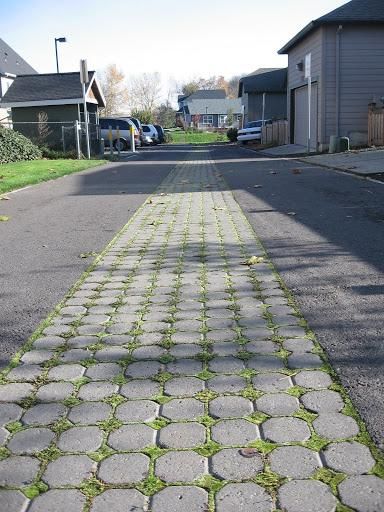
Table of Contents
Chapter 1: Introduction ................................................................................................................................................ 5
           Purpose of this Resource ................................................................................................................................. 5
           Environmental and Public Health Impacts of CSOs ......................................................................................... 5
           Available Controls ............................................................................................................................................ 6
           Green Infrastructure Controls ......................................................................................................................... 7
           Multiple Benefits of Green Infrastructure ....................................................................................................... 7
Chapter 2: Integrating Green Infrastructure into the Federal Regulatory Framework for CSO Control ...................... 9
           Implementing the CSO Control Policy ........................................................................................................... 10
           Phase I: Green Infrastructure and the Nine Minimum Controls ................................................................... 10
           Phase II: Developing the Long Term Control Plan ......................................................................................... 10
           Implementing the Long Term CSO Control Plan ............................................................................................ 11
           Importance of Monitoring ............................................................................................................................. 12
           Green Infrastructure in EPA Enforcement ..................................................................................................... 12
Chapter 3: Quantifying Green Infrastructure Controls as a Component of CSO Long Term Control Plans ............... 14
           Quantifying Green Infrastructure Implementation ....................................................................................... 14
           Green Infrastructure Planning on Multiple Scales......................................................................................... 17
           Examples of Green Infrastructure Planning................................................................................................... 18
           Using Green LTCP-EZ, a Simplified Tool for Small Communities ................................................................... 20
           Using Hydrologic & Hydraulic Models in Planning CSO Control Programs.................................................... 21
           The Role of Monitoring .................................................................................................................................. 23
           Examples of Communities Using H&H Models to Estimate Green Infrastructure Contributions to CSO
           Reductions ..................................................................................................................................................... 24
Chapter 4: Detailed Case Study of Incorporating Green Infrastructure into a CSO Model using SWMM v. 5.0 ........ 26
           Step 1: Characterize the System .................................................................................................................... 27
           Step 2: Define a Baseline Scenario ................................................................................................................ 29
           Step 3: Develop a Gray Infrastructure CSO Control Scenario ........................................................................ 30
           Step 4: Develop Green Infrastructure Alternatives ....................................................................................... 32
           Step 5: Analyze Gray/Green CSO Control Scenarios ...................................................................................... 34
           Model Outputs............................................................................................................................................... 37
Chapter 5: Conclusion ................................................................................................................................................. 37

Planning and Modeling Green Infrastructure Scenarios                                                                                              Page | 4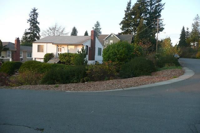
Chapter 1: Introduction
Purpose of this Resource
This technical resource is intended to assist communities in developing and evaluating Combined Sewer Overflow
(CSO) control alternatives that include green infrastructure. It is designed to provide municipal officials as well as
sewer authorities with tools to help quantify green infrastructure contributions to an overall CSO control plan.
This document is the result of a joint effort between EPA’s Office of Water (OW) and Office of Research and
Development (ORD), and is intended for use by both policy-oriented as well as technical professionals working to
incorporate green infrastructure into CSO Long Term Control Plans (LTCPs). This resource contains three main
parts:
General overview of the regulatory and policy context for incorporating green infrastructure into CSO
control programs.
Description of how municipalities may develop and assess control alternatives that include green
infrastructure.
Brief demonstration of a modeling tool, the Storm Water Management Model v. 5.0 (SWMM5), that can
help quantify green infrastructure contributions to an overall CSO control plan.
Chapter 1 describes how green infrastructure approaches fit into the Federal regulatory framework for CSO
control. Chapter 2 highlights general opportunities for integrating green infrastructure into CSO LTCPs. Chapter 3
explains how to develop and evaluate control alternatives that incorporate green infrastructure practices. Chapter
4 presents a case study demonstrating how a specific model, SWMM5, may quantify green infrastructure
contributions to a total CSO control program.
Environmental and Public Health Impacts of CSOs
Across the United States, more than 700 cities rely on combined
© Abby Hall, US EPA
sewer systems (CSSs) to collect and convey both sanitary sewage and
stormwater to wastewater treatment facilities. Most of these
communities are older cities in the Northeast, the Great Lakes
region, and the Pacific Northwest. When wet weather flows exceed
the capacity of CSSs and treatment facilities, stormwater, untreated
human, commercial and industrial waste, toxic materials, and debris
are diverted to CSO outfalls and discharged directly into surface
waters. These CSOs carry microbial pathogens, suspended solids,
floatables, and other pollutants, and can lead to beach closures,
shellfish bed closures, contamination of drinking water supplies, and
other environmental and human health impacts. For many cities
with combined sewer systems, CSOs remain one of the greatest
challenges to meeting water quality standards.
In 1994, EPA published the CSO Control Policy (59 FR 18688 (April 19,
1994) available at http://www.epa.gov/npdes/pubs/owm0111. pdf).
The CSO Control Policy provides guidance to municipalities and State
and Federal permitting authorities on controlling discharges from
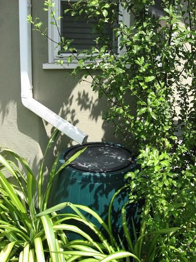
Rain barrel captures roof runoff in Santa Monica, CA.
Planning and Modeling Green Infrastructure Scenarios Page | 5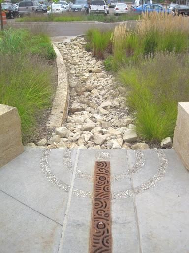
CSOs through the National Pollutant Discharge Elimination System (NDPES) permit program under the Clean
Water Act. In 2000, Congress amended section 402 of the Clean Water Act to require both NPDES permits and
enforcement orders for CSO discharges to conform to the CSO Control Policy (33 USC § 1342(q)). Under their
NPDES permits, communities are required to implement nine minimum controls (NMC) and to develop and
implement Long Term Control Plans (LTCPs). Many communities are still searching for cost effective ways to
implement their LTCPs.
Despite the progress achieved to date, significant infrastructure investments are still needed to address CSOs.
Although funding assistance is available from federal and state sources, local ratepayers ultimately fund most CSO
control projects. Therefore, CSO control programs represent a significant municipal investment that competes
with other local programs.
Climate change could further amplify investments required to mitigate CSOs. The frequency and severity of CSO
events is largely determined by climatic factors, including the form, quantity, and intensity of precipitation. The
Fifth Assessment Report of the Intergovernmental Panel on Climate Change (IPCC) concluded that changing trends
in climate are evident from historical observations (IPCC, 20131). In the United States, observed climate change in
the 20th century varied regionally, but generally included warming temperatures and an increased frequency of
heavy precipitation events. Anticipated changes in the 21st century also vary regionally and are not yet certain, but
research suggests continued warming and changes in precipitation throughout much of the United States
(Christensen et al., 2007)2. Though the extent of the risk is unknown, these changes could significantly affect the
efficacy of CSO mitigation efforts.
Available Controls
CSO Control Technologies:
CSO controls may be grouped into four broad categories:
operation and maintenance practices, collection system 1. Operation and maintenance practices
controls, storage facilities, and treatment technologies. Most of 2. Collection system controls
the early efforts to control CSOs emphasized what we refer to Conventional Approaches, and
in this document as “gray infrastructure,” which describes Green Infrastructure Approaches
traditional practices for stormwater management that involve o Retention, and
pipes, sewers and other structures involving concrete and steel.
o Runoff Control
One of the most commonly implemented types of gray
3. Storage facilities
infrastructure is off-line storage. Off-line storage facilities store
wet weather combined sewer flows in tanks, basins, or deep 4. Treatment technologies
tunnels located adjacent to the sewer system until a wastewater
treatment plant (WWT) of a publicly owned treatment works
(POTW) has the capacity to treat the stored wastewater.
1
IPCC, 2013: Summary for Policymakers. In: Climate Change 2013: The Physical Science Basis. Contribution of Working Group I to the Fifth
Assessment Report of the Intergovernmental Panel on Climate Change [Stocker, T.F., D. Qin, G.-K. Plattner, M. Tignor, S. K. Allen, J.
Boschung, A. Nauels, Y. Xia, V. Bex and P.M. Midgley (eds.)]. Cambridge University Press, Cambridge, United Kingdom and New York, NY,
USA.
2
Christensen, J.H., B. Hewitson, A. Busuioc, A. Chen, X. Gao, I. Held, R. Jones, R.K. Kolli, W.-T. Kwon, R. Laprise, V. Magaña Rueda, L.
Mearns, C.G. Menéndez, J. Räisänen, A. Rinke, A. Sarr and P. Whetton, 2007: Regional Climate Projections. In: Climate Change 2007: The
Physical Science Basis. Contribution of Working Group I to the Fourth Assessment Report of the Intergovernmental Panel on Climate
Change [Solomon, S., D. Qin, M. Manning, Z. Chen, M. Marquis, K.B. Averyt, M. Tignor and H.L. Miller (eds.)]. Cambridge University Press,
Cambridge, United Kingdom and New York, NY, USA.
Planning and Modeling Green Infrastructure Scenarios Page | 6
Green Infrastructure Controls
Green infrastructure practices mimic natural hydrologic processes to

                                                                                                                              © Alisha Goldstein
reduce the quantity and/or rate of stormwater flows into the the
combined sewer system (CSS). By controlling stormwater runoff through
the processes of infiltration, evapotranspiration, and capture and use
(rainwater harvesting), green infrastructure can help keep stormwater out
of the CSS. Green infrastructure also supports the principals of Low Impact
Development (LID), an approach to land development (or re-development)
that works with nature to manage stormwater as close to its source as
possible.

Green infrastructure can be utilized at varying scales—both at the site and
watershed level. For example, small source control practices such as rain
gardens, bioswales, porous pavements, green roofs, infiltration planters,
trees, and rainwater harvesting can fit into individual development,
redevelopment or retrofit sites. Larger scale management strategies such
as riparian buffers, flood plain preservation or restoration, open space,
wetland and forest preservation and restoration, and large infiltration
systems can be used at the subwatershed or watershed level.                   Drain collects runoff from impervious surface and
                                                                              directs it to rain gardens in Saint Paul, MN.

Multiple Benefits of Green Infrastructure
Green infrastructure can contribute to CSO control while providing multiple environmental and social benefits.
Although green infrastructure alone is often unlikely to fully control CSOs, it may be able to reduce the size of
more capital-intensive, “downstream” gray infrastructure control measures, such as storage facilities or treatment
technologies. It may also reduce operating and energy expenditures due to the passive nature of typical green
infrastructure practices. Green infrastructure can improve community livability, air quality, reduce urban heat
island effects, improve water quality, reduce energy use, and create green jobs. Larger scale green infrastructure
strategies can also increase recreational opportunities, improve wildlife habitat and biodiversity, and help
mitigate flooding. For further information on the multiple benefits of green infrastructure, see:
http://water.epa.gov/infrastructure/greeninfrastructure/index.cfm.

EPA recognizes the particular importance of ensuring resilient water infrastructure in the face of climate change.
Green infrastructure is one useful approach. Green infrastructure can provide flexibility in addressing
uncertainties surrounding future droughts and increased precipitation resulting from climate change. It may also
be incrementally and relatively rapidly expanded and adapted as necessary. EPA already has a number of
resources and tools available to communities to help assess and address the impacts of climate change. The
National Water Program Climate Change Strategy lays out goals and actions for protecting our nation’s water
resources, and EPA has already made significant progress in the areas of improving resiliency in water
infrastructure, watersheds and wetlands, coastal and ocean waters, and water quality (http://water.epa.
gov/scitech/climatechange/2012-National-Water-Program-Strategy.cfm). EPA’s Climate Ready Water Utilities
program assists the water sector, including drinking water, wastewater, and stormwater utilities, in addressing
climate change impacts and has a number of resources and tools available to water utilities and the public at
http://water.epa.gov/infrastructure/watersecurity/climate/. EPA also has publicly available resources and tools to
assist water utilities in addressing energy efficiency at http://water.epa.gov/infrastructure/sustain/
energyefficiency.cfm.

Planning and Modeling Green Infrastructure Scenarios                                                Page | 7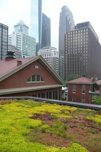
Figure 1-1. Green infrastructure practices commonly used in urban areas.

Green Infrastructure Practice     Description

                                  Disconnection refers to the practice of directing runoff from impervious areas such as
                                  roofs or parking lots onto pervious areas such as lawns or vegetative strips, rather
                                  than directly into storm drains.

        Disconnection

                                  Rain harvesting systems collect runoff from rooftops and convey it to a cistern tank
                                  where the water is available for uses that do not depend on potable water, like
                                  irrigation.

        Rain Harvesting

                                  Rain gardens are shallow depressions filled with an engineered soil mix that supports
                                  vegetative growth. They are designed to store and infiltrate captured runoff, and
                                  retain water for plant uptake. They are commonly used on individual home lots to
                                  capture roof runoff.

         Rain Gardens

                                  Green roofs (also known as vegetated roofs or ecoroofs) are vegetated detention
                                  systems placed on roof surfaces that capture and temporarily store rainwater in a soil
                                  medium. They typically have a waterproof membrane, a drainage layer, and a
                                  lightweight growing medium populated with plants that absorb and evaporate water.

         Green Roofs

                                  Infiltration trenches are gravel-filled excavations that are used to collect runoff from
                                  impervious surfaces and infiltrate the runoff into the native soil. Some systems are
                                  designed to filter runoff and reduce clogging by routing water across grassed buffer
                                  strips.

      Infiltration Trench

                                  Street planters are typically placed along sidewalks or parking areas. They consist of
                                  concrete boxes filled with an engineered soil that supports vegetative growth.
                                  Beneath the soil is a gravel bed that provides additional storage as the captured
                                  runoff infiltrates into the existing soil below. Street planters also can be designed with
                                  underdrains to avoid ponding on sites with inadequate infiltration capacity.
        Street Planters

                                  Permeable pavement and paver systems are excavated areas filled with gravel and
                                  paved over with a permeable concrete or asphalt mix. They may also be overset with
                                  a layer of pavers. Rainfall passes through the pavement or pavers into the gravel
                                  storage layer below where it can infiltrate at natural rates into the site's native soil.
       Porous Pavement

Planning and Modeling Green Infrastructure Scenarios                                                     Page | 8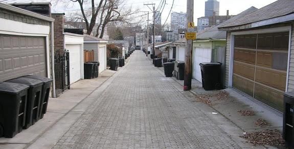
Chapter 2: Integrating Green Infrastructure into the Federal Regulatory
Framework for CSO Control

The 1994 CSO Policy provides guidance to EPA and State NPDES authorities on how to develop NPDES permits
for CSO discharges, as well as how to conduct enforcement actions against violators with CSOs. Although the
processes and practices for meeting the CWA and CSO Policy requirements with gray infrastructure are generally
well understood, the process for meeting them with a combination of gray and green infrastructure is less well
defined.

                                     Implement the Nine Minimum Controls

                                         Develop Long Term Control Plan

                                    Characterize the combined sewer system and
                                                  receiving waters

                                       Define CSO control targets to meet water
                                                  quality standards

                                       Develop alternatives to meet CSO control
                                                        targets

                                      Evaluate alternatives to meet CSO control
                                                        targets

                                    Select cost-effective alternatives, analyze
                                    financial capability, and develop schedule

                                        Implement Long Term Control Plan

                Figure 2-1. The process for meeting federal requirements for CSO controls generally follows
                                              the series of steps shown here.

Planning and Modeling Green Infrastructure Scenarios                                                   Page | 9
Implementing the CSO Control Policy

Phase I: Green Infrastructure and the Nine Minimum Controls
The Nine Minimum Controls (NMCs) are minimum technology-based requirements that municipalities must take
to address combined sewer overflows:

               Nine Minimum Controls:
               1. Proper operation and regular maintenance programs for the sewer system and the CSOs
               2. Maximum use of the collection system for storage
               3. Review and modification of pretreatment requirements to assure CSO impacts are
                  minimized
               4. Maximization of flow to the publicly owned treatment works for treatment
               5. Prohibition of CSOs during dry weather
               6. Control of solid and floatable materials in CSOs
               7. Pollution prevention
               8. Public notification to ensure that the public receives adequate notification of CSO
                  occurrences and CSO impacts
               9. Monitoring to effectively characterize CSO impacts and the efficacy of CSO controls

Green infrastructure approaches are adaptable in several components of the NMCs. For example, green
infrastructure practices can retain and control runoff for a period of time before slowly releasing it to the sewer
system. Green infrastructure practices can also increase available storage capacity in the collection system, which
reduces the likelihood of overflows and maximizes the amount of stormwater treated at a publicly owned
treatment works (POTW). The full text of EPA’s 1995 Guidance for Nine Minimum Controls is available at
http://www.epa.gov/npdes/pubs/owm0030.pdf.

Phase II: Developing the Long Term Control Plan
CSO communities are generally required under their NPDES permits to develop and implement a Long Term
Control Plan (LTCP). LTCPs set out plans for specific measures to meet the requirements of the Clean Water Act,
including the attainment of water quality standards. Detailed information on developing and implementing LTCPs
can be found at http://cfpub.epa.gov/npdes/cso/guidedocs.cfm?program_id=5.

The first two steps in developing an LTCP include characterization of the CSS and receiving waters, and the
development of CSO control targets to meet water quality standards (WQS). These two steps are independent of
the types of controls under consideration. Regardless of the types of controls considered, pursuant to the CSO
Control Policy, CSO communities are expected to develop a LTCP that adopts either the demonstration or
presumption approach to define targets for CSO control that achieve compliance with the Clean Water Act (CWA).

Planning and Modeling Green Infrastructure Scenarios                                             Page | 10
Once a community defines CSO control targets, they may develop and evaluate control alternatives to meet these
targets. The 1995 EPA Guidance for Long Term Control Plans identifies four categories of CSO control measures,
and includes specific green infrastructure measures in the category labeled “Source Controls” (1995 EPA Guidance
for LTCPs, Section 3.3.5.1). The measures discussed in this guidance include permeable pavements, flow
detention, downspout disconnection, and infiltration-based practices. The guidance also recognizes that, “since
source controls reduce the volumes, peak flows, or pollutant loads entering the collection system, the size of
more capital-intensive downstream measures can be reduced or, in some cases, the need for downstream
facilities eliminated.”
Elements of a Long Term CSO Control Plan:
1. Characterization, monitoring, and modeling of the Combined Sewer System (CSS)
2. Public Participation
3. Consideration of sensitive areas
4. Evaluation of alternatives
5. Cost/performance considerations
6. Operational plan
7. Maximization of treatment at the existing POTW treatment plant
8. Implementation schedule for CSO controls
9. Post-construction compliance monitoring program
The complete CSO Control Policy is available at:
http://cfpub.epa.gov/npdes/cso/guidedocs.cfm?program_id=5
Implementing the Long Term CSO Control Plan
Regardless of the type of controls included, LTCPs are expected to result in compliance with the requirements of
the CWA. To assess progress toward compliance, the CSO Policy requires development of a post-construction
compliance-monitoring program that adequately measures and evaluates the effectiveness of CSO controls,
protects designated uses, and complies with water quality standards (WQS).
For LTCPs incorporating green infrastructure approaches, an adaptive management approach can be employed
during the implementation process. Adaptive management means monitoring and evaluating green infrastructure
projects and practices as work proceeds, and adapting or revising plans and designs as appropriate based on
lessons learned. Evaluating practices as work proceeds can often be a more effective approach than adopting a
monitoring program confined to the post-construction phase.
Planning and Modeling Green Infrastructure Scenarios Page | 11Photo: Permeable paver retrofits help to infiltrate urban runoff in a Chicago alley. © Abby Hall, U.S. EPA. Importance of Monitoring As the previous section suggests, the installation of green infrastructure controls may occur incrementally over time. By monitoring the effectiveness of green infrastructure controls as they are installed, municipalities can compare observed performance to modeled performance. If necessary, they can modify designs of remaining planned projects to meet a CSO control goal, or retrofit existing practices as necessary. Green Infrastructure in EPA Enforcement Given the multiple environmental, economic and social benefits associated with green infrastructure, EPA has supported and encouraged the implementation of green infrastructure for stormwater runoff and sewer overflow management to the maximum extent possible. EPA enforcement in particular has taken a leadership role in the incorporation of green infrastructure remedies in municipal Clean Water Act (CWA) settlements. Many cities have used green infrastructure to effectively manage stormwater. Runoff reductions from green infrastructure are demonstrable, may be less expensive than traditional stormwater management approaches in many cases, and provide a wide variety of community benefits (http://water.epa.gov/infrastructure/greeninfrastructure /index.cfm). Based on this evidence, EPA enforcement has incorporated green infrastructure as part of injunctive relief, the measures and actions legally required to bring an entity back into compliance with the law, in a growing number of municipal CWA cases. Although communities are given discretion over how they want to comply with the CWA, EPA encourages the use of green infrastructure wherever appropriate. It has become common practice for green infrastructure to be included as injunctive relief in many municipal CWA settlements. Planning and Modeling Green Infrastructure Scenarios Page | 12
Many recently settled green infrastructure matters include an
More Enforcement Resources
option for communities to study the feasibility for green
infrastructure approaches, and to propose the replacement of An index of recent enforcement actions
specific gray infrastructure projects with green infrastructure on incorporating green infrastructure is
a case by case basis as a result of a feasibility analysis. Other available on EPA’s website here:
settlements call for a commitment to a certain level of green http://water.epa.gov/infrastructure/greeni
nfrastructure/gi_regulatory.cfm#csoplans
infrastructure implementation up front while still offering the
opportunity to scale up green infrastructure in the future, as For more information on incorporating
appropriate. green infrastructure in EPA enforcement
actions, see the U.S. EPA Green
Infrastructure Permitting and Enforcement
Factsheet Series here:
http://water.epa.gov/infrastructure/greeni
nfrastructure/gi_regulatory.cfm#permittin
gseries
© Abby Hall, U.S. EPA
A green roof captures stormwater in Chicago, IL. Under a
U.S. EPA Consent Decree, the Metropolitan Water Reclamation
District of Greater Chicago (MWRD) is required to develop a
detailed Green Infrastructure Program.
Planning and Modeling Green Infrastructure Scenarios Page | 13Chapter 3: Quantifying Green Infrastructure Controls as a Component of CSO
Long Term Control Plans
Once a community defines its CSO control targets, the next step is to develop a set of alternative CSO control
programs, and to evaluate these alternatives in order to select a preferred program. The development and
evaluation processes are closely linked, and rely on many of the same factors, including sizing, cost, performance,
and siting considerations. In assessing the performance of different control scenarios, Hydrologic and Hydraulic
(H&H) models are often used to simulate how a municipal collection and conveyance system will respond to
infrastructure changes. H&H models can evaluate the impact of a variety of infrastructure changes, such as the
addition of off-line storage or construction of a tunnel to convey and store wet weather flows. More recently,
these models have been adapted to simulate the effects of green infrastructure in a CSO service area.
Quantifying Green Infrastructure Implementation
Before beginning to model the effects of green infrastructure, it is important to understand the amount and types
of green infrastructure that can be implemented, realistically and cost-effectively, in a given catchment. If green
infrastructure opportunities are over-estimated, model results will over-estimate the potential for CSO
reductions. Over-estimation of the degree of green infrastructure implementation can also lead to under-sizing
gray infrastructure components downstream.
Green infrastructure opportunities within a catchment
© Abby Hall, EPA. U.S. EPA
largely depend on soil characteristics, topography and
land use. For example, if there are a large number of
sizable industrial and/or commercial properties within a
given catchment, there may be opportunities to add
green roofs to both existing and future rooftops. Single-
“It is important to understand the amount
and types of green infrastructure that can
be implemented, realistically and cost
effectively, in a given catchment.”
family residential lots with sufficient yard area offer
opportunities to capture runoff off from rooftops,
patios, driveways, and streets using residential rain
gardens. Planned road improvements present
opportunities to include green infrastructure practices
in the redesign/reconstruction of right-of-way areas.
Estimating the maximum or optimal amount of green
infrastructure implementation also requires
consideration of institutional factors that will affect the
degree of implementation.
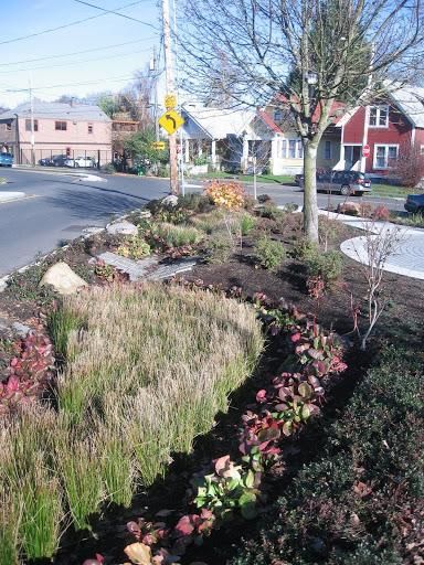
Curbside raingarden installation in Portland, Oregon.
Planning and Modeling Green Infrastructure Scenarios Page | 14Any proposal for the incorporation of green infrastructure into an LTCP should include, at a
minimum, robust analyses in the following two areas:
1. Community and Political Support for Green Infrastructure
The municipality or sewer authority responsible for implementing the LTCP should solicit initial
buy-in from the community and relevant political powers. Developing a substantial green
infrastructure program will involve iterative interaction with both the community and local
government officials. Meaningful local buy-in is essential for long-term success.
2. Realistic Potential for Green Infrastructure Implementation
The municipality or sewer authority responsible for implementing the LTCP should adequately
investigate local factors that may limit the implementation of green infrastructure, including
physical factors (e.g. soils, topography and land availability), regulatory factors (e.g. codes and
ordinances), and social and political factors (e.g. ability to enact incentives and/or regulatory
drivers for green infrastructure).
When simulating the performance of green infrastructure measures using H&H modeling, the technical
characteristics utilized for each type of green infrastructure measure should reflect those likely to be realistically
achieved, given both costs and physical, regulatory and/or social and political factors.
Factors to consider when evaluating the degree of green infrastructure implementation
potential within a catchment should minimally include:
Soil characteristics. Many green infrastructure practices rely on infiltration as a means of stormwater
disposition. Areas with very tight soils (e.g., clay soils not conducive to infiltration of water) will
reduce the infiltration potential of many green infrastructure measures. In some situations it may be
appropriate to amend soils to enhance storage and infiltration, and to promote plant growth.
Land Use and Ownership. How much land is residential, commercial, and industrial? What are the lot
sizes? Are there vacant lots? Who owns them? How much land in the catchment is publicly owned or
controlled (e.g., are there parkways in the public right-of-way)? What is the configuration of the
existing street drainage system? Weaving green infrastructure into the existing landscape requires an
understanding of current land use, as well as the local codes, plans and ordinances that will shape
future land use patterns. Since impervious cover tends to vary across land use type, parcel-level land
use data can help estimate green infrastructure potential. Detailed land use data can also determine
what types of green infrastructure approaches are most appropriate for a given catchment.
Commercial or publicly owned buildings, for example, may be better suited for green roof installations.
Industrial parks with large minimum lot sizes exhibit potential for larger retention basins or
constructed wetlands.
Planning and Modeling Green Infrastructure Scenarios Page | 15© Nancy Arazan
Local Buy-in. Will landowners be
receptive or resistant to green
infrastructure practices in the
neighborhood or on their
property? How will green
infrastructure fit into the existing
fabric of the neighborhood?
Drawing on the knowledge and
experience of community leaders,
as well as key groups such as home
owner associations, land trusts,
etc., will help inform outreach
strategies.
Seattle’s Street Edge Alternatives (SEA) program installed curbside
stormwater features in residential neighborhoods.
Topography. Green infrastructure practices should ideally be located on slopes of less than 5%. Steeper
terrain tends to make implementation more difficult and less cost-effective. For example, detention basins
built on slopes over 5% are often difficult to design, plant and berm effectively. In response many
communities prohibit the construction of green infrastructure in areas with slopes greater than 25%. GIS
software can help identify and map steeper slopes, as well as areas with low infiltration potential (i.e.,
poorly drained soils).
Financing and Institutional Factors. Are there financial incentives to promote green infrastructure
practices on private property? What incentives would effectively encourage property owners to construct
and maintain green infrastructure practices? Do codes and ordinances require green practices at existing
sites or redevelopment sites? What is the budget for green infrastructure implementation on public
properties? Are there institutional barriers or impediments to requiring or incentivizing green
infrastructure? Does the jurisdiction have the legal authority and the institutional capacity to require or
incentivize green infrastructure?
Redevelopment Rate. Will there be redevelopment and reuse of many parcels, allowing new green
infrastructure practices to be constructed as part of the redevelopment process? Some localities require
new and re- development to meet onsite retention standards. If this is the case, the CSO authority may use
redevelopment rates to predict degree of new green infrastructure installation over time. If mandatory
requirements do not exist, communities may consider incentives that encourage developers to install green
infrastructure.
Planning and Modeling Green Infrastructure Scenarios Page | 16Green Infrastructure on Private Property. Privately-owned properties such as corporate campuses or
shopping malls can be good locations for green infrastructure practices in terms of the availability of space
and/or the location in a sewershed. However, implementing green infrastructure on private property as part
of a CSO control plan presents special challenges. Questions can arise as to who is responsible for
maintenance, as wells as weather the sewer authority has the right to come onto the property for inspections
or maintenance. In some cases, easements, deed restrictions, covenants, stormwater development
standards, or other programmatic elements can be used to retain benefits gained. If a sewer authority is
planning green infrastructure on private property as part of the long-term control plan, careful consideration
of maintenance and preservation measures is essential; otherwise, model results could overestimate the
actual flow reductions that will be achieved through green infrastructure practices.
Opportunities Presented by Partnerships. Opportunities for partnerships can help CSO communities plan
what green infrastructure measures can be placed where. In some cases, CSO communities may be able
to capitalize on opportunities presented by partners to work collaboratively on projects. Such
partnerships potentially could include:
Public-public partnerships– For example, the sewer authority could work with the streets
department, park district or school district to implement green infrastructure in streets, at parks
or on school grounds. Partnership opportunities may make public sites available for green
infrastructure implementation, and/or there may be opportunities to share green infrastructure
maintenance responsibilities across different departments or jurisdictions. Integrating green
infrastructure into Capital Improvement Plans can allow different government departments to
identify the most impactful and/or cost effective opportunities for green practices. For example,
coordinating green infrastructure efforts with scheduled Department of Transportation
improvements provides an opportunity to implement green streets at a much lower cost than
traditional stormwater retrofits.
Public-private partnerships—The CSO authority may engage the private sector in construction
financing efforts to support the installation of green infrastructure. They might also partner with
local Business Improvement Districts (BIDs) or other private entities to support the maintenance
and operation of existing green infrastructure practices.
Partnerships with non-profits and neighborhood groups – Working with not-for-profit
organizations and community groups can help garner input from citizens on green infrastructure
planning, gaining public acceptance, recruiting volunteers, and providing a sense of ownership
once the practices are in place.
Planning and Modeling Green Infrastructure Scenarios Page | 17Green Infrastructure Planning on Multiple Scales
The process of analyzing green infrastructure strategies for site-specific conditions should be carefully planned
and scaled. For example, a regional sewer district might first assess which sewersheds provide the most
opportunity for green infrastructure, and then focus on identifying what type of green infrastructure can
realistically and cost-effectively be implemented in those areas.
Another approach is to categorize sewersheds into groups, based on land use, soils, and topography, and then
develop green infrastructure templates for the various types/categories of sewersheds. Geographic Information
Systems (GIS) can help integrate land use, ownership, soil and slope data into a simple ranking system. A basic GIS
ranking model estimates green infrastructure implementation potential across a given service area using local
spatial data. Specific factors that can be brought into a ranking analysis include:
open space commercial/industrial ownership
slope residential housing (for downspout
soil characteristics disconnection)
publicly owned parking lots/buildings existing vegetation
Examples of Green Infrastructure Planning
Several CSO communities have planned for green infrastructure as part of their stormwater runoff management
strategies. Four different approaches are presented below.
Planning Case Study #1: Northeast Ohio Regional Sewer District
The Northeast Ohio Regional Sewer District (NEORSD) performed a systematic evaluation of where to best
implement green infrastructure measures within their service area. Under the terms of a Consent Decree
agreement with U.S. EPA and the State of Ohio, NEORSD committed to implementing green infrastructure as part
of its CSO control program. The District needs to plan for the
construction of green infrastructure to meet a performance criterion
© Abby Hall,U.S. EPA
of reducing CSOs by 44 million gallons in a typical year, beyond the
reductions achieved by planned gray infrastructure control measures.
NEORSD performed a geographic screening of neighborhoods within
the combined sewer service area using a Green Infrastructure Index to
identify locations most suitable for green infrastructure projects.
Factors involved in the Index ranking are described in the NEORSD
Green Infrastructure Plan here:
http://neorsd.org/projectcleanlake.php.
NEORSD’s Green Infrastructure Index has two separate components.
The first component, referred to as the Baseline Index, provides a
numeric score that characterizes general opportunities, space, and
potential effects of green infrastructure projects. The second
component is specific to the 44 million gallon performance criterion,
and provides a numeric score that characterizes projected impacts of
green infrastructure on CSO volume reduction. The Green
Infrastructure Index repressents a sum of these two scores. Factors
taken into account in the Index include development and
redevelopment opportunities, soils, open space and imperviousness,
Permeable pavers infiltrate street runoff in Portland, OR.
Planning and Modeling Green Infrastructure Scenarios Page | 18partnership opportunities, and environmental justice. The District assessed CSO volume reductions for the second component by running H&H model simulations where directly connected impervious areas (DCIAs) were reduced by fixed amounts. After determining which sub-catchments received the highest combined GI Index scores, staff identified 38 “priority” sub-catchments across the district. The District then developed, evaluated, and prioritized green infrastructure projects in each priority sub- catchment. Using a ranking-based tool such as NEORSD’s Green Infrastructure Index can provide a systematic approach for identifying the most promising sewersheds and most appropriate practices within a given service area. Planning Case Study #2: San Francisco Public Utilities Commission The San Francisco Public Utilities Commission also used a GIS-based analysis to identify maximum potential for specific green infrastructure practices across its sewershed based on physical constraints (see Section 3.2 and Table 6 of http://sfwater.org/modules/showdocument.aspx?documentid=560). The results of this analysis estimated a maximum of 38% of the total city area was available for conversion to green roofs, downspout disconnection, bioretention, urban trees, and permeable pavement. Modeling scenarios for San Francisco later incorporated goals related to this maximum potential for green infrastructure. A watershed-based planning process called The Urban Watershed Assessment will use this information to inform San Francisco’s Sewer System Improvement Program (SSIP). Planning Case Study #3: Metropolitan Sewer District of Greater Cincinnati The Metropolitan Sewer District of Greater Cincinnati (http://msdgc.org/) conducted a green infrastructure planning effort in a single pilot area, the Lick Run sub-sewershed. Lick Run is a 2,600 acre sub-sewershed with primarily single-family residential, commercial and undeveloped/open space. The District selected Lick Run for evaluation because its drainage area contains a mix of topography, land use, and surficial soil characteristics. In total, approximately 24% of the sewershed is impervious. The analysis focused on three classes of impervious areas: roofs, parking lots/driveways, and streets. GIS polygons representing roof footprints facilitated analysis of green roof potential. Both green roofs and roof top cisterns were considered for larger commercial, industrial, and multifamily residential buildings. For smaller single-family residential buildings, downspout disconnection to a rain garden was the selected green infrastructure practice. GIS data was unavailable for parking lots and sidewalks, so boundaries had to be delineated by hand from aerial photos. Bioretention and permeable pavement were the selected alternatives for these impervious surfaces. For roadways, GIS data was only available as street centerlines. As such, the District estimated associated impervious area for roads based on width estimates for each street type. Curbside bioretention and infiltration swales were the chosen practices for local roads where road narrowing was feasible. The district created a range of scenarios in which green infrastructure practices would manage 10-35% of roadways, 20-50% of rooftops, and 25-50% of parking lots and sidewalks. Once the inputs were appropriately set up, they ran a CSO model individually for three separate rainfall events, using a continuous simulation of a typical year in order to characterize the effects of the various levels of green infrastructure implementation. Planning Case Study #4: City of Toledo The City of Toledo, Ohio kicked off a significant green infrastructure retrofit project by first installing and monitoring bioswales along a residential street (http://www.estormwater.com/maywood-avenue-storm-water- volume-reduction-project). The City conducted monitoring of runoff from the street before and after installing Planning and Modeling Green Infrastructure Scenarios Page | 19
bioswales, and then monitored a nearby non-retrofitted street for comparison purposes. The monitoring study
provided data on the amount of stormwater stored or infiltrated at both test sites. The City then used this data to
calibrate its stormwater management model (SWMM). Finally, the City used this model to simulate flow
reductions provided by the green street upgrades. Long-term simulations using the SWMM model indicate an
annual average reduction of runoff volume from the bioswales of approximately 64%. Long-term simulation
results showed that during the fifth-largest storm event bioswales removed 70,000-80,000 gallons of flow from
the CSS. Toledo was also able to calculate a cost per gallon of stormwater removed by the bioswales. With this
data the city is now able to evaluate the cost effectiveness of implementing bioswales as an element of its CSO
control program.
After green infrastructure implementation sites and control measures have been selected, hydrologic and
hydraulic (H&H) modeling can be used to quantify how green infrastructure will change runoff characteristics and,
in combination with gray infrastructure, help reduce CSOs. More details about the methods for using H&H models
for these purposes will be covered in the following section of this report. Note that green infrastructure planning
and H&H modeling is an iterative process. For example, hydrologic modeling reflecting green infrastructure
practices might reveal opportunities to downsize downstream gray infrastructure. H&H modeling can thus help
evaluate varying combinations of green and gray infrastructure to identify what combination of alternatives is
most cost-effective.
Using Green LTCP-EZ, a Simplified Tool for Small Communities
Once analyses such as those mentioned above identify what green infrastructure practices can realistically be
implemented in a given service area, modeling work can simulate the effects of the green infrastructure on
reducing flows into the system. One tool that communities can use for developing a CSO long-term control plan
that includes green infrastructure is the Green LTCP-EZ Template. This tool was developed by EPA and is posted on
the Agency’s website here: http://water.epa.gov/infrastructure/greeninfrastructure/upload/final_green_ltcpez
_instructions withpoecacomments.pdf.
The Green LTCP-EZ Template is a planning tool for communities that wish to develop an LTCP to address CSOs
using, at least in part, green infrastructure. The template provides a framework for organizing and completing an
LTCP. Schedules 5A and 5B of the template lay out a process for communities to evaluate the ability of a set of
widely used green infrastructure runoff controls, as well as pipe network CSO controls to meet a CSO reduction
target.
Schedule 5A estimates the number of green infrastructure practices required to meet a runoff reduction goal. The
schedule estimates the number of practices that will need to be implemented to achieve the level of CSO control
required for Clean Water Act compliance, but it does not assess the capacity of the landscape to accommodate
those practices. While the actual volumetric reductions achieved by using different green infrastructure practices
The volume of runoff reduction achieved for each practice Five general green infrastructure controls
category is calculated using a variation of the following are considered in the 5A Schedule:
equation for volume of runoff reduction:
V = kAP24RR Green roofs
Bioretention
V = runoff reduction volume (gallons or million gallons [MG]) Vegetated swales
k = unit conversion factor Permeable pavement
A = area of impervious surface managed (acres) Rain barrels and cisterns
P24 = depth of 24-hour design storm rainfall (inches)
RR = average volumetric reduction rates (per practice)
Planning and Modeling Green Infrastructure Scenarios Page | 20will vary based on local conditions as well as sizing and design considerations, Green LTCP-EZ uses a simplified
approach that includes practice-specific volumetric reduction rates to provide an estimate of the volumetric
reductions achieved through implementation of green practices. Before making a final determination on the
approach to control overflows, the user would need to ensure that the green infrastructure practices are suitable
for a given catchment.
Green LTCP-EZ is suitable for small communities and situations that are relatively simple to assess. However,
Schedules 5A and 5B may be a resource for others as well in that they are an example of a way to quantify the
ability of green infrastructure practices to keep water out of a CSS.
To further quantify the impacts of green infrastructure on CSO frequency and volume in a sewershed, more
complex hydrologic & hydraulic (H&H) modeling tools are needed that simulate the processes involved in
stormwater runoff across the landscape as well as those involved in routing of storm and wastewater through CSS
infrastructure and outfalls.
Using Hydrologic & Hydraulic Models in Planning CSO Control Programs
H&H models are frequently developed and used to simulate how a municipal sewer system will respond to rainfall
events. Models are mathematical approaches that calculate estimated water flows through a sewer system.
Simulation models are critical for CSO planning because they can project the effects of alternative control
scenarios and identify the combination of control measures likely to result in the achievement of CSO control
goals.
H&H models are particularly well suited to municipalities with large, complex, combined sewer areas. H&H
models include detailed representations of catchments, conveyance systems, and storage and treatment facilities,
and simulate how these elements respond to local meteorological data.
In general, H&H models are developed in two stages: the
baseline stage, and the future scenarios stage. Prior to The H’s in H&H Models:
assessing alternative future scenarios, the current situation
or baseline condition is modeled. Observed results are then Hydrology
compared to simulated results in order to calibrate and Where does rainwater go and how much will flow into
validate the model. Several H&H models are available today the sewer network?
(see Green Infrastructure Permitting and Enforcement
Series, Supplement 3 “Green infrastructure Models and Hydraulics
Calculators” at What will be the volume and velocity of flow in the
http://water.epa.gov/infrastructure/greeninfrastructure/u sewer network? How will the constructed infrastructure
pload/EPA-Green-Infrastructure-Supplement-3-061212-1- manage and treat the flows?
PJ.pdf.
Once a model is built and tested with existing conditions, a
What Models Can Estimate for Proposed
community can then run the model and add in various
proposed control devices with varying capacities and Control Devices:
capabilities at different locations. The model will estimate How the system will perform
how the system will perform, and what the resultant CSO Resultant CSO event frequencies
event frequencies and discharge volumes will be under Resultant CSO discharge volumes
various alternative scenarios. There are a variety of
approaches to developing alternative scenarios.
Communities can then select a cost-effective combination
Planning and Modeling Green Infrastructure Scenarios Page | 21of control measures by finding combinations that meet established goals (e.g., no more than four CSO events in a
typical year) at the lowest cost.
There are two key components to an H&H model:
Hydrology - The hydrologic component of an H&H model looks at the catchment areas – how big are they,
what are the soils like, what land uses they contain – in order to estimate how much runoff will drain into
the sewer system over what time frame when there is a precipitation event. For precipitation that falls on
the land surface, hydrologic models predict how this water will redistribute into the soil, groundwater,
and atmosphere; and how much will flow into the sewer network. For the purposes of CSO modeling, the
final output of interest from hydrological modeling is the volume and timing of water that flows into the
CSS through storm drains.
Hydraulics - The hydraulic component of the model is used to simulate how the flows in a sewer system
will move through the sewer network. Information from the hydrology component of the H&H model is
an input to the hydraulic component of the model. Once flow is delivered to a sewer or another
conveyance such as a channel, hydraulic modeling is used to estimate the volume and velocity of flow
through the sewer. The complete drainage network needs to be represented in the hydraulic modeling,
including factors such as storage facilities or inflatable dams, to simulate the movement of water through
all the connected channels as it is transported to the wastewater treatment plants, or to overflow outfalls
if the volume of flows exceeds capacity of the system. In CSO contexts, an output of interest from
hydraulic modeling is the frequency and volume of these overflows.
The results that emerge from H&H model runs reflect the volume and timing of stormwater runoff that enters the
CSS as predicted by the hydrology model, as well as ways the CSO infrastructure system components will store,
convey, and treat flows, as simulated by the hydraulic model.
A dynamic H&H model is necessary for accurately describing the temporal and spatial variability of an urban
catchment’s response to rainfall events. Dynamic models can simulate varying conditions over time by calculating
the system’s state iteratively in short time steps. Commonly used dynamic models are listed below.
Examples of Dynamic H&H Models:
EPA’s SWMM http://www.epa.gov/nrmrl/wswrd/wq/models/swmm/
Related commercial products such as Info-SWMM (http://www.innovyze.com/products/infoswmm/),
PCSWMM (http://www.chiwater.com/Software/PCSWMM.NET/index.asp), XP-SWMM
(http://www.xpsoftware.com/products/xpswmm/), and MikeSWMM
(http://www.dhisoftware.com/mikeswmm/index.htm)
InfoWorks (http://www.innovyze.com/products/infoworks_cs/)
Mike Urban (http://www.dhisoftware.com/Products/Cities/MIKEURBAN.aspx)
SewerGems (http://www.bentley.com/en-US/Products/SewerGEMS/)
For more information on dynamic models is available reference:
http://water.epa.gov/infrastructure/greeninfrastructure/gi_modelingtools.cfm
Planning and Modeling Green Infrastructure Scenarios Page | 22You can also read