North Beach Sand Drift Management Plan - Copper Coast ...
←
→
Page content transcription
If your browser does not render page correctly, please read the page content below
North Beach Sand
Drift Management
Plan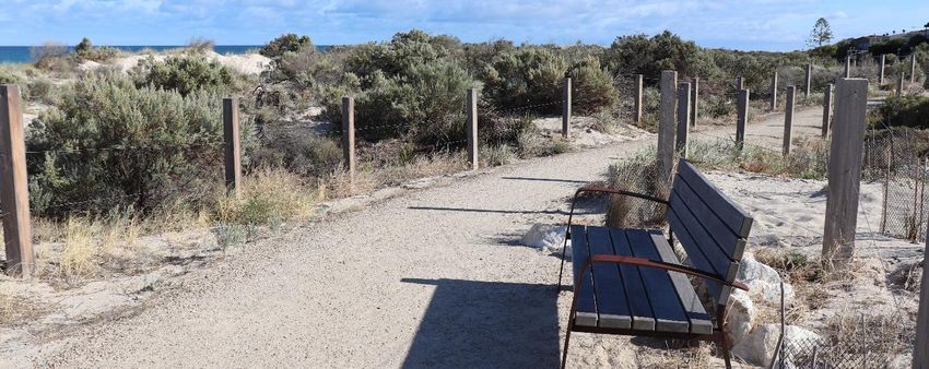
PROJECT SPECIFICATIONS

                                        Client: Copper Coast Council
                               Client contact: Müller Mentz
                                 Client email: mmentz@coppercoast.sa.gov.au

                 Succession Ecology contact: Briony Horner
                   Succession Ecology email: briony@successionecology.com.au

                                Prepared by:    Briony Horner
                                       Date:    23rd May 2020

                                     Quote #: EQ0320-06

DOCUMENT HISTORY

 Version      Date               Modified by                             Modifications
     1        18/03/2020         Briony Horner & Annette Scanlon         Draft
     2        17/04/2020         CCC & CPB                               For Review
     3        14/05/2020         Briony Horner & Annette Scanlon         Final
     4        23/05/2020         Briony Horner                           Update

This report may be cited as:

Succession Ecology (2020). North Beach Sand Drift Management Plan. Succession Ecology report
ES0420–06 prepared for Copper Coast Council.

COPYRIGHT: Use or copying of this document in whole or in part (including photographs) without the
  written permission of Succession Ecology’s client and Succession Ecology constitutes an infringement
  of copyright.

LIMITATION: This report has been prepared on behalf of and for the exclusive use of Succession Ecology’s
   client and is subject to and issued in connection with the provisions of the agreement between
   Succession Ecology and its client. Succession Ecology accepts no liability or responsibility whatsoever
   for or in respect of any use of or reliance upon this report by any third party.

                                                                                             Page 2 of 75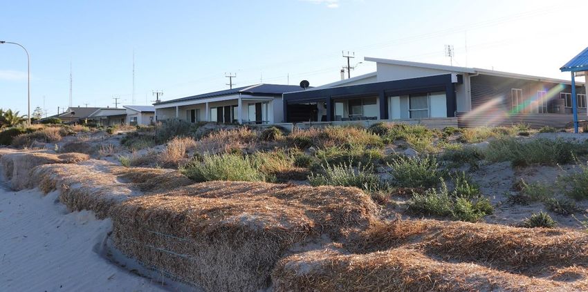
LIST OF ABBREVIATIONS

AHD     Australian Height Datum

CCC     Copper Coast Council

CPB     Coast Protection Board

DLWC    Department of Land and Water Conservation

WBHOA   Wallaroo Beach House Owners Association
WT      Water Technology

                                                    Page 3 of 75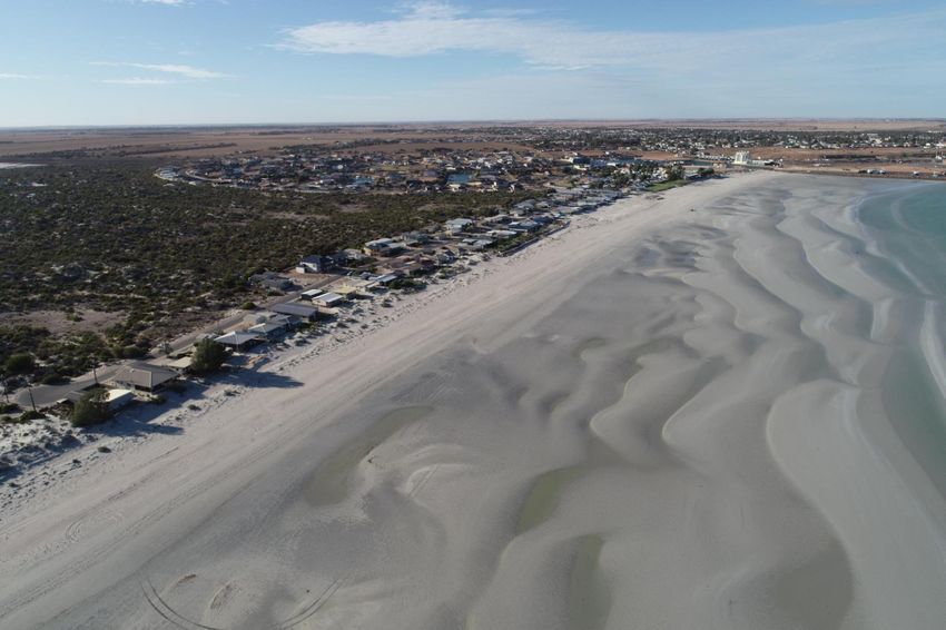
CONTENTS
Project Specifications ............................................................................................................................... 2
Document History .................................................................................................................................... 2
List of Abbreviations ................................................................................................................................. 3
Contents ................................................................................................................................................... 4
List of Figures ........................................................................................................................................... 6
List of Tables............................................................................................................................................. 8
1.0        Introduction.................................................................................................................................. 9
   1.1         Background............................................................................................................................... 9
   1.2         Sand Drift Management ......................................................................................................... 12
   1.3         Community Benefit................................................................................................................. 13
2.0        Coastal systems .......................................................................................................................... 14
   2.1         Dune Formation Processes ..................................................................................................... 14
   2.2         Dune Stabilisation ................................................................................................................... 15
   2.3         Sea Level Rise ......................................................................................................................... 17
   2.4         Vegetation .............................................................................................................................. 17
3.0        Site Assessment and Consultation .............................................................................................. 18
4.0        Establishing a foredune .............................................................................................................. 21
   4.1         Methodology .......................................................................................................................... 21
   4.2         Dune Recovery Examples ....................................................................................................... 23
   4.3         Site Preparation ...................................................................................................................... 24
   4.4         Drift Fencing ........................................................................................................................... 30
   4.5         Planting and Mulching ............................................................................................................ 33
   4.6         Beach Access Walkways ......................................................................................................... 35
   4.7         Temporary Gates .................................................................................................................... 36
   4.8         Exclusion Fencing.................................................................................................................... 36
   4.9         Signage and Interpretive Materials ........................................................................................ 37
   4.10        Toe Dune ................................................................................................................................ 37
5.0        Monitoring and Maintenance ..................................................................................................... 38
6.0        Timing of works .......................................................................................................................... 39
   6.1         Coast Protection Works .......................................................................................................... 39

                                                                                                                                           Page 4 of 75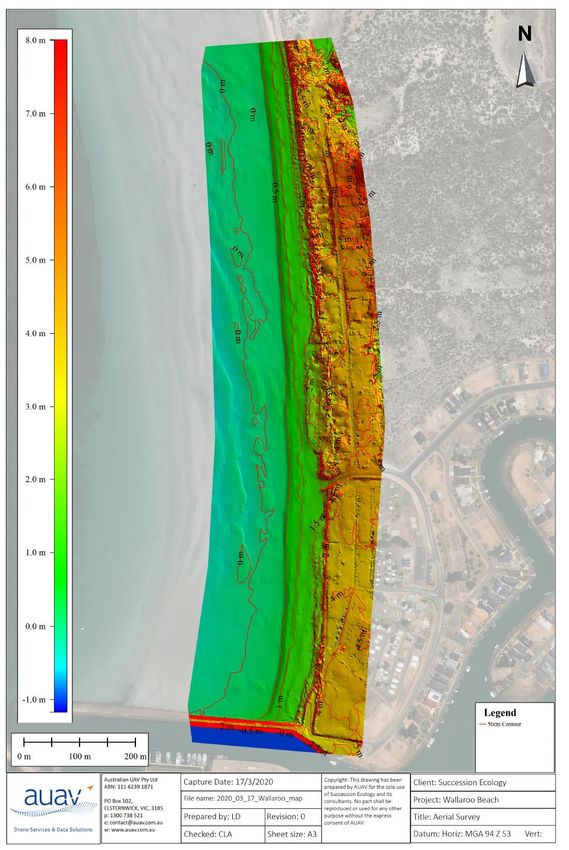
6.3       Coast Protection ‒ Post Works (July 2021 – June 2022) ......................................................... 40
7.0       Risk Assessment ......................................................................................................................... 42
   7.1       Risk Assessment Outcomes .................................................................................................... 42
   7.2       Mitigation Strategies .............................................................................................................. 42
8.0       References .................................................................................................................................. 47
Appendix 1 – EXISTING dune system and proposed foredune system ................................................... 48
Appendix 2 – mapping of fencing and fence heights .............................................................................. 64
Appendix 3 – Risk Assessment ............................................................................................................... 72
   Assessment Metric ............................................................................................................................. 74

                                                                                                                                       Page 5 of 75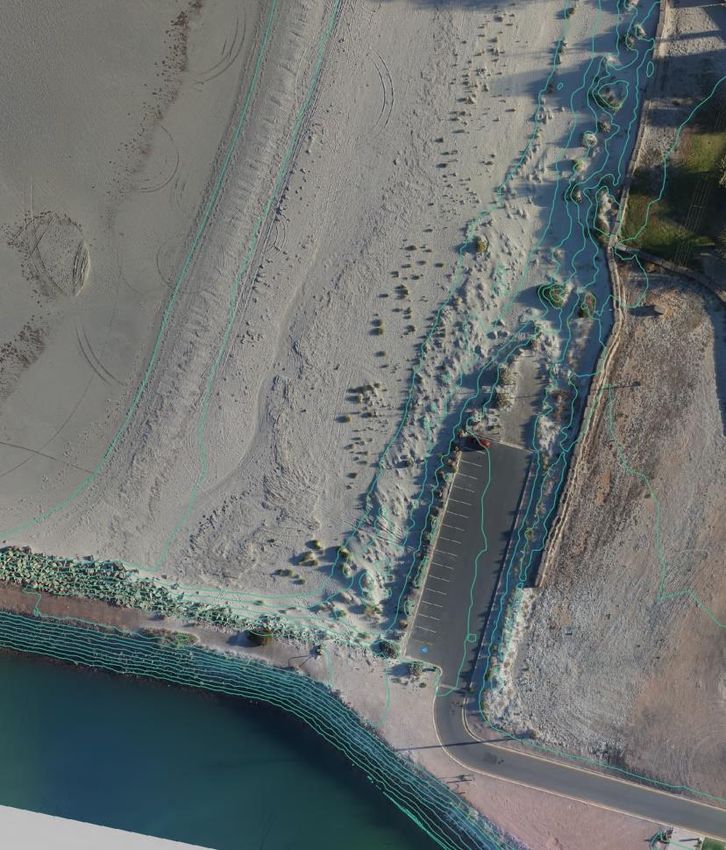
LIST OF FIGURES
Figure 1: North Beach area of Wallaroo in the Copper Coast Council region, and the south section of the
beach proposed for sand drift measures, marked in red. ........................................................................ 9
Figure 2: Wind-blown sand impacts private properties (top) and public infrastructure (bottom). ........ 10
Figure 3: Recent changes in the dune system of North Beach, Wallaroo from 2010 to 2018. ............... 11
Figure 4: Migrating sand (i.e. “transgressive” dune) impacting a property at North Beach, Wallaroo... 12
Figure 5: Storm damage at North Glenelg (left); an intact dune system at Tennyson Beach that absorbs
storm damage, enhances amenity and reduces risk of storm damage (right). ...................................... 13
Figure 6: Historic image of North Beach, Wallaroo in 1930; showing an extensive dune system; image
from the State Library of South Australia. .............................................................................................. 14
Figure 7: Transgressive dunes are formed when vegetation is absent, the sand is highly mobile and
moves inland. ......................................................................................................................................... 15
Figure 8: Vegetated dunes will trap airborne sand particles and replenish beaches following storms.
Illustration from NSW Department of Land and Water Conservation. Coastal Dune Management – A
Manual of Coastal Dune Management and Rehabilitation Techniques; photographs from CCC (top right)
and authors (bottom right). ................................................................................................................... 15
Figure 9: Storms transport sand away from the foredune, if dunes have no vegetation the sand will form
a transgressive dune, which moves inland and can impede on properties. Illustration from NSW
Department of Land and Water Conservation. Coastal Dune Management – A Manual of Coastal Dune
Management and Rehabilitation Techniques; photographs from the authors (top right) and from
WBHOA member (bottom right). ........................................................................................................... 16
Figure 10: Pedestrian walkway during September 2016 storm (photo from CCC), and during dry times
(March 2020, photo from authors). ....................................................................................................... 17
Figure 11: AUAV conducted a detailed survey of North Beach, Wallaroo, using two drones. ................ 18
Figure 12: Surveyors map of North beach at Wallaroo showing elevation at 0.5 m intervals (red lines)
and at 1 m intervals (shaded spectrum). ................................................................................................ 19
Figure 13: Meetings were held at North Beach Wallaroo in March 2020 with members of the Copper
Coast Council (top) and WBHOA (Wallaroo Beach House Owners Association; bottom)....................... 20
Figure 14: North Beach at Wallaroo was divided into seven sections for the purposes of mapping
recovery activities. ................................................................................................................................. 21
Figure 15: The foredune and toe dune height in relationship to beachfront properties, and low stature
native coastal vegetation. ...................................................................................................................... 22
Figure 16: Successful Spinifex establishment of coastal dunes by the Budgewoi Beach Dune care Program
NSW (NSW DLWC 2001). ........................................................................................................................ 23
Figure 17: Examples of current measures being used by landowners at North Beach, Wallaroo. ......... 24

                                                                                                                                       Page 6 of 75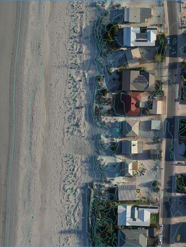
Figure 18: Relocating this public shelter on North Beach at Wallaroo is recommended........................ 25
Figure 19: Water outlets at the southern end of North Beach need augmenting to retain access (left).
The proposed boardwalk design (right) ................................................................................................. 25
Figure 20: Casuarina glauca (swamp sheoak), a declared weed, growing at two properties on the
northern end of Otago Road, Wallaroo. ................................................................................................. 26
Figure 21: Houses with a drift of sand in front of them and little vegetation cover. .............................. 27
Figure 22: Areas of dense, patchy and sparse vegetation cover occur on the site. ................................ 27
Figure 23: Fencing design allowing for a walkway every 4 houses from the houses on Otago Road and
walkways at pre-existing access points south of Pamir Court. The fences cover the hind slope (H; purple),
dune peak (P; orange) and mid slope (green). Each fence is divided into a fence block (FB). Sand
movement marked to add (yellow dash) and to remove (red dash). ..................................................... 29
Figure 24: A staged installation of drift fencing can be used to build a dune. ........................................ 30
Figure 25: Simple fence design for North Beach dune restoration, Wallaroo. ....................................... 31
Figure 26: Fencing mesh (left) and alternative fence end design (right). ............................................... 31
Figure 27: Species to be used in the plantings on site include Atriplex cinerea (left) and Nitraria
billardierei (right). .................................................................................................................................. 33
Figure 28: A sand walkway leading through dunes to beach. ................................................................ 35
Figure 29: Pallets are a readily accessible and affordable option for temporary gates that also reduce
wind erosion of the dune ....................................................................................................................... 36
Figure 30: Safety bollards used to deter pedestrians from dune restoration activity at Semaphore South.
............................................................................................................................................................... 36
Figure 31: Signage to guide people to beach-access pathways (left) and dune restoration information
(right). .................................................................................................................................................... 37
Figure 32: An irrigated sprinkler system can be used to wet sand and stabilise dunes during strong wind
conditions; they also promote rapid vegetation growth. ....................................................................... 44
Figure 33: Beach signs for the public are used to notify them of works, communicate the purpose of the
works and request certain behaviours (top); clearly delineated pathways and other public infrastructure,
such as seating, encourages the desired behaviours (bottom). ............................................................. 45

                                                                                                                                              Page 7 of 75
LIST OF TABLES
Table 1: Soil additions for each fence block allowing for a 2m band of the required height to be
established along each fence transect.. ................................................................................................. 28
Table 2: Estimated lengths and heights for sand drift fences within 17 Blocks along North Beach,
Wallaroo. ................................................................................................................................................ 32
Table 3: Locally native plant species selected for revegetating the restored dune system of North Beach,
Wallaroo. ................................................................................................................................................ 33
Table 4: The proposed schedule of works for activities outlined within the North Beach Sand Drift
Management Plan. ................................................................................................................................. 41
Table 5: Mitigation strategies for each of the outcomes identified by the Risk Assessment of the North
Beach Dune Restoration Project. ........................................................................................................... 43
Table 6: Risks associated with dune development, revegetation, and dust management of the North
Beach at Wallaroo. ................................................................................................................................. 72
Table 7: Threat level risk matrix for the dune development, revegetation, and dust management of the
North Beach at Wallaroo. ....................................................................................................................... 74
Table 8: The Likelihood Scale for the dune development, revegetation, and dust management of the
North Beach at Wallaroo. ....................................................................................................................... 74
Table 9: The Consequence Scale for the dune development, revegetation, and dust management of the
North Beach at Wallaroo. ....................................................................................................................... 75

                                                                                                                                          Page 8 of 75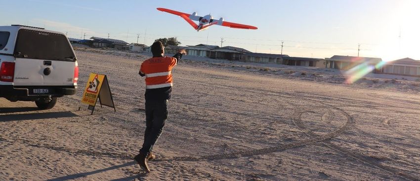
1.0 INTRODUCTION
1.1 Background
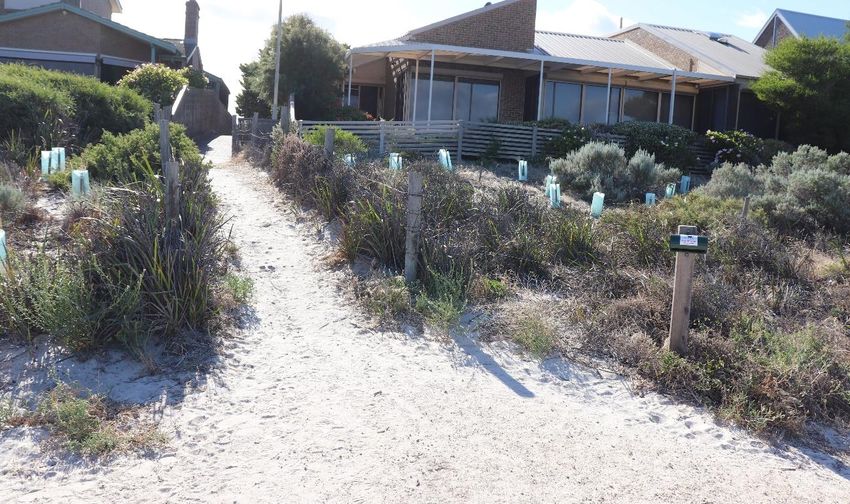
The southern section of North Beach at Wallaroo (within Copper Coast Council, CCC) has been impacted
by dune destabilisation processes (Figure 1). This degradation has resulted in wind-blown sand affecting
private and public infrastructure (Figure 2). Adverse impacts leading to dune destabilisation are
numerous and include the development of a marina and breakwater structures, clearing and
development on the dune system, and vehicle access to the beach. Restoring a healthy dune system,
while accommodating existing beach uses, would provide protection for adjacent properties against
storm surges and wind-blown sand.
The dune system has experienced varying states of repair in the past decade; dune health was in decline,
but the system was still functional in April 2017 (Figure 3). A storm surge in 2016 stripped away a portion
of the foredune, but satellite imagery shows that the system was beginning to recover. A complete
breakdown in many sections of the dune system is evident by late 2018. With the complete loss of
vegetative support, sand clearing was used recently to modify and remove the migrating foredune away
from many of the impacted properties. This migrating sand has been causing significant damage to
infrastructure, inundating the front of several properties (Figure 4). Historical and recent activities
(including development activities and large storms) have led to increased sand movement (both
erosional and depositional) along the beach as natural coastal processes work to re-build the dune.
Figure 1: North Beach area of Wallaroo in the Copper Coast Council region, and the south section of the beach
proposed for sand drift measures, marked in red.
Page 9 of 75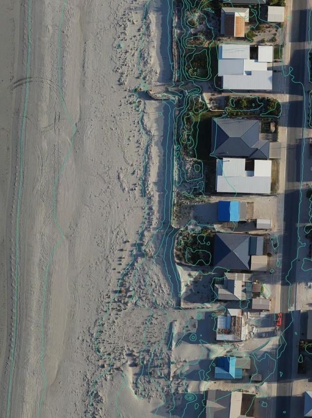
Sand encroaching on
beachside dwellings

     Figure 2: Wind-blown sand impacts private properties (top) and public infrastructure (bottom).

                                                                                             Page 10 of 75
September 2010
April 2013
November 2015
April 2017
November 2018
Figure 3: Recent changes in the dune system of North Beach, Wallaroo from 2010 to 2018.
Page 11 of 75Figure 4: Migrating sand (i.e. “transgressive” dune) impacting a property at North Beach, Wallaroo.
1.2 Sand Drift Management
In order to tackle the impacts of sand drift on the properties at the southern end of North Beach, CCC
engaged Water Technology (WT) to conduct a study of the beach and identify management options to
address sand drift and erosion issues (Water Technology, May and July 2019). It was recommended that
a restored foredune system was required to provide protection against coastal erosion, inundation, and
sea level rise for the properties. The engineered parameters of the required dune system included the
seaward slope gradient and crest elevation measures (in Australian Height Datum, AHD). In addition to
dune shape, the study noted that the reconstructed dune would need to be stabilised to ensure that
ongoing sand drift is minimised. Following these findings, coast protection works were proposed for the
southern section of North Beach, extending from the Wallaroo Marina to the northern end of Otago
Road, approximately 1.1 km (Figure 1).
Two differing methodologies were proposed by Water Technology (Option 1 in May 2019 and Option 2
in July 2019) for the coast protection works. The Coast Protection Board (CPB) recommended that a
combination of the two methods be used to address the issues identified on site.
Page 12 of 751.3 Community Benefit
Primary benefits of restoring the foredune on the southern section of North Beach include:
a. Reduced sand movement – improve site amenity for residents and visitors and reduce cleaning
and property maintenance requirements
b. Property protection – with expected sea level rise and increasing frequency and intensity of
storms with climate change, coastal properties will need a buffer for their protection (Figure 5)
c. Biodiversity restoration – dune systems provide habitat for a range of native species that will
benefit from the reinstatement of a natural system
d. Community cohesion – previous ad-hoc approaches to dune management have created a
disjointed ecosystem and community division; a broad and systematic approach to dune
restoration will stop the need for individual interventions and reactions to those activities
Figure 5: Storm damage at North Glenelg (left); an intact dune system at Tennyson Beach that absorbs storm
damage, enhances amenity and reduces risk of storm damage (right).
Page 13 of 752.0 COASTAL SYSTEMS
2.1 Dune Formation Processes
Dune systems of wave-dominated coastal environments have complex structures determined by
interactions among prevailing winds, sediment supply, wave action, and the broader geomorphology of
the area. Dunes are comprised of sand, which is inherently unstable, nutrient poor and highly mobile;
it also has poor water-holding capacity (high porosity). Coastal vegetation stabilises dunes by trapping
and holding the sand.
North Beach at Wallaroo has a primary dune (foredune) only; secondary and tertiary dunes were lost to
historic development (e.g. Figure 6). Currently, dune vegetation at North Beach is patchy and extensive
areas of no vegetation occur there. When vegetation is absent a transgressive dune forms, these dunes
can be problematic as they move in a landward direction, inundating coastal properties (Figures 4 and
7).
Vegetated dune system in 1930
Figure 6: Historic image of North Beach, Wallaroo in 1930; showing an extensive dune system; image from the
State Library of South Australia.
Page 14 of 75Transgressive dune moving inland
& inundating properties (2020)
Figure 7: Transgressive dunes are formed when vegetation is absent, the sand is highly mobile and moves inland.
2.2 Dune Stabilisation
Foredunes comprise the transition zone between the land and the sea, they are generated by trapping
wind-blown sand particles from the beach face with vegetation. Intact dunes provide a protective
structure and buffer for coastal properties. They also act as sand reservoirs that top-up the beach after
erosional periods (Figure 8).
Vegetated
dunes, 1971
Atriplex cinerea
Figure 8: Vegetated dunes will trap airborne sand particles and replenish beaches following storms. Illustration
from NSW Department of Land and Water Conservation. Coastal Dune Management – A Manual of Coastal Dune
Management and Rehabilitation Techniques; photographs from CCC (top right) and authors (bottom right).
Page 15 of 75During storm surges, sand is eroded from dunes by wave action and is deposited partly down the beach
or in nearshore areas. During periods with onshore winds the sand is transported back from the beach
into the dune area. Failure to trap fresh sand blown up from the beach and continued loss of sand from
wind erosion decreases the stability and effectiveness of these structures. Destabilised dunes become
transgressive and migrate landward (Figure 9).
The prevailing wind direction at North Beach is north and west in winter and south and southwest in
summer. These conditions drive northerly currents and longshore sand movement in winter and
southerly sand movements in summer. The fine sediment at North Beach (0.117 mm) is readily
mobilised with sand naturally migrating in both northerly and southerly directions along the beach front
at different times. It is essential that dune management strategies cater for natural sand movements,
such as promoting a continuous vegetated dune running parallel to the shoreline. It is important to
minimise the physical breaks in the dune, such as pathways, because these will disrupt sand flow and
encourage sand to build up or erode from these areas. Dune breaks (including pathways) must also be
angled (“dog leg” on seaward side) to minimise problems with sand movements and dune stability.
Large areas with no vegetation
Transgressive dune
Figure 9: Storms transport sand away from the foredune, if dunes have no vegetation the sand will form a
transgressive dune, which moves inland and can impede on properties. Illustration from NSW Department of Land
and Water Conservation. Coastal Dune Management – A Manual of Coastal Dune Management and Rehabilitation
Techniques; photographs from the authors (top right) and from WBHOA member (bottom right).
Page 16 of 752.3 Sea Level Rise
On a geological timeframe, fluctuations in sea level are not unusual and many variations are well
documented for the last 400,000 years. However, sea level has been relatively stable for the last 6,500
years, including in recent history when many seaside developments were established. Even with large
reductions in carbon emissions, a sea level rise of 30–60 cm is still projected for South Australia from
climate change. In addition to rising sea levels, climate change will increase the intensity and frequency
of extreme events, including extreme storms. Increases in wave overtopping of protective structures
are expected (Figure 10) as well as a dryer climate generally, which inhibits dune vegetation and
increases dune mobility (i.e. transgressive dunes).
Figure 10: Pedestrian walkway during September 2016 storm (photo from CCC), and during dry times (March 2020,
photo from authors).
2.4 Vegetation
Native coastal plants play a vital role in dune stabilisation. They act to bind dunes together with dense
scrambling root systems; they capture wind-blown sand and disrupt surface wind flow to reduce erosion.
These plants are specially adapted to tolerate the harsh conditions of coastal environments, thriving in
rapidly draining and nutrient poor sand. Coastal vegetation will vary across the dune system with
different suites of species occurring at different stages across the dune. The face of the foredune will
have low growing species such as spinifex grass (Spinifex hirsutus), the dune crest will have low growing
to larger species such as coastal saltbush (Atriplex cinerea), the back of the foredune will have larger
species such as coastal wattle (Acacia ligulata). Some species will grow across the entire dune area such
as nitre bush (Nitraria billardierei).
Page 17 of 753.0 SITE ASSESSMENT AND CONSULTATION
A survey of the southern section of North Beach was conducted in March 2020 by Australian UAV (AUAV)
(Figure 11). The survey provided detailed elevation maps with site topography (mapped at 0.2 and 0.5
m contours, e.g. Figure 12) with aerial imagery and video of the site. This information was used to plot
the existing beach profile against the proposed foredune profile (see Appendix 1: Existing dune system
and proposed dune system; Appendix 2: Mapping of fencing and fence height).
Meetings were also held with members of the CCC and WBHOA (Figure 13). The concerns, observations
and feedback from all stakeholders were incorporated into the management plan for restoring the site.
Figure 11: AUAV conducted a detailed survey of North Beach, Wallaroo, using two drones.
Page 18 of 75Figure 12: Surveyors map of North beach at Wallaroo showing elevation at 0.5 m intervals (red lines) and at 1 m
intervals (shaded spectrum).
Page 19 of 75Figure 13: Meetings were held at North Beach Wallaroo in March 2020 with members of the Copper Coast Council
(top) and WBHOA (Wallaroo Beach House Owners Association; bottom).
Page 20 of 754.0 ESTABLISHING A FOREDUNE
4.1 Methodology
The dune system of the southern section of North Beach at Wallaroo will be restored using a
combination of natural and mechanical processes. The mechanical movement of sand will be used
initially to define and shape the foredune, building the foundation on which natural processes will
follow, continuing the building and stabilisation processes. The rate of natural dune development will
be strongly dependent on climatic conditions, prevailing winds, storm events etc. To support these
natural processes a series of driftnet fences will be established to capture sand and shape the dune. The
fencing will not create a permanent visual impact, rather the aim is for the fences to build dune height,
and eventually become engulfed by the sand. These fences will be established, following the
specifications in the North Beach Sand Drift Study (Water Technology May 2019). Namely, to build a
foredune with a crest height of 3.6 m AHD with seaward slope gradient of 1:5 (every 5 m towards the
sea, the dune decreases by 1 m in height) and a smaller toe dune with a crest height of 2.6 m AHD.
For the purposes of designing this project the length of beach from the Marina to the end of Otago Road
was divided into seven sections (Figure 14). The landward start of the foredune will be the same height
as the base of each house (approximately 3.2 m AHD; Figure 15), it will rise to 3.6 m AHD at 13 m from
the front of the houses along Otago Road to Pamir Court (Sections 1 to Section 5). The beach from Pamir
Court to the Marina will have the foredune peak located 8 m from the retaining wall and car park
(Sections 5 to 7). Maps and graphs of the foredune profile relative to the existing beach profile are
available in Appendix 1.
The fencing design will cause some of the existing vegetation to be covered with sand. While covering
vegetation appears counterintuitive to stabilising the dune system, these plants will provide sub-surface
stabilisation services and organic matter for long-term outcomes. Once established, the foredune will
be planted with native vegetation and mulched to improve the integrity of the system and anchor sand.
The final dune system will be held together with vegetation and provide a buffer against storm surges
and wind-blown sand.
Section 1 Section 2 Section 3 Section 4 Section 5 Section 6 Section 7
Figure 14: North Beach at Wallaroo was divided into seven sections for the purposes of mapping recovery activities.
Page 21 of 755.0
4.5 Foredune
4.0 Toe dune
3.5
3.0
2.5
Dune Height (m; AHD)
2.0
1.5
1.0
0.5
0.0
0 13 17 22 27 32
Chainage (m)
Figure 15: The foredune and toe dune height in relationship to beachfront properties, and low stature native coastal vegetation.
Page 22 of 754.2 Dune Recovery Examples
This methodology has been successfully used in projects around Australia and beyond. Some examples
include Tennyson Beach in South Australia (https://www.tennyson.org.au/), Budgewoi Beach in NSW
(http://www.budgewoibeachdunecare.com.au/index.html and Merimbula Beach in NSW
(https://www.environment.nsw.gov.au/resources/coasts/130083Merimbula.pdf).
Figure 16: Successful Spinifex establishment of coastal dunes by the Budgewoi Beach Dune care Program NSW
(NSW DLWC 2001).
Page 23 of 754.3 Site Preparation
A range of site preparation activities will be required before the fencing can be established on site. These
include:
1) Removing existing sand control measures
A range of sand drift and erosion control measures have been established on the site (Figure 17). While
these measures have proved effective for some landowners, they create an ad-hoc, inconsistent
appearance for the beach. In order to provide a uniform approach to the management of the site,
improve amenity and support the establishment of a consistent foredune, the existing hay bales and
drift fencing will be removed from the site. Landowners will be provided with the option to remove
their own bales or leave them as a donation for using to establish the new dune management system.
Any remaining bales will be used to mulch the new dunes as they develop. This work will be carried out
by CCC under the supervision of Succession Ecology.
Figure 17: Examples of current measures being used by landowners at North Beach, Wallaroo.
Page 24 of 752) Moving the public shelter
A public shelter has existed on North Beach at Wallaroo for many years (Figure 18). Currently, the
structure is inundated by the foredune and it is in the direct path of the toe dune site. Sand inundation
has reduced access to the shelter, which is unlikely to change with time. It is proposed that the shelter
be moved toward the beach by around 15 m. The relocation would allow for ease of public use, enable
planned dune restoration activities, and encourage vehicle traffic to arc widely around the structure and
away from developing dunes. The structure could, at the same time, be upgraded to improve its safety
and function for public use. This work will be carried out by CCC.
Figure 18: Relocating this public shelter on North Beach at Wallaroo is recommended.
3) Water outlets
Two water outlets exist along the southern end of North Beach (Figure 19). Access to these outlets will
be maintained via small boardwalk structures, built out from and level with the nearby seawall (Figure
19). The boardwalk will also cover the plugs for amenity purposes. This construction will be managed
by CCC.
Figure 19: Water outlets at the southern end of North Beach need augmenting to retain access (left). The proposed
boardwalk design (right)
Page 25 of 754) Tree removal
Several Casuarina glauca (swamp sheoak) trees are growing at the northern end of the project area
(Figure 20). This species is a declared weed in South Australia under the Natural Resources Management
Act 2004. These plants present a significant risk to the project; they grow via suckers, inhibit growth of
other species, and can become invasive. They have the potential to become a significant pest species in
the restored dune system. The removal of these trees will be carried out by CCC.
Figure 20: Casuarina glauca (swamp sheoak), a declared weed, growing at two properties on the northern end of
Otago Road, Wallaroo.
5) Preliminary shaping of the beach and foredune profile
Some initial sand movement will be required to prepare for establishing the new foredune. These works
will remove sand from the areas where it has built up (where dune heights exceed foredune profile) and
move it to areas where the foredune profile needs building. In particular, sand removal will target those
areas that are problematic to landowners (e.g. Figure 21) and sand deposition in those areas with poor
dune profiles (i.e. the southern section of the beach). Vegetative cover on the existing dune varies,
some areas have extensive and dense cover, others are sparsely vegetated (Figure 22). Existing
vegetation will be preserved where possible; where vegetation is disturbed or covered it will still provide
important structural support for the new dune system. Mulch will be used in layers through the sand to
provide extra structural support in newly established areas.
Surveys indicate that dune height on the beach North of Pamir Court is close to the planned foredune
profile. Minimal sand movement will be required in this section, except for remedial works to remove
sand from inundated properties (Appendix 1). The beach south of Pamir Court has a significantly lower
foredune profile than is required. This section will require significant deposition and movement of sand
to raise the dune profile for fencing activities that will facilitate further dune development. Sand
movement and mulching work will be carried out by CCC under the supervision of Succession Ecology.
Page 26 of 75Figure 21: Houses with a drift of sand in front of them and little vegetation cover.
Figure 22: Areas of dense, patchy and sparse vegetation cover occur on the site.
The total estimated sand to be moved is 842.2 m3 (Table 1). The sand will be taken from a range of
sources with the aim to scalp sand thinly in two areas: 1) where it has built up too much in front of
properties in fence blocks 8 to 11 and 2) along the beach front between fence blocks 6 to 17 (Figure 26).
Machinery used to move the sand will include a water truck to stabilise sand and reduce windblown
sand, a grader to scrape sand from the tide line, an excavator, a dump truck and a smaller digger (skid-
steer). The heavier machinery will work mostly on the mid beach where the sand is firm with the dump
truck transporting and depositing sand to raise the areas required in preparation for fence construction.
Sand will be wet down to hold it in place and create a stable profile for fencing. A small skid steer will
be used for sand movements higher up the beach where the sand is soft and vegetation disturbance
should be avoided.
Page 27 of 75Table 1: Soil additions for each fence block allowing for a 2m band of the required height to be established along
each fence transect..
Hind Peak Mid
Fence Sand Height Sand Height Sand
Block Height Length Length Length
moved adjustme moved adjustme moved
(m) (m) (m) (m)
(m3) nt (m) (m3) nt (m) (m3)
1 0.1 44 8.8 1 52 104 0.1 50 10
2 0 0 0 0.2 51 20.4 0.1 50 10
3 0 0 0 0 0 0 0 0 0
4 0 0 0 0 0 0 0 0 0
5 0 0 0 0 0 0 0 0 0
6 0 0 0 0 0 0 0 0 0
7 0 0 0 0 0 0 0 0 0
8 0 0 0 0 0 0 0 0 0
9 0 0 0 0 0 0 0 0 0
10 0 0 0 0 0 0 0 0 0
11 0 0 0 0 0 0 0 0 0
12 0.4 17 13.6 1 16 32 0.2 90 36
13 0.2 70 28 0.9 71 127.8 0 0 0
14 0 0 0 0.2 63 25.2 0 0 0
15 0.1 50 10 0.9 50 90 0.2 90 36
16 0 0 0 0.5 58 58 0 0 0
17 0 0 0 0.8 134 214.4 0.1 90 18
TOTAL – 181 60.4 – 495 671.8 – 370 110
Page 28 of 75FB 1: H, P, M FB 2: H, P, M FB 3: Ha, Hb, P, M FB 4: Pa, Pb, M FB 5: Pa, Pb, Pc, M
FB 6: M FB 7: M FB 8: P FB 9: P FB 10: P FB 11: P
FB 12: H, P, M FB 13: H, P, M FB 14: H, P, M FB 15: H, P, M FB 16: H, P, M FB 17: H, P, M
Figure 23: Fencing design allowing for a walkway every 4 houses from the houses on Otago Road and walkways at pre-existing access points south of Pamir
Court. The fences cover the hind slope (H; purple), dune peak (P; orange) and mid slope (green). Each fence is divided into a fence block (FB). Sand
movement marked to add (yellow dash) and to remove (red dash).
Page 29 of 754.4 Drift Fencing
The purpose of drift fencing is to slow wind velocity, capture airborne sand and build dune structures
(Figure 24). This process can be used as part of a strategy to re-build a foredune that has been lost from
destabilisation processes. The rate at which dune re-building occurs will depend on wind direction and
speed. The aim for this project will be to establish the bulk of the foredune within one year. The low
dune profile at the southern end of the beach may require an extension to this timeline.
The design for this project will be a standard drift fence using 100 mm diameter posts set 4 m apart
connected with high tensile wire mesh and a 900 mm high drift fence (Figures 25 and 26). The height of
the fence and end sections above the dune will vary depending on location. As the primary aim is for
the fence to be inundated by sand, an additional wing would be added if a box section is used to support
the development of a slope at the end of the dune ridge. If the fence abuts a dune slope, an alternative
end design will be used to allow the fence to blend into the existing dune (Figure 26).
Figure 24: A staged installation of drift fencing can be used to build a dune.
Page 30 of 75Figure 25: Simple fence design for North Beach dune restoration, Wallaroo.
Figure 26: Fencing mesh (left) and alternative fence end design (right).
The fencing design includes establishing fences at the hind slope, peak and mid slope of the foredune.
It will cover approximately 2,382 m and will be divided into 17 fence blocks located between the beach
access walkways and the road access point at Pamir road (Table 2 and Figure 23). Each block will require
different lengths of hind, peak and mid dune fencing. The greatest amount of fencing will be needed
south of Pamir Court. Dune elevation from north to south is variable so fence height requirements will
also vary based on block elevation. Fencing relative to elevation is estimated in Table 2; fencing details
and maps are available in Appendix 2.
The fence will be constructed by a local fencing contractor employed by CCC under the supervision of
Succession Ecology.
Page 31 of 75Table 2: Estimated lengths and heights for sand drift fences within 17 Blocks along North Beach, Wallaroo.
Hind Peak Mid
Fence Block
Length (m) Height (cm) Length (m) Height (cm) Length (m) Height (cm)
1 44 90 52 90 50 90
2 34 50 51 90 50 90
3 36 & 15 50 62 90 63 90
4 – – 11 & 22 50 59 90
5 – – 8, 9 & 7 50 50 90
6 – – – – 65 50
7 – – – – 56 50
8 – – 60 70 60 70
9 – – 57 50 57 50
10 – – 57 50 57 50
11 – – 46 50 46 50
11 roadway – – – – 23 50
12 roadway – – – – 17 50
12 17 90 16 90 11 90
13 70 90 71 90 69 80
14 54 60 63 90 61 70
15 50 80 50 90 50 90
16 58 80 58 90 58 70
17 134 50 134 90 134 90
TOTAL 512 m 834 m 1,036 m
Page 32 of 754.5 Planting and Mulching
In order to stabilise the restored dune system, it is vital to establish plant cover. A planting density of at
least one plant per m2 will be used at North Beach. The species selected for this planting include those
known to grow well on the site, other dune species that occur in the region and those known to establish
rapidly (Table 3; Figure 27).
Table 3: Locally native plant species selected for revegetating the restored dune system of North Beach, Wallaroo.
Position on the
Growth form Scientific name Common name foredune
Front Mid Back
Carpobrotus rossii Native pigface
Creeper
Threlkeldia diffusa Coastal bonefruit
Distichlis distichophylla Emu grass
Grass
Spinifex hirsutus Hairy spinifex
Atriplex cinerea Coast saltbush
Atriplex paludosa Marsh saltbush
Olearia axillaris Coast daisy-bush
Shrub
Rhagodia candolleana Seaberry saltbush
Scaevola crassifolia Cushion fan flower
Nitraria billardierei Nitre-bush
Myoporum insulare Common boobialla
Large shrub
Acacia ligulata Umbrella bush
Figure 27: Species to be used in the plantings on site include Atriplex cinerea (left) and Nitraria billardierei (right).
Page 33 of 75The area to be covered by the plantings is around 2.4 Ha. With an average density of one plant per m2,
the planting effort will require 24,000 plants. Planting will be conducted in two stages: 1) preliminary
planting to stabilise dune areas that are already at the required foredune profile (approximately 30% of
the site with 7,000 plants), and 2) a secondary planting for the remaining dune once it has developed
suitably (approximately 70% of the site and 17,000 plants). The first 7,000 plants have already been
sourced and will be ready for planting in June 2020. These plants will be well mulched following planting
to improve water retention. If no rainfall occurs within three days of planting, they will be watered in
manually. Additional watering will be conducted as required over their first year. The secondary
planting will occur in June 2021 and will follow the same approach to mulching and watering.
The planting plan will incorporate the ecology of each species and the requirements of the site. Coastal
zonation patterns will inform the planting plan, such that rapidly growing grasses (e.g. emu grass and
hairy spinifex), which withstand salt spray, strong winds and sand abrasion, will be planted in the most
exposed foredune areas. Plant species assemblages then change with distance from beach; low shrubs
would be more common in swale and hind dune areas, for example.
Mulch will be added to the foredune as it develops to improve soil stabilisation and moisture holding
capacity. It will also be added along the fences as required to anchor captured sand that may otherwise
move on away from the dunes. Sources of mulch will include seaweed, existing hay bales on site and
possibly brush from areas where vegetation has died back. Additional straw bales will also be purchased
as required to bolster mulching activities.
The planting will be carried out by Succession Ecology with CCC providing staff to mulch and water plants
following planting.
Page 34 of 754.6 Beach Access Walkways
Beach access walkways will be established through the dune systems to guide foot traffic and discourage
walking across newly establishing dunes and vegetation. These walkways will occur at existing access
points south of Pamir Court and at a frequency of one walkway per four houses north of Pamir road.
Walkway frequency north of Pamir Court was greater than recommended by WT (2019) as property
owners were concerned that it would be difficult to prevent foot traffic across the dunes by visitors of
holiday rentals if beach access points were infrequent.
It is important to specify that beach access tracks would terminate on the beachside in a northward
heading “dog-leg” pattern. Seaward access points positioned perpendicular to the foredune would
interrupt the flow of sand along the dune and promote wind funnelling and risk of blowouts. The tracks
will comprise simple sand trails of about 1-m width (Figure 28). Fencing will run either side of access
tracks to encourage people to use them.
Fencing and pathways will be installed by CCC under the supervision of Succession Ecology. Pathway
condition will be reviewed during the project to determine whether the frequency is too intensive to
support the developing dune.
Figure 28: A sand walkway leading through dunes to beach.
Page 35 of 754.7 Temporary Gates
Temporary gates may be required during the dune development phase to prevent wind damage through
the breaks in the fence created for walkways. They can be as simple as applying a pallet across the gap
in drift fence, and some are already in use (Figure 29). Gates will be installed by CCC as required under
the supervision of Succession Ecology.
Pallets used for gates
Figure 29: Pallets are a readily accessible and affordable option for temporary gates that also reduce wind erosion
of the dune
4.8 Exclusion Fencing
The developing foredune will be a very fragile environment, its protection will be integral to the success
of the project. Eliminating foot and vehicle traffic from the surface will be vital. Exclusion fencing should
be established along the seaward and landward sides of the dune restoration areas. The fence could be
a simple post and rail or chain fence (Figure 30). Fencing will be installed by CCC under the supervision
of Succession Ecology.
Figure 30: Safety bollards used to deter pedestrians from dune restoration activity at Semaphore South.
Page 36 of 754.9 Signage and Interpretive Materials
Signage should be displayed alongside the exclusion fencing and in high-use areas to inform the public
of the foredune redevelopment project and encourage them to avoid the fragile foredune (Figure 31).
Other interpretation materials, such as brochures and community forums, could provide detailed
information on the dune ecosystem, the plants and wildlife that they could expect to see. Signage will
be designed and installed by Succession Ecology in collaboration with CCC. Other interpretive materials
can be designed as required.
Figure 31: Signage to guide people to beach-access pathways (left) and dune restoration information (right).
4.10 Toe Dune
It is recommended that a toe dune fence be installed once the foredune has achieved the desired height.
The timing of the installation will then vary across the restoration area, with fence blocks 6 and 7
receiving toe dune fencing after winter in 2020 and the remaining areas receiving fencing in winter 2021.
The smaller seaward dune would act as a protective buffer for the foredune. The crest of the toe dune
will occur 10 m from the foredune crest, reaching 2.6 m AHD (Figure 15); details on location of toe dune
fencing are available in Appendix 1. A toe dune is already forming in some northern sections of the
project site. The benefits of a toe dune include:
• Interruption of wind and sand movement from skating over the foredune, creation of additional
sand capture opportunity
• Additional protective buffer for properties
• Additional protective structure for the main foredune
• Promotion of a more diverse dune system with inter-dune swale habitat, which some plant and
animal species will prefer
• Additional deterrent for vehicles, keeping them further away from important foredune structure
• Working with the natural system of North Beach, the toe dune is already forming
Page 37 of 755.0 MONITORING AND MAINTENANCE
The development of the North Beach dune will be monitored quarterly following installation of the
fencing. Monitoring will be conducted by Succession Ecology and will enable recording of foredune
development, conditions on site, maintenance requirements, storm damage, walkway condition and
any other activity required to promote positive foredune development outcomes. Particular attention
will be given to monitoring efforts following storm events. A brief report to CCC will present required
activities and locations for these works. A 10% budget allowance has been factored into the project for
any remedial works required.
Maintenance works by CCC will include:
• Fence and signage repair – fences and signs may become damaged by storms, vandalism, and
environmental wear; the location and type of fence repairs required will be determined and
reported to the CCC to address
• Sand movement – supplementary sand movements may be required. For example, storm
events can displace large volumes of sand, blow-outs in the dune may occur from walkways, and
transgressive dunes may impact some properties before stabilisation works are complete. The
nature of the problem and required remedial sand movement will be reported and will be
addressed by CCC
• Mulching – mulching requirements will be assessed during the monitoring program; identified
mulching maintenance will be conducted by CCC as required
• Plant watering – watering of planted seedlings will be conducted by CCC for the establishment
period. Watering can occur by hand or via an irrigation system (see Section 7.2.1)
Page 38 of 756.0 TIMING OF WORKS
The project will be conducted over a 2-year period to allow for dune development and establishment
phases. For a detailed project timeline see Table 4. The project activities will be divided into:
1. Coast Protection Works
2. Coast Protection – Post Works
6.1 Coast Protection Works
6.1.1 April to June 2020
Activities required to achieve recovery of the foredune will include:
a) Materials and mobilisation – Purchasing and preparation of materials
b) Site preparation – Sand movement, remediation of previous sand control strategies (re-use of
materials where possible)
c) Install drift fencing – Construct drift fencing (hind-slope, peak and mid-slope of the proposed
foredune)
d) Stage 1 planting – Preliminary plantings in areas already at the required height (~30% of site and
7,000 plants)
e) Spread mulch – Use of old hay bales and seaweed to provide mulch for the preliminary planting
areas to reduce wind erosion in dunes that are at the required height
f) Pathways and gates – to be established at intervals of one per four houses
g) Exclusion fencing – to be established along pathways
h) Signage – designed and installed
6.1.2 July 2020 to June 2021
Activities required to achieve recovery of the foredune will include:
a) Site monitoring and maintenance – conducted quarterly
b) Toe dune fence installed – Construct sand drift fencing
c) Stage 2 planting – Secondary plantings following dune establishment (~70% of site and 17,000
plants)
d) Spread mulch – Use of hay bales and seaweed to provide mulch for planting areas
e) Exclusion fencing – expanded to protect foredune
Page 39 of 756.3 Coast Protection ‒ Post Works (July 2021 – June 2022)
6.3.1 Finalisation
On completion of the coastal protection works the Coast and Marine Branch of the CPB will be invited
to review the works and assess whether they are satisfied that the works meet the agreed outcomes.
6.3.2 Monitoring and Maintenance
A 12-month monitoring (Succession Ecology) and maintenance (CCC) period will follow the final
implementation. These services will include:
a) Quarterly site inspections and reports
b) Watering
c) Sand management
d) Infill planting
e) Fence repair
f) Pathway, fence and signage maintenance
6.3.4 Foredune Management Plan
As part of the handover for this project we propose that a Foredune Management Plan be developed,
which would describe management activities that support the continued health and viability of the dune
system in the medium- and long-term.
Page 40 of 75Table 4: The proposed schedule of works for activities outlined within the North Beach Sand Drift Management Plan.
2020 2021 2022
Activity
A M J J-S O-D J-M A M J J-S O-D J-M A-J
Preliminary Works
1. Site assessment and design ×
2. Liaison with partners and stakeholders ×
3. Materials for application to CPB ×
4. Plants and equipment orders ×
Coast Protection Works
1. Materials and mobilisation × x × x
2. Site preparation ×
3. Install foredune fencing ×
4. Planting and mulching × ×
5. Pathways and gates ×
6. Exclusion fencing ×
7. Signage ×
8. Monitoring and maintenance × × ×
9. Toe dune fencing × ×
3.0 Coast Protection ‒ Post Works
1. Finalisation ×
2. Monitoring and maintenance × × × ×
3. Foredune Management Plan ×
Page 41 of 757.0 RISK ASSESSMENT
A risk assessment is a tool for identifying variables that may impede project success. For the North
Beach sand management project, a range of variables have the potential to impact dune development,
revegetation, and dust management targets. Potential risks, their likelihood and consequences are
detailed in Appendix 3 and Table 6.
7.1 Risk Assessment Outcomes
The primary negative outcomes identified within this risk assessment include (Appendix 1):
1) Dune structure damage – from strong winds, waves, dry sand and public access
2) Sand Drift – from strong winds and dry sand
3) Plant losses – from lack of rainfall, wave damage, and public access
4) Weed competition – incursions from surrounding weed populations
5) Loss of project support – from financial constraints
6) Negative publicity – from failure to reach project targets
7.2 Mitigation Strategies
The identified risks with the greatest threat level to achieving project outcomes were extreme winds
and high tides or large waves (Level 4; Table 5). A range of strategies can be applied to mitigate against
these risks as well as for other risks of lower threat levels. Mitigating strategies for each of the identified
outcomes are described in Table 5.
Page 42 of 75Table 5: Mitigation strategies for each of the outcomes identified by the Risk Assessment of the North Beach Dune
Restoration Project.
Outcome Risk factors Mitigation Strategies
• Development of toe dune post-winter
• Monitoring and maintenance program
Storm events • Contingency for remedial works
• High planting density and use of mulch
• Additional fencing
• Plant species selection
• Mulch to provide organic material and increase
Drought
1. Dune structure damage water-holding capacity
• Use of irrigation system
• Exclusion fencing to deter foot traffic
• Signage to encourage desired behaviours
• High frequency of walkways to beach enabling
Public access
ready access
• Moving the public shelter so drivers arc around it
and away from dunes
• Use of irrigation system
• Additional fencing
• Development of toe dune post-winter
Strong winds
• Monitoring and maintenance program
• Contingency for remedial works
2. Sand Drift • High planting density and use of mulch
• Use of irrigation system
• Plant species selection
Dry Conditions • Strategic planting plan
• Mulch to provide organic material and increase
water-holding capacity
• Exclusion fencing to deter dune access
Public access
• Signage to encourage desired behaviours
• Plant species selection
• Strategic planting plan
3. Plant losses Severe conditions
• Mulch to provide organic material and increase
(including drought and
water-holding capacity
storms)
• Use of irrigation system
• Contingency for remedial planting works
• Selection of competitive native plant species
Invasion of dune • Monitoring and maintenance program
4. Weed Competition
system • Planned removal of existing invasive plants on site
(e.g. C. glauca)
• Effective project management
• Good working relationships with CCC, CPB and the
5. Loss of project support Funding limitations
community
• Adaptive management approach
Page 43 of 75You can also read