Post-Fire assessment using Sentinel-2 images in French Mediterranean area - Office National des Forêts Yvon Duché, Jean-Luc Kicin, Benoît Reymond ...
←
→
Page content transcription
If your browser does not render page correctly, please read the page content below
Post-Fire assessment using
      Sentinel-2 images in French
          Mediterranean area

               Office National des Forêts
Yvon Duché, Jean-Luc Kicin, Benoît Reymond, Rémi Savazzi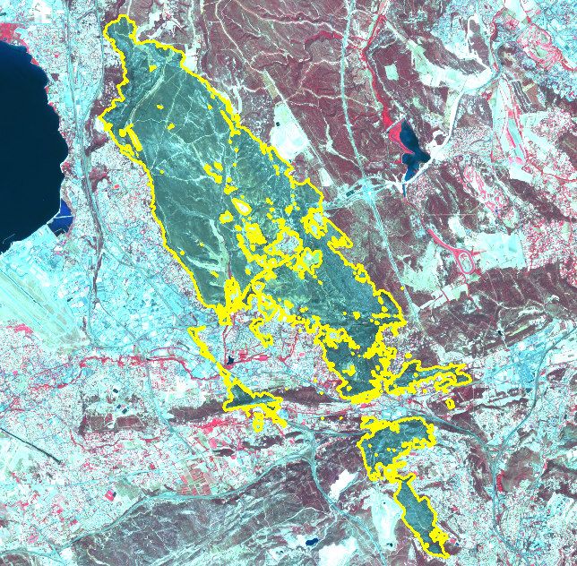
ONF presentation

ONF (National Forestry Board) is a State Public Body, under the joint supervision of the
Ministries of Forestry and the Environment.
ONF is responsible for forest management for both the state and local government, and
has a public service remit to help the State and local authorities in protecting forests
against fires.
ONF has a specialized agency in the Midi-Mediterranean area to deal with wildfire issues
that performs the following tasks:

   •   Operational - monitoring, detection, first response, support to control activities
   •   Development and maintenance work - roads, water points, areas cleared of undergrowth
   •   Expertise support - hazard and fire mapping, fire risk management plans, equipment mapping …
   •   Project management
Calculation method using
Sentinel-2 data
Within these missions, ONF establishes wildfire maps. Sentinel-2 images have
been used from 2016 using differenced Normalized burnt Ratio (dNBR) calculation
method. This method is based on the different spectral responses of Near InfraRed
(NIR) and Shortwave Infrared bands (SWIR) for unburnt/burnt areas.

                                                               Source : USDA Forest Service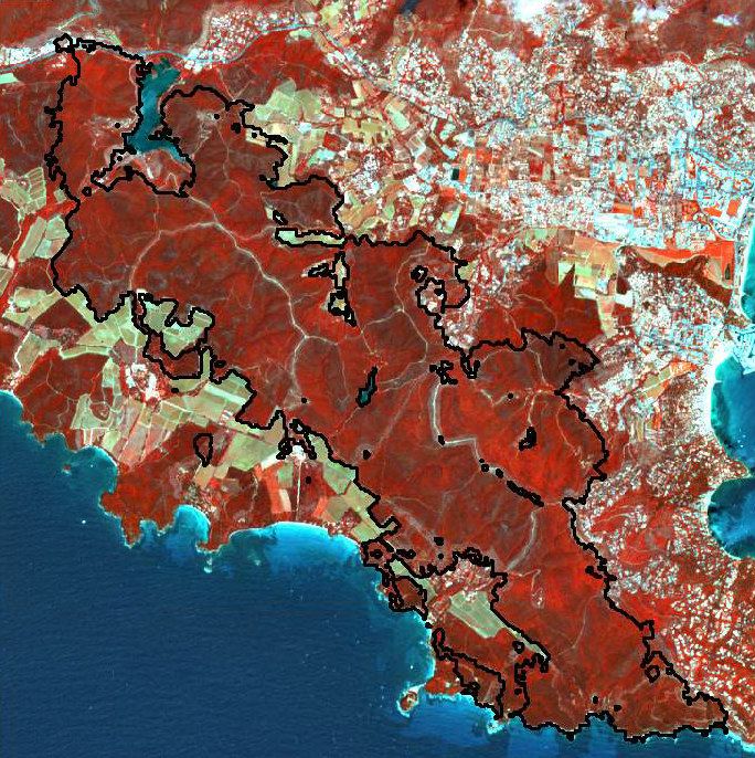
Calculation method using
Sentinel-2 data
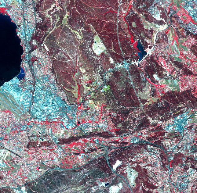
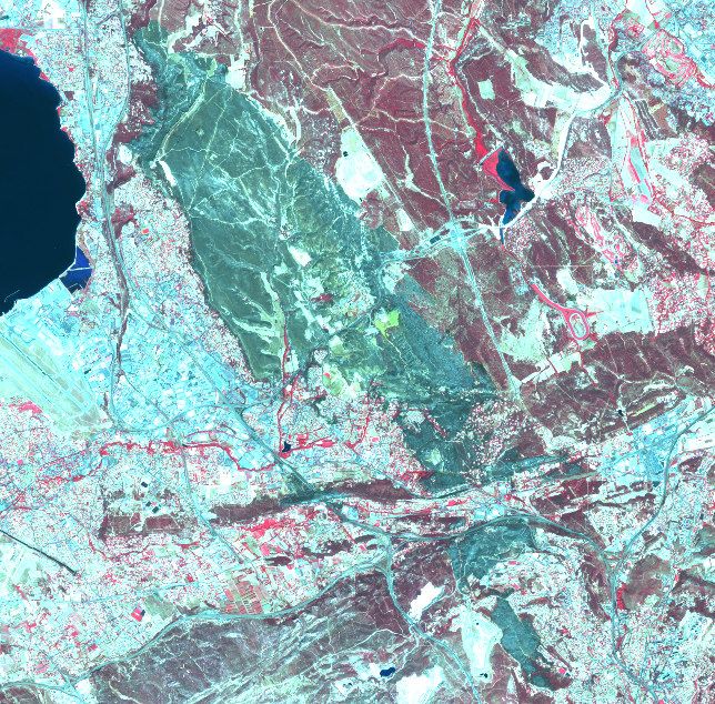
Example : Rognac fire, 10th of August 2016, 2 655 ha
NBR =
NBR pre fire NBR post fire
Pre-fire image 3rd of August Post-fire image of 13th of August
Sentinel 2A © ESA 2016 © CNES 2016 Sentinel 2A © ESA 2016 © CNES 2016
dNBR = NBR(pre-fire) - NBR(post-fire)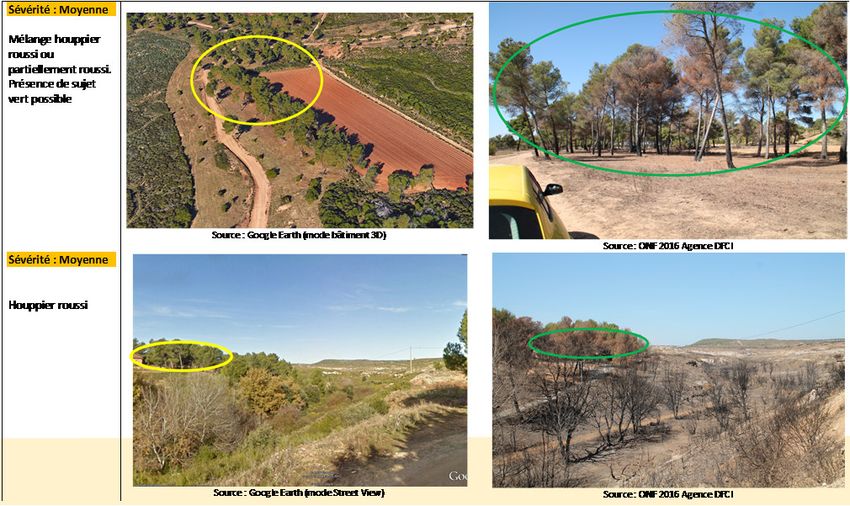
Fire outline mapping

      The dNBR calculation allows a quick fire outline mapping.

Result of the dNBR calculation
  (raster format) Value > 0.1

                                                                   No pixels
                                                                     shape
                                                                  generalizing

                                 Vector conversion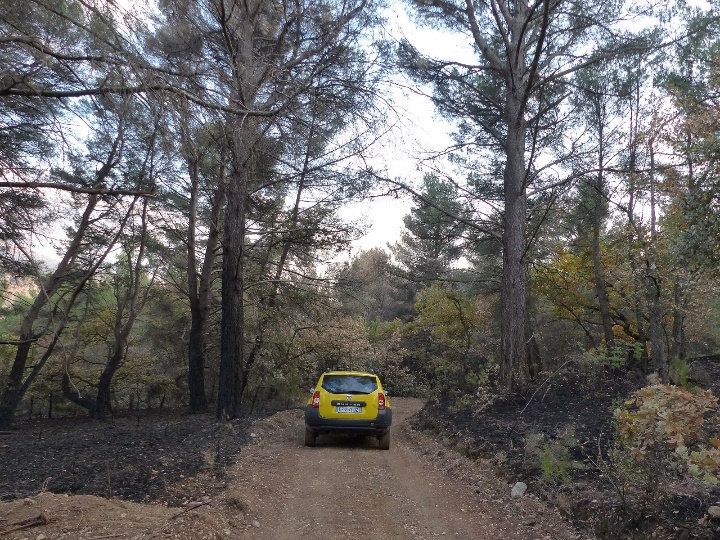
Fire outline mapping
        Accuracy of fire outline mapping has been validated on different kinds of situations.

• Flat terrain                                             • Steep terrain
• Maximum outline difference < 20 m (i.e. pixel size)      • 6 % surface difference between GPS/manual
• 0.4 % surface difference between GPS record and            cartography (unattainable areas) and dNBR map
  dNBR map

                      Aix-en-Provence, 14th of June 2016             Châteauneuf-les-Martigues, 14th of July 2016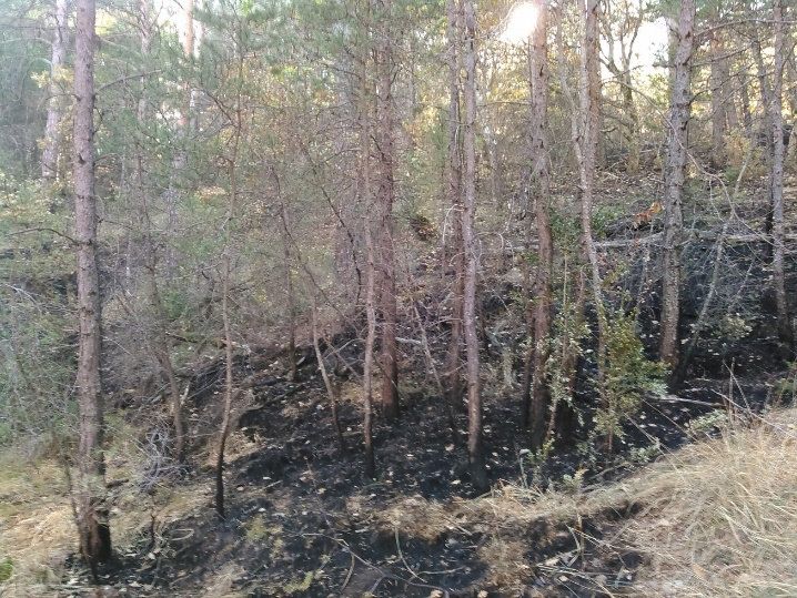
Fire outline mapping
        These tests have shown that :

• dNBR mapping seems accurate for “big” (size/intensity) fires / in
  most summer conditions in French Mediterranean conditions
  equivalent to GPS survey
• For big fires it allows a quick mapping of the fire outline
• In steep terrain, dNBR is more accurate than traditional mapping
• dNBR can also contribute to check and map small fire spots
  (20x20) more rapidly and more efficiently

                                                                      Red = false spot / Green = true spot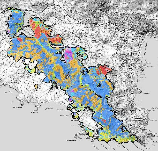
Fire outline mapping
But depending on burn severity and vegetation type, some
burnt areas can be missed by the dNBR calculation.

This kind of situations often occur during the winter period
when burn severity is lower than during summer time.

                                                                               Moustiers-Ste-Marie, 22nd of October 2017

                                     Detected                 Undetected
                  Moustiers-Ste-Marie, 22nd of October 2017

                                                                           Roquefort des Corbières, 6th of September 2017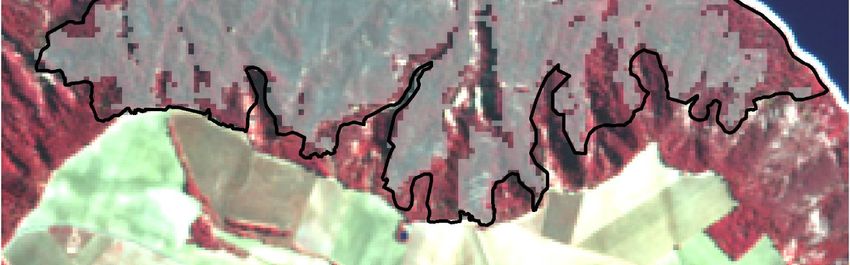
Fire outline mapping
Therefore, fire outline mapping during winter period must
complete dNBR calculation with GPS survey for instance.

    Detected

                                                             Undetected

                 Moustiers-Ste-Marie, 22nd of October 2017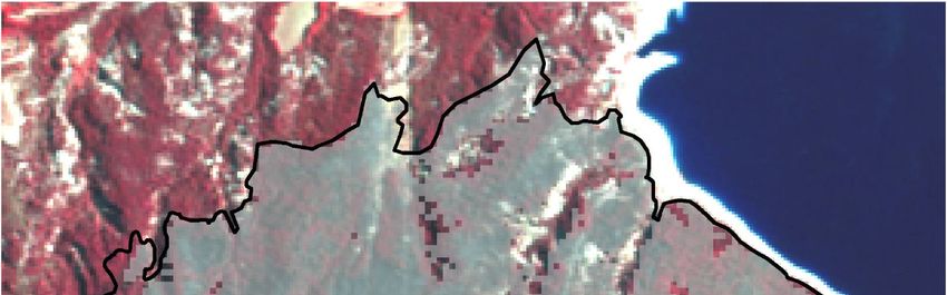
Fire outline mapping

In 2017, availability of Sentinel 2B
images has reduced the fire mapping
delay.
In Mediterranean area, all fires of 50
ha and over have been mapped. The
first one occurred on 24th of March,
the last one on 30th of November.
44 fires from 50 to 2263 ha have
been mapped using Sentinel images
(16280 ha overall i.e. 83% of all
burnt areas).
Assessing Post-fire vegetation
damages using severity index
The vegetation burn severity is defined as being the loss of aerial and subterranean
organic material due to burning, by combustion or mortality.
The classes of the severity index are defined from US fires, but can be used as first
approximation to interpret the dNBR in Mediterranean conditions.
Assessing Post-fire vegetation
damages using severity index
Fields measures on the Rognac fire indicate that :
• For a same severity index, impacts can vary with the type of vegetation in place before fire :
    •   Wooded type (forest) vegetation height > 3m
    •   Brush type (moor) vegetation height < 3m
    •   Grass type

• For a same severity index impacts on the vegetation vary with the vegetal cover density
• Test of a composite index mixing both the type of vegetation and of severity index
                                                                    Densité /
                                                                   couvert de
                                                                                                   Sévérité du feu sur la végétation (dNBR)
                                                                       la
                                                                   végétation
                                                                                         Faible                         Moyen                        Fort
                                                                                    Houppier vert ou
                                                                                                                                                Etage arborée
                                                                                légèrement roussi sur la       Houppier totalement roussi
                                                                                                                                                totalement ou
                                                         Forêt                      partie inférieure            (présence de quelques
                                                                                                                                              partiellement brulé
                                                                                  (Sous étage et litière       sujets encore vert possible)
                                                                                                                                                 (feu de cime)
                                                                                         brulée)

                                                                   Faible                                   Végétation totalement brulé

                                                        Arbustif   Moyenne      Strate arbustive roussie                 Végétation totalement brulée

                                                                                Strate arbustive verte et       Strate arbustive brulée et        Végétation
                                                                   Dense
                                                                                  roussie (en mélange)             roussi (en mélange)         totalement brulé
                                                                                    Végétation rase                 Végétation haute
                                                        Herbacée
                                                                                   totalement brulée               totalement brulée
Assessing Post-fire vegetation
damages using severity index
Sentinel-2 images can also be used to qualify the type of damaged vegetation,
analyzing pre-fire situation.
1 : Non combustible (mineral eau)
1 : Incombustible (Minéral, Eau) 2 : Herbacée
2 : Herbacee
3 : Arbustif dense
3 : Arbustif Dense
4 : Résineux hors IFN
4 : Résineux
5 : Feuillus 5 : Feuillus hors IFN
6 : Vigne
Pre-fire image Image classification 7 : Verger
8 : Haie
Pre-fire land cover
41 : Résineux indifférenciés
42 : Pin Alep
43 : Pin Maritime
44 : Pin Laricio ou Noir
45 : Pin Pignon
51 : Feuillus indifférenciés
External GIS 52 : Chêne liège
databases 53 : Chêne vertAssessing Post-fire vegetation
damages using severity index
Densité /
couvert de
Sévérité du feu sur la végétation (dNBR)
la
végétation
Faible Moyen Fort
Houppier vert ou
Etage arborée
légèrement roussi sur la Houppier totalement roussi
totalement ou
Forêt partie inférieure (présence de quelques
partiellement brulé
(Sous étage et litière sujets encore vert possible)
(feu de cime)
brulée)
Faible Végétation totalement brulé
Finally, the use of Sentinel-2 images Arbustif Moyenne
Dense
Strate arbustive roussie
Strate arbustive verte et
Végétation totalement brulée
Strate arbustive brulée et Végétation
allows a vegetation post-fire Herbacée
roussie (en mélange)
Végétation rase
totalement brulée
roussi (en mélange)
Végétation haute
totalement brulée
totalement brulé
Burn severity
damages assessment. They Pre-fire land cover
represent a quick and accurate tool
to evaluate the risk of potential Post-fire
secondary effects of wildfires. damages
Non Combustible
Vignes parcourue
Verger parcourue
assessment
Haie brulée
herbacée brulée
Arbustif dense vert en mélange avec roussi
Arbustif dense roussi
Arbustif dense totalement brulé
Chêne liège parcouru encore verts
Chêne liège roussis
Chêne liège totalement brulés
Feuillus Indifférenciés parcouru encore verts Pin Maritime totalement brulés
Feuillus Indifférenciés roussis Pin Pigon parcouru encore vert
Feuillus Indifférenciés totalement brulés Pin Pignon roussis
Feuillus hors IFN parcouru encore verts Pin Pignon totalement brulés
Feuillus hors IFN roussis Résineux Indifférenciés parcouru encore vert
Arbustif dense vert en mélange avec roussi Feuillus hors IFN totalement brulés Résineux Indifférenciés roussis
Pin Alep parcouru encore vert Résineux Indifférenciés totalement brulés
Pin Alep roussis Résineux hors ifn parcouru encore vert
Pin Alep totalement brulés Résineux horsIFN roussis
Pin Maritime parcouru encore vert Résineux hors IFN totalement brulés
Pin Maritime roussisConclusion Sentinel-2 has brought a great change in extended wildfire mapping thanks to good : • revisit delay • resolution • available bands It doesn’t replace draft operational cartography but allows to draw the final map accurately with limited field checking. Some post-fire damages can also be come up to. This assessment would need complementary data bases (soil) to evaluate the erosion and floods risk. Further work on images has to be made from now on to evaluate vegetation regrowth within 2017 burnt areas.
You can also read