SAEON Grasslands-Forests-Wetlands Node Science Plan: 2016 2018 - Compiled by Sue van Rensburg May 2016
←
→
Page content transcription
If your browser does not render page correctly, please read the page content below
SAEON Grasslands-Forests-
                             Wetlands Node
              Science Plan: 2016 – 2018
                              Compiled by Sue van Rensburg
                                             May 2016

                                                              1
SAEON Grasslands-Forests-Wetlands Node Science Plan 2016-18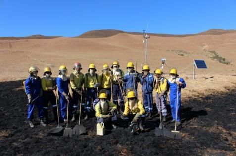
“South Africa is committed to addressing climate change based on science and
                                       equity”
      2015, COP21 SA’s Intended Nationally Determined Contribution pledge

Introduction and context

The South African temperate grassland biome covers approximately one third of the
land area of South Africa. It is arguably the most important biome for the country’s
economy. This is because of its size in combination with essential services we get
from healthy grasslands. Water is one of the most potentially limiting factors for
economic growth in South Africa. Grasslands are the major vegetation cover of the
primary water-producing mountain catchment areas in summer rainfall regions.
While not restricted to them, wetlands occur in high association with these
grasslands, providing additional service benefits. Wetlands are often described as
the “kidneys of the landscape”. They are known to regulate river flow, clean polluted
water, mitigate against floods, provide base flow in dry times, recharge groundwater
aquifers, trap sediments and provide habitat for various biota including a number of
rare bird species. This highlights their importance linked to water resources
management and their intrinsic value as ecological infrastructure assets in the
landscape. There is consequently a significant degree of overlap in South Africa’s
strategic water production areas and the grassland-wetland mosaic. The grassland
biome also provides natural forage, contributing significantly to dairy, beef and wool
industries, as well as subsistence livestock production and game ranching activities.
It is diverse and rich in natural resources traditionally used sustainably for
subsistence. More recently their potential importance in carbon mitigation strategies
has emerged. Healthy grasslands hold a significant proportion of the country’s soil
carbon pool, due to relatively high percentages of carbon within the soils in
combination with the extent of the system. Wetlands are also very important for
carbon storage. While not extensive in area, they are significantly more effective in
carbon storage compared to adjacent “dryland” systems. Depending on how the
wetland grassland mosaic is managed or transformed, these systems may
potentially be either significant sinks for or sources of carbon.

    “Over 60% of the national terrestrial carbon stock is located in grassland and
   savanna ecosystems. Within these two ecosystems, more than 90% of the total
    carbon pool is located below ground mainly in the form of soil organic carbon”
         (Synopsis Report: South African Carbon Sink Assessment, 2014)

Extractive and transformative use activities within the biome also contribute to the
economy. The majority of commercial forestry plantations, a significant proportion of
the country’s commercial and subsistence crop production as well as close to half
the mining activities in the country take place within the biome. These activities as
well as urbanization have resulted in over 30% of the Grassland biome being

                                                                                     2
SAEON Grasslands-Forests-Wetlands Node Science Plan 2016-18
permanently transformed and over 7% badly degraded. Only 2% of the grassland
biome is formally protected. The expansion of mining, forestry, cultivation and
urbanisation are considered immediate threats to grasslands and consequently the
ecosystem services they provide to society. In addition, the direct and indirect
impacts of climate change on this biome are predicted to be significant.

Indigenous forest is the smallest biome in South Africa, occupying approximately 0.3
% of the land area. South African forests are naturally patchy, having a
discontinuous distribution, scattered across the eastern and southern margins of the
country, with a high diversity of vegetation units. South African indigenous forests
play a minimal role as carbon sinks due to their limited extent. Climate models that
exclude fire, predict a much larger extent of forests in South Africa, including within
the grassland biome, reflecting a potential alternate state to grasslands. There is a
northern hemisphere-driven emphasis on the importance of reforestation programs
for carbon sequestration. Some of these incorrectly classify South African grasslands
as “degraded”, and promote afforestation of these systems. However, the relative
impacts of albedo changes linked to land use change and carbon sequestration in
African systems are unknown. Studies elsewhere indicate that albedo feedbacks can
be more influential than carbon sequestration gains in influencing global warming.
Furthermore using forests for carbon sequestration in African systems may be
misplaced, given the high frequency of fires in these systems and the potential for
increased fire storms to burn forest patches. This points to the need of assessing
the “net effect” implications of climate and land use change on interactions between
biological feedbacks and local, regional and global energy, carbon and water
dynamics. Local effects may be differentially detrimental or positive compared to
regional and global effects.

Notably, South African temperate grasslands are considered relatively old (i.e. they
are not “degraded” secondary grasslands). The biome is dominated by C4 grasses
which expanded globally in the Miocene. Pollen records show that open grasslands
in the moist regions of southern Africa were well established early in the Holocene.
Levels of diversity and endemism in grasslands are high, (second only to the fynbos
biome) with several plant centres of endemism, including endemic-rich C3
dominated grasslands at higher altitudes. The biome also has relatively high faunal
endemism and hosts 55 of 122 important bird areas recognised in the country.
Unlike savannas, temperate grasslands are rare elsewhere in Africa.

The distribution of temperate grasslands can be largely explained by a combination
of summer rainfall, minimum temperatures in winter and fire. Lightning strikes are
common in grassland areas and considered the natural agent for starting fires. Fire
is the key agent attributed to keeping forests out of grasslands at high altitudes.
Grasslands and savannas share a large portion of their boundary with each other.
Fire and summer rainfall are characteristic of both systems. Grasslands are thought
to become distinct from savannas as a result of cooler winter temperatures (and fire)

                                                                                     3
SAEON Grasslands-Forests-Wetlands Node Science Plan 2016-18
and more mesic summers at higher elevation. Changes in CO2 concentration,
temperature, precipitation and fire regimes are predicted to have a dramatic effect on
the grassland biome. Increases in temperature, for example, will make it possible for
frost sensitive species to encroach into grasslands. A combination of land use
impacts and increased CO2 may further facilitate the rate and extent of this
expansion of trees into the grassland biome. However, because of uncertainty
around changes in precipitation and poorly understood ecological and earth system
feedbacks, there is still uncertainty about how changes may manifest and what the
net impacts will be on the services grasslands have traditionally provided. It is of
major importance to understand how global change may impact these systems.
Information is needed to guide the appropriate protection of critical water sources,
while concurrently guiding sustainable development coupled with appropriate land
care programs.
Studying mosaics of C3-C4 grasslands, wetlands and forests, provides an
opportunity to understand past and future drivers of vegetation change with respect
to grasslands. The boundary zone between the grassland and savanna biomes
offers further opportunity in this regard with respect to broader scale biome changes
within the country. Multiple land use impacts within such areas would allow for an
assessment of the relative impacts of global change on the services these systems
provide. Outputs would provide a basis for informing sustainable development
strategies and building resilience for the country. Given its size, it is also important to
understand the potential contribution of the grassland biome for mitigating global
change impacts under different land use/climate change scenarios. There is a
growing need to understand the feedbacks between landuse, vegetation, biological
processes and soils on carbon, water and earth system processes. A key question is
to understand under what circumstance do these interactions moderate or amplify
net global change impacts.
In summary, grasslands and the embedded mosaic of forests and wetlands within
them, provide vital services to society. Change drivers include land use change, land
cover change, climate change, changes in disturbance regime (fire and grazing) and
possible CO2 impacts. Long term observation and research is required to determine
the magnitudes of anthropogenic and environmental changes in these systems and
the key mechanisms by which they are induced. In addition the implications of
different land use and land cover for climate change trajectories need to be
determined. Research outputs may be used to inform optimal land use for
sustainable development. A guiding question here is what is the optimal
development strategy for land use in South Africa that will reduce regional and global
temperature increases.
4
SAEON Grasslands-Forests-Wetlands Node Science Plan 2016-18Themes and approach
Global change is likely to impact on the services provided by grasslands, wetlands
and forests, and consequently the communities reliant on them and the economy of
the country. SAEON’s mandate is to detect change resulting from anthropogenic
forcing. The science activities we undertake are guided by SAEON’s Core Science
Framework. The approach adopted is to measure responses to a specific set of
drivers linked to human activity. Within this context, science activities at the
Grasslands-Forest-Wetlands Node aim to be policy relevant, and need to address
how global change is impacting on key services provided by these ecosystems.
The GFW node has thus structured its science activities for the next five years
centered on the following four themes representing key services of ecological and
economic value;
1. Water delivery
2. Carbon dynamics
3. Biodiversity
4. Land use-biological feedbacks with earth system processes.
South Africa is a water scarce country. There is concern about both the quantity and
quality of water resources across the country. Pressure on water resources is
increasing and demand is likely to outstrip supply. Managing carbon in landscapes is
considered a priority field of investigation by government with respect to climate
change mitigation and adaptation strategies, yet little information is available
regarding the carbon cycle in these systems. Biodiversity provides resilience and
services to society. The relative impacts of land use as well as direct and indirect
impacts of climate change on biodiversity patterns are uncertain. Leading on from
this, very little is known about the potential role of landuse-landcover change and
biological feedbacks on earth system processes (e.g. changes in carbon cycling or
radiative forcing with changes in landuse, climate and vegetation). The aim is thus to
understand how global change will impact on the ecosystem and the consequences
of this for society, by determining the moderating or amplifying interactions under
different land-use, land-cover and climate change scenarios.
The four themes are interlinked and our platforms are specifically structured to
enable understanding them in an integrated manner. This is achieved by co-locating
the long term observation activities of each theme. A consistent research approach
is applied that includes detailed long term observation and process level research at
benchmark sites, complemented by work at satellite sites that represent contrasting
land use and land cover situations. These include degraded sites relative to the
benchmark, alternative land use states as well as restored sites. The intention is to
understand the patterns, processes and services of benchmark sites, what services
5
SAEON Grasslands-Forests-Wetlands Node Science Plan 2016-18might be lost (or gained) under global change, or land degradation, and whether or
not vital ecosystem services that have been lost can be regained through restoration.
Two systems, representing opposite extremes of the elevation gradient, have been
selected on which to develop co-located long term monitoring and research activities
to support the four themes. Both are classified as “Strategically Important Water
Source areas” for South Africa. They are:
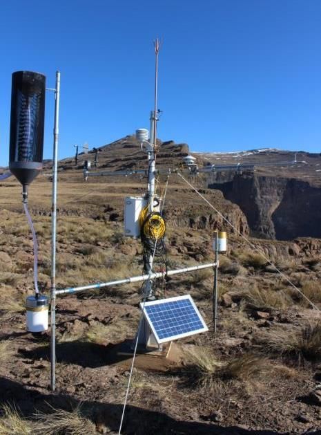
1) The uKhahlamba Drakensberg, the “water tower” of the country. The core
benchmark site is centered at the Cathedral Peak research catchments. The
area is predominantly grassland, interspersed with forest patches and
wetlands. The site represents mid to high altitude headwater catchments.
Despite their importance for water delivery, active monitoring and research in
such high altitude areas is scarce. The value of the site lies in the fact that
historically it was a forestry research station. As a result, it has a rich data
legacy including long term streamflow, weather and rainfall records.
Monitoring, however, ceased in the mid 1990’s and was resumed by SAEON
in 2012/13. The core site is within a protected area enabling researchers to
look at change detections specifically with respect to climate. Treatments
(pristine grassland, degraded and fire protected catchments) within the site as
well as in the surrounding landscape provide opportunities for assessing
multiple land use impacts including rural farming and land degradation in the
Upper Thukela catchment and restoration initiatives. Lower altitudinal sites
within the area adjoin the savanna biome. Additional sites providing
complimentary opportunities to look at the impacts of land-use/land-cover
change include Baynesfield agricultural farm and the Two Streams forestry
research site.
2) The Maputaland coastal plain from Mapelane to just south of Khozi Bay. This
is a groundwater driven system adjacent to the sea (low altitude site). There
are multiple land use impacts and cumulative impacts on water systems
emanating from the contributing catchments. It is predominantly a wetland
system within a grassland forest mosaic. Within the area there are high levels
of poverty, with few opportunities for economic activity. It is currently a very
water stressed area, with multiple demands on the groundwater resource.
Parts of the system are protected in conservation areas, whereas others are
undergoing rapid transformation. There is increasing pressure for expanding
commercial forestry in the area. Good baseline groundwater data exist for
various sites within the broader study area, including within the iSimangaliso
Wetland Park. Detailed studies on the hydrodynamics and diversity have been
undertaken by other researchers in sub-catchments in the area, for example
Mgobozeleni, that SAEON can build on to assess longer term trends. While
the focus in the next five years is understanding sub-catchment dynamics and
fine scale processes, the ultimate long term vision for this area is to gain a
6
SAEON Grasslands-Forests-Wetlands Node Science Plan 2016-18better understanding of the regional groundwater/surface water/land
use/climate interaction.
For each theme the research process applied involves:
1. Characterizing the key components of each of the themes (survey and
observation). This information will quantify parameters and their
characteristics and provide the baseline for assessing trends over time and
parameterising models (e.g. the ACRU hydrological model and Dynamic
Global Vegetation Models (DGVM’s).
2. Process level research into how these key components interact. Building on
the data from survey and monitoring, this level looks at more in-depth process
level research into the linkages and feedbacks among the components in
each theme. It is intended to stimulate integrative research that will be the
basis for developing and improving integrated/coupled process based models,
linking vegetation (biodiversity), hydrology and earth system processes E.g.
Dynamic Soil Vegetation Atmosphere Transfer models (DSVAT’s) through
understanding system dynamics.
3. Determining the current impacts of global change on the key components
of each theme (change detection). This level is aimed at stimulating research
on change detection to provide the information required for modelling the
impacts of global change on the four themes and refining our understanding
of process interactions and dynamics among these in a changing world.
This approach is encapsulated in Figure 1 developed for the water theme. It also
highlights the commitment and importance of capacity building in all activities that
will be undertaken.
7
SAEON Grasslands-Forests-Wetlands Node Science Plan 2016-18Figure 1 Long term monitoring as the foundation for improved understanding and the
facilitation of resilient water management, from Warburton 2016, with permission.
An integrated model, encompassing outputs of all 4 themes, to determine the net
effect of alternative scenarios of land use-land cover and climate change (scenario
modeling) on earth system processes essentially forms a 5th theme. Here the
intention is to explore the net consequences of anthropogenic forcing on earth
system - ecosystem functioning and the associated services they provide under a
range of alternative scenario trajectories. This will not be achieved conclusively
within the next five years but it provides the guiding vision of the platform, from which
to structure long term monitoring and research activities. This document outlines the
science activities towards achieving this that will be undertaken over the next five
years
Theme 1: Global change impacts on water delivery
Key question motivating theme: What are the relative impacts of climate and
landuse changes on water delivery, with respect to quantity and quality of
water?
While there is relative confidence around predictions relating to increased
temperature, there is still significant uncertainty around the impact of global change
on South Africa’s water delivery potential. This is partly due the fact that a large
number of processes interact, often in complex ways, influencing rainfall and the
translation of this into water reserves. Understanding the patterns, processes and
functional linkages governing hydrology in strategic water source areas is crucial for
the country. Determining the relative land use impacts and climate change impacts
and how these interact remains a key challenge. To achieve this understanding,
long-term monitoring combined with process level research is essential to detect
changes and reduce uncertainty. It is also important to assess what positive impacts
can be detected. Recognizing the importance of ecological infrastructure and
ecosystem services, restoration programs are a key feature of government’s
adaptation and mitigation strategy as a means of enhancing resilience for the
country. Significant investment is being made into these programs. How effective
are these interventions in winning back lost services and what interventions work
best?
In Cathedral Peak we aim to address the following in the next five years.
a. “What’s up with the weather?” Is it getting hotter? Is rainfall changing?
Are our seasons changing? Long-term data will be used to address these
change detection questions for our high altitude catchments: The aims are: to
extend the historic weather and rainfall records; investigate rainfall pattern in
relation to topography; use this to in-fill data gaps (there was a hiatus in
8
SAEON Grasslands-Forests-Wetlands Node Science Plan 2016-18monitoring from 1990-2012) and analyse infilled rainfall records for change
detection. Historical versus current temperature records will also be analysed
for directional trends and changes with respect to seasonal patterns. Detailed
climatological analysis are beyond the capacity of the node, however data
collected will be of value to experts interested in climatological analysis.
Additional benefits of this work will include calibration studies between historic
and current instruments.
b. “Where has all the water gone?” Can we detect changes in the hydrology
of the catchments since the 1940’s? If so, what can these be attributed
to? What are the implications for changes in hydrological processes for
water delivery? Activities will be centered on: extending the historical
streamflow record; in-filling data gaps for the period when no monitoring took
place and undertaking analysis to detect changes in streamflow. Process-
level research will be undertaken to determine the mechanisms moderating or
amplifying changes in hydrological cycle. This will include investigating the
different components of the water balance and how these interact with soils,
vegetation communities, land use and weather. Such information will lead to
the improvement of existing and new process-based models both in the
description of processes and parameterization of the models.
c. “Can I drink that?” What are the human induced global change impacts on
water quality?
i. Can we detect atmospheric pollutants (Sulphur and nitrogen
deposition) as well as DOC fluxes in pristine catchments? This acts as
a benchmark for other sites impacted additionally by land use.
(collaborative project with WITS)
ii. How does land use and land cover impact on erosion and sediment
loads. This will be assessed in different treatments within the
catchments as well as satellite sites reflecting different land uses and
levels of degradation (collaborative project with UKZN)
d. “Putting it together”. What are the impacts of land use on water flow?
Here the hydrology of various land use/land cover systems will be assessed
holistically. The relative impact of land use to any changes detected in
weather patterns will be analysed. A component of this includes redefining the
baseline reference for all vegetation units with respect to streamflow reduction
activities. This project forms the basis of the PDP postdoctoral work
undertaken by Dr Michelle Warburton. The work will extend well beyond the
Cathedral Peak area. Drawing on advances made on the process-based
models, the impacts of change can be further explored thereby providing
improved information and understanding to ensure resilient and adaptive
management of water resources.
e. “Should we invest?” How effective is restoration in improving
hydrological processes in previously degraded areas? In addition, areas
where restoration work has taken place (Okhombe) will be compared with
benchmark and non-restored degraded areas. Outputs will be used to
9
SAEON Grasslands-Forests-Wetlands Node Science Plan 2016-18determine the returns on investment of restoration projects on water flow and
water quality.
It should be noted that while we may produce trends within the next five years, as
the current record is extended, outputs addressing change detection will become
more robust.
In the Maputaland study area we will investigate the relative impact of rainfall versus
land use on the groundwater level of the system. Specifically:
a. What is the relationship between rainfall and recharge rate in the sandy
aquifer? Fine scale data is required to understand the recharge dynamics in
relation to rainfall within this system. This may vary depending on land use
and position in landscape. This question will be explored in restored (eastern
shores) , pristine and plantation scenarios (western shores and Vazi).
b. What are the transpiration rates of indigenous versus alien plantation
species? The relative impact of different land uses on the ground water
dynamics within this system is a contentious and politically sensitive issue.
Forestry plantations are considered by some to have a significant impact on
the groundwater resource. However, there is insufficient data to adequately
inform water user licence processes regarding this. The aim is to provide
evidence based data regarding the relative impact of different vegetation
communities, on groundwater dynamics.
c. What is the relative impact of climate versus land use on groundwater
level? Ground water levels in the Maputaland areas have been dropping over
the last decade. Attributing the cause of this to the relative contribution of
changes in land use, prevailing climate (extended drought) and possible
climatic changes is not well understood.
d. Where are the wetlands? This study will focus on understanding soil
moisture dynamics and using this to delineate wetlands and margins for
commercial forestry planting using the Cosmic Ray Rover System. Good
wetland delineation is important for informing spatial planning with respect to
where plantations boundary limits should be in relation to wetlands as per
legislation.
e. What should we “plant”? Here we investigate whether we optimize
commercial and indigenous systems to secure the groundwater resource
without compromising economic and ecological benefits. The aim is to explore
the optimum agroforestry- forestry production system within the mosaic of
grasslands, wetland, forest that does not irreversibly compromise the
groundwater resource.
f. What is the interaction between surface water and groundwater? Using
all the information above, ultimately we would like to advance regional models
that interlink surface and groundwater systems, to understand their influence
on each other at the regional scale, and under different land use- climate
10
SAEON Grasslands-Forests-Wetlands Node Science Plan 2016-18trajectories. This work will be initiated towards the latter part of the next five
years.
Theme 2: Carbon dynamics in a changing world
Key question motivating theme: What are the consequences of global change on
the regional carbon cycle?
The carbon cycle is a biogeochemical process interlinking biotic components with
climate systems. Changes in the carbon cycle are therefore likely to impact on both
climate systems and biological processes independently as well as the interaction
between them. Indeed human induced carbon emissions are the primary cause
attributed to contemporary climate change, however the impacts on biological
processes are less clear.
At the regional scale the carbon cycle influences a number of biophysical processes.
These differ across ecosystems. Characterising ecosystem specific carbon dynamics
is valuable for a range of applications including improving regional hydrology and
vegetation models as well as global carbon models. It also provides an indication of
whether a system is a net source or sink of carbon and one can explore how land
use or land cover change may affect this balance. The largest proportion of the
carbon pool in grasslands is in the soils. Understanding soil carbon pools and
processes governing these and how these translate to atmospheric fluxes is
important in resolving the carbon balance as well as understanding the
consequences of land use or land cover change on these stocks and fluxes. Within
this theme we will be addressing the following questions within the next five years:
a. Are mesic fire climax grasslands a net source or sink of carbon? Here
soil carbon stocks will be evaluated and characterised (French-SA
collaboration), the full carbon balance of catchment 6 (a pristine fire climax
grassland) will be determined using a combination of eddy covariance and soil
respiration data. This will be characterised in relation to time since burn,
season and phenology over a two year period. The project is structured to
measure net ecosystem exchange, based on in situ measurements, to
determine if grasslands are a net source or sink of carbon over time in relation
to average burning frequencies (SAEON PhD SJvR-CE). Outputs will help
parameterise and validate models. Complimenting this, a study is planned to
assess the effect of different burning regimes on soil carbon stocks and
respiration using the 30 year old Brotherton Plots (SJVR, CE and GFW
Interns).
b. What are the consequences of changes in temperature (and soil
moisture?) on soil respiration? Soil carbon pools in grasslands are
significant. Changes in cycling rates of these stocks are therefore likely to
have significant effects on the regional carbon balance. Warming chambers
11
SAEON Grasslands-Forests-Wetlands Node Science Plan 2016-18will be used (over a moisture gradient) to determine how predicted increases
in temperature may alter cycling rates of carbon in the system via soil
respiration. This directly addresses potential shifts in seasonality and
phenology that may result from changes in the temperature regime for these
high altitude catchments. (SAEON PhD SJvR-CE with EMU MteB)
c. What are the consequences of potential future alternative vegetation
states on the regional carbon balance? Experimental treatments historically
applied as well as the natural mosaic of vegetation units within the Cathedral
Peak area will allow us to determine soil respiration in alternative vegetation
states in the landscape (degraded catchments, fire protected, and forest
systems). It is also planned to test the impact of warming on soil respiration in
each of these vegetation units. (SAEON PhD SJvR, CE, with French
collaborators)
d. What is the impact of land use change on the carbon balance?
Collaborative research with UKZN and French colleagues is underway
assessing carbon dynamics in different land uses. We will contribute to this
work by assessing respiration in degraded versus restored grasslands in
community areas (OKhombe). Outputs will assist in determining the impact
and value of restoration on carbon dynamics in the system.
e. Productivity of different land uses: GOEGLAM: RAPP. Partnering with
SANSA and RAPP, the aim is to use a combination of remote sensing and in
situ measurements to understand rangeland productivity in a changing climate
in the greater area.
In Maputaland
f. How does soil respiration differ between alien plantations, coastal
grassland, indigenous coastal forest and encroaching indigenous
thicket? Point measurements will be taken to determine relative differences in
summer and winter. As this project advances, we will develop it further to
incorporate all the elements being addressed within the Cathedral Peak sites.
Theme 3: Global change impacts on biodiversity?
Key question motivating theme: What are the natural patterns of biodiversity and
how are global change drivers influencing these patterns?
Grasslands are diverse and as outlined above, support and provide numerous
ecosystem services that are of benefit to society. There are a number of changes
predicted for grasslands in relation to global change. These include:
a. Changes in the vegetation community assemblages, within as well as at the
boundary of the grassland biome as a result of the ingress of C3 and savanna
elements, and possibly the ingress of grassland into the Nama Karoo, mainly
as a consequence of CO2 loading, climate change, alteration of fire regimes,
land use and management.
12
SAEON Grasslands-Forests-Wetlands Node Science Plan 2016-18b. Faunal and floral species shifts in response to warming
c. Radical habitat transformation to make way for development infrastructure
and agriculture with a consequent loss in the services provided by these
systems
Over the next five years activities will focus on determining the following:
a. What are the climatic envelopes of plant species and communities in the
Drakensberg? (SAEON PDP NH-TOC) All available vegetation data will be
consolidated into one database. This will be used to analyse and asses
distributions in relation to physical parameters. Outputs from this will be used
to inform a long-term vegetation monitoring program across land uses and up
the altitudinal gradient
b. Can directional change trends be detected in plant species in the
Drakensberg, despite land use/treatment? This work relies on follow up
studies repeating various historical plant surveys (including Thomlinson,
Granger, Everson and Everson and others). (SAEON PG PHD, TS MSc-
TOC). Plot locations and activities are such that outputs will also necessitate
and include analysis on the impact of land use on plant communities, as well
as detect potential encroachment from the savanna boundary.
c. What are the impacts of different fire regimes on plant and microbial
communities in the Drakensberg? ( SAEON PG PhD-TOC; SAEON SJvR
and GM from RU)
d. What is the historic and current distribution of C3 and C4 grass species
in the berg and how is this likely to change? (local scale SJvR, regional
scale: LB and TOC, CA (SANSA) and UM (UKZN)- remote sensing)
e. Are ant assemblages responding to changes in temperature with
altitude? Annual data is collected at three altitudes each year. Data from
theme 1 will be used to assess temperature trends. Trends in the ant
assemblages themselves may not be evident within the next five years but the
work forms a component of what is being undertaken in the field to build a
long-term dataset (SAEON SJvR- UP)
f. What changes occur in the vegetation on the Maputaland plains, and
what drives these? (AS, CE, TOC and others).
Theme 4: Land use-biological feedbacks to earth system processes
Key question motivating theme: What are the potential land use-biological
feedbacks with earth system processes and how might these change with
global change?
Earth system processes include interacting chemical, biological and physical
components. Research into quantifying these parameters in different ecosystems
and determining how they interact assists in improving regional and global models.
Such models are aimed at understanding how climate change will impact on earth
13
SAEON Grasslands-Forests-Wetlands Node Science Plan 2016-18system processes and vice versa. Determining the impact of changes in land use
and land cover on these interactions is an important contribution to parameterizing
and validating models to enable scenario projects under different land use/land cover
climate scenarios. A big unknown is to what extent land use and land cover change
will amplify or moderate regional and global climate change impacts, where tipping
points in cycles such as the carbon cycle may occur, how strong relative feedbacks
may be and what thresholds might be reached as systems change. Focus areas in
this theme for the next five years will be on the following.
a. What is the energy-carbon-water balance in Cathedral Peak? Drawing on
work outlined above, as well as additional measurements on energy and soil
moisture, a carbon energy water balance will be characterized for Cathedral
peak for Catchment 6 which is representative of C4 grassland for this high
altitude catchments. This data will provide a benchmark from which to
compare the impact and interaction of alternative land use/land cover
changes in grasslands and these physical parameters. (SAEON-CE). For
example the impact of radiation on different mountain slopes and how this
affects vegetation will be explored in pristine, degraded and fire protected
catchments.
b. What would be the consequences of a shift in vegetation communities
on the water –carbon-energy balance? In particular we will be exploring:
i. The impacts of a change in dominance from C4 to C3 grasses, as well
as the consequences of woody thickening on the water balance in
Cathedral peak. This work necessitates determining key vegetation
traits and Eco-physiological characteristics routinely used in dynamic
vegetation and hydrological models (including transpiration of C3 and
C4 plants growing together and also whole swards dominated by
Festuca/Merxmuellera versus Themeda). Optimal use will be made of
the warming chambers outlined in theme 2 to also assess eco-
physiological responses of different plant functional types in a warmer
world. (SAEON – SJvR CE, GM).
ii. The same questions will be addressed on the Maputaland site where
the impact on indigenous versus commercial woody encroachment into
the coastal grasslands and wetland sites on the ground water resource
will be determined. The approach here will be explore differences in
transpiration rates of different tree species and consequences for
groundwater. This draws on the analysis of rainfall patterns and
groundwater dynamics covered in theme 1 above.
c. What is the impact of landuse-landcover on albedo and consequently
regional energy balance? This will be done at high resolution at local scales
within the two key study sites; Cathedral Peak and the Maputaland coastal
plain, using in situ measurements. Different land uses and vegetation units
will be assessed (SAEON-SjVR CE, and EMU- MtB). At the landscape scale,
land cover change and remote sensing products will be used to determine
14
SAEON Grasslands-Forests-Wetlands Node Science Plan 2016-18consequences of change at regional scales (EMU-MtB, EKZNW, UKZN with
assistance from SAEON).
Collectively this work, in combination with outputs from themes 1, 2, and 3 will make
a key contribution towards the long term vision of the node: determining the net
effect on earth system processes of different land uses and land cover changes
under different climate scenarios. There is a paucity of data from natural systems of
many of the parameters that will be measured. Models often revert to using crop
standards and proxies and this does not necessarily accurately represent non-crop
systems. Outputs from this work will enable improved process-based models to be
developed and parameterized. It will also allow hydrological, carbon and vegetation
modeling, and ultimately facilitate the integration between these and climate models.
Of particular relevance is the role ecosystems can or may play in mitigating human
impacts as well as understanding their relative resilience and adaptation
characteristics under natural and modified scenarios. Contextualizing information on
changes in ecosystem functioning in relation to ecosystem services, resilience,
adaptation and mitigation potential provides a workable framework for influencing
policy. Ideally outputs could be used to optimize land use and land management
policies for resilience and mitigation.
Opportunities for developing research platforms which could
attract science collaborators
Effort should be focused within selected priority catchments (strategic water source
areas), adopting a catchment-to-coast model, where, in transformed catchments,
cumulative impacts on systems can be explored, and in relatively pristine
catchments, consequences of change modeled. Criteria for selecting catchments
include; economic importance linked to service provisioning, potential and actual
demand pressure and/or potential for transformation, the representation of
grasslands forests and wetlands mosaics within catchments, pre-existing data sets
to build on and the potential for linking cross-nodal efforts dovetailing across
terrestrial and marine systems (estuaries, nearshore and marine observation efforts).
It thus follows that site selection should take cognisance of the national development
goals and strategic research infrastructure proposals (e.g. SIPS). Once catchments
have been selected, focal sites should be set up for detailed observation and
process level research within natural/protected sites within the catchments. This
provides a benchmark for ecosystem functioning. Linked to focal sites,
complementary observations structured along altitudinal and land use gradients
within the catchments, that are aimed at assessing ecosystem patterns, shifts and
boundary dynamics as well as assessing the ecosystem services lost through
degradation/ change and possibility of regaining these (restoration initiatives). Many
other institutions are assessing land use transformation. We would not duplicate
15
SAEON Grasslands-Forests-Wetlands Node Science Plan 2016-18effort here but rather, using their products, focus on consequences of land use
change.
Recommendation 1: An integrated catchment observation program centered on
understanding ecosystem services provided by natural areas and cumulative
impacts of climate and land use on the St Lucia wetland system, incorporating all five
inflowing catchments (Mfolozi, Nyalazi, Hluhluwe, Mkuze, Mphati). River systems
flow through different land use types and protected areas before culminating within
the St. Lucia estuary system
● Focal sites within protected areas assessing climate diversity, carbon energy
water dynamics in natural systems combined with assessing the protected
areas services e.g. cleaning water, carbon storage etc)
● Compliment focal site observations with discrete question driven research and
observation when necessary, employing experimental techniques and
manipulation were appropriate.
o Extend critical components of the focal site observations to satellite
sites within the catchment, along altitudinal, land use and
environmental gradients. ( e.g. simple rainfall wind stations as opposed
to fully automated weather stations)
o Add complementary data collection to enable assessments of the
extent, dynamics (shifts) and integrity of communities, ecosystems and
landscape-level relations (Exploring boundary patterns and processes
between ecosystems across land use and environmental gradients).
● Cross-Boundary patterns and processes explored (across biomes and large
scale biological-earth-system interfaces).
Relevant legislation, that the science will help serve
1 Legislation
1. SPLUMA: Spatial Planning and Land Use Management Act, August 2013
(potentially most effective insertion point)
2. National Climate Change Response White Paper, October 2011
3. Carbon Tax Policy Paper, May 2013/ Nov 2015- for comment
4. National Development plan 2030
5. RAMSAR convention (reporting on states of RAMSAR wetland sites)
6. Forestry 2030 Roadmap (Forestry Strategy 2009-2030) (monitoring
threats).
7. National Environmental Management: Biodiversity Act 2004 (Act No. 10 Of
2004)
a. National list of ecosystems that are threatened and in need of
protection Insertion point for policy and lised sites can guide site
selection for future studies)
8. Department Of Environmental Affairs National Environmental
Management: Protected Areas Act, 2003 (Act No. 57 Of 2003)
16
SAEON Grasslands-Forests-Wetlands Node Science Plan 2016-189. The South African National Infrastructure Plan,
http://www.gov.za/issues/national-infrastructure-plan
2 Key initiatives and alignment opportunities to keep in mind that we
could contribute to with respect to data and or reporting
1. COP21 Emissions reduction pledge
2. COP21 Water pledge (SA not signed but may consider doing so in future)?
3. South Africa’s: National Climate Change Adaptation Strategy and Plan
4. South African carbon atlas (DEA, we will contribute data to improve model
outputs)
5. Sustainable development goals (contribute to setting up indices and
reports)
6. Millennium development goals Superseded by SDG’s
a. Outcome 10: Protected and enhanced environmental assets and
natural resources
b. Suboutput 4.4 • Valuing ecosystem services • 4.4.1
Environmental costs related to the provision of resource based
services • (a)Number of tools developed for the economic valuing of
ecosystem services
7. National Freshwater priority areas / strategic water source areas(site
alignment)
8. National System of innovation (contribute and report to)
9. Carbon mitigation strategy (we can align and provide key data)
10. Bio-economy road map
11. WRC TOR project: A National Water R&D and Innovation Roadmap for
South Africa
12. Valuing Natural Capital A Government Perspective Current Policy
Approaches and Priorities, February 2014.
13. The South African Coal Roadmap, 2013 (Industry driven not government)
(Monitor threats/ potential land use pressure shifts)
14. IPBES
15. IPCC
16. SIPS program linked to NDP (Monitor potential land use change, threats,
and possibly provide data to guide)
Collaborations
1 Current collaborations
● WITS ( Prof Chris Curtis)
● UKZN (T Hill, J Finch Alistair Clulow, Oni Matango)Jewitt?
● UP (M Robertson) + Plant Production and Soil Science (they own LAS, CRP
through RISP and will manage the Vasi contract with WRC)
● UFS (E Sieben)
● DARD (C Botha)
17
SAEON Grasslands-Forests-Wetlands Node Science Plan 2016-18● IRD (V Chaplot)
● UMR CNRS BIOGEOSCIENCES, Université de Bourgogne, Dijoun. (Olivier
Mathieu, Jean Leveque, Mathieu Thevenot)
● UCT (PCU) (T. Hoffman)
● DEA: Natural Resource Management (NRM)
● Umea, Sweden ( J Cromsigt, M te beest)
● (Water Research Commission)
● DWS, regional and national
● EKZNW (D Mabunda)
● Ground truth (M Graham)
● Mondi (B Cochren+P.Gardiner)
● Robert B. Daugherty Water for Food Institute at the University of Nebraska
(Trenton Franz)
2 Potential Collaborations
● WRC- strengthen relationships to develop and support internal and external
projects around focal sites and themes. Co theme and location investment
model
● Africa Welcome Center if research catchment to estuary program in St Lucia
is developed
● INR: science capacity but not sure of funding model to adopted
● MONDI: both contract as well as collaboration work
● CSAG in situ data mode output synergies
● SANSA- remote in situ synergy for long term monitoring
a. GEOGLAM:RAPP initiative
● State vet services ( looking at a project on parasite loads in cattle at focus
sties ( berg and Vazi)
● GNOMO & GLORIA
Opportunities for cross-nodal collaboration
All of the above themes could be common to all nodes. It would be of particular value
to determine soil carbon pools, carbon balance and albedo in all sites along with all
required weather variables, biological feedbacks and implications for water security
under different land use/land cover/climate change trajectories.
Key beneficiaries of the science
There are a number of beneficiaries of the science, both direct and indirect. The
primary intended recipient of knowledge generated through the South African
Environmental Observation Network is government. The ultimate beneficiary of this
information should be society. The obligation of the SAEON GFW node is to provide
relevant and commanding enough science to exert sufficient stimulus to positively
influence sustainable development within South Africa. In addition to national needs,
18
SAEON Grasslands-Forests-Wetlands Node Science Plan 2016-18the science outputs should serve global change science efforts internationally. They
should also position South Africa as a credible respected contributor to global
change science.
Science outputs, data and product offerings will be of benefit to academics spanning
several disciplines. Students aiming to further their studies are also intended
beneficiaries of data provided by the platform that they can utilize for analysis and
knowledge generation while at the same time advancing their qualifications. They
should also use the platform and the sites to advance their knowledge, networks and
skills in global change science. The aim is to use the platform to build a new
generation of scientists that can talk across disciplines and advance cross discipline
integrations.
Science products should be most relevant to municipal development planners and
conservation agencies through the implementation of SPLUMA. Products to facilitate
this would be made available through local collaborators making use of the data
● South Africa carbon atlas program,
● Risk and vulnerability atlas,
● SAWS,
● CSAG,
● Climate modelers,
● DWS,
● hydrologists,
● Systems ecologists.
● SAEON
● WRC
● WaterNet
Internationally data would potentially feed into any one or all of the following
international initiatives:
● ILTER
● International Geosphere-Biosphere program IGBP (2006)
● GEWEX
● COSMOS
● Future earth
● FLuxnet
● Global carbon project
● World Climate Research Program (WCRP)
● Global water system project (GWSP)
o Themes and relevant activities from GWSP (water) from Earth system
science partnership (ESSP)
a. Theme 1. What are the magnitudes of anthropogenic and
environmental changes in the global water system and what are the
key mechanisms by which they are induced?
19
SAEON Grasslands-Forests-Wetlands Node Science Plan 2016-18b. Theme 2. What are the main linkages and feedbacks within the earth
system arising from changes in the global water system?
c. Theme 3. How resilient and adaptable is the global water system to
change, and what are sustainable water management strategies?
● GEO networks through GEOBON,
o The integrated global water cycle observations (IGWCO) community of
practice
List of Acronyms
ACRU Agriculture Catchments Research Unit (UKZN)
ARC Agricultural Research Council
COSMOS ?
CRP ?
CSAG Climate System Analysis Group
CSIR Council for Scientific and Industrial Research
DARD Department of Agriculture and Rural Development
DEA Department of Environmental Affairs
DGVM Dynamic Global Vegetation Models
DOC Dissolved Organic Carbon
DSVAT’s Dynamics Soil Vegetation Atmosphere Transfer models
DWS Department of Water and Sanitation
ESSP Earth system science partnership
GEO Group on Earth Observations
GEOBON GEO Biodiversity Observations Network
GEWEX Global Energy and water cycle Experiment
GNOMO Global Network of Mountain Observatories
GLORIA Global Observation Research Initiative In Alpine Environments
GEOGLAM Group on Earth Observations Global Agricultural Monitoring
GWSP Global water system project
IGBP International Geosphere-Biosphere program
IGWCO Integrated Global Water Cycle Observations
IPBES Intergovernmental Science-Policy Platform on Biodiversity and
Ecosystem Services
IPCC Intergovernmental Panel for Climate Change
IRD Institut de recherche pour le développement
LAS ?
NDP National Development Plan
NRM Natural Resource Management
PDP Professional Development Programme
RAPP Rangelands and Pasture Productivity
RISP Research Innovation Support Programme
SANSA (The) South African National Space Agency
20
SAEON Grasslands-Forests-Wetlands Node Science Plan 2016-18SAWS South African Weather Service
SIPs Strategic Infrastructure Projects
UCT University of Cape Town
UFS University of the Free State
UKZN University of KwaZulu-Natal
WCRP World Climate Research Program
WRC Water Research Commission
21
SAEON Grasslands-Forests-Wetlands Node Science Plan 2016-18You can also read