SPENCER OPEN SPACE AND RECREATION PLAN - Spencer MA
←
→
Page content transcription
If your browser does not render page correctly, please read the page content below
SPENCER OPEN
SPACE AND
RECREATION PLAN

           2021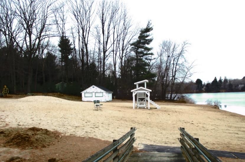
Town of Spencer
                            Open Space and Recreation Plan

                                            2021

Prepared For: Town of Spencer
              157 Main Street
              Spencer, MA 01562

Prepared By: Central Massachusetts Regional Planning Commission
             1 Mercantile Street, Suite 529
             Worcester, MA 01608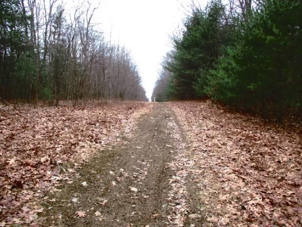
Acknowledgements

The Town of Spencer Open Space and Recreation Plan Working Group
William Shemeth, Town of Spencer Parks and Recreation Commission
Mary Baker Woods, Town of Spencer Historical Commission
Michael Toomey, Massachusetts Department of Conservation and Recreation Friends Network
Jeremey Snow, Common Ground Land Trust
Sheryl Moore, Camp Marshall
Alan Stolarczyk, President - Sugden Reservoir Association
John Knight, Brooks Pond Association
Charles Bellemer, Town of Spencer Conservation Commission
Peter Sielis, Spencer Snowbirds Snowmobile Club
Thomas Cosgrove, Spencer Snowbirds Snowmobile Club

The following individuals and organizations have also contributed to the development of this
Open Space and Recreation Plan for the Town of Spencer:
Paul Dell’Aquila, Former Town Planner
Todd Miller, Town Planner
George Russell, Conservation Agent
Mimi Kaplan, Central Massachusetts Regional Planning Commission
Matt Franz, Central Massachusetts Regional Planning Commission

Cover Photo: Town of Spencer
TABLE OF CONTENTS

Section 1: Plan Summary..................................................................................................................................... 3
   definitions ..................................................................................................................................................................4
Section 2: Plan Introduction ................................................................................................................................ 5
   A: Statement of Purpose ...........................................................................................................................................5
   B: Planning Process and Public Participation .............................................................................................................5
Section 3: Community Setting ............................................................................................................................ 7
   A. Regional Context ...................................................................................................................................................7
   B. History ...................................................................................................................................................................8
   C. Population Characteristics ...................................................................................................................................10
   D. Growth and Development Patterns ....................................................................................................................16
Section 4: Environmental Inventory and Analysis ................................................................................................21
   A. Geology, Soils & Topography...............................................................................................................................21
   B. Landscape Character ...........................................................................................................................................22
   C. Water Resources .................................................................................................................................................23
   D. Vegetation ...........................................................................................................................................................25
   E. Fisheries and Wildlife ...........................................................................................................................................26
   F. Scenic Resources and Unique Environments .......................................................................................................29
   G. Environmental Challenges...................................................................................................................................30
Section 5: Inventory of Lands of Conservation and Recreation Interest ..............................................................37
   5A. Private Parcels ...................................................................................................................................................39
   5B Public and Non-Profit Parcels .............................................................................................................................42
Section 6: Community Vision .............................................................................................................................46
   A. Description of Process .........................................................................................................................................46
   B. Statement of Open Space and Recreation Goals.................................................................................................47
Section 7: Analysis of Needs ..............................................................................................................................48
   A. Resource Protection Needs .................................................................................................................................48
   B. Community Needs ...............................................................................................................................................50
   C. Management Needs ............................................................................................................................................55
   D. Park Improvement Needs ...................................................................................................................................55
Section 8: Goals and Objectives .........................................................................................................................58
SECTION 9: SEVEN YEAR ACTION PLAN ..............................................................................................................60
Section 10: Public Comments ............................................................................................................................75

Spencer Open Space & Recreation Plan, 2021                                                                                                                        1
Section 11: References ......................................................................................................................................76

Spencer Open Space & Recreation Plan, 2021                                                                                                       2
SECTION 1: PLAN SUMMARY
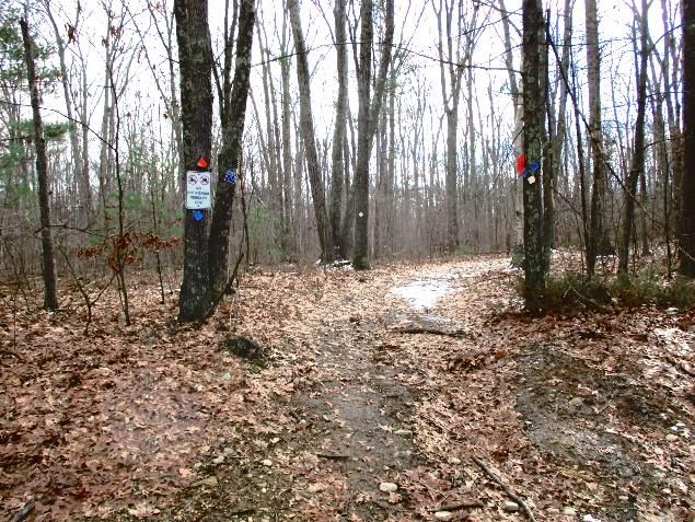
The Town of Spencer is rich in both history and natural resources. It has a multitude of scenic places,
recreational areas, and open spaces. Some highlights include Luther Hill Park and Howe State Park.
Luther Hill Park and Howe State Park are popular destinations that attract many visitors during the
summer months. Both have swimming areas, and Howe State Park has many hiking trails. O’Gara Park is
home for many sporting events, such as softball and
Pop Warner Football. There are plentiful hiking
opportunities throughout the Town, including Buck Hill,
the Mid-State Trail, Ralph Warren Park, and Four
Chimneys Wildlife Management Area. Spencer also has
significant amounts of conservation land such as
Burncoat Pond Wildlife Sanctuary, Sibley/Warner Farm,
and the St. Joseph’s Abbey property.
Photo Credit: Town of Spencer
The Town, through the Parks and Recreation
Commission, has worked hard to maintain recreational facilities (including upgrades to improve
accessibility to the disabled) despite limited staffing and resources. Likewise, the Town has worked to
protect environmental resources and open spaces. The Town of Spencer purchased a conservation
restriction to permanently protect approximately 60 acres abutting Burncoat Pond in 2005. The
property is now owned and managed by Mass Audubon as a wildlife sanctuary and provides protection
for the wetlands, waterways, and scenic character of this area of town. Sibley and Warner Farms is a
350-acre property that was purchased for conservation in 2012, and is permanently protected by a
conservation partnership that includes the Mass Audubon, Greater Worcester Land Trust, Common
Ground Land Trust, Town of Spencer, and several agencies of the Executive Office of Environmental
Affairs. Despite the Town’s successes, Spencer continues to face financial and staffing challenges to
address long-term recreational and open space needs.
This Open Space and Recreation Plan (OSRP) is an update of Spencer’s previous OSRP completed in
2012. This OSRP builds on an understanding of Spencer’s current place in the region, its history and
character, its demographics, and its growth and development patterns. A thorough review of the
geology, landscape, water resources, vegetation, wildlife and fisheries, unique and scenic resources, as
well as the environmental challenges was completed in order to develop a clear picture of the Town’s
strengths and opportunities for improvement. The goals of the OSRP focus on: protecting water
resources, protecting and conserving land resources, preserving Town character, providing varied
recreational facilities and opportunities throughout the Town, and enhancing use of existing recreation
and conservation resources in Spencer. Working with the Town’s assessor and others, an inventory of
both public and private lands of conservation and recreation interest was compiled.
Spencer Open Space & Recreation Plan, 2021 3
A working group was formed in July 2019 to update the OSRP, and the group first met in August 2019.
The Town contracted with the Central Massachusetts Regional Planning Commission (CMRPC) to assist
in the development and submission of an OSRP that would meet the requirements of the
Commonwealth. This plan will provide substantive updates to the 2012 Spencer Open Space and
Recreation Plan. Strong community involvement has been integral to the creation of this plan. Through
regular meetings, the survey and public forum, the OSRP working group identified many opportunities
to improve and enhance the Town’s open space and recreation resources. The plan includes an updated
inventory of open space and recreation lands and an analysis of Spencer’s open space and recreation
needs.

As a result of this planning process, the following five primary goals were developed:

    GOAL 1:      Protect valuable water resources from adverse impacts.

    GOAL 2:      Preserve Spencer’s rural, small-town character.

    GOAL 3:      Enhance recreation opportunities for Town residents & visitors

    GOAL 4:      Preserve Spencer’s open spaces and natural heritage.

    GOAL 5:      Establish a continuous open space planning process

DEFINITIONS

The term “open space” in this document refers to either public or privately-owned land that is
undeveloped. It is land in a predominantly natural state or altered for natural resource-based uses (i.e.,
farming, orchards, forestry, hunting and fishing, walking-type parks and trails). Examples of privately-
owned open space might include farms, forest lands, and passive recreation areas.

The term “recreational open space” or “recreation” refers to land used for active recreational purposes.
Land used for active recreation does not qualify technically as open space because these parcels often
have portions covered with paved surfaces such as that for tennis courts, basketball courts and parking
lots. In addition, athletic fields require regular fertilizer applications and are usually installed with fencing
and outbuildings. Since this plan deals with both open space and recreation, we have presented an
approach to obtaining the benefits of maintaining and improving existing recreational facilities, and
developing new facilities, without losing scarce valued environmental assets. In addition, grants and
partnerships between federal state and local agencies are often based on recommendations the applicant
community makes in its OSRP. Thus, we recognize and embrace opportunities for healthy outdoor
activities, whether it be hiking along forest trails or a playing with a team on a soccer or football field.

Spencer Open Space & Recreation Plan, 2021                                                             4
SECTION 2: PLAN INTRODUCTION
A: STATEMENT OF PURPOSE
This Open Space Plan was created to help preserve Spencer’s small-town character, enhance the
attractiveness of the community, and encourage compatible growth for the future. The Open Space and
Recreation Plan will be an integral part of the Town’s Master Plan. The Town of Spencer developed this
plan in order to coordinate efforts to best protect, improve, and manage open space and recreation
resources, particularly in light of current residential and commercial development pressures, and those
likely to occur in the future. The 2020 OSRP builds on past and recent planning initiatives to provide a
framework for priority needs and actions. It is part of a
Town-wide effort to manage growth and protect the
natural and built resources that make Spencer a unique
and special place. Completion of the Plan will make the
Town eligible for matching funds for open space
acquisition and park improvements. With an outstanding
natural resource base and high development pressure
that threatens loss of open space, this Plan provides a
thoughtful strategy for guiding investment in land and
park facilities in the light of limited municipal finances.
Photo Credit: George Russell
B: PLANNING PROCESS AND PUBLIC PARTICIPATION
The Open Space and Recreation Plan working group first convened in August of 2019 and began working
with CMRPC on a town-wide survey to gauge residents’ sentiments regarding open space and recreation
resources within the Town. The survey was opened up for responses on the Survey Monkey Platform in
October 2019 and kept open for approximately six weeks until late November. The survey was linked
electronically on the front page of the Town’s website as well as on the OSRP page. Hard copies of the
survey were made available at various locations throughout town, including the Municipal Offices, the
Town Library, and the Senior Center. Announcements of the survey were included in emails that went
out through the schools and the Parks and Recreation Department, and it was also publicized on
community cable access, in the Spencer New Leader, and the message signboard in front of Town Hall.
Announcements were also posted on the Town website and the Town Facebook page. The survey
received 257 responses, primarily through the online survey but a number of responses with the hard
copies were received as well. Summaries of the results of the survey are presented in the appendices of
the plan.
The Town initially planned to hold a public forum in May 2020, however those plans were put on hold
due to the Covid-19 pandemic. The working group then planned to hold a virtual public forum over
Zoom on October 6, 2020. It was decided that due to Covid-19 and the prohibition on meetings over 25
Spencer Open Space & Recreation Plan, 2021 5people that a virtual public forum would be safer than an in-person meeting and allow for more participants. The meeting was publicized through announcements in the local newspaper (Spencer New Leader), postings on various pages on the Town website and on Facebook, ads on the local cable access bulletin board, and posting on the message signboard in front of Town Hall (located at the prominent intersection of Rte. 9 and Rte. 31). The flyer was emailed to the Spencer East Brookfield Regional School District for distribution, and to Quaboag Valley CDC and Spencer Housing Authority in order to target residents living in Spencer’s Environmental Justice areas. The flyer was also printed out and handed out with books picked up at the Richard Sugden Library. Anyone interested in attending needed to RSVP and register in order to receive the Zoom link. As of the day before the public forum, only two individuals had registered. Due to this low number, Town staff decided to cancel the public forum and to reschedule. Two public hearings on the OSRP were then held to solicit input from residents. Both of these public hearings were advertised through all of the methods listed above for the first public forum. A slide show providing information about the OSRP process and asking for input was posted on the Town website as well. The first public hearing was a Conservation Commission virtual meeting held on November 18. Two Town residents called in to provide comments. The second public hearing was at a virtual Planning Board meeting held on December 15. One Town resident called in to provide comments. Working Group members met approximately every two months beginning in August 2019, and provided substantial information and feedback for the plan, including, reviewing and providing constructive feedback on plan drafts, the goals, objective, and action plan, completing the Americans with Disabilities Act (ADA) facility inventory, and stewarding the document through its presentation to the Town Select Board and submittal to the state. Spencer Open Space & Recreation Plan, 2021 6
SECTION 3: COMMUNITY SETTING
A. REGIONAL CONTEXT

The 21,592 rolling acres of Spencer are located 12 miles west of Worcester and 40 miles east of
Springfield, in Worcester County and are bounded by Oakham, Paxton, Leicester, Charlton, East
Brookfield, and North Brookfield. The Town center is located where Route 9, a major Massachusetts
east-west highway intersects Route 31, the major north-south road through Town. Route 49 connects
Spencer to Sturbridge, Route 20, and the Massachusetts Turnpike.

Spencer has many important natural
resources, and the Town is both a local
and regional destination for outdoor
recreation. Spencer waters are tributary
to and lie in the headwaters of the
Chicopee and French River watersheds.
Spencer’s seven major ponds (Brooks
Pond, Browning Pond, Cranberry
Meadow Lake, Sugden Reservoir, Stiles
Reservoir, Thompson Pond, and Lake
Whittemore) are a significant resource
and draw people and economic activity to
the town. Spencer also shares its water      Photo Credit: George Russell
resources with neighboring towns. The
Town’s emergency water supply, the 64-acre Shaw Pond, is located in Leicester, but it is not an active
source and the water is not treated. Spencer owns an additional 94 acres of undeveloped land in
Leicester surrounding Shaw Pond for watershed protection. In addition, many waterbodies are shared
with adjacent towns. These include, Browning Pond (Oakham), Burncoat Pond (Leicester), Cranberry
Meadow Pond and Jones Pond (Charlton), and Stiles Reservoir (Leicester), as well as the privately owned
Brooks Pond (North Brookfield, New Braintree and Oakham). The watershed feeding Thompson Pond
lies largely in Paxton, and flows from Turkey Hill Pond in Rutland.

The Midstate Trail is a scenic footpath extending 92 miles across central Massachusetts, from the New
Hampshire border on Mt. Watatic to the Rhode Island border in Douglas State Park. The trail enters
Spencer from Oakham above the western shore of Browning Pond, and exits into Charlton through the
Four Chimneys Recreation Area on Borkum Road. Other trails include the Depot Trail, a 2-mile walking
path along an abandoned railroad bed, and trails in the Sibley and Warner Farm property, Spencer State
Forest, and Buck Hill Conservation Area. The Spencer Snowbirds Snowmobile Club maintains a network
of snowmobile trails throughout the Town. Hunting is permitted in Spencer State Forest, in the
Department of Fisheries and Wildlife’s Wildlife Management Areas (Four Chimneys and Moose Hill), as
well as on some private lands.

Spencer Open Space & Recreation Plan, 2021                                                    7
Spencer is the major economic center in the Central Massachusetts Regional Planning Commission
(CMRPC) West sub-region. While many Spencer residents travel each day to work outside town, some
local businesses, such as Flexcon, Big Y, Price Chopper, and Klem’s Department Store provide
employment for townspeople and for residents of surrounding communities. The majority of the
region’s large employers are in Worcester and along the I-495 corridor.

Spencer is a regional hub of activity. The Spencer Fair is a major agricultural exposition. O’Gara Park and
the Little League’s Small Park are athletic facilities which are utilized regionally and have ample parking.
Similarly, Howe State Park and Camp Marshall are regional recreation resources. Saint Joseph’s Abbey
occupies about 2,000 acres in North Spencer, and offers week-long retreats as well as tours for visitors.
The Trappist monks who reside there also produce Trappist jams and jellies and Spencer Trappist Ale.
Lastly, the Spencer-East Brookfield School District enables people from other towns to enjoy the athletic
facilities at David Prouty High School and Knox Trail Junior High.

B. HISTORY

Spencer’s history began in 1686 as an eight square mile tract of land purchased from the Native
Americans, named Leicester and established as a proprietorship by men from Boston. Approval from the
colonial authorities was contingent upon settlement but settlement was slow, at first delayed for a
generation by struggles with the natives. Eventually,
in 1717, Nathaniel Wood purchased 100 acres for a
homestead. In 1721, Samuel Bemis of Watertown
bought land adjacent to Nathanial Wood’s property
near Seven Mile River and erected the first frame
house in the area that later became the Town of
Spencer. The Bemis Monument on Route 9 marks
the site of this house as well as the contributions that
Captain Edmund Bemis made during the French and
Indian War.
                                                          Photo Credit: Town of Spencer
In 1741, frustrated by Leicester’s refusal to provide
roads, a church, and schools in the district, the settlers petitioned the General Court and received
approval to separate from Leicester but the change was vetoed by the Royal Governor. In 1753, after
continued effort, the request was finally granted. The new Town hardly had its affairs in order when the
War of Independence broke out. Spencer had a few Tories, but in 1775 Captain Ebenezer Mason led 65
Minutemen to Cambridge to aid the cause of the colonies.

The main livelihood in town was farming, until 1812 saw the start of two industries, boot (later to be
shoes) and wire making. Josiah Green established his boot shop in this year, while Elliott Prouty began a
small wire business in the section of Town later known as Wire Village. Steel was available locally, made
from bog iron at a forge in North Brookfield on the Five Mile River. The growth of the boot and wire

Spencer Open Space & Recreation Plan, 2021                                                        8
businesses reached its climax in the late 1800s, represented by Isaac Prouty & Company and the Spencer
Wire Company respectively.
The Town had several village centers in the 1800s, based on the distribution of suitable locations to dam
streams for water power. The Upper Village had the meeting house and a small group of houses,
including the Pope Mansion. The Lower Village included three taverns and other buildings. One tavern
was the Mason House (which was located in southwest corner of the present parking lot of Price
Chopper). The other taverns were the Jenks House (the Massasoit Hotel was later built on this site) and
the tavern owned by James Livermore, at the corner of Main Street and High Street. There was a post
office and a peg factory in North Spencer. The growth of industry led to growth of population and needs
that were previously overlooked. The first Town Hall was built in 1839. Eighteen years later the Town’s
first high school, Denny Hall, was erected.
The historical Great Post Road, which ran from Boston to Springfield and formed the eventual path of
Route 9, begins in Spencer at the Leicester line at the original Polar Spring (1886 source of Polar
Beverages). It continues behind the Country Inn to what is now David Prouty High School, follows Route
9 and then old Main Street to the Seven Mile River.
The outbreak of the Civil War, in which 319 Spencer men served, opened an era of growth and
expansion. At the start of the war, Spencer’s population was 2,800; ten years later it was 4,000; and
twenty years later it was 7,500. With this rapid growth
came steam power, railroads, street lighting, a newspaper
in 1872, water works in 1882, and a gas works in 1886. In
1888, Spencer’s prosperity was demonstrated when three
citizens - David Prouty, Richard Sugden and Luther Hill -
respectively gave the Town a new high school, a library
and a public park. The Town re-centered around mills on
Muzzy Brook and the rail line connecting Boston with
Albany, NY. Howe Park is named for the Howe family that
included three great inventors, brothers William and Tyler,
Photo Credit: National Park Service
and their nephew Elias, and is at the location of the family
farm. William Howe was born in Spencer in 1819 and designed the first wooden truss railroad bridge
that was built over the Connecticut River in 1840. This design was patented and used on bridges across
the country. His brother Tyler invented and patented the first box-spring bed in 1855, which was a great
commercial success. Their nephew Elias designed and patented an innovative design for sewing
machines in 1846, and although it never found wide commercial success, it was copied by others,
including Isaac Singer (of Singer sewing machines).
In the early 1890s, Spencer experienced a series of setbacks: a labor dispute in its shoe factories, an
economic recession and a disastrous fire that leveled six acres of property in the Wall Street area near
where Rt. 31 now crosses Route 9. The boom ended. Shifting economic conditions made recovery slow.
The advent of automobiles in the early 1900s weakened the influence of railroad transportation; water
power was replaced by petroleum-based power sources. Wire making and the shoe industry have gone,
Spencer Open Space & Recreation Plan, 2021 9along with a number of small cotton and woolen plants. Currently, the largest manufacturer is Flexcon, followed by Dienes Industries and Mercury Wire, which insulates wire and manufactures cables. Spencer now relies economically on service businesses, trades, and leisure and tourism. Spencer is governed by a Board of Selectmen/Town Administrator form of government. The Board is comprised of five elected members and is responsible for setting policy for the Town of Spencer. The Administrator is responsible for day-to-day operations. The Town also holds an annual Town Meeting. There are a full-time Town Planner and part-time Conservation Commissioner, and in addition there are many active boards and committees in Spencer run by volunteers. C. POPULATION CHARACTERISTICS The characteristics of Spencer’s population are important in planning for the recreation and open space needs of Town residents. Table 1 shows the changes in Spencer’s population from 1940. The town grew steadily from 1940 to 1970 with growth rates between 5 and 12 percent, from 6,641 in 1940 to 8,779 in 1970. There was a large jump in population in the 1970s of 22.7%, with the population increasing to 10,774 by 1980. Beginning in 1990, the population grew more slowly, and actually declined by a small amount between 2000 and 2010. The estimated population for 2018 of 11,971 shows a small increase again after 2010. TABLE 3.1- Spencer Population Over Time Year Total Population Change % Change 1940 6,641 -- -- 1950 7,027 386 5.8% 1960 7,838 811 11.5% 1970 8,779 941 12.0% 1980 10,774 1,995 22.7% 1990 11,645 871 8.1% 2000 11,691 46 0.4% 2010 11,688 -3 -.03% 2018 11,971 283 2.4% Source: U.S. Census Bureau, 2013-2018 American Community Survey 5-Year Estimates Central Mass Regional Planning Commission (CMRPC) regularly publishes population projections for its constituent communities based on U.S. Census estimates. The town level projections were vetted with the communities for transportation planning purposes as part of the 2016 Long Range Transportation Plan. The CMRPC projections indicate a decline in population from 2010 to 2020, and then a gradual increase until 2040. However, the 2018 American Community Survey data actually shows that the population grew between 2010 and 2018, with the 2018 population higher than the 2020 projection. It Spencer Open Space & Recreation Plan, 2021 10
is likely that revised population projections will show a higher population for 2020 through 2040, with
the population growing to over 12,000. Projections for surrounding towns show similar gradual
increases through 2040, with Charlton projected to have the largest increase in population growth.

TABLE 3.2 - CMRPC population projections for Spencer and surrounding towns

               2010                          2020       2030          2040
 Town                        2015 ACS
               Census                        CMRPC      CMRPC         CMRPC

 Spencer       11,688        11,521          11,174     11,673        11,815
 Leicester     10,970        11,394          11,278     11,619        11,898
 Oakham        1,902         1,963           1,969      2,030         2,053
 East
               2,183         2,215           2,233      2,297         2,367
 Brookfield

 North                       4,808
               4,680                         4,510      4,663         4,804
 Brookfield

 Charlton      12,981        13,697          13,802     14,675        15.730
 Paxton        4,806         4,963           5,054      5,274         5,543

As housing prices in the greater Boston area and towns in the eastern-most portions of the Central Mass
region continue to rise, the relative low cost of homes and land in Spencer is likely to attract more
homebuyers over the next few decades. It is also possible that the impacts of climate change, such as
flooding and high heat, on Boston and coastal Massachusetts towns will also attract more homebuyers
to inland communities such as Spencer. As Spencer’s population increases over the next few decades,
development pressure on open space in the town will also increase.

Spencer had the second highest population density (number of people per square mile) compared with
surrounding towns, using 2018 population estimates from the American Community Survey. As Table
3.3 indicates, Oakham had the lowest population density, and Leicester had the highest population
density (likely a result of the town’s proximity to Worcester). Spencer also had the second largest
population after Charlton, and the second largest land area compared with surrounding towns, with
only Charlton having more land area.

Spencer Open Space & Recreation Plan, 2021                                                     11
TABLE 3.3 – Population Density of Spencer and Surrounding Towns
Town Total Land Area in Estimated 2018 Number of People
Square Miles Population per square mile
Spencer 32.85 11,971 364
Leicester 23.36 11,394 487
Oakham 21.12 1,963 93
East Brookfield 9.84 2,215 225
North Brookfield 21.06 4,808 223
Charlton 42.71 13,697 321
Paxton 14.74 4,963 337
Source: 2013-2018 American Community Survey 5-Year Estimates
The percentage of the population by age groups is shown in Table 3.4 below for the years 2010 and
2018. The data is from the 2010 Census and the 2018 American Community Survey (estimated
population). There have been some significant shifts in age distribution in Spencer, primarily an increase
in the population of individuals over the age of 45, and a decrease in the population of individuals under
the age of 45, particularly those age 0-19. This indicates that the population of Spencer is aging overall,
similar to the population of many other towns in central Massachusetts. The median age in Spencer was
39.0 in 2010, and it increased to 45.2 in 2018. It will be important to consider the needs of the older
population when planning for outdoor recreation opportunities and facilities. Despite the aging
population, there is still a significant population of younger residents – approximately 15% of the town is
under 19 years of age. The recreation needs of younger and residents and families will need to be taken
into account as well.
TABLE 3.4 - Population by Age Group
Age Distribution by % of Total Population 2010 2018
Under 5 years of age 5.9% 3.8%
5 to 19 years of age 18.9% 14.5%
20 to 44 years of age 33.9% 31.7%
45 to 64 years of age 28.2% 32.1%
65 and over 13.1% 18.1%
Source: U.S. Census Bureau, 2013-2018 American Community Survey 5-Year Estimates
1
The median household income in Spencer in 20181was $71,830, which was lower than all of the
surrounding towns as well as for Massachusetts as% a whole. The percentage of people living below the
poverty level is also relatively high, at 10.1%, and again is the highest among surrounding towns. This
low-income population also overlaps with the Environmental Justice population in Spencer, discussed
Spencer Open Space & Recreation Plan, 2021 12below, and should be considered when planning for open space and recreation opportunities, including
ensuring that there are accessible low-cost and no-cost recreation and outdoor opportunities.
TABLE 3.5 - Household Income
Income by Geography Median Household Per Capita Income % Below the
Income Poverty Level
Spencer 71,830 33,055 10.1%
Leicester 82,229 32,621 6.4%
East Brookfield 84,444 34,737 6.8%
North Brookfield 73,599 33,347 6.2%
Paxton 99,875 43,782 2.8%
Oakham 84,375 36,408 3.4%
Charlton 97,805 32,621 3.8%
Massachusetts 77,378 41,794 10%
Source: U.S. Census Bureau, 2013-2018 American Community Survey 5-Year Estimates
According to the Massachusetts Executive Office of Labor and Workforce Development (EOLWD), in
June 2019 Spencer had a labor force of 6,281. Of this population, 6,030 were employed and 251 were
unemployed, resulting in an unemployment rate of 4.0%. This is about one percentage point higher than
the state unemployment rate of 3.1% for the same period. However, this was a fairly low
unemployment rate, and it had gradually decreased since the great recession in 2008 and 2009.
However, as of the writing of this Plan, the Covid-19 pandemic occurring in spring and summer of 2020
has caused significant unemployment, and it will likely take a number of years for the state and the
Town to fully recover economically.
Data from the EOLWD for May 2019 (shown in Table 3.6 below) indicates that the industry with the
largest number of establishments in Spencer is Education and Health Services (92) followed by Social
Assistance (74). However, the industry with the highest average employment is Goods Producing (999),
followed by Education and Health Services (634) and Retail Trade (460). Finance and Insurance, Goods
Producing, and Construction contribute the largest amounts to the local economy via employee wages.
Table 3.7 shows the 25 largest employers in Spencer in 2019. FLEXcon employs the largest number,
between 500-999, with Big Y, Price Chopper, and Klem’s Tractor and Auto Parts the next largest
employers, with 100-249 employees.
Spencer Open Space & Recreation Plan, 2021 13TABLE 3.6: 2019 Estimated Spencer Employment and Wages by Industry
(Civilian Employed Population 16 years and Over)
Industry # Establishments Average Average Weekly
Employment Wage
Construction 43 263 $1,328
Goods Producing 55 999 $1,319
Education and Health 92 634 $771
Services
Retail Trade 28 460 $525
Professional and 31 141 $894
Business
Finance and Insurance 8 81 $1,368
Leisure and Hospitality 23 392 $372
Professional and 18 56 $928
Technical Services
Administrative and 12 72 $670
Waste Services
Social Assistance 74 111 $297
Arts, Entertainment and 5 47 $293
Recreation
Food Services 18 346 $382
Other Services 23 90 $830
Total All Industries 292 3,132 $894
Source: Massachusetts Executive Office of Labor and Workforce Development
TABLE 3.7: Largest 25 Employers in Spencer, 2019
Company Name Address # of NAICS* NAICS Category
Employees Code
FLEX Con Corp S Spencer Rd 500-999 3222 Converted Paper Product Manufacturing
Big Y World Class W Main St 100-249 4451 Grocery Stores
Market
Klem's W Main St 100-249 4532 Office Supplies, Stationary, Gift Stores
Price Chopper Main St. #5 100-249 4451 Grocery Stores
St. Joseph’s Abbey N. Spencer Rd. 50-99 8131 Religious Organization
David Prouty High Main Street 50-99 6111 Elementary and Secondary Schools
School
East Brookfield & Podunk Pike 50-99 4821 Rail Transportation
Spencer RR
Spencer Open Space & Recreation Plan, 2021 14Company Name Address # of NAICS* NAICS Category
Employees Code
McDonald's W Main St 50-99 7222 Limited-Service Eating Places
Mercury Wire Products Mercury Dr 50-99 3314 Metal Production & Processing
Inc
Wire Village School Paxton Rd 50-99 6111 Elementary and Secondary Schools
Worcester County 4-H McCormick Rd 50-99 7212 RV Parks and Recreational Camps
Consolidated Edison Sol. Wilson Street 20-49 2211 Electric Power Generation
Dienes Corp W Main St 20-49 3322 Cutlery and Handtool Manufacturing
Dunkin' Donuts W Main St 20-49 7222 Limited-Service Eating Places
ERA Key Realty Main St 20-49 5312 Real Estate Agents and Brokers
Knox Trail Junior High Ash St 20-49 6111 Elementary and Secondary Schools
School
Advance Auto Parts Lake St 20-49 4413 Auto Parts, Accessories and Tire Stores
Spencer Fire Dept. W. Main St 20-49 9221 Justice, Public Order and Safety Services
Northeast Vehicle Svc Podunk Pike 20-49 5419 Professional & Technical Services
LLC
Pizza Hut Main St 20-49 7225 Restaurants and Other Eating Places
Spencer Country Inn Main St 20-49 7223 Special Food Services
US Post Office Mechanic St. 20-49 4911 Government Services
Todd Vitkos Plastering Bacon Hill Rd 20-49 2383 Building Finishing Contractors
Inc
Town of Spencer Police Main St #1 20-49 9221 Justice, Public Order & Safety Activities
Dept
*North American Industry Classification System
Source: Executive Office of Labor and Workforce Development (EOLWD)
Since 2002, the Executive Office of Energy and Environmental Affairs (EOEEA) has been implementing an
Environmental Justice Policy to help ensure that all Massachusetts residents experience equal protection
and meaningful involvement with respect to the development, implementation, and enforcement of
environmental laws, regulations, and policies and the equitable distribution of environmental benefits.
This policy was instituted recognizing that communities across the Commonwealth, particularly those
densely populated urban neighborhoods in and around the state’s older industrial areas, face many
environmental challenges associated with Massachusetts’ industrial legacy. Residents in these
predominantly low-income and minority communities – nearly 29% of the state population – often lack
open space and recreational resources, and frequently live near existing large and small sources of
pollution and old abandoned, contaminated sites, which can pose risks to public health and the
environment. Critical to advancing Environmental Justice (EJ) in the Commonwealth is the equitable
distribution of environmental assets such as parks, open space, and recreation areas. Toward this end
municipalities should identify and prioritize open space sites in their OSRPs that are socially,
Spencer Open Space & Recreation Plan, 2021 15recreationally, and ecologically important to EJ populations within the community. EJ neighborhoods
represent areas based upon 2010 Census data that meet one or more of the following criteria:
• Households that earn 65% or less of the statewide household median income;
• 25% or more of the residents are minority;
• 25% or more of the residents are foreign-born; or
• 25% or more of the residents are lacking English proficiency.
Map 2 displays the Spencer’s “Environmental Justice” (EJ) neighborhoods, which occur in Census Tract
7262, Block Groups 3 and 5 in Spencer Center. The Spencer EJ neighborhoods qualify because their median
household income is below 65% of the statewide median. The EJ population in Spencer in 2010 was 886,
which was 7.6% of the total population of the town. As noted above, when planning for open space and
recreation, the Town needs to ensure that opportunities for both passive and active recreation are
accessible to residents of all income levels.
D. GROWTH AND DEVELOPMENT PATTERNS
PATTERNS AND TRENDS
By automobile, Spencer is 20 minutes west of Worcester and 45 minutes east of Springfield. Largely
residential, the Town has been a supplier of workers for many employers in the greater Worcester area,
Fitchburg-Leominster, Springfield and Amherst. In addition to a small commercial airfield on Paxton
Road, the Town is less than twenty minutes from the Worcester Regional Airport. The Worcester
Airport offers limited commercial passenger service as well as cargo services.
The region’s population has steadily grown over the past half century, with the largest gain during the
1980s. Regional growth has spread out from Worcester to surrounding suburban and rural towns. As
Spencer’s population has increased, residential development has increased as well. There were 515
residential building permits issued for housing units from 2000 through 2018, as shown in Figure 9,
below. Interestingly there were more residential building permits issued in the years between 200 and
2010 when population growth actually decreased slightly, and fewer building permits issued between
2010 and 2018, when the population increased.
Spencer Open Space & Recreation Plan, 2021 16FIGURE 1: Annual Number of Housing Units Authorized by Building Permits, 2000 - 2018 Source: Spencer Annual Reports While a percentage of these authorized units may not have been constructed, the fact that the number of new housing units has increased despite stagnant population growth reflects a general trend in smaller household sizes. Low taxes and relatively low housing costs are attracting new residents to the Town, and these new homes are generally replacing agricultural or forest lands. According to the 2020 edition of Massachusetts Audubon’s “Losing Ground”, the rate of development in the Town of Spencer has increased significantly in the past two decades. Between 2012 and 2017, there were 121 acres of newly developed land in Spencer, or 3.6 acres per square mile, which was the 54th highest rate of development in the State (standardized by town size). This was up from 2005-2012, when there were 62 acres of newly developed land in Spencer, or 1.8 acres per square mile. That put the Town in 148th place for rate of development. From 2012 to 2017, the Town of Spencer permanently conserved 467 acres of land, for a total of 3,335 acres of permanently conserved land. This ranked Spencer 145th of all municipalities in the state for amount of total conserved land. However, Spencer is only ranked 245th in the state for the percent of permanently conserved land in Spencer, which is 15%. Only 3 of the 467 protected acres were BioMap2 Core Habitat, and 20 acres were BioMap2 Critical Natural Landscape. Thus, although Spencer has protected a significant amount of land and conservation resources from development, there is more progress to be made. Spencer Open Space & Recreation Plan, 2021 17
INFRASTRUCTURE

According to the Town of Spencer Office of Utilities and Facilities, 41% of the total number of
households (4,744 according to the 2010 Census) were served by the Town’s water supply. Almost all
other housing units, 59%, were supplied by private drilled or dug wells. Town data indicates that 36% of
housing units were served by public sewer, and the remaining 64% of housing units used private septic
systems. Households with public sewer service are located in the Town center and along major roads
leading from the center.

Spencer has easy access to the Massachusetts Turnpike via Route 49. Most of Spencer’s residents are
highly dependent on motor vehicles. In 2010, there were 13,046 vehicles (excluding trailers and boats)
registered to Spencer owners, more than 1 per person (MA Department of Revenue). However, the
2018 American Community Survey reported 471 households in Spencer were without access to a motor
vehicle. The core area has bus service to Worcester, and this public transportation allows residents of
Spencer who are not able to or do not want to drive a motor vehicle to access employment
opportunities in Leicester or Worcester. The Worcester Regional Transit Authority (WRTA) offers a fixed
daily route that travels through the center of Spencer along Route 9. SCM Elderbus also offers ADA
Paratransit services, which is available to all residents aged sixty and over, as well as residents with
disabilities. Together, the fixed route service and the paratransit service are an important element of the
transit infrastructure in Spencer.

ZONING AND LONG-TERM DEVELOPMENT PATTERNS

Current zoning districts in the Town of Spencer are: Commercial, Industrial, Town Center Mixed Use,
Village Residential, Suburban Residential, Lake Residential, and Rural Residential. Spencer has adopted
bylaws to manage its growth and protect open space, including conservation, stormwater, subdivision,
and site plan regulations, as well as zoning bylaws for groundwater protection, flood zone protection,
and Open Space Residential Development (OSRD).

                                                  The cluster of historic buildings in Spencer Center
                                                  helps anchor the core and define the town’s visual
                                                  character. Spencer’s roads and infrastructure follow
                                                  the streams and ridgelines where the original
                                                  footpaths and cart paths were located as the Town
                                                  was settled. The Zoning Map (Map 3) shows the
                                                  current zoning which mimics the existing land use
                                                  pattern. It clearly shows how that the densest
                                                  development is in the center of town, with much of
Photo Credit: Town of Spencer                     the town remaining rural. Development patterns
around the lakes and ponds are primarily of a higher density, a vestige of old summer cottage colonies.

With OSRD, residential developments utilize smaller lots in order to create more common open spaces.
Growth in many towns has consisted primarily of Approval Not Required (ANR) residential development
that permits lots to be developed along existing town roads without town review. This can result in

Spencer Open Space & Recreation Plan, 2021                                                      18
more sprawl and loss of woodlands and farmland for housing, as well as loss of a town’s rural character. The Town adopted an OSRD bylaw in 2006, and in order to preserve open space the Town also adopted bylaws in 2007 to allow the creation of parcels which do not meet the minimum frontage requirements. Solar development has become a significant factor in the loss of open space in Spencer since the 2012 OSRP. The large number of acres of open, primarily wooded land in Spencer has attracted many solar development proposals, and as of May 2020, 15 solar projects have been built or permitted in the Town. These projects comprise 56 MW of solar energy production, with project footprints of 212.52 acres on a total 2107.15 parcel acres. The largest of these projects is a solar array at Saint Joseph’s Abbey, which takes up over 1,400 parcel acres cumulatively. This is one of the largest solar arrays in Massachusetts. Three additional projects are in the permitting process, and if granted, these projects will take up an additional 250 parcel acres. The Town is currently considering bylaw revisions that would limit the scale of solar development on open space parcels that are ecologically fragile or valuable, as well as land with prime agricultural soil. In addition, the State is in the process of revising its solar program to provide disincentives to solar companies developing projects on ecologically valuable open space land. TABLE 3.8: Town of Spencer Zoning Districts Town of Spencer Zoning Districts Area Percent of Town Rural Residential 328.37 1.62% Suburban Residential 330.25 1.63% Lake Residential 346.19 1.70% Village Residential 17,888.14 88.02% Town Center Mixed Use 665.17 3.27% Commercial 51.64 0.25% Industrial 712.23 3.50% Total 20,321.99 100% Since the 2003 Master Plan was adopted, the Town of Spencer has been steadily targeting revitalization in the Town Center. In 2006, the Town revised its zoning bylaws to create a Town Center Mixed Use District. This zoning laid the foundation, from a land use perspective, to allow property owners to realize the value of their property and to begin to rehabilitate buildings that in the past were perceived to be of limited value due to zoning constraints. In 2008, the Zoning Bylaws were again revised to redraft the Town’s Sign Bylaw allowing for reasonable regulations in commercial districts including the Town Center. Additionally, over the past decade, the Downtown area has been the subject of several planning studies. In 2009, a Town Center Revitalization Project report was issued by a consultant team led by The Cecil Group. That report identified existing conditions within the target area and outlined several potential development options for Downtown, with an emphasis on design and infrastructure improvements in the public realm. In 2013, Downtown Spencer was identified as a Priority Development Area under the Central Spencer Open Space & Recreation Plan, 2021 19
Thirteen Prioritization Plan issued by the Central Massachusetts Regional Planning Commission (CMRPC).
The state designed Downtown Spencer as a Priority Development Area (#280-3) in 2014 and further
analyzed by CMRPC as part of a PDA assistance project in 2015. A Property Assessment and Reuse Planning
Project (PARP) was carried out in 2015 which identified further revitalization strategies and a parcel-based
assessment of property conditions for most properties in the Downtown Area, which was also addressed
by a Slum and Blight Inventory performed by Pioneer Valley Planning Commission (PVPC) in 2017. More
recently, in 2018 Spencer received a grant from the Mass Downtown Institute (MDI) for the creation of
Downtown Design Guidelines, and in 2019, a grant from MDI to perform a downtown parking analysis.
Downtown Spencer is also in a Federally designated Opportunity Zone.

In terms of infrastructure, the Town adopted Complete Streets Guidelines in 2013. Additionally, the town
received TIP funding in 2016 to improve Route 31 from Downtown south to the Charlton border on top of
$15 million voted for town-wide road improvements at Town Meeting in May 2016. That roadwork was
completed this past year. Also, the Town recently completed a major reconstruction of Main Street
through downtown incorporating aesthetic and pedestrian improvements to the public realm. All of these
efforts are aimed at revitalizing the Town Center in order to establish a thriving commercial district with
proper infrastructure, parking, and suitable housing which coincides with the goals of the 2003 Master
Plan.

COMPLETE STREETS

Both the Town Center Mixed Use and Village Residential Districts provide some support for pedestrian
travel with sidewalks and crossing lanes. However, until recently there were a number of streets which
were narrow and lacked sidewalks in areas without available alternate pedestrian routes. In order to
address this issue as well as to improve other issues of safety and access, the Town of Spencer applied
for and received Complete Streets funding from the MA Department of Transportation.

Spencer Complete Streets Tier II Priorities, Sidewalk Betterment and ADA Transition Plans were
approved by the Spencer Board of Selectmen in November 2016, and approved by Mass DOT in March
of 2017. Complete Streets emphasizes improving safety and access for pedestrians, cyclists and transit
users. Municipalities are required to pass a Complete Streets Policy and to develop a Prioritization Plan
to be eligible for construction funding.

The Town has prioritized a number of projects for Main Street East and West, Pleasant Street, and a
number of other streets. This includes the construction of new sidewalks, sidewalk improvements,
crosswalks, transit pullouts, bump-outs, and shared shoulders for bicycles. The Town has recently
completed the Main Street Sidewalks Complete Streets Project, as well as installation of new sidewalks
on Main Street from School Street to Water Street. Currently in design is a project for improvements to
Smithville Road (Meadow to Pleasant) and Pleasant Street (Meadow to High Street) using Complete
Streets guidelines, although not funded by Complete Streets. In addition, with funding from the State
Transportation Improvement Program, the Town will be implementing a project to reconstruct Meadow
Road that will include a shared use path from Main Street to Pleasant Street.

Spencer Open Space & Recreation Plan, 2021                                                       20
Section 4: Environmental Inventory and Analysis
A. GEOLOGY, SOILS & TOPOGRAPHY

The geology of Spencer is the primary structure on which the natural and human communities are
based. Bedrock and materials sculpted or deposited by ice age glaciers were then weathered, eroded
and relocated to form Spencer’s topography of hills, valleys, and today’s soils. The soils determine the
kinds of vegetation that grow and the limitations or suitability for land uses. Together geology, soils,
and topography determine how surface water and ground water systems function together.

In Spencer the bedrock formations are metamorphic or igneous rock with a north-south alignment.
Glaciers reformed the bedrock reinforcing the north-south alignment, created the current surficial
geology, the soils, and directed Spencer’s river and stream courses. The type and structure of the
surficial deposits strongly influences the movement of ground water through the soil layers.

SOILS

Most of Spencer is now covered by till soils made up of unsorted rocks, stones, sands and finer particles.
These soils are generally found on ridges and side slopes. Many of the till soils have layers with low
permeability, limiting their suitability for septic systems. On milder slopes they are often suitable for
agriculture, and the great majority of Spencer’s prime agricultural soils are of this type. A significant
fraction of the prime agricultural soils has already been developed irreversibly for other uses such as
residential development. Parcels of open space with prime agricultural soils are an important resource
to the Town and the State, and should be conserved for agricultural use where possible.

In the valleys, extensive sand and gravel banks were left where glaciers melted. Depressions and valleys
carved out by the glaciers are today’s ponds, bogs, wetlands, and streams. Wind and water erosion
continue to add deposits in low areas and flood plains. These sand and gravel soils lie largely along the
Seven Mile and Cranberry Rivers. They are very permeable to water and carry large quantities of
groundwater to the Big Meadow and Cranberry Meadow municipal wells. At several locations, these
soils are mined in gravel pits for construction materials. The gravel is an economically valuable resource
but its extraction must be carefully monitored as the process can cause ecological damage. The
permeability of these sand and gravel soils makes them suitable for septic systems, however where they
are exposed they are easily contaminated, and water movement through them can transport pollutants
comparatively rapidly. When used for septic fields, their poor filtering capacity makes careful design
essential.

In 1998 USDA/Natural Resources Conservation Service published a Soils Report for all of Southern
Worcester County. The report has extensive details of the soil composition of Spencer. Soils information
can now be found online at http://websoilsurvey.nrcs.usda.gov/app/.

Spencer Open Space & Recreation Plan, 2021                                                      21
TOPOGRAPHY
Spencer has many named hills with steep grades dipping to winding valleys of small rivers. Large, low-
lying areas are found along the floodplains of the Seven Mile River, the Cranberry River and in the large
wetland systems of Alder Meadow and Morgan Swamp. Elevations in Town range from 620 feet to
1,063 above sea level. Eight to fifteen percent (8-15%) slopes predominate but slopes range up to 35%.
Slopes greater than 15% are more susceptible to erosion and have severe limitations for septic
suitability and buildings.
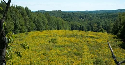
B. LANDSCAPE CHARACTER
Spencer’s structure of rolling hills and small river valleys led to the use of water power during the 18th
and early 19th centuries. Villages developed in the areas where water mills clustered around stream
convergences, and focused around the current town center along the Post Road (Route 9), with
businesses, housing, and the railroad creating a bustling downtown. Even in this developed center of
Spencer, however, there are panoramic views to the west. Some hills offer views of Mount Wachusett
and Boston; Bacon Hill offers views to the south, and from Northwest Road there are vistas across the
valley of the Five Mile River to the west.
Spencer’s ponds and lakes, most of which were
created or enlarged for water power, became
attractions for recreation during the 19th and 20th
centuries. Summer camps and seasonal homes sprang
up along the shores of lakes and in wooded areas.
Over time, many of these seasonal homes became
year-round homes, and these areas became more
densely settled. The landscape in Spencer now
alternates between the clusters of housing and open
spaces in between these clusters.Many areas of
undeveloped land such as Scout camps, Wildlife
Photo Credit: Town of Spencer Management Areas, Spencer State Forest, Howe Park,
and the fields and pastures of the remaining farmed land contribute to Spencer’s rural character, in spite
of the gradual accumulation of residential development along the existing roads. St. Joseph’s Abbey, in
the northwest corner of the Town, is a significant area of privately-owned open space with 1,754 acres
of well-maintained agriculture, wildlife and forest land. There is a large solar development on the land,
as mentioned in Section 3. The Abbey is also a cultural landmark – it is a Trappist Monastery settled in
1950 that houses monks and offers programs and retreats. The Abbey is also one of the largest
businesses in Spencer, producing and selling fruit preserves as well as Spencer Beer its own brewery.
Spencer Open Space & Recreation Plan, 2021 22You can also read