THE RIVER BURN THE NORFOLK RIVERS TRUST - RESTORING NORFOLK'S RIVERS A WATER FRAMEWORK DIRECTIVE LOCAL CATCHMENT PLAN
←
→
Page content transcription
If your browser does not render page correctly, please read the page content below
THE NORFOLK RIVERS TRUST
             RESTORING NORFOLK’S RIVERS

THE RIVER BURN
A WATER FRAMEWORK DIRECTIVE LOCAL CATCHMENT PLAN

DEVELOPED IN
PARTNERSHIP WITH

                            THE RIVER STIFFKEY A WATER FRAMEWORK DIRECTIVE LOCAL CATCHMENT PLAN | PAGE A
CONTENTS INTRODUCTION
Introduction 1
The Water Framework Directive 1 This plan has been produced by Norfolk Rivers Trust in habitats throughout the catchment, providing benefits to
consultation with relevant agencies, landowners, farmers the river wildlife and the community.
A choice for the future of our rivers… 2
and local people in the Burn Catchment. The aim of the
River Burn statistics 4 plan is to provide a framework for improvement of the The plan begins by providing an audit of the current state
Why restore rivers? 4 ecological status of the Burn River, guided by the Water of the catchment. Solutions to ecological problems are
Framework Directive. Delivery of the actions outlined in then are identified, costed and prioritised.
the plan will lead to improvements in water quality and
THE CATCHMENT
The community 6
Overview of restorations options 7
Wildlife 8
Geology and geodiversity
History of The River Burn (Nelson’s Country)
10
13 THE WATER FRAMEWORK DIRECTIVE
The Burn from source to mouth 15
The Water Framework Directive (WFD) was introduced moderate, good or high. Each member state is required
Section 1 – Sources to South Creake 15 in 2000 and commits European Union member states to to bring its water bodies to good status by 2015. Where
Section 2 – Below South Creake to Burnham Thorpe 18 improving the chemical, physical and ecological quality this is not possible, good status must be achieved by
of their streams, groundwater areas, rivers and lakes. 2021 or 2027, depending on the severity of the barrier to
Section 3 – Burnham Thorpe to Roy’s Mill 20
The quality of these waters is measured using a range good status. The majority of Britain’s rivers currently fail
Section 4 – Roy’s Mill to tidal sluice outfall 22 of indicators which combine to give a picture of a river’s to attain good status due to a wide variety of pressures.
health. Using this combination of indicators a river (or In England, the Environment Agency are responsible for
THE PROBLEMS AND SOLUTIONS groundwater unit or lake) is then graded on its overall
“ecological status”, and designated as either bad, poor,
WFD delivery.
River structure 23
Floodplain connectivity 23 Water Framework Current river Predicted by 2015
Directive Status Status (2009)
Fish passage 24
Water quality and sediment pollution 24 Bad
Environmental flows 24 Poor Fish
Invasive species 25
Trees and woody habitat 26 Moderate Ecological Potential Fish
Phosphate Phosphate
Dissolved Oxygen Dissolved Oxygen
AN ACTION PLAN Overall Status Overall status
Good Invertebrates Invertebrates
Section 1 – Sources to South Creake 27 Hydrology supports Hydrology supports
good good
Section 2 – Below South Creake to Burnham Thorpe 27
High Ammonia Ammonia
Section 3 – Burnham Thorpe to Roy’s Mill 28 Temperature Temperature
Section 4 – Roy’s Mill to tidal sluice outfall 28 Copper Copper
Zinc Zinc
Costs and timeline 29 Ammonia Ammonia
Further Information 31 Author: Olly van Biervliet of Norfolk Rivers Trust pH pH
The Burn is classified as a Heavily Modified
Design: Ark Creative (UK) Ltd Heavily Waterbody
Modified Waterbody
THANKS This plan has been enriched by
cooperation and contributions
John Lorrimer
Diana Brocklebank Scott
David de Stacpoole
Dr Carl Sayer
Jonah Tosney
Jonathan Lewis
Table 1. Results of detailed water body investigations undertaken by the Environment Agency to determine
the status of the River Burn. A prediction about the status at the next “waypoint” in the WFD schedule (2015)
from many different people and
organisations. Norfolk Rivers Anthony Scott Rory Sanderson Emmie van Biervliet (Artist) is also shown.
Trust are grateful to the help from Andrew Green Helen Blower Sam Brown
these individuals, and do not
seek to imply that the document Nina Plumbe Lorraine Marks
is necessarily endorsed by those Marjorie and John Stabler Bridget Marr
listed below. NRT would like to
Tim Holt-Wilson Kelly Powell
thank all those involved for
their help: Nick Zoll Will Fletcher
THE RIVER BURN A WATER FRAMEWORK DIRECTIVE LOCAL CATCHMENT PLAN | PAGE 1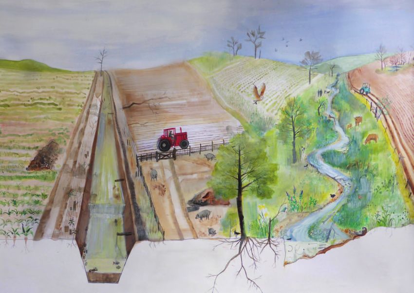
A CHOICE FOR THE FUT URE OF OUR RIVERS…

                                                                                                                                                                       Emmie van Biervliet

PAGE 2 | THE RIVER BURN A WATER FRAMEWORK DIRECTIVE LOCAL CATCHMENT PLAN                                             THE RIVER BURN A WATER FRAMEWORK DIRECTIVE LOCAL CATCHMENT PLAN | PAGE 3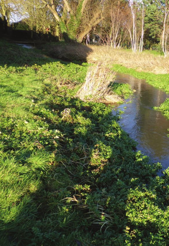
RIVER BURN STATISTICS                                                                                                              SECTION 1 THE CATCHMENT
       Approximate river length:            12.1 km (Sluice to primary source near Southgate Road)
                                                                                                                                          The River Burn is a chalk stream which flows through a          to which flows in the sections which lie above Burnham
       Catchment area:                      99.6 km2
                                                                                                                                          low-lying catchment and discharges into salt marshes.           Thorpe are affected by abstraction. Substantial flow joins
       Discharge at named point:            Burn at Burnham Overy                                                                         These salt marshes are adjacent to the biologically rich        the Burn at Burnham Thorpe from a system of springs
                                                                                                                                          freshwater grazing marshes of Holkam National Nature            surrounded by sedge beds. Below this point the remaining
                                            Base Flow Index: 0.96                                                                         Reserve. The River is classified by the Environment Agency      2.5 km of the river has reliable flows, and has not dried out
                                            Mean Flow:       0.317 m3/s                                                                   as a Heavily Modified Waterbody, a designation which            in the last 50 years for which data is available.
       Legal designations:                  Nitrates Directive                                                                            recognises the long history of modifications to the Burn
                                                                                                                                          over several centuries. The upper Burn is a winterbourne,       Most of the course of the river has been altered by
       County Wildlife Sites:               Fakenham Road Meadow, Grove meadow (near source at Southgate), South of Abbey
                                                                                                                                          which means that some headwater sections dry out                diverting it into straightened sections. Impoundments
                                            farm; Thorpe Common and Fen
                                                                                                                                          naturally as the level of water in the underlying chalk         reduce the potential for fish movement and migration
       Protected area                       Holkam National Nature Reserve SSSI, NNR, SAC, SPA, Biosphere Reserve                         aquifer drops. However, there is debate about the degree        along the river.
       designations:
       Other areas of conservation          40 ha of land managed for conservation close to National Trust Mill
       importance

      WHY RESTORE RIVERS?
       Britain’s rivers generally fail to reach “good” ecological          invertebrates in the river corridor also absorb and process
       quality. This is both a problem in itself and a sentinel of         pollutants. This enhances water quality within limits.
       trouble.                                                            However, very polluted rivers have less wildlife and in turn
                                                                           they a reduced capacity to provide such benefits. This
       A well-functioning river system is an inseparable                   leads to a downward spiral. Wildlife itself has an intrinsic
       combination of good water quality, distinctive physical             value as well as being enjoyed by interest groups such as
       processes and diverse wildlife. These factors interact              fishermen, ramblers and bird watchers.
       to provide benefits. A naturally functioning river has a
       floodplain with sufficient capacity to absorb inundation            If any of the three pillars of the river system is damaged
       and to act as a store for silt carried by high flows. The           (water quality, physical processes, ecosystem), then the
       river channel would also be naturally self-scouring.                value of the entire interconnected system is reduced.
       This reduces flood risk and the need for expensive                  Arguably, we also have a responsibility to repair our
       management. Headwater forests reduce surges of water                damaged natural heritage for future generations. Thus,
       into the system by increasing drainage and removal                  ecological restoration aims to enhance the functioning,
       of water. Moreover, the vegetation, microbes and                    as well as the intrinsic value of our beautiful rivers.

                                                                                                                                                                                    Map 1. The Burn Catchment.

PAGE 4 | THE RIVER BURN A WATER FRAMEWORK DIRECTIVE LOCAL CATCHMENT PLAN                                                                                                                               THE RIVER BURN A WATER FRAMEWORK DIRECTIVE LOCAL CATCHMENT PLAN | PAGE 5
THE COMMUNITY                                                                                                       OVERVIEW OF RESTORATION OPTIONS
       It is part of the Norfolk Rivers Trust’s mission to gain the                                                        Summary of possible restoration options on the river Burn.
       active participation of the community. Stakeholders help                                                            These proposals would greatly enhance the value, water
       us to set objectives, keep us informed about issues on the                                                          quality and wildlife value of the river. It is stressed that
       ground such as pollution and actively volunteer to make                                                             these are subject to consultation and are only outline ideas
       many more worthwhile projects possible.                                                                             at this stage.

       Norfolk Rivers Trust have recently started to work in the
       Burn Catchment, and we were very pleased to receive
       over 80 people at our latest event at North Creake Village
       Hall. The River Burn is a rural catchment, with 10 villages
       positioned close to the river, including: Waterden, South
       Creake, North Creake, Burnham Deepdale, Burnham
       Westgate, Burnham Sutton, Burnham Ulph, Burnham
       Overy, Burnham Thorpe and Burnham Norton.

       An opportunity to restore a section of the River Burn by
       fencing off livestock and tree planting has already been
       identified with the aid of the landowner, and this project will
       be greatly aided by the help of volunteers. Norfolk Rivers
       Trust are grateful for the help which The Brocklebank Trust
       has given to make this project happen, and hope that
       more projects will be initiated in the near future.

                                                                           Photos. A Norfolk Rivers Trust event in North
                                                                           Creake in February 2014 which was attended
                                                                           around 85 people.

                                                                                                                                                                                                Map 2. Approximate locations of possible
                                                                                                                                                                                                restoration options on the River Burn.

PAGE 6 | THE RIVER BURN A WATER FRAMEWORK DIRECTIVE LOCAL CATCHMENT PLAN                                                                                                                  THE RIVER BURN A WATER FRAMEWORK DIRECTIVE LOCAL CATCHMENT PLAN | PAGE 7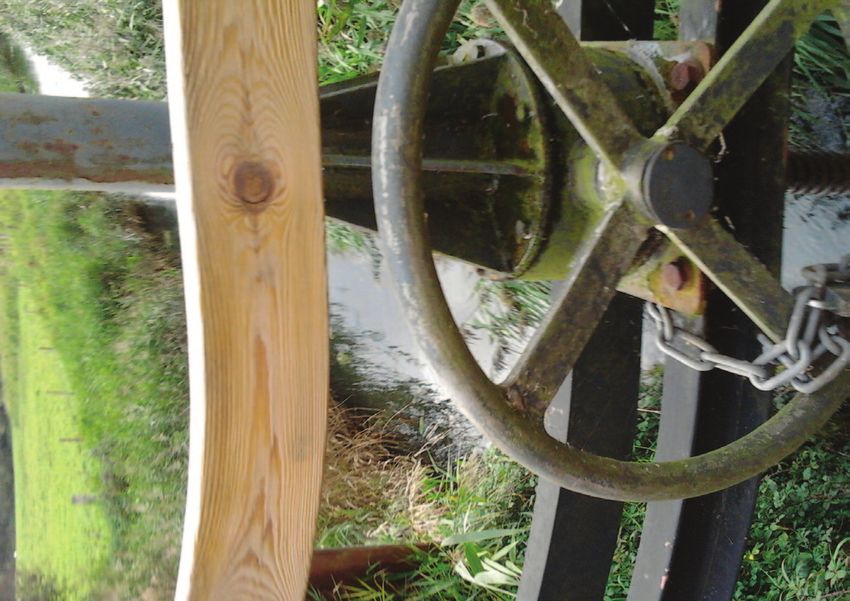
Photo 3. Kingfisher
WILDLIFE Wildlife profile:
Despite the many challenges which the wildlife in the River plants
Burn valley faces, the catchment supports a diversity of
organisms which benefit from the river. The benefits of aquatic plants for lowland river systems are threefold: they reduce pollution,
they improve river structure and they are a vital habitat for other wildlife.
Photo 3. Riffle Scientific studies have shown that plants remove excess nutrients caused by sewage effluent or
Photograph: © JAPEM©
beetle and larvae agriculture. Their sinuous fronds create a large surface area for colonisation by algae, bacteria and
(Elmis aenea), invertebrates which process nutrients and organic matter within the river. Their roots directly remove nutrients. They
also stabilise sediment and thus prevent movement of toxins which may be bound to sediment particles. Water
Photograph: © Jonathan Lewis. plants’ physical role is also vital. They narrow the channel in places and cause water to accelerate, as well as holding
water up in other places. This allows differential scour and deposition of sediment, which helps river channels to
remove and store sediment. Together with trees, they are nature’s architects of channel structure, helping rivers
Species profile: which have been artificially straightened to recover to a more meandering form. Water plants are also a rich habitat
River Kingfisher, for invertebrates which feed the larger animals in the river system. Last, but not least, their delicate greens and subtle
white flowers are also one of the wonders of the British countryside.
Alcedo atthis
Species profile:
When walking down a gurgling river, one is
Riffle Beetle sometimes lucky enough to be graced by the teal
blue flash of a kingfisher speeding busily past. Ten years ago this section of stream was absolutely straight and
The riffle beetles (family Elmidae) are small beetles This incredible little bird feeds on small fish and featureless. Growth of plants and sediment deposition around dead plants
between 1.25-4.75 mm in length, have long legs and invertebrates at a voracious rate, consuming its has caused a return to a more natural meandering form, which in turn has
claws relative to their body size and are generally dark entire body weight each day. During the mating started to cause pools and riffles to develop. (Photo: Olly van Biervliet,
brown to black in colour. The long claws help them to season, the kingfisher will catch 5,000 small fish Fox’s Beck, Norfolk. With thanks to John Dowland)
keep hold of the substrate and plants on the river bed to sustain itself and its young. Kingfishers do not
to stop them from getting washed downstream. This have a beautiful song to match their striking colours,
is very important as they are not able to swim. There but they do have a variety of calls with different
are a small number of species in the family, some meanings. In fact, one call signifies to their mate and
of which are very common and some that are Red young: “I’m home!”
Data Book species. Most common in the North West
Norfolk rivers are Elmis aenea which are found in In the winter, when some of the kingfishers’ feeding
rivers and streams where ‘riffle’ features are present. spots freeze over, the birds migrates towards coastal
One of the regionally notable species found is Riolus estuaries where the warming effect of the sea, and
subviolaceus which inhabits base-rich streams and the salt water prevent freezing. Most of the time,
rivers with good flow velocities. however, kingfishers stick to a particular territory and
Contribution: Nina Birkby, Environment Agency will routinely be seen in the same spot.
Photo 2. Otter
Species profile:
The Eurasian Otter,
Lutra lutra
Water crowfoot
Photograph: © Jack Perks
The otter is a predatory mammal which uses its excellent swimming in flower.
ability and specialised teeth to feed on a variety of prey such as fish but
also amphibians and occasionally birds. They have even been shown
to be capable of eating toads despite their poisoned skins. They corral
the amphibians into groups before proceeding to skin them and eat the
nutritious innards. Otters hold territories against the same sex, and this
stops their numbers building up into high densities, especially when food is Varied water plants represent shelter and food for a diversity of other wildlife.
scarce. This beautiful and reclusive animal is wide ranging and can be seen
around ponds, lakes, rivers and marine habitats.
A possible good news story for the future? Could a
native species be introduced to the River Burn? Water plants cause flow
variation which also
Britain’s only native crayfish requires clean, well oxygenated, mineral-rich encourages sediment
water and was once common throughout southern and eastern England, but storage and scour.
is now on the verge of extinction following the introduction of the American
signal crayfish. If the water quality and habitat were sufficiently improved, this Native and endangered crustacean:
species could be introduced to the Burn one day. However, this would rely on The white clawed crayfish,
the absence of invasive crayfish such as the American signal crayfish. Austropotamobius pallipes
PAGE 8 | THE RIVER BURN A WATER FRAMEWORK DIRECTIVE LOCAL CATCHMENT PLAN THE RIVER BURN A WATER FRAMEWORK DIRECTIVE LOCAL CATCHMENT PLAN | PAGE 9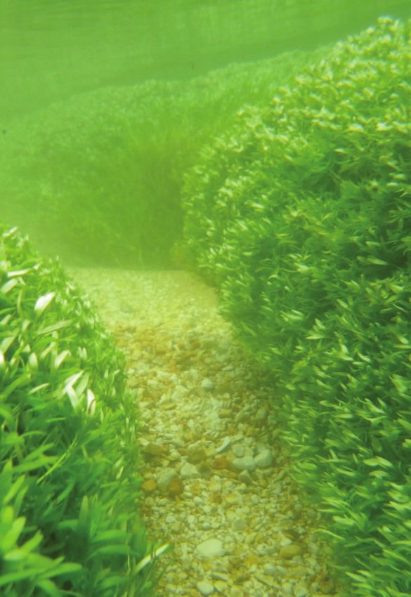
GEOLOGY AND They are fed principally from groundwater rather than
The headwaters
The Burn has its headwaters in the uplands around South
winterbournes where the valley floor intercepts the water
table. Flows may dry up seasonally if water levels fall in
GEODIVERSITY
surface water, and flow is gradually released through the aquifer. There is an important permanent spring near
springs or directly up through the river bed. Chalk rivers Creake, Syderstone and Sculthorpe. Groundwater flows Grove Cottage at Southgate, and several intermittent
have a distinctive flow regime: their springheads tend to converge on the valley through chalk bedrock and thick sources, for example a pond near Leicester Meadow
have steady flow, although some headwater valleys may layers of Marly Drift and associated sands and gravels and land round Waterden (literally ‘water-valley’) and
be dry in summer when groundwater levels fall. They tend of Anglian age. Sandy deposits, resulting from slope South Creake Common. These sources converge on
Introducing Chalk Rivers to have more stable temperature regimes than other rivers erosion in Pleistocene and more recent times, have the wet meadows at Fakenham Road, parts of which
Chalk rivers are a distinctive part of England’s landscape. due to a constant baseflow component. Their waters are accumulated on the valley floor. The permeable nature are designated as a County Wildlife Site. This area of
There are more found here than anywhere else in the highly alkaline, which gives rise to a distinctive ecology of such superficial deposits means that water percolates confluence, which includes the Southgate Spring, may be
world. They are located wherever rivers flow across chalk and suite of plants and animals. High quality chalk streams downwards to emerge as springs, wet flushes and considered as the permanent source of the river.
bedrock or chalk-rich superficial deposits, in a tract of land are prized by anglers because they support abundant
stretching from East Yorkshire, Norfolk and the Chilterns to brown trout populations, which shelter and feed amongst
Wiltshire and Dorset. There are 12 such rivers in Norfolk. characteristic water plants such as water crowfoot.
The Heacham
River: a Norfolk
chalk stream,
having clear, lime-
rich water flowing
over flint and
chalk gravel.
Seasonal winterbourne flow in the headwaters near Swimmer Barn, Southgate. February 2014.
Chalk underlies most of Norfolk, but only reaches the river will typically flow through several geological zones
surface in the western and northern parts of the county, and soil types on its way to the sea, but will still retain its South Creake and North Creake
as well as in valleys where rivers have incised down characteristic ‘chalk river’ flow regime and basic alkaline
to bedrock. Chalk is also found in the glacial deposits chemistry. The Burn has a regular presence through South and
which form a superficial layer across much of Norfolk, North Creake. It has a shallow channel which has been
as it was readily eroded and redeposited by ice sheets Wildlife in chalk rivers is vulnerable to changes in river conspicuously straightened and canalised for flood
during the Pleistocene period (2.6 million to 10,000 structure and processes. Over-abstraction can lead to management purposes; in some stretches it is embanked
years ago); these chalk-rich glacial deposits are known lowered flows and siltation. Flood defence and drainage above the level of the valley floor. It flows over superficial
colloquially as Marly Drift. Thus the chalk rivers of Norfolk work may lead to an alteration of the channel shape by layers of slope-derived deposits and alluvium resting on
have a mixed geological origin, which subtly alters the deepening and straightening, with knock-on effects on chalk bedrock. Because of the proximity of the aquifer
chemical composition of their waters. A Norfolk chalk river flow and biodiversity.
it maintains a constant flow, although water levels may
seasonally vary, sometimes falling to as low as 15 cm
(6 inches) in dry summers but also occasionally filling
the channel to the top of the banks. It is augmented by
springs along its route, as in the woodland near Manor
House. Silt is washed into the river from farmland in a few
places, most notably at Holgate Lane where it crosses
a ford. The valley opens out significantly beyond North
Creake. Water is said sometimes to erupt from the ground
under artesian pressure in the meadows between Norman
Lane and Creake Abbey. In past centuries this abundant
flow gave rise to areas of fenland, indicated today by
shallow tracts of wasting peat on the valley floor north and
south of the Abbey. The river was artificially straightened
in the early 19th century, probably as part of a drainage
project, and now runs down the centre of the valley.
The Burn is confined by embanked dredging spoil at
Abbey Farm meadows. It is prone to disappear in this
stretch, due to seasonally intermittent flow.
PAGE 10 | THE RIVER BURN A WATER FRAMEWORK DIRECTIVE LOCAL CATCHMENT PLAN THE RIVER BURN A WATER FRAMEWORK DIRECTIVE LOCAL CATCHMENT PLAN | PAGE 11
From Burnham Thorpe to Norton Sluice
       North of the Abbey, the Burn continues its canalised
                                                                            saltmarsh creeks are present on the floodplain. The river
                                                                            is joined by its only significant tributary, the Goose Beck,     HISTORY OF THE RIVER BURN (NELSON’S COUNTRY)
                                                                            at Burnham Market; this is fed by permanent springs at
       course between banks of dredging spoil which separate it             Westgate, and is headed by a long, dry valley developed
       from its floodplain. It passes through an area of banks and          on chalk bedrock containing a winterbourne. Chalk is also
       drainage ditches at Open Meadow which may represent                  exposed more widely along the lower reaches of the Burn
                                                                                                                                             Ancient history
       the remnants of a floated water meadow complex. The                  valley, and Marly Drift mantles the higher ground; both          20,000 years ago, The Burn was a wide meandering river              The Mesolithic (middle Stone Age) period is defined in
       river is reported to run dry periodically between the Abbey          give a calcareous character to the groundwater welling           fed by glacial waters. Norfolk and most of East Anglia was          Britain as the time between the final retreat of the glacial
       and Thorpe Common some 2.5 km (1½ miles) away                        up in the valley floor. There is discharge from a sewage         covered by ice sheets. Norfolk was probably inhabited               ice to about 8,300 BC. Norfolk like most of Britain was
       down river; the floodplain in this stretch of the valley is          works at Burnham Market, but this does not make a                from around this time, although it might have been earlier.         occupied by small groups of hunter-gathers. Their
       underlain by permeable slope-derived deposits overlying              significant contribution to river flows. The river’s course is                                                                       distinctive flint work including long blades and macrolides,
       chalk bedrock. Its re-emergence at Burnham Thorpe                    interrupted by two mill dams in Burnham Overy: the pool          Tools from this period have been found in gravel pits and           which were probably hafted in wood, creating saw like
       Common coincides with the transition of its geological               of the upper mill backs up into an extensive area of carr        rivers, brought up by fishermen in their nets. In addition          cutting edges and arrowheads, were used for hunting
       substrate from sandy deposits back to peat. This tract               (wet) woodland; the pool of the lower mill is substantially      to these tools, animal bones and plant remains have been            small animals. Flint axes were also used for felling trees.
       of valley peat extends downstream as far as the tidal                embanked above the surrounding floodplain meadows.               found in sand and mud deposits. These deposits were
       sluice at Burnham Overy. It indicates that brackish water            The river and groundwater feed water-dependent habitats          first recognised at Cromer in the middle of the last century        In the Neolithic (New Stone Age, 4,500 BC)
       conditions and coastal reed marshes extended upriver in              in the grazing marshes and inter-tidal saltmarshes. The          and are called the Cromer forest bed series because of              settled communities gradually arose in
       past centuries as far as Thorpe Common. Traces of former             river discharges into Overy Marsh at Norton Sluice.              the fossilised wood it contains. Many of the plants have            Britain, partly or fully dependent on
                                                                                                                                             been identified from pollen, such as Oak, Ash, Hazel, Lime          arable farming or stock raising. This
                                                                                                                                             and Hornbeam. Fir and Spruce have also been found                   would have resulted in a change
                                                                                                                                             but they are no longer native to Britain. Animals which             in the landscape of the Burn
                                                                                                                                             would appear exotic to us now roamed the area. These                Catchment. The range of crops
                                                                                                                                             included an early species of large elephant, a smaller              that were grown included Rye
                                                                                                                                             species of rhinoceros, which is related to the present day          on poor ground, Barley on good
                                                                                                                                             Sumatran rhinoceros, and three or four species of giant             (mainly used for beer making) with
                                                                                                                                             deer, the males of which had very large antlers, measuring          other crops including peas, beans and
                                                                                                                                             over three metres across. Within the woodland of the                grasses.
                                                                                                                                             Cromerian inter-glacial were lakes and slow flowing rivers.
                                                                                                                                                                                                                 During the Copper and Bonze Age (c. 2,500BC)
                                                                                                                                             Man was certainly present in East Anglia during the period          environmental evidence indicates that humans felled
                                                                                                                                             which we know as Hoxian Interglacial. This began about              considerable areas of ancient wildwoods. Thus the
                                                                                                                                             400,000 years ago. These Palaeolithic (old Stone Age)               process commenced by Neolithic arable farming and
                                                                                                                                             people used large flint flakes and later hand axes as tool.         pasture was extended to allow production of food for an
                                                                                                                                             These people hunted horse, deer, oxen, elephant and                 expanding population.
                                                                                                                                             rhinoceros; they also went wildfowling and fishing.

           Ponded section of River Burn above National Trust Mill.

                                                                                        Tim Holt-Wilson
                                                                                        Norfolk Geodiversity Partnership

                                                                                                                                              Bronze Age tools including a well preserved axe head.

PAGE 12 | THE RIVER BURN A WATER FRAMEWORK DIRECTIVE LOCAL CATCHMENT PLAN                                                                                                                                   THE RIVER BURN A WATER FRAMEWORK DIRECTIVE LOCAL CATCHMENT PLAN | PAGE 13
History of the Burn from Mouth
       to Headwaters
                                                                            watch the Danes marching up from the sea. The invaders
                                                                            did not pass the fort without a fight. Legend has it that       THE BURN FROM SOURCE                                               In its highest reaches, the stream course originates
                                                                                                                                                                                                               from several areas (Map 3). As the stream proceeds

                                                                                                                                            TO MOUTH
                                                                            the bodies of the slain were piled up to the height of                                                                             downstream towards South Creake flows become more
       Norfolk was not always a backwater. At the time of                   the defences and the blood flowed like a river down the                                                                            constant and it runs over clean gravels. It is completely
       the Domesday Book, Norwich was the second largest                    hill, hence its name Bloodgate Hill. Not much is visible,                                                                          straightened to run parallel to the road. It forms an
       city in England. This did not change until well into the             but it is still worth a visit for the view of the surrounding                                                                      attractive feature running through the front gardens
       eighteenth century. Agriculture was a vital part of this                                                                                                                                                of the houses at the beginning of the village. In South
                                                                            countryside. This was the beginning of the Viking invasion      Section 1 – Sources to South Creake                                Creake village centre itself the stream changes character
       success. One agricultural practice starting in the Middle            that defeated King Edmund The Martyr and turned East
       Ages and continuing until the 18th century, was the use              Anglia into a Viking settlement.                                This section of the stream is very much a winterbourne             to a rectangular channel and is crossed by 2 fords. The
       of oak woodlands in Common Land as foraging areas for                                                                                section, with the very highest reaches rarely running. It is       slowed flow velocities here, and an abundance of ducks
       grazing pigs which fed on acorns. In the medieval period,            Jumping forward in history about 1100 years, at the             not a useful concept to think of the Burn as having one            contribute to a silty channel with an absence of water
       the county was the most prosperous in England, and this              bottom of Bloodgate Hill is a place that was the birthplace     particular source all the time. Rather, as one reaches the         plants. The fords and lack of varied water velocities due
       goes some way to explaining one of the most striking                 of modern mechanised agriculture. Bluestone Farm                uppermost sections of the river, the point of first flows          to the uniform river channel result in steadily increasing
       features of the Norfolk landscape – the very high density of         was the first fully mechanised farm in England. The Alley       moves up the course with increasing groundwater levels.            siltation in the stream below this point.
       Parish Churches.                                                     brothers rented the 113 acre farm from Lord Townshend
                                                                            Bircham’s Estate in 1930. They also introduced caterpillar
       The Estuary of the Burn in medieval times was a harbour              tractors and were the first to plough to the unheard of
       known as Skottermouth, probably from the Norse and                   depth of nine inches. Such innovations enabled man to
       Skutic, meaning “projective ridge,” due to the shelter               further modify the landscape in the catchment of the Burn.
       offered from northerly gales by a stretch of dunes called
       Burnham Meals. Documents from 1565 refer to two
       navigable creeks as Burnham Rodested and it was                      John Lorimer
       recorded that between them Norton, Overy and Deepdale
       had seven mariners. The estuary was clearly an important
       hub for waterborne trade, with the banks of the river
       between Overy town and Burnham Norton hosting a
       boat market. Records from Creake Abbey show that
       the Canons brought such things as salt and fish from
       Cromer and hay from Setchey, which might have come via
       Burnham Rodested.

       Many people know of the Burnhams because of Admiral
       Nelson but there is another famous Sea Captain, Richard
       Woodget, the Master and Captain of the record-breaking
       Clipper “The Cutty Sark”. He was born in Norton Cottage
       in 1846 and was known for his hobbies on board “The
       Cutty Sark”, such as learning to ride a bike and to roller
       skate on the tween decks when the ship was in ballast
       (empty to us land lubbers!)

       Continuing further from Overy we come to Burnham
       Thorpe, the birthplace of the famous Admiral Nelson.
       Because his father’s parsonage was being repaired and
       redecorated at the time of his birth, Nelson was actually
       born at the shooting box where his family were staying                                                                               Map 3. Main sources - South Creake: light green shows the ephemeral sections of the stream and green represents the
       with friends. Born seven weeks premature on 29th                                                                                     area of more constant flow. Locations of major sources: 1. Waterden to the East 2a. Leicester Meadows 2b. Source close
       September 1758, he was baptised within a few hours as it                                                                             to White Hall Farm 3. Meadow at Southgate is the main spring.
       was thought unlikely that he would survive. It is said that
       during his childhood he would play with toy boats in the
       Burn which ran past his house. The lectern in Burnham
       Thorpe church is constructed with timbers that came from
       Nelson’s flagship, HMS Victory, given to the church by the
       Board of The Admiralty.

       If you follow the Burn towards North Creake, you will
       come to the ruins of North Creake Abbey. Starting life in
       1206 as a small chapel, in 1226-7 the chapel received
       Royal Favour and it passed to the Black Canons, a name
       derived from the colour of their habits. In 1483 there was
       a disastrous fire and much of the abbey was destroyed. In
       the sixteenth century Plague ravaged the Abbey sparing
       only the Abbot himself, Giles Sheryngton, who died alone
       on 12th December 1506.

       Further up the River Burn is South Creake where, a short
       walk from the centre of the village, you will find Bloodgate
       Hill. Here there was an Iron age encampment. Behind a                                                                                   Photo 4. Clear gravels in section of River Burn above South Creake.
       ring of earthworks the Saxons of East Anglia gathered to

PAGE 14 | THE RIVER BURN A WATER FRAMEWORK DIRECTIVE LOCAL CATCHMENT PLAN                                                                                                                                  THE RIVER BURN A WATER FRAMEWORK DIRECTIVE LOCAL CATCHMENT PLAN | PAGE 15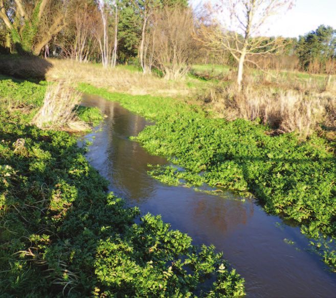
Photo 2. Water plants (macrophytes) including fool’s watercress (Apium Nodiflorum) create
some sinuosity and habitat variation within the straightened channel.
Photo 3. Photo 4.
Photo 6. The stream becomes increasingly silted due to lack of natural
Photo 5. Ford over the Burn in South Creake. stream morphology and sediment inputs.
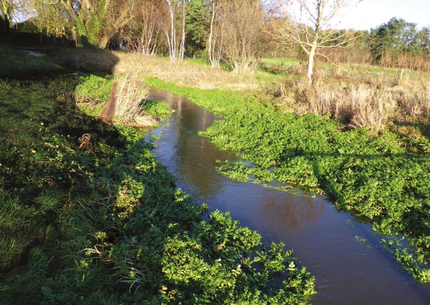
PAGE 16 | THE RIVER BURN A WATER FRAMEWORK DIRECTIVE LOCAL CATCHMENT PLAN THE RIVER BURN A WATER FRAMEWORK DIRECTIVE LOCAL CATCHMENT PLAN | PAGE 17Section 2 – Below South Creake to to the river with native vegetation, making particularly good
Photo 7. A representative section of the Burn between the Creakes
quality areas for wildlife such as damsel flies and water
Burnham Thorpe voles. Norfolk Rivers Trust are happy to advise on how to
Between South and North Creake the stream runs in a ensure that gardens are beneficial for wildlife. This section
straightened channel, a typical example shown in Photo still dries out relatively frequently, with several dry periods
7. A 1996 Environment Agency report draws on evidence in the early 1990s and a dry year in 2011 according to
from hydrological model runs and an MSc thesis to records kept by the residents.
demonstrate that the bed of the channel between North
and South Creake is above the groundwater height, so Between North Creake and Burnam Thorpe the Burn
would lose stream water to the ground in this section. This flows in straightened sections through rough pasture. In
partially explains the notable vulnerability of this section to some places, these areas are grazed to an extent which
drying. However, model runs also showed that abstraction reduces riparian vegetation and causes banks to be
had probably led to a 13% increase in the number of days over-widened as shown in Photo 8. Excessive livestock
for which the stream was dry. The current situation in the trampling in some places also causes sediment from
context of this finding should be further investigated. collapsed banks to enter the river. The reduced marginal
vegetation greatly decreases the value of the river for
In North Creake, the stream again forms an attractive wildlife such as trout and morhens which shelter in
feature in many back gardens, and runs through an open marginal plants.
space in the village. Some gardens gradually grade down
Photo 8. Representative section of grazed and straightened river channel. The channel banks are over-widened
due to poaching and a lack of vegetation development. This results in siltation because the channel to too wide
for the volume of flow, so gravels are covered in mud. In turn, this damages habitat, for instance preventing some
species of fish from spawning.
Map 4. River Burn between South Creake and Burnham Thorpe.
PAGE 18 | THE RIVER BURN A WATER FRAMEWORK DIRECTIVE LOCAL CATCHMENT PLAN THE RIVER BURN A WATER FRAMEWORK DIRECTIVE LOCAL CATCHMENT PLAN | PAGE 19Section 3 – Burnham Thorpe Below the springs, the river continues to flow through
meadows, but has been deepened by dredging.
to Roy’s Mill The excess capacity of the channel contributes to
Through Burnham Thorpe the river is again straightened sedimentation of this part of the channel and incursion of
to follow the course of the road. On the northern side emergent water plants across the channel. The stream
of the village the stream is joined by a significant flow of then enters wet woodland and heads towards Roy’s Mill.
water from clear springs which contribute greatly to flow The stream is joined by the effluent from Burnham Market
and can dilute the considerable sediment load carried by Sewage treatment works at this point, which contributes
the stream during rainy periods as shown in Photo 9. This to levels of phosphate which exceed Water Framework
input of flow gives this section of the river potential to have Directive targets. Below this point the Burn flows through
a thriving brown trout population, but density of trout is and around Roy’s Mill, which a Wild Trout Trust report
very low for reasons discussed later. suggests is an impediment to fish passage.
Photo 10. Springs to North of Burnham Thorpe.
Photo 11. River Burn at Thorpe Common. Photo 12. Burnham Thorpe Sewage Treatment Works outlet.
Map 5. River Burn from Burnham Thorpe to Roy’s Mill.
Photo 9. Spring water joining flow at Burnham Thorpe (joining from left). This adds flow and dilutes sediment load
from upper Burn (right fork). Photo 13. Outflow of channel which bypasses Roy’s Mill.
PAGE 20 | THE RIVER BURN A WATER FRAMEWORK DIRECTIVE LOCAL CATCHMENT PLAN THE RIVER BURN A WATER FRAMEWORK DIRECTIVE LOCAL CATCHMENT PLAN | PAGE 21Section 4 – Roy’s Mill
SECTION 2 THE PROBLEMS
which crosses the A149 about 100m to the West of the
mill. Locals have seen large trout in this spring-fed channel
to tidal sluice outfall below the road. The mill pond itself is clay lined and has
AND SOLUTIONS
Immediately below the mill the river flows under Mill Road silty substrate due to the slow flow velocity in this section.
and through an Environment Agency gauging weir. This The mill is a barrier to fish passage.
represents a barrier to fish passage. Then the stream
passes a section of wet woodland and the main river Below the mill, the river moves through a deep channel
enters a long mill pond upstream of the National Trust Mill. towards the sea defences where a one-way tidal sluice
This mill pond is clay-lined to ensure a waterproof seal. prevents sea water from penetrating up the stream (Photo
This work was apparently completed by Italian prisoners 15). According to the Wild Trout Trust report, this structure The River Burn has been artificially straightened and and trout. Water quality in the lowest section of the river
of war during the Second World War. The historic flow may discourage fish migration because they will be closed deepened from source to mouth, with very few natural below the Burnham Sewage Treatment works is also poor
of the river is via a stream which is now a low-level drain on an incoming tide, but is certainly not a total barrier. sections remaining. Impoundments along the river also due to nutrient enrichment.
prevent passage of migratory fish such as lampreys, eels
RIVER STRUCTURE
The straightening of the Burn has three profound Adding meanders to the entire course of the river will not
implications for the Burn’s ecosystem. Firstly, the river be possible, but opportunities to do this in places would
is very much shorter than it would naturally be, and be very valuable. In cases where this is not possible, pool-
consequently represents a reduced habitat. Secondly, riffle sequences could be restored by the “dig and dump”
natural flow dynamics, which result from a meandering method. A natural river would also have backwater pools,
river, are not present, and this means that natural and these features should also be reinstated. Moreover,
processes such as differential storage and removal of any opportunities to add natural features such as woody
sediment by scour are impaired. Finally, it results in a lack debris, and to protect bank-side vegetation from over-
of variety of habitat for aquatic organisms, and this leads grazing would be valuable.
to a lack of biological diversity.
FLOODPLAIN CONNECTIVITY
In a natural, highly productive stream, there is seasonal
Map 6. Lowest section of River Burn finishing at tidal sluice. connectivity between the river and its floodplain and
unimpaired movement of fish species along the river.
The Burn’s artificial river channel is designed in a way that
rarely if ever allows over-bank flow in most sections. This
greatly reduces the river’s marginal habitat, and prevents
Photo 15. Tidal sluice gates. the rich ecological interchange between the stream and
its river corridor which would occur during seasonal
inundation. Moreover, the inevitable response of a stream
to over-capacity is to increase sediment deposition within
the stream because the water will move slowly through the
river channel. This causes siltation.
Photo 14. Burn upstream of tidal sluice.
PAGE 22 | THE RIVER BURN A WATER FRAMEWORK DIRECTIVE LOCAL CATCHMENT PLAN THE RIVER BURN A WATER FRAMEWORK DIRECTIVE LOCAL CATCHMENT PLAN | PAGE 23Photograph: © Jack Perks
FISH PASSAGE INVASIVE SPECIES Photograph: © Mike Sutton-Croft
Ecological restoration of the Burn would need to involve Invasive species can outcompete British wildlife, and can
facilitation of fish passage past major barriers identified cause specific problems such as river bank collapse and
by a Wild Trout Trust report, in particular the National damage to property. Because they have evolved under
Trust Mill and the Burnam Thorpe Environment Agency different conditions, natural checks and balances such as
gauging station. The tidal sluice, Roy’s mill, a private weir predation often do not control them effectively.
upstream of Burnham Thorpe, and the tidal sluice weir
There are some reports of Himalayan Balsam in the
also represent some impediment to fish passage. catchment. This has apparently been removed, but
Norfolk Rivers Trust are keen to work with landowners and
volunteer groups to help tackle invasive species as they
arise. Moreover, invasive crayfish are reported in ponds in
WATER QUALITY AND SEDIMENT POLLUTION the upper catchment, however locations remain unsure.
Norfolk Rivers Trust is keen to work with landowners
to determine if crayfish are present. This is particularly
important because the Burn could be a candidate for
The elevated phosphate in the lower Burn, has probably Moreover, sediment is washed into the Burn in several introduction of the imperilled native white clawed crayfish
contributed to very high water plant densities and algal places due to livestock grazing, field erosion and damage in the future. The lack of information about the exact
location of invasive crayfish in the catchment could
growth below this point. In turn it is likely that this has lead to road verges. This sediment settles in the channel
prevent this potential project.
to a seasonal supersaturation in dissolved oxygen, which causing siltation. A catchment strategy to reduce siltation
is also of concern. A reduction in nutrients is therefore in the Burn is needed with targeted buffer strips, livestock Norfolk Rivers Trust always appreciate it when people
desirable, and a cost effective solution must be sought. management, and modifications to drains from the road report the presence of invasive species, and can often
network to reduce sediment inputs. mobilise volunteer groups or relevant authorities to deal
with the problem. Moreover, the link below can be used to
report invasive species from your smart phone and trigger
the local authority into action: Himalayan Balsam (Impatiens glandulifera).
ENVIRONMENTAL FLOWS Nevertheless, a more subtle analysis was reported in a 1996
Environment Agency report, which showed that abstraction
http://www.rinse-europe.eu/smartphone-apps
caused a 13% increase in no-flow periods between
1972-1992, and this represents some cause for concern.
Locally, there is concern about the lack of water in the The relative value of water for domestic use and for watering Giant hogweed
upper part of the River Burn. The issue is complex due the crops, which we all consume, set against the
the natural state of the river as a winterbourne, and the importance of environmental flows is an important debate
aforementioned perched channel below South Creake. which will become increasingly acute in water-starved East
A simple examination of average gauged river flows at Anglia. Further examination of the no-flow issue using
Burnham Overy over the last 48 years shows no available information and modelling exercises could allow
appreciable change (it actually shows a tiny increase in decisions to be reached which allow natural levels of
flows but this would not be statistically significant). environmental flow, whilst allowing abstractions to continue.
Photograph: © Olaf Booy
PAGE 24 | THE RIVER BURN A WATER FRAMEWORK DIRECTIVE LOCAL CATCHMENT PLAN THE RIVER BURN A WATER FRAMEWORK DIRECTIVE LOCAL CATCHMENT PLAN | PAGE 25TREES AND WOODY HABITAT SECTION 3 AN ACTION PLAN
Over the past two decades the importance of trees meanders to develop. Tree roots in banks provide vital
bordering rivers has become increasingly apparent. habitats for a multitude of species, notably native crayfish,
otters and eels. Dead trees in the river are equally
Recent research has highlighted the threat that climate important. They are a key habitat. Moreover, large dead Despite its many problems the River Burn is a pretty little river which brings happiness to many gardeners and walkers.
change poses to aquatic ecosystems through changing wood (especially entire trees) initiate the natural recovery However, it could be a meandering stream, covered by dappled shade from native trees with a variety of habitat supporting
water temperatures. As water warms, oxygen levels of rivers from straightening and cause flow diversity. In a greater abundance of wildlife, in particular a healthy sea trout population and perhaps even native white clawed crayfish.
decrease in water and this can cause death of aquatic fact, tree planting and addition of large woody material
organisms. Small streams such as the Burn are are the most cost effective and among the most beneficial From a Water Framework Directive perspective, phosphate pollution, a poor fish community and seasonal oxygen
especially vulnerable. The recent Environment Agency measures which Norfolk Rivers Trust undertake.
supersaturation are of particular concern. Improving the fish community will involve tackling several issues: 1. Poor fish
project “Keeping Rivers Cool” highlights the importance
preventing dangerous temperature increases in the water The Burn has tree cover through much of its length. habitat, 2. Poor fish passage, 3. Nutrient enrichment, 4. Determining whether dry periods in the river are unnaturally long.
by shading. Trees also intercept and modulate agricultural However, there are still some sections which lack the Fish passage would increase the ability of fish to avoid pollution, drying, and exploit the best habits which the river has to
nutrients and sediment. They can increase infiltration, thus desirable mixture of tree cover and shade which would offer. Also restoration of deep water habitat including pools and backwaters in the upper river would greatly increase the
reducing flooding. keep the water cool and provide shelter for a variety of resilience of the fish community. However, all pressures need to be tackled together to solve the ecological problems of
wildlife. the Burn.
Trees are also vital as “architects” of river structure. Live
trees act as hard points, stabilizing banks and helping
SECTION 1 – SOURCES TO SOUTH CREAKE
Marginal habitat Fallen tree forms
developing framework for This section of the Burn needs to be treated as a river opportunity to manage the river in sympathy with nature
water plants channel the whole way to the ephemeral sources even by keeping weed cutting to a minimum and using sinuous
when the course is dry. Agricultural pollution and road run cuts where vegetation management is strictly necessary.
off should be avoided. Gardeners in South Creake have an
SECTION 2 – BELOW SOUTH CREAKE TO BURNHAM THORPE
The combination of a lack of natural structure (few pools addition of large woody habitat, and reducing grazing
or backwaters) and ephamoral flows mean that this pressure on the stream margins could be very beneficial.
Growing trees have changed this former section of river has few refuges during low flow periods. Sensitive gardening could also greatly promote stream
straightened drainage channel into a river with Therefore work on channel structure would be especially functioning in sections of rivers. Natural vegetation growth
a more natural structure and in-stream islands important here. Re-naturalisation in this section would can restore river processes such as a sinuous pattern,
(anastonising channel).
Flow diversity also be important, and measures such as tree planting, scouring of gravels, and can represent important habitats
in themselves. Marginal vegetation is also vital as cover for
Wood acts a encouraged
Tree acts as a hard point and has caused a aquatic species such as trout.
sediment trap meander to develop. A moorhen
Natural tree fall has several benefits for habitat creation,
channel structure and sediment modulation.
Grazed
Tree acts as a hard point and has caused the development of a pool.
Submerged tree roots are also excellent habitat for brown trout.
Natural tree fall Ungrazed
has caused a
great range of
microhabitats
and greatly
increased in-stream Where the river is grazed vegetation is reduced and the stream becomes overwidened. Where it is ungrazed
surface area for river channel is narrowed, and this differentially scours the central channel and traps sediment at the fringes. The
a diversity of river ungrazed area also provides excellent cover for species such as brown trout and families of morehens.
invertebrates.
PAGE 26 | THE RIVER BURN A WATER FRAMEWORK DIRECTIVE LOCAL CATCHMENT PLAN THE RIVER BURN A WATER FRAMEWORK DIRECTIVE LOCAL CATCHMENT PLAN | PAGE 27SECTION 3 – BURNHAM THORPE TO ROY’S MILL
This section of river, which has assured flows, could to be considered prohibitively expensive by Anglian Water.
benefit from channel morphology improvements to return Therefore, creative solutions may need to be considered.
the river to a natural form where possible. An increase of An option that has been suggested by stakeholders is
sinuosity and restoration of pool-riffle sequences would be to increase the size of existing wetland treatment areas.
beneficial. Improvements to fish passage at the mill would Norfolk Rivers Trust are currently undertaking a pilot
be a step towards rehabilitating the fish population. project to construct a similar wetland on the river Mun,
and the monitoring results could help to inform future
Finally, damagingly high concentrations of phosphate from plans. Piping of treated effluent to the sea (1.7 km) might
the Burnham Market Sewage Treatment works should be another option. Phosphate is not a problem when
be reduced. Phosphate is a nutrient which results from sufficiently dilute, and the flushing by coastal waters
the breakdown of sewage once it has been treated, and could provide this dilution. These solutions would avoid
is also present in cleaning products such as dish washer the problems associated with eutrophication such as
tablets. We all contribute to this problem. Phosphate filamentous algal build ups reported in the National Trust
stripping (chemical removal of phosphate) is the Mill pond.
conventional method of removing phosphate, but is likely
SECTION 4 – ROY’S MILL TO TIDAL SLUICE OUTFALL
Aforementioned improvements to water quality would inputs. If the excess capacity is not altered then any
benefit this stretch. channel morphology work will rapidly silt up. A two-
stage channel with appropriate bank full capacity and a
Options to improve channel structure could include “floodplain” overspill is therefore probably the best solution
increases in sinuosity around the existing channel’s as shown in Figure 1. This would have the benefits of:
constraints, use of paleochannels (historic channels), being ecologically beneficial, sustainable in the sense that
or using “dig and dump” methods to instate pool-riffle silt management would not be required (or very little) and
sequences within the existing channel. Whichever method increasing flood storage capacity.
is chosen, the bank-full capacity and floodplain capacity
of the river will need to be carefully considered. The Additionally, rehabilitation of fish populations will only be
current channel is acting as a sediment trap because it accomplished if it is possible for them to bypass structures
has a greater conveyance capacity than is required for which currently prevent their movement and migration.
the volume of water, and because of upstream sediment
COSTS AND TIMELINE 4. Definitively investigate the alleged unnaturally frequent
low flows in the top of the catchment.
The Water Framework Directive objective for the Burn
catchment is to reach Good Ecological Potential by 2027, Measures to improve in-stream habitat through tree planting,
and each of the actions set out in this report will assist in livestock fencing and placement of large woody debris
achieving that goal. where appropriate can start immediately. Volunteer groups
could have an important role in making such work possible
The river is approximately 12 km long and, due to centuries in the near future. Channel morphology work will need
of modification, many sections of the river could benefit from careful planning both in terms of technical aspects and in
ecological restoration to return it to a productive and terms of gauging community opinion. This aspect of the
natural state. work is therefore a longer term aspiration.
Overall, the order of priorities for the river are as follows: Success in attaining fish passage past priority structures
is contingent on finding solutions that will be acceptable
1. Improve in-stream and riparian habitat. This would to owners of structures which cause the barriers. We are
include targeted tree planting, addition of woody hopeful that Norfolk Rivers Trust’s inclusive approach will
habitat, work on channel structure and reducing the help to achieve this. Similarly, improvements of the poor
diffuse sediment inputs from roads, livestock trampling water quality in the lowest section of the Burn relies on
and arable. investment in the Burnham Market Sewage Treatment
Works. Creative solutions and a partnership approach might
2. Ensure fish passage is possible past barriers, with an help to make the cost of such work financially viable. Finally,
Figure 1. Structural modifications to streams should be based on bank full capacity (the
initial focus on the 2 impoundments identified as a information about the low flows in the upper Burn should be
height of common high flows) and should have sufficient flood capacity (maximal levels). If
particular priority. collated with results reported to the community. If necessary,
bank full capacity and sinuosity are properly incorporated, then sediment regime will also
a high quality hydrological modelling exercise could be
be modulated by alternate sediment storage in slow moving water and scour in faster
3. Improve water quality in lowest section of the river. undertaken to inform wise use of water on the Burn.
water. This will reduce/negate need for sediment clearance.
PAGE 28 | THE RIVER BURN A WATER FRAMEWORK DIRECTIVE LOCAL CATCHMENT PLAN THE RIVER BURN A WATER FRAMEWORK DIRECTIVE LOCAL CATCHMENT PLAN | PAGE 29Action Number of
kilometres / sites
Predicted cost Achievable
timeline
Responsibility /
capability FURTHER INFORMATION
Livestock Fencing and off stream 1.5 km £30,427 2021 Norfolk Rivers
drinking for cattle. Several fields up- Trust (NRT)/ Environment Agency - Keeping Rivers Cool report Norfolk Wildlife Trust
stream of Burnam Thorpe. Natural England/ Rivers by Design - rethinking development and river restoration River Rehabilitation for Eastern England Rivers
landowners World Wildlife Fund - Why are chalk streams special? Environment Agency homepage
River Restoration Centre manual of river restoration techniques Introduction to the Water Framework Directive
Channel structure (1): Roy’s Mill to 0.8 km £30,800 2021 Volunteers /NRT/
National Trust mill EA
River Structure (2): Immediately 1 km £38,500 2021 Volunteers /NRT/
downstream of Burnam Thorpe EA
Cricket pitch and including Thrope
Common Photograph: © Jack Perks
Addition of woody habitat (2): Im- 1 km £13,112 2021 Volunteers /NRT/
mediately downstream of Burnam EA
Thorpe Cricket pitch and including
Thrope Common
River structure (3) (Option 1 for this 1.6 km £61,600 2021 Volunteers /NRT/
stretch): (priority for channel structure EA
work on the Burn) between Creake
Abbey and Burnham Thorpe
Addition of woody habitat (Option 1.6 km £20,926,40 2021 Volunteers /NRT/
2 for this stretch): (priority) between EA
Creake Abbey and Burnham Thorpe
using woody material
Wetland mosaic where opportunities 11 km £26,501 2021 Volunteers /NRT/
arise in Burn above Burnham Thorpe EA
and into headwaters. Including back-
waters and ponds. This will increase
low-flow resilience.
Tree planting 1.6 km £331 2015-21 Volunteers /NRT
Prevention of silt from road runoff 3 main fords Fords (3x £50,000) 2021 NRT/ Highways/
and fords Multiple inputs £153,000 Landowner
from road Diffuse pollution: cooperation
10 person days per year for
community engagement+
£1,500
Fish passage 1: past 2 priority 2: National Trust £100, 000 2021 NRT/EA
structures Mill, EA gauging
weir
Fish passage past remaining 3 3: Roy’s Mill, Tidal £60, 000 2027 NRT/EA
structures sluice, Private
weir upstream of
Burnham Thorpe
Reduction in phosphate in lower river 1 £100,000 Thereafter: 2021 Anglian Water
by phosphate stripping £500,000 pa
Reduction in phosphate in lower river 1 £50,000 2021 Anglian Water
by increase in wetland size with advice from
NRT
Reduction in phosphate by piping to 1 Pending answer from 2021 Anglian Water
tidal section of river Anglian Water
Hydrological modelling exercise 1 £ 10, 000 2021 NRT/EA
to determine the extent to which
abstraction is impacting steam flows
*Note: costs include another 10% for monitoring where appropriate and always include VAT.
Damselle.
PAGE 30 | THE RIVER BURN A WATER FRAMEWORK DIRECTIVE LOCAL CATCHMENT PLAN THE RIVER BURN A WATER FRAMEWORK DIRECTIVE LOCAL CATCHMENT PLAN | PAGE 31PAGE 32 | THE RIVER BURN A WATER FRAMEWORK DIRECTIVE LOCAL CATCHMENT PLAN (DRAFT) THE RIVER BURN A WATER FRAMEWORK DIRECTIVE LOCAL CATCHMENT PLAN (DRAFT) | PAGE 33
THE RIVER BURN A WATER FRAMEWORK DIRECTIVE LOCAL CATCHMENT PLAN

                                                THE NORFOLK RIVERS TRUST
                                                RESTORING NORFOLK’S RIVERS
                                                The Norfolk Rivers Trust
www.norfolkriverstrust.org                      Stody Hall Barns, Stody, Near Holt,
                                                Norfolk NR24 2ED
You can also read