Woodland for Water: Creating new native woodlands to protect and enhance Ireland's waters - DAFM
←
→
Page content transcription
If your browser does not render page correctly, please read the page content below
Woodland for Water:
      Creating new native
 woodlands to protect and
  enhance Ireland’s waters
The Department of Agriculture, Food & the Marine (DAFM) is responsible for ensuring the development
of forestry within Ireland in a manner and to a scale that maximise its contribution to national socio-
economic well-being on a sustainable basis compatible with the protection of the environment. Its
strategic objectives are to:
¾¾ foster the efficient and sustainable development of forestry
¾¾ increase quality planting
¾¾ promote the planting of diverse tree species
¾¾ improve the level of farmer participation in forestry
¾¾ promote research and training in the sector
¾¾ encourage increased employment in the sector
For further information, contact:
Department of Agriculture, Food & the Marine,
Johnstown Castle Estate
Co. Wexford
Tel. 053 91 63400 / Lo-Call 0761 064 415
E-mail forestryinfo@agriculture.gov.ie
Web www.agriculture.gov.ie/forestservice
All photos DAFM unless otherwise stated.
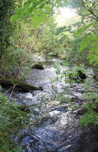
(Front cover, insert photo of stream, C. Bullock)
DAFM gratefully acknowledges the assistance of Woodlands of Ireland in the compilation of the
overview of relevant research underpinning the ‘Woodland for Water’ measure, as set out in Section 4.
© Forest Service, Department of Agriculture, Food & the Marine, Ireland
June 2018
Contents

Section 1 Woodland for Water: Introduction				           1
Section 2 Native Woodland Establishment Scheme			        5
Section 3 Water Setback						                           13
Section 4 Relevant Research & Initiatives				           17
Section 5 Conclusion: Realising Woodland for Water			   31
References & Further Reading					                       33
Woodland for Water
Section 1
Woodland for Water: Introduction
Overview
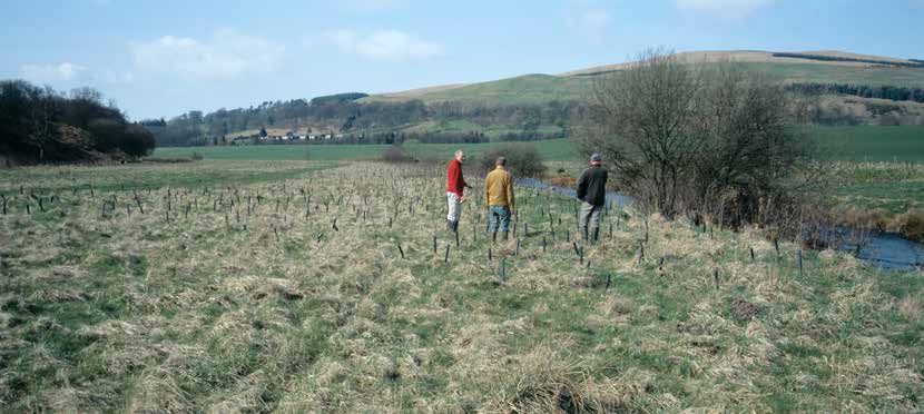
This document explores how new native woodland and an undisturbed water setback can
be used in combination to deliver meaningful ecosystem services that protect and enhance
water quality and aquatic ecosystems. This ‘Woodland for Water’ measure can be realised
using the existing Native Woodland Establishment Scheme (NWS Establishment), available
from the Department of Agriculture, Food & the Marine (DAFM).
This measure can be used alongside streams, rivers and lakes to form permanent semi-natural
landscape features that will protect and enhance water quality and aquatic habitats into the
future. Where basic site requirements are met, the DAFM perceives widespread potential for
this measure, from upper to lower catchments and in relation to various land uses.
The Woodland for Water measure operates alongside other water-related measures applied
by DAFM through its regulatory and promotional role, as part of its responsibilities under the
2nd cycle of the Water Framework Directive (WFD). For further details, see Forests & Water:
Achieving Objectives under Ireland’s River Basin Management Plan 2018-2021 (DAFM, 2018).
The Woodland for Water measure comprises areas of new native woodland planted by
farmers and other landowners availing of the grants and 15-year premiums available under
the Native Woodland Establishment Scheme. The water setback – which itself forms an integral
part of the NWS Establishment project – follows specifications set out under the Environmental
Requirements for Afforestation (DAFM, 2016) to form a strip of undisturbed ground vegetation
alongside the bank of the watercourse. Both elements can be strategically widened at key
locations onsite, where adjoining land uses, site hydrology and slope increase the vulnerability
of receiving waters.
Figure 1 (overleaf) provides an overview of the Woodland for Water measure.
1.
Department of Agriculture, Food & the Marine

                                                     Figure 1 Overview of the Woodland for Water measure.

          Adjoining land use, including                     Woodland for Water measure,
            agriculture, commercial                       combining new native woodland &
           forestry, built environment                      an undisturbed water setback

                                                                                                   B
                                                                                                   .
                                                     D
                                                     .

                                                                   A

                                                                                               C

       Key:
       A New native woodland created under NWS Establishment, 20 metres or greater in width &
       uncrossed by new drains. Can be strategically widened at key locations onsite, where
       adjoining landuse, site hydrology & slope increase the vulnerability of receiving waters.
       B Permanent undisturbed water setback, 10-25 metres in width (or greater, if required),
       uncrossed by new drains & largely unplanted. Can be strategically widened at key
       locations onsite, where site hydrology & slope increase the vulnerability of receiving waters.
       C Setback planting comprising single or small groups of trees of suitable native riparian
       species, strategically planted & maintained for bank stabilisation, dappled shading & as a
       food source for aquatic life.
       D Possible interventions within existing drains (e.g. silt traps, slow-flow dams) to break existing
       pathways from source to the receiving watercourse, & to create pocket wetlands &
       settlement areas.

2.
Woodland for Water

Water-related benefits
        A wide range of significant water-related ecosystem services can be realised by applying the
        Woodland for Water measure. These include:
          ¾¾ reduction in sediment mobilisation and runoff into watercourses
          ¾¾ interception of nutrient runoff into watercourses
          ¾¾ bank stabilisation
          ¾¾ food input into the aquatic ecosystem
          ¾¾ shading / cooling
          ¾¾ regulation of floodwater
          ¾¾ riparian restoration

        These are in addition to other ecosystem services such as the promotion of native woodland
        biodiversity, habitat linkage within the wider landscape, carbon sequestration, amenity and
        environmental interpretation, etc., which are not explored in this document.

Realising Woodland for Water
        The DAFM is keen to work with landowners and with relevant bodies involved in the protection of
        water, to realise the Woodland for Water measure. These include Woodlands of Ireland, Inland
        Fisheries Ireland, the National Parks & Wildlife Service (NPWS), the Environmental Protection
        Agency (EPA), Irish Water and Teagasc, and with the various structures set up to support the
        implementation of the River Basin Management Plan for Ireland 2018-2021, published in April
        2018 (Department of Housing, Planning & Local Government, 2018). In particular, the Local
        Authority Waters & Community Officers, the Regional Catchment Scientists and the Teagsac
        Agricultural Sustainability Advisors will be in a key position to identify important opportunities
        where the Woodland for Water measure might have a significant positive impact.
        The Woodland for Water measure can also be targeted strategically at particular sites, using
        geographical information system (GIS) technology. This approach is echoed by Perrin et al.
        (2008), who make the following recommendation in relation to the National Survey of Native
        Woodlands 2003-2008: “The GIS component of the project could assist in regional woodland
        creation schemes by providing spatial information on the existing occurrence of woodland
        and woodland types in the landscape. This could assist environmental managers who wish to
        link up existing sites or create new woodland in largely unwooded landscapes.”
        Further targeting may also be possible through the Woodland Fund, an initiative arising from
        the mid-term review of the Forestry Programme. Through a system of payments for ecosystem
        services, the mechanism could attract additional funds for farmers and other landowners
        to create new native woodland in key locations for (inter alia) water protection purposes.
        Although focused on carbon capture, the ongoing Microsoft / Natural Capital Partners /
        Green Belt project provides a working example of this approach. For further information, also
        see the European COST Action on forests and payments for water-related ecosystem services
        (www.forestry.gov.uk/fr/pesforw).

Document overview
        Section 2 and Section 3 of this document detail relevant specifications regarding both

                                                                                                       3.
Department of Agriculture, Food & the Marine

           components of the Woodland for Water measure, i.e. NWS Establishment and the water
           setback. Section 4 then presents an overview of relevant research and initiatives in Ireland, the
           UK and elsewhere, which demonstrate the water-related ecosystem services provided by this
           approach. This overview has been compiled with input from Woodlands of Ireland within the
           context of the partnership between that organisation and DAFM in the ongoing development
           and implementation of the Native Woodland Scheme package (see woodlandsofireland.
           com).
           The overall Native Woodland Scheme package comprises NWS Establishment and the Native
           Woodland Conservation Scheme (NWS Conservation), focused on restoring existing native
           woodlands and converting non-native forest into native woodland on key sites. The Woodland
           for Water measure relates to NWS Establishment only. NWS Conservation also has significant
           application in the protection of water and aquatic habitats and species, as set out in Forests
           & Water (DAFM, 2018).

4.
Woodland for Water

                                                                                 Section 2
                      Native Woodland Establishment
                                           Scheme

Purpose of the Scheme
           NWS Establishment(*) provides grant and premiums to farmers and other landowners to
           support the creation of new native woodland within the Irish countryside. The purpose is to
           promote the expansion of our native woodland resource and its associated biodiversity, and
           to realise other ecosystem services that new native woodlands can deliver. These include the
           protection and enhancement of water quality and aquatic habitats, and promoting linkage
           between semi-natural habitats at a wider landscape level, using natural features such as
           streams, rivers and lakes.
           (* As represented by Grant & Premium Categories (GPCs) 9 and 10 of the general Afforestation
           Scheme. For full details, see Native Woodland Establishment GPC9 & GPC10: Silvicultural
           Standards (DAFM, 2015) and Forest Service Circulars 3/2018 and 5/2018.)
           Many woodlands created under NWS Establishment are suitable for the future harvesting of
           quality timber and other wood products on a sustainable basis. This potential is encouraged, so
           as to provide an economic reason for the ongoing management of these woodlands, similar
           to what is being achieved in Wales under the Coed Cymru project (see www.coedcymru.
           org.uk). At a site level, however, this objective is only acceptable where compatible with
           the scheme’s primary ecological purpose and with site factors such as soil type, slope and
           ecological sensitivities. Furthermore, wood production can only be pursued using ‘close-to-
           nature’ continuous cover forestry (CCF) systems such as selection, shelterwood and coppicing.

 A NWS Establishment site,
  Dunmanway, Co. Cork,
    subsequently planted.

                                                                                                       5.
Department of Agriculture, Food & the Marine

             CCF is a silvicultural approach based on the selective harvesting of single or small groups
             of trees and restocking with natural regeneration, to promote uneven-aged stands and a
             continuous tree cover more typical of natural forests. It mimics natural woodland processes
             and excludes large-scale clearfelling – see ProSilva Ireland (www.prosilvaireland.wordpress.
             com/) for further information.
             Woodlands created under NWS Establishment provide opportunities for traditional types of
             woodland management (e.g. coppice) that form part of our countryside heritage. Other
             important ecosystem services include carbon sequestration, landscape enhancement,
             woodland recreation and the promotion of health and well-being amongst users, cultural and
             historical heritage, and the provision of ‘outdoor classrooms’ for environmental education
             and awareness-raising. (These amenity and educational roles can be developed further, by
             combining the NWS Establishment and the NeighbourWood Scheme (DAFM, 2017).)
             NWS Establishment attracts the highest grant and premium available under the Afforestation
             Scheme. NWS Establishment provides a payment of up to €6,220 / ha for approved
             establishment works, and a 15-year annual premium of €665 / ha / year, increasing to €680 for
             sites 10 hectares of over.

Ecological focus
             NWS Establishment has an overriding ecological focus. For example, site disturbance and
             inputs must be minimised, species selection must reflect the most appropriate native woodland
             type for the site (based on site, drainage, elevation, etc.), and all forest reproductive material
             (seed, transplants, cuttings) used must come from suitable sources within Ireland (within
             limited practical exceptions). Since its inception in the late 1990s, DAFM has developed and
             implemented the scheme in close partnership with Woodlands of Ireland, NPWS, the Heritage
             Council and a wide range of other stakeholders with a direct and indirect interest in native
             woodland, including Inland Fisheries Ireland and the EPA, the latter in the context of agreed
             changes to the Acid Sensitivity Protocol for Afforestation (see later).
             With this focus, NWS Establishment creates opportunities for farmers and other landowners

   Joint DAFM / Woodlands
        of Ireland training of
  foresters and ecologists is
a key feature of the Native
        Woodland Scheme.

6.
Woodland for Water
within environmentally-sensitive areas to create woodlands which have the potential for future
wood production and income generation, and which also contribute towards protecting the
particular sensitivity involved, be it water, designed habitats or species, landscape, etc. This
is achieved through DAFM’s approval system (which includes public consultation, referrals to
relevant bodies, screening for appropriate assessment and environmental impact assessment,
and procedures regarding fisheries, acid sensitivity areas and Freshwater Pearl Mussel).
NWS Establishment operates within the context of technical support and outreach by Woodlands
of Ireland. This includes an extensive training programme run in partnership with DAFM,
and the publication of the Native Woodland Information Notes, authored by experienced
practitioners and covering relevant topics, from riparian woodland to rhododendron control
to deer management (see www.woodlandsofireland.com/publications/native-woodland-
information-notes).
Foresters operating the NWS Establishment must be on the Register of Foresters and Forest
Companies, and must also complete the required Woodlands of Ireland / DAFM training
course, which includes a strong element regarding the use of native woodland to protect
water and aquatic habitats.
Specifications
Various scheme specifications apply that relate directly to the use of NWS Establishment to
deliver the Woodland for Water measure. Key specifications are outlined below. For full details
on these and other specifications, see Native Woodland Establishment GPC9 & GPC10:
Silvicultural Standards (DAFM, 2015) and Circular 5/2018. Also see Management Guidelines for
Ireland’s Native Woodlands (Cross & Collins, 2017) and the Woodlands of Ireland Information
Notes, for good practice in this area.
Site requirements
Each site proposed for NWS Establishment must be capable of supporting the vigorous growth
and sustainable long-term development of the most appropriate native woodland type
identified for that site (or parts thereof). This must be possible without the need for fertiliser
input (with limited exceptions – see below).
Generally, sites that flood are excluded from the Afforestation Scheme. However, NWS
Establishment (GPCs 9 and 10) plots located on natural floodplains may be acceptable,
where:
¾¾ the frequency of flooding and the inundation periods involved do not impede
woodland establishment and development; and
¾¾ such plots form part of a larger application or a wider multi-site project developed
with input from other statutory bodies and aimed at the strategic development of
native woodland along a sensitive watercourse, for water protection.
This is in recognition of the rarity of riparian and alluvial woodlands (for example, residual
alluvial forests are a priority Annex I habitat under the Habitats Directive) and their role in
protecting water and the aquatic ecosystem.
7.Department of Agriculture, Food & the Marine
Area, size and width
Sites and individual plots proposed for NWS Establishment must be 0.1 ha or greater in area
and 20 metres or greater in width, as measured tree-to-tree (i.e. excluding required setbacks
for water, archaeology, public roads, etc.). In certain situations (e.g. to cater for landscape
and existing features), 10% of the proposed area can be less than 20 metres in width. These
lower limits allow NWS Establishment to be used to create relatively narrow woodland strips
along watercourses, without encroaching too greatly on agricultural land.
Conversely, individual native woodland plots can be widened at key locations onsite, where
adjoining land uses, site hydrology and slope increase the vulnerability of receiving waters.
Native woodland type
Each project under NWS Establishment must promote the native woodland type that would
occur naturally on the site (or parts of the site). This decision is made by the NWS Forester at the
planning stage, using the NWS Framework (see Circular 5/2018). This framework uses location,
soil and main habitats and vegetation to identify the most ecologically appropriate native
woodland type. Five scenarios currently apply:
¾¾ Scenario 1: Podzols / Oak-Birch-Holly Woodland
¾¾ Scenario 2: Brown Podzolics / Oak-Birch-Holly with Hazel Woodland
¾¾ Scenario 3: Brown Earths / Oak-Ash-Hazel Woodland
¾¾ Scenario 4: Gleys / Alder-Oak-Ash Woodland
¾¾ Scenario 5: Highly Modified Peat & Peaty Podzols / Pioneer Birch Woodland
For illustration, Figure 2 is an extract from the framework, describing Scenario 4 sites.
Acceptable species and mixtures
All tree species proposed under NWS Establishment must be: (i) native to the island of Ireland;
and (ii) appropriate to the native woodland type identified for promotion onsite (or parts
thereof). To achieve this, each of five scenarios is underpinned with a prescribed species mix
designed as a ‘starter kit’ for the woodland type associated with that scenario. For example,
Scenario 4: Gleys (Alder-Oak-Ash Woodland) plots must be planted with the following mixture:
Pure groups (30-40 trees) of alder (50%), grey willow (10%) & downy birch (10%).
Groups interspersed alternately. Pedunculate oak (10%) on drier areas. Hawthorn (5%)
scattered throughout. Minor species (15%) to comprise at least two of the following,
positioned between the above pure groups: holly, hazel, guelder rose. Note: The
above interspersed group planting of major species is carried out to improve stability &
robustness, & to prevent the development of an alder monoculture.
In order to ensure traceability and to protect native genetic biodiversity, rules apply regarding
the source of all forest reproductive material (i.e. seed, plants, cuttings) used.
Site inputs
Under NWS Establishment, the identified woodland type should be realised with the minimal
amount of site inputs (e.g. fertilisers) and disturbance (e.g. cultivation). The focus is on retaining
8.Woodland for Water
Figure 2 Extract from the NWS Framework (from Circular 5/2018), showing the
application of Scenario 4: Gleys / Alder-Oak-Ash Woodland.
If…
Location: Drumlins, river valleys, lake
shores & water-logged hollows.
Soil: Mineral & peaty gleys (very wet
soils, generally fertile). Average pH
c.5.9.
Main habitats & vegetation:
Wet, rushy grassland with yellow flag.
Semi-natural woodland dominated by
/ hedgerows containing: alder, ash,
grey willow, hazel, hawthorn, spindle &
A typical ’rushy’ field with heavy, wet gley soils. These are
blackthorn. Field layer indicators
sometimes semi-improved for pasture & are common in
include bramble, meadowsweet,
drumlin belts, low-lying, & poorly drained locations.
creeping buttercup, remote sedge.
Scenario 4: Gleys / Alder-
Oak-Ash Woodland
Most appropriate Major Native
Woodland Type: AF Alder–
meadowsweet.
Predominant trees & shrubs: Alder, grey
willow & ash.
Predominant ground flora:
Meadowsweet, remote sedge,
A very poorly-drained ‘dauby’ gley soil profile with a
creeping buttercup, yellow flag &
clay-rich topsoil approx. 30 cm deep, which overlies a
water mint.
saturated & mottled, blue-grey & red-brown subsoil. The
subsoil overlies a very compact parent material derived
from glacial till.
Planting mixture: Pure groups (30-40
trees) of alder (50%), grey willow (10%)
& downy birch (10%). Groups
interspersed alternately. Pedunculate
oak (10%) on drier areas. Hawthorn
(5%) scattered throughout.
Minor species (15%) to comprise at
least two of the following, positioned
between the above pure groups: holly,
hazel, guelder rose.
Note: The above interspersed group
planting of major species is carried out
to improve stability & robustness, & to
prevent the development of an alder
monoculture.
A typical AF Alder–meadowsweet alluvial woodland on
If NWS Establishment: GPC10 applies gley soil. Hazelwood, Co. Sligo.
(with required min. stocking 2,500 / ha)
1
9.Department of Agriculture, Food & the Marine
natural site conditions and facilitating the emergence of the native woodland type that
would occur naturally on the site.
Ground preparation is largely limited to inverted mounding, scrap mounding, shallow ripping,
pit planting and auger planting. While standard afforestation drainage practices are not
accepted under NWS Establishment, localised drainage may be allowed in certain situations
to aid establishment – full details must be provided with the submitted application. The slow-
water damming of existing land drains may be acceptable, to reinstate natural hydrological
conditions and to improve how well the water setback protects the adjoining watercourse.
While standard fertiliser application is not accepted under NWS Establishment, a once-off
hand application at establishment (using slow release formulations) is allowed on marginal
sites, in order to boost initial growth. However, this need is unlikely to arise on most sites where
the Woodland for Water measure might be applied.
The control of competing vegetation such as grasses, herbaceous plants, bramble and
bracken is vital for the rapid establishment and growth of young trees. Inadequate control will
result in poor growth and increased mortality, leading to further inputs later on (e.g. beating
up). Non-herbicide control (trampling, mulches, mats, etc.) is only realistic on a small scale,
such as highly sensitive parts of individual sites. Otherwise, targeted herbicide application
represents the most practical and effective method of vegetation management.
Pre- and post-planting herbicide application must be kept to the minimum required to ensure
success, and should be used together with other methods, e.g. planting with larger transplants.
Post-planting application should be carried out using a knapsack sprayer, with the aim of
maintaining a 1-metre wide control area around the base of each tree until it has become
fully established and free of competing vegetation.
Herbicide application is not permitted within the water setback or within 20 metres of an
aquatic zone, whichever is greatest. Limited exemptions may apply, where agreed by the
relevant statutory body (e.g. stem injection to eliminate stream-side rhododendron, in order
to tackle infestation and to reinstate natural vegetation.)
Scrap mounding on a
riparian site, illustrating the
low level of site disturbance
at planting stage under
NWS Establishment.
10.Woodland for Water
Emerging pioneer birch
woodland on a sheltered
upland site, Co. Wicklow.
Acid Sensitivity Protocol for Afforestation
NWS Establishment applications within acid sensitive areas are exempt from the water sampling
requirement under the Acid Sensitivity Protocol for Afforestation, as set out in Appendix 11 of
the Forestry Standards Manual (DAFM, 2015). This change to the protocol was proposed by
DAFM with the support of Woodlands of Ireland, Inland Fisheries Ireland and other scheme
partners, and subsequently agreed by the EPA and implemented in early 2013 (see Forest
Service Circular 4/2013). The amendment only applies to applications that comprise solely of
GPC9 and / or GPC10 on enclosed / improved land, and no fertiliser application is permitted.
This amendment is particularly relevant to the Priority 8 Freshwater Pearl Mussel Catchments,
the majority of which are identified as acid sensitive areas under this protocol.
Incorporating NWS Est. plots into standard afforestation projects
NWS Establishment GPC9 and GPC10 can be used on their own to create a stand-alone
native woodland, or as part of a wider afforestation project alongside other Grant & Premium
Categories, e.g. GPC3 (Sitka spruce plus 15% broadleaves). This allows for the integration of
native woodland into standard forest design, specifically to realise associated ecosystem
services regarding (for example) water, landscape and wider habitat linkage. This integration
is promoted by the Environmental Requirements for Afforestation, in that the wider water
setback required on peat sites or within the catchment area of a high ecological status
objective water body can be reduced through the use of an adjoining GPC9 or GPC10 plot.
11.Department of Agriculture, Food & the Marine 12.
Woodland for Water
Section 3
Water Setback
Overview
(Please note, the following relates to various mandatory measures required under the
Environmental Requirements for Afforestation (DAFM, 2016), as they relate specifically to NWS
Establishment plots. Additional measures apply in relation to other types of afforestation.)
As described in the Environmental Requirements for Afforestation (DAFM, 2016), the water
setback is designed to create, at the very outset of an afforestation project, an intact and
permanent buffer of natural vegetation alongside the aquatic zone(*), in order to protect
water quality and aquatic ecosystems from possible overland flow of sediment and nutrient
runoff and other potential impacts. In effect, the water setback breaks the ‘pathway’
between the source of possible pollution and the receiving watercourse. Within the context
of NWS Establishment, the water setback complements the protective role of the emerging
native woodland, itself established with minimal site disturbance and managed according to
close-to-nature silviculture, principally for biodiversity.
(* An aquatic zone is defined as “Any natural river, stream of lake (but not an artificial drain)
illustrated on an Ordnance Survey 6 inch map.” Other water features are also protected
under the Environmental Requirements for Afforestation, i.e. relevant watercourses, hotspots
and drinking water abstraction points. See Forest Service Circular 12/2017 for details.)
The water setback – which forms part of the overall woodland site – must be left largely
undisturbed during afforestation and throughout subsequent woodland development,
to allow it to develop into a well-vegetated area supporting a mosaic of natural ground
vegetation and (potentially) pockets of native scrub.
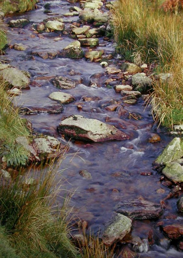
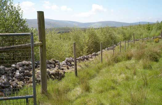
A typical water setback
installed as part of a
broadleaf afforestation
project.
13.Department of Agriculture, Food & the Marine
A water setback cannot be used for any purpose which might undermine its protective
function or which could damage the aquatic zone. Planting is limited to environmental
setback planting (see below), and operations such as cultivation and drainage are excluded.
Machine traffic must also be excluded, apart from limited passage with prior DAFM agreement
(e.g. for once-off fencing of a property boundary).
As with other setbacks for retained habitats, archaeology, public roads, etc., water setbacks
also have a wider biodiversity role within the overall woodland site, by creating structural
diversity and important woodland edge and open habitats for native flora and fauna.
The water setback can be included in the 15% allowance for Areas for Biodiversity Enhancement,
without any reduction in grant and premium payments under NWS Establishment – see Circular
16/2017 for details.
The Environmental Requirements for Afforestation specify the minimum width of the water
setback, taking into account of the slope leading to the aquatic zone. Based on the use of
NWS Establishment, the minimum setbacks required are set out in Table 1. (Note, for GPCs
other than GPC9 and GPC10, wider setbacks are required for sites on peat soil or within the
catchment area of high ecological status (HES) objective water bodies.)
The value of the water setbacks, in terms of water protection, biodiversity, landscape, etc.,
can be further enhanced by the following:
¾¾ The water setback can be strategically widened at key locations onsite, where site
hydrology and slope increase the vulnerability of receiving waters.
¾¾ Based on the immediate landform / topography, the width of the setback can be
varied to avoid artificial lines and to create a naturally undulating forest edge.
Appropriate tree planting within the water setback will deliver direct in-stream benefits such
as bank stabilisation, cooling / shading, and food drop into the aquatic ecosystem, and will
create further habitat diversity within the setback.
The following applies:
¾¾ Water setback planting involves the planting of single or small irregular groups (5-10
individual stems) of trees of appropriate native riparian species (birch, willow, and
occasional alder and pedunculate oak) at strategic points within the water setback.
¾¾ This planting should not exceed 20% of the area of the water setback.
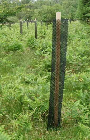
¾¾ Trees should be pit-planted and protected from grazing, as necessary. This may involve
individual tree shelters or small fenced-off exclosures. Deer-prone areas will require
Table 1 Minimum required water setbacks for aquatic zones (as measured from the
bank of the watercourse), as applied to NWS Establishment plots.
Slope leading to the aquatic zone (apply as
Minimum setback width
appropriate, where slope varies over the site)
Moderate (even to 1-in-7 / 0-15%) 10 metres
Steep (1-in-7 to 1-in-3 / 15-30%) 15 metres
Very steep (1-in-3 / >30%) 20 metres
14.Woodland for Water
particular attention in this regard.
¾¾ Where applied as groups, adopt a robust planting design using trees with compatible
growth rates.
¾¾ Typically, trees are to be pit-planted. No cultivation is permitted within the water
setback, but soil can be imported from outside the setback, and deposited to create
individual planting positions, if required.
¾¾ Fertiliser application and vegetation management can be applied to establish
setback planting, based on the following restrictions:
¾¾ Fertiliser application is limited to the manual application of an appropriate slow-
release formulation into the planting pit.
¾¾ Regarding vegetation management, herbicide use is prohibited. Use non-
herbicide methods instead, such as trampling, mulches and mats.
As set out in the Environmental Requirements for Afforestation, the Registered Forester must
ensure that all operators are aware of the importance of the water setback, its location and
extent, and what is and is not permitted within it. The marking out of the setback prior to
the commencement of site operations is encouraged, to avoid incursions. Furthermore, “An
environmental setback must not be used for any forest operation or for any other purpose
which could compromise its protective function or which could damage the environmental
feature or sensitivity being protected.” Under the Forestry Scheme Penalty Schedules (DAFM,
2015), failure to adhere to the required
water setback can incur significant
penalties.
Ongoing maintenance
The required treatment of water setbacks
up to the end of the 15 year NWS
Establishment premium is as follows:
¾¾ The intended protective
function of the setbacks must be
maintained throughout this stage
of the woodland’s development.
This entails leaving these areas
undisturbed, excluding machine
traffic, and allowing natural
ground vegetation to develop.
Management may be required
in some cases, e.g. to control
excessive woody growth.
¾¾ Any planting carried out within the
water setback must be monitored
Suitable native trees planted singly or in groups within the
water setback must be protected against grazing. Tree
guards can be used to protect against grazing animals,
including deer.
15.Department of Agriculture, Food & the Marine
and (as necessary) maintained (e.g. vegetation management, replacement of
mortalities, adjustment and eventual removal of tree guards) until the trees are fully
established and free of grazing pressure.
¾¾ The type of natural vegetation likely to emerge in the water setback will vary
according to soil, drainage, elevation, aspect, grazing pressure, etc. On most sites, a
mosaic of natural ground vegetation and pockets of naturally regenerating woody
growth will typically emerge throughout this period.
¾¾ However, ongoing monitoring and appropriate control is needed to prevent the
colonisation of water setbacks by invasive exotics. In particular, Japanese knotweed,
Himalayan balsam and rhododendron are of significant concern regarding water
quality. Where best practice involves herbicide use, consult with Inland Fisheries
Ireland and other relevant bodies in advance. Controlling such species is difficult
and expensive, and often requires a wider catchment approach for progress to be
sustained.
¾¾ Existing access by anglers should be maintained, with appropriate stiles added to
facilitate the crossing of fencelines.
¾¾ Periodic mowing and strimming of vegetation and subsequent removal of cuttings
from the site, may be useful in reducing the build-up of nutrients in the water setback
arising from its buffering role. Controlled grazing, with prior DAFM agreement, may also
fulfil this role.
16.Woodland for Water
Section 4
Relevant Research & Initiatives
Introduction
A range of significant water-related ecosystem services can be realised by applying the
Woodland for Water measure, combining new native woodland and an undisturbed water
setback, particularly under the following headings:
¾¾ reduction in sediment mobilisation and runoff into watercourses
¾¾ interception of nutrient runoff into watercourses
¾¾ bank stabilisation
¾¾ food input into the aquatic ecosystem
¾¾ shading / cooling
¾¾ regulation of floodwater
¾¾ riparian restoration
This section presents an overview of relevant research in Ireland, the UK and elsewhere,
demonstrating these ecosystem services. Various research titles are listed under each of the
above headings, together with a concise overview of the main findings of that research.
Please note, this is intended as a brief overview of relevant research. Full references are
provided for follow-up reading.
This overview has been compiled with input from Woodlands of Ireland within the context
of the partnership between that organisation and DAFM in the ongoing development and
implementation of the Native Woodland Scheme package.
Reduction in sediment mobilisation and runoff into watercourses
The role of riparian vegetation in protecting and improving chemical water quality in streams
Dosskey, M.G., Vidon, P., Gurwick, N.P., Allan, C.J., Duval, T.P. & Lowrance, R. 2010. Journal of
the American Water Resources Association 46(2):261-277.
A review of the research literature concludes: that riparian vegetation influences stream
water chemistry through diverse processes including direct chemical uptake and indirect
influences such as the supply of organic matter to soils and channels, modification of water
movement, and stabilization of soil. Our analysis suggests that the level and time frame of a
response to restoration depend strongly on the degree and time frame of vegetation loss.
Legacy effects of past vegetation can continue to influence water quality for many years
or decades and control the potential level and timing of water quality improvement after
vegetation is restored. Through the collective action of many processes, vegetation exerts
substantial influence over the well-documented effect that riparian zones have on stream
water quality. However, the degree to which stream water quality can be managed through
the management of riparian vegetation remains to be clarified.
17.Department of Agriculture, Food & the Marine
Land use management effects on flood flows and sediments – guidance on prediction
McIntyre, N. & Thorne, C. (Eds.). 2013. CIRIA Report C719. CIRIA, London.
At the plot scale, experiments at the Pontbren catchment showed that tree planting can in
some circumstances reduce runoff by orders of magnitude.
Interception of nutrient runoff into watercourses
The role of herbaceous woodland perennial diversity for improving nutrient uptake capacity
of riparian areas
McMullen, C.M. & Thompson, J. 2006. Leopold Center Completed Grant Reports. Paper 258.
Volume 15 (2006) Leopold Center Progress Report.
The principal conclusion is that perennial herbaceous species, because of the biomass they
accumulate during the growing season, have the potential to improve the capacity of
riparian buffers to seasonally store nutrients and prevent them from entering surface waters.
Because the degraded forests in the study were lacking a group of species that have peak
growth in early spring, their capacity to retain nutrients was seriously impaired in the spring, a
time of high potential nutrient loss.
Design and placement of a multi-species riparian buffer strip system
Schultz, R.C., Collettil, J.P., Isenhart, T.M., Simpkins, W.W., Mize, C.W. & Thompson, M.L. 1995.
Agroforestry Systems 29(3):201-226.
This suggests better soil stabilization, absorption of infiltrated water, and soil-root-microbe-
NPS [non-point source] pollutant interaction characteristics within the multi-species riparian
buffer strip system (MSRBS) than the cropped fields. Nitrate-nitrogen concentrations in the
MSRBS never exceed 2 mg l-1 whereas the levels in the adjacent agricultural fields exceed
12 mg l-1. The water quality data collected suggest that the MSRBS is effective in reducing
NPS pollutants in the vadose [region of aeration above the water table] and saturated zone
below the system. Overall the MSRBS system seems to be functioning as expected. This MSRBS
system offers farmers a way to intercept eroding soil, trap and transform NPS pollution, stabilize
streambanks, provide wildlife habitat, produce biomass for on-farm use, produce high-quality
hardwood in the future, and enhance the aesthetics of the agroecosystem.
Theme 2: Nitrate leaching
Hansen, K., Gundersen, P., Rosenqvist, L., Vesterdal, L. & van der Salm, C. 2004. In: Guidelines
for planning afforestation on previously managed arable land. Edited by Hansen, K. &
Vesterdal, L. Forest & Landscape, Hørsholm, 105 pp.
The nitrogen cycle in agricultural soils is an open cycle. Fertilisers (NPK) are supplied regularly
in large amounts and approximately the same amount of nitrogen leaves the ecosystem by
leaching or in harvested products. Leaching to seepage water and stream water is large
since the soils often are ‘saturated’ with nitrogen and the vegetation cover is sparse during
the wet season. On the contrary, old forests are characterized by a tight nitrogen cycle where
losses of nitrogen are low. Water from old forests is, therefore, generally of good quality with a
low concentration of dissolved nitrogen compared to other land uses. Afforestation of former
farmland is seen as a strategy to improve water quality, especially with regard to nitrate
leaching. In this context, the challenge is to keep nitrate leaching from the new forests at a
18.Woodland for Water
low level, despite the large nitrogen pool, which is a legacy of the former land use.
From existing knowledge about the nitrogen cycle in forests and afforested former arable
land we have the following recommendations for afforestation where low nitrate leaching is
wanted: Afforestation should preferably be performed over larger united areas building larger
fragments of forest in connection to already existing forest in order to decrease deposition
caused by edge effects. The new forests should preferably consist of deciduous tree species
(e.g. ash and oak) since they have a lower deposition of nitrogen and a higher water recharge
which mostly leads to lower nitrate concentrations in leaching water.
Riparian forests as nutrient filters in agricultural watersheds
Lowrance, R., Todd, R., Fail, J., Hendrickson, O., Leonard, R. & Asmussen, L. 1984. BioScience
34:374-377.
Riparian (streamside) vegetation may help control transport of sediments and chemicals to
stream channels. Studies of a coastal plain agricultural watershed showed that riparian forest
ecosystems are excellent nutrient sinks and buffer the nutrient discharge from surrounding
agroecosystems. Nutrient uptake and removal by soil and vegetation in the riparian forest
ecosystem prevented outputs from agricultural uplands from reaching the stream channel.
The riparian ecosystem can apparently serve as both a short- and long-term nutrient filter and
sink if trees are harvested periodically to ensure a net uptake of nutrients.
Case study 16: Pontbren catchment land use change study – North Powys
Nisbet, T., Page, T. & Woodland Trust Wales. 2016. Commissioned by the Environment
Agency’s Evidence Directorate, as part of the joint Flood and Coastal Erosion Risk
Management Research and Development Programme, UK.
The study found that tree and hedgerow planting to reduce run-off can help to mitigate
diffuse pollutants such as sediment, phosphorus and pesticides, and can help to change
sediment yields. Riparian planting was also shown to stabilise riverbanks and to offer refuge
for wildlife.
Bank stabilisation
Quantifying the mechanical and hydrologic effects of riparian vegetation on streambank
stability
Simon, A. & Collison, A.J.C. 2002. Earth Surface Processes & Landforms 27:527-546.
Tree roots were found to increase soil strength by 2-8 kPa depending on species, while grass
roots contributed 6-18 kPa. Slope stability analysis based on data collected during bank
failures in spring 2000 (following a very dry antecedent period) shows that the mechanical
effects of the tree cover increased Fs [factor of safety] by 32 per cent, while the hydrologic
effects increased Fs by 71 per cent.
The effects of riparian vegetation on bank stability
Easson, G. & Yarbrough, L.D. 2002. Environmental & Engineering Geoscience. 8(4):247-260.
[In relation to sweet gum (Liquidambar styraciflua),] Increased tensile strength due to root
19.Department of Agriculture, Food & the Marine
reinforcement was found to be between 0.0 and 245 kPa, depending on depth. For a
given depth of 40 cm, the increased tension due to root reinforcement averaged 148 kPa,
depending on lateral distance from tree. The modelling results showed a contrast between
root-reinforced and unreinforced soil. When no root reinforcement existed, the slope failed
marginally. When simulated root reinforcement of 20 kPa was applied, the slope was shown
to be completely stable.
The effects of vegetation on stream bank erosion
Wynn, T.M., Mostaghimi, S., Elizabeth, H.E. & Alpin, F. 2004. In: 2004 ASAE Annual Meeting.
Published by the American Society of Agricultural and Biological Engineers, St. Joseph,
Michigan.
Riparian vegetation had multiple significant effects on soil erodibility. In addition to reinforcing
the stream banks, the streamside vegetation affected soil moisture and altered the local
microclimate, which in turn affected freeze-thaw cycling.
Where along a river’s length will vegetation most effectively stabilise stream banks?
Abernethy, B. & Rutherfurd, I.D. 1998. Geomorphology 23(1):55-75.
This paper illustrates a structured decision-making approach for assessing the role of vegetation
in stream bank erosion at different points throughout a catchment. Bank erosion in upper
reaches is dominated by subaerial preparation, in mid-basin reaches by fluvial entrainment,
and in the lower reaches by mass failure. We find that in upper reaches, windthrown trees are
responsible for most bank sediment transfer to the flow. Where direct fluvial entrainment of
bank material is the dominant erosion process, flow resistance due to vegetation becomes
crucial. In reaches where bank slumping is the dominant erosion process, increased bank
shear strength due to root reinforcement is the major role of vegetation in stabilising banks.
Considering the above variables we are able to define a critical zone in which revegetation
will be most effective in reducing bank erosion. On the Latrobe River, this zone occurs in that
A potential site for the
Woodland for Water
measure, to protect
against bank erosion.
20.Woodland for Water
portion of the river where it first leaves the mountain front and meanders across a broad
floodplain.
Effects of wet meadow riparian vegetation on streambank erosion. 2. Measurements of
vegetated bank strength and consequences for failure mechanics
Micheli, E.R. & Kirchner, J.W. 2002. Earth Surface Processes and Landforms 27(7):687-697.
Wet meadow floodplain vegetation creates a composite cut bank configuration (a cohesive
layer overlying cohesionless materials) that erodes via cantilever failure. Field measurements
and a geotechnical model of cantilever stability show that by increasing bank strength, wet
meadow vegetation increases the thickness, width, and cohesiveness of a bank cantilever,
which, in turn, increases the amount of time required to undermine, detach, and remove
bank failure blocks. At Monache Meadow, it takes approximately four years to produce and
remove a 1 m wide wet meadow bank block. Wet meadow vegetation limits bank migration
rates by increasing bank strength, altering bank failure modes, and reducing bank failure
frequency.
Stabilising characteristics of New Zealand indigenous riparian colonising plants
Marden, M., Rowan, D. & Phillips, C. 2007. In: Eco- and Ground Bio-Engineering: The Use of
Vegetation to Improve Slope Stability. Volume 103 of the series ‘Developments in Plant and
Soil Sciences’, pp 143-153. Springer.
The effectiveness of riparian restoration programmes using indigenous species, though
potentially high for low-order stream, will be limited by their relatively shallow-rooted habit for
bank stabilisation on larger rivers without the prior installation of structural protection works.
The effect of riparian tree roots on the mass-stability of riverbanks
Abernethy, B. & Rutherfurd, I.D. 2000. Earth Surface Processes & Landforms 25:921-937.
Modelling bank stability against mass failure with and without the reinforcing effects of River
Red Gum (Eucalyptus camaldulensis) or Swamp Paperbark (Melaleuca ericifolia) indicates
that root reinforcement of the bank substrate provides high levels of bank protection. The
model indicates that the addition of root reinforcement to an otherwise unstable bank section
can raise the factor of safety (Fs) from Fs = 1.0 up to about Fs = 1.6. The addition of roots to
riverbanks improves stability even under worst-case hydrological conditions and is apparent
over a range of bank geometries, varying with tree position. Trees growing close to potential
failure plane locations, either low on the bank or on the floodplain, realise the greatest bank
reinforcement.
Food input into the aquatic system
Role of streamside vegetation as a food source for Galaxias olidus Gnnther (Pisces:
Galaxiidae)
Cadwallader, P.L., Eden, A.K. & Hook, R.A. 1980. Australian Journal of Marine & Freshwater
Research 31(2):257-262.
Terrestrial organisms were taken more frequently by larger fish than by smaller fish and
formed a substantial part of the diet of those fish taken from sites surrounded by overhanging
21.Department of Agriculture, Food & the Marine
vegetation. Terrestrial organisms were much less common in the diet of fish taken from sites
with little overhanging vegetation.
Linking ecosystems, food webs, and fish production: Subsidies in salmonid watershed
Wipfli, M.S. & Baxter, C.V. 2010. Fisheries 35:373-387.
Traditional freshwater food web illustrations have typically conveyed the notion that most
fish food is produced within the local aquatic habitat itself, but the concepts and model
[presented] in this article show that most fish food comes from external or very distant sources
– including subsidies from marine systems borne from adult returns of anadromous fishes,
from fishless headwater tributaries that transport prey to downstream fish, and from adjacent
streamside vegetation and associated habitats.
Resurrecting the in-stream side of riparian forests
Sweeney, B.W. & Blaine, J.G. 2009. Journal of Contemporary Water Research & Education
136(1):17-27.
Forested riparian habitats exhibited greater percent maximum frequency of woody
vegetation and reduced water temperatures than unplanted riparian habitats and grass
filter strips. Forested riparian habitats also exhibited greater canopy cover, woody vegetation
taxa richness, and coarse particulate organic matter input than grass filter strips and greater
riparian widths and woody vegetation
abundance than unplanted riparian
habitats.
Effects of bioengineered streambank
stabilization on bank habitat and
macroinvertebrates in urban streams
Sudduth, E.B. & Meyer, J.L. 2006.
Environmental Management 38(2):218-
226.
Percent organic bank habitat at each
site proved to be strongly positively
correlated with many factors, including
taxon richness, total biomass, and
shredder biomass. These results suggest
that bioengineered bank stabilization (i.e.
planting trees) can have positive effects
on bank habitat and macro-invertebrate
communities in urban streams, but it
cannot completely mitigate the impacts
of urbanization.
As bank-side vegetation develops,
native trees, shrubs and other plants
contribute directly to the aquatic
ecosystem. (Photo C. Bullock)
22.Woodland for Water
Shading / Cooling
The influence of riparian shade on lowland stream water temperatures in Southern England
and their viability for Brown Trout
Broadmeadow, S., Jones. J.G., Langford, T.E.L., Shaw, P.J. & Nisbet, T. 2010. River Research
and Applications 27(2):226-237.
Riparian shade was found to have a marked influence on stream water temperature,
particularly in terms of moderating diel temperature variation and limiting the number of days
per year that maximum temperatures exceeded published thermal thresholds for brown trout.
Expansion of riparian woodland offers potential to prevent water temperature exceeding
incipient lethal limits for brown trout and other fish species. A relatively low level of shade (20-
40%) was found to be effective in keeping summer temperatures below the incipient lethal
limit for brown trout, but ca. 80% shade generally prevented water temperatures exceeding
the range reported for optimum growth of brown trout.
The vegetation communities of unmanaged aquatic buffer zones within conifer plantations in
Ireland
Mc Conigley, C., Lally, H., O’Callaghan, M., O’Dea, P., Little, D. & Kelly-Quinn, K. 2015. Forest
Ecology and Management 353:59-66.
It is noted that tree species are not a feature of the riparian zone on peat soils and thus
tree planting is not recommended as a management option unless used to control water
temperatures. There is scope for tree planting on mineral soils, as control sites contained
woodland habitats which were absent from the ABZs of clearfell and replanted sites.
Regulation of floodwater
Impacts of upland land management on flood risk: Multi-scale modelling methodology and
results from the Pontbren experiment
Wheater, H., Reynolds, B., McIntyre, N., Marshall, M., Jackson, B., Frogbrook, Z., Solloway, I.,
Francis, O. & Chell, J. 2008. Flood Risk Management Research Consortium (FRMRC) Research
Report UR16. www.floodrisk.org.uk
Comparisons of soil hydraulic properties show significant increases in hydraulic conductivity
and saturated moisture content of soil under trees compared to adjacent improved pasture.
Catchment-scale simulations show the effects of improved and unimproved grassland, and
the potential effects of land management interventions, including farm ponds, and tree
shelter belts and buffer strips. Results indicate that careful placement of such interventions
can significantly reduce the magnitude of peak runoff at the field and small catchment scale.
Simulations carried out within a framework of uncertainty analysis suggest that, for frequent
events, the median effect of introducing optimally placed tree shelter belts to the current
land use is to reduce peak flow by 29%; introducing full woodland cover would reduce flows
by 50%. Considering an extreme event (the Carlisle January 2005 rainfall), the corresponding
median effects are a 5% and 36% reduction.
23.Department of Agriculture, Food & the Marine
Evaluating the effects of riparian woodland and large woody debris dams on peak flows in Pickering
Beck, North Yorkshire
Odoni, N.A., Nisbet, T.R., Broadmeadow, S.B., Lane, S.N., Huckson, L.V., Pacey, J. & Marrington, S. 2010.
In: Proceedings of the Flood and Coastal Management 2010 Conference, The International Centre,
Telford, 29 June – 1 July 2010. 10 pp.
A number of key conclusions for wider flood risk management practice emerge. First, a large number of
smaller interventions can lead to significant reductions in peak flow, albeit not enough on their own to
protect properties from flooding during an event estimated to have just under a 100 year return period.
However, such interventions could make an important contribution to a whole-catchment approach
to managing flood risk, where the integration of a range of different measures could make a significant
difference.
An assessment of the impact of floodplain woodland on flood flows
Thomas, H. & Nisbet, T.R. 2007. Water & Environment Journal 21:114-126.
This paper examines the potential role of floodplain woodland in flood alleviation. Both models predicted
a reduction in water velocity within the woodland, increasing water level by up to 270 mm and creating
a backwater effect that extended nearly 400 m upstream. Flood storage increased by 15 and 71%,
while flood peak travel time was increased by 30 and 140 min for the two scenarios simulated. The results
suggest that there is considerable scope for using strategically placed floodplain woodland to alleviate
downstream flooding. In particular, it offers a means of tackling the increased flood risk associated with
climate change.
Land use management effects on flood flows and sediments – guidance on prediction
McIntyre, N. & Thorne, C. (Eds.) 2013. CIRIA Report C719. CIRIA, London.
At the small catchment scale, which may be considered as catchment areas less than 10 km2, land use
effects may also be significant. For example, model results show that low footprint, strategic tree planting
in a 6 km2 sub-catchment at Pontbren would be expected to reduce peak flow by nearly 50% for a short
return period rainstorm, decreasing to 5% for a very extreme, long return period rainfall event.
A riparian afforestation project in Perthshire, Scotland, initiated by the World Wildlife Fund Scotland
for downstream flood mitigation and other water-related ecosystem services.
24.Woodland for Water
Case study 16: Pontbren catchment land use change study – North Powys
Nisbet, T., Page, T. & Woodland Trust Wales. 2016. Commissioned by the Environment
Agency’s Evidence Directorate, as part of the joint Flood and Coastal Erosion Risk
Management Research and Development Programme, UK.
At Pontbren, tree planting resulted in significant flood attenuation at the small scale (area 6
km2). However, this has not been matched in terms of performance in the larger scale (261
km2) Hodder catchment.
The research at Pontbren confirms other investigations showing that, at the small scale, the
placement of individual trees and shelter belts will generally have a positive effect on flooding
by increasing interception losses, increasing water storage within the soil and increasing the
rate of water movement to the subsurface. More work is needed on how flow peaks from
upland catchments combine as they move down river.
Riparian restoration
Water quality in the Scottish uplands: A hydrological perspective on catchment
hydrochemistry
Soulsby, C., Gibbins, C., Wade, A.J., Smart, R. & Helliwell, R. 2002. Science of the Total
Environment 294(1-3):73-94.
The study showed that little acidification of either soil water or groundwater were likely to result
from native forest growth. Thus it was concluded that minimal impact of stream water acidity
would occur as a result of native woodland re-establishment due to: (a) differences in forest
characteristics, such as a less dense canopy compared to commercial forests, slower growth
rates and reduced nutrient uptake, lower evapotranspiration and lack of ground preparation
(cultivation and drainage); and (b) the relatively small proportion of the catchment being
suitable for native woodlands (extensive areas of the catchment have peat soils or are
montane and above the anticipated timberline).
Woodland for Water: Woodland Measures for Meeting Water Framework Directive Objectives
– Summary of final report from Forest Research to the Environment Agency and Forestry
Commission (England)
Environmental Agency. 2011. Environmental Agency, Bristol, UK. www.environment-agency.
gov.uk
Opportunities still exist for promoting native riparian woodland as a means of aiding the
biological recovery of acidified waters. The clearing back of dense conifer shading and
opening out of stream sides to encourage the restoration of native riparian woodland have
been shown to greatly enhance aquatic and riparian habitats; this could aid upstream fish
migration and the biological recovery of these streams.
The application of the Native Woodland Establishment Scheme in Acid Sensitive Areas: A
proposed refinement of the existing acid sensitivity protocol for afforestation
DAFM. 2013. Proposal presented to the Environmental Protection Agency by the Forest
Service (Department of Agriculture, Food & the Marine), with the support of Inland Fisheries
Ireland, National Parks & Wildlife Service, the Heritage Council and Woodlands of Ireland.
Forest Service, Department of Agriculture, Food & the Marine, Agriculture House, Kildare St.,
25.You can also read