A Look at the Texas Hill Country - Following the path we are on today through 2030
←
→
Page content transcription
If your browser does not render page correctly, please read the page content below
A Look at the Texas Hill Country
     Following the path we are on today through 2030

This unique and special region will grow, but what will
          the Hill Country look like in 2030?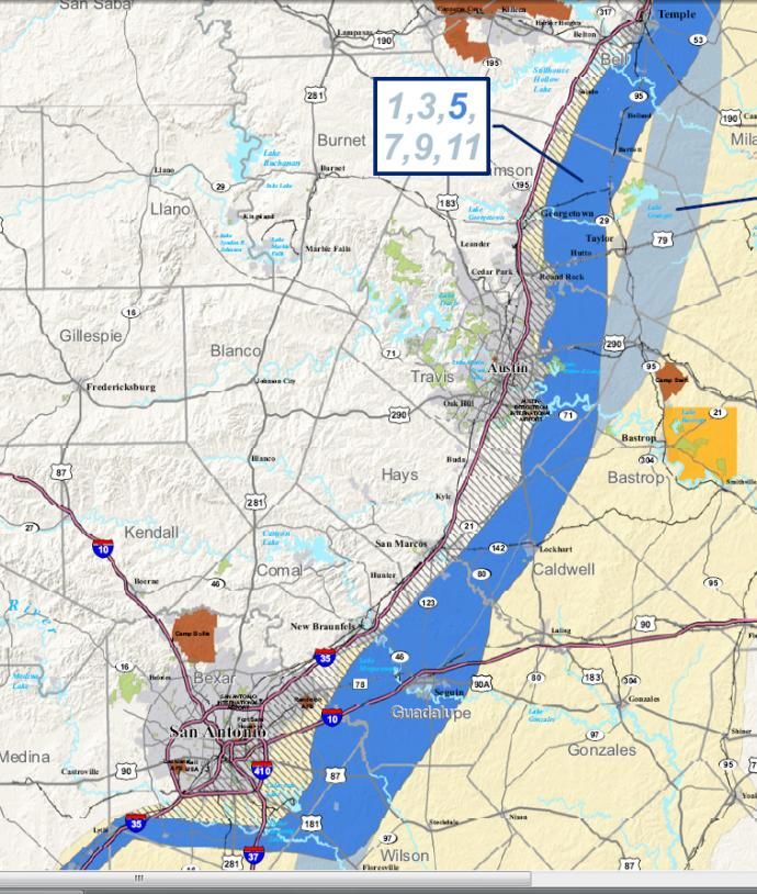
Growth of the Hill Country

The Hill Country Alliance (HCA) is a nonprofit organization whose purpose is to raise public
awareness and build community support around the need to preserve the natural
resources and heritage of the Central Texas Hill Country. HCA was formed in response to
the escalating challenges brought to the Texas Hill Country by rapid development
occurring in a sensitive eco-system. Concerned citizens began meeting in September of
2004 to share ideas about strengthening community activism and educating the public
about regional planning, conservation development and a more responsible approach
growth in the Hill Country.

                                 This report was prepared for the Texas Hill Country
                                 Alliance by Pegasus Planning

                                                                                          2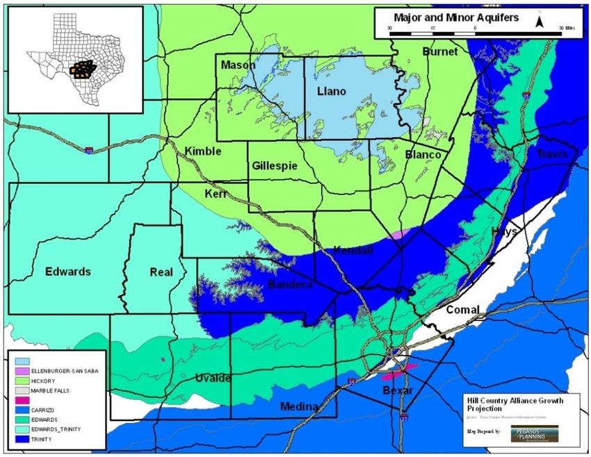
Growth of the Hill Country

                             3
Growth of the Hill Country

                                  Table of Contents

Executive Summary

Introduction

The Hill Country Today

The Hill Country in 2030

Strategic Considerations

Reference
       Land Development and Provision of Utilities in Texas (a primer)
       Organizational Resources
       Materials Reviewed During Project
       End Notes
       Methodology

The HCA wishes to thank members of its board and review team for assistance with this project,
  and the authors and contributors to the many documents and studies that were reviewed.

                                       September 2008
                                                                                             4
Growth of the Hill Country
The Setting
The population of the 17-County Hill Country region grew from approximately 800,000 in 1950
(after the last drought on record) to 2.6 million in 2000. What was once a region of two larger
cities, with small towns to support the many farmers and ranchers living off the land, has given
rise to unmanaged growth and a very different landscape than it was in 1950. The potential
impacts of unmanaged growth will be detrimental to the culture, the natural resources and the
economy of the Hill Country.
The region’s current population of 3.1 million in the Hill Country is now projected to climb to at
least 4.3 million by 2030. The growth is being fueled by two main factors – 1) the changing
demographics in the United States sending baby boomers flocking to the Hill Country to live out
their final years, and 2) spillover growth from Austin and San Antonio -- two of the fastest
growing economies in the U.S. Compounding these growth factors is the lack of county land use
authority in the unincorporated areas of the Hill Country -- which is 90% of the entire region
(everything in grey in the following map).
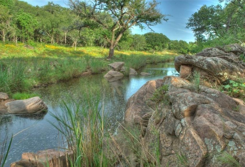
The Hill Country’s unique physical characteristics -- rolling and rugged hills, natural springs and
rivers, and lush landscape -- are primary reasons for developing subdivisions in the region
(additionally, it is easier from a regulatory perspective to develop in the county versus the city).
5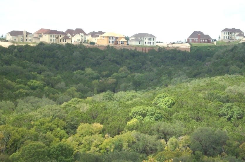
Growth of the Hill Country
Any realtor will tell you that views sell houses. However, the views are being replaced with more
rooftops on the ridgelines and roadways to get to those homes. Without a proactive growth plan
the region will kill the goose who laid the golden egg.

The Hill Country is also unique for its culture; a fusion of Spanish, German, Czech, and Indian
influences found in food, beer, architecture, and music that forms a distinctively "Texan" culture
different than the state's other regions.

In 2008, The New York Times declared the region as the
number one vacation spot in the nation. Traditional Main
Street experiences, historic and cultural treasures such as
the Alamo, recreation, music and other Hill Country
tourism assets continue to fuel the strong tourism sector.
Hill Country tourism is a $5 billion per year industry,
including $20 million per year from the vineyards alone.
The Hill Country has emerged as the center of the Texas
wine industry, with three distinct viticulture regions
located in the region. Nationally, Texas ranks number one
in total hunters and anglers (2.6 million), money spent
($6.6 billion), jobs supported (106,000) and tax revenue
generated ($1.3 billion). Hunting and fishing are major
contributors to the Hill Country’s overall tourism
economy. However, the primary industry of two thirds of
the Hill Country counties is farming and ranching.

The impacts of unmanaged growth will be seen and felt on the culture of the Hill Country. How
will the growth impact the tourism industry? Hunting and fishing are just two examples of
industries that could be negatively impacted by staying on the current path of growth.

Until the last decade the region has experienced modest population growth. However, like other
fast growing regions in the U.S., the assets that drew people here, and the overall character and
beauty of the Hill Country, are now threatened by the growth itself.

                                                                                                6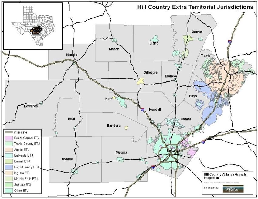
Growth of the Hill Country
Introduction
The purpose of this report is to educate stakeholders in Texas and the Hill Country on what this
17-county, Central Texas region will look like in 2030 (given the assumption that the population
will grow at the projected rate of growth, and no new authority is granted for managing the
growth).
Key Findings
Several main themes arose from this project:
Population in the region will grow
from 2.2 million people in 2000 to
4.3 million by 2030.
Ground and surface water will not
be sufficient to support the
projected growth. Every one of
the four regional water planning
studies that includes parts of the
Hill Country region anticipates a deficiency of water supply.
Nearly 90% of land most at risk in the Hill Country is in unincorporated areas, where
county authority to manage growth is substantially limited compared to incorporated
Texas cities.
Amount of land in mid-size farms and ranches declined in the last decade, giving way to
subdivisions and water rights speculation.
Every regional planning process done in the Hill Country points to an interest among
stakeholders for regional solutions to many of the growth management issues that are
and will affect the region, such as water/wastewater regional planning, transportation
planning, and land use planning.
HCA firmly believes that if more individuals are aware of the growth and its impacts, that
collectively the region will strive to determine a more proactive way to accommodate the
anticipated growth while preserving certain aspects of the Hill Country that are essential to our
livelihood and quality of life.
7
Growth of the Hill Country

The Hill Country Today
Two percent of Hill Country homes had electricity in 1930, but by 1960 only 2% did not have it.
The arrival of utilities made the Hill Country more accessible and welcomed the growing
population to what was and still is a
treasured region.

The region’s growth is most noticeable
in the countryside near Austin and San
Antonio city limits. Farm and ranchland
in many of these suburban counties
has been converted at a rapid rate into
residential development, and houses
are being built across the ridgelines of
the hills that make this region unique.

Population
Population in the Hill Country grew from 2.6 million people in 2000 to 3.1 million in 2007 --
representing an 18% increase in the region’s overall population growth over this time period. The
table to the right illustrates which counties experienced the most significant growth during this
seven year period. Clearly, Hays and Comal counties -- located in between the two large metro
areas -- had the most significant change, with both counties growing more than 34%.

The Hill Country is also home to a                     Population Population
growing population of retirees. On          County                            % Change
                                                          2000       2007
average, rural Texas counties have a
larger percentage of retirees than         Bandera          17,645     20,197       14%
urban counties (Texas Comptroller          Bexar         1,392,931  1,594,493       14%
2001). In the Hill Country, Burnet,        Blanco            8,418      9,067        8%
Blanco, Bandera, Gillespie, Kendall,       Burnet           34,147     43,689       28%
Kerr, Llano and Real Counties are          Comal            78,021    105,187       35%
considered “Retirement Haven”              Edwards           2,162      1,938      -10%
counties because their population          Gillespie        20,814     23,507       13%
older than 60 years increased by                            97,589
                                           Hays                       141,480       45%
more than 15 percent between 1980
                                           Kendall          23,743     31,342       32%
and 1990. Retirees often look to
reduced traffic, air pollution and         Kerr             43,653     47,860       10%
crime; more parkland, recreational         Kimble            4,468      4,461        0%
facilities and open space; and a lower     Llano            17,044     18,394        8%
cost of living when choosing to move       Mason             3,738      3,890        4%
to rural counties.i Texas is second        Medina           38,304     43,826       14%
only to the state of Florida as a          Real              3,047      2,965       -3%
premier retirement destination, and        Travis          812,280    974,365       20%
the Hill Country is the premier
                                           Uvalde           25,926     26,581        3%
retirement destination in Texas.
                                           Region         2,623,930 3,093,242       18%
                                                                                               8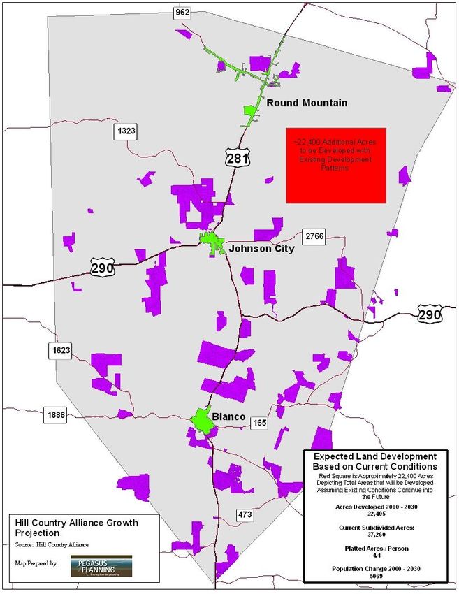
Growth of the Hill Country
Natural Resources
One of the unique attributes of the
Hill Country is its geography. The
majority of counties in the 17-county
region lie over the Edwards Plateau --
a limestone outcrop that is the
southernmost extension of Texas’
Great Plains. The Plateau is marked
by a line of southward and eastward-
facing hills which descend steadily
through the Hill Country. Starting at
elevations over 2,400 feet in parts of
Edwards, Kerr and Menard Counties,
the Edwards Plateau drops down to
800 feet or less at its eastern
borders, which end abruptly at a geologic fault known as the Balcones Escarpment. Combined
with the many rivers and aquifers in the region, this unique Texas topography is yet another draw
to tourists and residents.ii

A live oak-juniper-cedar elm savannah is common in upland areas. The diverse bottomlands have
bald cypress, sycamore, little walnut and Texas Oak as dominant canopy species. Grasslands have
in many cases been managed well in this traditional Texas ranch setting, and it is not uncommon
to see upland pastures with little bluestem and of course Texas wildflowers. iii These natural
features contribute to the overall water quality of the springs and rivers in the Hill Country.

Because of the limestone landscape with caves, fissures, and underground streams, the region
also features a number of aquifers which serve as a source of drinking water for many residents.
Several tributaries of the Colorado River of Texas (including the Llano and Pedernales rivers which
cross the region west to east and join the Colorado as it cuts across the region to the southeast)
drain a large portion of the water in the Hill Country. The Guadalupe, San Antonio, Frio, Medina,
and Nueces rivers also originate in the Hill Country. Creeks in the region are fed, in part, by spring
flow that recharges through the porous limestone formations. The springs in the region are a
tremendous natural and cultural asset. Water quantity and quality, loss of native pasture, and
loss of native species habitat are seen as the most critical areas of concern among stakeholders in
the region.

Economy
Farming and ranching families, whose property has been under family ownership and
management for a century or more, have left a wonderful legacy in the Hill Country. Agriculture
and ranching are major economic engines in the Hill Country. Nearly two-thirds of the counties in
the region rely on agriculture as their primary economic base. Vineyards are a burgeoning
agricultural industry in the Hill Country, with many national wine experts suggesting that the Hill
Country could become the next Napa Valley, in terms of the quantity and quality of the wines and
the economic impacts of tourism potential.

                                                                                                    9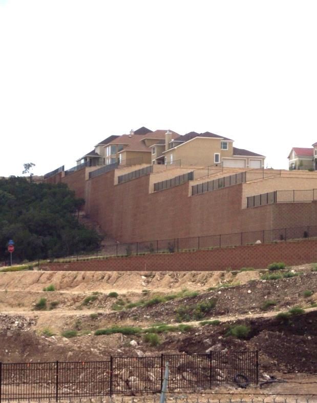
Growth of the Hill Country
The American Society of Farm Managers and Rural Appraisers found in its 2007 study of rural
land values that the “primary investment motive for large tracts in Region 6, which includes
counties outside of Bexar county, is for residential subdivision.iv The study notes that water
rights speculation is another primary motivation for land investment in Bexar, Medina, and
Uvalde counties. Recreational values of land (especially in counties with rivers and hills) were also
seen as a primary factor among buyers of large tracts of land.

Tourism also plays an important role in the Hill Country economy with local, national and
international tourists visiting the region for conventions in Austin and San Antonio, historical trips
to the Alamo, hunting in the “Deer Capital of the World”, or tubing down one of the cool rivers.

Culture
While the impacts of growth on the culture of the Hill Country are noticeable, the more dramatic
impacts will be seen on culture over the next 20 years. The views that new residents and tourists
come to the Hill Country for will be degraded by the same patterns of development that promote
new subdivisions and roadways on ridgelines. Historic ranches are being lost as owners pass on
ranches to their heirs who may not be interested in maintaining a ranch.

Some counties have adopted rules that are within their limited tools granted by the State. Hays
and Comal have adopted rules reducing night lights; other counties try to promote clustered
subdivisions; others are adopting park and open space plans.

The region has made significant progress in building upon its existing parklands such as
Pedernales Falls State Park, LBJ State Park, and others. Cities, counties, the state and regional
organizations have added to the inventory by passing bonds, obtaining grants, and securing
dedicated active and passive recreation areas. Additionally, a strong movement to preserve open
spaces through conservation easements, transfer and purchase of development rights, and
quality developments has made a significant impact.

With increased population, come increased demands for services such as fire, police, parkland,
and open space. The cost for providing services to residential development has been found to be
much more costly than servicing commercial development or agricultural/ranching. Counties and
cities will experience more of a burden on their budget to service the projected growth.

                                                                                                   10
Growth of the Hill Country
The Hill Country in 2030
The question many in the Hill Country want to know is “What is the growth going to look like and
how will it affect my life?” To start with, there will be a lot more neighbors. Putting a picture on
anticipated growth of a double in population is difficult to portray. Keep in mind, this study was
done assuming no changes in policies that could impact the pattern of growth.
The population that the region will absorb Population
Projected
over the next 22 years will be dispersed County Population % Change
2000
throughout the region, with more of the 2030
Bandera 17,645 48,577 175%
growth occurring in the unincorporated areas
Bexar 1,392,931 2,059,112 48%
than has been the case in the past. The
Blanco 8,418 13,487 60%
majority of the growth will continue to occur Burnet 34,147 60,382 77%
close to the two major metro areas, along Comal 78,021 190,873 145%
major roadways, and in suburban counties. Edwards 2,162 2,364 9%
Yet, every county -- even Real and Edwards Gillespie 20,814 28,845 39%
who are both (wrongly) projected to lose Hays 97,589 302,795 210%
population -- will grow beyond what the Texas Kendall 23,743 65,752 177%
Kerr 43,653 57,565 32%
Water Development Board projects. Cities and
Kimble 4,468 4,702 5%
counties throughout the region have already Llano 17,044 17,360 2%
surpassed the 2007 population projections. Mason 3,738 3,876 4%
Medina 38,304 62,416 63%
The table to the right and accompanying graph Real 3,047 3,042 0%
on this page illustrate that while urban and Travis 812,280 1,385,236 71%
suburban counties will continue to grow Uvalde 25,926 33,802 30%
rapidly, it will be counties such as Bandera and Region 2,623,930 4,340,186 65%
Kendall that will experience the most significant change in population and growth impacts. (The
graph does not include Travis & Bexar counties as their large numbers downplay the growth in
the more rural and suburban counties).
350,000
Population 2000
Projected Population 2030
300,000
250,000
200,000
150,000
100,000
50,000
-
Bandera Blanco Burnet Comal Edwards Gillespie Hays Kendall Kerr Kimble Llano Mason Medina Real Uvalde
11Growth of the Hill Country
Projected Development Patterns
An analysis of potential sprawl in the region reveals that as the Hill Country grows distinct sub
regions will emerge (based on projected population density and prior levels of development) –
creating new suburban centers in the Hill Country that serve as regional hubs for retail,
healthcare.
Projected land consumption (acreage devoted to residential land development), based on
historical and projected population growth, and average amount of acreage per capita (4.4 acres
per person on average) reveals that nearly 7,500,000 acres of the entire 11,378,000 acres in the
Hill Country will be developed to support growth in the Hill Country through 2030. Yet, many in
the region believe these numbers -- as daunting as they may be -- could be higher.
Take, for example, Blanco County,
who under the projected land
consumption model is expected to
have nearly 22,400 additional acres
developed to accommodate the
projected population growth.
The map to the right illustrates all
the existing subdivisions in Blanco
County (areas in pink). Only 3,500
acres of the 37,000 acres of
subdivisions is within city limits in
Blanco County, leaving 33,500
acres in unincorporated areas. The
red square on the map represents
the size of the 22,400 acres that is
projected for development.
A new 6,000 acre subdivision is
already planned in Blanco County
which would account for 28% of
the projected developments in this
county. Facts like this make it safe
to assume that the amount of
acres to be developed to support
the projected 2030 population will
be much more.
The projected amount of acres to be developed to support the 2030 population will be much
more than projected in Blanco and the region. Texas Water Development Board projections are
not reflecting what's happening on the ground. The projections for Johnson City for 2010 have
already been exceeded based on 2008 Census estimates. Population growth is outstripping
projections and the anticipated impacts of growth could be much more significant.
12Growth of the Hill Country
Impacts of Growth
We know that the region’s population will grow,
perhaps doubling by 2030, and that each county will
grow at different rates resulting in varying levels of
acreage developed to support this growth. The
question that many wonder is “what will this increase
in population look like, and what are the potential
impacts of this growth?” Certainly, the impacts will
be felt in many ways, but for purposes of this report,
we have segmented the impacts into Natural
Resources, Economy, and Culture.
Natural Resources
The impacts of the growth will be felt and seen in
many ways, but what many fear the most is what the
growth will do to the natural resources of the Hill
Country -- resources which are both essential to
living and to the very character of the region.
Land
Many farms and ranches have been fragmented as they are subdivided into smaller parcels of
land for residential development. Land fragmentation also leads to the loss of open space, a
decline in wildlife habitat, water quality problems caused by increased erosion and run-off, and a
higher demand for county services in rural areas with the increased residential development.
Land fragmentation is the single greatest threat to
wildlife and the long-term viability of agriculture in
Texas and the Hill Country. How land continues to be
developed is of paramount concern to most
stakeholders in the region – whether you concerned
about ground water quality, loss of ranch or
farmland, or lack of water to support living and
playing.
Water
According to the State Water Planning regions, the
Hill Country, which is part of four separate regions
may not have sufficient water supply to meet the
demands of growth. The following points are taken
from each of the four region’s water plans.
Collectively these four regions comprise land areas
much larger than the Hill Country region, yet the Hill
Country is wholly within these four areas and make
up the majority of land area:
13Growth of the Hill Country
Region F expects a water supply shortfall of 217,000 acre feet/year by 2060.
Region J expects a water supply shortfall of 10,000 acre feet/year by 2060.
Region K expects a shortage of nearly 230,000 acre feet by 2060.
Region L estimates a shortage of 436,000 acre feet/year by 2060.
Many fear that during droughts this potential shortfall will have a dramatic affect on the region’s
farming and agricultural industries, recreation and tourism industries, as well as to general living.
Certainly water quantity is a significant concern, but for some, water quality is seen as a more
important component of the region’s natural resources that will be impacted by growth and
development patterns. New developments in the county lack sufficient detention facilities --
structures that detain water from running off the development site so that post-development
runoff does not exceed pre-development runoff. As a result, runoff funnels off the landscape
rather than widespread infiltration absorbing into the ground by grasses. Also, the 1st inch of
rain, which is full of contaminants from streets, oils, and fertilizers, flows into the creeks and
water wells of neighbors.
Economy
The economic impact that most are concerned about is on industries such as farming, ranching,
viticulture, and tourism. For nearly two thirds of Hill Country counties, farming and ranching is
the largest industry.
The Texas’ Economic Development and Tourism Department estimated an impact of nearly $5
billion from travel spending in the Hill Country in 2006.v Hunting and fishing are an integral part
of the tourism industry. The Texas Wine Marketing and Research Institute estimated in 2004 that
the economic impact of the Hill Country vineyards injects nearly $20 million per year into the
Central Texas economy.
It is difficult to surmise from this preliminary analysis what the true economic impacts of
projected growth will be on the Hill Country economy. Industries that rely on water availability
and the beauty of the Hill Country stand to be most impacted by unmanaged growth.
Cost of Services
With new residents and commercial development, cities and counties will undoubtedly see
significant increases in their tax revenue, but will the services demanded by new residents and
businesses surpass the fiscal benefits of growth? Several studies have examined the cost of
sprawl development or the cost of residential development versus farming or agriculture.
A national study suggests that uncontrolled sprawl (no new policy or legislation) would absorb
18.8 million acres nationwide, but that with a more compact growth the acreage consumed
would only be 4 million acres. The study suggests that water and sewer line savings under a more
compact growth scenario would amount to $12.6 billion over 25 years; road and highway savings
14Growth of the Hill Country
would be $109 billion; and public serviced cost savings could be as much as $4.2 billion.vi
According to the American Farmland Trust’s Cost of Service Study in Hays County, “for every
dollar these [agriculture and ranch] lands generated in revenue for the county, school and public
service districts, they required back only $0.33 in services. Commercial and industrial lands
provided a similar net benefit to the county, needing only $0.30 back for every $1 generated in
taxes. While residential lands generated significantly more dollars in property taxes, they
required even more in services — $1.26 for every $1 paid in taxes. Education was the most
expensive service provided, accounting for 53 percent of total expenditures.” vii
Culture
Hill Country “character” is an essential part of
the cultural experience of the region yet
defining this character is challenging. It
includes wide and seemingly never-ending
views of the rolling hills, the rivers, creeks and
springs, the wildflowers, and an abundance of
wildlife. This character is a draw to new
tourists and residents yet at the same time the
growth does have an impact on the Hill Country
culture and character. Ranchers who have
worked their land for more than a few decades
have noticed more lights at night on the
hilltops.
Quality of Life
The most difficult area to measure the impacts of growth on is the quality of life of residents in
the Hill Country. In several studies reviewed for this project stakeholders cited as their primary
concern losing their unique quality of life. Quality of life means different things to everyone but
the main take-away on this point is that many believe that the essence of the Hill Country may be
lost if population growth is not managed properly. This manifests in many ways such as more
night lights from homes, views of the hilltops degraded by new rooftops and roadways, and
neighbors who do not share the same environmental/nature ethic as those who have lived off
the Hill Country land for decades.
There are aspects of quality of life that can be measured such as emergency response time for
911, fire or ambulance; or increased amounts of travel time to work due to congestion or more
cars on the roadways. These are aspects of quality of life that many city dwellers who move to
the Hill Country will want. Demands on municipalities will increase as these new residents clamor
for the quality of life they desire.
15Growth of the Hill Country
Strategic Considerations
Nearly every study examined for this project has recommendations or strategic considerations
addressing many of the issues discussed in this report. The following represent a summary of
those recommendations, plus several additional considerations. Absent new legislation that
would give county’s additional land use authority, these recommendations can help better
manage the impacts of the impending growth:
1. City Comprehensive Planning
Not all cities in the Hill Country have an updated Comprehensive Land Use Plan. It is very
possible that cities in the Hill Country can plan for an additional population than is
projected for their city by absorbing more density within their existing city limits and ETJ.
In the long run, this will increase their tax base and more than likely provide cost savings
on utility outlays that would normally need to be spent to accommodate sprawling
development on the fringes of their ETJs. Several cities are in the process of updating
their comprehensive plan, including Johnson City, Bandera, Marble Falls, and Burnet
County. Recently completed plans include Boerne, Bertram, and Blanco.
2. Regional Planning
Several regional plans have been developed focusing on water availability and habitat
conservation, but the single most important regional plan would focus on future land use
planning and utility plans. With a utility plan for water and wastewater, the region can
focus growth where it wants it and away from where it does not. Developers, utility
providers, municipalities and tax payers stand to save a significant amount of money
under a proactive and planned vision for growth.
3. Develop a Better Knowledge Base
Digitize existing parcel boundaries for every county/appraisal district. Begin base mapping
and parcel updates regularly for every county, and categorize land use with the
recommended state standards for appraisal districts to use. Without a historic record of
how parcels are being subdivided, it will continue to be difficult to get a more accurate
estimate of the impacts of projected growth.
4. Natural Area and Open Space Conservation
Several organizations and elected bodies in the region have had some success with
preserving open space and natural areas. This model (such as with Hays County’s park
16Growth of the Hill Country
and open space bond referendum and plan) could be implemented in other counties in
the region.
5. Transfer and/or Purchase of Development Rights (TDR/PDR)
These two tools have become increasingly effective and more often used to preserve
areas deemed as important to water quality or animal habitat, and should be further
promoted throughout the region.
6. Habitat Conservation
Several habitat conservation plans have been developed to protect endangered species
or habitats. This may become increasingly important as development encroaches into
new areas.
7. Public education
Continuing to educate the general public about the anticipated growth and its impact will
lead to a cadre of individuals who can serve as a resource to assisting with many of the
recommendations found here or within the plans developed for the region.
8. Promote Changes in Development Patterns
Several development techniques are used by some developers but can be further utillized,
including: Clustered Development, Siting of Development, and Sustainable Construction
Practices.
How to Get Involved
The Hill Country Alliance (HCA) has developed a
supplement to this report in the form of a power point
presentation that can be available to anyone in the
region. HCA will also host several workshops or trainings
over the next six months to prepare “docents” or
individuals who wish to provide the presentation to
other stakeholder groups.
To learn more and get involved in addressing the points
and recommendations in this report, please visit the Hill
Country Alliance website at www.hillcountryalliance.org
17Growth of the Hill Country
REFERENCE SECTION
Land Development and Utility Provision in the Hill Country
Land is developed to meet the demand of population growth. Many have jokingly argued that
building a fence will “keep out” all the newcomers and maintain the Hill Country as it is today.
While this fictitious strategy may seem like a solution, the primary issue is haphazard land
development in the unincorporated areas.
The main drivers for population growth are normally employment opportunities and quality of
place amenities such as schools, convenience, parks, and others. Every community in the Hill
Country has their own unique quality of place assets that have drawn, and will continue to pull
residents and businesses to the region.
Developers argue that their dense new subdivisions with modern water and wastewater systems
are better for the environment than older subdivisions that relied on septic tanks and well water.
Yet, large scale subdivisions with dense development (houses on ½ acre or less) cannot occur
without a regional water system and wastewater. Of the many forces pushing the Hill Country
development boom, none is more influential than the arrival of water pipes.
A basic understanding of how land can be developed and how utilities are provided in Texas is
essential to understanding why land is being developed at a rapid pace, and why nearly 75,000
acres of Hill Country land is expected to be developed over the next 20 years.
Incorporated versus Unincorporated
Land in Texas that is
outside state or
federal parks and
reserves is either
designated as
unincorporated or
incorporated. Cities
in Texas are
incorporated. Every
city has an imaginary
boundary that
extends a certain
distance (based on
the city’s population
size) from their city
limits called the Extra
Territorial Jurisdiction
(ETJ). Land outside of
the ETJ is in the
unincorporated area,
18Growth of the Hill Country
which is regulated by counties. Texas cities have much more authority than counties in how land
is regulated.
Nearly 90% of all the land in the Hill Country is in County % of Acres
County Acres ETJ Acres
Name not in ETJ
unincorporated areas. The vast majority of
Bandera 510,552 3,179 99.4%
incorporated land is within the cities of Bexar, Hays, Bexar 804,879 403,997 49.8%
and Travis counties (as the colored areas in the map Blanco 457,363 3,409 99.3%
below illustrates). Burnet 652,362 47,455 92.7%
Comal 368,453 23,447 93.6%
Edwards 1,359,561 754 99.9%
Counties do not share the same authority as Cities to
Gillespie 679,166 12,774 98.1%
manage growth. Counties have limited, and very Hays 433,280 146,188 66.3%
specific powers that have been granted by the state Kendall 424,086 5,146 98.8%
and are focused mostly on subdivisions, county Kerr 708,619 14,604 97.9%
roads, and septic tank permitting (also in Kimble 799,949 1,494 99.8%
Llano 618,307 4,284 99.3%
conjunction with the State). It is troubling to many
Mason 597,191 2,294 99.6%
who have followed planning and development that Medina 858,135 10,842 98.7%
with so much land in the unincorporated areas of Real 448,202 249 99.9%
the region, that development will occur haphazardly Travis 656,566 534,579 18.6%
and not within a shared regional vision for growth. Uvalde 1,001,006 5,420 99.5%
Region 11,377,677 1,220,115 89.3%
Counties do have authority to regulate septic tanks and subdivisions, among a few other minor
areas, yet the regulations themselves generally promote larger lot subdivisions. Cities have the
authority to develop comprehensive land use plans and utility plans to serve their future growth
– thus staying ahead of their projected growth. Counties have very limited authority to plan for
their growth. Regional planning is a relatively new type of planning that has focused largely on
transportation planning and most recently a five county regional land use vision called Envision
Central Texas. Regional plans for water (discussed below) and habitat conservation have also
been developed, but no regional utility plan has
yet to be developed for areas in the region.
Transportation Infrastructure
Roadways and utilities contribute to where
people want to live. Federal and state roadways
are planned and developed by the Texas
Department of Transportation. The main
roadways in the Hill Country include Interstate
35 and 10, and State Highways 290, 46, 71, 281,
183, 90, 377, and 83. These roadways form a
network of inter-regional and national
transportation corridors -- carrying goods and
people to and from their destinations. The
projected growth of the region by TWDB does
not factor in any new roadways, so with
additional state or federal highways, the
projected population could end up much larger
than predicted.
19Growth of the Hill Country
Many are concerned about the impacts of the Highway 281 expansion and the proposed Trans-
Texas Corridor (TTC). The map to the right illustrates the preliminary study area for this major
new highway system (in dark blue, running between Austin and San Antonio to the east I-35 and
the Hill Country). While not within the Hill Country, a new roadway system of this magnitude will
have an impact on growth throughout the region.
Water,
Wastewater, and
The big problem with these
On-site Sewage
Facilities underground water
Water is provided districts throughout the
for residential,
state of Texas is that they
business,
agricultural, or are confined to a particular
ranch use from county or geographic area
either
underground or
that they represent, and the
above ground water is not restricted to
(referred to as those areas.
surface) sources.
Several rivers and
aquifers are found
in the Hill Country. Water is regulated at the federal, state, and local levels. Several major and
minor aquifers lie within the Hill Country and are the primary water source for the majority of the
new development occurring in the unincorporated areas of the Hill Country, as most new
developments in unincorporated areas rely on groundwater as the primary source of water.
The “rule of capture” is an aspect of Texas water law that is critical to understanding our state
and region’s need for water planning. Adopted in 1904, this rule gives landowners the right to
capture an unlimited amount
of groundwater by tapping
into the underlying aquifer.
Many stories have been told
about farmers and ranchers
whose water availability
dwindled significantly due to
an adjacent landowner or
developer who put a well
next to their land (often
deeper than the other
landowner’s wells) and
essentially captured the
water before it went to the
farmer’s or rancher’s well.
Groundwater districts, which
20Growth of the Hill Country
have been Texas' preferred
management tool for groundwater
resources since the 1950's, have the
ability to modify the rule of capture
slightly by regulating spacing and
production of wells to ensure the
availability of groundwater within the
district's boundaries. Groundwater
districts can deny a permit to
withdraw groundwater based on the
effect it may have on aquifer
conditions. The districts can require a
permit amendment and charge a fee
for an export, but they cannot deny the permit based on the groundwater's destination and they
cannot adopt rules to limit exports.
Groundwater Management Districts have been given the authority by the state of Texas to
manage groundwater resources in specific regions, of which four such districts are within the Hill
Country – Districts 7, 8, 9 and 10.
Surface water and water transfer is managed by river authorities that have been established by
the legislature based on river basin boundaries. The main river authorities providing surface
water in the Hill Country are the Lower Colorado River Authority, Guadalupe-Blanco River
Authority, San Antonio River Authority, and the Trinity River Authority. These river authorities
have plans for additional centralized water supply system to compensate for the lack of
groundwater in the area.
One common criticism of the way the state of Texas handles its water quality and quantity issues
has been that there is a lack of coordination and communication among the myriad number of
entities who have some level of management authority over water. Senate Bill 1 and then Senate
Bill 2 created sixteen regional water-planning districts in the state with a mandate to create a
coordinated plan to provide water for the rapid growth in Texas and to ensure that all the entities
coordinate and communicate. Texas is now in the second phase of its regional water planning
efforts. Hill Country counties fall within four water planning regions (listed are only those counties
within the Hill Country Region) – Region F (Kimble and Mason); Region J (Bandera, Edwards, Kerr,
and Real counties); Region K (Bastrop, Burnet, Blanco, Gillespie, Hays (partial), Llano, & Travis
counties); and Region L (Bexar, Comal, Guadalupe, Hays (partial), Kendall, Medina, & Uvalde
counties).
The real key to planning and developing in unincorporated areas is the provision of large
quantities of water and centralized wastewater. Ironically, with a regional utility plan, growth can
be directed where the region wants it, and residential development can clustered on smaller lots
-- preserving the integrity of the Hill Country and the natural assets that are essential to the
culture, economy, and natural resources of the region. Without a centralized wastewater
system, such as what most municipalities in the region operate, on-site sewage facilities (OSSF)
are the preferred and required method for storing and treating sewage. OSFFs, more commonly
referred to as septic tanks, are the preferred choice for two
21Growth of the Hill Country
out of three new homeowners in Texas.viii Ironically, with centralized wastewater, development
can be clustered on smaller lots; however, with OSFFs, residential parcels must be large enough
to meet state and local standards -- creating larger lot developments and consuming more
acreage.
22Growth of the Hill Country
Organizational Resources
Hill Country Alliance
Capital Area Planning Council of Governments (CAPCOG)
Alamo Area Planning Council of Governments (AACOG)
Envision Central Texas
Hill Country Conservancy
Trust for Public Lands
Nature Conservancy
Sierra Club
Texas Water Development Board (TWDB)
Texas Commission on Environmental Quality (TCEQ)
Lower Colorado River Authority
Guadalupe-Blanco River Authority
San Antonio River Authority
Materials Reviewed for this Project
Regional Water Plan, Region F, J, K, and L, www.twdb.state.tx.us (2002-present)
Cost of Community Services in Hays County, Trust for Public Land, May 2000.
Conservation Plan for the Pedernales River Watershed, Nature Conservancy, May 2007.
Cost of Sprawl, Transit Cooperative Research Council, 2000.
Cost of Sprawl Revisited, Urban Land Institute, 2002.
Regional Water Quality Protection Plan for Barton Springs Segment of the Edwards Aquifer and
Its Contributing Zone, June 2005.
Southwest Travis County Growth Dialog, 2005.
What do Groundwater Users Want?, LBJ School of Public Affairs, UT-Austin, 2007.
2007 Texas Travel Impacts, http://www.deanrunyan.com/pdf/pdftx/County-Trend07.pdf
Methodology
A Review Team of local and regional experts provided feedback throughout this project, and
insight into documents, resources, stakeholder sentiment, and overall direction for the project.
Rather than re-create the wheel, authors of this report pulled from these materials.
The population numbers that form the basis of analysis for this project are based on 2000 U.S.
Bureau of Census data and 2030 projections of the Texas State Water Development Board. The
latter figures have been used extensively during regional water planning discussions and while
they represent the best figures to use, several stakeholders in the region believe the numbers are
too low or too high. For purposes of this project, available TWDB projections are used.
Population projections were then applied to geographic units – city, county, and block groups
(smaller geographic areas within a county boundary). It was found that the average amount of
acreage developed for residential use is 4.4 acres per capita. This per capita number was used as
a basis to project how much acreage can be developed to support the projected population
growth under existing conditions and regulations. Ideally, the project team would have used
parcel data changes over time to analyze the patterns of growth. Yet, updated and consistent
parcel data is not available at this time for every county in the region. This information - which is
collected and maintained by County Appraisal Districts – cannot be combined or viewed
23Growth of the Hill Country
collectively since each appraisal district applies varying degrees of resources and sophistication in
updating their parcel information. The State of Texas has provided recommendations to
appraisal districts on how parcel data should be categorized. If parcel data was updated for every
county and categorized in the same manner than stakeholders could be much more sophisticated
with analysis, and the region could see historic patterns of growth and change.
Endnotes
i
Parkland and Open Space in the Texas Hill Country, Texas Center for Policy Studies, 2001.
ii
Ibid (Mace et al, 2000)
iii
Southwest Travis County Growth Dialog, 2005.
iv
Texas Rural Land Value Trends 2007. Texas Chapter of the ASFMRA Land Value Survey, 2007.
v
Texas Travel Spending Tables, Texas Department of Economic Development and Tourism.,
http://travel.state.tx.us/asp/tspend.asp?reporttype=r&title=Hill%20Country&where=6
vi
Cost of Sprawl Revisited, ULI, 2002.
vii
“Cost of Services Study for Hays County” American Farmland Trust, 2000.
viii
Tips for Septic Systems, Texas Commission on Environmental Quality (TCEQ),
http://www.tceq.state.tx.us/assistance/sblga/fyiossfs.html
24You can also read