COASTREK 2021 EVENT MAP BOOK - MELBOURNE - cloudfront.net
←
→
Page content transcription
If your browser does not render page correctly, please read the page content below
MELBOURNE

COASTREK 2021
EVENT MAP BOOK
WALKING FOR MENTAL HEALTH
Hey Coastrekker,
Are you ready?
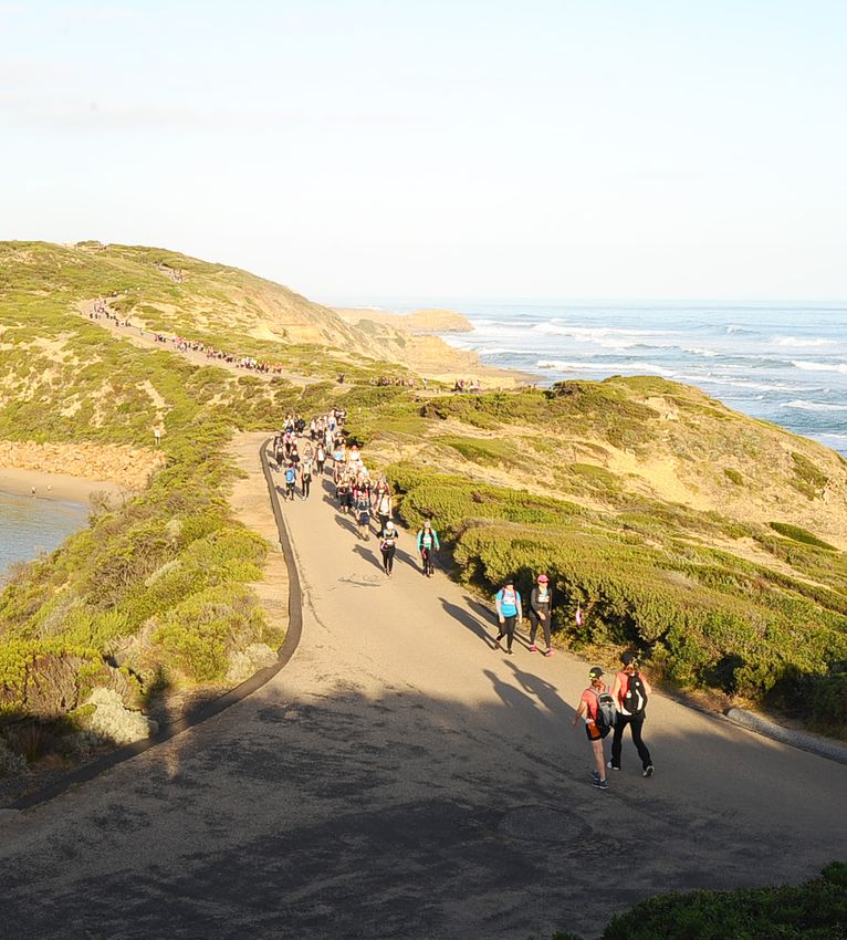
You are about to embark on a life-changing adventure of fun with your friends, getting fit and fundraising
for Beyond Blue!
Did you know that teams who prepare and train on the route enjoy the day 150% more than those who
don’t? (YES! We made that stat up! But it’s also true!). That’s why we’ve prepared this printable route guide
for Melbourne Coastrek (30km and 60km) to help you and your team train and navigate on Event Day.
How to use this guide
The 60km route starts on page 1, the 30km route starts on page 9.
On one side, you have the map with the route highlighted in purple. On the other side, you’ll find detailed
track notes for that section of the route. The MAPS.ME map is still available for you to download onto
your phone – the two complement each other.
About our route
What makes Coastrek the best event ever (if we do say so ourselves!) is that we keep you visually
connected to the coastline as much as possible. We want you to be IN nature, not on roads or urban
footpaths. When walking, stick to bush tracks and beaches (yasss soft sand) to experience the most
beautiful walk. Use the track notes to guide you onto the secret paths and trails. Shhh! These are for
Coastrekkers only!
Toilets are available along the route approximately every 15km. We’ve marked the spots so you can see
where the next loos are. Remember if you’re training at night or very early morning, some toilet blocks
are locked – eeek! Plan carefully, learn ‘bush wee etiquette’ and please don’t leave any mess on the trail
if you do an unplanned stop.
Please note: We can’t control public works, council works, or other construction works, so please be open
minded when you have to navigate around obstacles. Please check our website for the most up-to-date
version of the Melbourne Coastrek route and FAQs. If you encounter hazards or potential route changes
on Event Day, please notify us via text on 0411 344 138.
IMPORTANT: On Event Day each Luv Stop has a designated closing time. If your team doesn’t reach
a stop before the times listed on the website or pocket guide, you will be required to withdraw from the
event. Sorry we cannot make exceptions – our insurance doesn’t cover us for that!
Some Coastrek rules
• Please keep noise levels low when walking near residential areas during early morning and at night.
• Leave no trace! Take your reusable coffee cup, water bottle and a rubbish bag with you, and please
be mindful of the waste you create.
• Be patient… Coastrek is NOT a race!
• If you’re seriously injured during training or on Event Day and need urgent medical assistance,
please call 000.
• If you need to withdraw on Event Day, please contact HQ on 0411 344 138. We must account for
each participant and we will call you if you don’t cross the timing strips at all Luv Stops or Finish Line.
• Remember to post and #coastrek while training and on Event Day so we can give you a shout out.
Woohoo! Happy training, good luck and we can’t wait to see you at the finish line!Cape Schanck 60km Start to Rye Beach Luv Stop
Map 1 of 2
10
MARK
5
MARK
15
MARK
KEY
Route Start Public Toilets
Next/Previous
Section
Luv Stop Road Crossing
1MELBOURNE COASTREK 60KM
Cape Schanck 60km Start to Rye Beach Luv Stop – Map 1 of 2
Cumulative distance Must depart Fingal Must depart Rye
Distance
60km event Luv Stop by Beach Luv Stop by
± 26km ± 26km 11:00am 2:00pm
TRACK NOTES
• The 60km event starts here!
• Start at the Cape Schanck Lighthouse Reserve.
• Exit the reserve through the turnstile gate and walk along a narrow trail. Take an immediate RIGHT onto a
gravel path. Follow this path towards the toilet block (do not take boardwalk out to Cape).
• Follow the gravel footpath in front of the toilets, then carefully cross the carpark to a narrow trail entrance on
your RIGHT onto the Two Bays Walking Track.
• Follow the Two Bays Walking Track along the cliff edge, towards Bushrangers Bay
• In 2km, follow the Bushrangers Bay walking track over Burrabong creek (do not go RIGHT to Bushrangers Bay),
and continue straight for another 3.5km until you reach Boneo Road.
• Cross Boneo Road to the Two Bays Walking Track straight ahead and walk for approx. 3.5km.
• Take a LEFT turn onto the Gate 2 Break track. In 800m, you will reach the 10km mark and a toilet stop!
• Turn LEFT onto Rodgers Road, and follow it until the you reach the end, then turn RIGHT onto Long Point Road.
• Remain on this road until you reach a T-junction at Boneo Road.
• Turn RIGHT onto Boneo Road and be mindful of traffic. After 200m, carefully cross Boneo road and take a LEFT
onto Cape Schanck Road.
• Follow Cape Schanck Road for 2km, until you reach a secret path off to the RIGHT where a wonderful volunteer
will be waiting to greet you!
• The volunteer will direct you through a farm gate and across a grass clearing towards your first checkpoint, the
Fingal Luv Stop! You have reached the 15km mark! Woohoo!
• Grab a snack, refill your water and take a quick rest! When you’re leaving, make sure you cross the timing strip
as a team with your event bib on your front!
• Join the walking track behind the Fingal picnic area toilet block. Follow the route markers towards Fingal Beach
(do not take the track to Fingal Beach).
2Cape Schanck 60km Start to Rye Beach Luv Stop
Map 2 of 2
25
MARK
KEY
Route Finish Public Toilets
Next/Previous
Section
Luv Stop Road Crossing
3MELBOURNE COASTREK 60KM
Cape Schanck 60km Start to Rye Beach Luv Stop – Map 2 of 2
Cumulative distance Must depart Fingal Must depart Rye
Distance
60km event Luv Stop by Beach Luv Stop by
± 26km ± 26km 11:00am 2:00pm
TRACK NOTES
• Proceed on the route, past the National Golf club and onto the sand at Gunnamatta Ocean Beach.
• After walking 1.4km along this beautiful beach, take the walkway up to the Gunnamatta Ocean beach carpark.
You have reached the 20km mark!
• Cross the carpark and follow the bush track (not Truemans Road) for 200m and turn LEFT towards the
secondary carpark. Carefully walk through the carpark to the bush track. Follow the bush track to
Truemans Road.
• Follow Truemans Road for 350m, then turn LEFT along a fire trail.
• Check out the view at Boags Rocks, then head onto the sand at Gunnamatta Beach for 800m.
• Depart the beach at St Andrews beach carpark. Cross the carpark to a newly created bush track and follow it
along the coastline for approx. 1.2km.
• Continue approx. 1.2km on the sand until you reach the Rye Beach Luv Stop!
• Grab a snack, refill your water and take a quick rest! When you’re leaving, make sure you cross the timing strip
as a team with your event bib on your front!
• Depart the Luv Stop via the walking track towards the toilet block, walk to the end of the track until Dundas
Street, then turn LEFT.
4Rye Beach Luv Stop to Sorrento Luv Stop, Map
Map 1 of 2
30
MARK
25
KEY MARK
Route Finish Public Toilets
Next/Previous
Section
Luv Stop Road Crossing
5MELBOURNE COASTREK 60KM
Rye Beach Luv Stop to Sorrento Luv Stop – Map 1 of 2
Cumulative distance
Distance Must depart Sorrento Luv Stop by
60km event
± 16km ± 42km 7:00pm
TRACK NOTES – 60KM EVENT ONLY
• Follow Dundas Street, up to Sandy Road and carefully cross Sandy Road onto the other side.
• Walk on the designated footpath along Dundas Street for approx. 1.5km. Then carefully cross Dundas Street
onto Alison Avenue.
• After approx. 125m follow the route markers down a bush track and turn RIGHT onto the beach, following the
sandy coastline for approx. 2km.
• Once you’ve reached Lizard Head rock, you have hit the 30km mark! Woohoo! You’re halfway – take a photo and
post it to Facebook using the hashtag #Coastrek. Then, leave the sand via the steps, towards Number 16 Beach
carpark.
• Be mindful of cars entering the car park, as you turn LEFT onto the bush track, as indicated by route markers.
•
(Tip: There’s a good foodie shop about 50m from here if you continue straight across Tasman Drive, called “16 Beach
General Store”. It has great coffee and organic produce. If you choose to do pop into the store, please be sure to join
the Coastrek route via the bush track within the Number 16 carpark afterward.)
• Follow the route markers, winding your way along the clifftop tracks and coastline. Don’t forget to look to the
left as you walk along; you’ll see Dimmicks Beach, Pearses Beach, Pirates Bay, Bridgewater Bay, Fowlers Beach
& Monforts Beach.
6Rye Beach Luv Stop to Sorrento Luv Stop,
Map 2 of 2
40
MARK
35
MARK
KEY
Route Finish Public Toilets
Next/Previous
Section
Luv Stop Road Crossing
7MELBOURNE COASTREK 60KM
Rye Beach Luv Stop to Sorrento Luv Stop – Map 2 of 2
Cumulative distance
Distance Must depart Sorrento Luv Stop by
60km event
± 16km ± 42km 7:00pm
TRACK NOTES – 60KM EVENT ONLY
• Continue along the route and onto the Life Saving Track to Sorrento. Cross the bitumen road at the bottom of
Hughes Road.
• Turn RIGHT up Hughes Road to the bay. Cross Point Nepean Road carefully and walk to the beach, then take a
LEFT onto the sand.
• At Cameron’s Bight Jetty, walk another 50m, then turn LEFT off the beach and join the Bay Trail to the RIGHT.
• Follow the Bay Trail all the way to the Sorrento front beach, take a RIGHT 200m after the Sorrento Couta Club
onto the sand. Take a walk on the sand for 950m, before going LEFT at the Italico restaurant (great place for a
post-trek pizza!).
• Follow Ocean Beach Road all the way down to Sorrento SLSC. Enjoy the cafes and window shopping along
the way!
• Carefully walk through the Sorrento Beach carpark, past All Smiles Café and towards the SLSC. You have
reached the Sorrento Luv Stop!
• Grab a snack, refill your water and take a quick rest! When you’re leaving, make sure you cross the timing strip
as a team with your event bib on your front!
8Point Nepean 30km Start to Sorrento Luv Stop
Map 1 of 1
40
15 MARK
TO GO
KEY
Route Finish Public Toilets
Next/Previous
Section
Luv Stop Road Crossing
9MELBOURNE COASTREK 30KM
Point Nepean 30km Start to Sorrento Luv Stop – Map 1 of 1
Cumulative distance
Distance Must depart Sorrento Luv Stop by
30km event
± 13km ± 13km 7:00pm
TRACK NOTES – 30KM EVENT ONLY, 60KM WALKERS SKIP THIS PAGE
• The 30km event starts here!
• Start at the Point Nepean National Park Parade Ground
• Head straight along the coast following the bush path towards Police Point Shire Park.
• At Defence Road turn LEFT and join the clearly marked footpath.
• Follow the footpath for approx. 500m, then turn LEFT onto The Cutting.
• After 120m, turn RIGHT onto the sand. Walk to the end of the beach and up onto the pathway towards the
jetty. Follow the path past the jetty and along the lawns in front of the Portsea Hotel.
• Take the steps down to Portsea Beach and walk along the sand until the other end. Take the pathway RIGHT
through the trees into a clearing.
• Walk straight across the clearing to the bush track. Follow the bush track along the coastline behind the
houses towards Collins Bay.
• Travel along the sand on Shelly Beach for 600m, then turn RIGHT up a sandy path towards Hemston Avenue.
At the end of Hemston Avenue, turn LEFT onto Point Nepean Road.
• After 520m walking along Point Nepean Road, take a LEFT onto Point King Road towards the Millionaires
walk. Enjoy the walk along the coast and the amazing houses!
• Travel through a wooden door to the end of Lentil Avenue. Take a RIGHT down Lentil Avenue, then go LEFT
along the footpath on point Nepean Road.
• After 450m, take a LEFT down St Aubins Way towards Sorrento Boat ramp. Cross the road safely at the
roundabout and join the path in between the two carparks. Travel through Sorrento park to the Esplanade.
• At Sorrento Pier, cross the road safely at the roundabout before joining the Bay trail on the RIGHT. Travel
along the sand at Sorrento Front Beach for 1.1km. Turn RIGHT off the beach just before the Sorrento Couta
Club and take the steps up to the Club carpark.
• Walk through the carpark towards Point Nepean Road and carefully cross the road to the other side. Take a
LEFT, then a quick RIGHT and follow all signs to the Tuckey Track.
• Travel the Tuckey Track all the way to Melbourne Road and cross the road carefully. Take the Melbourne
Road Trail to the LEFT, then take a quick RIGHT down Ivanhoe Street.
• At the end of Ivanhoe Street, take the trail on the LEFT-hand-side.
• Follow the route markers, winding your way along the clifftop tracks and coastline. Don’t forget to look to the
left as you walk along; you’ll see the beautiful Bay of Islands, Diamond Bay, Jubilee Point and St Pauls Beach.
• Once Sorrento back beach and a rotunda on the hill to your left is in your sights, take a sharp hair-pin LEFT
turn off the track, down the steps, towards Ocean Beach Road.
• Cross Ocean Beach Road at the pedestrian crossing, then walk along Ocean Beach Road for 60m before
crossing again at the pedestrian crossing.
• Carefully walk through the Sorrento Beach carpark, past All Smiles Café and towards the SLSC. You have
reached the Sorrento Luv Stop!
• Grab a snack, refill your water and take a quick rest! When you’re leaving, make sure you cross the timing
strip as a team with your event bib on your front!
10Sorrento Luv Stop to Point Nepean Finish
Map 1 of 2
2
TO GO
10
TO GO
15
TO GO
KEY
Route Finish Public Toilets
Next/Previous
Section
Luv Stop Road Crossing
11MELBOURNE COASTREK 60KM & 30KM
Sorrento Luv Stop to Point Nepean Finish – Map 1 of 2
Cumulative distance
Distance Finish line closing time
30km event 60km event
± 18km ± 30km ± 60km 12:30am (Sat 22 May)
TRACK NOTES
• With the SLSC on your right, take the stairs to Coppins lookout and check out the views!
• From the Lookout, follow the route markers towards Sphinx Rock.
• Follow the track onto the sand at Portsea back beach for approx. 1.5km. Do not walk on the vegetation.
CAUTION:
A 0.5m low tide is forecast for 11:19am on Event Day. If there is limited sand to walk on or if there
is an unusually high tide, or it’s after dark, participants will be notified at the Sorrento Luv Stop
and told to take the free shuttle to Portsea SLSC operating between 4pm – 7pm. Your safety is our
number 1 priority!
• Depart the beach after the Portsea SLSC via the ramp, up to the Portsea back beach middle carpark.
• Walk through the middle carpark with the bush immediately to your left.
• Take the track signposted Farnsworth Track (do not take the steps down to the beach).
• Follow the track for approx. 700m and at the Y junction, veer to the RIGHT and continue to follow the track
until you reach the London Bridge carpark. Toilets and drinking water are here on your right.
• Carefully walk through the carpark via the zebra crossing to other side. We recommend taking the
Farnsworth track directly ahead to check out the view at London Bridge lookout (if you choose to visit the
lookout, please be mindful this is a narrow two-way track, so watch for oncoming walkers). Otherwise, turn
RIGHT toward the track signposted Wilsons Folly to Point Nepean, and turn LEFT.
12Sorrento Luv Stop to Point Nepean Finish
Map 2 of 2
2
TO GO
4
TO GO
3
TO GO
10
TO GO
KEY Training Days Only Detour
The Butlers Track section is
Route Finish Public Toilets Training Days
not accessible until event day.
Only
Next/Previous
Section
Luv Stop Road Crossing Please use this alternate route
during training. It is relatively 13
the same distance.MELBOURNE COASTREK 60KM & 30KM
Sorrento Luv Stop to Point Nepean Finish – Map 2 of 2
Cumulative distance
Distance Finish line closing time
30km event 60km event
± 18km ± 30km ± 60km 12:30am (Sat 22 May)
TRACK NOTES
• Follow the Wilsons Folly track for approx. 600m, then take a sharp hair-pin turn LEFT through an open farm gate
towards Point Nepean National Park. Beyond this point is a track only available to walk on Event Day.
On training days, please stay straight and continue along Wilsons Folly Track.
• Follow the route markers through the bush to Butlers track. Continue along Butlers track (ignoring the slip tracks
on your left and right), until you reach the rifle range.
• Turn LEFT along the rifle range for approx. 250m, before re-joining Butlers track on your RIGHT.
• Continue along Butlers track for another 800m until the track meets Defence Road at the Cheviot Hill bus stop.
Toilets and water here.
• Turn LEFT onto Defence Road and walk all the way to Fort Nepean. Don’t forget to look left and right. Check out
Eagles Nest and Pearce Barracks on your right, and Fort Pearce and Bass Strait on your left.
• Continue along Defence Road to a Y junction at the Fort Nepean steps, then veer LEFT onto the gravel road.
Travel through the bus turning circle and continue along the gravel road to the bottom of the hill. Follow the road
around the tip of the peninsula towards the engine house.
• You’ve reached the Fort Nepean Kiss Stop! Enjoy the views and a little treat in the engine house. Only 5kms to go!
• Turn RIGHT out of the engine house and take the 115 steps to the top. When you get to the top where the
cannons are, there is a toilet block on your right.
• At the cannon beside the bunker, you will see a tunnel entrance on your RIGHT. Go into the tunnel and take the
first LEFT as you go through. Note: tunnel lights operate between 8am and 8pm. Please have your head
torch ready to help navigate your way through if arriving outside this time.
• As you leave the tunnel at the other end, meander down the boardwalk and past a sculpture of a soldier pushing
rail carts. Veer LEFT down the steps and continue along Defence Road straight ahead. Stay to your LEFT as
inbound trekkers arrive at Fort Nepean.
• After approx. 1km, there will be an orange arrow directing you LEFT onto a sandy trail with a sign “< Cheviot Hill
via walking track 700m” and “< Gunners Cottage via Cheviot Hill 1.8km”.
• Follow the trail to a Y junction and go LEFT past a bunker, then continue along the trail RIGHT behind the bunker.
• This sandy track becomes Coles Track which eventually turns into a gravel road. Follow the route markers along
Coles Track (onto Defence Road and back onto Coles Track).
• Continue past Jarman Oval on your right and the Bay on your left, then veer LEFT at the old buildings
onto Bogle Road. Walk through the heritage-listed Cyprus tree tunnel and past the Quarantine Station
building on your right.
• Continue straight towards the Point Nepean Parade Ground to the Finish Village. YOU DID IT!
14COASTREK 2021 MELBOURNE EVENT MAP BOOK WALKING FOR MENTAL HEALTH www.coastrek.com.au
You can also read