Community Wildfire Safety Program - SOLANO COUNTY March 31, 2020 - PGE.com
←
→
Page content transcription
If your browser does not render page correctly, please read the page content below
Community Wildfire
Safety Program
SOLANO COUNTY

March 31, 2020
Meeting Purpose and Discussion Topics
                                                                                                                         DISCUSSION TOPICS:
                                                                                                                                       CIRCUIT MAPS
                           MEETING PURPOSE                                                                                             Communicate how local energy is supplied

                                                                                                                                       REDUCING FUTURE PSPS IMPACTS
                           Share what we’re doing                                                                                      Lay out the short-term and long-term plan

                           across our system and at the                                                                                LOCAL PROGRESS UPDATE
                           county level to reduce                                                                                      Review critical wildfire mitigation work planned in 2020

                           wildfire threats and improve                                                                                30-YEAR WEATHER ANALYSIS
                                                                                                                                       Share results of weather analysis including PSPS likelihood and frequency
                           Public Safety Power Shutoffs
                           (PSPS) in 2020.                                                                                             FEEDBACK AND PLANNING
                                                                                                                                       Share what we’ve heard and how we’re planning for 2020

                                                                                                                                       IMMEDIATE IMPROVEMENTS
                                                                                                                                       Convey immediate improvements to the PSPS program

                                                                                                                                       PREPARE FOR 2020 WILDFIRE SEASON

All data is preliminary and based on early 2020 work planning. Data as of February 2020.
Following the wildfires in 2017 and 2018, some of the changes included in this document are contemplated as additional precautionary measures intended to further reduce future wildfire risk.             2
Wildfire Risks Across PG&E’s Service Territory
                                                                                                                                                                                     PG&E                             SOLANO
                                                                                                                                                                                 SYSTEM-WIDE                          COUNTY
                                                           50%
                                                           of PG&E’s service
                                                                                                          Overhead distribution line miles in
                                                           territory is in high
                                                           fire-threat district                           high fire-threat district (HFTD) areas                                   25,000+                            139
                                                           areas
                                                                                                          Overhead transmission miles
                                                                                                          in HFTD areas                                                              5,500+                            92
                                                                                                          Electric customers served                                                    5.5M                           175K
                                                                                                          Weather stations installed                                                     654                            3
                                                                                                          High-definition cameras installed                                              155                           2*
                                                                                                          Estimated number of trees
                           PG&E service
                           territory                                                                      near power lines                                                              20M
                                                                                                                                                                                 *2 Cameras on Mount Vaca bordering
All data is preliminary and based on early 2020 work planning. Data as of February 2020.                                                                                                   Napa and Solano Counties
Following the wildfires in 2017 and 2018, some of the changes included in this document are contemplated as additional precautionary measures intended to further reduce future wildfire risk.                                 3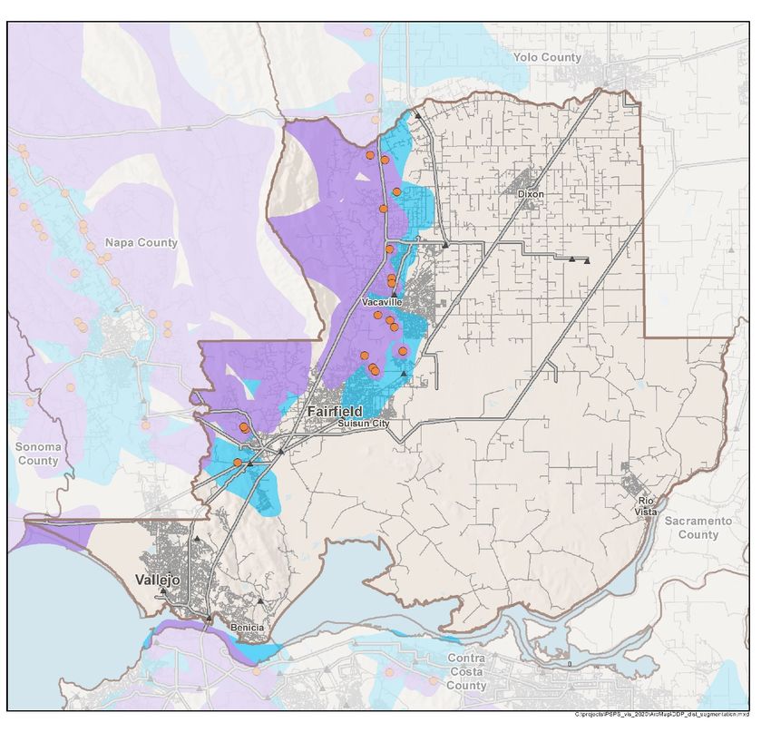
Key Objectives for 2020

          1           REDUCE WILDFIRE
                      IGNITION POTENTIAL
                        • Asset inspection and repair
                        • Enhanced vegetation
                          management
                                                                                                                                                                       3          REDUCE IMPACT OF
                                                                                                                                                                                  PSPS EVENTS
                                                                                                                                                                                     •
                                                                                                                                                                                     •
                                                                                                                                                                                         Reduce impacted customers
                                                                                                                                                                                         Reduce duration
                                                                                                                                                                                     •   Reduce frequency
                        • System automation                                                                                                                                          •   Improve coordination with
                        • System hardening                                                                                                                                               and support communities
                        • Public Safety Power Shutoffs                                                                                                                                   and customers

                                                                                        2           IMPROVE SITUATIONAL
                                                                                                    AWARENESS
                                                                                                       • Weather stations
                                                                                                       • High-definition cameras
                                                                                                       • Wildfire Safety Operations
                                                                                                         Center (WSOC)
                                                                                                       • Meteorology

All data is preliminary and based on early 2020 work planning. Data as of February 2020.
Following the wildfires in 2017 and 2018, some of the changes included in this document are contemplated as additional precautionary measures intended to further reduce future wildfire risk.                       4
2019 vs 2020 By the Numbers
                                                                                                                                                     2019                                 2020         2020
                    PROGRAM                                                                                                                          COMPLETE                             TARGET       PROGRESS

                      SYSTEM HARDENING                                                                                                              171                                   241          28
                      Stronger poles, covered lines and/or targeted undergrounding                                                                LINE MILES                           LINE MILES    LINE MILES

                      ENHANCED VEGETATION MANAGEMENT                                                                                              2,498                                 1,800         565
                      Inspecting, pruning and removing vegetation                                                                                 LINE MILES                           LINE MILES    LINE MILES

                      HIGH-DEFINITION CAMERAS                                                                                                       133                                   200          13
                      Improving real-time monitoring of high-risk areas and conditions                                                             CAMERAS                              CAMERAS      CAMERAS

                      WEATHER STATIONS                                                                                                              426                                   400          28
                      Enhancing weather forecasting and modeling                                                                                   STATIONS                             STATIONS     STATIONS

                      SECTIONALIZING DEVICES                                                                                                        287                                   592          28
                      Separating the grid into small sections for operational flexibility                                                           DEVICES                              DEVICES      DEVICES

                      TRANSMISSION LINE SWITCHES                                                                                                       0                                   23           1
                      Enabling targeted transmission outages to lessen downstream customer impacts                                                  DEVICES                              DEVICES      DEVICE

                      COMMUNITY RESOURCE CENTERS                                                                                                    111                                   201           1
                      Safe, energized locations for customers to receive basic resources and information                                      SITES ACTIVATED                       SITES TARGETED   SITE READY

All data is preliminary and based on early 2020 work planning. Data as of February 2020.
Following the wildfires in 2017 and 2018, some of the changes included in this document are contemplated as additional precautionary measures intended to further reduce future wildfire risk.                    5
2020 PSPS Improvements

                                    SMALLER IN SIZE                                               SHORTER IN DURATION                                              SMARTER FOR CUSTOMERS
                                                                                           Restore power for customers twice SMARTER
                                                                                                                              Provide more
                                                                                                                                       FORaccurate and timely
                                                                                                                                            CUSTOMERS
                      Reduce the number of customers
             GOAL

                                                                                           as fast after severe weather has   communications and additional
                      impacted by PSPS every year
                                                                                           passed                             customer resources
                       • Installing 23 transmission switches                                 • Adding more field crews to speed                                    • Enhancing meteorology technology
                         capable of re-directing power                                         inspection of lines                                                   to pinpoint severe weather
                       • Adding 592 sectionalizing devices                                   • Expanding helicopter fleet from                                     • Improving customer alerts with
                         that limit the size of outages                                        35 to 65 for aerial line inspections                                  earlier restoration timing
                       • Hardening poles/wires and                                           • Commissioning two new                                               • Upgrading Customer Resource
                         conducting targeted undergrounding                                    fixed-wing planes for aerial line                                     Centers with additional items and
                       • Developing temporary microgrids                                       inspections                                                           services
                                                                                             • Utilizing infrared equipment to                                     • Establishing a new collaborative
                                                                                               enable more inspections at night                                      working approach with cities,
                                                                                                                                                                     counties, tribes and critical service
                                                                                                                                                                     providers
                                                                                                                                                                   • Bolstering website and call center
                                                                                                                                                                     capacity
All data is preliminary and based on early 2020 work planning. Data as of February 2020.
Following the wildfires in 2017 and 2018, some of the changes included in this document are contemplated as additional precautionary measures intended to further reduce future wildfire risk.               6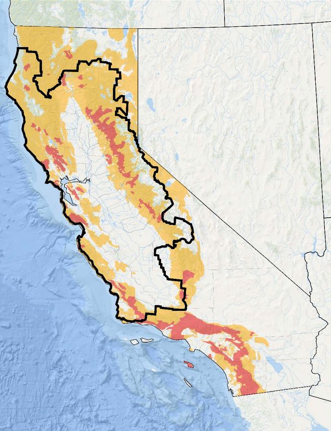
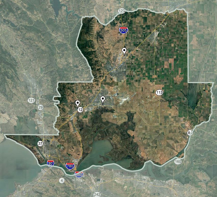
Review of County-Specific
Electric Grid
CIRCUIT MAP
Solano County Overview
                    CPUC High Fire-Threat District Map
                    Solano County
                                                                                                                                           1,554          total overhead distribution miles
                                                                                                                                           139 in Tier 2 | 0 in Tier 3
                                                                                          DIXON

                                                                       VACAVILLE
                                                                                                                                           589        total overhead transmission miles
                                                                                                                                           92 in Tier 2 | 0 in Tier 3

                                                               FAIRFIELD
                                                                                                                                              17 total substations
                                          VALLEJO
                                                          BENICIA
                                                                                                                                            174,800           total customers served
                                                                                                                                            8,000 Medical Baseline Customers
                                                                                           TIER 2
                                                                                           Elevated
                                                                                           TIER 3                                           750 total critical facilities
                                                                                           Extreme

All data is preliminary and based on early 2020 work planning. Data as of February 2020.
Following the wildfires in 2017 and 2018, some of the changes included in this document are contemplated as additional precautionary measures intended to further reduce future wildfire risk.   8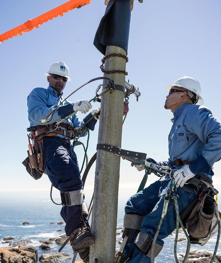
Electric Power Supply Solano County
                        High Fire-Threat District
                                Tier 2 – Elevated
                                Tier 3 – Extreme

                        PG&E Facility
                                Substation

                        Electric Transmission Line
                                60 kV
                                115 kV
                                230 kV
                                500 kV

                       2019 Peak Load:
                       631 MW

All data is preliminary and based on early 2020 work planning. Data as of February 2020.
Following the wildfires in 2017 and 2018, some of the changes included in this document are contemplated as additional precautionary measures intended to further reduce future wildfire risk.   9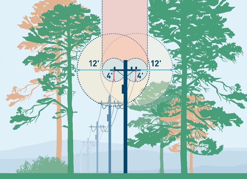
Grid Flyover
REDUCING FUTURE PSPS IMPACTS
Work In Your Community
LOCAL PROGRESS UPDATE IN SOLANO COUNTY
Prioritizing Wildfire Mitigation Activities

                    PG&E prioritizes wildfire mitigation work by evaluating which circuits in our service territory are at
                    the highest risk for wildfire. This is a dynamic and ongoing process.

                       We look at three key factors when
                       determining a circuit’s risk for wildfire:                                                                   Circuits at the greatest risk for wildfire are

                     1
                                                                                                                                    prioritized for:
                                  Likelihood of an ignition
                                                                                                                                                Inspections and repairs

                     2            How quickly a fire could spread in that
                                  location and potential impact
                                                                                                                                                Enhanced vegetation management

                                                                                                                                                System hardening

                     3            How easy it is to get in and out of the
                                  area in the event of a fire                                                                   NOTE: In some cases, PG&E made changes to the prioritization order
                                                                                                                                of circuits based on other factors (e.g., environmental issues, safety,
                        Working to include PSPS likelihood as an                                                                planned projects, geographic access and weather).
                        additional criteria

All data is preliminary and based on early 2020 work planning. Data as of February 2020.
Following the wildfires in 2017 and 2018, some of the changes included in this document are contemplated as additional precautionary measures intended to further reduce future wildfire risk.            12
PG&E In Your Community
2019 2020
WILDFIRE SAFETY PROGRAM EFFORTS COMPLETE TARGET
Weather Stations 3 IN PROGRESS*
Enhancing weather forecasting and modeling STATIONS
High-Definition Cameras 2 IN PROGRESS*
Improving real-time monitoring of high-risk areas and conditions CAMERAS
System Hardening 0 0
Stronger poles, covered lines and/or targeted undergrounding LINE MILES LINE MILES
Sectionalizing Devices 6 20
Separating the grid into small sections for operational flexibility DEVICES DEVICES
Enhanced Vegetation Management 21 30
Inspecting, pruning and removing vegetation LINE MILES LINE MILES
*Locations identified on a monthly basis
All data is preliminary and based on early 2020 work planning. Data as of February 2020.
Following the wildfires in 2017 and 2018, some of the changes included in this document are contemplated as additional precautionary measures intended to further reduce future wildfire risk. 13Weather Stations
We’re installing real-time tools to better
understand how severe weather can impact our
system and proactively respond to potential
threats.
Targeting one station roughly every 20 circuit-
miles in high fire-threat areas by 2022.
Weather stations installed to date
3
MAP LEGEND:
PG&E Weather Station installed
PG&E Weather Station planned
Remote Automated Weather Stations (RAWS)
within PG&E territory
Data available at mesowest.utah.edu
All data is preliminary and based on early 2020 work planning. Data as of February 2020.
Following the wildfires in 2017 and 2018, some of the changes included in this document are contemplated as additional precautionary measures intended to further reduce future wildfire risk. 14High-Definition Cameras
We’re supporting the installation of new
High-Definition cameras in high fire-threat
areas, which allow PG&E and first responders to
monitor wildfires in real time.
This will increase our coverage to more than 90
percent of our service territory by 2022.
Cameras installed to date
2*
MAP LEGEND:
PG&E High-Definition Camera installed
PG&E High-Definition Camera planned
Non-PG&E Camera that looks into PG&E territory
*2 Cameras on Mount Vaca bordering Napa and Solano Counties
All data is preliminary and based on early 2020 work planning. Data as of February 2020.
Images available at alertwildfire.org
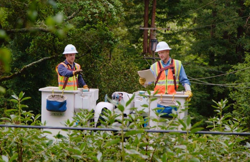
Following the wildfires in 2017 and 2018, some of the changes included in this document are contemplated as additional precautionary measures intended to further reduce future wildfire risk. 15System Hardening Overview
Our system hardening work involves:
2019 2020
Installing stronger and more resilient poles that will be set COMPLETE TARGET
deeper in the ground to better withstand high winds.
Re-framing poles to increase the separation of the 0
LINE MILES
0
LINE MILES
conductors.
Replacing bare conductors with larger, covered conductors.
Installing more poles than previously needed to support
the weight of the covered conductor and to meet new
utility standards.
No longer using trees to support PG&E infrastructure.
Adding down guys and anchors to some poles to prevent
leaning or falling.
Targeted undergrounding of select overhead lines.
All data is preliminary and based on early 2020 work planning. Data as of February 2020.
Following the wildfires in 2017 and 2018, some of the changes included in this document are contemplated as additional precautionary measures intended to further reduce future wildfire risk. 16PSPS Sectionalizing
We are increasing the quantity of 2019 2020
automated sectionalizing devices on COMPLETE TARGET
distribution lines to help minimize the
number of customers impacted by PSPS 6 20
outages. DEVICES DEVICES
200 customers associated with
new sectionalizing devices
To date, we have installed 8 devices in
your community. 100% of those devices
have remote control capabilities (i.e., are
SCADA-enabled).
All data is preliminary and based on early 2020 work planning. Data as of February 2020.
Following the wildfires in 2017 and 2018, some of the changes included in this document are contemplated as additional precautionary measures intended to further reduce future wildfire risk. 17Local Sectionalizing
Distribution sectionalizing device
planned for 2020
Potential PSPS Impact Area for
Planning Purposes:
Area potentially removed from scope
due to planned sectionalizing
New area now in scope
No change from 2019
PG&E Substation
Electric Transmission Line
60 kV; 70 kV; 115kV only
Electric Distribution Line
Note: Map reflects projects in planning
and/or underway and may not include all
miles planned for 2020
All data is preliminary and based on early 2020 work planning. Data as of February 2020.
Following the wildfires in 2017 and 2018, some of the changes included in this document are contemplated as additional precautionary measures intended to further reduce future wildfire risk. 18Temporary Microgrids and Local Resiliency
One of the ways PG&E is working to reduce PSPS impacts is through establishing new temporary
“microgrids” in portions of our service area most likely to experience future PSPS events. In 2019,
PG&E piloted a series of microgrids that were able to safely provide 4,800 customers across four
communities with electricity during PSPS Events.
In 2020 we plan to continue these efforts by: Example Placerville Temporary Microgrid
Targeting the development of additional
temporary microgrids, with more than 50 sites
currently being considered.
Exploring the ability to support communities and
customers to develop their own multi-customer
or community-level microgrids through our new
Community Microgrid Enablement Program.
We will have more information about site selection
and timing of microgrid projects in the coming months. The diagram above shows the approximate area a temporary microgrid
was able to serve in Placerville during a 2019 PSPS event using
temporary backup generation.
All data is preliminary and based on early 2020 work planning. Data as of February 2020.
Following the wildfires in 2017 and 2018, some of the changes included in this document are contemplated as additional precautionary measures intended to further reduce future wildfire risk. 19Enhanced Vegetation Management
We are exceeding state vegetation and fire safety 2019 2020
standards by addressing vegetation that poses a COMPLETE TARGET
higher potential for wildfire risk to maximize the
safety of our customers and communities. 21
LINE MILES
9
LINE MILES
This includes establishing increased safety
clearances between power lines and surrounding
vegetation in high fire-threat areas.
This also includes evaluating trees that pose a
potential risk to the lines if they are tall enough
to strike.
For illustrative purposes
All data is preliminary and based on early 2020 work planning. Data as of February 2020.
Following the wildfires in 2017 and 2018, some of the changes included in this document are contemplated as additional precautionary measures intended to further reduce future wildfire risk. 2030-Year Weather Analysis
30-Year Weather Analysis
                    PG&E analyzed 30 years of high-resolution data covering ~80 billion data points, as well as 26
                    years of wildfire data in our service territory to help determine the average likelihood and
                    frequency of a PSPS event.
                    The following weather model data points were analyzed:

                                                                                                                                            DEAD FUEL MOISTURE
                                            WIND SPEED
                                                                                                                                            (4 TYPES)

                                            WIND GUST                                                                                       LIVE FUEL MOISTURE

                                                                                                                                            FOSBERG FIRE
                                            TEMPERATURE
                                                                                                                                            WEATHER INDEX

                                                                                                                                            OUTPUTS FROM THE NATIONAL FIRE
                                            RELATIVE HUMIDITY
                                                                                                                                            DANGER RATING SYSTEM (4 MAIN OUTPUTS)

                                                                                                                            During an event, the meteorology model is updated
                                            PRECIPITATION
                                                                                                                            and run 4x daily.
All data is preliminary and based on early 2020 work planning. Data as of February 2020.
Following the wildfires in 2017 and 2018, some of the changes included in this document are contemplated as additional precautionary measures intended to further reduce future wildfire risk.   22
Probability of Outage Producing Winds (OPW)
KEY TAKEAWAYS
Datasets/Model
PG&E 30-year climatology
Outage activity from 2008
(over 300,000 unplanned events)
Analysis/Results
Wind speeds were extracted for each
outage record per location per hour from
climatology
Numerous wind-outage model fits were
tested
Operational high-resolution model
predicts the frequency of unplanned
outages based on location-specific wind-
outage model
All data is preliminary and based on early 2020 work planning. Data as of February 2020.
Following the wildfires in 2017 and 2018, some of the changes included in this document are contemplated as additional precautionary measures intended to further reduce future wildfire risk. 23PG&E Utility Fire Potential Index (FPI)
KEY TAKEAWAYS Analysis/Results
Datasets/Model Benchmarked FPI against agency and utility best practices
Evaluated dozens of parameters to determine best predictors of
PG&E 30-year climatology large fires
Fire Occurrence dataset from USFS (1992 – 2018) Constructed over 4,000 FPI model variants for predictive analysis
PG&E FPI outputs the probability of large fire occurrence
PG&E Utility FPI
+ +
Weather Fuels Land Type
Wind Speed, Dead Fuel Moisture Forest, shrub/brush
Temperature and and Live Fuel or grass-land
Humidity Moisture dominated
All data is preliminary and based on early 2020 work planning. Data as of February 2020.
Following the wildfires in 2017 and 2018, some of the changes included in this document are contemplated as additional precautionary measures intended to further reduce future wildfire risk. 24Integrating FPI and OPW Models
The Utility Fire Potential Index and Outage Producing Winds Model are used in unison to
analyze what conditions existed during the most catastrophic fires in California history to
forecast when catastrophic fires are most likely to occur in the future.
1
High Scenario: Winter Scenario: Wind Event with
Storm Dry Fuels
High Outage Probability High Outage Probability
Low Probability of an Ignition High Probability of an Ignition
Outage Becoming a Large Fire Becoming a Large Fire
Producing
Winds
(OPW) Scenario: Blue Sky Day in Scenario: Hot/Dry
February/March Summer Day
Low Outage Probability Low Outage Probability
Low Probability of an Ignition High Probability of an Ignition
Low Becoming a Large Fire Becoming a Large Fire
0 0.5
Low
All data is preliminary and based on early 2020 work planning. Data as of February 2020.
Fire Potential Index (FPI) High
Following the wildfires in 2017 and 2018, some of the changes included in this document are contemplated as additional precautionary measures intended to further reduce future wildfire risk. 2530-Year Weather Analysis Solano County
The following is a conservative estimate of
Annual Average of Local PSPS Events
potential PSPS events in your community based
(1989-2018)
on 30 years of data when FPI and OPW met the
PSPS criteria threshold.
6
Potential Historical PSPS
Events Over 30-year Period 5
50
40 39
30
33 4
20 18 18 16
15
10
7 7 11 9 3
10 4 8 43 23
2 3
0
JAN FEB MAR APR MAY JUN JUL AUG SEP OCT NOV DEC
2
Number of Events Red Flag Warning Days (2015-2019)
1
NOTE: Additional factors are considered before turning
0
power off for safety such as red flag warning days or
conditions on-the-ground during winter months.
1-2 events per year on average
All data is preliminary and based on early 2020 work planning. Data as of February 2020.
Following the wildfires in 2017 and 2018, some of the changes included in this document are contemplated as additional precautionary measures intended to further reduce future wildfire risk. 262020 Public Safety Power Shutoff FEEDBACK, PLANNING AND IMPROVEMENTS
What We Heard: PSPS Planning for 2020
We completed 36 sessions with counties and tribes impacted by the October and November 2019
PSPS events to listen to concerns, gather feedback and improve our coordination going forward.
Common Themes
Community Resource Centers PSPS Criteria
Advanced planning and/or additional resources Noted confusion regarding PSPS criteria and specific
weather conditions Solano County Feedback:
Accurate and Timely Event
Information Operational Briefings Requested reduction of PSPS
More timely and accurate event information for all Requested less frequent, streamlined and concise impacts to City of Vallejo
stakeholders briefings
Improvements to maps on PSPS
More Granular, Parcel-Level Maps Coordination with Telecom Providers portal
Noted need for circuit info Requested additional preparedness efforts for Telecom
Increase coordination with
Critical Facilities/Medical Baseline Assigned Liaison Representative telecommunication providers
Customers (previously referred to as “SPOC”)
Requested to review and align on lists Found the information flow through Assigned Liaison
Requested additional cameras
Representatives to be helpful
Backup Power and weather stations on Mount
Requested backup power support for critical Sectionalizing, Microgrids and Power Vaca
facilities Resiliency
Raised interest in other power resilience solutions
All data is preliminary and based on early 2020 work planning. Data as of February 2020.
Following the wildfires in 2017 and 2018, some of the changes included in this document are contemplated as additional precautionary measures intended to further reduce future wildfire risk. 28What We’re Doing In Response
Based upon feedback received, we are standing up multiple workstreams to improve
communications and make PSPS events smaller, shorter and smarter. Some of the key actions
underway include:
INFORMATION SHARING: POWER RESILIENCY:
Sharing circuit level planning maps of the electric infrastructure Working to establish more temporary
Improving PSPS notification process and mapping to provide more timely microgrids across our service area to
and accurate event information for all stakeholders help minimize the potential scope
of future events
Providing additional maps and weather data to help clarify how PG&E determines
when a PSPS event is necessary Installing ~600 automated reclosing
sectionalizing devices to remotely
Providing a live, interactive map during future PSPS events sectionalize portions of our electric grid to
Enhancing critical customer lists and updating PSPS data sharing policies related to reduce PSPS event scope and shorten overall
critical and Medical Baseline customers outage durations
CUSTOMER AND AGENCY RESOURCES: TELECOM COORDINATION:
Identifying more permanent CRC locations and working with the California Foundation Increasing coordination with telecom
for Independent Living Centers (CFILC) to assist the AFN population (i.e. transportation providers to improve alignment
resources) during PSPS events
Streamlining briefings for public safety partners and stakeholders
Continuing to provide Assigned Liaison Representatives (previously
referred to as “SPOCs”) to impacted counties and tribes
Working to streamline the portal to be more intuitive and timely
All data is preliminary and based on early 2020 work planning. Data as of February 2020.
Following the wildfires in 2017 and 2018, some of the changes included in this document are contemplated as additional precautionary measures intended to further reduce future wildfire risk. 29Event Communications
Once PG&E’s Emergency Operations Center (EOC) is activated, we will provide information
through the following:
Regional Twice-Daily Briefings at the Local Level
Hosted by Assigned Liaison Representatives (previously referred to as “SPOCs”) When and where
for counties and tribes. possible, we will strive
Event-specific information changes will be reviewed. to provide timely
information to
Opportunity to resolve local issues.
emergency service
Q&A session will be available.
agencies in advance of
notifying customers.
Once-Daily Cooperator Call
Calls will be 15-30 minutes and provide the latest high-level updates.
All counties and tribes within the service area are welcome to join
the call, as well as telecom service providers, water agencies, special
districts and other public safety partners.
Event-Specific Information
Up-to-date information will be provided twice-daily at regular intervals.
Information provided will include counties and tribes in scope, estimated time of de-energization, estimated
time of restoration, number of Medical Baseline customers and number and types of critical facilitates in scope.
All data is preliminary and based on early 2020 work planning. Data as of February 2020.
Following the wildfires in 2017 and 2018, some of the changes included in this document are contemplated as additional precautionary measures intended to further reduce future wildfire risk. 30Emergency Operations Center (EOC) Coordination
PG&E will offer the following resources to support local EOCs during a PSPS event:
Local EOC Liaison
An Assigned Liaison Representative can be embedded in a
county or tribe’s local EOC, upon request.
Assigned Liaison Representative
Counties and tribes will be assigned a single point of contact to
provide them updates twice-daily and help resolve local issues.
GIS Analyst
A PG&E GIS Analyst can be embedded in a county or tribe’s local
EOC upon request; remote support is also available, if preferred.
Third-Party Representative in the PG&E EOC
Per CPUC guidelines, cities, counties, tribes, water agencies and
telecom providers may request to send a representative to
observe the PG&E EOC in San Francisco during a PSPS event.
All data is preliminary and based on early 2020 work planning. Data as of February 2020.
Following the wildfires in 2017 and 2018, some of the changes included in this document are contemplated as additional precautionary measures intended to further reduce future wildfire risk. 31PSPS Agency Portal
A secure data transfer site (also known as “the portal”) is available for cities, counties, tribes and
emergency responders that require confidential customer data to support community needs
during an event. Based upon feedback received during the listening sessions, we are working to
streamline the portal and make it more intuitive and provide real-time updates.
The portal includes the following: CONCEPTUAL LAYOUT
1,262 portal users
Event-Specific Information as of 1/10/2020
Maps (GIS, PDF, KMZ)
CRC Location Information
Summary of Affected Customers
Summary of Affected Medical
Baseline Customers
NOTE: Though we are going to open the portal to all
public safety partners (including telecom, water
agencies and hospitals), not all partners will receive
confidential customer data.
All data is preliminary and based on early 2020 work planning. Data as of February 2020.
Following the wildfires in 2017 and 2018, some of the changes included in this document are contemplated as additional precautionary measures intended to further reduce future wildfire risk. 32Sample PSPS Event Map Refinement
Santa Rosa
2019 buffered event map (polygon level)
Proposed event map (parcel level)
All data is preliminary and based on early 2020 work planning. Data as of February 2020.
Following the wildfires in 2017 and 2018, some of the changes included in this document are contemplated as additional precautionary measures intended to further reduce future wildfire risk. 33Community Resource Centers
Earlier this year, PG&E conducted outreach to tribes and counties to streamline and enhance the
overall Community Resource Center (CRC) process, including working together to identify
permanent locations.
Our goal is to secure multiple hardened CRC The following resources will be available:
locations within each county and tribe.
We will set up and open a CRC as soon as possible
after the start of a PSPS event. Heating Power strips to Bottled Non-perishable
and cooling water snacks/fresh fruit
The location will be set up within the PSPS event charge devices
footprint and with the input of county OES/tribal
agencies.
During a PSPS event, the locations will be made Wi-fi Coffee/ Bagged Blankets
service tea ice
available to customers on pge.com/pspsupdates and
via social media, local news and radio.
ADA-accessible toilets and Security Chairs and
hand washing stations personnel tables
All data is preliminary and based on early 2020 work planning. Data as of February 2020.
Following the wildfires in 2017 and 2018, some of the changes included in this document are contemplated as additional precautionary measures intended to further reduce future wildfire risk. 34CRC Locations
Proposed CRC Locations Proposed
in Your Community CRC Locations
1 Solano Community College, Fairfield Dixon
2 Joseph Nelson Community Center, Suisun City
3 Solano Community College, Vacaville Vacaville
*Locations will be activated as needed, depending on
event scope and potential customer impacts.
Fairfield
Vallejo
Benicia
All data is preliminary and based on early 2020 work planning. Data as of February 2020.
Following the wildfires in 2017 and 2018, some of the changes included in this document are contemplated as additional precautionary measures intended to further reduce future wildfire risk. 35Identifying Critical Customers and Facilities
Before, during and after a PSPS event, PG&E provides advanced communication (when possible)
and prioritizes restoration to certain non-residential customers identified as “Critical.” These
customers include:
Public Safety Impacting Customer Schools
Level 1 – Public Safety Partner; Provides Emergency Services Level 1 – Universities/Higher Education Facilities
• Emergency Services: Fire and police stations; 911 Dispatch; EOCs
• Government Agencies: Government agencies critical to national defense/cybersecurity; Prisons and jails Level 2 – K-12 Schools
• Communications Services: Critical telecom infrastructure
• Water Agencies: Critical potable water/wastewater treatment
• Energy Sector: Publicly-owned utilities; Electric co-ops In 2019, PG&E conducted outreach to all 267
• Health Services: Emergency hospitals; Surgical centers cities and counties in our service area to receive
Level 2 – Supports Emergency Response Needs feedback on which customers they deemed
critical as well. Through this process:
• Emergency Services: Non-critical fire and police stations; Evacuation centers/shelters
•
•
Government Agencies: Local/state/national staging sites
Health Services: General hospitals; Hospice center; Kidney dialysis centers; Public Health Departments; etc. 85 Jurisdictions provided feedback
Critical customers
500+ were added to database
• Communications Services: Non-critical telecom infrastructure; Radio/TV broadcasting critical
facilities
• Chemical Sector: Fuel refineries; Hazardous materials facilities; etc.
Critical customers were
• Water Agencies: Non-critical potable water/wastewater treatment
• Transportation: Major local and national public transportation 800+ confirmed in database
As we approach the 2020 wildfire season, we continue to enhance and validate our critical customer lists through internal
process improvements and additional coordination with local governments. Outreach is expected to begin in April 2020.
All data is preliminary and based on early 2020 work planning. Data as of February 2020.
Following the wildfires in 2017 and 2018, some of the changes included in this document are contemplated as additional precautionary measures intended to further reduce future wildfire risk. 36Data Sharing and Critical Facilities
We have received a number of inquiries from government and tribal agencies related to
PG&E’s ability to share critical facility and Medical Baseline customer data both before and
during PSPS events.
We are currently reviewing and working to update our PSPS
data sharing policies, including working with the CPUC, by this
wildfire season.
In the interim, if your agency is willing to execute an updated
non-disclosure agreement (NDA), we can share sensitive
customer data via the agency portal in accordance with our
2019 policy.
To submit an NDA, or if you have questions related to the
agreement, please email wildfiresafety@pge.com.
All data is preliminary and based on early 2020 work planning. Data as of February 2020.
Following the wildfires in 2017 and 2018, some of the changes included in this document are contemplated as additional precautionary measures intended to further reduce future wildfire risk. 37Collaborating with the California
Foundation for Independent Living Centers
(CFILC)
PG&E and the CFILC will conduct a pilot program
to provide AFN community members with
support and resources to help them prepare for
disasters and extended power outages.
Through the initial agreement for this pilot program, PG&E and the California Foundation for
PG&E is providing funding to the CFILC beginning in Independent Living Centers (CFILC) are
October 2019 through October 2020.
working together to determine ways to
best serve the Access for Functional
The CFILC will determine who qualifies for resources
Needs (AFN) community before, during
through an application process. Medical needs and
income will be taken into account.
and after a Public Safety Power Shutoff
event or other emergency.
Applications will be accepted at CFILC locations. California Foundation for Independent Living Centers (CFILC)
Registered 501 (c)(3) non-profit
Your local CFILC location is:
450 Chadbourne Road, Suite C, Fairfield, CA 94534 For more information visit: cfilc.org
All data is preliminary and based on early 2020 work planning. Data as of February 2020.
Following the wildfires in 2017 and 2018, some of the changes included in this document are contemplated as additional precautionary measures intended to further reduce future wildfire risk. 38Sharing the Message
You can help your community take steps to prepare.
Encourage customers to update their contact information with
their utility provider.
Additional
materials are
Let customers know they may be eligible for the Medical available
Baseline Allowance. upon request
Remind residents to attend a local Community Wildfire Safety
Program open house (schedule to be found at pge.com/wildfiresafety)
Share our preparedness messages through your newsletter,
website or social media.
Let us know what other opportunities you see.
All data is preliminary and based on early 2020 work planning. Data as of February 2020.
Following the wildfires in 2017 and 2018, some of the changes included in this document are contemplated as additional precautionary measures intended to further reduce future wildfire risk. 39Next Steps
We want to coordinate with you to:
CONFIRM contact information
CONFIRM portal access
FINALIZE CRC locations
REVIEW critical facility information
DISCUSS PSPS communications timeline
All data is preliminary and based on early 2020 work planning. Data as of February 2020.
Following the wildfires in 2017 and 2018, some of the changes included in this document are contemplated as additional precautionary measures intended to further reduce future wildfire risk. 40Open Discussion
Thank You
Please direct customers with questions to:
  • Call us at 1-866-743-6589
  • Email us at wildfiresafety@pge.com
  • Visit pge.com/wildfiresafety
Appendix
Appendix Table of Contents

                        SLIDE # TOPIC

                              45          2019 PSPS Overview

                              46          PSPS Decision Framework Summary

                              47          PSPS Transmission-level Criteria

                              48          Agency Notifications

                              49          Microgrids

                              50          Undergrounding

                              51          Inspection Plans

                        52-58             Preparedness Resources

All data is preliminary and based on early 2020 work planning. Data as of February 2020.
Following the wildfires in 2017 and 2018, some of the changes included in this document are contemplated as additional precautionary measures intended to further reduce future wildfire risk.   44
2019 PSPS Overview
JUNE SEPT OCT OCT OCT OCT 26 - NOV
EVENT DETAILS
8-9 23 - 26 5-6 9 - 12 23 - 25 NOV 1 20 - 21
CUSTOMERS IMPACTED ~22,000 ~50,000 ~12,000 ~735,000 ~179,000 ~968,000 ~49,000
COUNTIES IN SCOPE 5 7 3 35 17 38 11
CRCs OPEN 4 8 3 33 28 77 34
PEAK WIND GUSTS 63 mph 58 mph 51 mph 77 mph 80 mph 102 mph 75 mph
DAMAGE/HAZARDS 5 4 2 116 26 554 15
AVG. OUTAGE DURATION
AFTER ALL CLEAR
5 HRS 7 HRS 4 HRS 25 HRS 5 HRS 22 HRS 10 HRS
AVG. OUTAGE
DURATION TOTAL
16 HRS 16 HRS 14 HRS 37 HRS 25 HRS 55 HRS 25 HRS
Note: All data is subject to change based on ongoing data reconciliation.
All data is preliminary and based on early 2020 work planning. Data as of February 2020.
Following the wildfires in 2017 and 2018, some of the changes included in this document are contemplated as additional precautionary measures intended to further reduce future wildfire risk. 45PSPS Decision Framework Summary
Distribution (i.e., below 60kV) and select 115 kV
Outage Producing Winds Fire Potential Index Extreme-Plus Threshold @ Threshold Analysis Safety Shutoff Decision
100%
Outage Producing Winds (OPW)
Probability by Location
Wind-driven Fires
of Consequence
Hot and Dry Summer
Fires of Consequence
0%
Low Fire Potential Index (FPI) High
Rating by Location
OPW compared to FPI and
Localized quantification of Calibrated to PG&E territory OPW vs. FPI analyzed at the 3 Decision is made
normalized by location
outage probability based on using 30-year climatology, km x 3 km grid across all of at the
indicates a threshold for
11-year outage history and historical fire occurrence and PG&E’s territory during a meteorological
mitigating historical wind-
30-year climatology analysis fire spread modelling potential PSPS event impact area
driven fires of consequence
Transmission (i.e., 60/70kV, 115kV, 230 kV, 500 kV)
Asset Health Wind Speed Threshold CAISO Coordination Public Safety Impact Safety Shutoff Decision
Risk assessed based on Determined wind speed Grid stability and potential
Real-time coordination
enhanced and accelerated threshold based on repair de-energization impacts Decision is made on a
studies with CAISO
inspections for all T-line history and asset conditions; considered (e.g., non- transmission line level that
determine- direct and indirect
structures in high fire-threat most conservative rating consequential loss, intersects within an FIA
impacts to grid integrity
areas in Q4 2018 – Q2 2019 assumed for an entire T-line generation loss)
All data is preliminary and based on early 2020 work planning. Data as of February 2020.
Following the wildfires in 2017 and 2018, some of the changes included in this document are contemplated as additional precautionary measures intended to further reduce future wildfire risk. 46PSPS Transmission-level Criteria
As part of our wildfire risk monitoring, we will review a transmission lines in
the potentially affected area.
• While no single factor will drive a PSPS, some
factors for a transmission-level event include:
Severity and duration of weather
Site-specific environmental conditions
that increase wear
Age and condition of the asset
Status of recent repairs
Real-time field observations
• If it is determined that a transmission line might
be de-energized for safety, PG&E works closely
with the California Independent System
Operator to assess the system impacts.
All data is preliminary and based on early 2020 work planning. Data as of February 2020.
Following the wildfires in 2017 and 2018, some of the changes included in this document are contemplated as additional precautionary measures intended to further reduce future wildfire risk. 47Agency Notifications
We will be following up with you to confirm we have your latest contact information.
2,195 total contacts 6 total contacts
(as of 2/4/2020) for Solano County
Contact List:
LAST FIRST PRIMARY
NAME NAME DEPARTMENT TITLE PHONE EMAIL
Ryan Donald OES Emergency (707)784-1600 dlryan@solanocounty.com
Birgitta County Administration (707)784-6100 bcorsello@solanocounty.com
Corsello County Administrator
Jones Shana CAL FIRE Local Cal Fire (707)967-1400 Shana.jones@fire.ca.gov
Vasquez John County Board of Supervisors Chair of the Board (707)784-6129 ehannigan@solanocounty.com
Chadwick Josh Fire Area Coordinator Fire Chief (707)590-3193 jchadwick@ci.benicia.ca.us
Ferrara Thomas Sheriff's Department Sheriff (707)784-7030 Tferrara@solanocounty.com
All data is preliminary and based on early 2020 work planning. Data as of February 2020.
Following the wildfires in 2017 and 2018, some of the changes included in this document are contemplated as additional precautionary measures intended to further reduce future wildfire risk. 48Microgrids – Community Microgrid
Enablement Program (CMEP)
PG&E is exploring the ability to support communities and customers to develop their own
multi-customer or community-level microgrids as a way to reduce PSPS impacts.
This may include sponsoring enhanced technical support for project
development, project tools and in some cases, one-time matching funds.
To qualify for this program, microgrid projects must meet the following criteria:
Serve areas that experienced a PSPS event in 2019
Located in an area that could be safely energized during a PSPS event
Serve one or more critical facility
Supported by local governments and stakeholders
This program is currently under development and pending approval by the CPUC.
All data is preliminary and based on early 2020 work planning. Data as of February 2020.
Following the wildfires in 2017 and 2018, some of the changes included in this document are contemplated as additional precautionary measures intended to further reduce future wildfire risk. 49Undergrounding
The process for identifying priority circuits for undergrounding includes the
following steps:
IDENTIFY overhead circuits with highest wildfire risk.
REVIEW of circuits by PG&E or contract staff specialized in electric systems, fire prevention
and suppression, construction and environmental impact.
CONSIDER if elimination of high-risk assets is possible (including if customers or
communities can be served through alternate means).
DETERMINE the most effective, timely and feasible approach. If undergrounding is not
feasible, a hardened and/or relocated overhead system can be pursued.
CONFIRM chosen risk mitigation approach and design (asset elimination, undergrounding
or hardened overhead) will reduce wildfire risk.
We will engage with local officials throughout this process to discuss decision factors and considerations. Note that
undergrounding is a complex process that can take years to complete. We will continue to take immediate wildfire safety
measures while work is planned.
All data is preliminary and based on early 2020 work planning. Data as of February 2020.
Following the wildfires in 2017 and 2018, some of the changes included in this document are contemplated as additional precautionary measures intended to further reduce future wildfire risk. 50Inspection Plans
PG&E completed safety inspections of all electric
infrastructure in areas of higher wildfire risk in 2019, as
part of our enhanced wildfire safety efforts.
In 2020, our System Inspections Program will continue
to evaluate our electric infrastructure on an ongoing
basis to find and fix potential risks to the safety and
reliability of our system.
Continuing in 2020, we are accelerating our inspection
cycles beyond minimum compliance regulations to
align with wildfire risk. This means HFTD Tier 2/Tier 3
areas will be evaluated more frequently.
Specifically for 2020, we are inspecting all assets in Tier
3 areas and one-third of assets in Tier 2 areas. All non-
HFTD areas will be inspected at minimum every six
years.
All data is preliminary and based on early 2020 work planning. Data as of February 2020.
Following the wildfires in 2017 and 2018, some of the changes included in this document are contemplated as additional precautionary measures intended to further reduce future wildfire risk. 51Preparing for Outages
The threat of extreme weather and wildfires continues to grow. We are asking
our customers to prepare their emergency plan using the checklist below:
PLANNING BASICS: FOR CUSTOMERS WHO USE ELECTRICITY
Keep a hard copy of emergency phone AND BATTERY-DEPENDENT DEVICES
numbers. Plan for any medical needs including
medications that need refrigeration or
Build or restock an emergency supply kit medical devices that require power.
Stock supplies to last a week — include flashlights,
fresh batteries, first aid supplies, food, water and cash. Ensure any backup generators
Practice manually opening their garage door. are ready to safely operate
Backup power safety tips
Designate an emergency meeting location. can be found at
Learn more at PG&E’s Safety Action Center pge.com/backuppower.
Visit safetyactioncenter.pge.com for helpful Consider staying with a
safety and preparedness tips in English, Spanish or
friend or relative during
Chinese.
an outage.
Update contact information. Visit prepareforpowerdown.com to
PG&E account holders can call download the Pacific ADA Center’s
us at 1-866-743-6589 or visit Emergency Power Planning Fact Sheet.
pge.com/mywildfirealerts.
All data is preliminary and based on early 2020 work planning. Data as of February 2020.
Following the wildfires in 2017 and 2018, some of the changes included in this document are contemplated as additional precautionary measures intended to further reduce future wildfire risk. 52Weather and PSPS Forecasting Website
PG&E has a dedicated weather
forecasting webpage.
pge.com/weather
Weather data and daily forecasting information,
including a 7-Day PSPS potential lookahead.
Lookahead shows when and where PG&E is
forecasting the type of conditions that may lead to a PSPS
event.
See live weather information from the hundreds of
weather stations PG&E has installed.
View images from the more than 150 high-definition
cameras PG&E has deployed in HFTD areas.
All data is preliminary and based on early 2020 work planning. Data as of February 2020.
Following the wildfires in 2017 and 2018, some of the changes included in this document are contemplated as additional precautionary measures intended to further reduce future wildfire risk. 53Safety Action Center
The Safety Action Center
contains helpful information about
wildfire risks and what customers
can do before, during and after an
emergency to keep their home,
family or business safe.
VISIT:
safetyactioncenter.pge.com
All data is preliminary and based on early 2020 work planning. Data as of February 2020.
Following the wildfires in 2017 and 2018, some of the changes included in this document are contemplated as additional precautionary measures intended to further reduce future wildfire risk. 54Backup Power and Air Quality
We are providing resources to help customers determine if backup power is right for them
as part of their preparedness plan.
A dedicated website and fact sheet on backup
power options that include:
Tips for assessing energy needs and choosing the right
backup power option.
Alternatives to generators, including portable power
storage and battery technology.
Guidance for how to safely use portable and permanent
stand-by generators.
Financing options including a list of resources.
A marketplace to search all major backup power
retailers and find energy efficient products.
Operating a backup generator may be subject
to air quality regulations; for information visit
pge.com/backuppower
arb.ca.gov/app/dislookup/dislookup.php.
All data is preliminary and based on early 2020 work planning. Data as of February 2020.
Following the wildfires in 2017 and 2018, some of the changes included in this document are contemplated as additional precautionary measures intended to further reduce future wildfire risk. 55Medical Baseline Program
Applying for Medical Baseline
What is Medical Baseline? 1 Complete the “Medical Baseline
Allowance” application form.
The Medical Baseline Program provides financial assistance to residential customers that Forms can be found by visiting
have special energy needs due to certain qualifying medical conditions. pge.com/medicalbaseline. Note:
Eligible customers may receive a “standard” Medical Baseline quantity of approximately 500 a licensed medical practitioner
must sign the application and
kilowatt-hours (kWh) of electricity and/or 25 therms of gas per month, in addition to certify the medical condition.
regular baseline quantities.
Mail the completed and signed
2 application form to:
Who Qualifies for Medical Baseline? PG&E
A licensed medical practitioner must certify that a full-time resident in your home is: Attention: Medical Baseline
P.O. Box 8329
Dependent on life-support equipment used in the home. Stockton, CA 95208
A paraplegic, hemiplegic, quadriplegic or multiple sclerosis patient with special heating
and/or air-conditioning needs.
A scleroderma patient with special heating needs.
Being treated for a life-threatening illness, compromised immune system or other medical
condition with special heating and/or air-conditioning requirements necessary to sustain
the patient’s life or prevent deterioration of the patient’s medical condition.
All data is preliminary and based on early 2020 work planning. Data as of February 2020.
Following the wildfires in 2017 and 2018, some of the changes included in this document are contemplated as additional precautionary measures intended to further reduce future wildfire risk. 56Update Contact Info
Make sure PG&E has your current contact information by visiting pge.com/mywildfirealerts today!
If we need to turn off power for Updates will also be provided through:
safety, we will attempt to Social media (Facebook, Twitter, Instagram)
contact PG&E account holders
This is an
important safety in advance by: Local news
alert from Pacific
Gas and Electric
Company Phone Radio
Text PGE.com
Email
Nixle
Nextdoor
We will be following up with you to confirm the latest agency
automated notification contacts and portal access users.
All data is preliminary and based on early 2020 work planning. Data as of February 2020.
Following the wildfires in 2017 and 2018, some of the changes included in this document are contemplated as additional precautionary measures intended to further reduce future wildfire risk. 57Additional Preparedness Resources
prepareforpowerdown.com
Statewide education and awareness resource, led jointly by PG&E, San Diego Gas &
Electric and Southern California Edison at the direction of the California Public
Utilities Commission (CPUC)
ready.gov
Disaster preparedness information from the U.S. Department of Homeland Security
readyforwildfire.org
CAL FIRE’s wildfire preparedness website
cpuc.ca.gov/wildfiresinfo
Information on the CPUC’s wildfire safety efforts
caloes.ca.gov
California Governor’s Office of Emergency Services website
firesafecouncil.org
California Fire Safe Council website
noaa.gov
National Oceanic and Atmospheric Administration website
All data is preliminary and based on early 2020 work planning. Data as of February 2020.
Following the wildfires in 2017 and 2018, some of the changes included in this document are contemplated as additional precautionary measures intended to further reduce future wildfire risk. 58You can also read