Marine Knowledge 2020 - Green Paper from seabed mapping to ocean forecasting - European ...
←
→
Page content transcription
If your browser does not render page correctly, please read the page content below
Green Paper
Marine Knowledge 2020
      from seabed mapping
      to ocean forecasting

      Maritime
      Affairs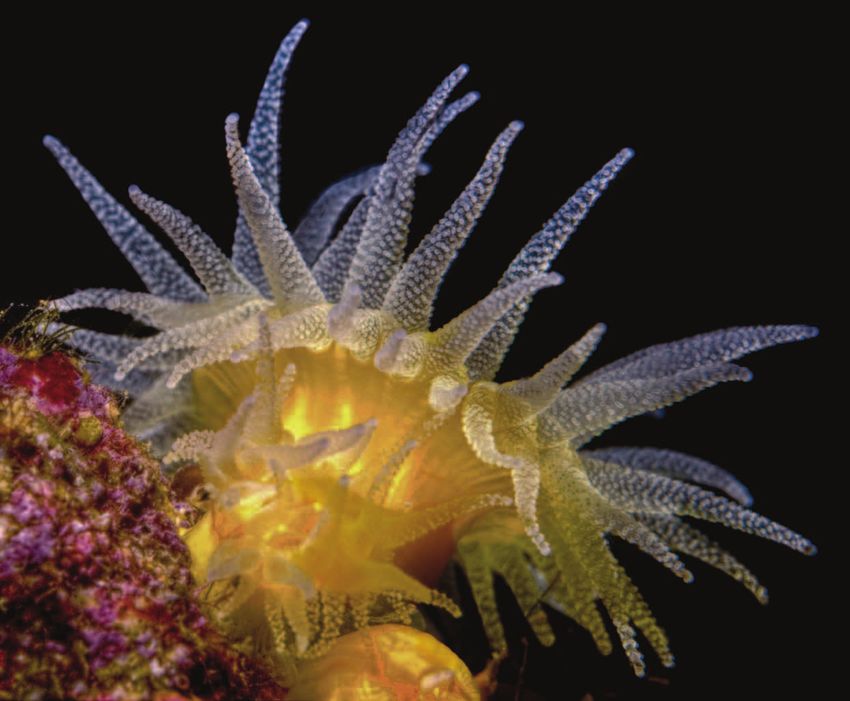
Europe Direct is a service to help you find answers
                                     to your questions about the European Union.

                                                      Freephone number (*):

                                              00 800 6 7 8 9 10 11
                                 (*) Certain mobile telephone operators do not allow access to 00 800 numbers
                                                           or these calls may be billed.

More information on the European Union is available on the Internet (http://europa.eu).

Cataloguing data can be found at the end of this publication.

Luxembourg: Publications Office of the European Union, 2012

ISBN 978-92-79-25350-8
doi:10.2771/4154

© European Union, 2012
Reproduction is authorised provided the source is acknowledged.

Cover picture: Sunset cup coral (Leptopsammia pruvoti) shot at the Marine Protected Area of Portofino, Italy. – © Marco Faimali.

Printed in Belgium

Printed on white chlorine-free paper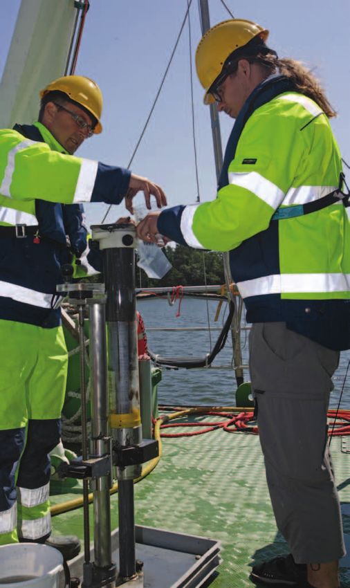
European Commission

      Green Paper
Marine Knowledge 2020
         from seabed mapping
          to ocean forecasting
                  COM(2012) 473 final

Directorate-General for Maritime Affairs and Fisheries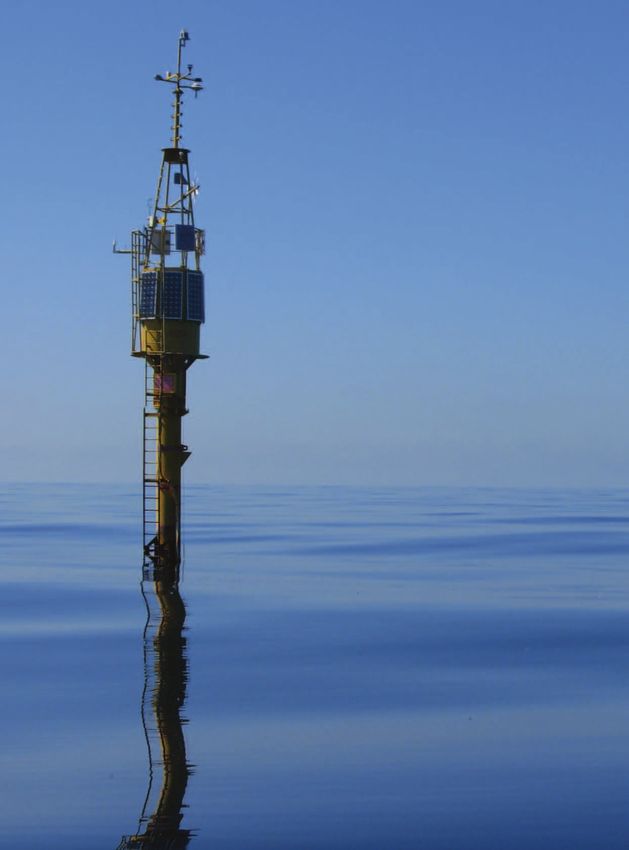
3

Table of contents
 1.    Vision                                                   5

 2.    This Green Paper                                         6

  3.   The need for marine knowledge                            8
3.1.   Industry                                                 8
3.2.   Public authorities                                       9
3.3.   Science                                                  9
3.4.   Civil Society                                            9

  4.   Availability and interoperability                        10
4.1.   Bottlenecks                                              10
4.2.   Multiple use of marine data                              10
4.3.   Competitiveness and Innovation                           11

  5.   Progress so far                                          12
5.1.   National efforts                                         12
5.2.   European Marine Observation and Data Network (EMODnet)   12
5.3.   GMES Marine Service                                      14
5.4.   Data Collection Framework for fisheries                  14
5.5.   Research                                                 15
5.6.   Environmental Reporting                                  16
5.7.   Climate Change Adaptation                                18
5.8.   International Initiatives                                18

  6.   Governance                                               19
6.1.   Balance between efforts of EU and Member States          19
6.2.   EU support to assembly and processing of marine data     19
6.3.   Involvement of Neighbours                                20
6.4.   Selecting priorities                                     20

 7.    Private sector involvement                               22

 8.    Responding to Green Paper                                23
4   GREEN PAPER

                  The open ocean observatory ODAS Italia 1 moored in the Ligurian Sea
                  and managed by the National Research Council of Italy
M ar i ne K no w l edge 2 0 2 0 from seabed mapp i ng t o ocean forecas t i ng 5
1 Vision
The oceans and seas that surround Europe offer
new opportunities to meet the Europe 2020
accompanied by access to timely observations
and information on the present and past physi-
goals (1). To realise this potential, we need to make cal, chemical and biological state of the overly-
it easier for companies to invest. We need to ing water column, by associated data on human
lower costs, reduce risks and stimulate innova- activities, by their impact on the sea and by oce-
tion. And we need to ensure that this expansion anographic forecasts. All this should be easily ac-
of the blue economy is sustainable. The resourc- cessible, interoperable and free of restrictions on
es are large but not infinite. To ensure that the use. It should be nourished by a sustainable pro-
expansion of the blue economy happens, that it cess that progressively improves its fitness for
is sustainable and that Europe’s seas will achieve purpose and helps Member States maximise the
good environmental status (2) we need to know potential of their marine observation, sampling
what the state of the sea is now, how it was in and surveying programmes.
the past and how it might change in the future.
The Commission aims to work together with While the EU can provide support through the
Member States to bring together available re- Common Strategic Framework for structural fund-
sources and mechanisms to deliver that knowl- ing, including the European Maritime and Fisheries
edge for the benefit of industry, public authorities, Fund, commitment from Member States and the
researchers and society. private sector is needed to achieve this goal.
This will include a flagship project to prepare
a seamless multi-resolution digital seabed map
of European waters by 2020. It should be of the
highest resolution possible, covering topography,
geology, habitats and ecosystems. It should be
© Roberto Bozzano and Sara Pensieri
1. Europe 2020 A strategy for smart, sustainable and inclusive growth Brussels, 3.3.2010 COM(2010) 2020.
2. As required under the Marine Strategy Framework Directive (2008/56/EC) by 2020.6 GREEN PAPER
2 This Green Paper
The Commission’s ‘Marine Knowledge 2020’
Communication of September 2010 (3), explained
These common principles, rules and standards en-
sure that Member States’ programmes, as well
why we need to unlock the economic potential of as other significant EU efforts can contribute,
Europe’s wealth of marine observations. It showed together with EMODnet, to create a capability
this would contribute towards meeting Europe much greater than the sum of its parts. These in-
2020 (4) targets on employment, innovation, edu- clude the marine service of the European Earth
cation, social inclusion and combatting climate moni-toring programme (GMES) (6), the Data
change. It would provide the knowledge base to Collection Framework in fisheries and new pan-
facilitate the growth of a sustainable, job-creating European research infrastructures identified by
‘blue economy’ in marine and maritime sectors by the European Strategy Forum for Research Infra-
improving the competitiveness and efficiency structures (ESFRI).
of industry, public authorities and researchers.
It would stimulate innovation and improve our un- Since the adoption of ‘Marine Knowledge 2020’,
derstanding of the behaviour of the sea. The there has been good progress. Preparatory actions
Communication then outlined the basic principles under the integrated maritime policy have deliv-
for a strategy that would enable investments in ered prototype thematic portals for EMODnet for
marine observation from Member States and the selected sea-basins. An interim evaluation (7) based
EU to realise their potential for creating sustaina- on user feedback has confirmed the basic sound-
ble growth and jobs. ness of the technological choices and the process-
es for assembling disparate data sets. On this
Central to this strategy was the concept of basis, a second phase of EMODnet, financed by
a European Marine Observation and Data Network the Integrated Maritime Policy Financial
(EMODnet (5)), a network of marine organisations Regulation (8), has begun. This will provide access
that would provide a single entry point for access- to a digital map of all European waters by the end
ing and retrieving marine data derived from ob- of 2014.
servations, surveys or samples from the hundreds
of databases maintained on behalf of agencies, This will show, through a single access point, the
public authorities, research institutions and univer- depth of water, as well as the nature of sedi-
sities throughout the EU. It would also deliver dig- ments, the whereabouts of minerals, zones of
ital map layers of parameters derived from these human activity and the type of habitat. It will be
primary data for entire sea basins around Europe. accompanied by observations of physical, chemi-
cal and biological parameters such as tempera-
But the ‘Marine Knowledge 2020’ initiative is ture, salinity, acidity, chemical pollution and
broader than EMODnet. It provides a unifying marine life. It will be tightly linked to the GMES
framework for all ongoing activities on marine ob- marine service which will continue to deliver pro-
servation within the EU. It embraces the full cycle, gressively more refined observations and fore-
from initial observation through to interpretation, casts of the state of the ocean.
processing and dissemination. It enshrines basic
principles such as ‘collect data once and use them However, there are a number of new challenges
for many purposes’ and ‘data should be interoper- to be faced:
able, accessible and free of restrictions on use’.
3. Marine Knowledge 2020: marine data and observation for smart and sustainable growth, 8.9.2010 COM(2010) 461.
4. See footnote 1.
5. In this Green Paper we will endeavour to limit the use of acronyms but please indulge us in this one which will recur
throughout the text.
6. Commission Communication on the European Earth monitoring programme (GMES), 30.11.2011, COM(2011) 831 final.
7. Annexed to this Green Paper.
8. Regulation (EU) No 1255/2011 of the European Parliament and of the Council of 30 November 2011 establishing
a Programme to support the further development of an Integrated Maritime Policy.M ar i ne K no w l edge 2 0 2 0 from seabed mapp i ng t o ocean forecas t i ng 7
(1) major EU initiatives, especially EMODnet and allow the creation and distribution, at least
GMES, have so far been implemented in some regions, of the much higher resolu-
through limited-duration projects that will tion product that users want.
finish by 2014.
(3) the 2014-2020 financial framework for the
(2) the prolonged financial crisis has focused at- EU offers an opportunity to develop a more
tention on public spending. There is an even sustainable governance structure in which
greater need to ensure that some one and the collection, assembly and dissemination
a half billion euro spent annually by EU of marine data moves from being a set of
Member States on Europe’s marine monitor- projects defined by the Commission to a con-
ing network is cost-effective. tinuous, integrated process with priorities
based on the needs of users in industry, pub-
(3) easier access to fisheries data has not lic authorities and the research community.
happened.
(4) the rapid expansion of offshore wind power
(4) the March 2011 earthquake and tsunami will transform, stimulate and augment
tragedy in Japan, followed by the nuclear ac- the overall marine economy. Benefits of
cident at Fukushima, highlighted the bene- better access to marine data calculated on
fits of bringing near-real time information the basis of the 2010 economy will be
on the state of the marine environment into underestimates.
the public domain.
(5) the new Horizon 2020 research programme
(5) uncertainty as to the present and future im- offers an opportunity to improve technolo-
pact of climate change on Europe’s seas and gies for gathering and processing marine
coasts is stalling local and regional authori- observations.
ties’ efforts to adapt.
(6) Member States and Associated Countries
and also new opportunities: have agreed to pool resources in a Joint
Programming Initiative ‘Healthy and Produc-
(1) a study (9) has shown that private companies tive Seas and Oceans’ that can provide
collect even more data than public authori- a framework for coordination of observation
ties, but these have not been incorporated programmes (10).
within EU initiatives so far.
This Green Paper takes stock of what has been
(2) what will be provided through EMODnet in done. It then opens a debate on the best strategy
2014 is an improvement over what exists for moving forward to a new phase that meets the
and will already provide useful services to challenges defined here and profits from the op-
public and private bodies. However, it does portunities to deliver an accessible, sustainable
not stretch the capabilities of current tech- digital mapping of European sea-beds by 2020. It
nology. The digital terrain model of the Euro- would also provide timely information on the pre-
pean seabed will be delivered at a resolution sent and past physical, chemical and biological
of about 250 metres; four times better than state of the overlying water column and forecasts,
what was previously publicly available on together with a process that helps Member States
a pan-European scale. Surveying instruments maximise the potential of their marine observa-
have a precision of centimetres, which would tion, sampling and surveying programmes.
9. Marine Data Infrastructure, Final Report submitted to DG Maritime Affairs and Fisheries, November 2009.
10. Commission Recommendation of 16 September 2011 on the research Joint Programming Initiative
‘Healthy and Productive Seas and Oceans’ (2011/C 276/01).8 GREEN PAPER
3 The need for
marine knowledge
3.1. Industry ancillary services such as cabling or supply net-
works. Or if all are obliged to carry out separate
Our seas and oceans can provide the stimulus we surveys of the sea bottom, to measure tide and
need to get our economies moving. They can pro- currents, assess marine life that might be dis-
vide challenging, rewarding jobs that meet the ex- turbed by their activity and monitor risks from tsu-
pectations of our young people. They can provide namis, storms or unfriendly marine life.
the clean energy we need if we are to avoid a cli-
mate catastrophe. They can provide protein for For instance, aquaculture operators need warn-
healthy diets. They can provide pharmaceuticals ings of approaching toxic algal blooms or jellyfish
or enzymes from organisms that inhabit the invasions. Mining companies need to know the to-
greatest extremes of temperature, light, and pres- pography and geology of the seafloor. Insurance
sure encountered by life. And a growing global companies and investors in ports and tourism
hunger for raw materials is increasing the eco- need data on past extreme events to estimate the
nomic attractiveness of deep-sea mining. likelihood of future damage and to develop cli-
mate-proof coastal infrastructure. Biotechnology
These new opportunities for blue growth and jobs companies looking for new pharmaceuticals or en-
are being driven by two developments. First, zymes to catalyse industrial processes need to
a shortage of available land and freshwater is en- know where to look for the strange life forms that
couraging mankind to look again at the 71 % of can live without light or withstand extremes of
the planet covered by saltwater. Second, rapid ad- temperature.
vances in underwater observation, remote han-
dling and construction technology, developed Marine knowledge is needed in the licencing,
primarily in the petroleum industry, now allow safe design, construction and operation of offshore in-
operations in deeper waters under a wider range stallations. A leading licensee of offshore wind en-
of oceanographic and meteorological conditions. ergy has argued (11) that marine data should be
a public good, that business could be more com-
In some sectors the growth is already happening. petitive and the cost of generating offshore ener-
For instance, wind energy is the fastest growing gy cut if there were clearer public policies on data
form of electricity generation in terms of installed ownership, less cost-recovery pricing from public
capacity. Already, 10 % of wind installations are bodies and common standards across jurisdictions
offshore and this proportion is growing. The and disciplines.
European Wind Energy Association reckons that by
2020, 30 % of new construction will be offshore And, since ‘even an entire society, a nation, or all si-
and 60 % by 2030. Success breeds success. multaneously existing societies taken together, are
Investments such as electricity grids for these not owners of the Earth. They are simply its posses-
offshore wind platforms will bring growth to other sors, its beneficiaries, and have to bequeath it in an
industries in their wake. improved state to succeeding generations’ (12), this
new marine economy needs to be sustainable.
However, working at this new frontier will inevita- Offshore operators need marine knowledge to
bly be costlier and riskier than operating on land assess and limit the environmental impact of any
if each offshore facility needs to construct its own proposed activity.
11. Twelfth meeting of Marine Observation and Data Expert Group, 10 March 2011
https://webgate.ec.europa.eu/maritimeforum/node/1709
12. Karl Marx, Capital Vol. III Part VI Transformation of Surplus-Profit into Ground-Rent.M ar i ne K no w l edge 2 0 2 0 from seabed mapp i ng t o ocean forecas t i ng 9
3.2. Public authorities With these observations, scientists can begin to
reduce uncertainty about the past and present be-
Coastal authorities need knowledge of erosion haviour of processes such as ocean circulation, ice
rates, sediment transport and topography to melting, sea-level rise, carbon uptake, ecosystem
determine whether protection, accommodation or shifts or ocean acidification – all of which have
retreat is the most appropriate strategy for man- significant impacts on human well-being and nat-
aging shorelines. Fisheries authorities need data ural ecosystems. Better monitoring of the seas
on past effort and catch composition to set quo- and oceans is not enough to reduce this uncertain-
tas for the following year. Public health authorities ty, but it is certainly necessary. The Economist (17)
need to assess whether the sea is safe for bath- has suggested that governments are not spend-
ing and seafood safe for eating. Civil protection ing enough on satellite observations.
authorities need to be able to calculate where an
oil spill will hit the shore. Coastguards need to Reducing uncertainty in the past and present can
know how long survivors of an accident can sur- improve forecasts for Europe’s climate that are
vive in the water. Environmental authorities need fed into the review and assessment process of the
to assess the environmental status of their seas Intergovernmental Panel on Climate Change
and oceans and to ensure they remain safe and (IPCC). Wide international participation and care-
clean (13). The achievement of EU goals on inte- ful peer-review ensure that the Panel’s assess-
grated coastal zone management (14) and maritime ments are the main vehicle for informing
spatial planning (15) requires knowledge of human government officials responsible for introducing
activities and sensitive habitats. Maritime surveil- adaptation measures.
lance by radar or sonar is improved with knowl-
edge of sea-surface conditions, temperature and
salinity. 3.4. Civil Society
Citizens in a democracy need information for hold-
3.3. Science ing their elected representatives to account on is-
sues that affect their neighbourhood, their
Scientific understanding underpins industrial inno- livelihoods, their health or the planet Earth that
vation and environmental protection. they wish to bequeath to their children. Experience
has shown it is wrong to assume that the techni-
Marine science depends on observations. We can- cal background to these issues is best left entirely
not run controlled experiments with two planet to the appropriate responsible authorities. An edi-
Earths. Only by looking back at the past can we torial in Nature (18) used the example of the
understand what might happen in the future. Gaps Fukushima accident to make the case that better
left in the record cannot be filled later. An edito- public access to data would contribute to better
rial on this subject in the scientific periodical risk assessment: ‘This would unleash the diverse
‘Nature’ argued that ‘an accurate and reliable re- creativity of academic researchers, journalists,
cord of what is going on can trump any particular software geeks and mappers’.
strategy for trying to understand it’ (16).
13. Directive 2008/56/EC of the European Parliament and of the Council of 17 June 2008 establishing a framework
for community action in the field of marine environmental policy (Marine Strategy Framework Directive).
14. Recommendation of the European Parliament and of the Council of 30 May 2002 concerning the implementation
of Integrated Coastal Zone Management in Europe OJ L 148, 6.6.2002, p. 24-27.
15. Maritime Spatial Planning in the EU – achievements and future development, COM/2010/0771 final.
16. Editorial Nature 450, 761 (6 December 2007).
17. Editorial Economist ‘Something to watch over us’. 12 May, 2012.
18. ‘A little knowledge’, Nature 472, 135 (14 April 2011).10 GREEN PAPER
4 Availability
and interoperability
4.1. Bottlenecks
The European Commission, in its 2010 Commu-
nication ‘Marine Knowledge 2020’ (19), pointed out
that bottlenecks were preventing investments in
marine data from delivering their potential bene-
fits. Data were held by hundreds of different insti-
tutions in the EU – hydrographic offices, geological
surveys, local authorities, environmental agencies,
research institutes, universities. Finding out who
held the data was a major challenge. Obtaining
them could take weeks of negotiation. And putting
them together to provide a complete picture could
be a complex and lengthy process. Many data were
typically neither accessible nor interoperable.
4.2. Multiple use of marine data
The same marine observations on physical, chemi-
cal and biological parameters can meet the needs
of a multitude of end-users. For example, data on
ocean temperature and salinity are used for as-
sessing ocean climate change, choosing sites for
aquaculture or determining the limits of sonar to
detect submarines. Data on seabed substrata are
needed to plan the extraction of aggregates or hy-
drocarbons, ensure secure foundations for wind
turbine platforms, or assess the impact of fishing.
The same data on marine habitats can be used to
assess the impact of a new facility or to report on
the state of the environment.
It is this multiple functioning of underlying marine
data across disciplines and sectors that makes an
open access policy the most efficient option. For
such a policy to be efficient and effective, the data
need to be publicly available and interoperable.
Bottom sediment sampling on board Commission policy is that marine data should
R/V Geomari in Gulf of Finland be relevant, accessible, free of charge and free of
© GTK
restrictions on use.
19. See footnote 3.Marine Knowledge 2020 from seabed mapping to ocean forecasting 11
4.3. Competitiveness that a 25 % reduction in uncertainty in future sea-
and Innovation level rise would save public authorities responsible
for coastal management approximately € 100 mil-
There is a clear cost to the fragmentation and lion per year.
inaccessibility of marine data. The impact assess-
ment (20) accompanying the Communication esti- An optimised, accessible and interoperable marine
mated that existing users would save € 300 observation system that helps scientists reduce
million a year if the data were properly integrated uncertainty would be a major contribution to cli-
and managed. These estimates do not take into mate change adaptation. Ocean acidification or
account inevitable future growth in the marine changes in ocean salinity and dissolved oxygen
economy and the consequent increased demand will certainly have an impact on marine ecosys-
for data. The first specific objective of ‘Marine tems and our ability to harvest from them. Earlier
Knowledge 2020’ is to reduce costs for industry, information will give industries such as that for
public authorities and researchers. shellfish aquaculture time to adapt. And, although
it is certain that the planet is warming, it is not
Without better accessibility to marine data, added- clear what is going to happen to local climates in
value services such as fish stock assessment or Europe over the next decades (22). However, it is
vulnerability of coastal infrastructure to storm known that changes in ocean circulation drive the
surges can only be provided by the organisations severity or mildness of Europe’s seasons. With
holding the data. This is inefficient and anti-com- more certainty, forecasts of energy demand or ag-
petitive. Opening up these resources allows new ricultural production can be improved. Investments
operators to enter the market. Interoperability al- in adaption can be made in confidence. The third
lows small businesses or academics to develop specific objective of ‘Marine Knowledge 2020’ is
new products and services based on data from dif- to reduce uncertainty in our understanding of the
ferent sources and of different types. The value of behaviour of the sea.
this to the EU economy is hard to estimate, but the
impact assessment suggested it could be of the These specific objectives were endorsed by the
order of € 200 million per year. The second specif- Council in December 2011 (23).
ic objective of ‘Marine Knowledge 2020’ is to stim-
ulate innovation.
1. Are there any reasons why there should
That estimate does not take into account a ration- be exceptions, other than those related
alisation of present marine observation systems to personal privacy, to the Commission’s
that would reduce uncertainty in our understand- policy of making marine data freely
ing of the behaviour of the sea. The economic available and interoperable?
value of this is even harder to guess, but could be
even greater. Indeed, uncertainty is a principal
enemy of those responsible for designing offshore
structures that can withstand the vagaries of the
sea, for managing fish stocks or for designing
protected marine areas. It has been estimated (21)
20. European Marine Observation and Data Network Impact Assessment, 8.9.2010, SEC(2010) 998.
21. See footnote 20.
22. The real holes in climate science Nature Vol 463, 21 January 2010.
23. 3139th Environment Council meeting Brussels, 19 December 2011.12 GREEN PAPER
5 Progress so far
5.1. National efforts 5.2. European Marine Observation
and Data Network (EMODnet)
Data on the marine environment are a valuable
asset. Long-term trends can only be distinguished The concept of a European Marine Observation and
from seasonal changes and decadal-scale natural Data Network (EMODnet) that would unlock frag-
variation if observations from the past, including mented and hidden marine data resources was
those collected before the advent of digital storage first mooted in the 2006 Green Paper for maritime
devices, can be compared with those of the pre- policy (26). EMODnet is a network of organisations
sent. If these data are lost they are gone forever. supported by the EU’s integrated maritime poli-
Observations cannot be repeated. cy. These organisations work together to observe
the sea, to render the marine data collected free-
And they need to be available for use immediately ly available and interoperable, to create seamless
to prepare for threats such as incoming oil-slicks. data layers across sea-basins and to distribute the
data and data products through the internet.
Accordingly, a number of Member States are set-
ting up national processes for proper stewardship A first set of preparatory actions was launched
of data that ensures not only safe archiving, but in 2009 to set up prototype data platforms. Six
also cataloguing using standards and technology thematic assembly groups – for hydrography, ge-
that allows fast retrieval of data through auto- ology, physics, chemistry, biology and physical
mated processes. These national systems are the habitats – brought together a network of 53 or-
foundations of the distributed processes that are ganisations. These were largely public bodies
being built up at EU level using INSPIRE (24) -based – hydrographic offices, geological surveys, ocean-
standards. Examples include MEDIN in the UK, the ographic institutes – that already manage marine
French Ifremer-Sextant geoportal, the German data themselves. They were supported by private
MaNIDA coordination of research data and their companies with expertise in data processing and
MDI-DE initiative for agencies. Regional initia- dissemination.
tives, such as the Spanish Balearic Islands Coastal
Observing and Forecasting System (25), can also These groups constructed internet gateways to
contribute. data archives managed by Member States and in-
ternational organisations. They reinforce and build
on ongoing efforts within the Member States such
2. How can Member States ensure that the as those listed in section 5.1. From these six por-
data they hold are safely stored, available, tals, public or private users of marine data can
and interoperable? now not only access the standardised observa-
tions themselves, together with data quality indi-
cators, but also data products such as sediment or
physical habitat maps for entire sea basins. No re-
strictions have been imposed on access or use of
these data products. The work builds on and rein-
forces the INSPIRE Directive (27), the Environmental
Information Directive (28) and the Directive on the
24. Directive 2007/2/EC of the European Parliament and of the Council of 14 March 2007 establishing an Infrastructure
for Spatial Information in the European Community (INSPIRE).
25. This is not an exhaustive list of national endeavours.
26. Green Paper ‘Towards a future Maritime Policy for the Union: A European vision for the oceans and seas’,
7.6.2006 COM(2006) 275.
27. See footnote 24.
28. DIRECTIVE 2003/4/EC of the European Parliament and of the Council of 28 January 2003 on public access
to environmental information.Marine Knowledge 2020 from seabed mapping to ocean forecasting 13
re-use of public sector information. The Common The thematic groups allow the appropriate experts
Information Sharing Environment (CISE) (29) will be to define a common structure for all data with-
able to import EMODnet data and so provide infor- in each theme. For instance, biological species ob-
mation (30) to maritime authorities in environment, servations need at least common descriptions for
fisheries, transport, border control, customs, and the time, place and method of sampling, the name
general law enforcement as well as defence. of the species and precision of measurement. The
interim evaluation of EMODnet (35) found the pro-
The work was guided and monitored by an inde- posed fields for thematic groups logical, but sug-
pendent group of experts and an interim eval- gested that consideration be given to merging the
uation (31) has confirmed the soundness of the hydrography and geology groups. Nearly all nations
approach. Accordingly, the work is being extend- have separate hydrographic agencies and geolog-
ed under the 2011 Regulation to support the ical surveys with separate missions, but there is
Integrated Maritime Policy (32) to cover all European now some overlap. Both are now concerned with
sea basins. A thematic group on human activi- environmental protection and some of the instru-
ties will be set up to complement the other six. By ments and methods used for surveys are the same.
2014, the aim is to deliver a medium-resolution (33) Both construct knowledge of the seafloor from
mapping of European seas for these seven themes. multibeam echosounder surveys.
The Regulation also supports prototype ‘sea-basin
checkpoints’ for the first time. These are mecha- 3. Are the seven thematic groups of the
nisms to identify whether the present observation European Marine Observation and Data
infrastructure is the most effective possible and Network the most appropriate? Should some
whether it meets the needs of public or private be combined? (e.g. geology and hydrography)
users. The first two will cover the North Sea and or should some be divided?
the Mediterranean.
4. What should be the balance in EMODnet
The Commission proposal for a new European between providing access to raw data and
Maritime and Fisheries Fund (34) under the 2014- developing digital map layers derived from
2020 financial framework aims to provide financial the raw data across seabasins?
support for EMODnet’s move towards operation-
al capability. With a secure budget, the Network
can move from being a set of finite-duration pro-
jects specified by the Commission to a continuous
and sustainable process, with priorities defined by
the needs of industry, public authorities and the re-
search community. Options for a governance struc-
ture for this process are outlined in section 6 of
this paper.
29. Directive 2003/98/EC of the European Parliament and of the Council of 17 November 2003 on the re-use
of public sector information.
30. Communication on a Draft Roadmap towards establishing the Common Information Sharing Environment
for the surveillance of the EU maritime domain, 20.10.2010 COM/2010/0584.
31. See footnote 7.
32. Regulation (EU) No 1255/2011 of the European Parliament and of the Council of 30 November 2011 establishing
a Programme to support the further development of an Integrated Maritime Policy.
33. For instance one eighth of a minute longitude and latitude for digital terrain model and 1:250 000 for seabed sediments.
34. Proposal for a Regulation of the European Parliament and of the Council on the European Maritime and Fisheries Fund,
2.12.2011, COM(2011) 804 final.
35. See footnote 7.14 GREEN PAPER
5.3. GMES Marine Service characteristics for the Marine Strategy Framework
Directive, as well as providing a valuable building
The European Earth monitoring programme block of the proposed new climate service.
(GMES) (36) is a flagship of European Union space
policy (37). The main objective of its marine service Standards are being developed so that both the
is to deliver products and services that added-val- GMES marine service and EMODnet can access the
ue service providers can build on to provide ser- same in-situ data.
vices to public and private users. The vision is to
ensure that products are developed from the most
advanced technology, satellite observations, com- 5. Should a common platform be set up to
putational power and forecasting capability avail- deliver products from both GMES and
able in Europe. EMODnet?
Under the GMES programme, a marine service has 6. Should the GMES marine products and
been progressively developed and implemented by service also be tailored for use by those
60 organisations. This processes and analyses in- studying climate change and environmental
formation from in-situ and space measurements protection as well as those needing
to deliver two classes of information: (1) ocean a near-real-time operational service?
observations and (2) monitoring and forecasting.
Ocean models are used to deliver three-dimen-
sional past, present and future ocean states (38) at 5.4. Data Collection Framework
a global and European sea-basin level for differ- for fisheries
ent parameters such as sea temperature, currents,
salinity, sea ice, sea level, wind and biogeochem- Since 2001 (39), the EU has funded the collection
istry. Until now, this marine service has been fund- and dissemination of data on EU fisheries by na-
ed through the EU’s research budget. As of 2014, tional authorities. Data from surveys, samples
GMES will enter its full operational phase and and reported catch, effort and discarding ena-
should be funded through an operational budget. ble the impact on the fish stock to be assessed.
Parameters such as fleet capacity, employment
In addition to the marine service which has, up and profitability also enable analysis of the so-
to now, focused on observation and providing cio-economic health of fishing communities. The
near-real time and forecasted information on primary purpose is to support management of
the oceans, a GMES climate service is proposed. the Common Fisheries Policy, though a revision in
The simulation models of the current marine ser- 2008 (40) extended the data to the aquaculture and
vice need to be calibrated and validated against processing sector and widened access for scientific
observations of the past, so the marine service al- or public awareness purposes.
ready has the capacity to store and process these
time series of ocean observations. This investment
will be useful for determining changes in ocean
36. See footnote 6.
37. Communication ‘Towards a Space Strategy for the European Union that benefits its citizens’ 4.4.2011 COM(2011) 152.
38. Effectively the oceanographic equivalent of a weather forecast.
39. Council Regulation (EC) No 1543/2000 of 29 June 2000 establishing a Community framework for the collection and
management of the data needed to conduct the common fisheries policy.
40. Council Regulation (EC) No 199/2008of 25 February 2008 concerning the establishment of a Community framework for
the collection, management and useof data in the fisheries sector and support for scientific advice regarding the Common
Fisheries Policy.Marine Knowledge 2020 from seabed mapping to ocean forecasting 15
Article 37 of the Common Fisheries Reform pro- 7. Should data that is assembled under the
posal (41) goes further. It obliges Member States Data Collection Framework for a particular
to collect biological, technical, environmental and purpose such as a fish stock assessment be
socio-economic data and to cooperate regional- available for re-use without the requirement
ly. These provisions of the Basic Regulation will to obtain authorisation from the original
replace the 2008 Regulation. The details will be providers of these data?
spelled out in a new EU Multi-Annual Programme
for 2014-2020. 8. Should an internet portal similar to those for
EMODnet be set up to provide access to data
The Commission proposal for a new European held by Member States, as well as data
Maritime and Fisheries Fund (42) under the 2014- assembled for particular stocks, particular
2020 financial framework proposes that the Data fleet segments or particular fishing areas?
Collection Framework for Fisheries shift from If so, how should it be linked to EMODnet?
centralised to shared management, so that
Member States take over responsibility for manag- 9. Should control data, such as that derived
ing funding and monitoring implementation from from the Vessel Monitoring System that
the Commission. tracks fishing vessels, be made more
available? If so, how can confidentiality
In general, fisheries advice requires data from all concerns be resolved?
countries that fish a particular species or particu-
lar area. Once the data are assembled for a specif-
ic purpose, the aggregated data may be published
in a report. However, the raw data provided by the 5.5. Research
Member States cannot currently be distributed for
other purposes without the consent of those who EU Member States spend approximately € 1.85
provided the data. In practice, this procedure is so billion a year on marine research. About half is
cumbersome that it never happens. This leads to on infrastructure for facilitating observation. This
a lack of independent checks, which severely lim- includes ships, underwater observatories, float-
its confidence in the results and stifles innovation. ing buoys, drifting devices, remotely operated or
autonomous underwater vehicles, all equipped
The Commission believes that overcoming is- with a range of sensors and analytical capabili-
sues of personal and commercial confidentiality is ties. The European Strategy Forum for Research
straightforward. It is perfectly feasible to distribute Infrastructures (ESFRI) has currently identified six
fisheries information that meets all requirements pan-European infrastructures that will have an es-
for understanding the ecosystem without reveal- sential role for the European marine research com-
ing the activity of individual vessels. The new Multi- munity. The Commission’s 2010 Communication on
Annual Programme 2014-2020 has been framed an ‘Innovation Union’ proposes that 60 % of infra-
accordingly. structures identified by ESFRI be launched or con-
structed by 2015.
Currently, EMODnet does not provide access to data
collected under the Data Collection Framework.
41. Proposal for a Regulation on the Common Fisheries Policy [repealing Council Regulation (EC) No 199/2008] COM(2011) 425.
42. Proposal for a Regulation of the European Parliament and of the Council on the European Maritime and Fisheries Fund,
2.12.2011, COM(2011) 804 final.16 GREEN PAPER
The EU’s contribution to marine and maritime re- 10.What should be the focus of EU support
search related actions in the Seventh Framework to new marine observation technologies?
Programme amounted to € 350 million (43) annu- How can we extend ocean monitoring and
ally. € 25-30 million per year of this is dedicated its cost effectiveness? How can the EU
to marine research infrastructures and research strengthen its scientific and industrial
on marine observation technologies (sensors and position in this area?
systems for marine observation). The Framework
Programme has also supported the SeaDataNet 11. Should there be an obligation for research
project, which has been instrumental in harmonis- projects to include a provision ensuring
ing marine data standards and ensuring interop- the archiving and access to observations
erability between marine databases. SeaDataNet collected during the research project?
technology is fundamental to the EMODnet plat-
form. Other EU projects make observations to im-
prove our knowledge of the sea.
5.6. Environmental Reporting
The Commission’s ‘Horizon 2020’ proposal for
a research and innovation programme in the years A wide range of data is collected by Member
2014-2020 includes a larger budget and simpler States to implement EU Directives such as the
procedures than the outgoing programme. This re- Water Framework Directive, the Bathing Waters
search programme can contribute to the ‘Marine Directive, the Habitats Directive, and, most re-
Knowledge 2020’ objectives through (1) support cently, the Marine Strategy Framework Directive.
to the development and integration of marine re- Member States also report environmental indica-
search infrastructures at EU level, (2) development tors to regional sea conventions such as OSPAR,
of user-oriented and cost-effective marine obser- HELCOM, the Barcelona Convention and the
vation technologies, (3) research projects that will Bucharest Convention. As part of the obligations of
deliver data on the marine environment and its in- the Marine Strategy Framework Directive, Member
teractions with human activities, including for the States have a legal obligation to report data un-
Marine Strategy Framework Directive. derlying initial assessments and stemming from
monitoring programmes to the Commission and
To encourage the development of intellectual prop- the European Environment Agency. The reporting
erty, ideas developed in EU research programmes requirements of the Marine Strategy Framework
become the property of the researcher. So new Directive are the basis of the marine component
sensors or marine observation platforms will not of the Water Information System for Europe, WISE-
only support more efficient, effective monitoring Marine. Under Article 19 of the Marine Strategy
of our seas and oceans, but can also provide the Framework Directive, there is a requirement for
basis for export potential in a high-technology sec- Member States to provide access to data resulting
tor with a global market. from the assessments and monitoring. EMODnet
will be used to enable this access.
However, ocean observations themselves cannot
be patented and will benefit the economy most if The European Environment Agency has been fully
they are made freely available. At present, many involved with the development of EMODnet. The
of these observations are not disseminated once prototype portals already built in the first phase
the research project has finished. This is partly be- of the project and the more advanced ones being
cause researchers wish to publish their results be- prepared in the second phase were specifically
fore releasing them, but also because there are designed to deliver parameters that can be used
no incentives or requirements for them to make for constructing indicators that will be necessary
the effort. to assess the state of the environment under the
Marine Strategy Framework Directive.
43. Out of a total of € 5.4 billion on average.Marine Knowledge 2020 from seabed mapping to ocean forecasting 17
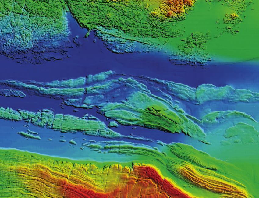
© Geological Survey of Ireland & Marine Institute
Bathymetry of Aran Sound, Galway Bay, Ireland –
INFOMAR Mapping Programme
The reporting protocols used for different report- 12. Should the ‘push’ process whereby marine
ing mechanisms are not necessarily the same, but environment reports are delivered be
in the context of the Marine Strategy Framework progressively replaced by a ‘pull’ process,
Directive, greater convergence is expected. And whereby data are made available through
while some of the data used to construct the indi- the internet and harvested by the competent
cators reported to the competent authority or the authority using technology developed
Commission are publicly available, many are not. through EMODnet?18 GREEN PAPER
5.7. Climate Change Adaptation 5.8. International Initiatives
To support the development and dissemina- Piecing together a global picture of the marine
tion of the knowledge base on adaptation, the world and how it is changing requires observa-
Commission launched the European Climate tions and data from organisations outside Europe
Adaptation Platform, CLIMATE-ADAPT (44) in March as well as inside. More structured and open access
2012, a publicly accessible internet site to sup- to European marine observations and data, as de-
port policy-makers in the development of climate scribed in this Green Paper, will enable Europe to
change adaptation measures and policies at EU, provide a practical contribution to international ef-
national, regional and local levels. CLIMATE-ADAPT forts to provide global coverage such as the Global
features a section on EU marine and fisheries poli- Ocean Observing System (GOOS), the Global Earth
cies, indicators of climate change and a database Observation System of Systems (GEOSS) and the
of adaptation case studies, in particular those from United Nation process for global reporting and as-
OURCOAST (45). The Commission is developing a pro- sessment of the marine environment.
posal for an EU Adaptation Strategy, to be adopt-
ed in 2013.
14. A
re any additional measures required, over
A more structured approach to marine observations and above existing initiatives such as EMOD-
can deliver more accurate indicators of local chang- net and GMES, to enable Europe to support
es in climatic parameters such as sea-level rise and international initiatives on ocean data such
ocean acidification to the CLIMATE-ADAPT platform as GOOS and GEOSS?
and therefore help the adaptation process.
13. What information on the behaviour of our
seas and coasts can best help business and
public authorities adapt to climate change?
44. http://climate-adapt.eea.europa.eu
45. http://ec.europa.eu/ourcoast/Marine Knowledge 2020 from seabed mapping to ocean forecasting 19
6 Governance
A sustainable marine data infrastructure requires
a process to decide which observations to make,
6.2. EU support to assembly and
processing of marine data
to choose which data products to create and to
provide financial support for the process of col- Up to now, services from each thematic assem-
lection, assembly, processing and dissemination. bly group in EMODnet have been delivered by
consortia through procurement contracts, with the
six consortia selected through separate calls for
6.1. Balance between efforts tender for each group. In all, 53 different organi-
of EU and Member States sations have been involved as partners in the con-
sortia, with many others contributing. Grants to the
Member States have a legal responsibility to mon- GMES marine service have been awarded follow-
itor their own waters and their own fishing fleets. ing open calls for proposals. Again, about 60 or-
Nevertheless, in some cases, there are clear ad- ganisations are involved. The EU budget pays for
vantages in pooling efforts. The obvious example the delivery of defined outputs in procurements
is observation from Earth-orbiting satellites. It and contributes towards agreed eligible costs in
would clearly be inefficient for each Member State grants. The partnerships in both EMODnet and
to launch a constellation of satellites to measure GMES are heterogeneous. They include research
ocean colour, sea-surface temperature, sea-level institutes, agencies for meteorology or hydrogra-
and ice extent. Indeed, the EU has supported the phy and universities. Some private companies pro-
development and initial operation of satellites vide software expertise.
through its GMES programme (36). The EU also sup-
ports survey and sampling programmes in fisher- The Commission has no influence over the compo-
ies, where it requires the results for its own sition of these partnerships; they are self-selected.
purposes. The large partnerships are an indication that the
agencies or institutes involved prefer to be joint
However, there are other examples where effort owners of a common enterprise rather than sup-
at an EU level might be justified. For instance, re- pliers to a single lead contractor.
ducing uncertainty in the magnitude and impact
of climate change in Europe is impossible without The open calls in both cases ensure transparency
monitoring the subsurface currents of the Atlantic and the results in both cases have been very satis-
in areas outside territorial or jurisdictional waters. factory. However, as the initiatives mature, there is
Doing so does not benefit the Member State doing a need to ensure the long-term continuity of oper-
the monitoring more than any other Member ations and infrastructure. Since much of the work
State. It benefits all European countries, even in EMODnet involves the remodelling of national
landlocked ones. data archives, no partnership without the participa-
tion of the major national marine data centres can
The Arctic Ocean is another example where the EU be complete. This might indicate the desirability of
could contribute to ongoing monitoring and map- moving to a grant or a negotiated procedure which
ping programmes to provide support for those could be easier if the EMODnet partnerships had
who live and work there. a legal status. Governance issues for the GMES
marine service include a legal entity for the coor-
dination and an appropriate financial mechanism.
15. What criteria should be used to determine
EU financial support of observation pro-
grammes other than those that it already 16. H
ow could the governance of EMODnet
supports? Can you provide examples? and GMES evolve to better accommodate
Could the Joint Programming Initiative for the need for long term sustainability?
European Seas and Oceans play a role?20 GREEN PAPER
17. What could be the role of the Joint The process to select Earth observation satellites
Research Centre and the European needed to monitor the oceans is similarly satis-
Environment Agency? factory. It has been defined through the GMES
process by determining which parameters
Earth-orbiting satellites can actually observe
6.3. Involvement of Neighbours from a height of about 800 kilometres above the
ocean. Technological progress and better scien-
Europe’s seas do not only wash the shores of tific understanding enable progressive improve-
EU Member States. Understanding the ecologi- ments in accuracy and the addition of more
cal health of the Black Sea or planning a cross- parameters. For instance, the operational moni-
Mediterranean cable requires cooperation with the toring of sea-ice thickness will become feasible
neighbouring countries that share these sea-ba- with the launch of Sentinel-3. The European
sins. For this reason, institutes from these countries Environment Agency is in the process of identi-
have taken part in the first phase of the EMODnet fying what other (non-satellite) measurements
construction. They too are faced with unaccepta- are needed to calibrate and validate GMES fore-
ble levels of unemployment and they too can ben- casting models (47).
efit from knowledge that will help them understand
how to take advantage of offshore opportunities. For other observations, more needs to be done.
Since shifting currents, migrating species and
many economic activities do not respect national
6.4. Selecting priorities borders, the question on optimum observation
and sampling infrastructure needs to be an-
Mapping and monitoring the sea is, for reasons swered at sea-basin level. Within the integrated
set out above, essential for sustainable economic maritime policy regulation (48), a prototype mech-
growth, environmental protection and under- anism has been set up to help Member States
standing climate change. However, public budg- hone their observation and monitoring infra-
ets are limited and priorities need to be decided. structure. The ‘sea-basin checkpoints’ for the
As we shift from a paradigm of collecting data North Sea and the Mediterranean will evaluate
for specific purposes to collecting them once and by 2014 how well the present monitoring and as-
using them for different purposes, two specific sembly network meets the needs of private,
questions need answering: (1) what observation public and academic users. They will determine
infrastructure and sampling strategy are needed the relative merits of different monitoring sys-
for a particular sea-basin? and (2) how can the tems – ferryboxes, fixed buoys, floats – measur-
EU’s financial contribution provide the most ing the same parameter. All information sources
added-value? will be considered; public and private. This infor-
mation will help guide Member States in their
The Data Collection Framework is satisfactory on investments. For instance, should multibeam sur-
both counts. A process is in place to define what veying of the seabed be accelerated, or is more
data need to be collected. Since an objective of accurate information needed on changes in
the Common Fisheries Policy is to limit the envi- sea-level?
ronmental damage of fishing (46), the sampling
strategy already goes beyond the interest in
maximising the fish yield.
46. Council Regulation (EC) No 2371/2002 of 20 December 2002 on the conservation and sustainable exploitation
of fisheries resources under the Common Fisheries Policy.
47. Through the Seventh Framework Programme project GISC (GMES in-situ coordination).
48. See footnote 8.Marine Knowledge 2020 from seabed mapping to ocean forecasting 21
Similar choices need to be made at an EU level. 18. Is a regular process needed to evaluate
In the proposed marine knowledge component of the effectiveness of the observation and
the Europe Maritime and Fisheries Fund, is it sampling strategy for each sea-basin?
more urgent to focus on assembling data on
mineral resources or on marine mammals? 19. W
hat mechanism could be envisaged to
Should the EU support surveying or sampling in manage the evaluation and assessments
international waters? Ultimately, Member States needed to inform the Commission, Member
must make these decisions in the framework of States and Parliament on priorities for
the Council, but they need to have a proper eval- EU support?
uation of the options to guide them. The answers
to these questions will depend on estimated
costs and benefits.22 GREEN PAPER
7 Private sector
involvement
Marine industries will certainly benefit from the
measures outlined in this paper, but there is po-
There may also be a case for extending report-
ing obligations once the licence has been grant-
tential for increasing these benefits by encourag- ed. The cost of instrumenting offshore platforms
ing the engagement of the private sector. to provide continuous information on the state of
the sea would be an almost negligible increase
According to a 2009 study (49), more marine data in the overall costs of the installation. The idea
is collected by European companies than by the would be to collect data from all EU platforms
public sector. If a private company collects data as well as other observing platforms and make
for its own purposes then, in principle, there is no them publicly available. This could well cost less
reason for public authorities to intervene or inter- than the potential benefit to the whole offshore
fere. European legislation on access and re-use of industry of obtaining better knowledge of poten-
these data does not apply. tial threats such as rogue waves (50), poisonous
algae or radioactive leaks Improving the compet-
However, private companies are already obliged itiveness of offshore business has been a prime
to collect data as part of the impact assess- motivation for ‘Marine Knowledge 2020’. A pub-
ment they have to carry out to obtain a licence lic-private partnership whereby private compa-
for certain offshore activity. They may also be nies share the expenses of running the European
obliged to continue monitoring once operations Marine Observation and Data Network in return
start. In many cases, they are obliged to hand for a say in the setting of priorities could accel-
the data collected over to the licensing author- erate this process.
ity. However, once the licence has been granted,
there is no apparent competitive disadvantage in
releasing these data into the public domain. The 20. Under what circumstances should data
Commission is aware that imposing reporting ob- provided by private companies for licencing
ligations on private companies under normal cir- purposes be made publicly available?
cumstances creates an administrative burden
that is to be avoided. However, replacing a hotch- 21. Should licenced offshore private sector
potch of different obligations with a single re- actors be obliged to contribute to wider
porting mechanism with common INSPIRE-based monitoring of the sea where this is feasible?
standards could reduce the existing burden. A
study has been launched to help assess costs 22. What public-private partnership models can
and benefits. maximise incentives for industry to share
data and investments in data as well as
benefits to all stakeholders?
49. Marine Data Infrastructure, Final Report submitted to DG Maritime Affairs and Fisheries, November 2009.
50. Also known as freak waves, monster waves, killer waves, extreme waves or abnormal waves.You can also read