Paddling Guide Great Adirondack Waterways - Adirondack Park
←
→
Page content transcription
If your browser does not render page correctly, please read the page content below
Paddling Guide Great Adirondack Waterways
Adirondack Waterways                                                                                                                                                                              Adirondack Waterways

                                                                                                                         The 21st
                                                                                                                         Annual              Paddlefest
                                                                                                                         & Outdoor Expo 2019
      The                                                                                                                Saratoga Springs: April 27 & 28 • Old Forge: May 17, 18 & 19

      Adirondacks                                                                                                           America’s Largest On-Water
      depend on us.                                                                                                         Canoe, Kayak, Outdoor Gear
      World-class paddling is what makes this place
      special. Together we are protecting Adirondack
                                                                                                                                 & Clothing Sale!
      lands and waters, from Lake Lila to Boreas Ponds,
      for future generations of paddlers to enjoy.
                                                                                                        © Erika Bailey

      Join us at nature.org/newyork
      Adirondack Chapter | adirondacks@tnc.org | (518) 576-2082 | Keene Valley, NY

                                                                            Avoid spreading invasive species
                                                                       to your favorite Adirondack paddling spots.

                                                                             TAKE THESE
                                                                            SIMPLE STEPS
                                                                             Clean your vessel and gear after every
                                                                             outing.

                                                                             Drain any standing water from inside.

                                                                             Dry your canoe or kayak after each
                                                                             use for at least 48 hours.

                                                                                       Learn more                                                                             MARTIN, HARDING & MAZZOTTI, LLP®

                                                                                     adkinvasives.com

                                                                                                                         MountainmanOutdoors.com • Old Forge (315) 369-6672 • Saratoga Springs (518) 584-0600
2                                                                                                                                                                                                                    3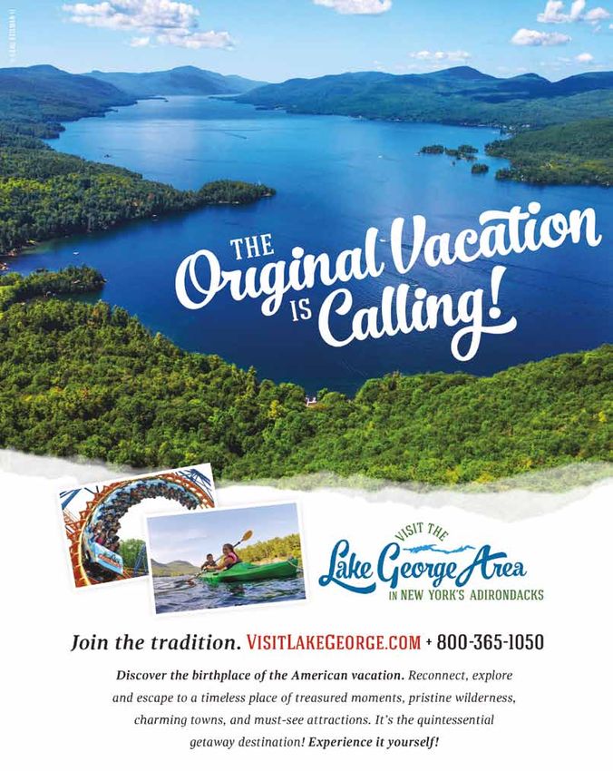
Adirondack Waterways Adirondack Waterways
A Loon’s-eye View Photography Tips
For your next paddling trip
J E R E M Y A C K E R M A N
1. Maximize your Depth of Field
2. Use a Tripod
3. Look for a Focal Point
4. Think Foregrounds
5. Consider the Sky
6. Create Lines
7. Capture Movement
8. Work with the Weather
9. Work the Golden Hours
10. Think about Reflections
Photos by: Jeremy Ackerman
W hether it’s kayaking, hiking, or photography, my love for the Adirondacks grows with
every trip I take. I dream of one day getting paid to explore and take pictures. I feel like
this journey for me is just in its infancy and cannot wait to see what the future brings.
I explore various coves and small waterway that drain
into the lake. Eventually, the sun begins to set, and I
paddle as hard as I can for about two miles across the
lake. The sky is a dazzling shade of pink and the reflection
on the water is breathtaking. I snap a few more pictures,
and then enjoy the rest of the sunset until I can barely
see the shore, where I know my car is parked even if I
can’t see it. Time to pack up and head home.
The night is gorgeous and clear – and I think to myself
that the conditions are perfect for taking pictures of
the stars. But someone has to work in the morning, so I
head home instead.
Driving back down the dirt road I see a doe and her
fawn standing not far from my car, just looking at me. Read more about Jeremy & others at VisitAdirondacks.com/area-adk
They’re so innocent. ‘Enjoy the woods’ I whisper, I’ll be
back again soon. S H A R E Y O U R E X P E R I E N C E # V I S I T A D K S
4 5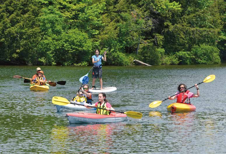
Adirondack Waterways Adirondack Waterways
Paddle the Waters of a Wilderness Like No Other Paddling the Adirondacks’ Iconic Waterways
There are more than 3,000 lakes and ponds and 6,000 miles of rivers and streams in the Adirondacks. Paddling ranges from roiling Essential vocab: network of lakes and ponds with opportunities for gentle ponds and shorelines home to water fowl, or
whitewater chutes to glassy ponds where deer stop to drink; from a short circuit around a scenic lake to a multi-day river and lake trip. Portage/Carry – When you want to pond hop to another portaging and continued exploration, as well as 75 try a sea kayaking adventure on Lake Champlain,
body of water, but need to carry your canoe over a stretch primitive tent sites, and three lean-tos. paddling out to Valcour Island, or rise at dawn to
This is a general guide to locations for paddling opportunities. Once you decide on a location, get yourself a good topographic map and/or guidebook. Special usage of land to access it. See St. Regis Wilderness Canoe Area for watch the sun rise over the water.
regulations may apply along some routes, so refer to the appropriate Department of Environmental Conservation publications or call them for specific information (see
example. The 90-Miler Adirondack Canoe Classic
below). Much of the lands that border the routes identified in this guide are privately owned. State navigation law allows for paddlers to travel on private lands for short PFD – Personal Flotation Device, aka a life jacket. This is The Adirondack Canoe Classic is a paddling race Necessary Equipment
necessary whenever you’re on the water. If you get stopped from Old Forge to Saranac Lake, spanning three You’ll enjoy your Adirondack paddling experience
distances to bypass obstacles in the waterway. However, entering private lands for any other reason, including putting in and taking out, is trespassing, unless permission by a Forest Ranger and are caught without one for each
has been granted from the landowner. If you lack experience or gear, knowledgeable guides and outfitters will be happy to make your outing memorable. member of your group, they may issue you a ticket and
grueling days of open-water paddling. Held annually so much more if you have the proper gear, whether
escort you back to shore. in early September, the 90-Miler attracts paddlers you’re going out for a few hours or a couple of
from across the county. As the ultimate in distance days. Necessities include:
Boat Launch/Put-In – Designated places to put your
Adirondack Guidebooks and Maps canoe or kayak in the water, operated by the New York paddling challenges, the race is open to all abilities, • Personal Flotation Device (PFD) – Don’t leave
State Department of Environmental Conservation. ages and classes of canoes, kayaks and stand- shore without one for each member of your group.
up paddleboards, and crosses some of the most If a Forest Ranger stops you and you don’t have a
The Adirondacks are unique among mountain
Guides Maps National Geographic Trails Illustrated Map
regions in North America for the simple fact that for
unique waterways in the Adirondacks, including the PFD, you will be fined. Think of it as the safety belt
Adirondack Canoe Waters: North Flow
Canoeing the Adirondacks with Nessmuk:
Adirondack Canoe Map
Series: Adirondack Park Saranac River Locks. of the sea—buckle up!
Paul Jamieson and Donald Morris
The Adirondack Letters of George Washington
Old Forge to Upper Saranac Lake and the Saranac Lakes/
Series of five topographic maps. Trails are every mountain peak, there are hundreds of miles of
Sears Saint Regis Canoe Area. Available at local sporting goods
marked with point to point mileage. Designated waterways. From the mighty Hudson River, to the Whether you’re training for the 90-Miler, or just • Drybag—Sometimes, your dry goods can end
Adirondack Paddler’s Guide George Washington Sears; Dan Brenan, editor wilderness and wild forest areas, access and boat
3rd edition
stores. www.adirondackmaps.com
launch sites, parking, leantos and portage trails. magnificent Lake Champlain, the Adirondacks are a going for a morning paddle, remember: safety first. up tipping over the side and floating away on the
Discover the Adirondacks Series Waterproof. Scale: 1:75,000. Carry life jackets and other personal flotation current. To avoid soggy snacks, pack your food
Adirondack Paddling: Northern Adirondacks, South Central Adirondacks,
Adirondack Map Series paddler’s paradise boasting more than 3,000 lakes
Series of five topographic trail maps: Central devices to ensure you and your group’s safety. and other supplies in a drybag. Even if it does go
60 Great Flatwater Adventures West Central Adirondacks, Adirondack High Peaks, Mountains, High Peaks Region, Lake George Region,
Map 742: Lake Placid/High Peaks and ponds, and 30,000 miles of rivers and streams.
Phil Brown Southern Adirondacks, Southeastern Adirondacks, Northwest Lakes, West-Central Wilderness Area. Map 743: Lake George/Great Sacandaga overboard, your camera and your food will survive.
Whether you’ve never been paddling before, or
Adirondack Passage: The Cruise of the
Southwestern Adirondacks, Eastern Adirondacks,
Central Adirondacks, Northwestern Adirondacks,
Scale: 1:62,500. Find at area sporting goods stores.
www.adirondackmaps.com
Map 744: Northville/Raquette Lake
you’re one of the few who make it their life’s passion
Tandem and Solo Kayaking Exploration • Map—A good map and basic orienteering
Canoe Sairy Gamp Map 745: Old Forge/Oswegatchie
Christine Jerome
Northeastern Adirondacks. Barbara McMartin
Map 746: Saranac/Paul Smiths to get out on the water as much as possible, you’ll For extreme whitewater kayakers, the Adirondacks skills are recommended, especially when doing
Adirondack Paddler’s Map
Adirondack Waterfall Guide
Fun on Flatwater
for Canoe & Kayak Travel find paddling experiences in the Adirondacks that offer routes that few have conquered, including overnight trips. Additionally, paddling route maps
An Introduction to Adirondack Canoeing NY State Atlas and Gazetteer
Russell Dunn Barbara McMartin
Large waterproof topographic map. Includes the DeLorme Mapping www.delorme.com you won’t find anywhere else on Earth. Hanging Spear Falls. Recently the focus of pro identify boat launch sites, nearby hiking trails and
Saranac Lakes Chain and headwater ponds, St. Regis
Adirondack Canoe Routes Longstreet Highroad Guide Lakes and St. Regis Canoe Area, Osgood River and U.S.G.S. Topographic Maps Red Bull athlete and documentary film maker the nearest towns and villages.
William Howard
Bob Marshall in the Adirondacks
to the New York Adirondacks
Phil Brown
Rainbow Lake area, Santa Clara Tract (St. Regis River
and Madawaska Area), Five Ponds Wilderness and
Available at area sporting goods stores.
Canoeing: Family-Friendly Adventure Steve Fisher, Hanging Spear Falls is located on Throughout the region, professional outfitters,
Northern Forest Canoe Trail Map the Opalescent River, and is the steepest mile of including St. Regis Canoe Outfitters in Saranac
Writings of a Pioneering Wilderness Preservationist.
Quiet Water Canoe, New York
Oswegatchie River, William C. Whitney Wilderness Adirondack North Country (west): Fulton Chain The Adirondacks are home to New York State’s whitewater in New York State. The route should
Edited by Phil Brown (Little Tupper Lake, Round Lake and Lake Lila), Lake and Adirondack Coast Paddle Board Co. in
John Hayes et Alex Wilson Cranberry Lake Wild Forest, Raquette River (Long
of Lakes to Long Lake. Adirondack North Country only designated canoe wilderness area, the only be attempted by whitewater kayaking pros.
Canoe and Kayak Guide: (central): Long Lake to Saranac River. Adirondack Plattsburgh, can provide maps, equipment and
Reflections from Canoe Country: Paddling the Lake to below Tupper Lake), Bog River Flow and North Country (east): Saranac River to Lake St. Regis Canoe Area, which spans 18,400 acres in
East-Central New York State
Waters of the Adirondacks and Canada Lows Lake. Designated wilderness/wild forest areas, Fortunately, the Adirondacks offer thousands of advice on where to go based on your group’s ability.
Edited by Kathie Armstrong and Chet Harvey access and boat launch sites, parking, portage trails,
Champlain. the aptly named Adirondack Lakes Region. Ideal
Christopher Angus miles of flatwater paddling for novices. Explore
Canoe Guide to Western and Central campsites, lean-tos and hiking trails. Scale:1:50,000. NFCT Safety Brochures: for overnight canoe camping trips, St. Regis offers a
www.canoeoutfitters.com The Paddler’s Safety Checklist, Wear It! Life Jackets
New York State
Matter, Cold Water Survival
Edited by Mark Freeman
Adirondack Region Information Centers
www.schroonlake.com
NYS Dept of Environmental Conservation (DEC)
For trail conditions, backcountry information and permits, fishing and hunting regulations and licenses,
Your Life, Your Life Jacket.
WEAR IT!
www.whitefaceregion.com contact the DEC offices listed below. Normal office hours are Monday-Friday, 8:30am to 4:45pm.
www.lakechamplainregion.com
www.visitmalone.com
www.adirondackexperience.com
DEC Headquarters DEC Region 6
625 Broadway, Albany, NY St. Lawrence, Lewis, Herkimer, Jefferson
Lewis County Tourism 518-402-8013 & Oneida counties
800-724-0242
www.dec.state.ny.us DEC Region 6 Headquarters:
www.adirondackstughill.com
info@adirondackstughill.com DEC Region 5 Watertown, 315-785-2239
Adirondack Coast Clinton, Franklin, Essex, Hamilton, Warren, DEC Region 6 Sub-Offices:
Adirondack Regional Tourism Council Visitors Bureau (Clinton County) Fulton, Saratoga & Washington counties Potsdam, 315-265-3090
518-563-1000 or 877-242-6752
Comprehensive travel information DEC Region 5 Headquarters: Herkimer, 315-866-6330
for a seven-county region. www.goadirondack.com
Ray Brook, 518-897-1200 Lowville, 315-376-3521
www.VisitAdirondacks.com St. Lawrence County
Chamber of Commerce DEC Region 5 Sub-Offices: Forest Preserve Campgrounds
Regional Office of Sustainable
Tourism/CVB of Lake Placid 315-386-4000 or 877-228-7810 Northville, 518-863-4545 Reservations 800-456-CAMP
2608 Main St., Lake Placid, NY 12946 www.northcountryguide.com Warrensburg, 518-623-1200 www.reserveamerica.com
518-523-2445 or 800-447-5224 Warren County Tourism
www.roostadk.com 518-761-6366 or
www.lakeplacid.com Park-wide DEC Forest Ranger Emergency Search and Rescue and Forest
800-365-1050, extension 908
www.tupperlake.com
www.saranaclake.com
www.visitlakegeorge.com Fire Hotline: 518-891-0235
Universally Accessible Waterways in the Adirondacks
Recreational opportunities for people with mobility impairments can be found throughout the Adirondacks. Look for universally accessible facilities such as docks,
outhouses and viewing platforms at places such as Ausable Marsh (pg. 6), Lampson Falls (pg. 8), Sand Pond-Mud Pond Area on the West Branch Oswegatchie River
(pg. 13), Francis Lake (pg. 13) and Moss Lake (pg. 13). Scenic boat tours can be enjoyed on many Adirondack lakes. John Dillon Park, just north of Long Lake, is a state-
of-the-art facility (www.dillonpark.org) that does it all. Check with full-service outfitters for more options.
Disclaimer: By its compilation and distribution of this brochure, the Adirondack Regional Tourism Council & JMF Publishing Inc. assume no responsibility of any nature for damages or injury to persons or property arising
out of or resulting from travel on any of the routes described herein, or from any service, sales or accommodations provided by the businesses represented herein, and accordingly, does disclaim any and all liability on its
part for such damages or injuries should they occur. © All rights reserved. Printed in the USA. WearItNewYork.com
Cover photo by parks.ny.gov
6 7
8
Adirondack Waterways Map Index
How to use the Descriptions & Maps
Get more information
The descriptions are brief and the maps rudimentary—the information provided
here is not intended to be used as a working field guide. The complex nature of
the waterways found in the Adirondacks requires that you obtain a good map
and guidebook before setting out. The guidebooks and maps will not only help
Adirondack Waterways
make your outing a safer one, they will also enhance your experience by providing
interesting background information on the areas you will be visiting. A list of
guidebooks and maps is found on page 6. Area and regional information centers
and the NYS Department of Environmental Conservation (DEC) are also good
sources of more information (see page 6).
Whitewater
Whitewater trips require special skills and equipment. See International Scale
of River Difficulty below. It is essential to obtain good maps and guidebooks
before venturing out to do any whitewater trips. If you don’t have the necessary
skills or equipment, consider taking a guided trip with outfitters who provide
these services.
Water Levels
Adequate water levels are essential to running most of the river and
whitewater routes in this brochure. Extreme water levels will change the
difficulty classification of rivers (see below). Minimum and ideal levels are
suggested in guidebooks. Most river routes are best done in the Spring (April to
May), Fall or after periods of heavy rain.
Personal Floatation Devices: New York State Law requires all
boats and canoes must carry a U.S. Coast Guard approved
wearable Personal Floatation Device (PFD) for each person
in the boat. State law also requires that children must be
wearing a PFD, and highly recommend that all
occupants wear a PFD.
International Scale of River Difficulty
Class I. Moving water with a few riffles and small waves. Few or no
obstructions.
Class II. Easy rapids with waves up to three feet and wide, clear channels
that are obvious without scouting. Some maneuvering is required.
Class III. Rapids with high, irregular waves often capable of swamping an
open canoe. Narrow passages that often require complex maneuvering.
May require scouting from shore.
Class IV. Long, difficult rapids with constricted passages that often require
precise maneuvering in very turbulent waters. Scouting from shore is often
necessary, and conditions make rescue difficult. Generally not possible
for open canoes. Boaters in covered canoes and kayaks should be able to
Eskimo roll.
Class V. Extremely difficult, long, and very violent rapids with highly
congested routes which nearly always must be scouted from shore. Rescue
conditions are difficult and there is a significant hazard to life in event of a
mishap. Ability to Eskimo roll is essential for kayaks and canoes.
Class VI. Difficulties of Class V carried to the extreme of navigability.
Nearly impossible and very dangerous. For teams of experts only, after
close study and with all precautions taken.
Cold water temperatures below 50 degrees and extended trips in remote areas
increase normal difficulty by one class level.
Deer River, Hatch Brook, Lake Kushaqua, Osgood Pond & River, Madawaska Flow & Quebec Brook, Rainbow Lake, St. Regis River
Deer River MAP KEY
paddling routes
Above High Falls is the 10-mile flatwater, Deer River
motorized vessels prohibited
Meadows. Below High Falls, the river drops rapidly with
a mix of moving flatwater and rapids. Note that paddlers some restrictions to motorized vessels
need to carry around the falls. Access is via dirt roads in physical barriers to motorized vessels, ex.
Deer River State Forest. Beware of rapids. waterfalls, culverts, etc. Hatch Brook
A swift current propels you
Everton Falls Preserve – through a marsh and varied
Silver Staircase East Branch St. Regis scenery on a nine-mile flatwater
cruise with good water levels
Seven miles of nearly continuous Above Everton Falls, nine miles of all summer; take-out is above
winding flatwater traverses a broad the Chasm Falls dam. En route
whitewater. Requires advanced
march. Paddle upstream as far as you you can explore upstream on
skills to maneuver through long and wish or start from the upstream end via
complex rapids rated up to Class IV. a dirt road accessed from Route 458. A
the Salmon River for a half mile.
Scouting is not always possible. portage trail leads to the river. Scenic area side trips include
Indian Lake and Mountain View
Lake. High Falls is a short hike
from the road along the north
bank of the Salmon River.
St. Regis Flow/East Branch
Deer River Flow
A flatwater extends upstream for 6 miles above the dam
in St. Regis Falls. Below Everton Falls, a 3-mile section of Enjoy mountain views and
the East Branch picks up speed with a series of rapids and bird watching on this 2.7-mile
falls that may require portaging, alternating with moving marsh-lined waterway.
flatwater channels. Medium-high water levels are best.
Lower Osgood River Lake Kushaqua to
Osgood Pond
Starting from Meacham Lake’s outlet
St. Regis River & Santa Clara Flow and its sandy southern shore, paddle The 12-mile trip from Lake
upstream and then downstream on Kushaqua to Osgood Pond
Launching near an oxbow, you’ll enter a section of moving flatwater traverses an interesting group of
See page 12 for Waterways to the West.
which can be paddled upstream for several miles. Two miles the Osgood which meanders through a
lakes and channels. There’s a 0.75-
See page 10 and 11 for Waterways to the East.
downstream from the launch is a half-mile portage which marks the wide marsh and beside a forested esker.
Look for the huge eagle’s nest on your mile carry between Rainbow Lake
beginning of the Santa Clara Flow — a winding, marsh-lined flatwater. and Jones Pond. You may need
Take-out is at the state boat launch near the bridge on Route 458. left as you enter the river.
to wade sections of the channel
between Jones and Osgood when
water levels are low. Take time to
explore the three-mile Stillwater
Madawaska Flow & Quebec Brook outlet of Osgood Pond. An old
Explore the extensive marshes, bogs and waterways of the Madawaska canal connects Osgood to Church
Flow — a classic example of a northern Boreal forest. Quebec Brook Pond. Extend the trip by carrying
flows into and out of Madawaska Pond and provides an alternate and to Lower St. Regis Lake where
more challenging access route that starts from Blue Mountain Road and myriad lakes and routed await the
follows Quebec Brook upstream; several portages are required. The adventurous paddler.
area is part of the Santa Clara Tract and is easily accessed via a five-mile
dirt road starting from Route 458, one mile west of Route 30.
St. Regis River
Paddle up through a scenic 12-mile winding stillwater on the St. Regis River—
part of the Santa Clara Tract. Access is via a 0.7-mile carry along an old road
starting from Blue Mountain Road. An optional downstream take-out near the
bridge is preceded by 1.5 miles of fast water rapids; look for carry trails on the
right bank. No take-out downstream due to private property.
See pages 11 and 12 for Waterways to the South.
Adirondack Waterways
9
10
Ausable River, Chateaugay Lakes, Chazy Lakes, Great Chazy River, Lake Champlain North, Saranac River
Adirondack Waterways
Great Chazy River
Upper & Lower The last 20-mile section of this 46-mile river is
Chateaugay Lake good for paddling. A downstream float starts at
Mooers and extends to King Bay. Expect some
A wide channel connects these motor boat traffic from Lake Champlain.
two lakes creating a 10.5 mile
waterway. Check out Bluff Point
with its adjacent shallow reef or
paddle three miles up the South
Inlet to the state land boundary at Chazy Lake
bridge. Below the outlet dam, the
Chateaugay River drops rapidly This four-mile lake is nestled at the
with several falls including the foot of Lyon, Johnson and Ellenburg
spectacular 120-ft. High Falls. Mountains. Access the lake from the Lake Champlain – North
beach and park near the lake’s dam on
Route 374. The lake can get rough on Lake Champlain is a big lake and paddlers should note the cautions
windy days. A nearby 3.5-mile hiking mentioned on page 10 before planning to paddle on these potentially rough
trail leads to the open summit waters. Avoid the wind by traveling early or late in the day.
of 3830’ Lyon Mountain. Roads parallel to the lake and boat launch sites are numerous along Lake
Champlain’s northern shore. Beautiful, state-owned Valcour Island is
a popular stop-over on the lake – explore its many bays, campsites and
11.9 miles of trails. It is a one-mile crossing to the island from the Peru
state boat launch site. The sheltered waters near Point Au Roche State
Park may also be an interesting area to explore.
See page 9 and 11 for Waterways to the West.
Saranac River
From its confluence with the North Branch
at Clayburg, the Saranac becomes a big river,
100-feet wide, with up to Class II rapids. It is
a rocky passage at all but the highest water
levels in the early spring. At Redford there are
some difficult rapids and ledges, Class II-IV,
which require a carry. Take out is at High Falls
Dam. NYSEG regulates water levels below
High Falls Dam. The 9 miles from Moffitsville
to Cadyville is initially shallow and rocky with Ausable Marsh Wildlife
some Class I rapids but it quickly becomes
deep, moving flatwater to take-out at the
Management Area
beach in Cadyville. An interesting five-mile circuit tours
extensive marsh areas amid the wide
meanders of the Ausable Delta and at the
mouth of the Little Ausable River. The marsh
is home to many species of waterfowl.
See Page 11 and 13 for Waterways to the South.
Ausable River, Chubb River, Saranac Lakes Chain, Saranac River Headwaters, St. Regis Canoe Area, St. Regis Lakes
See page 9 and 10 for Waterways to the North.
Saranac River
St. Regis Canoe Area &
the Saranac River Headwaters From Union Falls Pond, the Saranac
River drops rapidly. Class I-II rapids in
The St. Regis Canoe Area and the headwater lakes and ponds of the Saranac the first 4 miles are followed by a Class
River are a pond-hopper’s paradise. Many carries are short and most routes V drop at Tefft Pond Falls. The carry is
can be done as an unencumbered day trip. The classic “Seven Carries adjacent to private property. The next
Route” is 9 miles from Little Clear Pond to Paul Smiths, traversing 10 lakes five miles include a complex series of
and ponds. You may need more time and a lightweight canoe for the “Nine Class II-III ledges, drops and hydraulics
Carries Route” which starts from either Hoel Pond or Long Pond (1.5 miles which demand advanced skills and
of carries) or Little Clear Pond (2.5 miles of carries); your ultimate goal is ample water. It is rocky and there is a
a cluster of ponds near remote Fish Pond. The area is bisected by a steep wide fluctuation in the water level due
esker formation. Just south of the St. Regis Canoe Area, the Saranac River to dam releases.
headwater ponds—Follensby Clear, Floodwood and Fish Creek—provide
the starting point for various short loop trips. Short carries connect the St. Regis Lakes Loop
many small ponds and channels. Expand these loops by carrying north into
The St. Regis Lakes—Lower St. Regis
Long and Hoel Pond.
Lake, Spitfire Lake and Upper St. Regis
Lake—are connected by wide channels;
a loop tour would include a 0.6 mile
carry from the Upper Lake to the outlet
dam on Lower Lake. Great Camps can be
seen along much of this route. Be sure
to explore beautiful Black Pond.
Saranac River
The Saranac River is a slow-moving
flatwater with one section of up to
Class III water at Permanent Rapids
just before Franklin Falls Pond. Carry
around the falls on the adjacent road.
A 0.4-mile carry leads from the dam on
Franklin Falls Pond to Union Falls Pond.
See page 13 for Waterways to the East.
See pages 9 and 12 for Waterways to the West.
East Branch
Ausable River
The East Branch has some
great spring paddling with
Class II water and a tricky
Class III boulder patch. You’ll
West Branch pass quickly through a scenic
valley lined with high peaks
Saranac Lakes Chain Ausable River and meadows. Shoreline is
Cruise through eight miles of mostly private lands. Put in
From the north end of Upper Saranac to the east at boat launch in Upper Jay.
end of Lower Saranac is 17.5 miles of continuous mostly tranquil water with
Chubb River some Class I riffles and one Downstream take out is a
waterway with only one half-mile carry. Lean-tos 150 ft. stretch of state land, 2
and campsites are found along the shore and on carry, spring water levels are
Take a wilderness cruise upstream best. Don’t miss your take out miles upstream (before) high
islands. A fee is charged for campsites on Lower through a winding channel into a school. In summer, the water
and Middle Saranac lakes. This popular route just prior to monument falls. An
remote mountain-ringed marsh. The unrunnable boulder-filled gorge is too shallow to paddle.
continues through Oseetah Lake into the Village nine-mile round trip has one short
of Saranac Lake, where the Saranac River begins. follows which is better viewed
carry midway and you may find from Rt. 86.
several beaver dams along the way.
Adirondack Waterways
See page 14 and 15 for Waterways to the South.
11
12
Black Lake, Cranberry Lake, Grass River, Little River, Massawepie Area, Oswegatchie River, Raquette River
Lower Grass River Raquette River Reservoirs & Beyond
The Lower Grass River from 27 miles of the Raquette is now a series of reservoirs. Orion Power New York
Canton to Massena (36 miles) maintains carry routes, picnic areas, boat ramps, beaches and campgrounds. Below
can be paddled with several the reservoirs, river travel continues on a series of smaller reservoirs at Hannawa,
short portages along the way. Potsdam, Norwood and Norfolk. Further downstream, between Raymondville to
Raquette River Village, are 14.5 miles of untamed river that can be paddled when
Adirondack Waterways
water levels are adequate; run or carry around any rapids.
North Branch Grass River
Black Lake Enjoy a mix of rapids and flatwater on this
16.5-mile paddle. What starts as a meandering
Black Lake’s irregular shoreline, river in a marsh quickly changes to Class II
mid-lake shoals, rocky points, rapids. Class IV rapids and a moderate-sized
expansive weedbeds and many double hydraulic are met before reaching the
islands contribute to the area’s 50-foot Harper Falls, where a carry is required.
scenery and provide a favorable
habitat for thriving populations
of bass and panfish. Raquette River
Lampson Falls Area
South Branch Grass River 17 miles of exciting
This spectacular stretch of the Grass whitewater starts below
accommodates a range of paddling skills. the dam at Piercefield,
The Tooley Pond Tract includes a long
The first 4.5 miles is a winding flatwater, winding north through a
section of the South Branch Grass River.
then, at 40-foot Lampson Falls, the river series of rapids and over
The upper section to Rainbow Falls is
abruptly changes. Over the next 7 miles two waterfalls. State land
good for canoeing with carry trails around
the river drops 220 feet over nine dramatic borders most of the area and
waterfalls. Access is via Spruce Mountain
cascades and Flumes rated up to Class V. carry trails skirt some of the
Road. A carry trail above Rainbow Falls
A speedy 4.3 miles of almost continuous harder sections. Water level
leads to parking on Tooley Pond Road.
Class II rapids fallows. Only experts should is critical and it can fluctuate
Below Rainbow Falls, the river and its many
attempt paddling the lower section. due to dam releases.
waterfalls are more suitable for expert
kayakers and shoreline users.
Lower Oswegatchie River
A gentle section of the Oswegatchie starts near Gouverneur
and flows 65 miles to Ogdensburg where it flows into the
St. Lawrence River. The river is wide and slow-moving here
as it passes beside low-rolling hills, rock ledges, marshes
and pasture land. Scenic cliffs line the shore near Oxbow. Oswegatchie River
There are carries at the dams and most of the rapids can be
See pages 9, 11 and 15 for Waterways to the East.
portaged or run by experienced paddlers. Numerous access From Newton Falls to Hailesboro
points permit trips of varying lengths. the river drops over 970 feet. Cranberry Lake
Some areas are hard to access
and there are many Class II-IV Flows and bays extend in every direction; great
rapids and impassable ledges and for exploration and refuge on windy days. Hiking
dams. Water levels may fluctuate trails originate from the lakeshore leading to
Middle Branch Oswegatchie River due to dam releases. remote ponds and overlooks. There are 46 Massawepie Area
The middle branch plunges over waterfalls and though a designated campsites.
Pond-hop among the many small
rocky gorge. A drop of 90 feet in the first two miles gets the lakes near Massawepie Lake
adrenalin going with an exciting mix of waterfalls and Class III Little River or paddle 8.5 miles through
rapids. Scout for possible runs or carries around impassable Massawepie Mire and Grass River
sections, such as narrow Sluice Falls. The second half of this The lower six miles of the Little River includes Flow. (Closed to the public from
12-mile run is a calm Class I flatwater that winds through some technical Class III rapids; the upper 12 June 15 to August 31.)
marsh and woodland. miles is a quiet Class I with some riffles and
two short carries.
See page 15 and 17 for Waterways to the South.
Boquet River, Lake Champlain, Silver Lake, Taylor Pond
See page 10 for Waterways to the North.
MAP KEY Silver Lake & Taylor Pond
paddling routes
These secluded lakes are great places to
motorized vessels prohibited camp, fish or just paddle around. Dense woods
some restrictions to motorized vessels and mountains surround the lakes. Take a
physical barriers to motorized vessels, ex. short hike to the top of Silver Lake Mountain
waterfalls, culverts, etc. or Catamount for great views. Note: Parking
fees for access.
Lake Champlain
Small vessels of any kind should avoid this large lake on all but the calmest days. Getting caught on the
water in a small kayak or open canoe on a rough, windy day is a life-threatening situation. Watch the
weather and pick your day carefully. Remain close to the shore in sheltered bays of the western shore.
Take advantage of the morning and evening calms, and paddle from south to north with the prevailing
winds. Taking these words of caution into consideration, it is possible to find the perfect day to paddle
along the Lake Champlain shore.
One of the more scenic cruises is from Westport around Split Rock Point to the historic village of
Essex, or to the sandbars and beach areas near the mouth of the Boquet River. The route offers
dramatic views of the sheer palisades that rise from the water at Split Rock Mountain; state land
borders the water here and several trails leave from bays along this section of shore. However,
the rocky shoreline provides little space for emergency landings. Start from Essex for a shorter
round-trip cruise to Split Rock Point and views of its historic lighthouse. The lake’s maximum depth
of 400 feet is found just off this point. Explore the waters in sheltered Willsboro Bay, or paddle out
to state-owned Schuyler Island (about 1 mile). Several campsites can be found along the island’s
rocky shore but there is also poison ivy so be careful.
See page 11 for waterways to the West.
Paddlers should check
guidebooks and other
Boquet River sources to determine
Canoeable at higher water levels in the spring, this river offers trips of varying lengths where legal put-in and
and difficulty. From starting points below Split Rock Falls, a fast current winds through a take-out sites are located.
narrow channel with mid-Class II rapids and one short carry. There are few boulders in
the 11-mile stretch to Elizabethtown. The next 6.5-mile section to the Northway overpass
becomes more difficult with tricky Class III drop and rapids. The next 25-mile stretch to
Lake Champlain is best done as a series of short day trips due to waterfalls and dams at
Wadhams, Boquet, Whallonsburg, and Willsboro which would require long carries. Overall
this is a fairly easy cruise through pasture lands and wooded hills, best done at high water
levels. There are limited locations for putting in or taking out, and a very small amount of
public land along the river.
Adirondack Waterways
See page 14 for Waterways to the Southwest.
13
14
Harris Lake, Henderson Lake, Hudson River, Newcomb Lake, Rich Lake, Schroon River & Lake
Essex Chain Lakes See page 11 for Waterways to the North.
FOR DETAILS go to:
http://www.dec.ny.gov/lands/91888 Henderson Lake
The Hudson River
The Essex Chain is the newest Privately owned since 1826, the public now has paddling and fishing access on
“Paddler’s Paradise” in the Henderson Lake and Lake Jimmy. Surrounded by tall mountains, Henderson Lake High on the shoulder of New York’s
is a very scenic with steep, rocky shorelines and many secluded coves to explore. highest peak, Mt. Marcy, is the highest
Adirondacks. Seven of the eight lakes
Adirondack Waterways
The water is very deep and clear. There is a quarter-mile carry past the gate to pond source of the mighty Hudson
and three other ponds are easily River, Lake Tear of the Clouds. From
the put-in from the Upper Works hikers’ parking area. Paddlers looking for a
accessible using four short carries. A this humble beginning the Hudson
challenge and even more solitude may want to attempt the adventurous trip up
four-mile route from the southern end to Preston Ponds and Duck Hole. The two-mile carry from northwest Henderson flows 275 miles to New York City
of Second Lake to the southern end of Lake to Upper Preston Pond is steep and difficult but the rewards in scenic and the Atlantic Ocean. In stages,
Seventh Lake can be done without beauty and solitude are great. Once on Upper Preston, continue to the outlet and the Hudson progresses from a small
ever leaving the water. Thirteen access Lower Preston Pond from a short carry. From Lower Preston, it is a short stream to one of the finest whitewater
designated tent sites are available bushwhack to Duck Hole. The trip is about five miles from beginning to end. runs in the East to the wide shipping
Newcomb Lake lanes of the Hudson Valley. An avenue
year round, but require a permit
Hitch a ride for you and your canoe (fee) for commerce and trade as well as
May 15-Oct 15. recreation, the Hudson River is New
on a horse-drawn wagon down a 4.5
dirt access road (closed to vehicles) to York State’s premier river.
Newcomb Lake where you can explore
both the lake and partially restored
structures of the Great Camp Santanoni.
Upper Hudson River
Three-mile long Sanford Lake is a long narrow lake flanked
by tailings from an old mine. From there the river meanders
through a marsh for the next six miles to a bridge. After
passing beneath the bridge, the river begins to drop more Upper Schroon
rapidly for several mile with come Class III rapids in a
The 15-mile stretch of
narrow channel. Below this point the river resumes its quiet
the Schroon River from
meandering to the outlet of Harris Lake on the right.
North Hudson to Schroon
Lake is an easy Class I
Harris Lake & Rich Lake flatwater cruise with one
Start on the public beach or boat launch Upper Hudson River & Hudson River Gorge carry, six miles into the
on Harris Lake for a scenic round-trip trip, at four-foot Schroon
The 12 miles from Newcomb to the Indian River is a beautiful remote of the Hudson River Falls. Wildlife sightings
cruise. The flatwater channel between the with some rapids. Beginners should portage around the Long Rapids and Ord Falls. The
lakes has some riffles and a carry. Do not are frequent as you
See page 15 for Waterways to the West.
Blackwell Stillwater—a long stretch of the river with no rapids which provides access to travel along this slowly
proceed beyond the Route 28N bridge lower reaches of the Goodnow River, can be directly accessed near the Iron Bridge. A
or you will be committed to running the meandering river. Take
See page 13 for Waterways to the East.
takeout just above the confluence with the Indian River allows paddlers to easily exit the out just below the Rt. 74
turbulent Hudson River Gorge. river before entering the Hudson River Gorge. The gorge packs in a series of difficult Class bridge or continue further
V rapids with powerful hydraulics, souse holes and high, standing waves. These 13 miles downstream and enjoy
are for expert paddlers only. Several outfitters offer rafting trips through the gorge. Water mountain views from the
releases from Lake Abanakee mean high water levels every day during the spring, four open waters of beautiful
days a week in the summer and weekends in the fall. Open canoes should not be used here Schroon Lake.
except by experts at mid-summer water levels.
Avoid approaching
wildlife too closely,
especially when they MAP KEY
are nesting or have paddling routes
young with them. motorized vessels prohibited
some restrictions to motorized vessels
physical barriers to motorized vessels, ex.
waterfalls, culverts, etc.
See page 16 for Waterways to the South.
Bog River, Blue Mtn. Lake, Cranberry Lake, Forked Lake, Lake Lila, Long Lake, Lows Lake, Oswegatchie River, Raquette Lake & River, Tupper Lake, Whitney Wilderness
See pages 11 and 12 for Waterways to the North.
Tupper Lake
A shallow marsh connects Tupper Lake, Simon
and Raquette ponds. State land on Tupper Lake’s
western shore has a leanto and campsites. Above
Cranberry Lake Bog River Falls you’ll find a 2-mile stillwater paddle.
Flows and bays extend in every direction; great for
exploration and refuge on windy days. Hiking trails
originate from the lakeshore leading to remote ponds Bog River
and overlooks. There are 46 designated campsites.
Raquette River
The lower Bog has 7 miles of
technical Class III water which From Long Lake to Tupper Lake (30 miles) the
includes unrunnable drops at 6’ Raquette meanders between sandy wooded
Split Rock Falls and the 30’ Pa’s banks with just one carry at Raquette Falls.
Falls. High water levels and Traveling with the current, you can easily enjoy
expert level skills are required.
some fishing and bird watching. Campsites and
Oswegatchie River leantos are found along the way. Stony Creek
Ponds outlet and Indian Carry provides access
Starting at Inlet, you must first paddle
north to the Saranac Lakes Chain.
upstream on this scenic winding river.
Stopping at a campsite along the way
may be more enjoyable than staying
in the High Falls area, which is often
filled to capacity. Above the falls, you Little Tupper Lake & Round Lake
will leave the crowds behind as you
lift over beaver dams, paddling deeper The William C. Whitney Wilderness includes Little Tupper
into a remote wilderness. The 40-mile Lake, Round Lake and Rock Pond—which are all connected
round-trip paddle takes a minimum via channels and have designated campsites. Little Tupper
of three days—two days up and one is six miles long and has several islands. Moderate winds
day down. Several hiking trails are can create rough water on these lakes. Anglers will enjoy
accessible from points along the river. catch-and-release fishing for native brook trout. A canoe
carry route from Rock Pond to Lake Lila links a series of
small ponds and carries to Shingle Shanty Brook.
Lows Lake & Bog River Flow
See pages 12 and 17 for Waterways to the West.
Starting from the lower dam, this 11-mile paddle, with one short
See pages 11 and 14 for Waterways to the East.
carry at the upper dam, traverses a beautiful narrow waterway.
The wide expanse of Lows Lake opens up at journey’s end with Lake Lila Long Lake
marshes to the south and a backdrop of rugged mountains to Forked Lake
the north. Islands and bays provide refuge on windy days. 39 Lake Lila has 17 campsites, 7 islands, The prevailing winds are usually
designated campsites are found on Lows Lake along the access State land borders the southeast shore, and the east
sandy beaches and tall white pines. A at your back on this 14-mile
channel. For the ambitious, a three-mile carry at the west end and west end of this 7-mile lake; the rest is privately
0.3-mile carry leads from the parking are “long” lake. Campsites and
of the lake leads to Upper Oswegatchie River. Your efforts owned and undeveloped. The downstream route to
to the sandy launch site. Climb Frederica leantos are found on state land
are rewarded with a good dose of wilderness and an 18-mile Long Lake is a mix of flat and fast water and carries.
Mountain for a panoramic overview of the along the eastern shore, north of
downstream cruise to your take-out at Inlet. area. Explore the winding route of Shingle Long Lake Village.
Shanty Brook.
Blue Mountain Lake
Raquette Lake
10 islands on this mountain-ringed lake
MAP KEY The many bays of this large lake will provide are part of the forest preserve. Explore
paddling routes hours of exploration; keep your eye out for the islands before heading west to the
some of the historic Great Camps. Explore the outlet, under the bridge and into narrow
motorized vessels prohibited two-mile channel of South Inlet and Browns Eagle and Utowana lakes. A half-mile
some restrictions to motorized vessels Tract Inlet where a one-mile carry connects to carry at the west end of the lakes leads
physical barriers to motorized vessels, ex. Eight Lake on the Fulton Chain. To the north, to the Marion River which flows gently
waterfalls, culverts, etc. an easy half-mile carry leads to Forked Lake. through meadow and marsh to Raquette
Lake and routes to the north and south.
Adirondack Waterways
15
See pages 16 and 17 for Waterways to the South.
16
Cedar River, Hudson River, Indian Lake, Jessup River, Kunjamuk Creek, Lake George, Piseco Lake, Sacandaga River, Schroon River
See pages 14 and 15 for Waterways to the North.
Cedar River Flow—Moose River Plains Indian Lake MAP KEY
paddling routes
Cedar River Flow is tucked in the mountains far from the main Snowy Mountain’s rugged cliffs and motorized vessels prohibited
road. Explore the wilderness shoreline and remote narrow fire tower stand out above the western
some restrictions to motorized vessels
inlet channel. A variety of lakes and ponds are accessible via shore. Take in the view from Baldface,
a short 1.25-mile trail starts from physical barriers to motorized vessels, ex.
40 miles of dirt roads in the Moose River Plains Wild Forest. Lower Schroon River
Norman’s Cove. This is just one of the waterfalls, culverts, etc.
Adirondack Waterways
many Adirondack lakes where you can The Lower Schroon from Schroon
enjoy island camping. Reservations are Lake to the Hudson River (27 miles)
required during peak season. is a mixture of long flatwater sections
and some exciting Class III-IV white
water, such as “The Big Drop,” which
Jessup River you may want to scout before running.
Adjacent roads provide easy access.
This is an interesting four-mile cruise which may involve Some access is limited to Public
lifting over log jams or beaver dams. It is best canoed at Fishing Rights.
higher water levels in the spring. Look for the short trail
that leads to a waterfall just prior to entering Indian Lake.
Sacandaga Lake Area Kunjamuk Creek
These two large headwater lakes are The 7-mile round-trip paddle to
connected by a short channel. From Elm Lake may include lifting over
Sacandaga Lake, paddle up to Mud several beaver dams. Explore Hudson River
Lake or carry to beautiful Fawn Lake. the four-mile Stillwater channel
of Sacandaga. From North River to North Creek
(five miles) the Hudson flows
gently with some Class II rapids.
Over the next 18 miles to its
Piseco Lake junction with the Schroon River,
Piseco Lake offers the Hudson resumes some of its
some interesting trips, former gusto with some Class III
such as paddling up Fall East Branch rapids and drops over ledges.
Stream to Fall Lake. Sacandaga River
Only two miles further
upstream, and several This eight-mile section of the
beaver dams later, East Branch has a gentle drop Lower Hudson
with some fun Class II water;
See page 17 for Waterways to the West.
is Vly Lake.
Lower West Branch it is often too shallow to paddle The Lower Hudson is broad
during the summer. Take out and shallow. The current is
An exciting eight-mile run with at the unrunnable Griffin Falls, a swift Class I but obstacles
up to Class III rapids. Spring is the a drop of 20 feet. are few except at low water
best time to attempt the steep levels when sandbars may Lake George
55 feet-per-mile gradient. impede progress down this
17-mile stretch of river. Mountains surround Lake George, and its crystal clear
Sacandaga River Take-out is one mile above water is mostly spring fed. A wealth of islands and small
the Hadley Luzerne Falls bays invite exploration by canoe or kayak but the lake is
13 miles of almost continuous which are dangerous and large, 32-miles long, and one of the best ways to explore
whitewater with up to Class should not be approached. it may be by sea kayak, over the course of several days.
III rapids is briefly interrupted Resorts and services of all kinds line the chore. Camp on
Upper West Branch by Lake Algonquin four miles 50 state-owned islands or at several state campgrounds
Sacandaga River into the run. Below the outlet along the shore; reservations are required and dogs are
dam, the race continues with a not allowed on islands.
This Class I flatwater can be paddled in drop of 47 feet in the next 2.5
either direction. Both Chub and Trout miles and some Class II water.
Lake have navigable outlets and are A final Class II-III section
worth a side trip. Below this point, the follows to take-out at Hope. Sacandaga River
river drops rapidly through a remote High water levels are best.
gorge with two impassable waterfalls. Below the Stewart Bridge Dam on Great Sacandaga Lake is
three miles of guaranteed Class II and III whitewater. Play
here every day, all summer long thanks to daily water releases.
Beaver River, Big Moose Lake, Black River, Fulton Chain of Lakes, Francis Lake, Moose River, Moss Lake, Sand Pond-Mud Pond, Stillwater Reservoir
See pages 12 and 15 for Waterways to the North.
Beaver River Canoe Route Sand Pond-Mud Pond Area Stillwater Reservoir
Enjoy a 14-mile paddle through a series of reservoirs Access to Sand Pond—part of the Croghan Tract—is The nine-mile long reservoir is surrounded by state land
and channels which begins just below the Moshier via logging roads and a new 0.2 mile universally and 46 designated campsites are situated on the scenic
Powerhouse and continues to the High Falls Pond accessible trail and carry from the parking area. Its points and bays. Caution is advised on windy days as the
take-out. Maintained by Orion Power New York, the marshy shores support an abundance of waterfowl water can get very rough. The area is known for its large
route requires six portages totaling slightly more and wildlife. Long Pond, Rock Pond, and Mud Pond loon population and great fishing. Summer weekends
than two miles. There are designated campsites on are connected by narrow corridors of stream which can be busy with motorboat traffic.
the Soft Maple reservoir. For more information and are best paddled at high water levels. On the east
a detailed route brochure call 1-877-85-ORION. end of Mud Pond is a handicapped accessible dock,
outhouse and parking area. Below Mud Pond there
are two waterfalls; a carry trail leads to the base of Big Moose Lake
the first waterfall. Then there’s a 0.7-mile paddle to
take-out at a footbridge above the second waterfall. Several interesting bays, marsh areas and
trails. The trails start from the lake and lead
into the Pigeon Lake Wilderness where
there are campsites and lean-tos on Russian
and Gull Lakes (half- mile carry) and the
remote Sister Lakes (3 miles). Public access
from Dunn’s Marina for a fee.
Black River
From Lyons Falls to the Carthage dam are
44 miles of uninterrupted flatwater winding Francis Lake
gracefully between the Adirondacks and
the Tug Hill Plateau. There are a variety of Stillwater Road provides easy access to
access points and services along the way. this beautiful lake. You’ll find campsites
near the put-in and on the southern shore.
There is a universally accessible trail to the
See page 15 and 16 for Waterways to the East.
lake and small dock for water access.
North Branch Moose River
Along this slow-moving, meandering stretch
of river you’ll travel 11 miles in complete
wilderness isolation. Wildlife and birds are
abundant along this branch of the Moose.
Please be considerate Lower Moose River Fulton Chain of Lakes
of other users on the The famous 16-mile Fulton Chain is a
waterways. Many of Expert whitewater skills are required for running these busy boating route. From First Lake to
17 miles of demanding Class V+ rapids with colorful Fifth Lake the waterway is continuous
the waterways are names like Froth Hole, Mixmaster and Elevator Shaft.
utilized by motorboats; Middle Branch Moose River and lined with summer cottages. Two
paddlers should avoid carries connect the remaining lakes
As you float down through this beautiful woodland which are less-developed and have
using marked channels several campsites and lean-tos. From
valley the Moose gradually picks up tempo with
or keep to the edge Eighth Lake, a one-mile carry connects
some exciting Class III rapids. There is a carry at a
of them as much as low dam and at Nelson’s Falls, a Class IV drop. to Raquette Lake and northern routes.
possible.
Adirondack Waterways
17
Adirondack Waterways                                                                                                                                                          Adirondack Waterways

                                                                                                       The 21st
                                                                                                                           Paddlefest
                                                                 DISCOVERUPSTATENY.COM

                                                                                                       Annual
                                                                                                       & Outdoor Expo 2019
                                                                                                       Saratoga Springs: April 27 & 28 • Old Forge: May 17, 18 & 19

                                                                                                          America’s Largest On-Water
                                                                                                          Canoe, Kayak, Outdoor Gear
                                                                                                               & Clothing Sale!
                                            Live The Adventure

                                 Live The Adventure

 THE

ment   Family Attractions
       Erie Canal History
 Y.COM Hiking, Biking & Paddling
       Great Dining
       Nature and Wildlife
                                                                                                                                                            MARTIN, HARDING & MAZZOTTI, LLP®
       Wine, Brew & Culinary

                            DISCOVERUPSTATENY.COM

                                 Set A Course For                                                      MountainmanOutdoors.com • Old Forge (315) 369-6672 • Saratoga Springs (518) 584-0600

                                UPSTATE
    8.5x11-DUNY Ad.indd 1                                                       8/16/2018 7:12:48 PM                                                                                               19
   18
Adirondack Waterways Adirondack Waterways
Lows Lake
Visit Tupper Lake and sleep with the loons.
Remote and serene, Lows Lake is accessed by
paddling along the beautiful Bog River, then
crossing Hitchins Pond. Once there, this large
lake delivers plenty of camping options and
wildlife viewing opportunities.
The Adirondacks are all about variety, and paddling
is no exception. There are hundreds of options here,
so let us whet your appetite for all things water
with this selection of lakes and rivers. Calm ponds, Schroon Lake
backcountry escapes, and intense whitewater — it’s Paddling Schroon Lake will keep you near
all here, and it’s all Adirondack. For more paddling town and close to wildlife, and the views of the
information, visit adirondacksusa.com. surrounding mountains can’t be beat. For a
longer adventure, point your bow toward the
Schroon River and explore its many sweeping
bends.
Blue Mountain Lake
Take your time St. Regis Canoe Area With beautiful Blue Mountain standing guard,
Blue Mountain Lake is a go-to spot for paddling.
An afternoon, a day, or a weekend excursion It’s a short drive from Malone or Saranac Lake Canoes and kayaks can be rented on site and
— when you’re here, the choice is yours. to the St. Regis Canoe Area, a wooded paradise then you can paddle your way among the 10
that’s home to opportunities for quick paddles islands on the lake. Campsites and day sites are
Mirror Lake and extended backcountry adventures. Pick from available for picnicking. To the west, an outlet
There’s nothing like launching a boat onto Mirror one of several launches and stay for as little, or as allows you to paddle to quiet Eagle Lake and on
Lake from downtown and sitting back to enjoy long, as you’d like. through to Utowana Lake.
views of the High Peaks while the bustle of Main
Street carries on just past the shoreline. It’s also
the best seat in the house for Lake Placid’s free,
Big water, big adventure Indian Lake
Start at the public boat launch and take in the
weekly outdoor summer concert series in Mid’s Like big views from big lakes? So do we! From views of beautiful Snowy Mountain and the
Park. roadside put-ins to backcountry solitude, it’s “Little Great Range” to your west as you paddle
easy to find yourself surrounded by water — north. A route to the east takes you into the
Lake Flower to Lower Saranac Lake and all of the natural scenery you can handle. narrow Jessup River, a quiet wilderness trip.
Starting in downtown Saranac Lake at the Lake There are dozens of excellent, water-access-
Flower boat launch, follow the Saranac River as it Lake Champlain only campsites along this 14-mile-long lake.
meanders through a series of mountain- The 120-mile-long Lake Champlain has elbow
lined waterbodies before finally room for water enthusiasts of every kind. Launch Raquette Lake
entering the island-spotted Lower from one of the many put-ins and enjoy views The unique shape of this lake gives it 99 miles of
Saranac Lake. There are a couple of historic sites, rugged shorelines, and the shoreline, 80% of which is New York state land.
of free campsites along the way Adirondack and Green mountains. Beautiful views will surround and astound you
— stop for lunch or pitch a tent as you paddle along. A number of campsites Blue Mountain Lake
under the stars. can be accessed via kayak and canoe.
I LOVE NEW YORK is a registered trademark and service mark of the New York State Department of Economic Development; used with permission.
21
20Adirondack Waterways Adirondack Waterways
Get your whitewater on
When we say the Adirondacks are wild, we’re
not just referring to the wildlife. Some of our
most notable rivers offer pulse-pounding, thrill-
seeking action and are as accessible as they are
fun to run.
Hudson River
Hudson River Gorge & Indian River
White-capped waves, fast currents, and bone drenching
plunges are a common occurrence among the rapids
on the Indian River and the Hudson River Gorge,
located in the heart of the Adirondacks. Intermediate Adirondack Center for
to advanced kayakers and canoeists from all over flock
to the region for its dependable whitewater. Adventure
Loon Conservation
seekers can also experience the excitement of Class IV
in the spring or family fun Class III in the summer with a
guided rafting trip!
Exhibits Art Gifts
Books T-shirts & More!
West Branch of the Ausable River
The fast, raging water of the West Branch of the
15 Broadway, Saranac Lake, NY
Ausable courses along the base of Whiteface info@adkloon.org 518-354-8636
Mountain as it flows toward Wilmington. The river is an www.adkloon.org
adrenaline-pumping route with rapids, waterfalls, and
gorges that serves up rugged scenery and 11 miles of
West Branch of the Ausable Class III-V whitewater action.
23
22You can also read