Zerbes Reserve Management Plan - August 2011 - Manningham Council
←
→
Page content transcription
If your browser does not render page correctly, please read the page content below
Zerbes Reserve
Management Plan

                  AugustPage
                          2011
                             1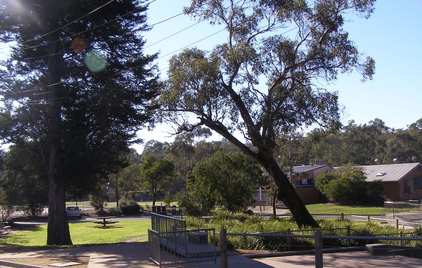
Message from the Mayor
                   Manningham Council’s vision is for a vibrant, safe and culturally
diverse community that fosters participation, connectedness, harmony, social
inclusion, health and wellbeing.

The more than 300 parks and Reserves across Manningham are valuable assets and
Council is strongly committed to providing the highest standard recreation and
relaxation facilities to the community, so they can be enjoyed today and by future
generations.

With competing priorities and limits to development funding, it is crucial that Council
works with the community to produce Management Plans to prioritise the
development, management and conservation of our recreational areas.

Zerbes Reserve is an important recreation reserve in East Doncaster that offers the
local community a wide range of structured recreation and sporting opportunities and
informal activities such as walking, dog walking, jogging, exercising, playground use,
picnicking, connecting with nature and simply relaxing.

The 2011 Zerbes Reserve Management Plan has been developed in conjunction with
the local community to provide a guide for the future use, development, landscaping,
management and maintenance of the Reserve.

The Management Plan will be used as a resource for Council Officers involved in the
planning, development and management of the Reserve and will be available to the
community to help them stay informed about the implementation of the Plan.

I would like to thank the community for their contribution to the consultation process to
date as it has greatly assisted us to identify the issues and opportunities that have
shaped the development of this Management Plan.

GEOFF GOUGH
Mayor

                                           2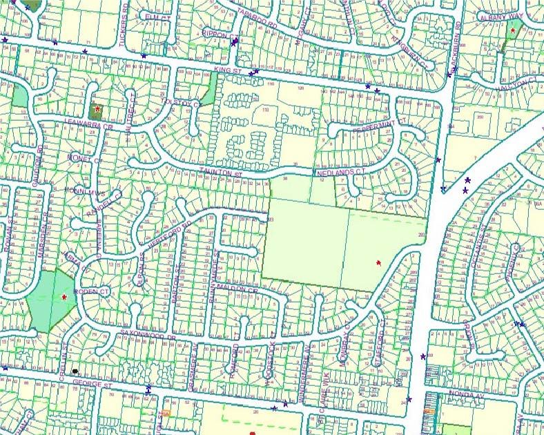
Contents
1         Introduction ................................................................................................. 6
    1.1      Manningham’s Open Space................................................................................................7
    1.2      Purpose ...............................................................................................................................8
    1.3      Key Attributes of Zerbes Reserve Environs ........................................................................8
    1.4      Site History ........................................................................................................................10
    1.5      Methodology......................................................................................................................11
2         Existing Conditions................................................................................... 12
    2.1      Study Area.........................................................................................................................12
    2.2      Land Tenure and Planning Controls .................................................................................13
    2.3      Natural and Cultural Environment .....................................................................................15
    2.4      Safety Management ..........................................................................................................15
3         Reserve Utilisation .................................................................................... 16
    3.1      Informal Recreation Use ...................................................................................................16
    3.2      Cultural/Social Activities ....................................................................................................19
    3.3      Formal Recreation Use .....................................................................................................20
4         Open Space and Landscape Values ........................................................ 25
    4.1      Conservation Values .........................................................................................................25
    4.2      Heritage Value...................................................................................................................27
    4.3      Zerbe Family .....................................................................................................................28
    4.4      Pine Management .............................................................................................................28
    4.5      Boundary Fences ..............................................................................................................29
    4.6      Fauna/ Bird Life .................................................................................................................30
    4.7      Neighbourhood Links ........................................................................................................32
5         Reserve Infrastructure .............................................................................. 33
    5.1      Landscape.........................................................................................................................33
    5.2      Signage .............................................................................................................................34
    5.3      Public Toilets .....................................................................................................................35
    5.4      Lighting..............................................................................................................................35
    5.5      Seating ..............................................................................................................................35
    5.6      Vehicle Access and Car Parking.......................................................................................36
    5.7      Litter ..................................................................................................................................37
    5.8      Power ................................................................................................................................37
6         Actions ....................................................................................................... 38
    6.1      Objective 1: INFRASTRUCTURE ....................................................................................38
    6.2      Objective 2: PARK ACCESSIBILITY................................................................................41
    6.3      Objective 3: RESERVE UTILISATION.............................................................................42
    6.4      Objective 4: OPEN SPACE & LANDSCAPE CHARACTER ............................................43
    6.5      Objective 5 CONSERVATION VALUES ...........................................................................43
    6.6      Objective 6: HERITAGE VALUE .....................................................................................45
    6.7      Monitoring and review of the Management Plan...............................................................46
    6.8      Consultation ......................................................................................................................46
Appendix 1............................................................................................................ 47
Planning and Policy Context............................................................................... 47
Appendix 2............................................................................................................ 54
Community Consultation .................................................................................... 54
Appendix 3............................................................................................................ 71
Demographic Analysis ........................................................................................ 71
Appendix 4............................................................................................................ 78
Zerbes Reserve Safety Management Plan ......................................................... 78

                                                                         3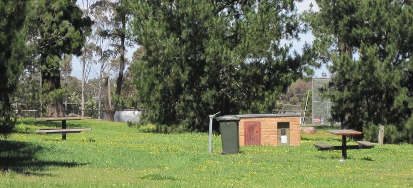
Executive Summary
Management Plans are produced for complex recreation areas that accommodate a range of
facilities and services and / or open space areas with a range of uses and purposes including
formal and informal recreation, landscape and environmental values. These reserves are
important community assets and due to competing priorities and limited funding, planning and
prioritising the development, management and conservation of these areas is crucial.
The purpose of the Zerbes Reserve Management Plan is to plan for the enhancement, land
management and maintenance of the Reserve for the active and passive recreation and
social needs of the community. The Management Plan includes an overview of the current
uses and provides a guide for the future use, development, management, landscaping and
maintenance of Zerbes Reserve.
Zerbes Reserve is an important community recreation reserve, covering an area of
approximately 8.0 hectares. The Reserve serves the East Doncaster area and surrounds.
The activities that take place at the Reserve occur both formally as structured recreation and
competition including football, cricket, scout and guide activities and informally such as
walking for recreation and fitness, dog walking, jogging, exercising, playground use,
picnicking, connecting with nature and simply relaxing. The opportunities offered at the
Reserve currently cater for all age groups.
Facilities within the Reserve include a scout hall, guide hall, playground, sporting oval,
pavilion used for football and cricket, cricket practice nets, barbeques, picnic tables, limited
walking/cycling paths and areas of open space and car parking. The Reserve contains an
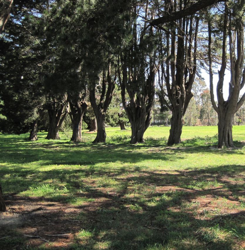
area of significant remnant vegetation which is protected within a “Conservation Zone”, a
stand of Monterey Pine trees, an Avenue of Honour and a Monterey Cypress windbreak.
The endorsed Zerbes Reserve Management Plan will be used as a resource document to
guide planning, development and management of the Reserve. It will also be available for the
community to access so that they are able to understand Council’s Vision for the Reserve
and are informed of the scope of future works at the site. The Plan contains
recommendations for capital works, as well as long term aims and objectives for the Reserve.
Vision
To provide for a wide range of social, recreational and environmental opportunities to create
and sustain a lively community park.
Aims:
To balance management, conservation and development opportunities in line with community
needs and expectations;
To continue sustainable utilisation of the Reserve by the community;
To provide facilities and landscapes for a range of recreational and community
activities where people of all ages can come together and feel safe;
To maintain facilities and landscapes in optimum condition; and
To minimise the impact of recreational pursuits on the environment.
4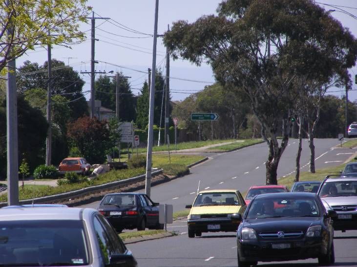
Following discussions with stakeholders, observation of trends and consultation with
residents, the following six objectives were prepared to guide the action plan for the future
management of Zerbes Reserve.

Objective 1: INFRASTRUCTURE
Maintain and improve the range of infrastructure for formal sport and informal recreation
within the Reserve.

Objective 2: PARK ACCESSIBILITY
Improve physical access including pedestrian, cycling and vehicular access and flow to and
through the site.

Objective 3: RESERVE UTILISATION
Increase community utilisation of the Reserve and expand the range of opportunities
available within the Reserve to inspire and promote socialisation and community
connectedness.

Objective 4: OPEN SPACE and LANDSCAPE CHARACTER
Maintain and improve opportunities for informal and passive recreation values at Zerbes
Reserve.

Objective 5: CONSERVATION VALUE
Protect and conserve the natural environment and wildlife habitat, rehabilitating and restoring
degraded areas; expanding the conservation zone and aligning the development and
refurbishment of built facilities with Ecologically Sustainable Design principles.

Objective 6: HERITAGE VALUE
Protect and conserve the heritage values of the Reserve for current and future generations.

                                              5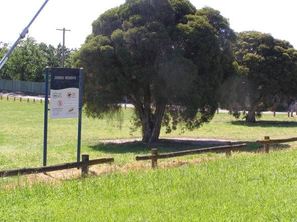
1 Introduction
                                 Zerbes Reserve provides natural areas, playing fields, open
                                 space, a playground and formal and informal recreation
                                 facilities.

                                 The park covers an area of approximately 8.0 hectares
                                 providing a “green lung”, a place for people who live in the
                                 surrounding area to recreate, play, relax and appreciate the
                                 outdoors and nature.

                                  The park has a history that informs what we see today
                                  dating back to indigenous Australia. The area was settled by
German orchardists, one of which the Reserve is named after and is now surrounded by an
eclectic mix of cultural backgrounds including Anglo Saxon, Chinese, Italian and Greek.

The park exists within one of the most populated residential communities within Manningham.
There are many children living in a 2km vicinity of the park represented by 8 local primary
schools and a secondary college. The Reserve is also a 5-minute walk from a local activity
centre and abuts a sizeable retirement home and independent living units for older adults.

The park is an important asset to the local community who are passionate about maintaining
it in a form which maintains the existing balance between the structured sporting
opportunities and passive recreation, and the open space and environmental benefits it
currently offers. Zerbes Reserve provides a place for the local community to experience
formal and informal activity, socialisation, relaxation and solitude.

This park has the potential to enhance these benefits and better connect to the surrounding
spaces and people. This Management Plan is a framework for making this happen.

                                             6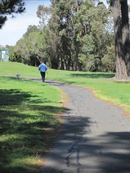
1.1 Manningham’s Open Space
The City of Manningham is located twelve kilometres north-east of Melbourne and covers 113
square kilometres. The municipality has a population of 118,5447 residents (June 2009, ABS
Census) and includes the suburbs of Bulleen, Doncaster, Doncaster East, Donvale, Lower
Templestowe, Templestowe, Park Orchards, Warrandyte, Wonga Park and North Ringwood.
The Yarra River provides the northern boundary to Manningham.

The Manningham open space network covers 19.8km2 and represents 17% of the area of the
municipality. It comprises over 300 parks and reserves. The City has one of the largest
networks of parks and open space in Metropolitan Melbourne.

Manningham City Council’s vision for public open space is:
“an open space network which provides a range of active and passive recreation
opportunities in accordance with community needs, which is readily accessible, conserves
and enhances the natural and cultural resources of the municipality, contributes to the local
economy, and offers an amenable environment in which to live, work and visit for current and
future generations”.

Manningham City Council is involved in the provision of open space recreation opportunities
because it believes that there are a number of benefits that derive from participation in, and
provision of, a diverse range of quality recreation opportunities including social, health,
environmental, urban liveability, cultural and economic benefits. Specific benefits in these
fields include:

Social/Health
Environment is a major influence on health. By providing high quality open space networks,
Council can create an environment that is supportive of health and encourages activity that
reduces the likelihood and extremity of disease. Activities within open space areas such as
walking have health benefits such as improved cardiovascular fitness, lower blood pressure,
stronger muscles and bones (built up by walking regularly), and decreased stress. Open
space areas are also social spaces that provide links with the broader community and
encourage social connections.

Environment
Open space provides for important ecological aspects such as waterways, flora and fauna.
Vegetation in open space provides habitat for wildlife and opportunities for people to connect
with and appreciate nature.

Urban Liveability
Open space brings an aesthetic value to a neighbourhood by providing a “green break”
between houses and roads.

Culture
Open space can be a venue for cultural displays, festivals, programs and activities. Open
space can also have pre settlement or post settlement cultural and heritage significance
associated with specific sites or features.

Economic
The economic benefit of open space can be measured in the spin-off effects of visitation and
tourism and the role of high quality open space in attracting residents to Manningham and
thus enhancing property values.

                                              7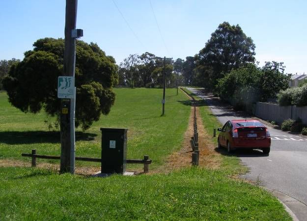
1.2 Purpose
A Management Plan is a document which sets out the uses, objectives and proposals for the
Reserve, as well as plans showing the proposed development for the Reserve in response to
the consultation with park users and local residents.

Manningham’s Open Space Strategy (2004) recommends providing a Management Plan for
reserves which have a range of uses and for which the planning is complex, including
Sporting Reserves, Conservation Reserves, Reserves of Municipal Significance, Community
Recreation Reserves and Linear Parks.
This Management Plan has been prepared to express a future framework for the use,
development and management of the Reserve based on feedback from user groups and the
local community. It proposes actions and budgets for developing and maintaining the
Reserve.
The endorsed Zerbes Reserve Management Plan will be used as a resource document for
Council Officers involved in the planning, development and management of the Reserve. It
will also be available for the community to access so that they are able to understand
Council’s vision and future works.
The endorsed Zerbes Reserve Management Plan is the basis for new capital works funding
to enhance and improve the Reserve and associated infrastructure over the next ten years.

1.3 Key Attributes of Zerbes Reserve Environs

Residential Character
Zerbes Reserve abuts residences to the north, south and west. The residential character is
made up of predominantly free standing dwellings. The initial period of dwelling construction
dates back to 1965-70, with pockets of new development to the north and northeast. Front
setbacks are typically 7-10 metres, with approximately 70% of front boundaries unfenced.
Street trees in the area contribute little to the streetscape character. The road layout is a grid
pattern including footpaths both sides. There is potential in future for enhanced street tree
planting. Local residents value Zerbes Reserve in terms of its proximity and use the Reserve
for a range of structured and unstructured recreational pursuits such as walking, dog
activities, nature appreciation and use of the playground.

Roseville Retirement Village
Roseville Retirement Village is situated at 100 King St and extends through to the northern
side of Taunton Drive, opposite Zerbes Reserve. The Roseville Retirement Village is owned
by Retirement Villages Group (RVG) via its proprietorship of 3 major lots in the strata
subdivision − namely a community centre, manager's residence and 38 room serviced
apartment complex. There are also 110 independent living lots in a village style subdivision.
In total there are in excess of 150 residents, all aged over 60 years and with an average age
of approximately 85 years. Roseville residents use the Reserve as an area for walking, dog
activities and passive recreation activities. The Reserve is also used as a thoroughfare for
residents to access the nearby Donburn Activity Centre on Blackburn Road.

                                                8
Community Facilities
Local Schools
At the time of developing the Management Plan it was determined that there
was a total school aged population (5 -17 year olds) of 4,797 pupils. This
includes 8 primary schools and 1 secondary college which exist within 2km
proximity to the Reserve. The schools are listed below:-
Beverley Hills Primary – 2-14 Cassowary Street, Doncaster East
(approx 178 pupils)
Donburn Primary – 22A Colchester Drive, Doncaster East (312
pupils)
Doncaster Gardens Primary – 4-20 Sandhurst Avenue, Doncaster East (520
pupils)
Milgate Primary School – Landscape Drive, Doncaster East 3109 (604 pupils)
Our Lady of the Pines – 59-77 Carbine Street, Donvale 3111 (470 pupils)
Serpell Primary – Tuckers Road, Templestowe (870 pupils)
St Charles Borromeo – 222 Serpells Road, Templestowe ( 180 pupils)
St Peter and St Paul Primary – 16 Beverley Street, Doncaster East (200 pupils)
East Doncaster Secondary College – George Street, East Doncaster (1,463
pupils)
Salvation Army
The Doncaster Corps of the Salvation Army is located at 37 Taunton Street directly opposite
the northern boundary of Zerbes Reserve. The facility operates as a church and provides a
range of community programs including an over 50’s companion program, pre school
program, music and holiday programs and limited welfare and community connection
services. The facility includes a utility hall with a full size carpeted basketball court and is
available for hire.
Donburn - Neighborhood Activity Centre
Located on busy Blackburn Road in Doncaster East no more than 1km from Zerbes Reserve
is Donburn Activity Centre, a small local convenience centre providing extensive dining and
takeaway facilities. Notable features of the Centre are the concentration of real estate firms
and presence of a large chemist and medical centre. The Centre is distinctive in that it is
surrounded by a significant number of medium density developments, adding to the vitality
and activity of the Centre both during the day and night.
Donburn Activity Centre fulfils a valuable retail and entertainment role for the surrounding
medium density residential community and businesses located within the Centre as well as
for the wider catchment.
East side West side
The western side of the precinct has a strong Asian influence with a number of Chinese
and Japanese restaurants and take away food outlets.
9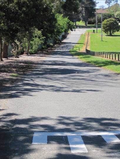
1.4 Site History
Manningham’s Aboriginal History
Manningham City Council acknowledges the Wurundjeri tribe as the traditional owners of
Manningham in which Zerbes Reserve sits. Investigation into the Aboriginal heritage values
of Zerbes Reserve via the Victorian Aboriginal Heritage Register determined that there are
registered Aboriginal Places on the nominated area of land.
Early Settlers
Information provided by the Doncaster and Templestowe Historical Society indicates that
farming in the area surrounding Zerbes Reserve commenced in 1853 with a syndicate of
three German pioneers buying an area of 320 acres located between George Street, Victoria
Street and Blackburn Road. In 1880 part of the land which Zerbes Reserve now constitutes
was purchased by a farmer, Fred Pickering, the son of the first permanent settler in
Doncaster. In 1932 the land was sold to Fred Zerbe, an early German settler. The naming of
the Reserve represented the active role the Zerbe family played in the early settlement of the
East Doncaster area.
In 1945 Blackburn Road to the oval was a paddock with extensive indigenous tree cover. The
Zerbe family home was located in the northwest corner of an open grassed area on
Blackburn Road (adjacent to conservation area). In 1957, the area that is now the oval was
still an orchard and the Taunton Street/ Nedland Court parcel of land was a combination of
orchard and a partly treed paddock separated by a Monterey Pine windbreak. Development
in East Doncaster dates from the post-war era. The oldest residential areas of East
Doncaster are those around Doncaster Road in the south of the suburb, first developed in the
1950's. Zerbes Reserve was acquired by Council in 4-parts between 1960 and 1982.
Land was purchased from:
Zerbe family in 1960 for £10,181 for Doncaster East Recreation Reserve (293
Blackburn Rd);
Melbourne Metropolitan Board of Works (MMBW) in 1972 for $48,018 for public
open space (293 Blackburn Rd);
Taunton developments in 1976 for municipal purposes (38-46 Taunton St); and
Kepons & Warson in 1982 for municipal purposes (12-13 Nedlands Court)
Facility Development
Facility development at the Reserve took place in the following years:
1960-1964 Oval, toilets and scout hall built
1970 Pavilion, access roads, southern cricket nets built and houses were
being built on the west, south and east sides. The Zerbe family home
was demolished during this period.
1975 Avenue of Honor moved from Blackburn Road into Zerbes Reserve
1984 Guide hall and playground built on Taunton Ave. There were no houses
north of Zerbes at this point. Residential development in the northern
parts of the suburb continued through to the late 1980's.
1990 A joint committee of Zerbes Reserve sporting clubs including Beverley
Hills Junior football Club, Doncaster East football Club and East
Doncaster cricket Club approached Council with a proposal to refurbish
the club rooms at the Reserve.
1991 Committee requested by Council to finalise plans and prepare cost
estimates for the proposal.
1998 Pavilion upgrade.
10Other Management Plans
The previous Management Plan for Zerbes Reserve was completed and endorsed by Council
in 1992. Revision of the 1992 Management Plan commenced in 2004 but was halted during
the consultation phase when certain elements were not supported by the local community.
The majority of recommendations from the 1992 Management Plan were implemented soon
thereafter and work on the current 2010 Management Plan has shown that a similar scope of
works to the 1992 recommendations are required with upgrades that include park furniture,
play space, pathways and car park.
Changes since the 1992 Management Plan that were not part of the plans
recommendations include:
Disbandment of the Zerbes Reserve Advisory Committee; and
Establishment of the BBQ area on the Taunton Street/Nedland Court side of the Reserve.
Changes since 2005 that were not part of recommendations from the
consultation include:
Demolition of the SES building; and
Conservation area fenced off to the public allowing trees to be left to encourage natural
regeneration of the area as per the recommendation in the Heritage Garden and Tree Study
(2006).
1.5 Methodology
Activities of the review and development of the Management Plan consultation included:-
1) An understanding of State and Municipal policy context (Refer Part 2 - 7)
2) ‘Your Community Voice’ questionnaire; distributed to 1200 residents
3) Key stakeholder consultation including meetings with sports clubs and reserve users;
4) An undertaking of demographic and use trends (Refer Appendix 1)
5) Analysis of existing conditions, risk assessment of use and facilities;
6) A review of current management priorities and issues;
7) Further consultation in relation to the proposed training net facility including meetings
with concerned residents, onsite consultation and BBQ session in the Reserve and
distribution of a further ‘Zerbes Reserve Fact Sheet’ and ‘Zerbes Reserve Feedback
Form” to residents.
The key stakeholders consulted included:-
Surrounding residents and users of the Reserve;
Beverley Hills Junior Football Club;
East Doncaster Football Club (Senior);
East Doncaster Cricket Club (Junior and Senior);
East Doncaster Girl Guides;
3rd East Doncaster Scout Group;
Roseville Retirement Village
East Doncaster Secondary College
Onemda Association
Salvation Army Doncaster Corps
Relevant Council staff
112 Existing Conditions
2.1 Study Area
Zerbes Reserve is 8.0 hectares in area and is located on Blackburn Road, between King and
George Streets, East Doncaster. The site can be accessed by car at Blackburn Road and
Saxonwood Drive or by foot or bike only from entrances at Taunton Street and Hertford Road.
The Reserve incorporates areas of open space, passive recreation areas, a fenced sporting
oval, pavilion, synthetic and turf cricket wickets, a scout hall, a guide hall, a playground, picnic
and BBQ facilities, public toilets, pathways and car parking areas.
The reserve is highly valued by local residents for a range of uses most predominantly for
walking and informal exercise either by themselves, with their dog, children or grandchildren,
for the play space and for opportunities to enjoy its natural elements such as the pine trees,
conservation area and wild life. There are a number of organised clubs and organisations
using the reserve for structured sporting and recreation activities including football, cricket,
guides and scouting.
Significant environmental and cultural features of the land include a prominent biosite, a
windbreak of Monterey Cypress trees to the north of the Reserve which have been identified
as having cultural value representing Manningham’s early orcharding heritage. There is also
a stand of Monterey Pine which is highly valued by the local community. An Avenue of Honor
adjacent to Saxonwood Drive which replaced an earlier Blackburn Rd avenue removed in the
1970’s for roadworks pays tribute to those who served in the Great War 1914-1918.
For the purposes of consultation for the development of the Management Plan the reserve
was divided into a series of zones.
The location of the study area including zones.
122.2 Land Tenure and Planning Controls
Zerbes Reserve – Existing and Proposed Planning Controls
Zerbes Reserve is generally bounded by Blackburn Road, Taunton Street / Nedlands Court
and Saxonwood Drive, East Doncaster and consists of four parcels of land;
Taunton St (LP114915);
Nedlands Court (LP139680); and
Blackburn Rd (Lot 1 TP323996, Lot 3 PS418262P, Vol 10548, Fol 764)
Existing Planning Controls
Existing Zone
The entire Zerbes Reserve area is affected by the Public Park and Recreation Zone (PPRZ),
reflecting the purpose of the Reserve:
“To recognise areas for public recreation and open space.
To protect and conserve areas of significance where appropriate.
To provide for commercial uses where appropriate.”
Figure 2.2.1 Land Parcels Affected by Public Park and Recreation Zone (PPRZ).
Existing Overlay
Only the parcels of land identified as 293 Blackburn Road are affected by a Vegetation
Protection Overlay (VPO5) which relates to the Monterey Cypress windbreak, Avenue of
Honour and the Lone Pine. No other overlay controls apply.
VPO5 recognises and protects a range of gardens and exotic, Australian native and
indigenous trees on private and public land within the municipality, as identified in The
Manningham Heritage Garden & Significant Tree Study – Stage 2 (April 2006). These trees
are significant for their cultural, heritage, aesthetic or landscape contribution. It is important
to note that VPO5 only provides protection to the specific trees identified in the
abovementioned study.
13Proposed Planning Controls
Proposed Overlay
As part of Amendment C54 to the Manningham Planning Scheme (exhibited 22 July 2010 - 3
September 2010), it is proposed to apply Environmental Significance Overlay (ESO2), to the
area of biological significance following non-cadastral boundaries (i.e. not following property
title boundaries). Sites proposed to be covered by ESO2 have been assessed as being the
most intact and significant areas of native vegetation, within Manningham, as identified in
Manningham City Council Sites of (Biological) Significance Review, 2004. The remainder of
the site was proposed to be covered by ESO3 (see figure 2.2.3 below)
Figure 2.2.3 Land Parcels Affected by Environmental Significance Overlay
ESO2/ESO3) as exhibited.
A total of 10 submissions relating to Zerbes Reserve were received during the public
exhibition period for Amendment C54. It was noted in the submissions that the planning
controls proposed under C54 do not extend over the entire boundary for Zerbes Reserve. In
querying the proposed controls for the area, submitters sought for the application of the
proposed ESO3 to be replaced with a Significant Landscape Overlay (SLO7) and to extend
this over the parcels of land included within 38-46 Taunton St and 12-13 Nedlands Court.
The proposed SLO7 seeks to protect pine and cypress trees in identified pine tree theme
areas.
It is noted that the parcel abutting Taunton Street is largely covered by pine trees and the
proposed ESO3 provisions would not afford protection to the pines as under this control, they
would be exempt from requiring a permit for their removal. Refer to section 3.7.2
It is considered that the most appropriate mechanisms for protecting and managing the trees,
particularly pine trees, is the Zerbes Reserve Management Plan. However, Council has
made application to an independent panel regarding the application of the SLO7 in place of
the ESO3 and extend this control over the northerly parcels of land.
The planning controls over Zerbes Reserve may need to be reviewed depending upon the
outcome of the independent panel.
14The Zerbes Reserve Management Plan has responded to resident concerns in the following
ways;-
Recommend replacement of any pine trees with appropriate species of pine trees
in the north-west part of Zerbes Reserve.
Request the independent panel to consider applying an SL07 in lieu of the initially
proposed ES03 and extend this control over the Taunton Street and Nedlands
Court land parcels.
2.3 Natural and Cultural Environment
Zerbes Reserve has areas of significant ‘remnant indigenous vegetation’, which occurred
naturally in the municipality prior to European settlement. Most of this vegetation is located
within the fenced off ‘Conservation Area’ which covers approximately 9400m2. However
other areas outside the fenced area, take the total area of remnant vegetation in the Reserve
to over 1.6ha.
A number of trees suggestive of the farming history of the area also remain at Zerbes
Reserve. A Monterey Cypress windbreak consisting of seven poor specimens and a mature
planting of Pinus Radiata are located in the northern portion of the Reserve. These trees are
highly valued by the local community and form a local landmark.
The management issues and recommendations relating to the remnant bushland areas of the
Reserve are discussed in Section 4.1. Conservation Values of this Management Plan
2.4 Safety Management
A risk assessment was undertaken at the Reserve by Council’s Safety, Health and
Environment (SHE) and Risk Management Consultant. The issues identified will be
addressed during the implementation phase of the Management Plan (Refer Appendix 4)
(and includes a summary of existing maintenance issues).
153 Reserve Utilisation
Zerbes is a very popular and well utilised reserve providing a range of facilities and spaces to
cater for formal and informal recreation activities. A key function of the Management Plan for
Zerbes Reserve is to identify opportunities for improvements and upgrade of park
infrastructure and facilities to enhance the park users’ experience. Opportunities for
improvements and upgrades were identified through consultation with local residents and
user groups of the Reserve and were considered in line with Council and statutory policy
guidelines and availability of resources.
3.1 Informal Recreation Use
Walking/Cycling
Consultation revealed that walking for pleasure and exercise, with others and with dogs is a
popular activity undertaken within the Reserve. Zerbes Reserve
also forms an important thoroughfare for residents in the
surrounding neighbourhoods to public transport links, schools
and shopping facilities.
Providing good pedestrian and cycling paths through the Reserve
is integral to supporting walking and cycling activity and providing
a healthy and convenient alternative to accessing areas within
the park as well as nearby amenities.
Consultation revealed that:
Existing paths although in poor condition are well
utilized.
There is a requirement to upgrade the existing paths
to improve their safety and useability.
There is a requirement for additional paths to
enhance ease of access particularly in a north/south
direction across the Reserve.
There was a level of interest for a path to circumnavigate the outside of the oval.
A path around the oval is constrained by the lack of space between the oval fence and the
embankment on the western side. Walking can take place around the inside perimeter of the
oval fence and alternative options for circuit walking will be provided if a new north/south
pathway which transverses the Reserve is implemented. There is an action item within
Manningham’s Bicycle Strategy Supplementary Action Plan for a shared path through Zerbes
Reserve to link Hertford Road to Nedlands Court. A shared path link through Zerbes Reserve
will strengthen the link between Ruffey Lake Park, Zerbes Reserve and Blackburn Road.
Actions
Improve and upgrade the path links between Taunton Street, Nedlands Court,
Hertford Road and the carpark in the northern section of the Reserve.
Install a new path link across the Reserve from the north to the south-east.
Install a short path link from the south side of the footpath on Blackburn Road to
the park entry road to negate the need for vehicle and pedestrian shared use of
the road at the entry/exit point to the Reserve.
16Dog Activities
The Reserve is classified as an off lead reserve provided that dogs are kept under effective
control at all times. For health and safety reasons, dogs must be on-lead at Zerbes Reserve
within 15 metres of the children’s playground, an organised sporting event (cricket, football,
netball and tennis) and an approved function or public meeting.
The “Our Community Voice” questionnaire responses indicated dog walking is a popular
activity undertaken at the Reserve. A number of responses also indicated requests for more
dog litter bins. There were requests for the Reserve to be made an on-leash reserve by
certain users who stated they were frightened by dogs and also feared for the safety of their
children.
Council’s Health and Local Laws has been consulted and indicated that there have been no
recorded complaints in the vicinity of the Reserve and dog owner behavior is considered
good. The Open Space Strategy is reviewing the status of dogs in areas of high conservation
value and any recommendation will be considered as part of the Domestic Animal Strategy
(due to be reviewed in 2014).
The need to offer specific bins for dog litter was identified through the consultation. However,
while Council does maintain dog litter bins in various Manningham reserves, there will not be
any new dog litter bins installed. Council encourages people to dispose of dog litter through
the existing litter bins in parks.
Actions
Retain existing dog controls in the Reserve.
Refer any recommendation from the Open Space Strategy regarding the status of
dogs in areas of high conservation value to the Domestic Animal Strategy Review
(due 2014).
Encourage dog owners to dispose responsibly of dog litter through the ‘all
purpose’ park bins.
Open Space
The area of open space at the front of Zerbes Reserve which is bounded by Blackburn Road
and Saxonwood Drive is a valued element of the Reserve. Consultation identified that the
area is used for exercising, walking, playing with children, relaxation and watching or playing
sports or ball games.
Although the space is used by both the senior and junior football clubs for pre season
training, the majority of use is unstructured and informal. Some suggestions for improvement
of this area included levelling, more seating, more trees, better parking and inclusion of a
BBQ picnic shelter.
Actions
Retain the area bounded by Blackburn Road and Saxonwood Drive as informal
open space.
Regrade and top dress the area bounded by Blackburn Road and Saxonwood
Drive to improve drainage and enhance safety and accessibility.
Enhance the area bounded by Blackburn Road and Saxonwood Drive with native
avenue tree planting.
17Play
In the Reserve, there is one formal play space and other informal play areas that have been
developed at various times. The informal play spaces/ cubbies are often made under the
pine trees in the area known as zone 1 and also in the fenced conservation area. These
informal areas in the trees give children a sense of space, being hidden, freedom, absence of
adults, creating, building, imagining and exploring which are all important developmental
experiences that should be encouraged. In our increasingly urbanised society, parks play a
more important role in the provision of such play. The placement of a picnic table under pine
trees close by will allow guardians of younger children to observe them playing safely.
The existing formal playground was installed as an action from the 1992 Management Plan.
However, the play ground is now outdated and requires replacement to provide a broader
range of play opportunities for all ages.
East Doncaster is the most densely populated suburb within Manningham and given Zerbes
Reserve is a large expanse of open space with a sporting precinct and in close proximity to
many schools, there is scope for the development of a district level play space to cater for a
more diverse age range. Other play spaces in 700m radius include Leawarra, Hertford,
Albany and Apple Blossom Reserves, all of which cater primarily for the 1-7 years age group
with limited play opportunities.
Apple Blossom Albany
Leawarra
Hertford Zerbes
3.1.2 Location of Surrounding Play Spaces.
The Urban and Park Design Guidelines provide some themes and landscaping
recommendations that could also be introduced into the play environment at Zerbes Reserve.
There is potential to interface the play space with the conservation area by increasing
plantings so that part of the nature experience extends outside the fenced conservation zone.
This creates a buffer between the conservation zone and the rest of the Reserve that allows
for interaction in nature without disturbing important conservation areas and creates an
opportunity for park users to appreciate some of the natural elements. Pathways can then be
used to create clear boundaries between the different management regimes and the large
open space area can be preserved.
Consultation identified considerable support for the existing play space to be expanded and
upgraded to offer more play variety for a broader range of age groups. Suggestions include
incorporating a nature based theme to align with the environmental elements of the Reserve,
improved shade planting and landscaping, more seating and a picnic/BBQ area.
18Actions
Upgrade the formal play space and investigate moving its location further north
into zone 4 (away from significant vegetation).
Encourage and monitor informal play and recreation opportunities by retaining the
lower branches of an existing stand of pine trees (Taunton St entrance).
Include access from the playspace into the conservation zone.
BBQ and Picnic Facilities
Consultation has identified that Zone 1 is a highly utilised area and an area that is highly
valued by the local residents for its pine trees and as a passive recreation area. There was
overwhelming feedback to suggest that the area be preserved in future as a passive
recreation area. Consultation has determined that there is demand for additional seating and
picnic table options in this area. Similarly there was feedback seeking shade, picnic and BBQ
facilities be located within proximity to the play space. There is evidence to suggest that these
enhancements would be well utilized and welcomed by residents.
There is presently a rubbish bin, drink fountain, picnic tables and BBQ facilities located in
zone 1 which services the residents at the northern end of the Reserve. The existing picnic
tables need upgrading but the BBQ is in well maintained condition. There is an opportunity to
add additional picnic tables in Zone 1 to enhance opportunities for picnicking, reading the
paper, rest and relaxation. The proposed upgrade to the existing playspace will incorporate a
picnic shelter and BBQ. It is intended that orchard themed shade trees be planted strictly in
close proximity to the picnic tables to reinforce the reserve’s orcharding history.
Actions
Provide picnic facilities, shelter, BBQ and people/pet drink fountain as part of the
playspace upgrade.
Install new picnic tables in Zone 1 amongst the Pine Trees in close proximity to
the existing BBQ.
Upgrade existing picnic tables adjacent to BBQ.
Upgrade the people/pet drinking fountain in Zone 1.
Plant ornamental orchard trees to reference orchard heritage
3.2 Cultural/Social Activities
A local reserve provides an area of green open space for those that live around it and also for
those driving and walking past. Areas of open space are publically owned land that exists for
the benefit of all. Often areas of open space are intermittently used for cultural and social
activities and events.
19There are opportunities to investigate a range of future uses for Zerbes Reserve that offer
expanded recreational, cultural and social opportunities for residents living in and around the
park. Zerbes Reserve provides a great location for such activities and would promote
participation in such events by residents of the nearby Roseville Retirement Village who may
otherwise have difficulty accessing community events and activities of this type.
Actions
Investigate opportunities to expand Manningham’s community events program to
Zerbes Reserve e.g. Cinema in the Park, Farmers Market, Community Carols,
Pets in the Park days, Manningham Music.
Investigate informal recreation opportunities such as walking groups, tai chi and
‘Know Your Neighbour’ activities.
3.3 Formal Recreation Use
Beverley Hills Junior Football Club
The club was formed in 1967 and is a member of the Yarra Junior Football League. In 2010,
the club fielded 12 teams and an Auskick program comprising 360 members.
East Doncaster Football Club (Senior)
Originally known as Beverley Hills Football Club, East Doncaster Football Club has been a
member of the Eastern Football League (formerly Eastern Districts Football League) since
1982. In 2010, the club fielded 3 teams with approximately 500 members.
East Doncaster Cricket Club (Junior & Senior)
East Doncaster Cricket Club was formed in 1886 and is currently a member of the Eastern
Cricket Association. In 2010, the club fielded 15 teams comprising 134 senior members, 93
junior members and 20 social members in competition to suit all levels of ability. Six teams
use the turf practice wickets and nine teams use the synthetic practice wickets. The club
facilitates an All Abilities program, ‘No Boundaries,’ for people with an intellectual or physical
disability.
Consultation with the sports clubs demonstrated similar opportunities and constraints for the
Cricket, Senior and Junior Football Clubs and for this reason have been grouped together.
The Clubs’ Combined Top Priorities are:
Construct a curator’s outbuilding to support a new club funded electronic
scoreboard and free up space within the pavilion for storage;
Provide tinting or blinds for the pavilion windows to reduce sun glare;
Upgrade oval floodlighting;
Upgrade existing and provide new additional spectator seating;
Provision of pavilion expansion & or addition of a veranda;
A balcony (as per original pavilion building plans) would be beneficial;
Improve airflow with an upgraded air conditioning system;
Increase storage capacity.
There are no female toilets in the change rooms downstairs. Change rooms cater
for same sex competition. Female spectators for the junior competition currently
use the public toilets. Refurbishment of the public toilets.
20Sports Club Pavilion
The pavilion was refurbished in
February 1998 and is adequate
for the type and scale of use.
Some work around the pavilion
is required. For example, the
ashpalt surface has
deteriorated and the post and
rail fence above the retaining
wall requires upgrading.
Change room facilities cater for
same sex competition only.
The junior football club locks
the pavilion during their
competition so all female
spectators are required to use the public toilets. Males are able to access the designated
male toilets in the change rooms downstairs.
Actions
Council to work with the clubs to address storage issues.
All clubs to make the female toilets in the social rooms available on competition
days.
Council to work with the clubs to address sun glare and air conditioning issues.
Replace public toilets (refer 5.3).
Re-level and re-surface asphalt on the north and south sides of the pavilion.
Galvanised post and rail fence at north eastern end of oval, replace rails with black
powder coated rails and paint galvanised posts with black paint.
Any pavilion upgrade will only be considered within the existing building footprint,
due to proximity to residences.
Oval
The oval’s size and close proximity to facilities means it receives approximately 80% usage
by all Clubs across both summer and winter seasons. The centre wicket is turf and a curator
is employed to maintain the sports field and turf practice nets all year round for cricket and
football. The sports oval has ongoing drainage issues that need to be addressed. The
existing safety netting behind the goal posts, at the southern end of the oval serves to prevent
balls going into neighbouring properties. The supporting posts and netting both require
replacement.
Actions
Replace boundary fencing and incorporate a ‘V’ drain under the fence line around
the entire oval.
Retain the existing flood retarding basin in the south western corner of the oval.
Replace the poles and galvanised netting with soft netting behind the goals at the
southern end of the oval.
Training Facilities
In order to manage the high level of oval usage throughout the year, the football clubs in
particular require options for pre season and pre-match warm up other than the oval. Training
is important as it minimises player injury, increases participation levels in physical activity and
assists in maintaining membership. The provision for an alternative open space would
21alleviate pressure from the heavily used oval and provide an alternative pre season training
venue for the football clubs.
Council’s 2009/10 capital works budget included a proposal for an expanded training multi
purpose net facility that would alleviate pressure from the heavily used oval and provide an
alternative training venue for the clubs. At the request of the community, further consultation
regarding the multi purpose training facility was provided and resulted in Council abandoning
the proposal in lieu of a proposal to upgrade existing cricket net facilities at both the northern
and southern ends of the oval (Refer to attached Zerbes Reserve Development Plan).
Benefits include no loss of trees, pine trees are all retained in the passive recreation area
(Taunton St), improved sport facilities and reduction of wear and tear on the oval.
Actions
Proposed upgrade of cricket nets at the southern end of oval to 4 four synthetic
wickets (12.4m x 37m concrete base with shield synthetic surface, chain mesh
fence on sides and behind batsmen, height 3m to 4m high including one portable
netball post and line marking for netball training) which will also be available for
community use.
Replace two existing synthetic wickets at northern end of oval with turf wickets,
new fencing, soft retractable netting with cabinets for club use only within existing
footprint.
Spectator Area
The current viewing area is a concrete terrace
that is deteriorating, only accommodates a
small number of spectators, is difficult to
access and does not allow for easy flow of
spectators and players through the site.
The Clubs struggle to accommodate the large
numbers of spectators on game days. The
Junior Football Club has indicated that they
can have up to 350 spectators on any given
Sunday and the Senior Football Club have an
average of 300. The Cricket Club attract
between 20 and 50 spectators.
The existing sheltered spectator seating provided within the pavilion cannot be comfortably
accessed by all who visit the Reserve. At the front of the pavilion, the undercover sheltered
area does not service the spectators as it acts as the players’ race (the area where they exit
the change rooms).
There is an opportunity to upgrade the existing spectator seating on the south side of the
pavilion and incorporate landscape treatments to shade, green and soften the area. (Refer
above). There is also an opportunity to provide new spectator seating at the north of the
pavilion on the elevated grassed area above the stone retaining wall.
Actions
Upgrade the existing spectator seating on the south side of the pavilion and
incorporate landscape treatments to green, soften and shade the area.
Re-level and re-surface asphalt on the north eastern side of the pavilion and install
new seating above the existing rock wall.
Floodlighting
The oval is currently floodlit. In accordance with Council's Seasonal Allocation of Sporting
Facilities Conditions of Use Policy, floodlights may only be used during the hours when
22Tenants are allocated use of facilities as set out in the schedule, and can only be used for the
playing of matches and for training purposes. Floodlights must be turned off when matches
and training programs have finished and must not be left on or used for social functions
conducted at the ground or pavilion without prior written consent.
Floodlighting, lux, spillage and glare levels are to comply with Australian Standards 2560, and
the Department of Planning and Community Development’s Football and Netball Lighting
Guide for Floodlighting. It has been identified that the existing floodlights have come to the
end of their useful life. Council will provide a 50% percent funding contribution for the upgrade
of the existing system with the remaining 50% funding to be provided by the sporting clubs. If
funding is received from a grant, it will be divided evenly amongst the club and council and
considered as a contribution to the project.
Actions
Replace poles and upgrade floodlighting to oval in accordance with Council’s
Floodlighting Policy.
Scoreboard
The tenant club have indicated they would like to replace the existing scoreboard with a club
funded electronic scoreboard. The electronic scoreboard would be a housed on a new
curator’s outbuilding that will provide storage space for all of the curator’s equipment. The
curator’s equipment is currently stored within the pavilion. This strategy will assist with
providing additional storage within the pavilion for the East Doncaster Football Club who
currently utilise the scout hall for their store and gym but with whom the agreement expired in
October 2010.
Actions
Construct a new curator’s outbuilding (including electronic scoreboard) to the west
of the cricket training nets at the north end of the oval and screen plant to
minimise visual impact from surrounding residents.
Manningham District Scouts & 3rd Doncaster East Scout Group
Council is very supportive of the scouts and
recognises their contribution to our youth
community. The primary purpose of scouting is
recreation. Scouts cater for both sexes ranging
from six years to 26 years. The Zerbes Reserve
scout hall was originally constructed in 1963
with an extension undertaken to the eastern end
in 1979. No refurbishment works have been
undertaken to the pavilion and as a result the
pavilion is in poor condition. The building is
owned by the scouts and is managed through a
peppercorn lease agreement with Council. The
scout hall currently accommodates the storage needs for the District Scout Association and
acts as a temporary gymnasium for the East Doncaster Football Club (EDFC). This lease
expired in October 2010. An interim arrangement has been struck whereby the scouts have
surrendered part of their building to Council and Council has allowed the East Doncaster
Football Club to continue using this part of the hall until 15th March 2012.
The Third Doncaster East Scout Group, who currently meets at the hall located at the rear of
the Manningham City Council Civic Offices, will be relocated to Zerbes Reserve to make way
for the Doncaster Hill Precinct 1 Master Plan implementation. To accommodate this group
and the District Scouts, the building in Zerbes Reserve will be redeveloped to bring it up to
current day standard. The Third Doncaster East Scout Group has a strong membership base
23with 66 young people and 10 adult volunteers. The lease agreement for the scout hall is 3
years + 3 years + 3 years + 11 months (September 2005 – August 2015).
The timing for the Scout Hall redevelopment will be as follows:
Consultation on concept design with Scouts August 2011
Concept plan approval October 2011
Design finalised November 2011
Completion of tender period February 2012
Commencement of works April 2012
Completion of works September 2012
Actions
Implement upgrade works to the Scout Hall with a view to project completion by
September 2012.
Renew the lease agreement for the Scout Hall.
Support the scouts to maximise utilisation of their facilities.
East Doncaster Girl Guides
Council is very supportive of the Girl Guides and recognises their contribution to our youth
community. The primary purpose of girl guides is recreation. Girl Guides provide girls and
young women with fantastic opportunities to meet personal challenges, to learn team building
and leadership skills and to make new friends. The East Doncaster Girl Guide group currently
has 10 members. The Manningham Girl Guide District is currently undertaking a marketing
program to increase participation.
The Girl Guide hall located at Zerbes Reserve is one of only two halls located in
Manningham. There was a hall located at Saxon Drive, Doncaster that was destroyed by fire
in January 2009 and following consultation with Girl Guides Victoria and the District Girl
Guide Leader it was decided that the insurance money would be used to refurbish the hall at
Zerbes Reserve. The works were completed in spring 2010. The building is owned by the Girl
Guides and is managed with peppercorn lease agreements with Council. The lease
agreement is currently in over hold and will be renewed.
Actions
Renew the expired lease for the Girl Guide Hall.
Support the scouts to maximise utilisation of their facilities.
Recognise the East Doncaster Girl Guide group on park signage as per other
park groups and clubs.
24You can also read