Landscape Use and Local Settlement at the Nuraghe S'Urachi (West-Central Sardinia): Results from the First Two Seasons of Site Survey (2014-2015) ...
←
→
Page content transcription
If your browser does not render page correctly, please read the page content below
The Journal of Fasti Online (ISSN 1828-3179) ● Published by the Associazione Internazionale di Archeologia Classica ●
    Palazzo Altemps, Via Sant'Appolinare 8 – 00186 Roma ● Tel. / Fax: ++39.06.67.98.798 ● http://www.aiac.org; http://www.fastionline.org

       Landscape Use and Local Settlement at the Nuraghe S’Urachi (West-
       Central Sardinia): Results from the First Two Seasons of Site Survey
                                     (2014-2015)
                                          Linda R. Gosner – Alexander J. Smith

            The nuraghe S’Urachi is a monumental stone tower complex that has served as regional center
            in the landscape of west-central Sardinia from the Bronze Age to the present day. The site was
            subject to investigations in the 1940s and 1980s, producing evidence of the construction of the
            towers as well as for later domestic occupation outside the tower walls in the Punic periods. In-
            vestigations of the site were re-initiated in 2013, when the Progetto S’Urachi (Brown University,
            Comune di San Vero Milis) began a collaborative research project aimed at understanding co-
            lonial encounters and daily life at the nuraghe in the Iron Age and Roman period. In conjunction
            with the Progetto S’Urachi, a multi-phase site survey was carried out consisting of a geophysi-
            cal survey (2014), microtopographical survey (2014), intensive survey (2015), and a series of
            test trenches to confirm survey findings (2016-2017). The goal of the survey was to better un-
            derstand settlement patterns and land use in the wider landscape surrounding the nuraghe.
            This article details the results of the first two seasons of site survey,1 which show that settle-
            ment extended far beyond the limits of the modern archaeological site boundaries and that the
            site was heavily occupied in the Punic and early Roman periods.

Introduction

         The nuraghe S’Urachi is a Bronze Age monument in west-central Sardinia outside of the modern town
of San Vero Milis in the province of Oristano (Fig. 1). Since 2013, the archaeological site has been the subject
of an ongoing investigation into the daily lives of local inhabitants living around the nuraghe from the Iron Age
through Roman period conducted by a joint team funded by Brown University and the Comune di San Vero Mi-
lis. Excavations have been carried out in two sectors outside of the nuraghe’s surrounding tower walls between
2013 and 2017. In order to understand the site on a larger scale, a geophysical survey and microtopographical
survey were carried out in 2014 in the immediate vicinity of S’Urachi. In July 2015, an intensive survey was
conducted, covering the area from the nuraghe to the eastern boundary of the archaeological site as well as in
a strip of land immediately south of the modern site limits known as Su Padrigheddu. The survey area encom-
passes 2.6 hectares. We collected materials from 63 circles arranged on a grid of 20 x 20 m in order to investi-
gate the distribution of cultural material in the wider landscape from the Iron Age to the present day.

1The results of the final two seasons of site survey carried out in 2016 and 2017 will be published following conclusions of our
ceramic analysis in summer 2018 (GOSNER et al., in preparation). Data from the 2015 intensive survey, including the finds
database, photographs of survey units, and additional finds photographs beyond those included in this article are available in open
access format (GOSNER and SMITH 2017).

                                                                                         www.fastionline.org/docs/FOLDER-sur-2018-7.pdf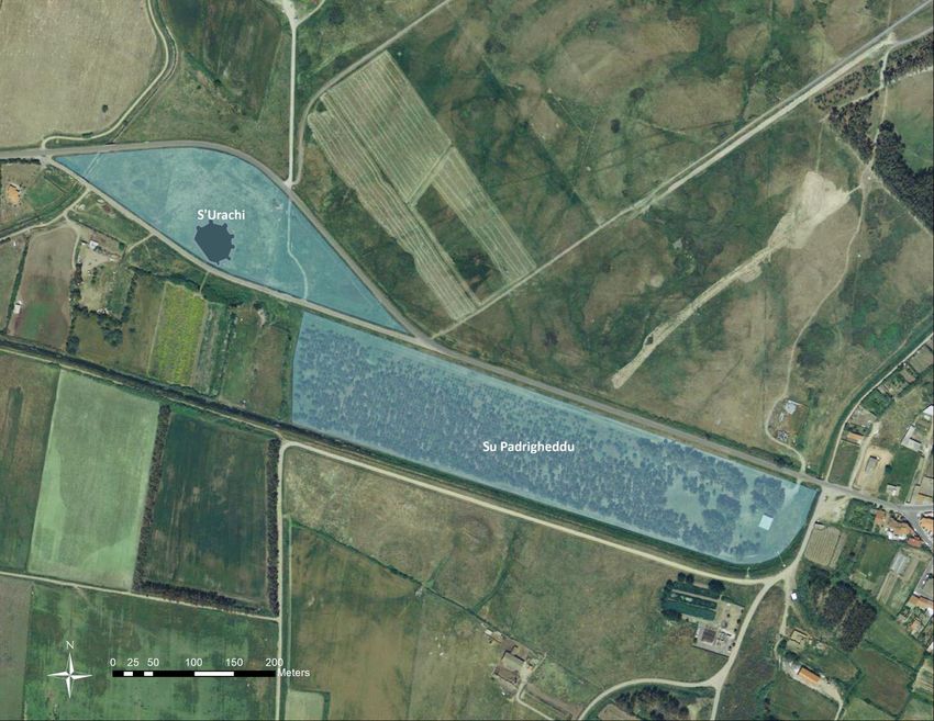
● Landscape Use and Local Settlement at the Nuraghe S’Urachi (West-Central Sardinia)

                                                                                         This article details the findings of
                                                                                the geophysical, microtopographical, and
                                                                                intensive surveys. Together these anal-
                                                                                yses reveal that human modification of the
                                                                                landscape and occupation of the site ex-
                                                                                tend well outside of the limits of the current
                                                                                excavation near the nuraghe, which has
                                                                                uncovered evidence of ancient habitation
                                                                                clustered around the monumental tower
                                                                                walls of S’Urachi. Further, the discovery of
                                                                                large quantities of materials from all peri-
                                                                                ods in the wider archaeological landscape
                                                                                has helped pinpoint patterns of site-use to
                                                                                specific periods. In particular, materials
                                                                                from the Punic through Roman imperial pe-
                                                                                riods were most heavily concentrated in
                                                                                the area north of the nuraghe. Conversely,
                                                                                the highest concentration of archaeological
                                                                                material from the Iron Age and potentially
                                                                                earlier was in Su Padrigheddu. Large
                                                                                quantities of modern material were also
                                                                                found throughout the survey area, with es-
                                                                                pecially high distributions of modern gar-
                                                                                bage in a triangular area east of the mod-
                                                                                ern dirt access road and north of the nu-
                                                                                raghe near the main modern highway. Fi-
                                                                                nally, the article pinpoints several areas of
                                                                                interest for future investigation based on
                                                                                the combined survey results.

Fig. 1. The location of S’Urachi in west-central Sardinia.

Site Overview and Condition

         The nuraghe S’Urachi is located approximately 1 km west of the modern town of San Vero Milis in the
province of Oristano. This monument is one of the most elaborate nuraghi in west-central Sardinia. These
monumental prehistoric towers are typically interpreted as defensive buildings constructed by the indigenous
Nuragic people of Bronze and Iron Age Sardinia, and thousands of them dot the landscape throughout the is-
land. As with the majority of these Nuragic monuments, the central tower at S’Urachi is presumed to date to the
Bronze Age, though this has not been confirmed through excavation. It is surrounded by a series of smaller
towers linked by walls, which together probably post-date the original central Bronze Age tower. The monumen-
tal structure continued to be used well after its initial phase of construction and inhabitation, and was a locus for
settlement and other activity in antiquity during the periods of Phoenician, Punic, and Roman colonial interac-
tion and colonization of the island over the course of the first millennium BCE. After the Roman imperial period,
local settlement was probably relocated to the site of the nearby town of San Vero Milis, which is in a location
less susceptible to seasonal flooding than S’Urachi.
         Today the archaeological site is bounded on the north by Strada Provinciale 10 and on the south by an
old, paved road frequently used by local farmers. The main parts of the central monument currently visible are
the substantial megalithic basalt walls and accompanying series of towers that surround the central tower.
South of the southern road bounding the site is an area colloquially known as Su Padrigheddu, a nearby site of
ancient settlement, which was never excavated and has been covered by a eucalyptus grove since the early
1980s. The land encompassing S’Urachi and Su Padrigheddu makes up the area investigated through various
site-based survey techniques. Figure 2 outlines the areas where surveys were conducted in 2014 and 2015.

                                                                 2
                                                                                    www.fastionline.org/docs/FOLDER-sur-2018-7.pdf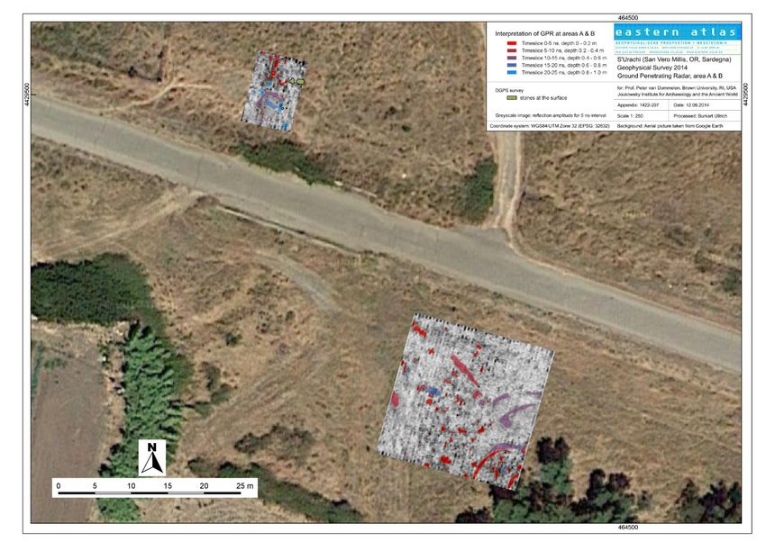
● Landscape Use and Local Settlement at the Nuraghe S’Urachi (West-Central Sardinia)

Fig. 2. Map showing the location of the nuraghe S’Urachi and core archaeological site, which is bounded by two paved roads. To
the south is Su Padrigheddu.

        Ongoing work carried out by the Progetto S’Urachi has focused primarily on the architectural study of
the nuraghe itself as well as excavation of the areas that immediately surround the megalithic construction. This
has revealed domestic architecture and refuse ranging in date from the Iron Age through the early Roman peri-
od.2 Work at the site in the 1940s, carried out by Giovianni Lilliu, had previously revealed other domestic struc-
tures of similar chronologies surrounding the nuraghe. It also uncovered parts of the towers that encircle the
site, many of which were partially deconstructed and/or reused in antiquity. 3 Excavations were again carried out
under the direction of Giovanni Tore and Alfonso Stiglitz in the 1980s. 4 The central tower of the nuraghe was
never fully excavated, though its upper levels of stone are partially visible on the surface. To the south, the area
of Su Padrigheddu was, for many years, thought to have been a Nuragic cemetery associated with S’Urachi.5
However, recent detailed studies of the ceramic assemblage collected from the surface—following the deep
plowing of the area in order to plant the eucalyptus grove—revealed that this was more likely to have been an
area of domestic settlement.6 The majority of ceramics were Iron Age Nuragic and Phoenician in date, including
Phoenician forms created with Nuragic fabrics and production techniques. 7 The wider landscape of S’Urachi
and Su Padrigheddu had not been systematically surveyed with the exception of a short intervention carried out

2 STIGLITZ et al. 2015. For a more in-depth history of work and findings at S’Urachi and Su Padrigheddu, see STIGLITZ 2016.
3 LILLIU 1950.
4 STIGLITZ and TORE 1988; TORE 1984a, TORE 1984b.
5 e.g., BERNARDINI 2011: 363.
6 ROPPA 2012.
7 ROPPA et. al. 2015.

                                                                3
                                                                                   www.fastionline.org/docs/FOLDER-sur-2018-7.pdf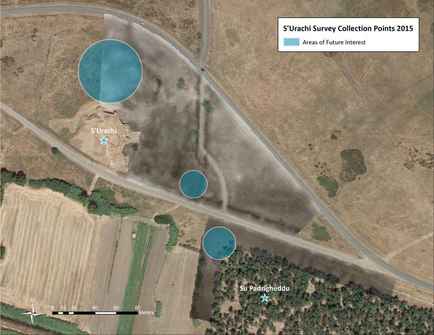
● Landscape Use and Local Settlement at the Nuraghe S’Urachi (West-Central Sardinia)

by Barbara Panico and published in 2011. She collected surface materials from the area surrounding the nu-
raghe up to 150 m in radius, or 120.093 sq. m., finding primarily ceramics from the later phases of occupation
of the site.8
          While the wider landscape in this area of west-central Sardinia is largely given over to agriculture, the
archaeological site itself is enclosed by a fence and remains unplowed. The land immediately surrounding the
nuraghe, and the monument itself, are routinely cleaned to allow tourists to see the monumental architecture,
but much of the wider archaeological site has heavy vegetation throughout the year. The western portion of the
site was especially difficult to access because of deep drainage ditches and heavy vegetation, and has not
been included in the present study. Although Su Padrigheddu, conversely, was deep plowed in the early 1980s,
the dense eucalyptus trees there cause very low surface visibility. The plants between the edge of the grove
and the old road, however, are regularly mowed as a measure for fire prevention and, there, surface visibility is
higher. These varied conditions made it difficult to carry out the type of traditional Mediterranean style-
pedestrian survey that is better suited for regularly plowed agricultural fields, where farming enhances surface
visibility and brings artifacts up from the subsurface. 9 Accordingly, we carried out microtopographical and geo-
physical survey, which do not rely as heavily on plowing or surface visibility, followed by a method of intensive
survey that employed surface and immediate subsurface collection.

Fig. 3. Map of the microtopographical survey carried out in 2014 with the locations and numbers assigned to survey collection
points across the site.

8   PANICO 2011.
9   CHERRY 1983; ALCOCK and CHERRY 2004.

                                                                4
                                                                                   www.fastionline.org/docs/FOLDER-sur-2018-7.pdf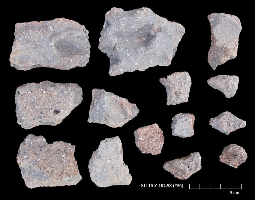
● Landscape Use and Local Settlement at the Nuraghe S’Urachi (West-Central Sardinia)
Microtopographical and Geophysical Survey
In preparation for the intensive survey, several preliminary studies were conducted in order to provide a
better understanding of the topography of the site and potential underground features. In 2014, microtopo-
graphical analyses were carried out on the eastern half of the site and the land adjacent to Su Padrigheddu.
For this work, we relied upon a 20 x 20 m grid system that had been laid out across the site during the cam-
paigns of the 1980s. Using this as a base grid, thousands of elevation points were systematically gathered
across the site at 4 m intervals. These were then used to create a high-resolution digital elevation model (DEM)
for surface mapping and visualization through GIS (Fig. 3). The map shows a variation of elevation of only ap-
proximately 2.5 m across the site, with the area just north of the nuraghe and below the Strada Provinciale 10
showing the highest elevations. This may be a result of the long-term occupation of these areas of the site,
which the intensive survey seems to confirm. There is a relatively level elevation both in the 50 m radius sur-
rounding the nuraghe as well as in Su Padrigheddu.
The microtopographical survey revealed, in particular, a series of shallow ditches, visible along the old
road as well as along an informal dirt road that extends north-south across the site. These are probably modern
interventions. While these are detectable to the naked eye, the survey enabled them to be mapped in detail.
The ditches appear to be for drainage, common along roads and field boundaries in this agriculture-rich area of
west-central Sardinia and especially around S’Urachi where the water table is often very high, causing occa-
sional flooding and an increased need for water management systems. Most of the ditches appear to redirect
water in ways conducive to modern farming in the land immediately south of the site. While these channels are
simply dug into in the earth without constructed elements, their excavation and use has modified the landscape
in such a way that our 2015 survey units in and around such channels produced very little material. Further, the
original excavation of these trenches may have removed archaeological materials to other areas of the site in
modern times, which must be taken into account when looking at the distribution of surface artifacts in the in-
tensive survey results, described below. Further archaeological investigation in the areas that have been modi-
fied by these channels is not recommended.
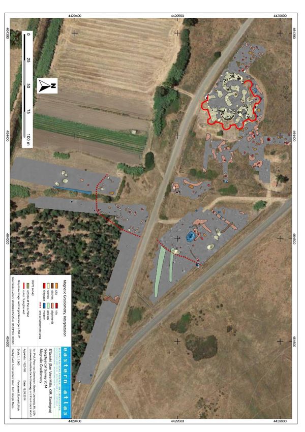
A limited geophysical survey was also carried out in 2014 in several areas of the archaeological site. 10
The surveyors used both ground penetrating radar (GPR) and magnetic gradiometry (MGR). Because intense
vegetation across the site made some areas inaccessible, the survey provided only a piecemeal and prelimi-
nary picture of the overall landscape (Fig. 5). However, several observations about the data are worth noting.
First, there is a significantly lower density of magnetic anomalies with high amplitudes at greater distance from
the site.11 This pattern likely indicates that the settlement zone is most dense in the area closest to the nuraghe
walls, and tapers off as the distance from the nuraghe in-
creases—a pattern typical of other excavated Nuragic set-
tlements.12 Magnetic anomalies may indicate walls and
foundations of building structures, pits, and hearths. Two
particular anomalies were pinpointed as potentially signifi-
cant in both the GPR and magnetometry data. The first, a
series of two strong dipoles, was located southeast of the
nuraghe, just north of the old road (Fig. 6). Ullrich and
Freibothe interpreted this as the remains of a refilled ditch
containing basalt stones or the remains of a wall. The
second, which formed roughly the shape of a circle, was
located just north of the eucalyptus grove in Su
Padrigheddu. It was interpreted as a possible Nuragic
structure.13
Fig. 4. GPR survey underway in Su Padrigheddu.
10 This survey was conducted by Burkart Ullrich and Ronald Freibothe of Eastern Atlas Geophysical Prospection. We are including
the summarized results of their unpublished report here with permission of the project directors.
11 Ullrich and Freiboth 2014: 4, 14.
12 See WEBSTER 2016, an updated version of WEBSTER 1996, for an overview of Nuragic settlements.
13 Ullrich and Freibothe 2014: 14.
5
www.fastionline.org/docs/FOLDER-sur-2018-7.pdf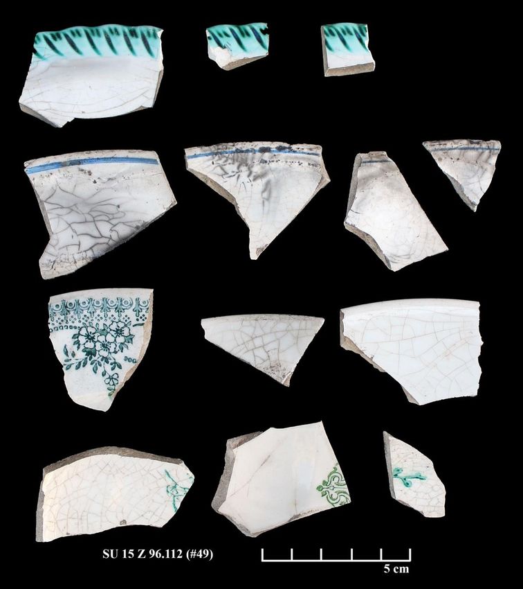
● Landscape Use and Local Settlement at the Nuraghe S’Urachi (West-Central Sardinia)

Fig. 5. Map of the site with the results of the magnetometry survey carried out in 2014.

                                                                  6
                                                                                     www.fastionline.org/docs/FOLDER-sur-2018-7.pdf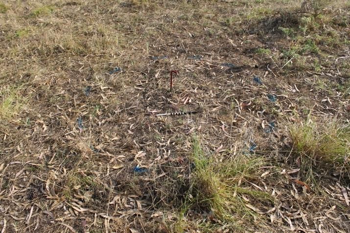
● Landscape Use and Local Settlement at the Nuraghe S’Urachi (West-Central Sardinia)

Fig. 6. Interpreted results of the GPR survey in Su Padrigheddu and southeast of the site.

                                                                 7
                                                                                    www.fastionline.org/docs/FOLDER-sur-2018-7.pdf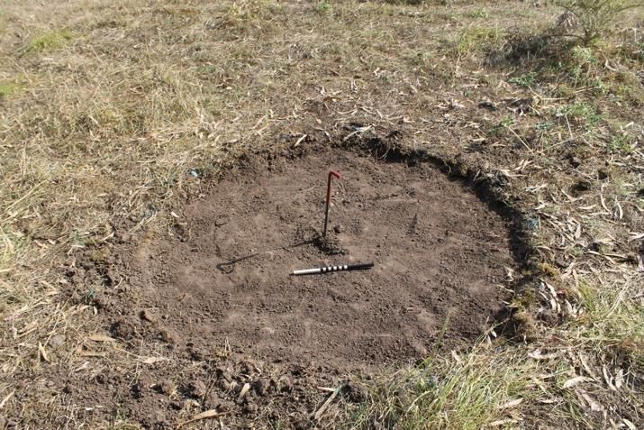
● Landscape Use and Local Settlement at the Nuraghe S’Urachi (West-Central Sardinia)

Intensive Survey

        Following the microtopographical survey and geophysical investigation, we undertook an intensive sur-
vey in 2015 involving the collection and analysis of surface and subsurface artifacts. The goal was to further
elaborate and expand our diachronic knowledge of the archaeological landscape surrounding the nuraghe at
S’Urachi, accessing and mapping data that demonstrate landscape use and site occupation from the Iron Age
to the present. The following sections describe the methodology employed in the 2015 survey as well as an in-
terpretation of the results.

Methodology: Sampling Strategy

         We strove to create a sampling strategy for the intensive survey that was compatible with the previous
microtopographical and geophysical surveys as well as an accurate reflection of the archaeological remains on
the ground. In order to accomplish this, we again used the existing 20 x 20 m grid across the site and surveyed
the area that had been the focus of the microtopographical and geophysical analyses. We first projected the
grid digitally through ArcGIS, then shot in each point of the grid on the ground using a Total Station. Each of
these points marked a survey collection point. Using this method, we laid out 63 collection points across the
survey area (Fig. 3). The 20 by 20 m grid was the most spatially intensive collection strategy possible taking in-
to account the month-long duration of the season and our limited number of survey participants (between 2 and
4 people per day).
         In order to facilitate a simple labeling scheme, the collection points were laid out according to the coor-
dinate system created during the 2013 and 2014 field seasons to assist in previous survey operations, which
used a series of still extant cement datums placed during excavations in the 1980s as reference points. The
cement datum located just to the southeast of the nuraghe was the origin, and was assigned the coordinate
1000m east (E) and 1000m north (N). The cement datum located to the northeast of the nuraghe, used for
backsighting the equipment, was exactly 50 m north and is thus 1000m E 1050m N. Beginning with this datum,
we were able to easily place the 20 by 20 m grid across the site, creating readily-identifiable points, such as
1020m E 1000m N, 1020m E 1020 N, and so on. No two points had the same coordinate, yet they were all mul-
tiples of 20, so we used the first three digits of the easting and northing to label our collection points. For exam-
ple, 1020m E 1000m N became 102.100. To further assist us in recording and organization, each collection
point was also given a sequential number based on the order in which points they were investigated. Thus,
each finds bag was labeled both with its coordinate (e.g., 102.102 14) and with its sequential number (#1). Both
numbering systems have been used in the discussion of materials below. 15
         Materials were collected in a circular area centered on each of the collection points. Each circle had a
radius of 81 cm, a length chosen so that each collection unit would be roughly 2 sq. m in total area. We created
a plastic stake with a string marked with the 81 cm measurement, and then we rotated the stake around the
grid point while spray painting the circle collection area on the ground to mark the boundaries of each collection
unit (Fig. 7). Ideally, this would represent 2 square meters for every 20 by 20 m square (400 square meters) or
about 0.5% coverage. With the irregular shape of the area, however, at roughly 26,154 square meters with 63
units (126 square meters), we were able to achieve 0.48% coverage of the area.

14 Units are labeled “SU 15 Z 102.102 (#1).” SU stands for S’Urachi, 15 stands for the collection year, and Z is used for all survey
units to differentiate from excavation Areas D and E (which were labeled SU 15 D and SU 15 E respectively). We also labeled units
sequentially (#1, #2, #3, etc.) to make it easier to visually sort finds bags by unit. The full unit names, therefore, allow each unit to
be located easily on the site grid and to reconstruct the order in which they were excavated. Collection bags were labeled with the
full survey unit name as well as a letter indicating the material type (A = pottery, B = bone, C = shell, D = stone, E = metal,
F=glass/plaster, G = other). The same letter designations are also used in the Progetto S’Urachi excavations.
15 For a full list of concordances between sequential numbers and numbers based on the coordinate system, see the document

“Components of the Dataset” in GOSNER and SMITH 2017. Please note that despite a nearly accurate north/south orientation of
the old cement datums, the coordinate system is rotated roughly 2 degrees to the west from the origin point at 1000m E 1000m N
when compared to UTM coordinates. The exact conversion of the origin from the arbitrary system (1000m E 1000m N) to WGS
1984 Zone 32N is 464,402.610m E 4,429,530.120m N.

                                                                   8
                                                                                       www.fastionline.org/docs/FOLDER-sur-2018-7.pdf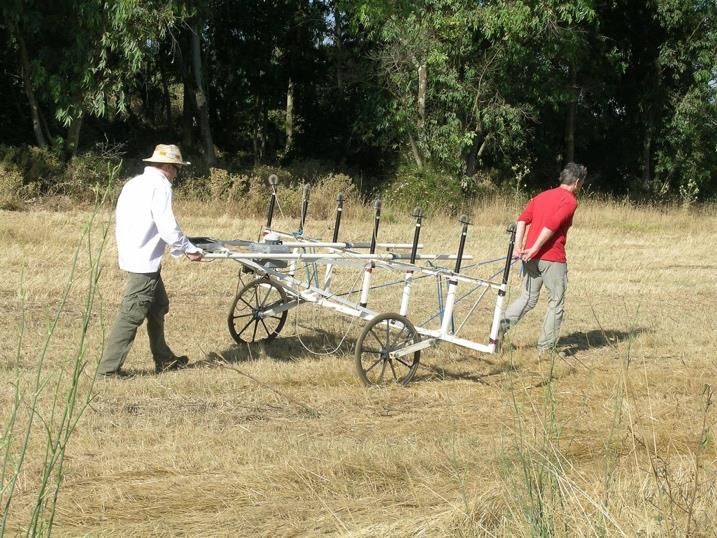
● Landscape Use and Local Settlement at the Nuraghe S’Urachi (West-Central Sardinia)

                                                                                                     At    some     collection
                                                                                            points, collection was either im-
                                                                                            possible or impractical. Circum-
                                                                                            stances such as a paved road,
                                                                                            a series of boulders, a stone
                                                                                            wall within the collection space,
                                                                                            or backfill piles obstructing the
                                                                                            ground made some points un-
                                                                                            usable as a clear reflection of
                                                                                            surface remains. In such cases,
                                                                                            we created an arbitrary offset,
                                                                                            ranging from 81 cm to 5 m,
                                                                                            placed along a chosen cardinal
                                                                                            direction from the grid point.
                                                                                            While this did affect artifact
                                                                                            concentrations and density met-
                                                                                            rics to a small degree, it had lit-
                                                                                            tle impact on the statistical
                                                                                            analysis. For the purposes of
                                                                                            clarity in the figures of this re-
                                                                                            port, the collection points are
                                                                                            represented in their original, in-
                                                                                            tended locations.
Fig. 7. Photograph of Alexander Smith and Nuri van Dommelen laying out a survey unit
(SU 15 Z 100.100 #57).

Methodology: Collection Strategy

         The areas surrounding S’Urachi and Su Padrigheddu are heavily obscured by vegetation and remain
unplowed. As suggested above, the condition of the landscape hindered the possibility of conducting a tradi-
tional intensive survey because of extremely low visibility throughout the survey area. In order to access the
“surface,” or immediate subsurface remains that would be visible in a plowed field, we dug approximately 10 cm
into the ground in each collection unit (Fig. 8).16 All soil was then sifted and artifacts of all sizes and all time pe-
riods were collected from the screens for laboratory analysis. We followed a policy of full collection for ceramic
(both vessels and construction material), glass, metal, worked stone, shell, and bone remains found within each
unit. We did not, however, collect plastic, paper, rubber, cement, or fabric remains, but noted the existence of
these modern materials in our field notes when they were present. In three cases, we did not sift the dirt and
instead manually collected a sample of materials using gloves because of the presence of medicine tubes, as-
bestos, or other hazardous items.
         The process of removing the vegetation and excavating the 10 cm of soil made collection slower than is
typical for pedestrian survey. Nevertheless, the 10 cm depth was necessary not only for the removal of live
vegetation, such as high grass, thistles, and bushes, but also to reach levels beneath root systems and vegetal
debris caused by periodic field burning over the past century. Our collection strategy was essentially designed
to recreate a very shallow ploughing episode in the 2 sq. m area of each unit. The artifact assemblages recov-
ered from each collection point are similar in quantity and condition to what one might expect in a more tradi-
tional survey. Most materials would not have been recovered if we had relied on the collection of visible surface
remains alone. Indeed, this explains the comparatively low quantity of materials recovered from a previous sur-

16This collection technique was adapted to the site survey scale from a similar method used in the Riu Mannu Survey in the river
valley of the Riu Mannu of west-central Sardinia, south of the area under discussion in this article (see VAN DE VELDE 2001). This
regional survey project, a five-year survey initiated in 1991, was directed by M. Beatrice Annis, Peter van Dommelen, and Piet van
de Velde (ANNIS et al. 1995; VAN DOMMELEN 1998: 60-67). Other regional survey projects in the wider region of west-central
Sardinia include the recent Capo Mannu Survey and the University of Maryland-Wesleyan Survey, which was carried out in the
1980s and early 1990s. The former used traditional Mediterranean field walking to document the coastal landscape of Capo
Mannu, west of S’Urachi (see CASTAGNIA 2011; 2012). The latter focused on the inland landscape, documenting the hinterland of
two inland Roman cities east of S’Urachi, Fordongianus and Usellus, through systematic fieldwalking. A more extensive survey
approach was take to studying the nuraghi in the survey area (DYSON AND ROWLAND 1991; DYSON and ROWLAND 1992;
DYSON 2008).

                                                                9
                                                                                   www.fastionline.org/docs/FOLDER-sur-2018-7.pdf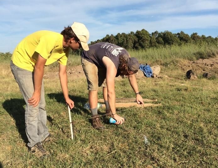
● Landscape Use and Local Settlement at the Nuraghe S’Urachi (West-Central Sardinia)

Fig. 8. Example of a unit before (left) and after (right) completion to show the low degree of surface visibility. Here, SU 15 Z 112.92
(#18) is pictured facing north.

face survey conducted at S’Urachi, in which only 638 artifacts were recovered from an area of 120.093 sq. m
(PANICO 2011: 113). Ultimately, this more intensive and time-consuming method of survey yields more finds
and more information about the landscape.

Results

         The survey produced a large quantity of material ranging from the Iron Age to present day (Fig. 9). The
overall proportions of ancient material mirror the results of the S’Urachi excavations in Areas D and E in 2013,
2014, and 2015.17 We uncovered primarily ceramic remains (both ceramic vessels and construction material)
and faunal bone with smaller quantities of worked stone and seashells. Unlike the excavations, however, in the
survey modern materials (especially construction materials and ceramic tableware) made up 42.9% of our finds
by weight. This is the result of many decades of trash dumping in certain areas of the site, an activity which
seems to have peaked in the late 1960s. S’Urachi and its immediate surroundings, therefore, are extremely rich
in cultural material. Only 2 units of 63 total produced no artifacts at all; all others yielded at least some finds. In
many cases, ancient material was mixed with modern material, while, in certain other areas of the site, ancient
and modern material were concentrated in distinct locations. In the north, for instance, modern garbage piles
were prominent. Units on or near these piles produced exclusively modern material, whereas other nearby lo-
cations in the north produced only ancient material. In the east, on the other hand, modern and ancient materi-
als were often found mixed in a single unit, likely the result of modern formation processes such as recent at-
tempts to clean garbage from the site as well the construction of drainage ditches in the area noted in the mi-
crotopographical survey.
         Overall, contemporary activities in the landscape strongly impacted the condition of the land as well as
the kinds of material that we were able to recover from each unit. Modern waste was especially frequent near
the roads and in the eastern extent of the site. Despite this, very clear patterns of ancient activity can be ob-
served. The land directly north of the nuraghe appears to have been occupied consistently from the Iron Age
through at least the 4th century CE. There were many instances of units with particularly high counts of Punic
and imperial Roman sherds, which may indicate that occupation during these later periods was more heavily
concentrated to the north than in other areas. Further, the survey uncovered high quantities of Nuragic material
characteristic of a domestic assemblage at Su Padrigheddu, confirming the conclusions of previous studies that
this was a settlement area in the Iron Age. The following pages provide a detailed breakdown of the ancient
patterns in the landscape from the Late Bronze Age through the Roman imperial period based on an analysis of
our ceramics. Although the site appears to have been abandoned as a settlement following the Roman imperial
period, the survey did uncover some dumping from the 18 th century to the present day. Accordingly, we present
our observations about trash deposition and land use at S’Urachi in more contemporary times following our dis-
cussion of ancient materials.

17   STIGLITZ et al. 2015: 205-207.

                                                                  10
                                                                                      www.fastionline.org/docs/FOLDER-sur-2018-7.pdf
● Landscape Use and Local Settlement at the Nuraghe S’Urachi (West-Central Sardinia)
Fig. 9. Map showing the distribution of ceramics on site by broad periodization (ancient and modern).
Ancient Patterns in the Landscape
While the nuraghe S’Urachi was a Bronze Age monument in its original phase, the structure and its sur-
rounding area remained a locus for ancient activity in the centuries that followed. The recent excavations at
S’Urachi have investigated some of these later periods of occupation, uncovering Punic domestic structures
south of the nuraghe (Area D) as well as Phoenician and Punic garbage deposits just east of the nuraghe (Area
E).18 The intensive survey also revealed ample evidence to support the hypothesis that there was ancient habi-
tation around the nuraghe until at least the early Roman period and into imperial Roman times, albeit at a
smaller scale.
For the purposes of this analysis, ancient ceramics were divided into 4 basic temporal categories: Nu-
ragic (Late Bronze Age-Iron Age, or 12th-8th centuries BCE), Phoenician (9th-6th centuries BCE), Punic-early
Roman (6th to 1st centuries BCE), and imperial Roman (1st to 5th centuries CE).19 No ceramics dating to earlier
periods were recovered, while ceramics dating to after the 5 th century CE—which primarily include modern ce-
ramics from the 19th and 20th centuries—are discussed below. Other ancient material encountered included
faunal bone, shell, and worked stone. Our faunal assemblage mirrors that encountered in the excavations, in-
cluding pig, sheep, goat, cattle, deer, bivalve shells and limpets, and a small number of chicken bones. Bones
18 STIGLITZ et al. 2015: 200-202.
19 In this chronological scheme, there is deliberate overlap of the Nuragic and Phoenician ceramic chronologies to accommodate
the actual overlap in the production of local Nuragic styles alongside the import of Phoenician wares (and eventual local production
of these Phoenician styles). For a discussion of this, see: TRONCHETTI 2016.
11
www.fastionline.org/docs/FOLDER-sur-2018-7.pdf● Landscape Use and Local Settlement at the Nuraghe S’Urachi (West-Central Sardinia)
were found throughout the site, often in areas that had similarly high proportions of ancient ceramic. Because
the faunal collection lacks any chronological certainty, however, it has not been taken into account as a dia-
chronic marker. Stones recovered included 1 probable fragment of a quern as well as 5 pieces of obsidian and
1 piece of red chert (Fig. 10). The obsidian is similar in appearance to fragments from the excavation confirmed
to have been sourced from the nearby Monte Arci and may be debitage from knapping around S’Urachi. Future
study of lithics from secure excavated contexts at S’Urachi should confirm the chronological scope of obsidian
knapping and use, but for the purposes of the intensive survey, lithic remains have not been assigned a
chronological marker.
Fig. 10. Lithics recovered from the sur-
vey including 5 pieces of obsidian: A) SU
15 Z 116.92 (#16), B) SU 15 Z 108.88
(#23), C) SU 15 Z 104.104 (#38), D) SU
15 Z 100.104 (#47), E) SU 15 Z 100.104
(#56); and one piece of chert: F) SU 15 Z
98.108 (#45).
Despite the fragmentary nature of many of our ceramics, we encountered enough diagnostic sherds
and identifiable fabrics to be able to place most sherds into one of the broad temporal categories, with some
caveats. First, a large portion of the ceramics encountered were produced using local clays, so in some cases
we had difficulty distinguishing non-diagnostic fragments by period. A closer analysis of these fabrics and pro-
duction processes in the future could demystify some of the temporal divisions for locally-produced ancient pot-
tery. We categorized sherds produced in well-sorted local fabrics into the Punic-early Roman category, while
those with burnishing or uneven surface firing were placed in the Nuragic category. Second, because many of
the vessels encountered were commonware or tableware with some continuity in fabric and/or style from the
Phoenician through early Roman periods, it was not always possible to differentiate these ceramics chronologi-
cally. This probably resulted in an underrepresentation of the Phoenician materials in our survey results. Addi-
tionally, this unfortunately obscured any local ceramic changes that may have occurred in the Punic-Early Ro-
man temporal transition. Finally, ceramic construction materials were omitted from chronological categories be-
cause of their extremely fragmentary nature. It is possible to say, however, that we did not encounter any Ro-
man roof tiles. This may indicate that—even though the site continued to be occupied at least through the 4 th
century CE—there is no evidence that occupants adopted styles of domestic construction seen in Roman cities
in Sardinia such as Tharros, the largest Roman port settlement near S’Urachi. 20
20On Roman cities in Sardinia generally, see: ZUCCA 2016 and MELONI 2012. For a summary of Tharros in particular, see:
ZUCCA 1993, ACQUARO 1986. On the architecture of cities of Roman Sardinia, see: GHIOTTO 2005.
12
www.fastionline.org/docs/FOLDER-sur-2018-7.pdf● Landscape Use and Local Settlement at the Nuraghe S’Urachi (West-Central Sardinia)
Fig. 11. Map of overall ancient ceramic distributions by weight.
The following sections discuss the chronological breakdown of ceramic finds by period, which were
found in the highest concentrations for the Punic-early Roman period with fewer finds in all other temporal cat-
egories (Fig. 11).
Nuragic Material Distribution
Overall, 63 Nuragic sherds were encountered totaling 0.915 kg. These were concentrated in two areas,
namely along the northern border of the site just north of a modern shed for storing site tools and in Su
Padrigheddu along the northwest boundary of the eucalyptus grove (Fig. 12). The presence of many Nuragic
sherds in Su Padrigheddu in the same area as a geophysical anomaly that has been preliminarily interpreted
as a round structure makes this an area of interest in future archaeological work. Unit 108.92 (#20) produced a
number of diagnostic Nuragic sherds including a handle, several rims, an incised fragment of an askos, and a
reverse elbow handle (Nuragic in form but possibly a later fabric) (Fig. 13). Apart from the original deep plowing
of the land when the eucalyptus trees were planted in the 1980s, there was little evidence at Su Padrigheddu
for modern disturbance such as the trash deposition common in other parts of S’Urachi. It may have been the
deep ploughing that brought these sherds up to the surface. The absence of modern trash or major landscape
modifications made this area a good candidate for a test trench to ground truth the possible subsurface struc-
ture and assess whether stratigraphy was intact anywhere in this area.
13
www.fastionline.org/docs/FOLDER-sur-2018-7.pdf● Landscape Use and Local Settlement at the Nuraghe S’Urachi (West-Central Sardinia)
Fig. 12. Map of Nuragic ceramic distribution by weight.
Fig. 13. Group of Nuragic ceramic
sherds: 1 handle at left, 2 rims at
center, an incised fragment of an
askos (top right), a fragment of a
reverse elbow handle. All from
SU 15 Z 108.92(#20).
14
www.fastionline.org/docs/FOLDER-sur-2018-7.pdf● Landscape Use and Local Settlement at the Nuraghe S’Urachi (West-Central Sardinia)
Phoenician Material Distribution
Phoenician material was quite sparse, with only one unit in Su Padrigheddu producing one sherd
weighing 0.03 kg (Fig. 14). It is difficult to determine whether this is a clear reflection of ancient activity in the
landscape, or whether sherds that indeed could be assigned to the Phoenician category have been misidenti-
fied. As noted above, this may have happened for two reasons. First, some Iron Age sherds that were locally-
produced may have been assigned to the Nuragic category because of their stylistic similarities with local
forms. Second, the continuity of forms from the Phoenician to Punic periods means that some sherds could
have been categorized as Punic that were actually produced earlier. For instance, we encountered a number of
pieces of tannur/tabouna, the traditional Phoenician bread oven introduced into the western Mediterranean and
used into later periods (Fig. 15). Because of their similarity to tannur fragments from the excavation unit Area E
that have been stratigraphically identified as Punic, we classified our fragments as Punic as well, but it is possi-
ble that they indeed date to an earlier period.
Fig. 14. Map of Phoenician ceramic distribution by weight.
15
www.fastionline.org/docs/FOLDER-sur-2018-7.pdf● Landscape Use and Local Settlement at the Nuraghe S’Urachi (West-Central Sardinia)
Fig. 15. Tannur/tabouna fragments from SU 15 Z 102.98 (#56) made in Phoenician tradition, but possibly dating to Punic times.
Punic and Early Roman Material Distribution
Punic and early Roman ceramics make up the largest number of ancient finds throughout S’Urachi and
Su Padrigheddu, totaling 1,772 sherds at 17.545 kg (Fig. 16). Finds range from Punic amphorae and other
storage vessels, to commonware vessels in local fabrics, to tableware. There are also imports from North Afri-
ca, peninsular Italy, and Attica. Based on the distribution and condition of the finds, two areas stand out as
places of interest for future investigation into the history of S’Urachi during these periods. Many units north of
the nuraghe produced Punic and early Roman finds that clustered in the later periods of this phase. There were
more diagnostic or semi-complete sherds concentrated in this area as well (e.g., Unit 96.106 (#44), Fig. 17).
Together with the discrete clustering of modern garbage north of the nuraghe and the excavations of several
preserved structures in the area by Giovanni Lilliu, this leads us to believe that there is a high possibility of dis-
covering intact structures with undisturbed stratigraphy in this part of the archaeological site.
The second area that produced a large quantity of interesting Punic-early Roman sherds was Unit
102.98 (#56), located just north of the old paved highway and southwest of the nuraghe. The quantity of mate-
rial from this unit was extremely high, as was the level of preservation and chronological uniformity of the mate-
rials in the Punic period. Aside from tannur, amphorae, and commonware fragments, several notable diagnostic
pieces such as a black-figured bowl base were found (Fig. 18). This may indicate that intact stratigraphy from
this period is likely to be present near and below the modern road. Although the placement of the road would
impede any large-scale excavation, it may at least be preserving any intact remains underneath.
16
www.fastionline.org/docs/FOLDER-sur-2018-7.pdf● Landscape Use and Local Settlement at the Nuraghe S’Urachi (West-Central Sardinia)
Fig. 16. Map of Punic-early Roman ceramic distribution by weight.
Fig. 17. Fragments from the Punic-early Roman
period in SU 15 Z 96.105 (#44).
17
www.fastionline.org/docs/FOLDER-sur-2018-7.pdf● Landscape Use and Local Settlement at the Nuraghe S’Urachi (West-Central Sardinia)
Fig. 18. Black-figured bowl
fragment (top at left, bottom
at right) from SU 15 Z
102.98 (#56).
Fig. 19. Map of imperial Roman ceramic distribution by weight.
18
www.fastionline.org/docs/FOLDER-sur-2018-7.pdf● Landscape Use and Local Settlement at the Nuraghe S’Urachi (West-Central Sardinia)
Imperial Roman Material Distribution
While imperial Roman ceramics were rare (10 identified sherds weighing 0.07 kg), examples dating at
least through the 4th century CE and possibly later indicate that some activity occurred on site in this later peri-
od. These finds were concentrated near the nuraghe’s northern and northwestern borders (Fig. 19). Fragments
of imperial Roman ceramics included some closed form bowls as well as terra sigillata Italica and African red
slip,21 demonstrating that materials were imported to this inland site from production centers in both Italy and
North Africa (Fig. 20). As noted above, no Roman roof tiles have been uncovered through either survey or ex-
cavation at S’Urachi and the ceramic evidence consists mainly of imported pottery. This pattern is worth explor-
ing more through future excavations, but it could indicate that there was not any major permanent Roman set-
tlement during the imperial period, or—perhaps more likely—that Roman architectural traditions were not
adopted by residents at the site during this period, but that certain goods such as terra sigillata were imported
and used.
Fig. 20. Terra sigillata Italica (left) and Afri-
can red slip (center and right) from SU 15 Z
108.98(#45).
Modern Site Use
Judging from the absence of material dating to after the 5 th century CE, S’Urachi was likely abandoned
following this period, perhaps corresponding with a permanent shift in local settlement to the location of the
present town of San Vero Milis 1 km away. The site was never again settled, but, in more recent times,
S’Urachi has been used in various non-archaeological capacities that that have impacted the archaeological
landscape. There is a long history of pastoralism and farming in this area, and parts of the site and the immedi-
ate surroundings have been used to both ends. Sheep, goats, and cows are occasionally let into the site to
graze, which impacts the distribution of vegetation and soil consistency. Additionally, some—though certainly
not a majority—of the faunal bones recovered appear modern and result from contemporary butchering and
consumption these animals on or nearby the site. In Su Padrigheddu, in particular, we noted several full sheep
skeletons, though none of these fell within a survey unit for collection. There is active farmland to the south of
the nuraghe and directly west of Su Padrigheddu. As suggested above, some of the landscape modifications
visible in the microtopographical survey, including roads and drainage ditches, were probably constructed to
support these nearby agricultural activities. Finally, the site has been used for trash disposal of domestic and
construction refuse for many decades. Though this activity declined in the 1980s when archaeological activity
at the site was reinitiated and dumping was prohibited by the local government, at least some dumping contin-
ued afterwards. While the high concentrations of trash could be a limiting factor to future archaeological explo-
ration of certain areas of the site because of health and safety concerns, this investigation has provided a more
detailed picture of the distribution and types of modern land use and waste disposal.
21 Unfortunately the small size of these pieces meant that they could not be assigned definitive forms.
19
www.fastionline.org/docs/FOLDER-sur-2018-7.pdf● Landscape Use and Local Settlement at the Nuraghe S’Urachi (West-Central Sardinia)
Modern Material Distribution
Contemporary material was present in low overall quantities in many units, but in especially high quan-
tities in the northern extent of the site (Fig. 21). Overwhelmingly, this material included ceramics associated
with domestic activities such as dining and cooking as well as construction materials such as handmade tiles.
Ceramics for dining and cooking fell into two basic categories: white ware and porcelain products imported from
England and other parts of western Europe and locally-produced lead glazed ceramics. Recent ceramics of un-
certain chronology—primarily fragmentary white ware sherds—have been included with the modern counts and
weights.
Fig. 21. Map of modern ceramic distributions by weight.
Of particular interest is the consistent appearance of ceramic vessels with glaze in shades of green and yellow.
These were primarily lead glazed ceramics produced in Oristano in the 19th and 20th centuries. 22 The glaze
was either applied directly onto the red clay, or the clay was slipped with white clay (likely sourced from the
coastal Tharros) before the glaze was applied. Vessel forms included bowls, basins, and other kitchenware for
domestic use. The most complete vessel recovered was a large basin for kneading bread dough (Fig. 22). It
had two perforations that would have been used to hang the basin from the kitchen wall. One bowl, recovered
22M. Beatrice Annis provided dates for these sherds. Because of the continuity of ceramic workshops in Oristano during these
centuries, it is difficult to narrow down their chronology further. There is historical mention of a potters’ guild in Oristano as early as
1692, which continued to operate in the city, and exploiting the same clay sources, through the 1950s. By the mid-1980s, there
were only three active potters left in an urban population of 29,085 (ANNIS 1985). As production waned, it became more difficult to
purchase this type of pottery, and most vessels we encountered were probably produced before this period.
20
www.fastionline.org/docs/FOLDER-sur-2018-7.pdf● Landscape Use and Local Settlement at the Nuraghe S’Urachi (West-Central Sardinia)
from Unit 110.102 (#33) was an older and finer production of domestic glazed ware (Fig. 23), potentially the on-
ly find from the site survey dating to the medieval period. It has bright green glaze produced with copper oxide
rather than lead.23
Fig. 22. Lead glazed ceramic basin produced in Oristano, probably in the 20th century, from SU 15 Z 96.112(#49).
Fig. 23. Fragments of a copper oxide glazed bowl
from the medieval period, from SU 15 Z 110.102
(#33).
23
M. Beatrice Annis has suggested it was produced in the medieval period while Sardinia was under Spanish control in a tradition
learned from Spanish artisans (personal communication 2015).
21
www.fastionline.org/docs/FOLDER-sur-2018-7.pdf● Landscape Use and Local Settlement at the Nuraghe S’Urachi (West-Central Sardinia)
Tableware also made up a large portion of the contemporary ceramic objects recovered from the inten-
sive survey. Much of this material was nondescript white ware, though there were several examples of transfer
printed plates and teacups. In Unit 96.112 (#49), for instance, multiple 19 th century plate sherds primarily from
England and Scotland were recovered. These included white ware with green transfer-printed and sponge-
printed designs (shown bottom row, second row from bottom) produced after 1840 in England, plain white iron-
stone ceramic or “hotelware” (second row from bottom), Scottish-made sponged-ware with blue annular bands
(third row from bottom), and English shell-edged pearl wear (top row)24 (Fig. 24). Finally, two units produced ce-
ramic bottle stoppers used to cap glass bottles with metal hinges, or “lightning-type” closures. One is printed in
red with the words “Fili Puddu Oristano,” showing that it was produced in the nearby city, likely between the
1880s and the 1920s when these types of stoppers were most common.25 Finally, we consistently recovered
high quantities of handmade roof tiles, which can still be seen in the roofs of many of the standing mud brick
houses in San Vero Milis. These tiles are extremely difficult to date because they have been consistently pro-
duced in this manner for several hundred years, but we suspect that some sizeable portion of the non-machine
made tile falls within this chronological purview.
Fig. 24. Fragments of
modern pottery from SU
15 Z 96.112 (#49).
24 Our shell-edged pearl wear is similar to that produced beginning in the 1780s in England, which had either green or blue coloring
along the rim. The greenish-blue coloring of these sherds is difficult to identify, and these may be an Italian or French imitation of
the English design. We thank Matthew Reilly and Miriam Rothenberg for identifying these ceramics.
25 LINDSEY 2017.
22
www.fastionline.org/docs/FOLDER-sur-2018-7.pdf● Landscape Use and Local Settlement at the Nuraghe S’Urachi (West-Central Sardinia)
A Note on Modern Trash Deposition
We observed and collected large quantities of materials from the wider archaeological site that were
present as a result of modern trash dumping. In accordance with our collection strategy, we saved modern
glass, modern ceramic, select metal objects, and the occasional plastic object. Because of sanitation and stor-
age concerns, we chose not to collect other kinds of objects including fabric, discarded medicine tubes, asbes-
tos and other fiberglass fragments, or plastic wrappers—all common material types encountered. For these
reasons, the modern glass density map serves as the best indicator of modern dumping (Fig. 25), demonstrat-
ing that modern material can be found throughout the site to varying degrees. The exception to this distribution
is the grassy area immediately surrounding the nuraghe’s western half, which has been well maintained for
tourist access around the standing monument. The highest concentrations of modern waste dating from the
1960s and later were found both north of the nuraghe and in the easternmost extent of the site. These areas
are most accessible by car, as the Strada Provinciale 10 stretches along the northern boundary of the site per-
pendicular to a north-south running dirt road that cuts through the field immediately east of the nuraghe.
Fig. 25. Map of modern glass distribution by weight.
23
www.fastionline.org/docs/FOLDER-sur-2018-7.pdf● Landscape Use and Local Settlement at the Nuraghe S’Urachi (West-Central Sardinia)
In general, the kinds of waste encountered fall into three basic categories: domestic refuse, construc-
tion materials, and trash related to pastoralism or other agricultural activities in the immediate landscape. In the
category of domestic refuse, beer, wine, and water containers made of glass were most frequent as well as ta-
bleware, especially white ware plates and teacups. Although we did not collect plastic containers, we also rare-
ly encountered them—these were perhaps dumped at a different location or used more rarely than glass bottles
prior to the 1980s. Construction materials include roof and floor tile as well as bricks. The prevalence of hand-
made rather than machine-made roof tiles indicates a continuity of local building tradition until quite recently.
Finally, glass medicine bottles for injecting livestock with hormones represent one type of pastoral activity in
and around S’Urachi. These were uncovered in at least 5 units. Several of them had expiration dates in 1968,
and they therefore help to date the many of the dumping episodes to the 1960s, though other material dates to
before and after this period.
The presence of asbestos and high amounts of other unsanitary trash in the easternmost portion of the
archaeological site, coupled with the absence of any major geophysical anomalies and a low density of ancient
survey finds, showed us that the area is not of interest for future investigation. Although trash was also common
along the northern border of the archaeological site, the presence of relatively high levels of ancient material
makes this an area of future archaeological interest. Nevertheless, any work in this area would have to be pre-
ceded by a thorough cleanup of hazardous materials.
Test Trenches and Future Investigation
We selected three primary areas of potential archaeological interest across the site based on the com-
bined results of the microtopographical survey, the geophysical survey, and the intensive survey (Fig. 26). First,
the northwest corner of Su Padrigheddu was significant for learning about early settlement at the site because
of the high proportion of Nuragic materials uncovered there through intensive survey as well as the potential
presence of a circular underground structure revealed through geophysical survey. Next, we wanted to investi-
gate the possible presence of an architectural feature based on the geophysical anomaly southeast of the nu-
raghe, although this location did not produce a high concentration of finds in 2015. Finally, we wanted to further
investigate the large area north of the nuraghe and below the Strada Provinciale 10 because of the promising
survey finds related to the later phases of occupation of S’Urachi. Although several of the survey collection
units there contained high proportions of modern garbage, others contained large quantities of well-preserved
Punic, early Roman, and imperial Roman ceramics. Other areas were excluded from future work based on the
intensive survey results, especially the eastern extent of the site, which contained large deposits of trash and
hazardous materials.
In 2016 and 2017, we opened up a series of small test trenches to ground truth these areas. Because
our intensive survey collection method was experimental, ground truthing the results through excavation proved
especially important in understanding whether our findings reflected true patterns in the occupation of the site.
In general, the results of the intensive survey were indeed a good predictor of the chronology of material un-
covered through the stratigraphic excavation of the test trenches, though trenches with deep intact stratigraphy
revealed older ceramics than did the survey since these were sealed well below the level of survey collection.
The detailed results of these test trenches and how they shed light on survey findings will be published follow-
ing the analysis of excavated materials in 2018. 26
Finally, we recommend several future activities to enhance the present study. Specifically, we suggest
a closer analysis of pottery from all units in conjunction with the study of ceramics from the excavation of Areas
D and E from the 2013-2015 seasons. A more thorough analysis of ceramic fabrics and typologies for locally
produced wares will help refine the chronologies, especially of the 1 st millennium BCE ceramics from Phoenici-
an and Punic traditions that were difficult to categorize without stratigraphic context. It will be fruitful to examine
in particular the ratio of local to imported ceramics for all periods during this re-analysis of the ceramic finds.
This will highlight periods of increased connectivity between S’Urachi and coastal or port areas, such as Thar-
ros, during periods of Phoenician, Punic, and Roman colonial contact and colonization.
26 GOSNER et al., in preparation.
24
www.fastionline.org/docs/FOLDER-sur-2018-7.pdf● Landscape Use and Local Settlement at the Nuraghe S’Urachi (West-Central Sardinia)
Fig. 26. Map showing areas of potential interest for the placement of test trenches based on survey results from 2014 and 2015.
Conclusions
The S’Urachi site survey conducted during the summer of 2015 produced a large quantity of material
ranging in chronology from the Iron Age through the present day and allowed us to pinpoint areas of interest for
future excavation. In total, we found 3,439 ceramic sherds (35.205 kg), including 1,340 modern sherds (15,325
kg) and 2,099 ancient sherds (19.88 kg). We also collected 3.82 kg of bone, 3.49 kg of modern glass, and
1.965 kg of metal, stone, shell and other materials. This assemblage has allowed us to confirm an expanded
chronological horizon for the site in antiquity at least through the 4 th century CE, with episodes of use into pre-
sent day.
The ceramic assemblage also reveals important trade connections and cultural influences correspond-
ing with Phoenician, Punic, and Roman occupation of this part of the rural Sardinian landscape. Still, the majori-
ty of material found from all periods appears to have been locally produced. Indeed, even modern glass and
ceramics were sometimes stamped with a label from the nearby city of Oristano. Finally, the vast majority of
materials recovered from periods of settlement in antiquity served as transport, storage, and cooking or serving
vessels, while the majority of finds from dumping in contemporary periods were construction materials.
Together, the surveys conducted in 2014 and 2015, attest to some of the changing uses of the land-
scape around the monument of S’Urachi over its long history. In antiquity, the nuraghe served as a regional
center in west-central Sardinia—both a place of settlement and a waypoint on the route from Sardinia’s western
coast to the central part of the island. Su Padrigheddu appears to have been a locus of Nuragic habitation,
whereas evidence for Punic-Early Roman habitation was concentrated in the northern sector of the site. In
more recent times, however, the activities at and nearby S’Urachi have included pastoralism, agriculture, and
trash deposition rather than settlement.
25
www.fastionline.org/docs/FOLDER-sur-2018-7.pdfYou can also read