TECHNOLOGY ROADMAP 2020/21 - NATIONAL MARINE FACILITIES - National Oceanography ...
←
→
Page content transcription
If your browser does not render page correctly, please read the page content below
NATIONAL MARINE FACILITIES

TECHNOLOGY
ROADMAP 2020/21

  National       National
  Oceanography   Marine
  Centre         Facilities   noc.ac.uk/facilities
EXECUTIVE SUMMARY                                          TABLE OF CONTENTS

The National Marine Facilities (NMF) Technology            1 INTRODUCTION .  .  .  .  .  .  .  .  .  .  .  .  .  .  .  .  .  .  .  .  .  .  .  .  .  .  .  .  .  .  .  .  .  .  .  .  .  .  .  .  .  .  .  .  .  .  .  .  .  .  .  .  .  .  .  .  . 01

Roadmap provides information regards how NMF                   1.1.1 NATIONAL MARINE FACILITIES . . . . . . . . . . . . . . . . . . . . . . . . . . . . . . . . . . . . . . . . . . . . 01

intends developing the National Marine Equipment               1.1.2 NMF STRATEGIC GOALS. . . . . . . . . . . . . . . . . . . . . . . . . . . . . . . . . . . . . . . . . . . . . . . . . 01

Pool (NMEP), including ship fitted instrumentation,            1.1.3 HOW NMF ENGAGES WITH THE UK MARINE SCIENCE COMMUNITY 	�����������������������01

and associated supporting infrastructure over the              1.1.4 THE NMF TECHNOLOGY ROADMAP. . . . . . . . . . . . . . . . . . . . . . . . . . . . . . . . . . . . . . . . 02

coming years. It tries to explain how these capabilities       1.1.5 THE NMF WORKFLOW AND A VISION FOR SCIENCE INTERACTION 	�������������������������04

support NERC’s commissioning of the National                   1.1.6 PLANNING. . . . . . . . . . . . . . . . . . . . . . . . . . . . . . . . . . . . . . . . . . . . . . . . . . . . . . . . . . . . . 05

Capability (Large Research Infrastructure) applicable          1.1.7 REAL TIME CONTROL . . . . . . . . . . . . . . . . . . . . . . . . . . . . . . . . . . . . . . . . . . . . . . . . . . . 05

marine science as well as feed into the broader goals          1.1.8 (NEAR) REAL-TIME DATA DISPLAY . . . . . . . . . . . . . . . . . . . . . . . . . . . . . . . . . . . . . . . . . 06

of an integrated observing system and how the data             1.1.9 DATA ARCHIVE. . . . . . . . . . . . . . . . . . . . . . . . . . . . . . . . . . . . . . . . . . . . . . . . . . . . . . . . . 06

gathered can support the Global Ocean Observing                1.2 ESSENTIAL OCEAN VARIABLES & THE GLOBAL OCEAN OBSERVING SYSTEM                                                                                                                 07

Systems and its constituent parts.                             1.3 DOCUMENT STRUCTURE . . . . . . . . . . . . . . . . . . . . . . . . . . . . . . . . . . . . . . . . . . . . . . . . . 08

The 2020/21 refresh of the roadmap incorporates

new components around deployment planning,                 2 MARINE FACILITIES PLANNING PORTAL.  .  .  .  .  .  .  .  .  .  .  .  .  .  .  .  .  .  .  .  .  .  .  .  .  .  .  .  .  .  .  .  .  .  .  .  . 09

data curation and the development of the research              2.1 CURRENT CAPABILITY. . . . . . . . . . . . . . . . . . . . . . . . . . . . . . . . . . . . . . . . . . . . . . . . . . . . 09

ship capabilities. These elements were added to                2.2 SCIENCE COMMUNITY DRIVERS . . . . . . . . . . . . . . . . . . . . . . . . . . . . . . . . . . . . . . . . . . .  10

provide a full picture of the support provided to the          2.3 FUTURE CAPABILITY. . . . . . . . . . . . . . . . . . . . . . . . . . . . . . . . . . . . . . . . . . . . . . . . . . . . .  11

UK marine science community by NMF and the British             2.4 ASPIRATIONS. . . . . . . . . . . . . . . . . . . . . . . . . . . . . . . . . . . . . . . . . . . . . . . . . . . . . . . . . . .  11

Oceanographic Data Centre (BODC).                              2.5 2019/20 UPDATE. . . . . . . . . . . . . . . . . . . . . . . . . . . . . . . . . . . . . . . . . . . . . . . . . . . . . . . . .  12

                                                           3 DATA MANAGEMENT AND PRACTICES .  .  .  .  .  .  .  .  .  .  .  .  .  .  .  .  .  .  .  .  .  .  .  .  .  .  .  .  .  .  .  .  .  .  .  .  .  . 13

                                                               3.1 CURRENT CAPABILITY. . . . . . . . . . . . . . . . . . . . . . . . . . . . . . . . . . . . . . . . . . . . . . . . . . . .  13
3.2 SCIENCE COMMUNITY DRIVERS . . . . . . . . . . . . . . . . . . . . . . . . . . . . . . . . . . . . . . . . . . .  13                                                                                 7.3 SCIENCE COMMUNITY DRIVERS . . . . . . . . . . . . . . . . . . . . . . . . . . . . . . . . . . . . . . . . . . . 25

    3.3 FUTURE CAPABILITY. . . . . . . . . . . . . . . . . . . . . . . . . . . . . . . . . . . . . . . . . . . . . . . . . . . . .  14                                                                      7.4 FUTURE CAPABILITY . . . . . . . . . . . . . . . . . . . . . . . . . . . . . . . . . . . . . . . . . . . . . . . . . . . . . 25

    3.4 ASPIRATIONS . . . . . . . . . . . . . . . . . . . . . . . . . . . . . . . . . . . . . . . . . . . . . . . . . . . . . . . . . . .  14                                                               7.5 ASPIRATIONS . . . . . . . . . . . . . . . . . . . . . . . . . . . . . . . . . . . . . . . . . . . . . . . . . . . . . . . . . . . 25

    3.5 2019/20 UPDATE. . . . . . . . . . . . . . . . . . . . . . . . . . . . . . . . . . . . . . . . . . . . . . . . . . . . . . . . .  15

                                                                                                                                                                                                         8 CONDUCTIVITY, TEMPERATURE AND DEPTH (CTD). .  .  .  .  .  .  .  .  .  .  .  .  .  .  .  .  .  .  .  .  .  .  .  .  .  .  . 27

4 RESEARCH VESSELS.  .  .  .  .  .  .  .  .  .  .  .  .  .  .  .  .  .  .  .  .  .  .  .  .  .  .  .  .  .  .  .  .  .  .  .  .  .  .  .  .  .  .  .  .  .  .  .  .  .  .  .  . 16                          8.1 ESSENTIAL OCEAN VARIABLES . . . . . . . . . . . . . . . . . . . . . . . . . . . . . . . . . . . . . . . . . . . . 27

    4.1 CURRENT CAPABILITY. . . . . . . . . . . . . . . . . . . . . . . . . . . . . . . . . . . . . . . . . . . . . . . . . . . .  16                                                                       8.2 CURRENT CAPABILITY. . . . . . . . . . . . . . . . . . . . . . . . . . . . . . . . . . . . . . . . . . . . . . . . . . . . 27

    4.2 SCIENCE COMMUNITY DRIVERS . . . . . . . . . . . . . . . . . . . . . . . . . . . . . . . . . . . . . . . . . . .  17                                                                                 8.3 SCIENCE COMMUNITY DRIVERS . . . . . . . . . . . . . . . . . . . . . . . . . . . . . . . . . . . . . . . . . . . 28

    4.3 FUTURE CAPABILITY. . . . . . . . . . . . . . . . . . . . . . . . . . . . . . . . . . . . . . . . . . . . . . . . . . . . .  17                                                                      8.4 FUTURE CAPABILITY. . . . . . . . . . . . . . . . . . . . . . . . . . . . . . . . . . . . . . . . . . . . . . . . . . . . . 28

    4.4 ASPIRATIONS . . . . . . . . . . . . . . . . . . . . . . . . . . . . . . . . . . . . . . . . . . . . . . . . . . . . . . . . . . .  17                                                               8.5 ASPIRATIONS. . . . . . . . . . . . . . . . . . . . . . . . . . . . . . . . . . . . . . . . . . . . . . . . . . . . . . . . . . . 29

5 SEISMICS .  .  .  .  .  .  .  .  .  .  .  .  .  .  .  .  .  .  .  .  .  .  .  .  .  .  .  .  .  .  .  .  .  .  .  .  .  .  .  .  .  .  .  .  .  .  .  .  .  .  .  .  .  .  .  .  .  .  .  .  .  . 18   9 STATIONARY AND TOWED PROFILING BODY SAMPLING .  .  .  .  .  .  .  .  .  .  .  .  .  .  .  .  .  .  .  .  .  .  . 30

    5.1 CURRENT CAPABILITY. . . . . . . . . . . . . . . . . . . . . . . . . . . . . . . . . . . . . . . . . . . . . . . . . . . .  18                                                                       9.1 ESSENTIAL OCEAN VARIABLES . . . . . . . . . . . . . . . . . . . . . . . . . . . . . . . . . . . . . . . . . . . . 30

    5.2 SCIENCE COMMUNITY DRIVERS . . . . . . . . . . . . . . . . . . . . . . . . . . . . . . . . . . . . . . . . . . .  19                                                                                 9.2 CURRENT CAPABILITY. . . . . . . . . . . . . . . . . . . . . . . . . . . . . . . . . . . . . . . . . . . . . . . . . . . . 30

    5.3 FUTURE CAPABILITY. . . . . . . . . . . . . . . . . . . . . . . . . . . . . . . . . . . . . . . . . . . . . . . . . . . . . 20                                                                       9.3 SCIENCE COMMUNITY DRIVERS . . . . . . . . . . . . . . . . . . . . . . . . . . . . . . . . . . . . . . . . . . . 32

    5.4 ASPIRATIONS . . . . . . . . . . . . . . . . . . . . . . . . . . . . . . . . . . . . . . . . . . . . . . . . . . . . . . . . . . . 20                                                                9.4 FUTURE CAPABILITY . . . . . . . . . . . . . . . . . . . . . . . . . . . . . . . . . . . . . . . . . . . . . . . . . . . . . 32

                                                                                                                                                                                                            9.5 ASPIRATIONS. . . . . . . . . . . . . . . . . . . . . . . . . . . . . . . . . . . . . . . . . . . . . . . . . . . . . . . . . . . 33

6 SAMPLING.  .  .  .  .  .  .  .  .  .  .  .  .  .  .  .  .  .  .  .  .  .  .  .  .  .  .  .  .  .  .  .  .  .  .  .  .  .  .  .  .  .  .  .  .  .  .  .  .  .  .  .  .  .  .  .  .  .  .  .  .  . 22

    6.1 CURRENT CAPABILITY. . . . . . . . . . . . . . . . . . . . . . . . . . . . . . . . . . . . . . . . . . . . . . . . . . . . 22                                                                     10 REMOTELY OPERATED PLATFORMS (ROP).  .  .  .  .  .  .  .  .  .  .  .  .  .  .  .  .  .  .  .  .  .  .  .  .  .  .  .  .  .  .  .  .  . 34

    6.2 SCIENCE COMMUNITY DRIVERS . . . . . . . . . . . . . . . . . . . . . . . . . . . . . . . . . . . . . . . . . . . 23                                                                                  10.1 ESSENTIAL OCEAN VARIABLES . . . . . . . . . . . . . . . . . . . . . . . . . . . . . . . . . . . . . . . . . . . 34

    6.3 ASPIRATIONS. . . . . . . . . . . . . . . . . . . . . . . . . . . . . . . . . . . . . . . . . . . . . . . . . . . . . . . . . . . 23                                                                 10.2 CURRENT CAPABILITY. . . . . . . . . . . . . . . . . . . . . . . . . . . . . . . . . . . . . . . . . . . . . . . . . . . 35

                                                                                                                                                                                                            10.3 SCIENCE COMMUNITY DRIVERS . . . . . . . . . . . . . . . . . . . . . . . . . . . . . . . . . . . . . . . . . . 36

                                                                                                                                                                                                            10.4 FUTURE CAPABILITY . . . . . . . . . . . . . . . . . . . . . . . . . . . . . . . . . . . . . . . . . . . . . . . . . . . . 37
7 MOORINGS.  .  .  .  .  .  .  .  .  .  .  .  .  .  .  .  .  .  .  .  .  .  .  .  .  .  .  .  .  .  .  .  .  .  .  .  .  .  .  .  .  .  .  .  .  .  .  .  .  .  .  .  .  .  .  .  .  .  .  .  . 24
                                                                                                                                                                                                            10.5 ASPIRATIONS . . . . . . . . . . . . . . . . . . . . . . . . . . . . . . . . . . . . . . . . . . . . . . . . . . . . . . . . . . 38
    7.1 ESSENTIAL OCEAN VARIABLES . . . . . . . . . . . . . . . . . . . . . . . . . . . . . . . . . . . . . . . . . . . . 24
                                                                                                                                                                                                            10.6 2019/20 UPDATE. . . . . . . . . . . . . . . . . . . . . . . . . . . . . . . . . . . . . . . . . . . . . . . . . . . . . . . . 39
    7.2 CURRENT CAPABILITY. . . . . . . . . . . . . . . . . . . . . . . . . . . . . . . . . . . . . . . . . . . . . . . . . . . . 24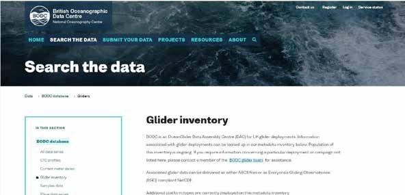
11 HIGH POWER MARINE AUTONOMOUS SYSTEMS (MAS) PLATFORMS	����������������������� 41                                                                                  14.2 CURRENT CAPABILITY. . . . . . . . . . . . . . . . . . . . . . . . . . . . . . . . . . . . . . . . . . . . . . . . . . . 62

   11.1 ESSENTIAL OCEAN VARIABLES. . . . . . . . . . . . . . . . . . . . . . . . . . . . . . . . . . . . . . . . . . . .  41                                        14.3 SCIENCE COMMUNITY DRIVERS . . . . . . . . . . . . . . . . . . . . . . . . . . . . . . . . . . . . . . . . . . 62

   11.2 CURRENT CAPABILITY. . . . . . . . . . . . . . . . . . . . . . . . . . . . . . . . . . . . . . . . . . . . . . . . . . . 42                                  14.4 FUTURE CAPABILITY . . . . . . . . . . . . . . . . . . . . . . . . . . . . . . . . . . . . . . . . . . . . . . . . . . . . 63

   11.3 SCIENCE COMMUNITY DRIVERS. . . . . . . . . . . . . . . . . . . . . . . . . . . . . . . . . . . . . . . . . . . 43                                           14.5 ASPIRATIONS . . . . . . . . . . . . . . . . . . . . . . . . . . . . . . . . . . . . . . . . . . . . . . . . . . . . . . . . . . 63

   11.4 FUTURE CAPABILITY . . . . . . . . . . . . . . . . . . . . . . . . . . . . . . . . . . . . . . . . . . . . . . . . . . . . 44                                14.6 2019/20 UPDATE. . . . . . . . . . . . . . . . . . . . . . . . . . . . . . . . . . . . . . . . . . . . . . . . . . . . . . . . 63

   11.5 ASPIRATIONS . . . . . . . . . . . . . . . . . . . . . . . . . . . . . . . . . . . . . . . . . . . . . . . . . . . . . . . . . . 47

   11.6 2019/20 UPDATE . . . . . . . . . . . . . . . . . . . . . . . . . . . . . . . . . . . . . . . . . . . . . . . . . . . . . . . . 48
                                                                                                                                                                15 LONG RANGE UNMANNED SURFACE VEHICLES .  .  .  .  .  .  .  .  .  .  .  .  .  .  .  .  .  .  .  .  .  .  .  .  .  .  .  .  . 64

                                                                                                                                                                    15.1 ESSENTIAL OCEAN VARIABLES . . . . . . . . . . . . . . . . . . . . . . . . . . . . . . . . . . . . . . . . . . . 64

12 UNDERWATER GLIDER PLATFORMS .  .  .  .  .  .  .  .  .  .  .  .  .  .  .  .  .  .  .  .  .  .  .  .  .  .  .  .  .  .  .  .  .  .  .  .  .  .  . 49               15.2 CURRENT CAPABILITY. . . . . . . . . . . . . . . . . . . . . . . . . . . . . . . . . . . . . . . . . . . . . . . . . . . 65

   12.1 ESSENTIAL OCEAN VARIABLES . . . . . . . . . . . . . . . . . . . . . . . . . . . . . . . . . . . . . . . . . . . 49                                          15.2.1 PROVEN PLATFORMS. . . . . . . . . . . . . . . . . . . . . . . . . . . . . . . . . . . . . . . . . . . . . . . . . . 65

   12.2 CURRENT CAPABILITY. . . . . . . . . . . . . . . . . . . . . . . . . . . . . . . . . . . . . . . . . . . . . . . . . . . 50                                  15.2.2 EXPERIMENTAL PLATFORMS (NOT RECOMMENDED FOR SCIENCE)	���������������������65

   12.3 SCIENCE COMMUNITY DRIVERS . . . . . . . . . . . . . . . . . . . . . . . . . . . . . . . . . . . . . . . . . . 50                                            15.3 SCIENCE COMMUNITY DRIVERS . . . . . . . . . . . . . . . . . . . . . . . . . . . . . . . . . . . . . . . . . . 65

   12.4 FUTURE CAPABILITY . . . . . . . . . . . . . . . . . . . . . . . . . . . . . . . . . . . . . . . . . . . . . . . . . . . .  51                               15.4 FUTURE CAPABILITY . . . . . . . . . . . . . . . . . . . . . . . . . . . . . . . . . . . . . . . . . . . . . . . . . . . . 66

   12.5 ASPIRATIONS . . . . . . . . . . . . . . . . . . . . . . . . . . . . . . . . . . . . . . . . . . . . . . . . . . . . . . . . . . 53                          15.5 ASPIRATIONS . . . . . . . . . . . . . . . . . . . . . . . . . . . . . . . . . . . . . . . . . . . . . . . . . . . . . . . . . . 66

   12.6 2019/20 UPDATE. . . . . . . . . . . . . . . . . . . . . . . . . . . . . . . . . . . . . . . . . . . . . . . . . . . . . . . . 54                            15.6 2019/20 UPDATE. . . . . . . . . . . . . . . . . . . . . . . . . . . . . . . . . . . . . . . . . . . . . . . . . . . . . . . . 67

13 LONG RANGE AUV PLATFORMS.  .  .  .  .  .  .  .  .  .  .  .  .  .  .  .  .  .  .  .  .  .  .  .  .  .  .  .  .  .  .  .  .  .  .  .  .  .  .  .  .  .  . 55   16 LONG RANGE MAS PLATFORMS COMMAND AND CONTROL (C2)	����������������������������� 68

   13.1 ESSENTIAL OCEAN VARIABLES . . . . . . . . . . . . . . . . . . . . . . . . . . . . . . . . . . . . . . . . . . . 55                                          16.1 CURRENT CAPABILITY. . . . . . . . . . . . . . . . . . . . . . . . . . . . . . . . . . . . . . . . . . . . . . . . . . . 68

   13.2 CURRENT CAPABILITY. . . . . . . . . . . . . . . . . . . . . . . . . . . . . . . . . . . . . . . . . . . . . . . . . . . 56                                  16.2 SCIENCE COMMUNITY DRIVERS . . . . . . . . . . . . . . . . . . . . . . . . . . . . . . . . . . . . . . . . . . 68

   13.3 SCIENCE COMMUNITY DRIVERS . . . . . . . . . . . . . . . . . . . . . . . . . . . . . . . . . . . . . . . . . . 56                                            16.3 FUTURE CAPABILITY . . . . . . . . . . . . . . . . . . . . . . . . . . . . . . . . . . . . . . . . . . . . . . . . . . . . 69

   13.4 FUTURE CAPABILITY . . . . . . . . . . . . . . . . . . . . . . . . . . . . . . . . . . . . . . . . . . . . . . . . . . . . 57                                16.4 ASPIRATIONS . . . . . . . . . . . . . . . . . . . . . . . . . . . . . . . . . . . . . . . . . . . . . . . . . . . . . . . . . . 70

   13.5 ASPIRATIONS . . . . . . . . . . . . . . . . . . . . . . . . . . . . . . . . . . . . . . . . . . . . . . . . . . . . . . . . . . 58                          16.5 2019/20 UPDATE. . . . . . . . . . . . . . . . . . . . . . . . . . . . . . . . . . . . . . . . . . . . . . . . . . . . . . . . 73

   13.6 2019/20 UPDATE. . . . . . . . . . . . . . . . . . . . . . . . . . . . . . . . . . . . . . . . . . . . . . . . . . . . . . . . 59

                                                                                                                                                                17 GRAVIMETERS .  .  .  .  .  .  .  .  .  .  .  .  .  .  .  .  .  .  .  .  .  .  .  .  .  .  .  .  .  .  .  .  .  .  .  .  .  .  .  .  .  .  .  .  .  .  .  .  .  .  .  .  .  .  .  .  . 74

14 LOW INFRASTRUCTURE AUV PLATFORMS.  .  .  .  .  .  .  .  .  .  .  .  .  .  .  .  .  .  .  .  .  .  .  .  .  .  .  .  .  .  .  .  .  . 61                          17.1 CURRENT CAPABILITY . . . . . . . . . . . . . . . . . . . . . . . . . . . . . . . . . . . . . . . . . . . . . . . . . . .  74

   14.1 ESSENTIAL OCEAN VARIABLES . . . . . . . . . . . . . . . . . . . . . . . . . . . . . . . . . . . . . . . . . . . 61                                          17.2 SCIENCE COMMUNITY DRIVERS. . . . . . . . . . . . . . . . . . . . . . . . . . . . . . . . . . . . . . . . . . . 75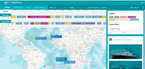
17.3 FUTURE CAPABILITY . . . . . . . . . . . . . . . . . . . . . . . . . . . . . . . . . . . . . . . . . . . . . . . . . . . . 76 21.3 FUTURE CAPABILITY . . . . . . . . . . . . . . . . . . . . . . . . . . . . . . . . . . . . . . . . . . . . . . . . . . . . 87
17.4 ASPIRATIONS. . . . . . . . . . . . . . . . . . . . . . . . . . . . . . . . . . . . . . . . . . . . . . . . . . . . . . . . . . . 76 21.4 ASPIRATIONS . . . . . . . . . . . . . . . . . . . . . . . . . . . . . . . . . . . . . . . . . . . . . . . . . . . . . . . . . . 89
18 MAGNETOMETERS . . . . . . . . . . . . . . . . . . . . . . . . . . . . . . . . . . . . . . . . . . . . . . . . . . . . 77
22 WINCHES. . . . . . . . . . . . . . . . . . . . . . . . . . . . . . . . . . . . . . . . . . . . . . . . . . . . . . . . . . . . . . 90
18.1 CURRENT CAPABILITY. . . . . . . . . . . . . . . . . . . . . . . . . . . . . . . . . . . . . . . . . . . . . . . . . . . 77
22.1 SHIP FITTED WINCHES . . . . . . . . . . . . . . . . . . . . . . . . . . . . . . . . . . . . . . . . . . . . . . . . . . 90
18.2 SCIENCE COMMUNITY DRIVERS . . . . . . . . . . . . . . . . . . . . . . . . . . . . . . . . . . . . . . . . . . 77
22.1.1 CURRENT CAPABILITY. . . . . . . . . . . . . . . . . . . . . . . . . . . . . . . . . . . . . . . . . . . . . . . . . . 90
18.3 FUTURE CAPABILITY . . . . . . . . . . . . . . . . . . . . . . . . . . . . . . . . . . . . . . . . . . . . . . . . . . . . 78
22.1.2 FUTURE CAPABILITY. . . . . . . . . . . . . . . . . . . . . . . . . . . . . . . . . . . . . . . . . . . . . . . . . . . 91
18.4 ASPIRATIONS . . . . . . . . . . . . . . . . . . . . . . . . . . . . . . . . . . . . . . . . . . . . . . . . . . . . . . . . . . 78
22.1.3 ASPIRATIONS. . . . . . . . . . . . . . . . . . . . . . . . . . . . . . . . . . . . . . . . . . . . . . . . . . . . . . . . . 91
18.5 2019/20 UPDATE. . . . . . . . . . . . . . . . . . . . . . . . . . . . . . . . . . . . . . . . . . . . . . . . . . . . . . . . 78
22.1.4 2019/20 UPDATE. . . . . . . . . . . . . . . . . . . . . . . . . . . . . . . . . . . . . . . . . . . . . . . . . . . . . . . 91
22.2 PORTABLE WINCHES. . . . . . . . . . . . . . . . . . . . . . . . . . . . . . . . . . . . . . . . . . . . . . . . . . . . 91
19 SHIP-FITTED HYDROACOUSTIC SUITE AND HYDROGRAPHY SOFTWARE ��������������� 79 22.2.1 CURRENT CAPABILITY . . . . . . . . . . . . . . . . . . . . . . . . . . . . . . . . . . . . . . . . . . . . . . . . . 91
19.1 ESSENTIAL OCEAN VARIABLES . . . . . . . . . . . . . . . . . . . . . . . . . . . . . . . . . . . . . . . . . . . 79 22.2.2 SCIENCE COMMUNITY DRIVERS. . . . . . . . . . . . . . . . . . . . . . . . . . . . . . . . . . . . . . . . . 92
19.2 CURRENT CAPABILITY. . . . . . . . . . . . . . . . . . . . . . . . . . . . . . . . . . . . . . . . . . . . . . . . . . . 79 22.2.3 FUTURE CAPABILITY. . . . . . . . . . . . . . . . . . . . . . . . . . . . . . . . . . . . . . . . . . . . . . . . . . . 92
19.3 SCIENCE COMMUNITY DRIVERS . . . . . . . . . . . . . . . . . . . . . . . . . . . . . . . . . . . . . . . . . . 80 22.2.4 ASPIRATIONS. . . . . . . . . . . . . . . . . . . . . . . . . . . . . . . . . . . . . . . . . . . . . . . . . . . . . . . . . 92
19.4 FUTURE CAPABILITY . . . . . . . . . . . . . . . . . . . . . . . . . . . . . . . . . . . . . . . . . . . . . . . . . . . . 81
19.5 ASPIRATIONS . . . . . . . . . . . . . . . . . . . . . . . . . . . . . . . . . . . . . . . . . . . . . . . . . . . . . . . . . . 81
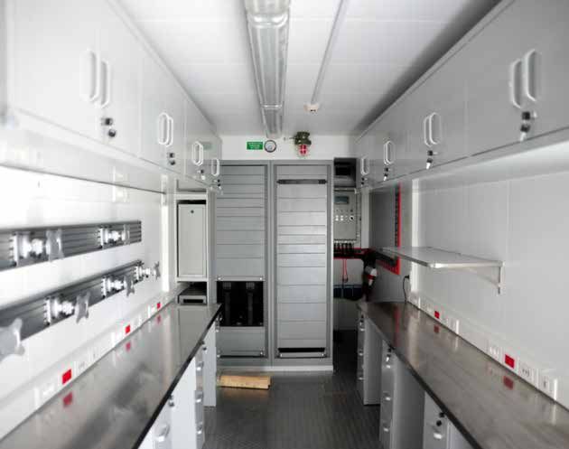
23 ANCILLARY EQUIPMENT AND FACILITIES. . . . . . . . . . . . . . . . . . . . . . . . . . . . . . . . . . . 93
23.1 CALIBRATION LABORATORY. . . . . . . . . . . . . . . . . . . . . . . . . . . . . . . . . . . . . . . . . . . . . . 93
20 OCEAN AND ATMOSPHERE MONITORING . . . . . . . . . . . . . . . . . . . . . . . . . . . . . . . . . . 82 23.1.1 CURRENT CAPABILITY. . . . . . . . . . . . . . . . . . . . . . . . . . . . . . . . . . . . . . . . . . . . . . . . . . 93
20.1 ESSENTIAL OCEAN VARIABLES . . . . . . . . . . . . . . . . . . . . . . . . . . . . . . . . . . . . . . . . . . . 82 23.1.2 SCIENCE COMMUNITY DRIVERS. . . . . . . . . . . . . . . . . . . . . . . . . . . . . . . . . . . . . . . . . 93
20.2 CURRENT CAPABILITY. . . . . . . . . . . . . . . . . . . . . . . . . . . . . . . . . . . . . . . . . . . . . . . . . . . 82 23.1.3 FUTURE CAPABILITY. . . . . . . . . . . . . . . . . . . . . . . . . . . . . . . . . . . . . . . . . . . . . . . . . . . 93
20.3 SCIENCE COMMUNITY DRIVERS . . . . . . . . . . . . . . . . . . . . . . . . . . . . . . . . . . . . . . . . . . 82 23.1.4 ASPIRATIONS. . . . . . . . . . . . . . . . . . . . . . . . . . . . . . . . . . . . . . . . . . . . . . . . . . . . . . . . . 93
20.4 FUTURE CAPABILITY . . . . . . . . . . . . . . . . . . . . . . . . . . . . . . . . . . . . . . . . . . . . . . . . . . . . 83 23.2 CONTAINER LABORATORIES . . . . . . . . . . . . . . . . . . . . . . . . . . . . . . . . . . . . . . . . . . . . . 94
20.5 ASPIRATIONS. . . . . . . . . . . . . . . . . . . . . . . . . . . . . . . . . . . . . . . . . . . . . . . . . . . . . . . . . . 83 23.2.1 CURRENT CAPABILITY . . . . . . . . . . . . . . . . . . . . . . . . . . . . . . . . . . . . . . . . . . . . . . . . . 94
23.2.2 SCIENCE COMMUNITY DRIVERS. . . . . . . . . . . . . . . . . . . . . . . . . . . . . . . . . . . . . . . . . 95
23.2.3 FUTURE CAPABILITY. . . . . . . . . . . . . . . . . . . . . . . . . . . . . . . . . . . . . . . . . . . . . . . . . . . 95
21 SHIP BASED DATA ACQUISITION SYSTEMS . . . . . . . . . . . . . . . . . . . . . . . . . . . . . . . . . 85
21.1 CURRENT CAPABILITY. . . . . . . . . . . . . . . . . . . . . . . . . . . . . . . . . . . . . . . . . . . . . . . . . . . 85
21.2 SCIENCE COMMUNITY DRIVERS . . . . . . . . . . . . . . . . . . . . . . . . . . . . . . . . . . . . . . . . . . 85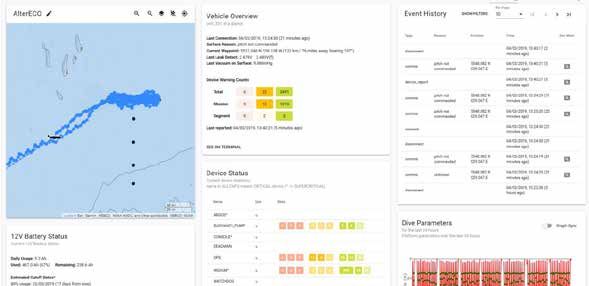
INS. . . . . . . . . . . . . . . . . . . . . . . . . . . . . . . . . . . . . . . . . . . . . . . . . . . . Inertial Navigation System

                                                                                                                                          LBL. . . . . . . . . . . . . . . . . . . . . . . . . . . . . . . . . . . . . . . . . . . . . . . . . . . . . . . . . . . . .  Long Baseline

                                                                                                                                          LRAUV. . . . . . . . . . . . . . . . . . . . . . . . . . . . . . . . . Long Range Autonomous Underwater Vehicle
ACRONYMS
                                                                                                                                          MARS. . . . . . . . . . . . . . . . . . . . . . . . . . . . . . . . . . . . . Marine Autonomous and Robotic Systems

 ACSIS. . . . . . . . . . . . . . . . . . . . . . . . . . . . . . . . . North Atlantic Climate System Integrated Study                    MEMS . . . . . . . . . . . . . . . . . . . . . . . . . . . . . . . . . . . . . . . . . .  Micro-electromechanical Systems

 ADCP. . . . . . . . . . . . . . . . . . . . . . . . . . . . . . . . . . . . . . . . . . . .  Acoustic Doppler Current Profiler           MPUS. . . . . . . . . . . . . . . . . . . . . . . . . . . . . . . . . . . . . . . . Modular Payload Underwater Systems

 AHRS. . . . . . . . . . . . . . . . . . . . . . . . . . . . . . . . . . . . . . . . . . Attitude Heading Reference System                NetCDF . . . . . . . . . . . . . . . . . . . . . . . . . . . . . . . . . . . . . . . . . . . . . Network Common Data Form

 ALR . . . . . . . . . . . . . . . . . . . . . . . . . . . . . . . . . . . . . . . . . . . . . . . . . . . . . . . Autosub Long Range     NRT . . . . . . . . . . . . . . . . . . . . . . . . . . . . . . . . . . . . . . . . . . . . . . . . . . . . . . . . . . . . Near Real-Time

 AMT. . . . . . . . . . . . . . . . . . . . . . . . . . . . . . . . . . . . . . . . . . . . . . . . . . Atlantic Meridional Transect      OAS. . . . . . . . . . . . . . . . . . . . . . . . . . . . . . . . . . . . . . . . . . . . . . . . . Obstacle Avoidance System

 ASSS. . . . . . . . . . . . . . . . . . . . . . . . . . . . . . . Autonomous Surface/Sub-surface Survey System                           OCS. . . . . . . . . . . . . . . . . . . . . . . . . . . . . . . . . . . . . . . . . . . . . . . . . . . On-board Control System

 AUV . . . . . . . . . . . . . . . . . . . . . . . . . . . . . . . . . . . . . . . . . . . . .  Autonomous Underwater Vehicle             OEM. . . . . . . . . . . . . . . . . . . . . . . . . . . . . . . . . . . . . . . . . . . . . Original Equipment Manufacturer

 CaPASOS. . . . . . . . . . . . . . . . . . . . . . . . . . . Calibrated pCO2 in Air and Surface Ocean Sensor                             OS . . . . . . . . . . . . . . . . . . . . . . . . . . . . . . . . . . . . . . . . . . . . . . . . . . . . . . . . . . . . Ocean Surveyor

 CarCASS. . . . . . . . . . . . . . . . . . . . . . . . . . . Carbonate Chemistry Autonomous Sensor System                                OTEG. . . . . . . . . . . . . . . . . . . . . . . . . . . . . . . . . . . . Ocean Technology and Engineering Group

 CODAS . . . . . . . . . . . . . . . . . . . . . . . . . . . . . . . . . . . . . .  Common Ocean Data Access System                       PCA. . . . . . . . . . . . . . . . . . . . . . . . . . . . . . . . . . . . . . . . . . . . . . . . . . . .  Post-Cruise Assessment

 COTS. . . . . . . . . . . . . . . . . . . . . . . . . . . . . . . . . . . . . . . . . . . . . . . . . . Commercial Off The Shelf         RAFOS. . . . . . . . . . . . . . . . . . . . . . . .  SOFAR (SOund Fixing And Ranging) spelled backwards

 CTD. . . . . . . . . . . . . . . . . . . . . . . . . . . . . . . . . . . . . . . . . . Conductivity, Temperature and Depth               RINGO. . . . . . . . . . . . . . Readiness of ICOS for Necessities of Integrated Global Observations

 DVL . . . . . . . . . . . . . . . . . . . . . . . . . . . . . . . . . . . . . . . . . . . . . . . . . . . . . . . Doppler Velocity Log   ROP. . . . . . . . . . . . . . . . . . . . . . . . . . . . . . . . . . . . . . . . . . . . . . . . . Remotely Operated Platform

 EGO. . . . . . . . . . . . . . . . . . . . . . . . . . . . . . . . . . . . . . . . . . . . . Everyone’s Gliding Observatories            ROS. . . . . . . . . . . . . . . . . . . . . . . . . . . . . . . . . . . . . . . . . . . . . . . . . . . . Robot Operating System

 EOV. . . . . . . . . . . . . . . . . . . . . . . . . . . . . . . . . . . . . . . . . . . . . . . . . . . . Essential Ocean Variable      RVDAS. . . . . . . . . . . . . . . . . . . . . . . . . . . . . . . . . . . .  Research Vessel Data Acquisition System

 ERDDAP. . . . . . . . . . . . . . . . . . . . . . . Environmental Research Divisions Data Access Program                                 SBP . . . . . . . . . . . . . . . . . . . . . . . . . . . . . . . . . . . . . . . . . . . . . . . . . . . . . . . . Sub Bottom Profiler

 FAIR. . . . . . . . . . . . . . . . . . . . . . . . . . . . . . . . Findable, Accessible, Interoperable and Reusable                     SME. . . . . . . . . . . . . . . . . . . . . . . . . . . . . . . . . Ship-time & Marine Equipment Application Form

 FAT. . . . . . . . . . . . . . . . . . . . . . . . . . . . . . . . . . . . . . . . . . . . . . . . . .  Factory Acceptance Testing       UDP. . . . . . . . . . . . . . . . . . . . . . . . . . . . . . . . . . . . . . . . . . . . . . . . . . . . . User Datagram Protocol

 GEBCO . . . . . . . . . . . . . . . . . . . . . . . . . . . . . . . . . . . . General Bathymetric Chart of the Oceans                    UHDAS. . . . . . . . . . . . . . . . . . . . . . . . . . . . . . . . . . University of Hawaii Data Acquisition System

 HAT . . . . . . . . . . . . . . . . . . . . . . . . . . . . . . . . . . . . . . . . . . . . . . . . . Harbour Acceptance Testing         USBL. . . . . . . . . . . . . . . . . . . . . . . . . . . . . . . . . . . . . . . . . . . . . . . . . . . . . . . Ultra Short Baseline

 HyBIS. . . . . . . . . . . . . . . . . . . . . . . . . . . . . . . . . . . . . . . . . Hydraulic Benthic Interactive Sampler             USV . . . . . . . . . . . . . . . . . . . . . . . . . . . . . . . . . . . . . . . . . . . . . . . . . . Unmanned Surface Vehicle

 ICOS . . . . . . . . . . . . . . . . . . . . . . . . . . . . . . . . . . . . . . .  Integrated Carbon Observation System                 WCB. . . . . . . . . . . . . . . . . . . . . . . . . . . . . . . . . . . . . . . . . . . . . . . . . . . . . . . . .  Western Core Box

 IMS. . . . . . . . . . . . . . . . . . . . . . . . . . . . . . . . . . . . . . . . . . . . . . . . Inventory Management System           WHOI. . . . . . . . . . . . . . . . . . . . . . . . . . . . . . . . . . . . . . . . Woods Hole Oceanographic Institution

                                                                                                                                                                                                                                                                                   K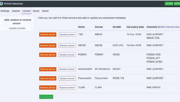
Oceanography Centre Association (NOCA), the Marine Facilities Advisory Board (MFAB) and

                                                                                                  the Cruise Programme Executive Board (CPEB). These are key channels[1] through which

                                                                                                  the community can discuss topics and raise, for example, the need for new capabilities for
1 INTRODUCTION
                                                                                                  inclusion in the NMEP.

1.1.1 NATIONAL MARINE FACILITIES
                                                                                                  1.1.4 THE NMF TECHNOLOGY ROADMAP

The aim of National Marine Facilities (NMF), part of the National Oceanography Centre (NOC),
                                                                                                  Against a backdrop of tight budgets, rapid technical development, big data and the increasing
is to develop, co-ordinate and provide major platforms, observing systems and technical
                                                                                                  use of Marine Autonomous Systems (MAS), NMF is committed to delivering the best possible
expertise to support the UK’s marine science community. Part of this national capability is
                                                                                                  support and value for money to the UK science community and to support the UK Marine
the National Marine Equipment Pool (NMEP); a collection of over 10,000 instruments and
                                                                                                  Science Strategy. Working closely with the British Oceanographic Data Centre (BODC),
technologies for deployment both from and independently of research vessels.
                                                                                                  NMF supports GO-SHIP, Argo, RAPID, Ellet and OSNAP programmes which have significant

1.1.2 NMF STRATEGIC GOALS                                                                         potential impact for international ocean observation activities such as the Global Ocean

                                                                                                  Observing System (GOOS) and the upcoming United Nations Decade of Ocean Science for
• To provide the UK Marine Science community with access to the most advanced
                                                                                                  Sustainable Development.
     oceanographic research ship fleet in the world (tonne for tonne) to enable discovery and

     strategic science.                                                                           NMF was commissioned by the NERC in 2018 to operate the RRS James Cook and the RRS

                                                                                                  Discovery, the NMEP and the associated planning, logistical, maintenance and repair functions.
• To be a world leader in the integrated provision of scientific technology for marine science,
                                                                                                  NMF receives additional capital funding from NERC to replace, refurbish, upgrade and further
     with effective deployments, novel capabilities and strong partnerships.
                                                                                                  develop the ship fitted scientific equipment and the NMEP. NMF reviews feedback from

• To train and retain our staff thereby embedding technical excellence and resilience and         multiple stakeholders as well as considering technology developments associated with current

     develop additional capacity.                                                                 capabilities to ensure its strategy for replacement, upgrade and development is evidence based.

                                                                                                  In addition, the MFAB provides advice to NMF with regards to its strategy for the equipment
• To develop strong internal and external partnerships which leverage both our expertise
                                                                                                  portfolio it operates and further provides guidance regarding new and emerging requirements.
     in managing major platforms and observing systems and our strengths in technological

     development.                                                                                 Within the five year horizon of this Technology Roadmap, research vessels will continue to be

                                                                                                  the primary means of enabling data collection and physical sampling. They will also continue
1.1.3 HOW NMF ENGAGES WITH THE UK MARINE SCIENCE COMMUNITY
                                                                                                  to deploy, recover and service autonomous instruments, such as moorings, as well as more

The NMF team works with the UK marine science community, through the National                     often deploying and recovering MAS, such as floats, gliders and Autonomous Underwater

01                                                                                                [1] In addition, feedback and enquiries are welcome at any time through nmfops@noc.ac.uk       02
Vehicles (AUVs). However, the growing focus on supporting a sustainable future for our              1.1.5 THE NMF WORKFLOW AND A VISION FOR SCIENCE INTERACTION

planet will require those assets which have large carbon footprints to maximise their impact
                                                                                                    A simplified vision of how NMF supports the marine science community is shown in the figure
per tonne of carbon. In the short term this can be achieved by leveraging the multi-role
                                                                                                    below. The core areas are dark blue with the lower engagement areas shown in progressively
nature of the UK’s research ships, e.g. by mapping the seabed and collecting atmospheric
                                                                                                    lighter blues. NMF’s objective is to streamline this workflow so that we can effectively support
samples at every opportunity whilst fulfilling the primary purpose of the scientific research
                                                                                                    the UK Marine Science community.
expedition being delivered. Over the medium term, upgrades to ship hulls and machinery will

improve efficiencies alongside the combined operation of multiple, ship-deployed and MAS

sensors. Longer term, the next generation of semi-autonomous research ships will utilise

novel energy sources, electrical distribution systems and methods of propulsion as well as
                                                                                                                                           Science Question

robotics, MAS, communication systems and advanced manufacturing techniques to meet
                                                                                                                                           Proposal Creation
those targets.

The importance of data management within the NMF Technology Roadmap is highlighted by                                                      Detailed Planning
both goal four of the NOC strategy[2], and the focus on data themes at OceanObs’19 which                    Develop New Data
                                                                                                                                                                               BODC
resulted in the conference statements :             [3]                                                      Collection Tools               Data Collection
                                                                                                                                                                            Data Curation
                                                                                                              & Techniques
• “Ensure that all elements of the observing system are interoperable, and that data is                                                      Data Analysis                          FAIR
     managed wisely, guided by open data policies and that data are shared in a timely manner”
                                                                                                                                          Publications, Policy,          The Global Ocean
• “Use best practices, standards, formats, vocabularies, and the highest ethics in the                                                      Societal Good                Observing System

     collection and use of ocean data”

In recent years, BODC and NMF have worked closely under the Oceanids C2 programme,

on the delivery of routine observations from ship-mounted sensor arrays. There is a strong          As NMF continues to optimise this workflow it is working towards a vision of four ‘screens’ that

desire to build on these links to address further gaps in capability and integration. Hence, this   allow scientists and engineers to interact with the planning, data collection and data curation

Technology Roadmap introduces a section on data management and practices that will evolve           phases. These ‘screens’ will be linked to allow data to flow between systems and will act as a

and develop further in future iterations.                                                           hub for information about the research activity. These ‘screens’ will be underpinned by a set of

                                                                                                    processes and procedures which will support the data flows, and will evolve over time. The intent

                                                                                                    is to automate and streamline these processes to maximise the benefit to the community.

         [2] https://noc.ac.uk/files/documents/about/noc-strategy.pdf
03       [3] http://www.oceanobs19.net/statement/                                                                                                                                                      04
1.1.6 PLANNING                                                                                      1.1.8 (NEAR) REAL-TIME DATA DISPLAY

This 'screen’ will captured the planning phase for both ship and autonomous platforms. This         Closely aligned with the Real Time Control system, the (Near) Real-Time Data Display will be

capability will be built on the existing Marine Facilities Planning website. It is envisaged that   a public facing portal that will allow visualization of the science data, but will not provide any

the planning phase metadata will flow to the Real Time Control, Real Time Display and Data          control functionality to the deployed system. The degree to which the data will be open to

Archive systems.                                                                                    public access will be adjustable, from fully open (all data available on the public portal) to fully

                                                                                                    restricted (data only available to the science team).

1.1.7 REAL TIME CONTROL                                                                             1.1.9 DATA ARCHIVE

Once a system is deployed the real time control system will provide the interface to monitor        The Data Archive ‘screen’ would allow access to previously collected near real-time data and

and control to the platform. This will be built on the existing Command and Control (C2)            the delayed mode data as per the FAIR (Findable, Accessible, Interoperable and Reusable)

infrastructure being developed under the Oceanids programme. It is envisaged to encompass           data principles. This would be developed based on the BODC infrastructure.

the long range fleet operations, the Remote Operated Vehicle (ROV) virtual control room

concept, and other deployed and controllable assets, such as moorings.

05                                                                                                                                                                                                       06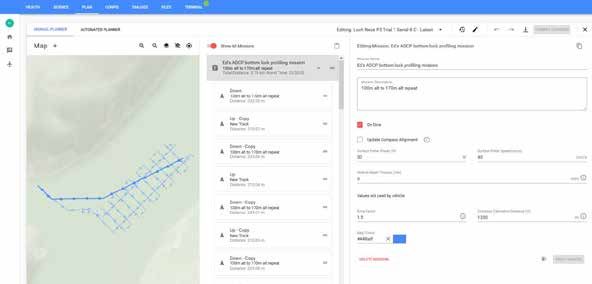
1.2 ESSENTIAL OCEAN VARIABLES & THE GLOBAL OCEAN OBSERVING SYSTEM                           1.3 DOCUMENT STRUCTURE

NMF and BODC are focused on ensuring that the data that we collect follows the FAIR data    The NMF Technology Roadmap is updated annually to reflect the ambitions of NMF to meet

principles and can be easily ingested into the Global Ocean Observing System (GOOS).        its remit. The NMF Technology Roadmap is structured to present sequentially each area of

As part of this focus the Technology Roadmap attempts to map the NMEP capabilities to the   capability, categorised as follows:

Essential Ocean Variables (EOVs) as shown below. It is appreciated that although some of
                                                                                            I. Essential Ocean Variables
these EOV are mature, NMF/NOC also have a much broader capability including less mature
                                                                                               Describes how the capability maps on the GOOS EOVs.
and niche parameters not listed as EOVs.

                                                                                            II. Current Capability
       DISSOLVED   ORGANIC    CARBON    •   FISH   ABUNDANCE   AND    DISTRIBUTION   •         A description of the current capability in that area.
       HARD CORAL COVER AND COMPOSITION • INORGANIC CARBON • INVERTEBRATE
       ABUNDANCE AND DISTRIBUTION (EMERGING) • MACROALGAL CANOPY COVER AND                  III. Science Community Drivers
       COMPOSITION • MANGROVE COVER AND COMPOSITION • MARINE TURTLES, BIRDS,
                                                                                               An overview of the science and operational pulls requiring process and technology
       MAMMALS ABUNDANCE AND DISTRIBUTION • MICROBE BIOMASS AND DIVERSITY
                                                                                               developments.
       (EMERGING) • NUTRIENTS • NITROUS OXIDE • OCEAN COLOUR • OCEAN SOUNDS • OCEAN

       SURFACE HEAT FLUX • OCEAN SURFACE STRESS • OXYGEN • PARTICULATE MATTER •
                                                                                            IV. Future Capability
       PHYTOPLANKTON BIOMASS AND DIVERSITY • SEA ICE • SEA STATE • SEA SURFACE HEIGHT
       • SEA SURFACE TEMPERATURE • SEAGRASS COVER AND COMPOSITION • STABLE CARBON
                                                                                               Developments that are planned and have associated funding in place.
       ISOTOPES • SUBSURFACE CURRENTS • TRANSIENT TRACERS • ZOOPLANKTON BIOMASS
                                                                                            V. Aspirations

                                                                                               Potential future capabilities for which funding will be sought.

                                                                                            VI. 2019/20 Update

                                                                                               Brief overview of progress developing enhanced capabilities since the previous issue of the

                                                                                               NMF Technology Roadmap.

                                                                                            It covers all ship-fitted equipment, ship deployed equipment, autonomous stationary

                                                                                            equipment and MAS operated by NMF. The developments in a lot of areas are carried out

                                                                                            alongside the cruise programme, thus it is not always possible to provide timelines for the

                                                                                            delivery of the new capability as it will depend on the cruise programme. Where possible

                                                                                            timelines for the new capabilities are given.

07                                                                                                                                                                                        08
NMF as it moves around the globe in support of the programme; and meets the HM
Revenue and Customs (HMRC) customs requirements of the NOC.
2 MARINE FACILITIES PLANNING PORTAL • Personnel Planning Module
Used to assign technicians to different expeditions in the programme, whilst highlighting
when individuals are nearing or exceeding acceptable days on duty at sea.
• Programme Construction Module
BARCODE CRUISE PROJECT
SCANNERS PLANNING MANAGEMENT REPORTING
Used in the development of the programme, clearly highlighting constraints for equipment
and personnel.
TECHNICAL INVENTORY MOORING
PLANNING MANAGEMENT CONFIGURATOR • Project Management Module
Used to provide the project framework for each SME, from application, engineering review
VOYAGE MAINTENANCE & CUSTOMS SCIENTIST and funding confirmation, through programme construction, cruise planning and itinerary,
PLANNING TOOL CONFIGURATION WAREHOUSE PORTAL
equipment preparation and finally post cruise actions and assessment.
• Scientist Portal
The tool used to request ship and/or equipment time by both scientists and technicians. To
2.1 CURRENT CAPABILITY access this tool an account must be requested at the marine facilities planning website.
The marine facilities planning system provides the backbone of the cruise and autonomous 2.2 SCIENCE COMMUNITY DRIVERS
deployment programme planning activities undertaken by NERC Marine Planning and the
• Simplify Use
NOC. It is a world leading system comprising the following modules:
It is desirable to continue to simplify access to the system and improve the user experience
• Programme Module when using the Marine Facilities Planning Portal (MFP).
Provides visibility of the approved programme, including the original Ship-Time & Marine
• Increase Visibility Of Equipment Capabilities
Equipment Application Form (SME), final supply agreement, equipment, technicians and
At present when requesting equipment, the applicant is presumed to know the capabilities
associated documentation for an expedition.
and limitations of the equipment in the NMEP. The visibility of equipment specifications,
• Inventory Management System (IMS) measurement ranges and limitations, and alternative equipment would provide applicants
Used to plan, record and track the location of all NMEP and non-NMEP equipment within with the information to request the most appropriate equipment for their objective.
09 102.3 FUTURE CAPABILITY days can be viewed, however this is not combined with allocated maintenance activities
in the planned maintenance system, or any planned absences from the NOC business
• Maintenance Improvements
management system; UNIT4. The ability to view all planned activities for an individual and
Periodic maintenance is recorded for equipment within IMS, but there is not currently the
group in one system would give better visibility of spare capacity, and consequently better
ability to add corrective maintenance or record failure events to give a full work history.
risk awareness across a group.
Additionally, administration of equipment maintenance must be done on a computer
rather than in the mobile application. In 2020, IMS will be upgraded to include corrective • Develop the MFP mobile application to simplify using the software in the field, in the
maintenance and failure recording, and will be incorporated into the mobile application workshops, and when away from a computer.
to provide portable/in-situ access to equipment history, documentation and recording
• Integration with other systems. To maximise the benefits of the four screen approach
capability.
outlined above, the MFP should be integrated with the C2 and data flows to BODC, as
• Personnel Capabilities noted in the section 3, Data Management and Practices, and section 16, Long Range
Recording of personnel training is necessary for both individual progression and to assure MAS Platforms Command and Control (C2). Further integration into the NOC business
the technicians embarked on an expedition are suitably qualified and experienced to safely management system will further streamline workflows reducing the operational costs of
and effectively complete the tasks required at sea. A new personnel capabilities module is in managing the system.
development, which will be used to document the syllabus required to achieve tier 1 and 2
2.5 2019/20 UPDATE
competence in each identified NMF capability, and an individual's progression to achieving
this competence. In 2020 this will only be introduced for NMF technicians only but is Development of the personnel capabilities module has progressed in 2019, with alpha testing
planned to be extended to mariners once completed. ongoing and due to be completed in 2020.
2.4 ASPIRATIONS
• The MFP is used as the primary tool for planning and recording NMF activities across all
modules. As such, it contains information that can be used to inform improvement initiatives
for these activities. At present most of this information can only be extracted manually which
is labour intensive and inefficient. The development of a reporting module would allow this
information to be accessed quickly and afford more time for improvements to be made.
• Understanding the capacity in terms of availability of personnel is essential in planning
activities for a given period. Within the personnel planning module the assigned sea
11 12• Key papers published on FAIR data principles[4] and Ocean Best Practices[5].
• Recommendations from OceanObs’19 and Research Data Alliance for integrated scientific
3 DATA MANAGEMENT AND PRACTICES data workflows[6].
3.1 CURRENT CAPABILITY • UN Decade of Ocean Science for Sustainable Development and Sustainable Development
Goal #14.
• Operational Oceanids C2 workflow for near real-time data from gliders and recovered data
from Autosub Long Range (ALR) vehicles. • NERC Digital Environment strategic goal.
• Well established manual routes for submission of end of cruise backups of ship system data to BODC. 3.3 FUTURE CAPABILITY
• Dedicated data processing group (BODC Underway Group), responsible for the delayed • Introduce data management planning and resourcing for autonomous platforms into the
mode and quality controlled (QC) delivery of routine underway variables from fixed sensor MFP process to facilitate integrated end-to-end data management.
arrays on NERC research vessels.
• Develop more scalable glider and autonomous platform data processing and delivery.
• Nippon Foundation – General Bathymetric Chart of the Oceans (GEBCO) Seabed 2030
• Introduce common metadata, standardised data formats, and open source data processing
Global Centre responsible for monitoring global sea floor mapping activities.
applications to improve access to science data across NERC research vessels.
• NERC Vocabulary Server (NVS), a global web service managed by a dedicated team at
• Introduce common metadata standards to event logging systems to unambiguously put
BODC who is responsible for publishing lists of terms used to standardise marine data and
scientific data into context.
information about data (metadata).
3.4 ASPIRATIONS
• Manual archive of high volume ROV and geophysical data in the NOC.
• Develop delayed mode workflows in Oceanids C2 for autonomous platforms.
• The Data Working Group was initiated in 2019 with the purpose of providing expert advice
and input to MFAB on topics relating to the full lifecycle of marine science data from NERC • Continuous ocean monitoring from fixed sensor arrays on research vessels, delivering near
Research Vessels and autonomous platforms. real-time and delayed mode data to end-users, making efficient and cost effective use of
research vessel time.
3.2 SCIENCE COMMUNITY DRIVERS
• Management systems to ensure archiving, processing and dissemination of high volume
• Topic 1 from the MFAB directed Data Working Group: Easy access to science data on-
data collected from NMF observing platforms, including underwater noise data and the
board research vessels.
[4] https://www.frontiersin.org/articles/10.3389/fmars.2019.00440/full
[5] https://www.frontiersin.org/articles/10.3389/fmars.2019.00277/full
13 [6] http://www.oceanobs19.net/wp-content/uploads/2019/09/OO19-Conference-Statement_online.pdf 14delivery of quality swath bathymetry to GEBCO Seabed 2030.
• Facilitate open data sharing and integration with other sensor networks through enabling
Application Programming Interfaces (e.g. National Oceanic and Atmospheric Administration 4 RESEARCH VESSELS
Environmental Research Divisions Data Access Program (ERDDAP), Sensor Web
Enablement, SensorThings Application Programming Interface (API).
• Manage data work flows with persistent identifiers for instruments and standardized controlled
vocabularies for metadata related to e.g. instruments, platforms, measurements, units.
• Investigate integrating NMF’s cruise planning system with BODC’s Cruise Inventory to
RRS DISCOVERY
reduce potential duplication of effort.
• Enhancing the quality control and assurance of near real-time data streams from observing
platforms. This is fundamental to ensuring end user trust in data and any products generated.
• Integrating cutting edge technologies (e.g. artificial intelligence and machine learning) to
support decision and policy making from observing platforms.
RRS JAMES COOK
3.5 2019/20 UPDATE
• Oceanids C2 workflow for near real-time data from gliders and recovery data from Autosub 4.1 CURRENT CAPABILITY
Long Range became operational, including delivery of open data via the web.
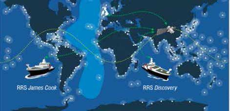
The NMF operates the two global class research vessels, the RRS James Cook and the RRS
• Bidding for resource to fund the development of automated near real-time data from Discovery. Satellite measurements, though increasing in accuracy, remain unable to collect
research vessel initiated. This includes data flow standardization across vessels and event data much below the ocean surface. Research vessels continue to be the principle platform
logging systems. from which the majority of oceanographic measurements are made, using the capabilities
listed in this Technology Roadmap. Their key capabilities include:
• Developed solution and gained approval from the MFAB Data Working group to resolve Topic
1 on the task list of the working group: Easy access science data on-board research vessels. • Hydroacoustic surveys • Clean seawater sampling
• Integrated data logging • CTD surveys
15 16• Deep water coring, towing and trawling • Seismic surveys
• Adaptable laboratory space • ROV operations
5 SEISMICS
4.2 SCIENCE COMMUNITY DRIVERS
• During seismic operations where twin acoustic sources are towed, the stability of the
acoustic source is affected by the propeller wash from the ships. Modification to the ship
infrastructure to move the twin towed beams outboard of the propeller wash could reduce
this interaction and improve the stability of the acoustic source.
• Endurance of grey water storage to allow longer periods between discharge where surveys SERCEL GI 250 AIRGUN
may need to be paused.
5.1 CURRENT CAPABILITY
• Research expeditions by necessity have a high carbon footprint. Alterations and additions
to ship fitted equipment to reduce or offset this as technology develops are highly desirable. • Bolt 1500-LL airguns • Big Shot fire control system
4.3 FUTURE CAPABILITY • Sercel GI 250 airguns • Avalon RSS-2 array source control system
Negotiation of long term service agreements with Original Equipment Manufacturer (OEMs) to • 2.4 km multichannel streamer, extended • 4 x Hamworthy 2000PSI containerised
assure service requirements and reduce costs associated reactive use. to 3 km where required through hire of compressors
remaining 600m length
4.4 ASPIRATIONS
The RRS James Cook can accommodate the full deployment of all four compressors and
Investigation into the feasibility of hybrid battery installation to reduce fuel use on station and
either acoustic source, however the RRS Discovery can only accommodate two compressors
extend the maximum endurance of the ships.
which in practice limits this to the use of the Sercel GI system only.
The current seismic source arrangements are outdated and optimized for operations on
previous classes of research ships, providing no advance in capability since the 1980s.
There are limitations with the volume of source that can be deployed and streaming and
recovery are slow. The multichannel streamer purchased remains up to date and in line with
industry use.
17 185.2 SCIENCE COMMUNITY DRIVERS • Flexibility
Bolt 1500-LL airguns can only be reconfigured by changing the entire chamber. Chambers
• Reduce costs
are large, unwieldy and expensive and NMF only holds a limited amount of each size
Long mobilisation periods are required to assemble and commission equipment taking up
therefore limiting the options for reconfiguring array size at sea. GI 250 airguns can
valuable ship time. Age, complexity and lack of reliability mean that costly sea trials are often
be reconfigured quickly by the use of an inexpensive plastic insert giving a Principal
required prior to science to provide equipment assurance and staff training. A containerised,
Investigator an almost unlimited choice of source configurations.
ready assembled system delivered to the ship with minimal set up time and low maintenance
overhead will cut mobilisation periods and require less technical support. 5.3 FUTURE CAPABILITY
• High performance source In 2020 a full refurbishment of the Bolt 1500-LL system and compressors is in progress, with
The aged fleet of bolt 1500-LL airguns and associated compressors do not provide the trials scheduled in 2020 in preparation for scientific use in 2021. This seeks to not only extend
energy or fidelity of signal to make full use of the NMEP modern multi-channel streamer to the service life, but to address some of the issues around the stability and reliability of the
deliver high resolution 3D images. GI guns deliver a much sharper waveform via a two stage acoustic source. It also includes the revision of operating procedures to improve the efficiency
firing process. and safety of equipment handling on deck. Improvements and additions to real time data
streaming will also be trialled.
• Improved reliability
The system of beam deployed airgun arrays with a pneumatic umbilical is unreliable and 5.4 ASPIRATIONS
can incur failures while firing often resulting in a change of source level while in mid seismic
In 2018 the findings of the seismics working group were submitted to the Cruise Programme
line. Airgun repair then requires a break in science to recover and fix. A J-rail deployment
Executive Board (CPEB) proposing the investment of ~£2M to upgrade the seismic source,
system and buoy mounted gun arrays coupled with the much smaller recoil of GI guns
handling and towing systems for the Sercel G series guns to provide:
would greatly reduce the mean time between failures and enable faster repairs.
• A versatile, highly configurable seismic airgun source comprising up to 24 individual airguns.
• Reduce wake interference
The twin propulsion designs of the RRS James Cook and the RRS Discovery produces • A source tow depth and geometry control system capable of supporting different
a much greater wake profile than previous research ships. Airguns are fired while being scientific applications.
towed through this aerated water seriously affecting source level and consistency.
• A versatile and adaptable seismic source deployment system, deployable from Ocean
Modifications to the after deck of both ships would allow sources to be towed much wider
Facilities Exchange Group partner research vessels as well as NERC's fleet, in full or in part
from the ship’s centreline and reduce this problem.
19 20• A full suite of potential field sensing systems, appropriate to fixed and mobile installation on
any of the global fleet of scientific research vessels.
• A high resolution, short streamer shallow sub-seabed imaging capability. 6 SAMPLING
An upgrade of this type would allow the retirement of the aging Bolt 1500-LL guns. If this
upgrade is completed the extension of the multichannel streamer up to 9,000m would allow the
measurement depth to be extended beyond the existing 3,000m limitation.
MEGACORER
6.1 CURRENT CAPABILITY
The NMEP sampling capability is primarily coring, with eight different types of corer with both
tubular and box varieties available.
• Tubular Corers
— Gravity Corer — Multi Corer
Sample tubes 63.5mm OD Up to 12 sample tubes 56mm OD
1 to 4m depth 0.6m depth
— Kasten Corer — Mega Corer
Sample 150mm square Up to 12 sample tubes 100mm OD
Up to 5m depth 0.6m depth
— Piston Corer
Sample tubes 90mm or 110mm OD
Up to 25m depth
21 22• Box Corers
— SMBA Corer — Day Grab
Sample 600mm square 10kg surface sample
7 MOORINGS
0.45m depth
7.1 ESSENTIAL OCEAN VARIABLES
— NIOZ (haja) Corer
Sample 500mm square • Dissolved organic carbon • Stable carbon isotopes
0.5m depth
• Inorganic carbon • Subsurface currents
6.2 SCIENCE COMMUNITY DRIVERS
• Nutrients • Subsurface salinity
• Enduring requirement for deep sea benthic sampling.
• Nitrous oxide • Subsurface temperature
• Accuracy of sampling. A lot of time is taken lowering sampling systems with no accurate
• Ocean colour • Surface currents
inspection of the sampling site.
• Ocean surface heat flux • Transient traces
6.3 ASPIRATIONS
• Oxygen • Zooplankton biomass and diversity
• A 40m piston corer utilising a bespoke handling and deployment system.
• Particulate Matter
• Potential development of a precision coring system deployable using HyBIS platform.
• Phytoplankton biomass and diversity
• A wire mounted camera system to view and record sampling sites.
• Sea surface salinity
• Sea surface temperature
7.2 CURRENT CAPABILITY
Bespoke full ocean depth mooring systems capable of up to 24 month time series observations,
utilising a wide range of NMEP and user supplied sensors and sampling devices, are designed
according to the specific science requirements of the study. The following sensor types are
available from the NMEP:
23 24• ADCPs 75kHZ – 1200kHz • Dissolved oxygen sensors benefits and feasibility of the development of in-situ moored power sources to enable
recharging of AUVs and prolong their deployment duration.
• Fluorimeters • Transmissometers
• Develop a suitable smoke beacon that will withstand full ocean depth and activate on return
• PAR sensors • Backscatter meters
to surface, either by pressure or conductivity, to provide a clear locator (better than a flag or
• CTDs (Conductivity, Temperature strobe in daylight).
and Depth)
• Design syntactic float collars for specific and individual items that would reduce the use of
inline glass in moorings for reducing mooring length in certain situations.
7.3 SCIENCE COMMUNITY DRIVERS
• Procure a two-way telemetry system for moorings to allow real-time data transmission and
• Capability to deploy the next generation of low drift bottom pressure landers.
modification of sampling routines during a deployment.
• Improved ability to measure the upper 50m of the water column where ocean/atmosphere
interaction is most evident.
• Improved reliability in trawl resistant mounts/landers.
• Inclusion and expansion of biogeochemical sensor availability (oxygen, pH, CO2, nitrate).
• Real-time data telemetry to allow access to environmental conditions to inform up to date
key decisions in the NERC science community and our wider stakeholders.
• The ability to recover moorings weights to better align with the NOC value of
environmental responsibility.
7.4 FUTURE CAPABILITY
A moorings module in the MFP has been developed for the design and costing of bespoke
moorings. The module will be tested in 2020 for implementation once proven.
7.5 ASPIRATIONS
• In collaboration with Marine Autonomous Robotics Systems (MARS), investigate the
25 268.2 CURRENT CAPABILITY
The NMEP has both stainless steel and titanium CTD systems and is capable of completely
8 CONDUCTIVITY, TEMPERATURE AND DEPTH (CTD) trace metal free sampling (in conjunction with portable MFCTD winches). CTD frames can
be fitted with 10 (Titanium CTD sampling frame only) and 20 litre sample bottles (24 of
each). The frame can carry sensors to measure conductivity, temperature, pressure, turbidity
(transmissometer and back scatter), oxygen, chlorophyll, Photosynthetically Active Radiation
(PAR) and water velocity. They can be deployed to full ocean depth (6,000m).
8.3 SCIENCE COMMUNITY DRIVERS
CTD
• Data derived from bottle samples collected with CTD sampling frames and from the
associated sensors are fundamental to all fields of oceanography and likely contribute
8.1 ESSENTIAL OCEAN VARIABLES
>75% of the biogeochemistry and physical oceanographic science delivered at sea.
• Dissolved organic carbon • Sea surface temperature A continued ability to collect samples (including trace metal sampling) and deliver
‘standard’ data streams from sensors (e.g. T.S. fluorescence, O2 etc.) will likely remain
• Inorganic carbon • Stable carbon isotopes
crucial for at least the next decade. The incorporation of state-of-the-art sensors, or the
• Nutrients • Subsurface currents capability to incorporate state-of-the-art sensors above and beyond the current technology
will be a key driver of future developments.
• Nitrous oxide • Subsurface salinity
• In-situ real time measurements of pCO2 and pH, high resolution nutrient profiling and fuller
• Ocean colour • Subsurface temperature
optical characterisation of both dissolved and particulate constituents are beginning to
• Ocean surface heat flux • Surface currents become feasible and/or more widely adopted and will likely facilitate new science in fields
such as ocean acidification and the physical and biological components of oceanic carbon
• Oxygen • Transient traces
cycling. All these areas have relevance to a range of NERC Discovery Science and funded
• Particulate Matter • Zooplankton biomass and diversity NC/strategic programmes.
• Phytoplankton biomass and diversity 8.4 FUTURE CAPABILITY
• Sea surface salinity • Full ocean depth carbonate system sensors with rapid response times have been
27 28purchased with the intention to trial CTD sampling frame incorporation during the Porcupine
Abyssal Plain (PAP) observatory in 2020. If successful they will be included in the NMEP.
• An Underwater Vision Profiler (UVP) is scheduled to be deployed from the RRS Discovery in 9 STATIONARY AND TOWED PROFILING BODY SAMPLING
2020. The benefits of this sensor will be evaluated in during this expedition for the potential
inclusion into the NMEP, possibly by incorporation into CTD sampling frames.
• Where possible new CTD sampling frame sensors procured are Ti instruments for trace
metal free sampling with a deeper rating (10,500m).
8.5 ASPIRATIONS
Continued use and development of CTD sampling frame swivels to prevent cable torque,
improve ship cable life and reducing cost.
VERTICAL MICROSTRUCTURE PROFILER (VMP) SEASOAR
9.1 ESSENTIAL OCEAN VARIABLES
• Dissolved organic carbon • Stable carbon isotopes
• Inorganic carbon • Subsurface currents
• Nutrients • Subsurface salinity
• Ocean surface heat flux • Subsurface temperature
• Oxygen • Surface currents
• Particulate Matter • Transient traces
• Phytoplankton biomass and diversity • Zooplankton biomass and diversity
• Sea surface salinity
29 309.2 CURRENT CAPABILITY • Moving Vessel Profiler (MVP 300-1700)
A towed vehicle for the measurement of CTD, chlorophyll concentration and light intensity
• 15 x Stand Alone Pump System (SAPS)
at speeds of up to 8 knots and up to 300m depth. As a tethered capability data can be
The SAPS were reintroduced in to the NMEP after the NMEP trials in 2019, after
transmitted in real time. This capability is not “ready to go”, and intentionally mothballed
removal to allow redesign work to combat increasing reliability issues and robustness.
to prioritise funding for equipment currently scheduled in the marine facilities programme.
This includes redesigned more efficient impeller and pump heads with more efficient
It remains however, available for use with an increased notice period.
programming timer control.
• EIVA Scanfish III Rocio
• 2 x Vertical Microstructure Profiler 6000 (VMP6000)
A towed vehicle for the measurement of high quality CTD, dissolved oxygen and bottom
An untethered, autonomous system for the measurement of turbulence microstructure and
depth, at speeds of up to 10 knots in a 200m range at up to 500m. As a tethered
CTD in a vertical profile of up to 6,000m. As a battery powered untethered capability data is
capability data can be transmitted in real time. This capability is not “ready to go”, and
recorded and downloaded and batteries recharged on recovery. This necessitates at least
intentionally mothballed to prioritise funding for equipment currently scheduled in the
two profilers to be allocated to maintain 24 hour operations.
marine facilities programme. It remains however, available for use with an increased
• 2 x Vertical Microstructure Profiler 2000 (VMP2000) notice period.
A tethered system for the measurement of turbulence microstructure and CTD in a vertical
9.3 SCIENCE COMMUNITY DRIVERS
profile of up to 2,000m. As a tethered capability data can be transmitted in real time.
• There is a continued requirement for profiling of large scale areas in short time frames that
• 2 x ISW Microstructure Profiler (MSS90L)
make CTD sampling frame profiling unfeasible. The speed and scale of profiling presented
A tethered system for the measurement of turbulence microstructure and CTD in a vertical
with towed vehicles is tempered with a lower sensor resolution than possible with CTD
profile of up to 500m. Smaller, lighter and easier to deploy, this presents a lower cost option
sampling frames. Increased resolution of payload sensors and/or an increase in the number
to the VMP 500 when the sample area is less than 500m.
of parameters that can be measured would make these survey types more cost effective.
• SeaSoar
• Availability of Marine Snow Catchers (MSC) to the scientific community, with trace metal
A towed vehicle for the measurement of CTD, dissolved oxygen, turbidity, irradiance,
free capability.
bioluminescence, fluoresence and plankton at vessel speeds of up to 12 knots and up to
420m depth. As a tethered capability data can be transmitted in real time. This capability is 9.4 FUTURE CAPABILITY
not “ready to go”, and intentionally mothballed to prioritise funding for equipment currently
• A new triaxis motion reference unit is in development for integration in to SeaSoar to allow
scheduled in the marine facilities programme. It remains however, available for use with an
higher resolution data acquisition from the vehicle.
increased notice period.
31 32You can also read