ADM-Aeolus CAL/VAL Rehearsal Workshop Book of Abstracts - Météo-France, Toulouse, France Tuesday 28 March - Thursday 30 March 2017
←
→
Page content transcription
If your browser does not render page correctly, please read the page content below
ADM-Aeolus CAL/VAL Rehearsal
        Workshop
        Book of Abstracts
        Météo-France, Toulouse, France

  Tuesday 28 March – Thursday 30 March 2017

                                              1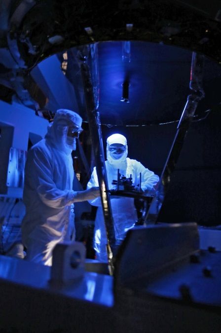
Contents

Abstracts for presentations and/or posters: .......................................................................................... 3
Scientific motivation for ADM/Aeolus mission ....................................................................................... 4
THE ALADIN INSTRUMENT AND ITS ON-GROUND PERFORMANCE TESTING ......................................... 5
Aeolus Level 1 data processing and instrument calibration ................................................................... 6
Aeolus L2B/C wind product processing, quality control and NWP monitoring at ECMWF .................... 7
Aeolus L2A aerosol optical properties product and assimilation in air quality models ......................... 8
Aeolus On-Ground Data Processing Facility and Data Distribution ........................................................ 9
Organisation of ESA’s In-orbit Data Quality Activities for ADM-Aeolus ............................................... 10
Aeolus VirES Tool .................................................................................................................................. 11
Aeolus Campaigns Planning .................................................................................................................. 13
Contribution of French research teams to ADM Cal/Val: ground-based and airborne comparative
experiments for optical and wind products.......................................................................................... 14
Wind, aerosols and clouds measurements using the French airborne UV HSRL LNG .......................... 15
Current Status of the US Calibration/Validation Effort for Aeolus ....................................................... 16
VAAC - Validation of Aeolus by Atmospheric model Comparison ........................................................ 18
MET Norway plans for contribution to calibration-validation and use of Aeolus winds and aerosols 19
Experimental Validation of ADM-Aeolus with the ALADIN Airborne Demonstrator (EVA4D) ............ 20
Validation and impact assessment of ADM-AEOLUS observations in the DWD modelling system ..... 21
Validation of ADM-Aeolus L2 aerosol and cloud product employing advanced ground-based lidar
measurements (VADAM) ...................................................................................................................... 22
Analysis of High Latitude PBL Winds in preparation for ADM-Aeolus Mission .................................... 23
Validation of Aeolus Level 2 products by comparison with global NWP and airborne flight data ....... 24
Validation experiment for the Atmospheric Dynamic Mission-Aeolus ................................................ 25
The Iqaluit Calibration/Validation Supersite......................................................................................... 26
Examination of ADM/Aeolus statistical characteristics for hemispheric sales for the Arctic region ... 27
IASBS Remote Sensing Station and its Participation in ADM-Aeolus Cal/Val ....................................... 28
ADM-Aeolus CAL/VAL Implementation Plan ........................................................................................ 29
Stratéole 2: Observing wind characteristics in the equatorial lower stratosphere along long-duration
balloon flights ....................................................................................................................................... 30
Abstracts for posters only: .................................................................................................................... 31
Retrieval of L2B HLOS winds using T3999 ECMWF and CALIPSO ......................................................... 32
Potential of the space-borne Doppler wind lidar measurements in a limited-area model for Europe 33
L2A product : aerosols optical properties ............................................................................................. 34

                                                                                                                                                        2
Abstracts for presentations and/or
posters:
The ordering of the abstracts is according to their place in the Workshop Programme. Please
note that some abstracts are missing.
3Scientific motivation for ADM/Aeolus mission
Erland Källén
ECMWF, Shinfield Park, Reading, RG2 9AX, United Kingdom
erland.kallen@ecmwf.int
Abstract
The ADM/Aeolus mission will provide a global coverage of atmospheric wind profiles, urgently
needed to enhance the quality of weather forecasts and improve climate analyses. Of particular
interest is the potential to improve analysis of tropical weather systems, both in terms of accuracy of
the initial state for numerical weather prediction and in terms of tropical circulation description in
climate analyses. Improvements in the tropics will lead to improved weather forecasts in mid-
latitudes as initial state errors in the tropics propagate to Europe, Asia and North America within a
week and thus affect weather forecast quality in the medium range (3-10 days). There are examples
of very poor six day forecasts over Europe that can be traced back to initial state errors in the
tropics. The wind profiles will also help to better define smaller scale circulation systems in mid-
latitudes, examples are atmospheric fronts and polar lows. In the upper troposphere and lower
stratosphere (UTLS) the wind profiles will enhance circulation analyses that helps to improve
weather prediction and better understand climate change dynamics in the UTLS region.
WMO co-ordinated assessments of observational needs for numerical weather prediction have
repeatedly highlighted the primary importance of improved wind observations. The information
content in the ADM/Aeolus wind profiles will roughly correspond to that available today in
radiosonde based observations. Observation impact experiments have shown that removing
radiosonde data in experimental setups significantly reduces forecast quality.
The Aeolus mission will also provide information about clouds and aerosols from lidar backscatter
intensities. This data will be useful for assimilating aerosol information in NWP systems and
contribute to improving atmospheric composition forecasts.
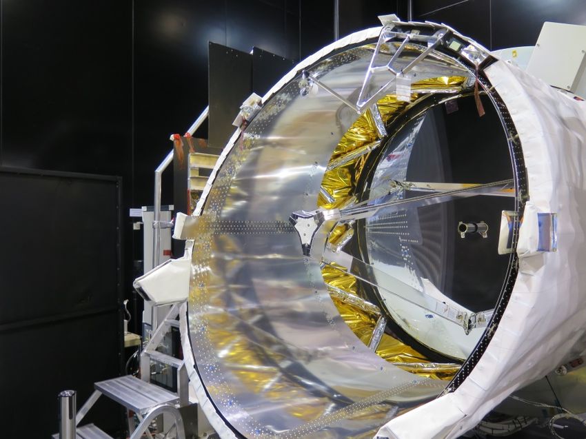
4THE ALADIN INSTRUMENT AND ITS ON-GROUND PERFORMANCE TESTING
Frederic Fabre, J.-C Barthes, Olivier Lecrenier, P. Couillaud (a)
Richard Wimmer, Phil McGoldrick (b)
Anders Elfving, Denny Wernham (c)
a – Airbus D&S France - 31, Av. des Cosmonautes – 31 402 Toulouse Cedex 4– France
b – Airbus D&S UK – Gunnelswood Road, Stevenage SG1 2AS, United Kingdom
c - ESA-ESTEC – Keplerlaan 1, NL 2200 AG - Noordwijk – The Netherlands
Abstract: Aeolus is an Earth Explorer mission of ESA’s Living Planet Programme dedicated to
study the atmospheric dynamics of the Earth by applying its on-board Doppler wind LIDAR
instrument, Aladin. Aeolus will be world-wide first in providing global observations of wind profiles
from space. Its operation in the UV band (355 nm) led to specific challenges which, themselves, led to
specific solutions.
The proposed presentation will, in a first part, provide a brief description of the ALADIN instrument’s
architecture in order to better understand the way it is intended to be verified and characterised on
ground. For memory, the ALADIN instrument is made of four main sub-assemblies: the optical bench
assembly (OBA, including the sealed TRO), the opto-mechanical assembly essentially made of the
telescope, the structural parts and the thermal control H/W (also including components of the in-situ
cleaning system), the lasers and finally the electrical units.
The second part will present the results obtained during the validation campaign at ambient pressure
led in April 2016. The measurement noise and the first contributors to the systematic errors will be
presented.
Finally, a perspective on the predicted in-orbit performance will be presented together with an
overview of the tests campaign to be led by the satellite Prime (Airbus D&S_UK) and which will
include mechanical tests (vibrations and shocks) and thermal vacuum tests.
5Aeolus Level 1 data processing and instrument calibration
Oliver Reitebuch1, Uwe Marksteiner1, Marc Rompel1, Markus Meringer2, Karsten Schmidt2,
Dorit Huber3, Ines Nikolaus4, Alain Dabas5, Jonathan Marshall6, Frank de Bruin7,
Thomas Kanitz7, Anne-Grete Straume7
1
DLR, Institute of Atmospheric Physics, Oberpfaffenhofen, Germany
2
DLR, Remote Sensing Technology Institute, Neustrelitz, Germany
3
DoRIT, Fürstenfeldbruck, Germany
4
University of Applied Sciences Munich, Munich, Germany
5
CNRS/Météo-France, CNRM, Toulouse, France
6
Airbus Defence and Space, Stevenage, UK
7
ESA-ESTEC, Noordwijk, The Netherlands
oliver.reitebuch@dlr.de
Abstract
The first wind lidar in space ALADIN will be deployed on ESA´s Aeolus mission and will be operational
in 2018. It is not only the first time that the space hardware of a high power UV laser and a Doppler
wind lidar was developed, but also the on-ground processors for wind retrieval, calibration and bias
correction schemes are novel, i.e. without heritage from earlier space missions. In order to assess
the performance of ALADIN and to optimize the wind retrieval and calibration algorithms an end-to-
end simulator was developed. This allows realistic simulations of data downlinked by Aeolus.
Together with operational processors this setup is used to assess random and systematic error
sources and perform sensitivity studies about the influence of atmospheric and instrument
parameters. The wind retrieval algorithms up to Level 1 will be introduced as well as the related bias
correction schemes for harmonic and range-dependent bias sources. Both Level 1 and 2 wind
retrieval algorithms rely on the instrument calibration modes using internal and atmospheric signals
in nadir-pointing mode of the satellite. These instrument calibration modes and the relevant
correction schemes for atmospheric temperature and pressure influence on wind retrievals from the
Rayleigh channel will be discussed.
6Aeolus L2B/C wind product processing, quality control and NWP
monitoring at ECMWF
Michael Rennie1, Jos de Kloe2, Gert-Jan Marseille2
1
European Centre for Medium-Range Weather Forecasts (ECMWF), Reading, UK
2
KNMI - Royal Netherlands Meteorological Institute, De Bilt, Netherlands
m.rennie@ecmwf.int
Abstract
An introduction to the Aeolus Level-2B line-of-sight wind observation processing will be given. The
software has been developed over the past decade in a collaboration between ECMWF, KNMI and in
the past Météo-France. The processor algorithms will be briefly described.
The data assimilation of Aeolus L2B winds is expected to provide a positive impact to Numerical
Weather Prediction (NWP) forecast skill, therefore ECMWF aims to operationally assimilate the data
as soon as possible. A by-product of such assimilation will be the L2C product which incorporates
the ECMWF analysis winds at Aeolus L2B geolocations.
L2B winds generated from accurate simulations of Aeolus using realistic atmospheric inputs in
combination with the real Ground Segment processing chain will be discussed. In particular an
example will be shown of how Aeolus samples upper troposphere/lower stratosphere equatorial
waves particularly well, in a region where NWP analyses are of relatively poor quality. An
assessment of the simulated L2B wind error statistics shall be presented, providing an indication of
what to expect. The end-to-end testing is also a useful validation of the processing chain with the
launch approaching.
Finally we discuss how users can apply product confidence information to quality control the L2B
winds and how ECMWF plans to do a comprehensive monitoring of the L1B, L2B and calibration
products during the mission.
7Aeolus L2A aerosol optical properties product and assimilation in air
quality models
Angela Benedetti (ECMWF) and Thomas Flament (Météo-France)
While Aeolus is primarily a wind mission, valuable information on atmospheric constituents such as
aerosols can be extracted from the lidar returns. To this end, ESA has funded the development of an
aerosol optical property product (L2A). The L2a processor takes advantage of the High Spectral
Resolution of Aladin to directly retrieve the extinction and backscatter coefficient of the
atmosphere. In the first part of this talk, the Aeolus aerosol product will be presented through an
overview of the principles and examples of processed scenes. In the second part, preliminary results
from the ESA-funded Aeolus/EarthCARE Aerosol Assimilation Study (A3S) will be presented. The
study aims at investigating the potential of L2A product for assimilation into the aerosol forecast
model run at ECMWF by the Copernicus Atmosphere Monitoring Service (CAMS).
8Aeolus
On-‐Ground
Data
Processing
Facility
and
Data
Distribution
F.Buscaglione1,
A.Martini1,
C.Lopes1
1
European
Space
Agency,
ESRIN,
Via
Galileo
Galilei,
00044
Frascati,
Italy
fabio.buscaglione@esa.int
Abstract
Aeolus
data
processing
is
performed
in
the
Payload
Data
Ground
Segment
(PDGS)
and
in
the
L2Met/Processing
Facility
(L2Met/PF).
PDGS
is
responsible
to
generate
products
up
to
Level-‐1B
and
Level-‐2A
while
Level-‐2B
and
Level-‐2C
products
are
generated
by
ECMWF
in
the
L2Met/PF.
Within
the
PDGS,
the
Aeolus
Processing
Facility
(APF)
processes
the
data
raw
data
downloaded
from
the
satellite
and
the
Aeolus
Calibration
and
Monitoring
Facility
(ACMF)
generates
the
Auxiliary
Data
Files
(ADFs)
from
the
calibration
data
acquired
on-‐board.
L2Met/PF
is
also
in
charge
to
generate
meteorological
data
file
(latest
atmospheric
pressure,
temperature
fields
forecast)
needed
in
the
PDGS
to
generate
L2A
products
and
ADFs.
The
raw
telemetry
(TLMX)
downloaded
from
the
satellite
is
processed
by
the
L1B
processor
in
‘wind’
mode;
this
is
a
single
processor
that
generates
at
the
same
time
the
L0,
L1A
and
L1B
products.
In
addition,
typically
once
per
week,
the
same
processor
(L1B)
is
used
in
the
ACMF
in
‘cal
mode’
to
generate
a
first
set
of
ADFs
on
the
basis
of
the
data
generated
on-‐board
during
the
Maintenance
and
Calibration
Sequence.
A
second
set
of
ADFs
is
then
generated/updated
by
the
Calibration
Processor
that
uses
also
the
of
meteorological
data
file
(AUX_MET)
generated
by
L2Met/PF
every
12
hours.
As
soon
the
L1B
products
are
available,
the
L2Met/PF
generates
the
L2B
and
L2C
products
that
are
sent
back
to
APF
for
further
distribution
to
the
users’
community.
At
the
same
time,
L2A
products
are
generated
from
the
L1B
products
in
the
PDGS
once
the
necessary
ADFs
are
available
from
ACMF
and
L2Met/PF.
All
the
data
(products
and
ADFs)
are
available
to
the
users’
community
on
the
Aeolus
Data
Dissemination
Facility
(ADDF).
Data
download
can
be
performed
via
manual
interaction
with
the
provided
web
interface
for
specific
data
selection.
In
addition,
specific
features
allow
also
systematic
data
download
via
scripts,
both
via
http
and
ftp.
Data
dissemination
is
organized
on
basis
of
Product
Level,
Baseline,
and
Sensing
Time
(Year-‐month,
day).
A
browse
image
is
also
present
for
product
levels
where
this
is
considered
useful/feasible).
Organisation
of
ESA’s
In-‐orbit
Data
Quality
Activities
for
ADM-‐Aeolus
Jonas
von
Bismarck1,
Philippe
Goryl1
,
Wolfgang
Lengert1
and
Anne
Grete
Staume-‐Lindner2
1
ESA-‐ESRIN
2
ESA-‐ESTEC
Jonas.Von.Bismarck@ESA.int
Abstract
ESA’s
Sensor
Performance,
Products
and
Algorithms
(SPPA/EOP-‐GMQ)
section
has
the
function
to
assure
that
ESA
mission
product
users
are
provided
with
best
possible
product
quality.
During
the
exploitation
phase
of
a
mission
this
includes
the
management
of
the:
·∙
Processor
(algorithms)
maintenance
and
evolution,
·∙
On-‐
and
Off-‐line
performance
assessment
and
on-‐demand
quality
control,
·∙
System
calibration
and
Product
validation,
·∙
and
assuring
the
end-‐to-‐end
sensor
dataset
performance.
The
big
range
of
associated
tasks
requires
for
an
effective
coordination
of
the
efforts
for
every
mission.
After
SWARM,
ADM-‐Aeolus
is
the
second
Earth-‐Explorer
mission
for
which
the
implementation
of
a
“Data
Innovation
and
Science
Cluster”(ADM-‐DISC)
is
planned
to
facilitate
the
swift
achievement
of
the
required
data
quality
after
commissioning.
DISCs
are
a
user
data
quality
concept
tailored
to
the
innovative
characteristics
of
Earth
Explorers,
grouping
various
instrument
data
expert
teams
in
a
cluster
performing
essential
activities
related
to
product
algorithm
evolution,
calibration,
validation
and
performance
monitoring.
Strong
interfaces
to
validation
teams
as
well
as
the
PDGS
and
the
adoption
of
the
Quality
Working
Group
concept
are
important
pillars
of
the
DISC.
Aeolus VirES Tool

                         Gabriella Costa1, Oliver Reitebuch2, Gerhard Triebnig3
               1
                European Space Agency, ESRIN, Via Galileo Galilei, 00044 Frascati, Italy
        2
        German Aerospace Center DLR, Institute of Atmospheric Physics, Oberpfaffenhofen,
                                 82234 Wessling, Germany
                     3
                      EOX IT Services GmbH, Thurngasse 9, 1090 Vienna, Austria

                                        cabriella.costa@esa.int

                                                Abstract

VirES (Virtual Workspaces for Earth-observation Scientists) stands for an innovative service concept
providing advanced data access to Earth Observation (EO) data – especially to those available from
Earth Explorer Missions – expanding the capabilities of discovery, download, view, analysis, subset,
and snapshot of EO data, thus providing better support to modern, inter-disciplinary and
crosscutting research.

The service is currently available at http://vires.services for Swarm, the geomagnetic satellite
constellation of ESA. The Agency is now extending the capability to support also ADM-Aeolus data,
ready for launch of this mission. The following users are targeted:

   •    Algorithm teams who fine-tune algorithms and processors
   •    Cal/Val users who filter, customize and download subsets of Aeolus products for specific
        regions or times
   •    Scientific users specially interested in specific regions, e.g. Tropics or polar regions, specific
        altitudes or atmospheric features (jet stream, dust transport)
   •    Numerical Weather Prediction NWP research departments; users working on atmospheric
        composition and air quality models, judging the Aeolus data for specific model applications

Envisaged functionalities being discussed with users are:

   •    Visualization of L1B, L2A, L2B, L2C products, AUX_MET and other auxiliary files
   •    1D data and 2D curtains of Mie and Rayleigh wind and aerosol backscatter observations on
        global views including underlying DEM and surface albedo maps
   •    Analytics panel with 1D scatterplots and 2D colour coded plots
   •    Observations filter with different quality indicators (instrument and satellite data, specific
        features (strong winds, strong wind gradients, altitude regions), using other Aeolus
        observations or auxiliary files)
   •    Possibility to derive differences or residuals between different Aeolus observations
   •    Download selected Aeolus observations with common formats from different products for a
        specific geographical region, with a selectable setting for grids, filtered with QC criteria and
        concatenated for longer time periods than available in the product files

                                                                                                       11
• Provide possibility to capture all plots as graphical output useable in scientific presentations
and publications
12Aeolus Campaigns Planning
Dirk Schüttemeyer1, Anne Grete Straume1, Thomas Kanitz1, Jonas Von Bismarck2
1
European Space Agency , ESTEC, Keplerlaan 1, 2200 AG Noordwijk, The Netherlands
2
European Space Agency , ESRIN, Via Galileo Galilei, 00044 Frascati RM, Italy
dirk.schuettemeyer@esa.int
Abstract
The European Space Agency (ESA) carries out instrument developments and campaign activities, to
provide support for future Earth Observation space missions and their users.
Related activities in support of future mission development have technological, geophysical and
simulation objectives. In this context several activities are ongoing or planned related to the ADM-
Aeolus mission.
The ongoing different activities combine airborne, satellite and coincident ground activities to
confirm and document the technical performance of mainly airborne lidars and their suitability for
the foreseen calibration/validation of the ADM-Aeolus missions.
This presentation will focus on recent and planned activities of calibration/validation preparation.
The presentation is intended to inform the different validation teams about potential future science
activities and to encourage the community to make recommendations on issues in view of the
calibration/validation objectives of ESA’s ADM-Aeolus Earth Explorer missions.
13Contribution of French research teams to ADM Cal/Val: ground-based
and airborne comparative experiments for optical and wind products
Alain Dabas1, Jean-Pierre Cammas2, Patrick Chazette3, Alain Hauchecorne4, Albert Hertzog5, Fabien
Gibert5, Jacques Pelon4.
1
Météo-France, Centre National de Recherches Météorologiques
2
Observatoire des Sciences de l’Univers de La Réunion
3
CEA, Laboratoire des Sciences du Climat et de l’Environnement
4
CNRS, Laboratoire Atmosphères, Milieux, Observations Spatiales
5
CNRS, Laboratoire de Météorologie Dynamique.
alain.dabas@meteo.fr
Abstract
The French research teams willing to participate to the calibration/validation of AEOLUS have
coordinated their efforts in the frame of a project supported by the French space agency CNES.
Several actions are foreseen. Two sites equipped with powerful, ground-based lidars will be
operated during several months every time AEOLUS is passing by. One of these sites is the
Observatoire de Haute Provence in the French Alps, and the other one is the Observatoire des
Sciences de l’Univers on the Reunion island in the Indian ocean. Both operate on a regular basis a
Mie-Rayleigh lidar implementing a dual Fabry-Perot receiver like AEOLUS. They can measure vertical
wind profiles from about 5km up to more than 35km, averaged over 1h or 2h. Another action will
consist in deploying a transportable instrumental setup in Europe, as close as possible to a crossing
point of ascending and descending orbit, thus overpassed two times a week by the AEOLUS. The
instrumental setup will comprise a UHF wind profiler and advanced aerosol lidars. They will be
operated during about a month, allowing up to 8 colocated measurements of wind and aerosol
products directly comparable to AEOLUS. The measurement will be used to check the sensitivity of
AEOLUS is actually close to our expectations. The operations will start as soon as possible, once the
precise phasing of AEOLUS orbit is known and a deployment site is found. At last a high-spectral
resolution, airborne lidar will be flown aboard the French research Falcon 20 aircraft, together with a
95GHz radar called RASTA. This direct-detection lidar works in the UV as AEOLUS. It will fly along the
satellite measurement track and provide aerosol and possibly wind products at a fine resolution,
thus documenting the variability of the aerosol and wind fields probed by the spaceborne lidar. A
last action will consist in using the measurements done by the stratospheric balloons of the
STRATEOLE-2 research program. They will fly in the equatorial band in late 2018 and 2020. They will
provide wind measurements to be compared to AEOUS wind products in a region where wind
observations are sparse.
14Wind, aerosols and clouds measurements using the French airborne
UV HSRL LNG
J. Pelon1, D. Bruneau1, A. Irbah2, Q. Cazenave2, J. Delanoë2, F. Blouzon3, M. VanHaecke2, P. Genau1
1
LATMOS/IPSL, UPMC, Sorbonne Universités, UVSQ, CNRS, Paris France
2
LATMOS/IPSL, UVSQ, UPMC, CNRS, Guyancourt France
3
INSU/DT, CNRS, Meudon, France
The High Spectral resolution and multiwavelength airborne lidar LNG has been upgraded to include a
slant viewing capability at 37° and measure line of sight wind projection in semi-transparent clouds
and aerosols, allowing for direct comparisons with ADM-Aeolus retrievals. During the North Atlantic
Waveguide and Downstream Impact Experiment (NAWDEX) field experiment linked to the EarthCare
PrepAraTion cAmpaigN (EPATAN) held in Iceland in September and October 2016 (with the support
of ESA and CNES), flights with the French SAFIRE Falcon were performed to characterize cloud
radiative properties and atmospheric dynamics. Dropsondes were launched in most of the flights to
complement lidar (LNG) and radar (RASTA) observations. In parts of the flights the new slant viewing
configuration of the UV-high spectral resolution lidar LNG was used to characterize horizontal wind
structure in semi-transparent ice clouds in the upper troposphere. In the standard nadir viewing
mode high spectral resolution measurements allowed combination with the 95 GHz cloud radar
RASTA operating in a Doppler mode to retrieve both reflectivity and wind field using 3 antennas. In
this configuration Velocity-Azimuth Displays (VADs) were also performed with the F20 flying in a
circular pattern to retrieve wind strength and direction from LNG observations. The characterization
of cloud properties from LNG and RASTA (and aerosols from LNG) as well as comparisons of LNG
wind LOS and VAD profiles with dropsondes and radar measurements in ice clouds are presented
and discussed.
15Current Status of the US Calibration/Validation Effort for Aeolus
M. Hardesty1, S. Boukabara2, A. Brewer3, J. Dunion4, D. Emmitt5, R. Ferrare6, I. Genkova7, B. Gentry8,
G. Gimmestad9, J. Hair6, R. Hoffman10, C. Hostetler6, M. Kavaya6, M. McGill8, Z. Pu11, S. Tucker12, C.
Velden7, J. Yoe2
1
CIRES, Boulder, CO USA
2
Joint Center for Satellite Data Assimilation, College Park, MD, USA
3
NOAA Earth System Research Laboratory, Boulder, CO USA
4
NOAA Atlantic Oceanographic and Meteorological Laboratory, Miami, FL USA
5
Simpson Weather Associates, Charlottesville, VA, USA
6
NASA Langley Research Center, Hampton, VA, USA
7
NOAA NCEP/NMC, Madison, WI USA
8
NASA Goddard Space Flight Center, Greenbelt, MD, USA
9
Georgia Tech Research Institute, Atlanta, GA, USA
10
Cooperative Institute for Marine and Atmospheric Studies, Miami, FL, USA
11
University of Utah, Salt Lake City, UT, USA
12
Ball Aerospace, Boulder, CO USA
13
Space Science and Engineering Center, Madison, WI, USA
mike.hardesty@noaa.gov
Abstract
We present the current status of the multi-investigator proposal from United States investigators for
Aeolus calibration and validation. The US team includes a variety of investigators proposing to
provide comparison measurements as well is model data assimilation studies for Aeolus cal-val.
Because the studies will piggy-back on science investigations, actual availability and location of both
aircraft and ground=based investigations will be dependent on the launch date for Aeolus and the
designated window for calibration. Potentially available airborne instruments include the NASA
Langley Research Center DAWN coherent Doppler lidar, which measures winds at 2 μm wavelength,
the Ball Aerospace Optical Autocovariance direct detection Wind Lidar operating at both 355 and
532 nm, and a NASA Langley UV/visible High Spectral Resolution Lidar. Also planned are dropsonde
studies from the NOAA P-3 aircraft in conjunction with hurricane research campaigns. The airborne
cal-val studies will include underflights of the Aeolus track as well as characterization of the wind
and aerosol environment before and after the overpasses. To supple the airborne comparisons,
16ground-based studies will focus on investigating longer term Aeolus performance by gathering data
sets during every available nearby overpass. We also plan to compare Aeolus estimates with
atmospheric motion vectors and to investigate the ability of forecast models to assimilate
observations during both the cal-val and operational stages.
17VAAC - Validation of Aeolus by Atmospheric model Comparison
Ad Stoffelen, Gert-Jan Marseille and Jos de Kloe
KNMI, de Bilt, the Netherlands
Ad.Stoffelen@knmi.nl
Abstract
ADM-AEolus data will be rather sparse compared to some other satellite data types. Therefore,
comparison to ground measurements will be rather challenging and much mission time will be
needed before statistically relevant validation results can be obtained. KNMI proposes to contribute
with a proven method of validation that provides a collocation with every measured profile and
apply it to the ADM-Aeolus system. Using Aeolus measurement system parameters and atmospheric
NWP model analyses and forecasts, statistically reliable results may be obtained of differences
between the atmospheric model and the Aeolus data in a relatively short time period. This depends
obviously on the accuracy of the NWP model used for comparison. This accuracy is generally well
known since NWP models are routinely confronted with many different observing systems, both
ground-based and satellite. We plan to use the ECMWF model for global comparisons. Moreover,
locally, we plan to use the abundance of Mode-S aircraft data to validate the ECMWF model and
Aeolus data.
The analyses and syntheses will take into account the errors in the model and the geophysical
sampling space used. Statistical comparisons will be made of different Aeolus aspects, namely,
optical molecular signal, atmospheric and ground calibration, and wind profiles. Aeolus parameters
used will be, e.g., time since last calibration, orbit phase, latitude, altitude, range, etc. Reports on
systematic differences and trends between NWP model simulations and Aeolus measurement data
will be provided as well as suggestions on how to prevent these. KNMI experience in the processing
chain and sampling studies will be useful to provide effective feedback. Besides contributions from
experienced staff, KNMI applies for a national grant for a PhD student to contribute to the Aeolus
Cal/Val and mission exploitation.MET Norway plans for contribution to calibration-validation and use
of Aeolus winds and aerosols
Harald Schyberg1, Roohollah Azad1, Jan Griesfeller1, Roger Randriamampianina1, Michael Schulz1 and
Svetlana Tsyro1
1
Norwegian Meteorological Institute (MET Norway), Blindern, Oslo, Norway
h.schyberg@met.no
Abstract
We present the planned activity at MET Norway to contribute to calibration and validation of the
Aeolus wind and aerosol products. The Aeolus winds will be investigated by using outputs of high-
resolution limited-area numerical weather prediction (NWP) models. Through the data assimilation
cycling the model implicitly integrates information from other available observation data. Also, the
NWP model error statistics are usually well characterized. The focus is on utilization of model and
observation data on high latitudes, in particular in the North-East Atlantic and part of the Arctic.
Since Aeolus is a polar orbiter, the orbit pattern gives increasing Aeolus observation density with
increasing latitude, up to the maximum latitude near the North Pole.
We plan to produce collocations of Aeolus with NWP data from versions of the HARMONIE-AROME
convection permitting model with 2,5 km horizontal resolution, for two different domains, one
covering Scandinavia and adjacent ocean areas, and one covering an Arctic domain. We will also
compare Aeolus winds with radiosondes and atmospheric motion vectors (AMVs) within these
model domains. In parallel with the calibration-validation activities and model vs observation
intercomparison, assimilation of the observations will be implemented in the same model
framework.
For aerosol products from Aeolus, we will validate Aeolus L2A products against independent data
(ACTRIS remote sensing measurements and EMEP/MSC-W chemical transport model) using tools
from AeroCom, an international science initiative on aerosols and climate. The quality of Aeolus L2A
data will be investigated as well as its validity for assessment of the chemical state of atmosphere,
for evaluation of air quality and climate models and data assimilation in Chemical Weather
Prediction models. In addition to NRT cross-check of co-located data, focus will be on consistency of
ALADIN/Aeolus extinction profiles and AOD with data from other satellites (ATSR, MODIS, CALIOP),
which is necessary for constructing long-term time-series.
19Experimental Validation of ADM-Aeolus with the
ALADIN Airborne Demonstrator (EVA4D)
Oliver Reitebuch1, Volker Freudenthaler2, Volker Lehmann3, Ines Nikolaus4, Roland Potthast3,
Karsten Schmidt5, Ulla Wandinger6, Martin Weissmann2
1
German Aerospace Center DLR, Institute of Atmospheric Physics, Oberpfaffenhofen, Germany
2
Ludwig-Maximilians University LMU, Meteorological Institute, Munich, Germany
3
German Weather Service DWD, Offenbach and Lindenberg, Germany
4
University of Applied Sciences Munich, Munich, Germany
5
DLR, Remote Sensing Technology Institute, Neustrelitz, Germany
6
Leibniz Institute for Tropospheric Research TROPOS, Leipzig, Germany
oliver.reitebuch@dlr.de
Abstract
The objective of the proposal is to validate the ADM-Aeolus L1B and L2B wind product and the
related instrument calibration modes and algorithms and assess the benefit of the observation for
numerical weather prediction (NWP). The validation will be performed by means of co-located wind
observations gathered during a ground and two airborne campaigns, a long-term comparison, and a
thorough characterisation of the observed atmospheric state (aerosol content, clouds, temperature,
pressure). The representativity of the co-located observations w.r.t. the satellite observations will be
assessed by use of high-resolution model simulations. The ground campaign is planned at the sites of
the Richard-Aßmann Observatory of DWD Lindenberg (and for long-term comparison also at other
DWD wind profiler sites), the Leibniz Institute for Tropospheric Research Leipzig and at DLR
Oberpfaffenhofen during a period of 10-12 weeks. Two airborne campaigns are planned for a
duration of 2-3 weeks each with DLR Oberpfaffenhofen as operation base of for the first campaign
and an operation base in Northern latitudes for the second campaign. The ALADIN airborne
demonstrator A2D will be the key reference instrument for the satellite ALADIN instrument during
ground and airborne campaigns. The ground campaign instrumentation includes up to four
tropospheric radar wind profilers, radiosondes and coherent wind lidars as reference for wind
observations. The characterisation of the atmospheric state will be performed by the Raman lidars,
radiosondes, ceilometers and sun photometers at Lindenberg and Leipzig and by the aerosol lidar
POLIS at DLR Oberpfaffenhofen. The payload for the airborne campaigns will be the ALADIN airborne
demonstrator A2D combined with a 2-µm wind lidar. The benefit of the observations for NWP will be
assessed through data denial experiments with the experimental global ensemble data assimilation
system of DWD and a recently developed tool for ensemble-based estimates of observation impact.
20Validation and impact assessment of ADM-AEOLUS observations in
the DWD modelling system
Alexander Cress1, Martin Weissmann2, Roland Potthast1
1
Deutscher Wetterdienst, Offenbach, Germany
2
Hans-Ertel-Centre for Weather Research, LMU Munich, Germany
alexander.cress@dwd.de
Abstract
Numerical weather prediction (NWP) systems require exact three-dimensional global observations
of wind, temperature, humidity, etc. Thereby, knowledge of the global wind field is essential in order
to represent synoptic and small-scale features of the atmosphere in a meteorological analysis. In the
framework of the german proposal to validate the ADM-Aeolus L1B and L2B wind product the goal
of the modelling and data assimilation part is to estimate representativity errors for the validation of
Aeolus observations with ground based observations Using the global and local NWP systems at
DWD representativity errors will be derived using simulations with varying grid space resolutions.
The DWD NWP system consists of a global model ICON with a resolution of 13 km and 90 vertical
levels and a two way nesting approach over Europe with a resolution of 6.5 km and 60 vertical levels.
Additionally, the convection resolving limited area model COSMO-DE over Germany with a grid
spacing of 2.8 km and 50 vertical levels is used operationally. For both, the global and regional
system, a local ensemble transform kalman filter (LETKF) data assimilation system is used with 40
members and a resolution of 40 km on the global scale and 2.8 km on the local scale. In a second
step, the ADM-Aeolus observations will be assimilated in the global data assimilation system of DWD
and their impact will be assessed using both data denial experiments and ensemble-based FSOI
methods.
21VAAC - Validation of Aeolus by Atmospheric model Comparison
Ad Stoffelen, Gert-Jan Marseille and Jos de Kloe
KNMI, de Bilt, the Netherlands
Ad.Stoffelen@knmi.nl
Abstract
ADM-AEolus data will be rather sparse compared to some other satellite data types. Therefore,
comparison to ground measurements will be rather challenging and much mission time will be
needed before statistically relevant validation results can be obtained. KNMI proposes to contribute
with a proven method of validation that provides a collocation with every measured profile and
apply it to the ADM-Aeolus system. Using Aeolus measurement system parameters and atmospheric
NWP model analyses and forecasts, statistically reliable results may be obtained of differences
between the atmospheric model and the Aeolus data in a relatively short time period. This depends
obviously on the accuracy of the NWP model used for comparison. This accuracy is generally well
known since NWP models are routinely confronted with many different observing systems, both
ground-based and satellite. We plan to use the ECMWF model for global comparisons. Moreover,
locally, we plan to use the abundance of Mode-S aircraft data to validate the ECMWF model and
Aeolus data.
The analyses and syntheses will take into account the errors in the model and the geophysical
sampling space used. Statistical comparisons will be made of different Aeolus aspects, namely,
optical molecular signal, atmospheric and ground calibration, and wind profiles. Aeolus parameters
used will be, e.g., time since last calibration, orbit phase, latitude, altitude, range, etc. Reports on
systematic differences and trends between NWP model simulations and Aeolus measurement data
will be provided as well as suggestions on how to prevent these. KNMI experience in the processing
chain and sampling studies will be useful to provide effective feedback. Besides contributions from
experienced staff, KNMI applies for a national grant for a PhD student to contribute to the Aeolus
Cal/Val and mission exploitation.Analysis of High Latitude PBL Winds in preparation for ADM-Aeolus
Mission
John A. Mayfield1, Gilberto J. Fochesatto1, Pierre H. Flamant2
1
Department of Atmospheric Sciences. Geophysical Institute and College of Natural Science and
Mathematics. University of Alaska Fairbanks. 903 Koyukuk Dr. Fairbanks, Alaska. 99775 USA.
2
LATMOS Université Pierre et Marie Curie 4 place Jussieu 75252 Paris Cedex 05 France
gjfochesatto@alaska.edu
Abstract
Low level winds in polar regions frame several physical processes in the Planetary Boundary Layer
(PBL) with wide implications in weather and climate. For instance, the occurrence of quiescent flows
in the polar PBLs is a key ingredient in promoting the formation of surface based temperature
inversion which slows down the surface radiative cooling during the long winter nights. Similarly, the
presence of shallow cold flows in polar basins impact the PBL thermodynamics and surface
turbulence as well as the surface energy balance of the snowpack. Such restricted conditions in the
PBL flow challenge mesoscale modeling to reproduce thermodynamic and flux exchanges at the
land-surface interface. This topic is critical to improve our understanding of weather and climate
processes across spatial and time scales.
A summary of Doppler Sodar profiling collocated to the NWS-Radiosonde system in the Fairbanks
International Airport during the Winter Boundary Layer Experiment (Wi-BLEx) will be given for the
winter 2009/2010. Then, on the basis of observations carried out during Wi-BLEx, the characteristics
of wind profiles in the PBL will be summarized for two locations in the Interior of Alaska; one of
them in the almost flat area of the Tanana Valley and the other one, located close to the mountain
slopes close to the University of Alaska Fairbanks Campus. Finally, a summary of statistical
characteristics of surface winds across several surface stations in Alaska will be provided to illustrate
the near surface wind regime across Arctic and subarctic landscapes. A review of proposed sites and
instrumentation for an Alaskan CAL/VAL site will be also presented to promote discussion and
feedbacks across ADM-Mission members.
23Validation of Aeolus Level 2 products by comparison with global NWP
and airborne flight data
Gemma Halloran, Mary Forsythe, Franco Marenco, Phil Brown
Met Office, Fitzroy Road, Exeter, EX1 3PB, U.K.
gemma.halloran@metoffice.gov.uk
Abstract
As the leading entity in the EUMETSAT NWP Satellite Application Facility (SAF), the Met Office has a
strong background in the evaluation of wind observations. During the Cal/Val phase, we will
compare global observations of HLOS from Aeolus directly to HLOS from the Met Office global NWP
model, and compare them to other collocated wind observations to evaluate their quality. These
comparisons will be made on a continual basis, to build up long term statistics, and we will also look
at HLOS wind profiles in detail for specific cases where appropriate. This will be aided by airborne
observations taken from Met Office aircraft campaigns using the Facility for Airborne Atmospheric
Measurements (FAAM) aircraft where possible. Use of the aircraft will also allow us make
comparisons between Aeolus cloud and aerosol products and airborne observations. We will fully
investigate any sources of bias in HLOS winds, and implement a solution in our assimilation system
to correct for any systematic biases found.
Once the HLOS winds have been validated to a satisfactory level, we will assess the impact of
assimilating Aeolus HLOS winds in our global NWP model (10km resolution), using 4-Dimensional
Variational Assimilation (4D-VAR). Assessment of the impact on the NWP model analysis and
forecast will be made, and compared to other observation types. This will further allow us to identify
where Aeolus HLOS winds give impact, and locate any areas where Aeolus observations may need
further calibration.
24Validation experiment for the Atmospheric Dynamic Mission-Aeolus
Shoken Ishii 1, Hironori Iwai 1, Makoto Aoki 1, Philippe Baron 1, Seiji Kawamura1, Kohei Mizutani1,
Masayuki Yamamoto1, Satoshi Ochiai1, and Tomoaki Nishizawa 2
1
National Institute of Information and Communications Technology, Tokyo, Japan
2
National Institute for Environmental Studies, Tsukuba, Japan
sishii@nict.go.jp
Abstract
We present the implementation plan for validation experiment of the ADM-Aeolus wind product.
We plan to make NICT Doppler wind lidar (DWL) and wind profiler radar (WPR) wind measurements
with a spatiotemporal resolution better than those from the ADM-Aeolus will be made at 5:30-6:30
and/or 17:30-1830 LT in Japan (Tokyo, Kobe, and Okinawa). Wind measured by DWLs and WPRs will
be compared with the ADM-Aeolus wind product. First analysis will be conducted for comparison
with LOS wind speed measured with low temporal and spatial resolutions. Temporal and spatial
resolution criteria and co-location criteria will be discussed on the basis on statistical analysis. The
ADM-Aeolus wind will be compared statistically with high temporal and spatial resolutions. We also
plan to make NICE aerosol lidar measurements at 5:30-6:30 and/or 17:30-1830 LT in Tsukuba. We
will compare NICE aerosol data with L2a and L2b aerosol of the ADM-Aeolus. We present the
implementation plan for validation experiment of the ADM-Aeolus aerosol products. First statistic
results will be delivered in about several months after the ADM-Aeolus launch.
25The Iqaluit Calibration/Validation Supersite
Stella Melo1, Zen Mariani1, Armin Dehghan1, Paul Joe1, Gabrielle Gascon2, William Burrows1
1
Severe Weather and Cloud Physics Research Section, Environment and Climate Change Canada,
Government of Canada
2
Meteorological Service of Canada Prediction and Services, Environment and Climate Change
Canada, Government of Canada
Abstract
This poster will report on the status of Environment and Climate Change Canada (ECCC) Iqaluit
(64oN, 69oW) Arctic supersite commissioning and describe the data that is being acquired. The
objective is to provide material for discussions on how this site can be best used in the context of the
Aeolus data characterization and validation over the Arctic region. Iqaluit site is situated in close
proximity to frequent overpasses by polar-orbiting satellites such as ADM-Aeolus and EarthCare,
making it useful to support satellite data characterization and validation (cal/val). The site currently
contains the following instruments which are operating continuously: Doppler Lidar, Ka-band Radar,
ceilometer, radiometer, particle imaging probe, precipitation sensors, and an aerosol and water
vapour (night-time observations only) Lidar. WMO standard radiosondes are launched twice a day
from this site. The quality-controlled processed dataset is available in near-real time via ecpass.ca.
During the summer of 2017, ECCC plans to install a second Doppler Lidar, a fog monitoring device,
two scintillometers, and an X-band weather radar.
The dataset we obtained so far demonstrate the instruments’ ability to measure winds at high
temporal and geographical resolution up to a range of 4 km (Lidar) and 25 km (Radar). The
instruments allow for measurements of the thickness, height, and composition of very light
precipitation (diamond dust, fog, and blowing snow) which traditional precipitation gauges would
not detect. The may influence Aeolus data processing in a significant manner The water vapour lidar
is demonstrating to be invaluable to characterize the atmosphere in this region. The dataset allow
also for clear characterization of the mixing layer as well as its temporal evolution..
Iqaluit supersite will support the Canadian participation in the WMO YOPP project. Our focus is at
evaluation of how active remote sensing can be used to support numerical weather forecast model
development with the goal of advice on a cost-effective approach for a Canadian Arctic observing
system.
26Examination of ADM/Aeolus statistical characteristics for
hemispheric sales for the Arctic region
Paul J. Kushner1, Christopher G. Fletcher2, Stephen Howell3
1
Department of Physics, University of Toronto, Canada
2
Department of Geography & Environmental Management, University of Waterloo
3
Climate Research Division, Environment and Climate Change Canada
paul.kushner@utoronto.ca
Abstract
Statistical properties of atmospheric winds such as turbulent spectral slopes and shape statistics of
probability distribution functions could potentially provide important checks on the physical realism
of the wind measurements of the ADM-Aeolus mission. For example, horizontal spectra of horizontal
winds can be well characterized from airborne high-resolution in situ measurements, and the
skewed distribution of surface wind stresses have been well characterized in scatterometer data.
Such statistical quantities could help assess the overall quality and accuracy of both the raw line-of-
sight winds and the assimilated vector wind ADM products. This calibration/validation project will 1)
develop validation tools for horizontal spectra of horizontal winds from the lower troposphere to the
lower stratosphere, 2) analyze ADM products in comparison with published or otherwise available
spectral characteristics, and 3) examine ADM-Aeolus derived wind statistics over the Arctic region, in
particular in relation to high quality station, sonde and reanalysis products. A particular focus will be
on high latitude extreme wind events responsible for blowing snow over land regions close to the
Arctic Ocean coast, with the hope of extending this analysis to areas of the ocean covered by floating
sea ice. The vertical profile of the winds under extreme surface conditions will be examined for
connections to boundary layer structure, synoptic conditions, and the broader scale pattern of
tropospheric circulation. The PI leads important funded projects under NSERC, including the
Canadian Sea Ice and Snow Evolution Network (CanSISE) which focuses on Arctic climate and
cryospheric prediction. In addition, the PI is a co-investigator on a recently funded proposal of the
Canadian Space Agency on snow processes and their connection to synoptic circulation systems. This
project includes a component that is related to ADM-Aeolus and that has received a statement of
support from ESA.
27IASBS Remote Sensing Station and its Participation in ADM-Aelous Cal/Val
Hamid R. Khalesifard
Institute for Advanced Studies in Basic Sciences, Zanjan 4513766731, Iran,
Email: khalesi@iasbs.ac.ir
The remote sensing station (RSS) of the Institute for Advanced Studies in Basic Sciences (IASBS)
has been established in 2004 in Zanjan, a city in Northwest Iran (36.7051 N, 49.5070 E, 1780 m
AMSL). Monitoring dust activities and evolution of tropospheric particles are the main missions of
the station. The station is equipped with a homemade 4-channel Raman lidar (1064 nm, 2x532
nm, 607 nm) a Cimel CE 318-2 Sunphotometer, and an automatic weather station. The IASBS-
RSS has another depolarized backscatter lidar that is moved it to Tehran for monitoring the
atmospheric anthropogenic pollution. In collaboration with Physics Department of the Shiraz
University, we have installed another 2- channel (1064 nm and 532 nm) backscatter lidar in Shiraz
University (29.6239 N, 52.5598 E, 1540 m AMSL).
Using the mentioned facilities, in synergy with satellite data, atmospheric models and synoptic
data, we have been able to:
Determine dust sources that have impact on Northwest Iran and Tehran,
Specify the type of atmospheric particles in Northwest Iran and Tehran,
Monitor annual dust activities in the region,
Participate in CALIPSO data validation program,
Looking at the Mesopotamia drought,
Study the dust activities over the open waters in south of the Iran plateau (just using
satellite data and atmospheric models).
During the ADM-Aelous Cal/Val, we are going to use our Raman lidar and the sunphotometer to
participate in the validation program. Using these instruments, we will be able to report the
atmospheric and aerosol optical depth as well as the spatio-temporal profile of the atmospheric
particles. Hopefully the backscatter lidar in Shiraz University will be in continuous operation in few
months and it will also join to the program. In this activity I will benefit from supports by my
colleagues, Ali Bayat and Ruhollah Moradhaseli. Their contacts and responsibilities are appeared
in the following table.
Table 1 The validation team
Name Email Affiliation Responsible for
Hamid khalesi@iasbs.ac.ir Institute for Advanced Directing the
Khalesifard Studies in Basic Sciences program
Ali Bayat abayat@znu.ac.ir Zanjan University, Faculty Sunfotometer
of Science, Department of Recordingd
Physics, Zanjan, Iran
Ruhollah rmhaseli1361@gmail.com Physics Department, Raman Lidar
Moradhaseli Zanjan Brach, Islamic operon
Azad University, Zanjan,
IranYou can also read