SEMIPALATINSK TEST SITE - Present State - NATIONAL NUCLEAR CENTER OFTH E REPUBLIC OF KAZAKHSTAN
←
→
Page content transcription
If your browser does not render page correctly, please read the page content below
NATIONAL NUCLEAR CENTER O FTH E REPUBLIC O F KAZAKHSTAN
       INSTITUTE OF RADIATION SAFETY AN D ECOLOGY

                                                           №
SEMIPALATINSK TEST SITE
                 Present State

                     Kurchatov, 2018
UDC 577.4:504.064
LBC 31.42
С 30

     Semipalatinsk test site. Present state. - Edition 3, corrected and enlarged. -
С 30 Pavlodar: Press House, 2017. - 52 p.
     Printed in Russian, Kazakh and English.

Edited by Batyrbekov E.G. and Lukashenko S.N.
Contributed authors: Lukashenko S.N., Strilchuk Yu.G., Umarov M.A., Krivitskiy P.E.,
Aidarkhanov A.O., Panitskiy A.V., Aktaev M.R., Aidarkhanova A.K., Larionova N.V.,
Yakovenko Yu.Yu., Subbotin S.B., Turchenko D.V., Lyakhova O.N., Romanenko V.V.,
Koigeldinova M.T., Baigazinov Zh.A.

Technical support and design: Seraya O.V., Tonevitskaya O.V.

                                                                    ISBN 978-601-7844-45-5

In brief and simple format the issue presents information about present-day radiation
situation at the former Semipalatinsk test site (STS) and adjacent territories obtained by
units of the National Nuclear Center of the Republic of Kazakhstan for the last 10 years.
Evaluation of hazard from various testing grounds and areas at the STS is made with
recommendation on the behavior at the STS territory. The issue is well illustrated with
numerous informative pictures and maps and could be of interest for both public interested
in ecology of Kazakhstan and specialists in environmental sciences.

                                                                          UDC 577.4:504.064
                                                                          LBC 31.42

ISBN 978-601-7844-45-5                                            © "Dom Pechati" LLP; 2018
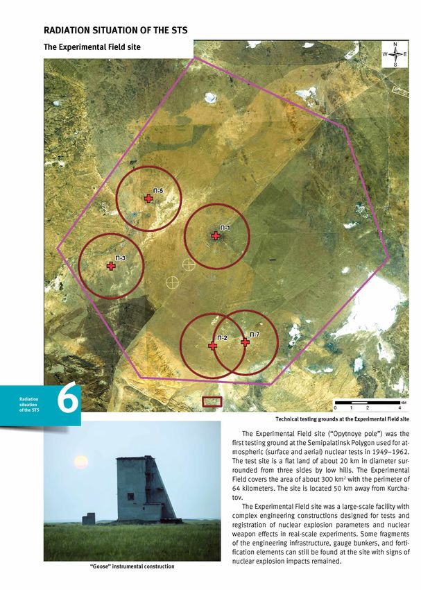
СОВЕТ М И Н И С Т Р О В СССР
                              '  ПОСТАНОВЛЕНИЕ tb JtfL JW "/"-
                           ' от . / * *   -н о а Д р и   ______ 194 б .г. Москве, Кремль.

 О подготовительных мероприятиях по строительству Горной станции для Первого главного
                       управления при Совете Министров СССР.

Совет Министров Союза ССР ПОСТАНОВЛЯЕТ:

     1. Принять предложение Первого главного управления при Совете Министров СССР о
необходимости сооружения специального полигона для испытаний «РДС». Специальный
полигон в дальнейшем именовать «Горная станция Первого главного управления».
     2. При проектировании Горной станции исходить из предварительной программы
исследований и оснащения станции установками и приборами предложенных академиком
Семеновым Н.Н. и утвержденных Научно-Техническим Советом Первого главного
управления при Совете Министров СССР, согласно приложению № 1.
     Проектирование Горной станции возложить на Первое главное управление при Совете
Министров СССР (ГСПИ-И).
     3. Поручить Первому главному управлению при Совете Министров СССР (т.
Ванникову) к 1 декабря 1946 г. представить на утверждение Совета Министров СССР
предложения о месте и сроках строительства Горной станции, начальнике Горной станции и
мерах по обеспечению строительства.
     4. Область Министерства: вооружения (т. Устинова), электропромышленности (т.
Кабанова), вооруженных сил СССР (т. Вершинина) выполнить по заданиям Института
химической физики АН СССР (акад. Семенова):
     а) в Государственном оптическом институте работы по проектированию и
изготовлению ряда оптических приборов, в том числе: спектрографов, измерителей размеров
светящегося тела и измерителей интенсивности излучения с разверткой показаний во
времени, согласно приложению №2;
     б) во Всесоюзном электротехническом институте работы по созданию эталонных
сверхмощных источников света, изучению излучения света воздухом при высоких
температурах, изготовлению специальных трансформаторов малой мощности на опытном
заводе, согласно приложению №3;
     в) в Научно-исследовательском институте ВВС работы по измерениям в воздухе на
аэростатах и самолетах, согласно приложению № 4.
     Поручить тт. Борисову (созыв), Устинову, Хруничеву и Кабанову разработать
совместно с директором института Химической физики Академии наук СССР академиком
Семеновым и представить в месячный срок в Совет Министров СССР план размещения по
заводам заказов на изготовление аппаратуры необходимой для целей предусмотренных
настоящим Постановлением.
     5. Обязать начальника инженерных войск т. Воробьева обеспечить выполнение в
Лаборатории №3 Инженерного Комитета сухопутных войск по программе академика
Семенова работы по моделированию взрывных волн с помощью мощных электроразрядов и
участие в работе, связанной с нахождением оптимальных условий практического
использования минного горна «РДС».

                                                             седатель
                                                             ртров Союза ССР                И.Сталин

                                                               пий Делами
                                                               нисгров СССР                 Я .Чадаев

Historical document about the creation of a special testing site: the Governmental Decree signed by Joseph Stalin, Chairman of the USSR
Council of Ministers, dated November 14, 1946 “About preparatory measures for construction of a Mountain Seismic Station for the First
Chief Directorate of the USSR Council of Ministers”.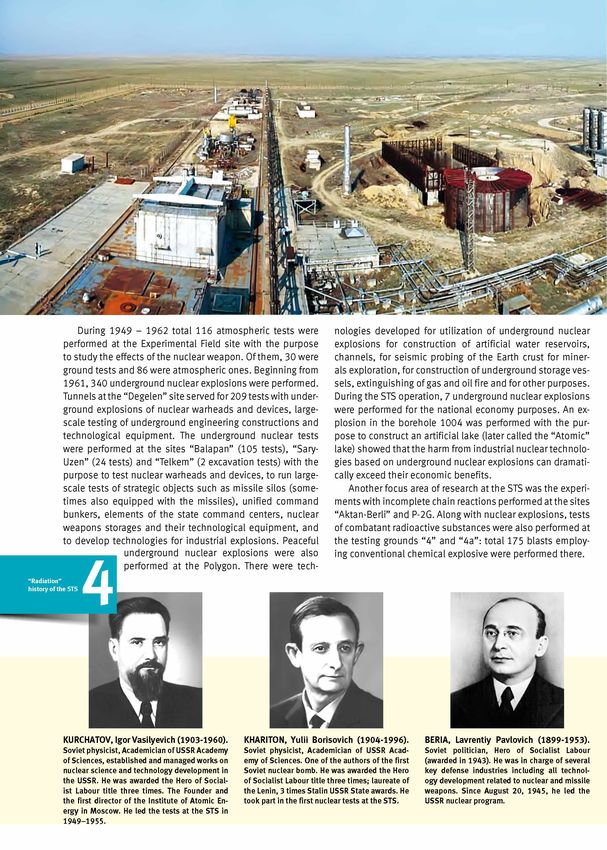
CONTENT

“ RADIATION” HISTORY OF THE STS                                                                                3

RADIATION SITUATION OF THE STS                                                                                 6
The Experimental Field site                                                                                    6
The sites “ Balapan” and “ Sary-uzen”                                                                          9
excavation explosions                                                                                          11
The “ Degelen” site                                                                                            13
Testing grounds for combatant radioactive substances “ 4а” and “ 4”                                            15
Lands outside the testing sites. Traces of radioactive fallouts                                                16
The Shagan River                                                                                               17

r a d io a c t iv e c o n t a m in a t io n c h a r a c t e r o f t h e m a in s t s e n v i r o n m e n t s   18
Surface waters                                                                                                 18
Soils                                                                                                          20
Vegetation                                                                                                     22
Fauna                                                                                                          24

MAP OF THE STS                                                                                                 26

Geology                                                                                                        28
Air                                                                                                            30
Snow cover                                                                                                     32
Peculiarities of the tritium contamination at the STS                                                          33

RADIOECOLOGICAL SITOATION OF TERRITORIES ADJACENT TO THE STS                                                   35
Traces of radioactive fallouts outside the STS                                                                 35
Radioecological conditions in the inhabited localities                                                         37
“ Conditionally clean territories” . Adjustment of the STS borders
in compliance with the radiological status of the lands                                                        39

“ NON-RADIATION” HAZARD FACTORS AT THE STS                                                                     41
Gas emissions in the uNE locations                                                                             41
Heavy metals                                                                                                   42

REHABILITATION MEASuRES AT THE STS                                                                             44

ECONOMIC ACTIVITIES AT THE STS                                                                                 46
Agricultural production                                                                                        46
Limitation of the commercial activities at the STS in order to assure radiation safety                         48
Prospecting and mining                                                                                         49

CONCLuSION                                                                                                     51
"RADIATION” HISTORY OF THE STS known as “Opytnoye pole” site - Site “P”) and a base airfield
in Zhana Semey - a suburb area of Sem ipalatinsk (Site “A”).
In later years, the Polygon expanded over new areas. In
The decision to construct a special testing site for a so- the beginning of 1960s, the mountain ridge Degelen was
called in top-secret papers “RDS” device was taken by the used to run underground tests in tunnels (adits); for that,
Decree of the USSR Council of Ministers on 14th of November, the Polygon incorporated a Mountain Seism ic Station of the
1946. This special site was named as “The Mountain Se is USSR Academy of Sciences. Later, the test site was expand
mic Station of the First Chief Directorate” or Object 905. The ed over new plain areas in Balapanzharen hole and Area 7
Council of Ministers’ Decree from April 21, 1947, ordered to in Sary-Uzen where underground explosions were performed
select in one month a location for the future Object 905 and in wells. Successful testing of the first Soviet nuclear bomb
to design in 20 days the testing program including a range of performed on August 29, 1949, at 7.00 a.m. was an out
objects and weapons to be subjected to testing. standing political and scientific event of the global scale.
Area in vicinity of the Irtysh River chosen for construction of the testing site
A progress report on the surveillance of potential areas On 12.08.1953 the first device with neutron amplification
for the test site construction included description of the fol was tested and on 29.11.1955 - the hydrogen bomb. There
lowing optional sites: a site in vicinity of the Irtysh River 170 were other particularly noticeable tests: a test with a bomb
km to the west from Sem ipalatinsk city; a site near the Lake dropped from a plane on October 18, 1951; the first indus
Balkhash 80 km southwest of Kiyik railroad station; a site on trial explosion in a well aimed at the creation of an artificial
the shore of the Ishim river 100 km to south from Atbasar lake at the conjunction of the Shagan and
railroad station; a site in vicinity of Naurzumsky nature re the Aschisu Rivers performed on January 15,
3
serve 60 km from Akmolinsk-Kartaly railroad station. The 1965.
general conclusion on the choice of the site was as follows: Since 1949 until the Polygon closure in
“The sites in the vicinity of the Irtysh River and Naurzumsky 1989, total 456 nuclear tests were performed
state nature reserve are the most suitable in terms of the (616 nuclear devices). The majority of tests
conditions specified. The best fit is the site in the vicinity of were performed in the beginning of 1960s
the Irtysh River.” when atmospheric tests were gradually re
On 21st of August, 1947, the USSR Council of Ministers placed by underground explosions. Nuclear weapon tests at
transferred the Mountain Seism ic Station to the USSR Minis the Sem ipalatinsk test site can be divided into two stages:
try of Defense, where it received a new cover name - Training the first one is the period when nuclear devices were explod
Proving Ground No.2. In the same Decree, the Kazakh SSR ed in the atmosphere, and the second one - the period of
Council of Ministers was obliged to transfer to the USSR De underground nuclear explosions in boreholes and adits.
fense Ministry the total area of 15,155 square kilometers in
the form of a regular circle (radius 60 km) except a cut of
lands in the vicinity of Maiskoye, Semiyarsk, and Grachevsky.
By the time of the first Soviet nuclear bomb in August
1949, the test site was already a large-scale and complex
enterprise. It included three main components: a zone of ad
ministration and living buildings (site M, later expanded to
become the town of Kurchatov); the Experimental field (also The first soviet atomic bombs "RDS-1” (left) and "RDS-6” (right)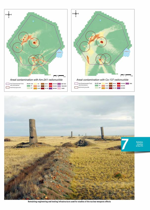
During 1949 - 1962 total 116 atmospheric tests were nologies developed for utilization of underground nuclear
performed at the Experimental Field site with the purpose explosions for construction of artificial water reservoirs,
to study the effects of the nuclear weapon. Of them, 30 were channels, for seism ic probing of the Earth crust for miner
ground tests and 86 were atmospheric ones. Beginning from als exploration, for construction of underground storage ves
1961, 340 underground nuclear explosions were performed. sels, extinguishing of gas and oil fire and for other purposes.
Tunnels at the “Degelen” site served for 209 tests with under During the STS operation, 7 underground nuclear explosions
ground explosions of nuclear warheads and devices, large- were performed for the national economy purposes. An ex
scale testing of underground engineering constructions and plosion in the borehole 1004 was performed with the pur
technological equipment. The underground nuclear tests pose to construct an artificial lake (later called the “Atomic”
were performed at the sites “Balapan” (105 tests), “Sary- lake) showed that the harm from industrial nuclear technolo
Uzen” (24 tests) and “Telkem” (2 excavation tests) with the gies based on underground nuclear explosions can dramati
purpose to test nuclear warheads and devices, to run large- cally exceed their economic benefits.
scale tests of strategic objects such as missile silos (some Another focus area of research at the STS was the experi
times also equipped with the missiles), unified command ments with incomplete chain reactions performed at the sites
bunkers, elements of the state command centers, nuclear “Aktan-Berli” and P-2G. Along with nuclear explosions, tests
weapons storages and their technological equipment, and of combatant radioactive substances were also performed at
to develop technologies for industrial explosions. Peaceful the testing grounds “4” and “4a”: total 175 blasts employ
underground nuclear explosions were also ing conventional chemical explosive were performed there.
performed at the Polygon. There were tech
KURCHATOV, Igor Vasilyevich (1903-1960). KHARITON, Yulii Borisovich (1904-1996). BERIA, Lavrentiy Pavlovich (1899-1953).
Soviet physicist, Academician of USSR Academy Soviet physicist, Academician of USSR Acad Soviet politician, Hero of Socialist Labour
of Sciences, established and managed works on emy of Sciences. One of the authors of the first (awarded in 1943). He was in charge of several
nuclear science and technology development in Soviet nuclear bomb. He was awarded the Hero key defense industries including all technol
the USSR. He was awarded the Hero of Social of Socialist Labour title three times; laureate of ogy development related to nuclear and missile
ist Labour title three times. The Founder and the Lenin, 3 times Stalin USSR State awards. He weapons. Since August 20, 1945, he led the
the first director of the institute of Atomic en took part in the first nuclear tests at the STS. USSR nuclear program.
ergy in Moscow. He led the tests at the STS in
1 9 49-1955.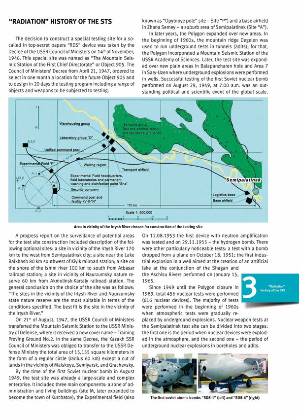
Reactor tests. Starting from 1958, the USSR Council of rate at the boundary of the Sem ipalatinsk test site comprised
Ministers initiated a series of decrees regarding research 15-20 pR/h what is very close to the background values for
and development works aimed at the creation of nuclear these territories. During this period, total 28 “hot” reactor
engines for rockets (NRE) and nuclear power propulsion en start-ups were performed at IVG.1 with activity release into
gines (NPPE). To test the NREs and NPPEs as well as their the atmosphere; at that the reactor power yield varied from
components, the pulse graphite thermal neutron reactor IGR 4.9 (min) up to 230 (max) MW. Total 178 gas-cooled fuel as
was constructed and commissioned in 1961 at the test site. semblies were tested in 4 experimental reactor zones.
Other tests in 1962-1970 required construction of a reac Various-design fuel elements and fuel assemblies for
tor facility “Baikal-1”. Tests of the fuel assemblies of the NRE and NPPE reactors as well as for the gas-dynamic instal
NREs and NPPEs in the reactor IVG.1 and the reactor IRGIT (a lations with diverse coolants (hydrogen, nitrogen, helium,
ground-based prototype of the NRE reactor) were performed and air) were tested at the IGR reactor facility. Environmen
at the stand facility “Baikal-1” in 1975-1988. tal safety was assured at the IGR stand by the closed-loop
Tests of gas-cooled fuel assemblies and the IRGIT reactor sealed system of the gas coolant release. Spent coolant was
at the stand “Baikal-1” were performed employing the open kept in sealed vessels until its activity decreased below the
loop scheme with coolant release into the atmosphere. The acceptable levels. It means that in 1970-1980, the second
release of the decay products during these tests was similar most important source of radioactive contamination at the
in its radio-isotopic contents and intensities to the releases STS were atmospheric releases of radioactivity during experi
from an NPP at normal operation, and the exposition dose ments at the reactor facilities.
5 "R a d ia tio n ” h isto ry
o f th e STS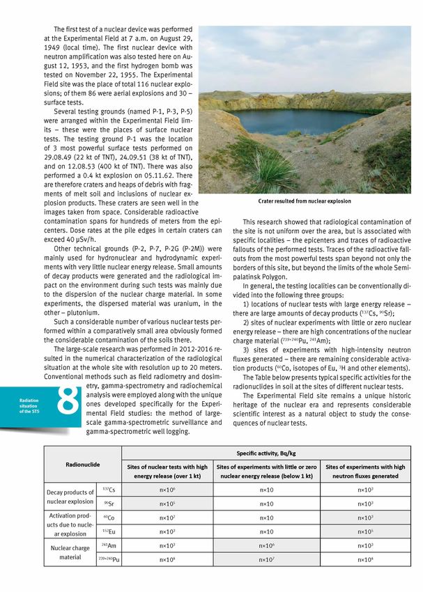
RADIATION SITUATION OF THE STS
first testing ground at the Sem ipalatinsk Polygon used for at
mospheric (surface and aerial) nuclear tests in 1949-1962.
The test site is a flat land of about 20 km in diameter sur
rounded from three sides by low hills. The Experimental
Field covers the area of about 300 km2 with the perimeter of
64 kilometers. The site is located 50 km away from Kurcha
tov.
The Experimental Field site was a large-scale facility with
complex engineering constructions designed for tests and
registration of nuclear explosion parameters and nuclear
weapon effects in real-scale experiments. Some fragments
of the engineering infrastructure, gauge bunkers, and forti
fication elements can still be found at the site with signs of
nuclear explosion impacts remained.
"Goose” instrumental construction
Remaining engineering and testing infrastructure used for studies of the nuclear weapons effects
The first test of a nuclear device was performed
at the Experimental Field at 7 a.m. on August 29,
1949 (local time). The first nuclear device with
neutron amplification was also tested here on Au
gust 12, 1953, and the first hydrogen bomb was
tested on November 22, 1955. The Experimental
Field site was the place of total 116 nuclear explo
sions; of them 86 were aerial explosions and 30 -
surface tests.
Several testing grounds (named P-1, P-3, P-5)
were arranged within the Experimental Field lim
its - these were the places of surface nuclear
tests. The testing ground P-1 was the location
of 3 most powerful surface tests performed on
29.08.49 (22 kt of TNT), 24.09.51 (38 kt of TNT),
and on 12.08.53 (400 kt of TNT). There was also
performed a 0.4 kt explosion on 05.11.62. There
are therefore craters and heaps of debris with frag
ments of melt soil and inclusions of nuclear ex
plosion products. These craters are seen well in the Crater resulted from nuclear explosion
images taken from space. Considerable radioactive
contamination spans for hundreds of meters from the epi This research showed that radiological contamination of
centers. Dose rates at the pile edges in certain craters can the site is not uniform over the area, but is associated with
exceed 40 pSv/h. specific localities - the epicenters and traces of radioactive
Other technical grounds (P-2, P-7, P-2G (P-2M)) were fallouts of the performed tests. Traces of the radioactive fall
mainly used for hydronuclear and hydrodynamic experi outs from the most powerful tests span beyond not only the
ments with very little nuclear energy release. Small amounts borders of this site, but beyond the limits of the whole Semi-
of decay products were generated and the radiological im palatinsk Polygon.
pact on the environment during such tests was mainly due In general, the testing localities can be conventionally di
to the dispersion of the nuclear charge material. In some vided into the following three groups:
experiments, the dispersed material was uranium, in the 1) locations of nuclear tests with large energy release -
other - plutonium. there are large amounts of decay products (137Cs, 90Sr);
Such a considerable number of various nuclear tests per 2) sites of nuclear experiments with little or zero nuclear
formed within a comparatively small area obviously formed energy release - there are high concentrations of the nuclear
the considerable contamination of the soils there. charge material (239+240Pu, 241Am);
The large-scale research was performed in 2012-2016 re 3) sites of experiments with high-intensity neutron
sulted in the numerical characterization of the radiological fluxes generated - there are remaining considerable activa
situation at the whole site with resolution up to 20 meters. tion products (60Co, isotopes of Eu, 3H and other elements).
Conventional methods such as field radiometry and dosim The Table below presents typical specific activities for the
etry, gamma-spectrometry and radiochemical radionuclides in soil at the sites of different nuclear tests.
analysis were employed along with the unique The Experimental Field site remains a unique historic
ones developed specifically for the Experi heritage of the nuclear era and represents considerable
mental Field studies: the method of large- scientific interest as a natural object to study the conse
scale gamma-spectrometric surveillance and quences of nuclear tests.
gamma-spectrometric well logging.
Specific activity, Bq/kg
Radionuclide Sites of nuclear tests with high Sites of experiments with little or zero Sites of experiments with high
energy release (over 1 kt) nuclear energy release (below 1 kt) neutron fluxes generated
Decay products of 137Cs nx106 nx10 nx103
nuclear explosion 90Sr nx105 nx10 nx103
Activation prod 60Co nx102 nx10 nx103
ucts due to nucle
ar explosion 152Eu nx103 nx10 nx105
Nuclear charge 241Am nx103 nx106 nx103
material 239+240Pu nx104 nx107 nx104The sites “Balapan” and “Sary-Uzen”
Radioactive contamination of the surface soil due to radioactive fallouts at the test sites “ Balapan” and “Sary-Uzen” remains within the following
specific activity intervals: 241Am - 1 - nx102 Bq/kg; 137Cs - 1 - nx102 Bq/kg, 90Sr - 10 - nx102 Bq/kg. The highest concentrations of the radioactive
contamination are found within the traces from nuclear tests.
The sites “Sary-Uzen and “Balapan” were used for under tors: radioisotope atmospheric fallout due to explosions at
ground nuclear explosions in wells. other sites and radioisotope fallouts from the tests at these
According to the archive data, total 105 military tests were sites with the release of radioactivity. For instance, a nuclear
performed in 106 wells at the “Balapan” site and 24 tests in test performed at the Experimental Field site on 24.09.1951
25 wells were performed at the “Sary-Uzen” site. In addition generated a radioactive plume that passed over the whole
to that, 3 more wells that looked like the combatant ones “Sary-Uzen” area. Radioactive fallout traces from nuclear
were found at the “Sary-Uzen” site. Nuclear experiments at tests at other sites also pass through the “Balapan” site; the
both sites started in 1965 and continued until 1980s. The trace with the 241Am concentration of up to n x io 2 Bq/kg is a
sites are noticeably different in the charge depth: so, ave particularly noticeable one.
rage depth for the arrangement of nuclear charges at the Radioactive contamination of the near-mouth areas of
“Balapan” site was 650 m while at the “Sary-Uzen” - about the boreholes can be conventionally divided
250 m. Power yield was also different reaching in some ex into the following three categories: clean
periments 150 kt of TNT. boreholes (24 at the “Balapan” site and Radiation
situatio n
Most of the area free from local radioactive fallout traces 10 boreholes at the “Sary-Uzen” site); bore o f th e STS
can be characterized by the following average concentra holes with minor radiological contamination
tions of the artificial radionuclides: 241Am - nx10' Bq/kg, (73 at the “Balapan” site and 12 boreholes at
137Cs - пх Ю 1 Bq/kg, 90Sr - п х 10' Bq/kg which is due to glo the “Sary-Uzen” site); and the boreholes with
bal fallouts. high levels of specific activities (9 at the “Balapan” site and
Areas with increased specific activities of the artificial ra 6 - at the “Sary-Uzen” site).
dionuclides are formed as a consequence of two major fac
A typical view of a worked-out borehole The borehole No. 1301 where Present-day view of the cavity
the emergency situation happened at the test borehole No.101Areal distribution of 241Am Areal distribution of 241Am Areal distribution of 137Cs Areal distribution of 137Cs
at the borehole No. 1069 at the borehole No.215 at the borehole No.1080 at the borehole No.101
(the “ Balapan” site) (the “Sary-Uzen” site) (the “ Balapan” site) (the “Sary-Uzen” site)
Radioactive contamination of the surface soil in vicinity of the wells can reach the following maximal specific activity values: 241Am - up
to 4 x 10⁶ Bq/kg, 137Cs - up to 5 x 10⁵ Bq/kg, 90Sr - up to l x i o 4 Bq/kg, 152Eu -u p to 2 x 10³ Bq/kg. Total contaminated area of the near-mouth lands
comprises about 10 % of the total site area.
Besides the boreholes at the “Sary-Uzen” site, there are Still, there is a possibility that a different type of radio
sets of engineering structures with spots of local radioactive active contamination can be revealed due to radionuclide
contamination. Each such set can incorporate up to 20 struc transport from the bottom to the day surface during a nuclear
tural elements on the surface and underground. Decay pro explosion. Considering in-depth radionuclide distribution in
ducts of the nuclear fuel, non-reacted charge remnants, and vicinity of the Borehole No. 1267, one can see that the con
neutron activation products were found at these locations. centrations for both 137Cs (above 0.5 m) and 241Am (above
A typical contamination of the Object 126/1 includes con 2.5 m) increase; at that, 241Am concentration reached up the
tamination in the concrete and in the reinforced concrete value of 9.8x10³ Bq/kg (at 4.5 m), and the 137Cs concentra
structures. tion does not decrease down to the 9m depth. Based on the
In-depth distribution of radioactive contamination at the obtained results, we currently set this as one of the priorities
sites “Balapan” and “Sary-Uzen” is, in general, similar to the to study the in-depth radionuclides distribution pattern at
character of radioactive contamination at other sites where the sites of underground nuclear explosions.
surface and aerial nuclear tests were performed.
Schematic map of the 152Eu areal distribution at the object 126/1
(the “Sary-Uzen” site)
Radioactive contamination of soil in vicinity of the object 126/1
remains within the following specific activity limits: 241Am -
In-depth distribution of 137Cs and 241Am near the mouth territory 1 - 50 Bq/kg, 137Cs - 1 - 6 x 10² Bq/kg, 90Sr - 10 - 3 x 10² Bq/kg,
of the Borehole No. 1267 (the “ Balapan” site) 152Eu - 1 - 1 x 10⁴ Bq/kg.Excavation explosions As a rule, such tests created craters of several dozens to
several hundred meters in diameter. Major part of the radio
Four experimental peaceful nuclear excavation explo nuclides generated during the explosions is concentrated in
sions were performed at the STS during 1965 - 1968 with the debris heaps and exceeding radiation levels are regis
the purpose to develop a technology for creation of artifi tered at distances from 200 m (“Telkem-1, -2”) to 10 kilome
cial water reservoirs and channels: “Chagan” (15.01.1965 ters (as for the “Atomic” lake). Now, most of these cavities
in the Borehole No.1004), “Sary-Uzen” (14.10.1965 in the are filled up with water at least seasonally.
Borehole No.1003), “Telkem-1” (21.10.1968 in the Bore The first and the most powerful excavation nuclear explo
hole No.2308) and “Telkem-2” (12.11.1968 in the boreholes sion was performed on January 15, 1965, at the conjunction
No.2305, 2306 and 2307). The nuclear charge used in the of the main rivers of the region - Shagan and Aschisu. The
“Taiga”-coded experiment was exploded on 04.11.1970 in 140 kt explosion created two large water reservoirs: the in
the Well No.125 at the “Sary-Uzen” site. Several craters were ternal one (the crater of 520 m in diameter and 100 m deep,
formed due to accidents during experiments in the wells volume 6 mln.m3) and the external one.
No .101 (the “Sary-Uzen” site) and No.1204 at the “Balapan”
site.
excavation explosion The “Atomic” lake The Well No. 1003. A view on the crater
in the Well No. 1004
(“Atomic” lake)
The in-depth radionuclide distribution at certain areas in
the vicinity of the “Atomic” lake varies. In the Shagan River
In-depth distribution of artificial radionuclides
floodplain and at the external reservoir area subjected to
seasonal flooding the radionuclides are uniformly distri
buted within the top 70 centimeters of soil due to intensive
infiltration. At the debris heap areas, the maximal radionuc
lide concentrations of up to n x io 4 Bq/kg can be observed
in the upper 2-meter layer; then down to the 6 m depth the
radionuclides are uniformly distributed with the concentra
tions of about n x io 2 Bq/kg.
Main radioactive contamination of the
lands adjacent to the “Atomic” lake spans
towards North and North-East. At larger dis
tances from the crater, the radionuclide con
centrations decrease considerably reaching
their background levels 8 -1 0 km away from
II
the Lake. The maximal EDR values can reach
Debris heap at the crater7 pSv/h and the maximal specific activity can be as high as
nx104 Bq/kg for 137Cs, nx103 Bq/kg for 90Sr, and nx104 Bq/kg
for 239+240Pu.
Radioactive contamination of water in these objects is
mainly stipulated by presence of the 3H and 90Sr radionu
clides. Their concentrations can be as high as 20,000 Bq/kg
and 700 Bq/kg, respectively. No presence of the 239+240Pu,
241Am and 137Cs radionuclides was revealed in water. At that
some objects demonstrate non-uniform in-depth distribu
tion of the radionuclides: for example, 3H concentrations
in the “Atomic” lake water vary from 100 to 20,000 Bq/kg
and 90Sr concentrations - from 1 to 15 Bq/kg. Minimal va
lues were registered at the depths above 10 m, the maximal
ones - at the depths 60-80 m.
90Sr distribution in water of the "Atomic” lake crater
A crater resulted from the underground excavation
nuclear explosion in the Well No.1003 of the "Sary-Uzen” site
3H distribution in water of the "Atomic” lake crater
Increased contents of the artificial radionuclides in the
air of these objects should now be expected only in the epi
center areas where the major radiological contamination re
mains. The maximal concentration of 239+240Pu radionuclide
137Cs distribution pattern for the near-mouths areas in the air above the “Atomic” lake was registered at the pile
of the wells No.1003 and No.215 edge and comprised 6,000 pBq/m3 what is twice the regula
tory level. But at the distance 1 -2 kilometers away from the
crater, concentrations of the artificial radionuclides 241Am,
137Cs, 239+240Pu become for 2 -3 orders of magnitude below
the regulatory level.
Special measures are to be undertaken to limit access to
the site and these hazardous objects for farm animals, large
wild animals, and unauthorized population; the measures
could include fencing, warning signs and posts since these
model of the crater lands contain huge amounts of radioactively contaminated
with the radioactive soil and debris, the proper burying of such amounts is eco
^contamination area ("Telkem-2”)
nomically impractical.The “Degelen” site
The testing site “Degelen” has been used for low and
intermediate yield tests. The site is located on the hom
onymous quaquaversal mountain ridge of about 1 7 -1 8 ki
lometers in diameter. The total area is about ~300 square
kilometers. Underground nuclear tests were performed in
adits (tunnels).
View on an adit before (left) and after (right) the sealing
An adit is a horizontal tunnel of several hundred to two kilometers in
length with about 3 meters in diameter. In order to assure that no ra
dioactive substance from a nuclear explosion is released to the atmo
sphere, a compound high-strength sealing plug was arranged in it.
Radioecological surveying of the “Degelen” site con
firmed that most of its territory is radiologically clean since
the majority of the radioactivity (more than 90 %) generated
during the nuclear explosions remained in the adits. At the
same time, there are areas and spots with increased concen
trations of radionuclides in the environmental objects (soil,
water, vegetation). Such areas and sports were formed due
to the following three factors: 1) accidents during nuclear
Underground nuclear explosion at the “ Degelen” site
tests; 2) unsealing of the adits after a nuclear explosion per
Total 209 nuclear explosions were performed in 181 ad formed; 3) proliferation of radioactivity from the adits with
its during 1961 - 1989. The last explosion was made on water flows.
04.10.1989 in the adit No. 169/2. The most contaminated areas at the “Degelen” site are
the near-portal areas of the adits with water flowing from the
tunnels. Many years of the monitoring studies performed
there have shown that transport of radionuclides with water
passing through the nuclear explosion cavities
takes place even today. Still, there are 8 to 12
of such adits, and the number varies from year
to year depending on the amount of precipita
tion in a specific year. Assessment of the ra
dioactivity release with water flowing from the
adits was performed in details in 1999-2003.
The total annual release of the radionuclides in 2003 was as
follows: 137Cs ~2 Ci, 90Sr ~5 Ci, 3H ~3.5 kCi. That year, radio
active water flows were found in 9 adits. Maximal specific
activities of the radionuclides in water flowing from different
adits comprised the following values: 137Cs - 820 Bq/l (adit
Location of the adits 504), 90Sr - 2,100 Bq/l (adit 177), 239+240Pu - 6.4 Bq/l (adit
50 3), 241Am - 2.6 Bq/l (adit 177), and 3H - 9.9x10⁵Bq/l (adit
Works to seal all the adits were performed on the site 160).
during 1996-1998 to eliminate possibilities for use of these As a rule, the maximal radiological contamination is
adits for nuclear testing. These works were performed within found at the adit portals where the waters reach the day sur
the Agreement between the US Department of Defense and face. The values decrease away from the adit portals.
the Ministry of Energy and Mineral Resources of the Republic 239+240Pu and 137Cs demonstrate the lowest migration
of Kazakhstan about the elimination of the nuclear testing ability: in most cases, they proliferate with water along the
infrastructure. springs for not more than a hundred meters from the source.90Sr can pass with water several hundred meters or even sev
♦ 1 3 7 C s , w a te r/so il specific activity
eral kilometers. . ■ 9 0 S r, w ater/so il specific activity
J1.0E -01 ' *
*
| l, 0 E - 0 2
^Ч.ОЕ-ОЗ
a1
J 1 .0 E -0 4
в
ll,0 E - O 5
О 0 ,5 1 1 ,5
Distance to the portal, km
The ratios of 137Cs and 90Sr specific activities in the water flow from the
adit No.176 to their respective specific activities in soil
LEGEND
InvntlfMion point»
О u n p lln i points
Y tunnel portal No extremely high radionuclide concentration has been registered in
spite of the continuous delivery of the radioactivity to the day surface
Radiation contamination of the near mouth area resulted by the water flows. Current ratios of the radionuclide maximal specific
from unsealing of the adits after explosion activities in water to their specific activities in soil at the near-mouth
areas of the adits do not exceed the following values: 90Sr - n x 10'3,
Radioactive contamination of the near-mouth area took place due to 137Cs - nx 10-5, 241Am - nx 10-4, and 239+240Pu - nx 10'6.
the adit opening and dumping of the debris. The adits were opened to
verify the nuclear explosion parameters and to use the adit for the sec
ond time. Radioactive contamination at such adits covers small areas Vegetation inhabiting the adit waterway banks usually
with a highly heterogeneous in-depth distribution of artificial radionu demonstrates the highest specific activities of the radionu
clides. The dumped debris varies in height from 1 to 20 meters.
clides: for i37Cs the values can reach n x io 4, for 90Sr - n x io 4,
239+24oPu n x io 1. 24iAm specific activity in vegetation was reg
Beta, part. (min*sq.km) istered at the determination threshold levels of 2-4 Bq/kg.
■Testing grounds for combatant radioactive
substances “4а” and “4”
The tests of the CRS were per
formed at the testing grounds “4”
and “4а”, located to the west and
to the north from the Experimental
Field site. Spreading of CRS was
achieved by the explosion of spe
cial amunition, bombardment with
mortar shells, air bombing or with
direct dispersion of the substances
employing planes.
Our investigations revealed at
these testing grounds more than
30 areas with local radiological
contamination. The main contami
nant is 90Sr: its maximal specific
activity in soil cover can be as high
as 5x10⁸ Bq/kg what corresponds
to intermediate level radioactive
waste. At that, other radionuclides
such as 239+240Pu, 152Eu, 154Eu, 137Cs,
241Am, 60Co, also present in the soil
cover in much smaller amounts
Areas of radiological contamination at the testing ground "4а1 of about nx103-106. Radioactively
contaminated spots can cover sev
Nuclear explosions were not the only types of tests per eral hundreds square meters up to several hundreds thou
formed at the STS. In 1953 - 1957, programs on testing of sands square meters, some of the spots span for a kilome
combatant radioactive substances (CRS) were in progress ter. Among the peculiarities of the radioactive contamination
there. CRS were liquid or powder radioactive substances at these spots, one can notice some higher radionuclide ac
made of radiochemical wastes or by irradiation of special cumulation coefficients in the vegetation. Accumulation co
substances with neutrons in a nuclear reactor. Specific ac efficients in the vegetation for the 90Sr radionuclide are much
tivities of such substances varied from tenth parts to several higher than those in the epicenters of surface nuclear explo
Curie per liter. sions and at the conventionally “background” territories of
the STS; these coefficients are comparable to the values ob
tained for the radioactive waterflow areas with the majority of
the coefficients exceeding 1. The accumulation coefficients
for 239+240Pu also exceed all previously obtained at other STS
lands values and the international generalised data. Such
accumulation of the 90Sr and 239+240Pu radionu
clides at the studied territories can, most prob
Radiation
ably, be related to the form of their delivery to situatio n
the environment at CRS tests. Such peculiari o f th e STS
ties in radionuclide accumulation in the veg
etation and high 90Sr contents in the soil cover
impose considerable hazard on people and
local animals at these territories what makes these testing
grounds the most radiologically dangerous ones among the
STS objects.
Physical barriers in form of trenches were constructed
to limit the access of people and animals to the “4a” test
ing ground, and the radiation warning signs were arranged
at the contaminated spots. Nevertheless, these lands are in
close vicinity of the lands planned for transfer for commer
cial use. This understanding sets up the priority to remediate
these lands and clean them up from the radiological con
taminants. Preliminary assessment performed for the CRS
testing grounds gave the amount of radioactive waste there
Surface distribution of radioactive contamination
to be about 45,000 m3 with the area of lands requiring reme
over one of the grounds
diation exceeding 110 hectares.Lands outside the testing sites. In the locations of the underground nuclear tests with
Traces of radioactive fallouts the release of debris, contamination is mainly found near
the craters and it goes beyond the grounds for a distance
\ *« / /
of several tens of kilometers. The nuclear explosion with the
07 /
П-2 \
/ ' . / s release of debris performed at the testing ground “Balapan”
\ / / in the borehole No.1004 on 15.01.1965 led to the most sig
nificant radioactive contamination of the lands. The near
radioactive fallout trace from this test is located at a dis
tance up to 10 km in the northeastern direction and stays
within the “Balapan” site limits. Similar in its parameters
П-2Г
trace has been identified on the site “Sary-Uzen”: this trace
was due to the test conducted in the borehole No.1003 on
10.14.1965. The test performed in the borehole No.101 on
18.12.1966 led to the radioactive contamination of the site
in the south-western direction up to the STS border. Based
on the comprehensive ecological survey of the area between
0 soo к Ю0 2 (XX и
the sites “Degelen” and “Balapan”, where the trace from the
Legend
J the E xp e rim e n ta l F ie ld site b o u n d a rie s A m -2 4 i.e p s 7-9 30-50 | И | 1 0 0 -1 5 0
test performed on 12.08.1953 is located, it is proposed to
~ 1 te c h n ica l g ro u n d s Ш ШThe Shagan River ters varies in a wide range. In the area of maximal contamina
tion, 3H contents vary from the minimal 100 Bq/kg in spring
The Shagan River is the longest waterway crossing the period up to its maximal values of 350,000 Bq/kg in summer
STS. The total length of the channel of the river is 275 km, of and fall. At the border of the test site, 3H concentration in the
which about 50 km lie on the STS. The river with braiding has river varies from 100 Bq/kg to 10,000 Bq/kg; at the conflu
a low flow rate, deadlock sloughs, swamping banks. In dry ence of the Shagan River and the Irtysh River, 3H concentra
periods the surface water periodically dries up on separate tions do not exceed 10 0-20 0 Bq/kg.
sections of the river.
Change in 3H areal specific activ In-depth change in 3H concentra
ity has been revealed over the tion in the flow (10 -3 5 cm) and
whole width of the river channel 3H specific activities (2,000
both in the surface and under 250,000 Bq/kg). In all cases,
Radioactive contamination of the Shagan River is stipulated by the flow waters of the left and right the maximal concentrations are
excavation thermonuclear explosion in the Well No.1004 (the “Atomic“ banks. At that, no specific cor observed in the near-bottom
Lake) and the consequences of the underground nuclear explosions at relation between 3H distribution layer and the minimal ones - at
the “ Balapan” site. in underflow and surface waters the flow surface.
has been revealed.
Presently, the artificial radionuclides 3Н, 90Sr, and 239+240Pu
are registered in the Shagan River water. Presence of 90Sr and
239+24°Pu at the levels 0.03 Bq/kg and 0.002 Bq/kg, respec
tively, has been revealed in the Shagan River only down
stream of the “Atomic” lake contaminated soils. Main radio
nuclide contamination of the Shagan River water is formed
by increased concentrations of 3Н: its contents vary from
100 up to 350,000 Bq/kg. At that, the areas with increased
3Н concentrations differ by the contamination sources and In winter times, the surface
water flows of the Shagan The well 5-PN and the 5-km post are
contamination mechanisms.
River are completely fro the localities with the maximal 3H
zen except a small interval concentrations. The 14-km post is
5 km downstream of the the place where the river crosses the
“Atomic” lake where the STS administrative border. The 110
water is diluted by the un km post is the confluence of the Sha
derrun. gan River into the Irtysh River.
In the vicinity of the Shagan River, there are about 15 per
manent winterings with people living there the whole year
round; there are also more than 10 temporary
summer shelters inhabited in a warm season.
Areas of the Shagan River contaminated with 3Н
Presence of 3Н downstream of the “Atomic” lake (area No.1 on the
graph above) is due to the 3Н leaching from the contaminated debris.
The noticeable increase in 3H in the interval 1 -2 km (area No.2) is asso
There is no doubt that the Shagan River wa
ters cannot be used by local people for drink
ing because of high salinity (1 0 -3 0 g/l), but
the water is used for watering of the domestic
animals. Livestock watering at the areas with
7
ciated with the inflow of underflow water from the old river chanel. The increased 3H concentrations results in tritium
interval from 5 to 6 kilometer downstream (area No.3) related to direct
discharge of the contaminated fracture water proliferated through the
intake and presence in the agricultural products like meat
tectonic disruptions from the combatant wells at the “ Balapan” site. and milk what has been confirmed in numerous studies.
Within the 8 -1 4 km interval, the inflow of contaminated groundwater In general, tritium specific activities in the Shagan Riv
is observed. From the distance 14-15 km and further, one can note the
er waters exceed for 5 -5 0 times the intervention level of
gradual decrease in 3Н due to dilution.
7,600 Bq/kg set by the sanitary rules. These 3H excess con
Some parts of the Shagan River represent particular inter centrations are registered for about 25 kilometers beyond
est: there are intervals with non-uniform areal and in-depth the administrative border of the STS.
3Н redistribution. The actual radiological conditions do therefore require
Monitoring of the Shagan River waters has been estab the implementation of specific measures in certain parts of
lished taking into account the specific features of the surface the river. Agricultural and cattle breeding activities are to be
and ground waters’ contamination. limited there in the areas with increased tritium concentra
The concentration of 3H in the underground waters of the tions; the lands should get the proper legal status of the
river is relatively stable. The concentration in the surface wa state reserve territories.RADIOACTIVE CONTAMINATION
CHARACTER OF THE MAIN STS
ENVIRONMENTS
Surface waters
The surface waters at the STS are represented by closed
natural or artificial basins and the waterways.
There are two main factors responsible for contamination
Kishkensor Lake
of the ground waters: surface and excavation nuclear tests
Kishkensor Lake is located next to the western border outside the
result in considerable contamination of the surface soil and
“ Balapan” site. in 2015, the 3Н content there was registered at the
debris, washing out or leaching out of the radionuclides from level of 400 kBq/kg; 90Sr - 1.2±0.2 Bq/l.
the bank soil and bottom sediments into the water is the ma
jor factor. Another one, in case of underground tests, is the
contamination of surface waters by an inflow of ground wa
ters containing the radionuclides leached out from the well
and adit space.
The artificial basins are located at the test sites Experi
mental Field, “Balapan”, “Telkem”, and “Sary-Uzen”. These
basins are, as a rule, craters filled with water and formed as
a result of a nuclear explosion.
The water basins at the Experimental Field site are the
craters of the surface nuclear tests filled with water and,
in most cases, with a perimeter covered by southern reed
(Phragmites australis). Water in the three craters on the test The site “Sary-Uzen” . The borehole No. 101
ing grounds No. 3 and No. 4 of the P5 site and water in the A crater of about 400 m in diameter. It is the most severely contami
crater V-1 are the most severely contaminated. There are to nated water object at the “Sary-Uzen” site. Radionuclides concentra
tal 10 craters of 10 to 150 meters in diameter at the Experi tions in the bottom sediments comprise 137Cs - (8.4±1.7)x103 Bq/kg,
90Sr - (1.3±0.2)x103 Bq/kg, 239+240Pu - (8.6±0.7)x103 Bq/kg, 241Am -
mental Field site.
(4±0.8)x102 Bq/kg.
The craters at the “Sary-Uzen” site were formed in the ex
cavation nuclear tests: these are the wells No.No. 101, 125, Technogenic radionuclides content in waters
and 1003 filled up with water. The well 1003 is filled up with of reservoirs of technogenic origin
melt snow during spring season floods and dries up by mid
summer. Specific activity, Bq/l
Sampling point
The maximal radionuclide concentrations registered in 3 H 137Cs 90 Sr 239+240 pu
the artificial basins are presented in Table 1 below.
B-1
Experimental
< 11 < 0.03 2.5 ± 0.4 0.11 ± 0.01
П5, Area
Field
Water objects 85 ± 13 0.12 ± 0.01 140 ± 15 (1.7 ± 0.3)x10-2
No. 3
П5, Area
Artificial reservoirs < 13 5.4 ± 0.5 400 ± 40 (2.9 ± 0.5)x10-2
No. 4
The "Atomic" lake 120 ± 13 < 0.01 0.32 ± 0.05 (0.8 ± 0.3)x10-3
"Telkem-1" < 12 < 0.01 700 ± 70 (9.1 ± 0.8)x10-2
"Telkem-2" 30 ± 13 < 0.03 170 ± 16 0.17 ± 0.01
Borehole 101 (3 ± 0,2)x105 0.06 ± 0.01 230 ± 25 (1.1 ± 0.4)x10-3
Telkem-l P5, site №3 "Sary-Uzen"
Natural lakes Intervention level 7600 11 4.9 0.55
The artificial radionuclides contents in the water are
below the registration thresholds of the methods used for
the majority of the craters - these are < 11 Bq/l for 3H andlake is located at the “Sary-Uzen” site and Solenoye Lake is The decrease of the artificial radionuclide contents in the
on the “Balapan” site; some are in close proximity (i.e. in stream waters is related to the radionuclide accumulation in
the influence zones): the lakes Zhangyldy and Kotansor are bottom sediments. The accumulation capability of the bot
close to the “Sary-Uzen” site, the lakes Kishkensor, Shunku- tom sediments in respect to the radionuclides can be nu
sor, Karazhurek, Zhanan, and others are close to the “Bala merically expressed in terms of the transition coefficient Ka
pan” site, the lake Zhaksytuz is at the border of the Experi calculated as the ratio of the radionuclide content in bottom
mental Field site, etc. sediments to its content in water. Higher the Ka, higher the
accumulation capability of the bottom sediments. Values of
the Ka for different types of the water objects at the STS are
presented in Table 2.
Transition coefficients for different types
of water objects
Zhangyldy Lake
Zhangyldy Lake is located in the south-eastern part of the “Sary-Uzen” Distribution coefficient (Kd )
site. The radionuclides contents in the bottom sediments are as follows: Type of object pu
239+240
137Cs 90 Sr
137Cs - 150±20 Bq/kg, 90Sr - 24±4 Bq/kg, 239+240Pu - 28±3 Bq/kg. The
contents in water are: 137Cs - 0.02 Bq/kg, 90Sr - (1.6±0.2)x10‘2 Bq/kg, from 7.5 x 10² from 3.5 x 10² from 2.0 x 100
239+240Pu - (2.4±0.4)x10‘3 Bq/kg. Artificial reservoirs
to 1.0 x 10⁸ to 1.3 x 10⁶ to 1.3 x 10⁴
from > 4 .3 x i o 3 from 3.2 x 10³ from 4 x 10¹¹
The lakes are in most cases closed with no inflows or out Natural lakes
to 1.5 x 10⁶ to > 1.5 x 10⁵ to > 2.6 x 10³
flows and are not connected to with the underground waters.
The contents of artificial radionuclides in their waters are be from 2.7 x 10² from > 9 x 10² from 4,8 x 101
Watercourses
low 11 Bq/kg for 3Н, < 0.01 Bq/kg for 137Cs, and are below to 1.5 x 10⁵ to 1.5 x 10³ to 1.5 x 10²
the intervention levels for 90Sr (nx10-2) Bq/kg and 239+240Pu
(nx10-3) Bq/kg, except the Kishkensor Lake. The Ka values for different artificial radionuclides vary in
The 3Н contents in the Kishkensor Lake waters were regis a wide range for different types of the water objects: in aver
tered at the level 400,000 Bq/kg what e xceeds for two times age, from nx102 up to nx104.
the IL for water. This radionuclide contamination is due to the It follows that most of the radionuclides in the system
underrun of groundwater contaminated with tritium leached “water - bottom sediments” is accumulated in the bottom
out from the well cavities at the “Balapan” site. sediments. The only exception is 90Sr which, in some cases,
Main waterways at the territory of STS are the springs of demonstrates the Ka equal to nx100. One can therefore con
the “Degelen” site and the Shagan River that runs along the clude that 90Sr in such a water object can be found in similar
eastern border of the “Balapan” site, leaves the STS bound amounts both in the bottom sediments and in water sup
ary and becomes a left-bank tributary of the Irtysh River. porting the statement about the high migration capability of
Main radioactive contamination of the creeks at the “De this radionuclide.
gelen” site is related to the transport of radioactivity from the
adit cavities with adit waters flowing out.
Permanent water flows from the adits No.No. 104, 165,
176, 177, 203, 204, 501, 503, 504, 506, 511, 609, 802 and
З-1 have been revealed at the “Degelen” site during 2015
2016. There are also about 20 springs in the vicinity of the
site. The 3Н contents in the water of springs and waterways
vary in the range nx103 - nx105 Bq/kg, 90Sr - from nx10’
up to nx103 Bq/kg, 137Cs - from < 0.02 to nx102 Bq/kg, and
239+240Pu - from < 3x10⁻⁴ to nx100 Bq/kg.
The waterways and the springs merge forming the main
creeks of the “Degelen” site: Uzynbulak, Karabulak, Tok-
takushuk, Aktybai, Baitles, Bezymianny and Bezymianny-2.
Contents of the artificial radionuclides in the water there is
as follows: 3H - about nx104 Bq/kg, 90Sr - fromSoils areas is to be mainly based on the radionuclide presence
The Sem ipalatinsk test site is located in the climatic zone forms in soil.
of steppes and occupies the eastern part of the Kazakh low
hills. These factors pre-determine the nature of the land
scapes there. The landscapes are represented by low-moun-
tain massifs, the individual ridges, hills, plains, and valleys,
dips under the dry and desert steppes on chestnut and light
chestnut soils. The typical soils there lack moisture content,
narrow friable deposits layers, contain lots of detritus and
small amounts of organic matter. Intrazonal meadow soils
are formed in the places of additional moistening by flank
flows and groundwater in the valleys of small rivers and
creeks that dissect the low hills. Such meadow soils are dark ■
= '00 -1— ■— —
gray in color and contain thick horizon rich in humus. у - 126e-° 4U
A
•5
3 X4
•6
“ n
R 2= 0,97
The investigations revealed the peculiarities in in-depth +■7
-9
-8
♦10
radionuclide distributions in the soil cover at different land f \ * ж ■ 11 a 12
*14
* x 13
scapes of the STS for diverse radionuclide contamination ♦ >s i
• 15 + 16
- 18
-17
patterns. I ♦ 19 ■ 20
A21 x 22
X ' » 23 • 24
■
t 25 -2 6
-2 7 ♦ 28
1,000
depth radionuclide distributions; still, there Bq/kg). in the depth interval
are the variations in the patterns due to dif 100 - 120, 241Am concentra
tions exceed 100 Bq/kg; at
ferences in moistening regimes.
the depth 150 cm, 60Sr can
One should note the deeper proliferation be found in amounts of sev
of 90Sr into the soils at the combatant radioactive substanc eral thousands of Bq/kg with
es (CRS) testing ground compared to other testing grounds. no noticeable decrease in its
concentration at the studied
High specific activities of 90Sr in the CRS site soils are regis depth range.
tered down to the parent rock.
The study revealed different mobility and biological ac
cessibility of the radionuclides in STS soils stipulated by
In-depth radionuclide distribution in the water-rich meadow soils
the differences in the radioactive contamination of soils de
pending on the test type, radioactive contaminants origin, The decrease in the 90Sr biological accessibility param
and etc. eters in soils of the conditionally background territories sub
It therefore follows that the most contaminated site jected to radioactive fallouts from the surface nuclear explo
“Opytnoye Pole” is characterized by minimal bioaccessibility sions has been revealed.
parameters of the radionuclides in soils while the STS areas Distribution of the radionuclides within the granulo
with high mobility and bioaccessibility of the radionuclides metric soil fractions depends on the conditions and the
in soils (testing ground “4A” (CRS), “Degelen”) are not less mechanisms of the radioactive contamination. At increased
hazardous. The choice of the remediation method at these moistening, the highest accumulation of the radionuclidestakes place in the fine-dispersed soil fractions (sorption- ments (239+240Pu, 241Am) and the decay products (137Cs, 90Sr)
desorption redistribution). Considerable “enrichment” of a within the granulometric soil fractions.
particular granulometric soil fraction can serve as an indica
tor for presence in the soil of radioactive fallout from nuclear
explosion.
The deep proliferation of the
radionuclide can be explained
by the light mechanical com
position of the soils, the type
of the tests at this site, and
mobility/high solubility of
this radionuclide. Some soil
cuts at the testing ground
"4a” demonstrate two zones
with different mechanisms
of the in-depth distribution: 90Sr presence forms in the soils of the conditionally
the first zone is the range of background STS lands
initial proliferation of the ra
dionuclides at the short-term At the STS, the 90Sr presence forms can be used along with the basic
spill of the radioactive liquid parameters to characterize the radioactive contamination at the back
during the test and the second ground STS territories and as a diagnostic parameter at the identifica
- further washing out with tion of the traces from surface nuclear explosions.
atmospheric precipitations
down to a certain soil horizon. At locations of surface nuclear tests, the decay elements
(239+240Pu, 241Am) distribution and the decay products (137Cs
In-depth distribution of the radionuclides in soils after the radioactive
combatant substances testing (two zones) and 90Sr) are of similar nature. The highest radionuclide ac
tivity is associated with the large-dispersed soil fraction.
a) b)
Radionuclide distribution within the granulometric soil fractions: a)
meadowland soils in the vicinity of the Adit No.176, b) in the arid soils
at the trace from the thermonuclear explosion in 1953.
90Sr presence forms in the soils of different STS objects
The lowest mobility and biological accessibility of the radionuclides Differences in the decay elements (239+240Pu and 241Am)
have been registered at the "Opytnoye Pole” site; the values then in
crease at the radioactive fallout traces from the surface tests and at
and the decay products (137Cs and 90Sr) distribution are re
the "Atomic” lake due to the peculiarities of the radioactive particle vealed in the locations of excavation nuclear explosions.
formation at surface and excavation explosions. The highest biological The highest 239+240Pu and 241Am activities are concentrated
accessibility of the radionuclides has been revealed in soils of the CRS
in the large-dispersed soil fractions, while
testing grounds (the site "4a”), influence zones of the waterways from
the "Degelen” Site and at the conditionally background STS areas with 137Cs and 90Sr are mostly found in the fine- ^
the sorption-type radioactive contamination of soil particles. dispersed one. Environments
contam ination
character
Г
i M
£ 1*
a) b)
Radionuclide distribution within the granulometric soil fractions at the
Change in mobility and biological accessibility of 90Sr "Opytnoye Pole” site (surface explosion): a) 137Cs, b) 239+240Pu.
as a function of distance to the epicenters of the surface
and the excavation thermonuclear explosions
The radionuclide 90Sr demonstrated the tendency to increase its mobil
ity and bioaccessibility in soils at the fallout traces from the excava
tion and the surface nuclear explosions at larger distances from the
epicenters.
The type of a nuclear explosion and the mechanisms of a) b)
the radioactive particle formation predetermine the similari Radionuclide distribution within the granulometric soil fractions at the
"Atomic” lake site (excavation explosion): a) 137Cs, b) 239+240Pu.
ties and the differences in the distribution of the decay ele-You can also read