URBAN DESIGN ANALYSIS - Killarney Neighbourhood Renewal
←
→
Page content transcription
If your browser does not render page correctly, please read the page content below
Killarney
Neighbourhood
Renewal

URBAN
DESIGN
ANALYSIS
Killarney Neighbourhood Renewal

Table of Contents
1     PUBLIC ENGAGEMENT SUMMARY                                 5   5   WALKING FOCUS AREAS                           61
      1.1    Building a Project Vision Together and Exploring            5.1   132 Avenue new sidewalks               62
             Opportunities6                                             5.2 127 Avenue new sidewalks                 65
      1.2    Exploring Options and Tradeoffs                    7
                                                                     6   DRIVING AND TRAFFIC CALMING FOCUS AREAS      69
2     URBAN DESIGN FOCUS AREAS                                  9       6.1   Traffic calming                        70
      2.1    Community Vision and Guiding Principles           10       6.2 128B Avenue (90 Street to 97 Street)      74
      2.2 Urban design focus areas                             12       6.3 130 Avenue (82 Avenue to 90 Street)      76
3     PARKS FOCUS AREAS                                        15       6.4 91 Street (Killarney School drop-off)    78
      3.1    129B Avenue roadway green space and road closure 16        6.5 93 Street and 128A Avenue (Mee-Yah-Noh School
      3.2 Killarney Park 1                                     19           drop-off)80

      3.3 Killarney Park                                       22       6.6 St. Matthew School and Killarney Park    82

      3.4 130 Avenue roadway green space                       25   7   NEXT STEPS                                   85

4     BIKE FOCUS AREAS                                         29       7.1   Next steps                             86

      4.1    Bike route options                                30
      4.2 128 Avenue bike route                                34
      4.3 90 Street bike route                                 48

List of Maps
Map 1. Urban Design Framework                                  13
Map 2. Intersections identified for measures to slow traffic   61

2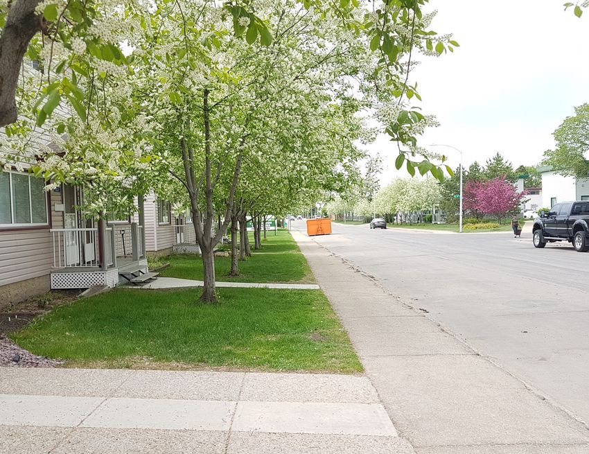
Urban Design Analysis | JUNE, 2021

List of Figures
Figure 1. Killarney kick-off party, September 2019             6   Figure 24. 132 Avenue service road looking east                          62
Figure 2. Project Team neighbourhood walk, May 2019            7   Figure 25. 132 Avenue service road looking east                          62
Figure 3. Community walk and workshop, October 2019           11   Figure 26. 127 Avenue at 93 Street                                      65
Figure 4. City of Edmonton’s Project Management Decision-           Figure 27. 127 Avenue at 95A Street                                     65
          Making Process                                      12   Figure 28. Road closure                                                  70
Figure 5. 129B Avenue roadway green space existing conditions 16   Figure 29. One-way road                                                  70
Figure 6. 129B Avenue roadway green space existing bus stop   16   Figure 30. Raised median                                                 70
Figure 7. Killarney Park 1 existing conditions                19   Figure 31. Raised median through an intersection                         71
Figure 8. Killarney Park 1 existing bench                     19   Figure 34. Mini roundabout                                               71
Figure 9. Killarney Park existing conditions                  22   Figure 32. Diagonal diverter                                             71
Figure 10. Killarney Park existing pathway and bench          22   Figure 36. Curb extensions                                               71
Figure 11. 130 Avenue roadway green space existing bench      25   Figure 33. Right-in/right-out island                                     71
Figure 12. 130 Avenue roadway green space existing conditions 25   Figure 35. Chicanes                                                      71
Figure 13. 129B Avenue looking east                           30   Figure 37. Raised intersection                                           72
Figure 14. 128 Avenue looking west                            30   Figure 38. Speed hump                                                    72
Figure 15. 132 Avenue looking east                            30   Figure 39. Raised crosswalk                                              72
Figure 16. 127 Avenue looking east                            30
Figure 17. 94A Street looking north                           32
Figure 18. 90 Street looking north                            32
Figure 19. 88 Street looking south                            32
Figure 20. 128 Avenue looking west at 92 Street               34
Figure 21. 128 Avenue looking west at 88 Street               34
Figure 22. 90 Street looking north at 129B Avenue             48
Figure 23. 90 Street looking north at 129B Avenue             48

                                                                                                                                                  3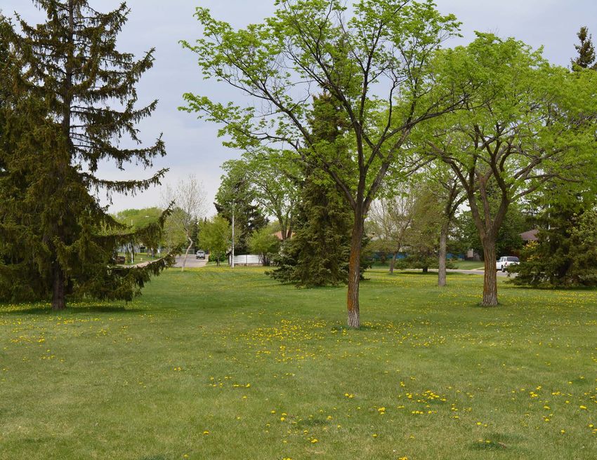
Killarney Neighbourhood Renewal

Executive Summary
The City of Edmonton’s Building Great              creating safe and welcoming park spaces;         The UDA conveys the story of how
Neighbourhoods is planning Neighbourhood           options to walk, bike and drive; creating safe   the neighbourhood design plan was
Renewal construction for Killarney starting        connections; and design for all seasons.         developed. It is used to inform decision
in 2022 with anticipated completion in 2023.       The recommended design’s outcomes are            making by the Project Team. Ultimately,
Before construction begins, an Urban Design        consistent with the community’s Vision and       implementation of the design is dependent
Analysis (UDA) is completed, which informs         Guiding Principles.                              on funding availability. Identified community
the final design. The UDA is a tool for decision                                                    enhancements unable to be included within
making, it captures the essential policy,          The recommended draft designs are classified     Neighbourhood Renewal efforts may be
technical and public input required for decision   by the overarching themes of Parks and           championed by other City programs and
making about design.                               City-owned Green Spaces, Biking, Walking,        departments or by the community itself.
                                                   and Driving/Traffic Calming. The draft designs
The public engagement process included             address gaps and create opportunities in the     Note: References to people walking within this
walking tours, workshop sessions, online           neighbourhood for each of these themes.          document include the following:
surveys, pop-up events and interactive
online events. The community identified            Community-identified issues and                  ++ People running
issues and opportunities and their feedback        opportunities were grouped by their themes.      ++ People standing
helped refine design options for Killarney         Focus areas were established at physical         ++ People using manual/motorized
Neighbourhood Renewal. Public knowledge            locations where issues and opportunities            wheelchairs or scooters
and feedback obtained throughout the               were concentrated. These focus areas             ++ People using canes or walkers
project influenced the draft design and final      included neighbourhood assets such as public     ++ People pushing strollers or carts
design. All focus area designs aim to maximize     parks and prominent streets and avenues.         ++ People pushing bicycles
the financial investments of Neighbourhood                                                          ++ And users of various other low-speed
Renewal and enhance the overall quality of life    Public feedback, City policies and technical        forms of human locomotion
in the neighbourhood.                              considerations were used to develop a series
                                                   of draft designs. An urban design framework
Residents and community stakeholders               was established to show the relationships
helped develop and refine a Vision statement       between the draft designs and the core
and six Guiding Principles to inform the           values of the community Vision.
Neighbourhood Renewal design process.
Themes highlighted within the Vision and
Guiding Principles include the importance of

4
Urban Design Analysis | JUNE, 2021

1   Public Engagement
    Summary

    A number of public engagement events were      The following provides a high-level overview
    hosted to inform the creation of the design.   of public engagement events within the
    The Concept Phase in the Building Great        following public engagement phases:
    Neighbourhoods (BGN) Public Engagement
    Plan is a time to understand the lived         Building a Project Vision Together
    experience of the community. Residents
                                                   ++ Exploring Opportunities
    and business owners identified issues and
                                                   ++ Exploring Options and Tradeoffs
    opportunities, creating solutions and helped
                                                   ++ Community Feedback on Draft Design
    refine draft design for Neighbourhood
    Renewal.

                                                                                                                                        5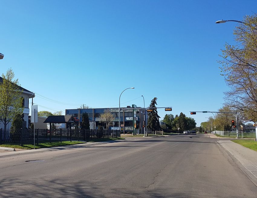
Killarney Neighbourhood Renewal

1.1   Building a Project Vision Together and Exploring Opportunities
      Public engagement process                           Community pop-ups                                What we heard
                                                          The Killarney kick-off party was held            Residents shared feedback on areas of City-
      The Killarney Neighbourhood Renewal Project
                                                          on September 22, 2019, at the Killarney          owned land and opportunities to enhance
      Team organized the following opportunities
                                                          Community League and Park. The event             the neighbourhood in coordination with
      for the public to CREATE a draft Vision and
                                                          introduced the project to the community and      the Neighbourhood Renewal project. The
      Guiding Principles for the project. These
                                                          gathered initial feedback from residents.        input from these events was used by the
      public engagement activities helped create
                                                                                                           community and City to collaboratively create
      the Project Team’s understanding of what
                                                          Two pop-up events were offered to students       a Vision and Guiding Principles.
      residents and businesses want Killarney to
                                                          at Queen Elizabeth High School and
      look like in the future.
                                                          Killarney Junior High School to share how
                                                          they experience living, moving and playing
      Online survey                                       in Killarney. In addition to the school pop-
      An online survey was available for the public       up events, the Killarney Neighbourhood
      to complete from September 22 to October 11,        Renewal Project Team joined the Killarney
      2019. The survey asked participants to share        Community Garage Sale to gather feedback
      the ways they experience living, working,           and thoughts on how residents experience
      playing and moving around the Killarney             their neighbourhood.
      neighbourhood.
                                                          Participation
      Community walk and workshop                         Over 150 participants were involved in various
      The community walk and workshop took                engagement activities in this stage.
      place on October 3, 2019, at the Killarney
      Community League Hall. Participants walked
      along one of three routes stopping at key
      locations to share their input about issues and
      opportunities for Neighbourhood Renewal.
      Attendees also participated in a series of
      small group brainstorming exercises to
      further explore issues and opportunities for
      walking, biking, rolling, driving and using parks
      and City-owned open spaces.                                                                          Figure 1. Killarney kick-off party, September 2019

      6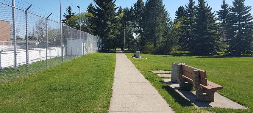
Urban Design Analysis | JUNE, 2021

1.2   Exploring Options and Tradeoffs
      Public engagement process                       Surveys
                                                      An online survey was available for the public
      In June and July 2020, Killarney residents,
                                                      to complete in June and July 2020. The
      business owners and visitors were invited to
                                                      survey presented specific design options
      join a conversation to explore design options
                                                      and features to help understand community
      for Killarney that considered issues and
                                                      preferences before incorporating them into
      opportunities identified by the community.
                                                      the draft design.
      Project Team members walked participants
      through options and asked for input on the
      following topics:                               Online sessions
                                                      12 online public workshops were held
      ++ Biking: including bike routes and types      between June and July 2020. The Project
      ++ Parks and open spaces: including types of    Team presented the design options for
         amenities                                    specific areas around the neighbourhood,
      ++ Walking: including areas where sidewalks     as well as the benefits and tradeoffs of each
         are missing or do not connect with other     design.
         existing sidewalks
      ++ Driving: including options to slow the       Attendees provided comments and feedback
         speed of traffic                             to identify their level of comfort for each
                                                      option and elements that the Project Team
      During the Exploring Options and Tradeoffs      should consider as it moves toward the draft
      stage, the Project Team distributed an online   design.
      survey, conducted meetings with community
      members and key stakeholders and hosted
      online public engagement events to gather
      input to assist us in REFINING the design
      options for the Killarney neighbourhood.
      The Project Team also provided information
      regarding cost-sharing opportunities for
      Local Improvements, including decorative
      streetlights and sidewalk reconstruction.
                                                                                                      Figure 2. Project Team neighbourhood walk, May 2019

                                                                                                                                                                  7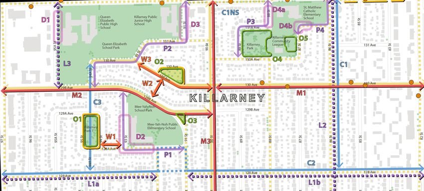
Killarney Neighbourhood Renewal

8
Urban Design Analysis | JUNE, 2021

2   Urban Design Focus
    Areas

                                                               9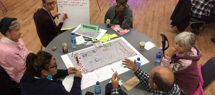
Killarney Neighbourhood Renewal

2.1   Community Vision and Guiding Principles
      The following community Vision and Guiding Principles were developed through the public engagement process. The Vision provides a short
      description that sets the direction for the community’s future livability. Guiding Principles provide ideas that inform how the Vision is applied to
      the neighbourhood design and how decisions are made.

      Public input on existing issues and future opportunities for Killarney was received at the Building a Project Vision Together stage. This feedback
      informed the development of the draft community Vision and Guiding Principles. Through the next phase, the draft community Vision and Guiding
      Principles were shared with the public.

      Community Vision

           “       Killarney is a welcoming and friendly neighbourhood defined by diverse
                   opportunities for people to live, work, play and learn. Killarney is defined
                   by its pleasant atmosphere, neighbourliness and access to a broad
                   range of amenities. The neighbourhood is family-friendly and residents
                   are well connected to parks, schools and commercial services.
                                                                                                                                ”

      10
Urban Design Analysis | JUNE, 2021
Guiding Principles
Create opportunities for Improve the safety of roadways Enhance the safety of
residents to gather with for all users including people connections to destinations
friends, family and each other who walk, bike and drive. and amenities within and
to build a sense of community outside of the neighbourhood.
and maintain the friendliness of Generate options for residents
the neighbourhood to walk, bike and drive. Ensure infrastructure considers
year-round use
Ensure parks and open spaces
are welcoming, safe and provide
a range of opportunities for all
ages
Figure 3. Community walk and workshop, October 2019
11Killarney Neighbourhood Renewal
2.2 Urban design focus areas
Building on the community Vision and Guiding Principles, the Urban Design Focus Areas, illustrated on Map 1, shows the interrelationship between
all recommended draft designs. The draft designs address gaps and create opportunities that were identified in the Urban Design Analysis
Background Report and through public engagement input. Draft designs were developed during the UDA and associated public engagement
process.
Draft urban designs
The following is a list of recommended draft designs, organized under the relevant analysis theme. Recommended draft designs for each focus
area are explained in detail in the following sections.
Parks focus areas Bike focus areas Driving and traffic calming focus areas
1. 129B Avenue roadway green space and 5. 128 Avenue bike route 9. 129B Avenue (90 to 97 Street)
road closure 6. 90 Street bike route 10. 130 Avenue (82 to 90 Street)
2. Killarney Park 1 Walking focus areas 11. 91 Street (Killarney School drop-off)
3. Killarney Park 12. 93 Street and 128A Avenue (Mee-Yah-
7. 132 Avenue new sidewalks
4. 130 Avenue roadway green space Noh School drop-off)
8. 127 Avenue new sidewalks
13. St. Matthew School and Killarney Park
PROJECT DECISION
Each draft design contains a summary of identified issues/challenges/opportunities, options
created, what we heard, a list of key features and conceptual graphics that help explain design
details. Draft designs proposed are the result of the City of Edmonton’s Project Management PUBLIC TECHNICAL
INPUT REQUIREMENTS
Decision Making process as shown below in Figure 1.
Ultimately, each recommended draft design strives to achieve public aspirations, city policies
and programs and various Design considerations and technical requirements.
CITY POLICIES
AND PROGRAMS
Figure 4. City of Edmonton’s Project Management Decision-
Making Process
12Urban Design Analysis | JUNE, 2021
Map 1. Urban Design Focus Areas
St. Cecillia Archbishop O’Leary
Catholic Junior Catholic High School
High School
82 St
O’Leary Fitness
90 St
and Leisure
97 St
95 St
91 St
Centre 132 Ave
132 Ave
7
St. Matthew
School
88 St
Queen Killarney Public
85 St
Elizabeth Junior High
Public High School 11
School 131A Ave Killarney
91 St
Community
95A St
League
13
131 Ave 3
Queen Elizabeth Killarney 131 Ave
89 St
87 St
86 St
83 St
School Park Park
St
93
90 St
130 Ave 130A Ave
130 Ave
13
94A St
130
Ave
4
130 Ave 10 130 Ave
129B Ave 9
129
BA
ve
Mee-Yah-Noh
School Park 129B Ave
129A Ave
2 1
Mee-Yah-Noh Public
Killarney Elementary School
Park 1
6
82 St
95A St
91 St
97 St
96 St
95 St
94 St
93 St
90 St
89 St
88 St
87 St
86 St
85 St
128A Ave 12
94A St
128 Ave 128 Ave
128 Ave 5
95A St
96 St
95 St
94 St
93 St
92 St
91 St
90 St
89 St
88 St
87 St
86 St
85 St
83 St
8
8 8 127 Ave
127 Ave
82 St
97 St
Killarney Neighbourhood Road Closure N 200m
Boundary
Parks Focus Areas Walking Focus Areas
Bike Focus Areas Driving and Traffic Calming
Focus Areas
13Killarney Neighbourhood Renewal 14
Urban Design Analysis | JUNE, 2021

3   Parks Focus Areas

                                                              15
Killarney Neighbourhood Renewal
3.1 129B Avenue roadway green space and road closure
Identified issues/challenges/opportunities
The following observations about the existing conditions of the
132 Ave
129B Avenue Roadway Green Space were identified through a
combination of public engagement and analysis by the Project Team:
90 St
++ Lack of lighting for people who walk and roll within the park 12
130 Ave
9B
Av
++ Opportunity to expand the area of the park e
11
++ Safety concerns related to limited sight lines and fast-moving
vehicles on 129B Avenue and 91 Street
++ Missing sidewalk connections along the south and east side of the
park
127 Ave
N
++ Amenities including waste bins and seating could make this space
200m
more attractive to community members of all ages
Key Map
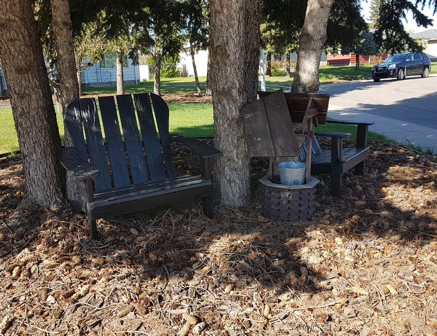
Figure 5. 129B Avenue roadway green space existing conditions Figure 6. 129B Avenue roadway green space existing bus stop
16Urban Design Analysis | JUNE, 2021
Exploring Options and Tradeoffs - 128 Avenue roadway green space and road closure
During the Exploring Options and Tradeoffs phase, the Project Team asked the public to share their feedback on the preferred improvements for
the 129B Avenue roadway green space. Options for amenities included:
++ Lighting ++ Pathways ++ Picnic tables
++ Benches ++ Waste bins ++ Or to leave the park as it is
What we heard What we considered
++ Participants indicated this park is not Vision and Guiding Principles City Policies and Programs
well used due to a lack of pathways and Aligns with the following principles: The design is informed by the following:
amenities ++ Create opportunities for residents to gather ++ Safe Mobility Strategy - support
++ Shortcutting and fast-moving vehicles with friends, family and each other to build initiatives to manage driver speeds and
are a concern on this roadway a sense of community and maintain the to stop drivers from using shortcuts to
++ Participants identified fast-moving friendliness of the neighbourhood increase the safety of all road users
vehicles create concerns regarding safety ++ Ensure parks and open spaces are ++ Access Design Guide - support access
on 91 Street, between the existing park welcoming, safe and provide a range of and use for people of all ages and abilities
and Mee-Yah-Noh School Park opportunities for all ages ++ BREATHE - Green Network Strategy -
++ Ensure infrastructure considers year-round promote an adequate supply, quality
use and distribution of open space, that is
Design considerations and technical accessible and inclusive for all
requirements ++ Corporate Tree Policy - reduce impacts
++ Work around existing underground and to trees
above ground utilities ++ Winter Design Guide - support year
++ Work around existing trees and landscaping round use through lighting
++ Align with landscaping design standards,
consider sightlines and maintain visibility
++ Design is being proposed to change the
intersection geometry to improve sightlines
and have people who drive come to a full
stop
++ Apply for road closure and rezoning/
subdivision, as required
17Killarney Neighbourhood Renewal
Community Feedback on Draft Design - 128 Avenue roadway green space and road closure
What we propose
++ To close the road along 91 Street between
the existing 129B Avenue roadway green
space and Mee-Yah-Noh School Park to Wider sidewalk 129B Avenue
increase the useable space of the park
++ To add new pathways through the park to
make it easier for people who walk and roll New sidewalk
Relocated
existing signage
to move around the park
++ To install waste bins, benches and lighting
New pathway
to improve user comfort
++ To add new landscaping to enhance the
91 Street
attractiveness and beauty of the park for New benches
users
++ To add a corner plaza as a place where
New sidewalk
neighbours can meet and get to know one
another
Road closure
New
landscaping
New pedestrian
oriented lights
New Seating Area New waste bin
N
Widen Existing Sidewalk New lighting
New Sidewalk/Pathway
Existing Sidewalk
Road Closure
18Urban Design Analysis | JUNE, 2021
3.2 Killarney Park 1
Identified issues/challenges/opportunities
The following observations about the existing conditions of Killarney
132 Ave
Park 1 were identified through a combination of public engagement and
analysis by the Project Team:
90 St
++ Missing pathway connections through the park 12
130 Ave
9B
Av
++ Opportunities for new landscaping such as trees and shrubs 22
e
++ Opportunity for new park benches and accessible seating
++ Amenities including waste bins, benches, picnic tables, shelters,
BBQ pits and lighting could make this space more attractive to
community members of all ages
127 Ave
N
200m
Key Map
Figure 7. Killarney Park 1 existing conditions Figure 8. Killarney Park 1 existing bench
19Killarney Neighbourhood Renewal
Exploring Options and Tradeoffs - Killarney Park 1
During the Exploring Options and Tradeoffs stage for the project, the Project Team asked the public to share their feedback on the preferred
improvements for Killarney Park 1. Options for amenities included:
++ Lighting ++ Picnic tables ++ Play structures
++ Beaches ++ BBQ/fire pits ++ Landscaping
++ Pathways ++ Shelters ++ Or to leave the park as it is
++ Waste bins ++ Dog parks
What we heard What we considered
++ Community members and students use Vision and Guiding Principles City Policies and Programs
this park frequently Aligns with the following principles: The design is informed by the following:
++ Some participants like the park the way ++ Create opportunities for residents to ++ Access Design Guide - support access
it is gather with friends, family and each and use for people of all ages and abilities
++ Some participants would like to see other to build a sense of community ++ BREATHE - Green Network Strategy -
new amenities added to the park such and maintain the friendliness of the promote an adequate supply, quality
as lighting, pathways, picnic tables and neighbourhood and distribution of open space, that is
benches ++ Ensure parks and open spaces are accessible and inclusive for all
++ Community members want to feel safe welcoming, safe and provide a range of ++ Corporate Tree Policy - reduce impacts
and comfortable in this park opportunities for all ages to trees
++ Participants noted concerns with irregular ++ Ensure infrastructure considers year- ++ Winter Design Guide - support year
park maintenance round use round use through lighting
Design considerations and technical
requirements
++ Work around existing underground and
above ground utilities
++ Work around existing trees and landscaping
++ Align with landscaping design standards,
consider sightlines and maintain visibility
20Urban Design Analysis | JUNE, 2021
Community Feedback on Draft Design - Killarney Park 1
What we propose
++ To add new north-south pathways to 129A Avenue
make it easier for people who walk and roll
New sidewalks New plaza and
to move around the park benches
++ To add new sidewalks on the north and
south side of the park to make it easier
for people who walk and roll to access the New pathway New seating
area and
park pedestrian-
Existing bench oriented lighting
++ To add three new plazas to encourage
neighbours to gather and meet one
another and to provide a place for children
to play
New plaza and
++ To install bins, benches and lighting along benches
the pathways to enhance user comfort
94 Street
95 Street
New pathway
New waste bin
Existing bench
New plaza
128A Avenue
New Seating Area New waste bin
N
Existing Sidewalk New lighting
New Sidewalk/Pathway
21Killarney Neighbourhood Renewal
3.3 Killarney Park
Identified issues/challenges/opportunities
The following observations about the existing conditions of Killarney
132 Ave
Park were identified through a combination of public engagement and
analysis by the Project Team: 33
90 St
++ Lack of lighting for people who walk and roll within the park 12
130 Ave
9B
++ Pathways are too narrow for waling side by side or for people Av
e
walking and rolling to pass each other
++ Missing east-west pathway connections through the park
++ Design of the park does now support activities during all seasons
++ Amenities including waste bins, picnic tables, play structures, a
127 Ave
dog park, BBQ pits and fire pits and shelters could make this space N
200m
more attractive to community members of all ages
Key Map
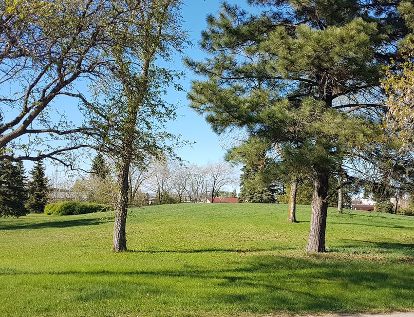
Figure 9. Killarney Park existing conditions Figure 10. Killarney Park existing pathway and bench
22Urban Design Analysis | JUNE, 2021
Exploring Options and Tradeoffs - Killarney Park
During the Exploring Options and Tradeoffs stage for the project, the Project Team asked the public to share their feedback on the preferred
improvements for Killarney Park. Options for amenities included:
++ Lighting ++ Picnic tables ++ Play structures
++ Benches ++ BBQ/firepits ++ Landscaping
++ Pathways ++ Shelters ++ Or to leave the park as it is
++ Waste bins ++ Dog parks
What we heard What we considered
++ Participants noted concerns with irregular Vision and Guiding Principles City Policies and Programs
park maintenance Aligns with the following principles: The design is informed by the following:
++ Community members and students use ++ Create opportunities for residents to gather ++ Access design guide - include access and
this park frequently with friends, family and each other to build use for people of all ages and abilities
++ Some participants would like to see new a sense of community and maintain the ++ BREATHE - Green Network Strategy -
amenities added to the park friendliness of the neighbourhood promote an adequate supply, quality
++ Community members want to feel safe ++ Ensure parks and open spaces are and distribution of open space, that is
and comfortable in this park welcoming, safe and provide a range of accessible and inclusive for all
opportunities for all ages ++ Corporate Tree Policy - reduce impacts
++ Ensure infrastructure considers year-round to trees
use ++ Winter Design Guide - enliven the
Design considerations and technical winterscape through the use of colour
requirements
++ Work around existing underground and
above ground utilities
++ Work around existing trees and landscaping
++ Align with landscaping design standards,
consider sightlines and maintain visibility
23Killarney Neighbourhood Renewal
Community Feedback on Draft Design - Killarney Park
What we propose
++ To add a new east-west 131A Avenue Wider sidewalk
diagonal pathway making it
easier for people who walk and
roll to move around the park
++ To widen the existing north-
south pathway
++ To install new waste bins,
benches and lighting along
New
the pathways to enhance user landscaping
comfort New benches
++ To widen the existing sidewalk and pedestrian-
oriented lighting
around the perimeter of the
89 Street
Killarney rink
park to enhance safety and building
comfort for people who walk
New pathway
and roll
++ To add a central focal point and New waste bins
gathering space for neighbours
Existing hill
to meet and get to know one Realign pathway
another
++ To relocate the existing
New plaza and
Killarney Park sign to align benches
with the proposed central focal
130A Avenue
point and gathering space
New Seating Area New Curb Extension
N
Widen Existing Sidewalk New waste bin
New Sidewalk/Pathway New lighting
Existing Sidewalk
24Urban Design Analysis | JUNE, 2021
3.4 130 Avenue roadway green space
Identified issues/challenges/opportunities
The following observations about the existing conditions of the
132 Ave
130 Avenue roadway green space were identified through a
combination of public engagement and analysis by the Project Team:
44
90 St
++ Missing pathway connections through the park 12
130 Ave
9B
Av
++ Sidewalks along the south side of the park that are cracked e
++ Opportunity to replace exiting benches
++ Opportunities for new landscaping such as trees and shrubs
++ Amenities including waste bins, benches and lighting could make
this space more attractive to community members of all ages
127 Ave
N
200m
Key Map
Figure 11. 130 Avenue roadway green space existing bench Figure 12. 130 Avenue roadway green space existing conditions
25Killarney Neighbourhood Renewal
Exploring Options and Tradeoffs - 130 Avenue roadway green space
During the Exploring Options and Tradeoffs stage for the project, the Project Team asked the public to share their feedback on the preferred
improvements for the 130 Avenue roadway green space. Options for amenities included:
++ Lighting ++ Picnic tables ++ Play structures
++ Benches ++ BBQ/fire pits ++ Landscaping
++ Pathways ++ Shelters ++ Or to leave the park as it is
++ Waste bins ++ Dog parks
What we heard What we considered
++ Community members noted that this Vision and Guiding Principles City Policies and Programs
park is not frequently used due to lack of Aligns with the following principles: The design is informed by the following:
amenities ++ Create opportunities for residents to gather ++ Access design guide - include access and
++ Community members support the with friends, family and each other to build use for people of all ages and abilities
addition of amenities to this park, such as: a sense of community and maintain the ++ BREATHE - Green Network Strategy -
++ Benches friendliness of the neighbourhood promote an adequate supply, quality
++ Trees and landscaping ++ Ensure parks and open spaces are and distribution of open space, that is
++ Shelters welcoming, safe and provide a range of accessible and inclusive for all
opportunities for all ages ++ Corporate Tree Policy - reduce impacts
++ Ensure infrastructure considers year-round to trees
use ++ Winter Design Guide - enliven the
Design considerations and technical winterscape through the use of colour
requirements
++ Work around existing underground and
above ground utilities
++ Work around existing trees and landscaping
++ Align with landscaping design standards,
consider sightlines and maintain visibility
26Urban Design Analysis | JUNE, 2021
Community Feedback on Draft Design - 130 Avenue roadway green space
What we propose
++ To renew the existing sidewalk on the
south side of the park to make it easier
for people who walk and roll to access the
park
++ To add a new plaza to encourage
neighbours to gather and meet one
another 130 Avenue
++ To install waste bins and benches to
enhance user comfort
++ To add planting that uses colour to enliven
the winterscape
Existing
sidewalk
130
Av
en
ue
Existing bench
New plaza, and waste bin
benches, and
landscaping
New Seating Area
N
Existing Sidewalk
New benches
New waste bin New
landscaping
27Killarney Neighbourhood Renewal 28
Urban Design Analysis | JUNE, 2021

4   Bike Focus Areas

                                                             29
Killarney Neighbourhood Renewal
4.1 Bike route options
During the Exploring Options and Tradeoffs phase of the project, we
asked the public to provide their feedback on a number of north-south
and east-west bike route options. The following options were shared
132 Ave
with the public at the July 2020 Exploring Options and Tradeoffs event. CC
90 St
East-west bike route options 12
9B
Av
130 Ave
e
AA
++ 129B Avenue (90 Street to 97 Street) and 130 Avenue (82 Street to
97 Street)
++ 128 Avenue (82 Street to 97 Street) BB
++ 132 Avenue (as a part of future collector renewal) D
D
127 Ave
++ 127 Avenue (as a part of 127 Avenue rehabilitation N
200m
++ Prefer no bike routes
Key Map
A B C D
Figure 13. 129B Avenue looking east Figure 14. 128 Avenue looking west Figure 15. 132 Avenue looking east Figure 16. 127 Avenue looking east
30Urban Design Analysis | JUNE, 2021
Exploring Options and Tradeoffs - East-west bike route options
The following table summarizes key themes we heard regarding an east-west bike route.
What we heard What we considered
++ Community members are interested in Vision and Guiding Principles ++ Connect to existing bike infrastructure
bike facilities that can provide benefits to Aligns with the following principles: in surrounding neighbourhoods and
all roadway users, including those who ++ Establish safe connections to destinations existing bike facilities
can walk, bike, and drive and amenities within the neighbourhood ++ 127 Avenue is constrained as a route due
++ Many residents value on-street parking ++ Improve the safety of roadways for all users to the privately owned sidewalks on the
++ The community identified their preference including people who walk, bike and drive south side of the roadway
for bike facilities that have minimal ++ Generate viable options for residents to City Policies and Programs
impacts on traffic flow walk, bike, and drive The design is informed by the following:
++ Participants indicated a high level of ++ Ensure infrastructure considers year-round ++ Safe Mobility Strategy and Community
support for 128 Avenue as a bike route use Traffic Management Policy - support
++ Community members are concerned with Design considerations and technical bike routes and facilities that reduce the
higher traffic volumes on 128 Avenue requirements instances of traffic fatalities and injury
++ Work around existing underground and ++ Access design guide - include access and
above ground utilities use for people of all ages and abilities
++ Minimize impact to on-street parking will ++ Edmonton Bike Plan - enhance the vision
not result in a shared pathway of a connected city by providing options
++ Minimize impact to private landscaping to help people feel safe and comfortable
within the City right-of-way riding their bikes
++ Active Transportation Policy - utilize
strategic improvements to support active
transportation
What we proposed
++ To design a bike route along 128 Avenue to enhance the feeling of safety and comfort for people who bike
++ This route connects to existing bike routes in adjacent neighbourhoods to the east and west
++ This route is located along a local residential roadway and is a direct connection through the neighbourhood that connects to a school and
local amenities along 82 Street and 97 Street
31Killarney Neighbourhood Renewal
North-south bike route options
++ 94A Street (128 Avenue to 130 Avenue)
132 Ave
++ 90 Street (127 Avenue to 132 Avenue)
++ 86 Street (128 Avenue to 132 Avenue) CC
++ Prefer no bike routes
90 St
130 Ave
12
9B
Av BB
e
AA
127 Ave
N
200m
Key Map
A B C
Figure 17. 94A Street looking north Figure 18. 90 Street looking north Figure 19. 88 Street looking south
32Urban Design Analysis | JUNE, 2021
Exploring Options and Tradeoffs - North-south bike route options
The following table summarizes key themes we heard regarding a north-south bike route.
What we heard What we considered
++ Participants indicated a high level of Vision and Guiding Principles ++ Connections to other destinations
support for 90 Street as a bike route ++ Establish safe connections to destinations in nearby neighbourhoods such as
++ Community members are interested in and amenities within the neighbourhood Glengarry and Glengarry District Park
bike facilities that can provide benefits to ++ Improve the safety of roadways for all users ++ A route that is direct and provides
all roadway users, including those who including people who walk, bike and drive connections to park spaces and schools
walk, bike, and drive ++ Generate viable options for residents to in the neighbourhood
++ Many residents value on-street parking walk, bike and drive City Policies and Programs
++ The community identified their preference ++ Ensure infrastructure considers year-round The design is informed by the following:
for bike facilities that have minimal use ++ Safe Mobility Strategy and Community
impacts on traffic flow Design considerations and technical Traffic Management Policy - support
requirements bike routes and facilities that reduce the
++ Work around existing underground and instances of traffic fatalities and injury
above ground utilities ++ Access design guide - include access and
++ Minimize impact to on-street parking to add use for people of all ages and abilities
a shared pathway ++ Edmonton Bike Plan - enhance the vision
++ Minimize impact to private landscaping of a connected city by providing options
within the City right-of-way to help people feel safe and comfortable
riding their bikes
++ Active Transportation Policy - utilize
strategic improvements to support active
transportation
What we proposed
++ To design a bike route along 90 Street to enhance the feeling of safety and comfort for people who bike
++ This route provides a central community connection within one block of multiple schools and green spaces
++ This route also provides a connection along 90 Street to the Glengarry community to the north
33Killarney Neighbourhood Renewal
4.2 128 Avenue bike route
Identified issues/challenges/opportunities
The following observations about the existing conditions of the 128
132 Ave
Avenue bike route were identified through a combination of public
engagement and analysis by the Project Team:
90 St
++ Bike facilities should be designed for all ages and abilities 12
130 Ave
9B
Av
++ On-street parking is valued by residents e
++ Important to connect to destinations within and outside of the
neighbourhood
55
++ Opportunity to connect to existing bike infrastructure in
surrounding neighbourhoods
127 Ave
N
++ Shortcutting and fast-moving vehicles are a concern
200m
++ Safety concerns related to limited sight lines
Key Map
++ Bike facilities that have minimal impact to traffic flow are preferred
Figure 20. 128 Avenue looking west at 92 Street Figure 21. 128 Avenue looking west at 88 Street
34Urban Design Analysis | JUNE, 2021
Exploring Options and Tradeoffs - 128 Avenue bike route
During the Exploring Options and Tradeoffs event, the Project Team asked the public to provide their input on three different bike route types for
128 Avenue. Benefits and tradeoffs of the following bike route types were shared with the public at the July 2020 Exploring Options and Tradeoffs
events for feedback.
Protected bike routes Benefits Tradeoffs
Protected bike routes are on-street bike ++ People who bike have their own space, ++ May result in loss of parking on one side
facilities separated from moving and parked separating them from people who drive or both sides of the street depending on
vehicles by a physical barrier. and walk width of street
++ Bike routes are prioritized for snow ++ May result in loss of two-way traffic
clearing direction
++ May result in reduction of travel lanes
What we heard
++ Community members are concerned with the loss of parking
++ Participants indicated that bikes should be separate from the sidewalk
++ Community members are concerned with the impacts on traffic movement
++ Participants noted some support for this bike route option
Shared pathway Benefits Tradeoffs
Shared pathways are for many activities and ++ People who bike can use the path in ++ People who walk and people who bike
can be used by people who bike, run, walk and both directions share the same space which can be a
more. Some sidewalks may be designated as ++ Shared pathways are prioritized for concern in high conflict areas
shared pathways. snow clearing ++ May result in potential reduction of lane
++ Typically does not result in major widths or number of travel lanes
changes to the operation of the road
What we heard
++ Participants indicated they are most comfortable with a shared pathway
++ Community members support the option as it provides more space for people who walk
and bike
++ Respondents noted concerns on the impacts to the width of the road
++ Participants support this bike route because it reduces conflicts between people who bike
and people who drive
++ Respondents are concerned with snow clearing
35Killarney Neighbourhood Renewal
Shared road bike route with measures used Benefits Tradeoffs
to slow traffic
++ On-street parking on both sides of the ++ People who bike and people who drive
Shared road bike routes use painted markings road is maintained share the road by travelling in single file
called “sharrows” or other signage to remind ++ Two-way traffic is maintained ++ Not prioritized for snow clearing; will be
people who bike and people who drive to ++ People who walk and people who bike bladed to a level snowpack along with
share the same travel lane. Shared road bike are separated residential roadways as necessary
routes can be complemented with measures ++ Landscaping within the City right-of- ++ Traffic calming measures will likely
to slow traffic speeds. way is not impacted impact design at intersections to slow
motor vehicle speeds
++ Painted markings may be difficult to
distinguish when covered by snow in the
winter
What we heard
++ Respondents indicated they prefer not to mix people who walk and people who bike
++ Community members believe this option is more suitable for roads with low traffic
volumes
++ Participants are concerned with the safety of users and noted this option is not family-
friendly
++ Respondents are concerned with snow clearing
36Urban Design Analysis | JUNE, 2021
Community Feedback on Draft Design - 128 Avenue bike route
The following table summarizes key themes we heard regarding an east-west bike route and what we considered while preparing two different
options for 128 Avenue.
What we heard What we considered
++ Community members are interested in Vision and Guiding Principles City Policies and Programs
bike facilities that can provide benefits to Aligns with the following principles: The design is informed by the following:
all roadway users, including those who ++ Establish safe connections to destinations ++ Safe Mobility Strategy and Community
can walk, bike and drive and amenities within the neighbourhood Traffic Management Policy - support
++ Residents value on-street parking ++ Improve the safety of roadways for all users bike routes and facilities that reduce the
++ The community identified their preference including people who walk, bike and drive instances of traffic fatalities and injury
for bike facilities that have minimal ++ Generate viable options for residents to ++ Access design guide - include access and
impacts on traffic flow walk, bike and drive use for people of all ages and abilities
++ Participants indicated a high level of ++ Ensure infrastructure considers year-round ++ Edmonton Bike Plan - enhance the vision
support for 128 Avenue as a bike route use of a connected city by providing options
++ Community members are concerned with Design considerations and technical to help people feel safe and comfortable
higher traffic volumes on this roadway requirements riding their bikes
++ Work around existing underground and + + Active Transportation Policy - utilize
above ground utilities strategic improvements to support active
++ Minimize impact to on-street parking transportation
++ Minimize impact to landscaping within the
City right-of-way
37Killarney Neighbourhood Renewal
128 Avenue shared pathway option
The following table summarizes key themes
we heard regarding the 128 Avenue shared
pathway and the benefits and tradeoffs of
the option.
What we heard Benefits Tradeoffs
++ Participants indicated they are most ++ People who bike can use the path in ++ There may be impacts to landscaping
comfortable with a shared pathway both directions within the City right-of-way and on
++ Community members support the ++ Priority given to snow clearing for private property
option as it provides more space for shared pathways ++ People who walk and people who bike
people who walk and bike ++ Parking is maintained on one side of the share the same space
++ Respondents noted concerns on the roadway between the following streets: ++ The roadway will be narrower in some
impacts to the width of the road ++ 95A Street to 97 Street locations, requiring drivers to yield to
++ Participants support this bike route ++ 85 Street to 90 Street oncoming vehicles
because it reduces conflicts between ++ 128 Avenue to 128A Avenue ++ Traffic calming measures will likely
people who bike and people who drive ++ Parking is maintained on both sides impact design at intersections to slow
++ Respondents are concerned with snow of the roadway between the following motor vehicle speeds
clearing streets: ++ Parking may be impacted along the
++ 92 Street to 95A Street north side of the roadway between the
++ 90 Street to 91 Street following streets:
++ 82 Street to 85 Street ++ 95A Street to 97 Street
++ Two-way traffic will be maintained ++ 85 Street to 90 Street
++ Provides a space for people of all ages ++ Parking may be impacted on east side
and abilities to ride their bike of 91 Street between 128 Avenue and
128A Avenue
++ Parking may be impacted on west side
of 92 Street between 128 Avenue and
38 128A AvenueUrban Design Analysis | JUNE, 2021
128 Avenue (97 Street - 94 Street)
Impacts to private landscaping New curb extension New curb extension New shared pathway
Impacts to parking on the Parking maintained on the Parking maintained
north side north side on the north side
94A Street
128 Avenue
95A Street
94 Street
96 Street
95 Street
97 Street
Parking maintained on the Parking maintained on the Parking maintained on the Parking maintained on the
south side south side south side south side
128 Avenue
Existing(93 Street - 91 Street)
Sidewalk New Stop Sign S
New Curb Extension Removal of Stop Sign
Wider sidewalk Existing Stop Sign
New Shared Pathway 128A Avenue
New curb extension
Existing Yield Sign
Removal of Yield Sign
Parking maintained on the
west side
Parking maintained on the Parking maintained
north side on the north side
Parking maintained on the
east side
93 Street
92 Street
91 Street
Parking maintained on the The Project Team explored Parking maintained
south side a potential connection here on the south side
Widen Existing Sidewalk, S New Stop Sign
N School Area
Existing
NewSidewalk
Shared Pathway
S New Stop Sign of Stop Sign
Removal
New Curb Extension RemovalExisting
of StopStop
SignSign
New Curb Extension
New Shared Pathway Existing Stop Sign
Existing Sidewalk Existing Yield Sign
Widen Existing Sidewalk Existing Yield Sign
Removal of Yield Sign
Removal of Yield Sign
39Killarney Neighbourhood Renewal
128 Avenue (90 Street - 88 Street)
Parking maintained on the north side Impacts to parking on the north side Impacts to parking on the north side Impacts to parking on the north side
New curb extension New curb extension New curb extension
128 Avenue
89 Street
90 Street
88 Street
Parking maintained on the south side Parking maintained on the south side Parking maintained on the south side
128 Avenue (87 Street - 85 Street)
Impacts to parking on the north side Impacts to parking on the north side Impacts to parking on the north side
Existing Sidewalk S New Stop Sign
New curb extension New curb extension New curb extension
New Curb Extension Removal of Stop Sign
New Shared Pathway Existing Stop Sign
Existing Yield Sign 128 Avenue
85 Street
86 Street
Removal of Yield Sign
87 Street
Parking maintained on the south side Parking maintained on the south side Parking maintained on the south side Parking maintained on the south side
128 Avenue (85 Street - 82 Street)
Impacts to parking on the north side Parking maintained on north side
Existing Sidewalk S New Stop Sign
New curb extension
New Curb Extension Removal of Stop Sign
New Shared Pathway Existing Stop Sign
Existing Yield 128
SignAvenue
Removal of Yield Sign
82 Street
85 Street
83 Street
Parking maintained on the south side Parking maintained on the south side Parking maintained on the south side
Widen Existing Sidewalk, S New Stop Sign
N School Area
Existing Sidewalk S New Stop Sign
New Shared Pathway Removal of Stop Sign
New Curb Extension Removal of Stop Sign
New Curb Extension Existing Stop Sign
New Shared Pathway Existing Stop Sign
Existing Sidewalk Existing Yield Sign
Existing Yield Sign
Removal of
Removal of Yield
YieldSign
Sign
40Urban Design Analysis | JUNE, 2021
128 Avenue shared road option with measures used to slow traffic
The following table summarizes key themes
we heard regarding the 128 Avenue shared
road with measures used to slow traffic and
the benefits and tradeoffs of the option.
What we heard Benefits Tradeoffs
++ Respondents indicated they prefer not ++ On-street parking on both sides of the ++ People who bike and people who drive
to mix people who walk and people who road is maintained share the road by travelling in single file
bike ++ Two-way traffic is maintained ++ Shared road bike routes do not receive
++ Community members believe this ++ People who walk and people who bike priority for snow clearing. Snow clearing
option is more suitable for roads with are separated only occurs on a standard residential
low traffic volumes ++ Landscaping within the City right-of- road schedule
++ Participants are concerned with the way is not impacted ++ Traffic calming measures will likely
safety of users and noted this option ++ Existing yield signs will be changed to impact design at intersections to slow
not a family-friendly stop signs on side streets to minimize motor vehicle speeds
++ Respondents are concerned with snow conflicts between all road users ++ Painted markings may be difficult to
clearing distinguish when covered by snow in the
winter
++ Some people who bike will still choose
to ride on the sidewalk rather than share
the road with vehicle traffic
41Killarney Neighbourhood Renewal
128 Avenue (97 Street - 94 Street)
New curb extension New curb extension
94A Street
128 Avenue
95A Street
94 Street
96 Street
95 Street
97 Street
128 Avenue
Existing(93 Street - 91 Street)
Sidewalk New Stop Sign S
New Curb Extension Removal of Stop Sign
New curb extension
Existing Stop Sign
Wider sidewalk
128A Avenue
Existing Yield Sign
New curb extension
Removal of Yield Sign
New curb extension
93 Street
92 Street
91 Street
New curb extension
Widen Existing Sidewalk, S New Stop Sign
N School Area
Existing Sidewalk S New Stop Sign
New Shared Pathway Removal of Stop Sign
New Curb Extension Removal of Stop Sign
New Curb Extension Existing Stop Sign
Widen Existing Sidewalk Existing Stop Sign
Existing Sidewalk Existing Yield Sign
Existing Yield Sign
Removal ofRemoval of Yield Sign
Yield Sign
42Urban Design Analysis | JUNE, 2021
128 Avenue (90 Street - 88 Street)
New curb extension New curb extension
128 Avenue
89 Street
90 Street
88 Street
128 Avenue (87 Street - 85 Street) Wider sidewalk
Existing Sidewalk S New Stop Sign New curb extension New curb extension
New Curb Extension Removal of Stop Sign
Existing Stop Sign
128 Avenue
Existing Yield Sign
85 Street
86 Street
87 Street
Removal of Yield Sign
128 Avenue (85 Street - 82 Street)
Existing Sidewalk S New Stop Sign Wider sidewalk
New curb extension New curb extension
New Curb Extension Removal of Stop Sign
Widen Existing Sidewalk Existing Stop Sign
Existing Yield Sign
128 Avenue
Removal of Yield Sign
82 Street
85 Street
83 Street
Widen Existing Sidewalk, S New Stop Sign
N SidewalkSchool Area
Existing S New Stop Sign
Removal of Stop SignRemoval of Stop Sign
New Shared Pathway
New Curb Extension
Existing Stop Sign
Wider Sidewalk New Curb Extension Existing Stop Sign
Existing SidewalkExisting Yield Sign Existing Yield Sign
Removal of Yield Sign
Widen Existing Sidewalk Removal of Yield Sign
43Killarney Neighbourhood Renewal
Final Design - 128 Avenue bike route
The following table summarizes key themes we heard regarding an east-west bike route and what we considered while preparing the final design
for 128 Avenue. After considering all feedback, the Project Team decided to construct a shared road bike route along 128 Avenue and a shared
pathway near Mee-Yah-Noh School.
What we heard What we considered
++ Respondents value on-street parking Vision and Guiding Principles ++ Design a shared pathway along 91 Street,
++ Those that participated identified their Aligns with the following principles: 128A Avenue, and 92 Street to reduce
preference for bike facilities that have ++ Establish safe connections to destinations potential conflicts between roadway
minimal impacts on traffic flow and and amenities within the neighbourhood users around the school
parking ++ Improve the safety of roadways for all users ++ Realign the roadway at 85 Street to
++ Respondents want to ensure the design including people who walk, bike, roll and ensure the driving lanes are aligned
of a bike route is safe, accessible and drive through the intersection
supports all ages and abilities ++ Generate viable options for residents to City Policies and Programs
++ A preference for a shared pathway next to walk, bike roll and drive The design is informed by the following:
schools ++ Ensure infrastructure considers year-round ++ Safe Mobility Strategy and Community
use Traffic Management Policy - support bike
Design considerations and technical routes and facilities that prevent injuries
requirements and encourage more people to bike
++ Design the roadway to reduce fast moving ++ Access design guide - include access and
vehicles and increase sightlines for all users, use for people of all ages and abilities
particularly around schools ++ Edmonton Bike Plan - enhance the vision
++ Construct curb extensions reduce crossing of a connected city by providing options
distances, slow fast moving vehicles and to help people feel safe and comfortable
increase sightlines for all roadway users riding their bikes
++ Design a route that can support future ++ Active Transportation Policy - utilize
enhancements identified in the Bike Plan strategic improvements to support active
transportation
++ Complete Streets Design and
Construction Standards
44Urban Design Analysis | JUNE, 2021
What we decided
++ To construct a shared road bike route ++ East-west along 128A Avenue from ++ To add new stop signs at the following
along 128 Avenue from 82 Street to 91 Street to 92 Street on the south side locations along 128 Avenue:
91 Street and from 92 Street to of the road ++ 95 Street
97 Avenue ++ North-south along 92 Street from 128 ++ 94A Street
++ To construct curb extensions along Avenue to 128A Avenue on the east ++ 94 Street
128 Avenue at the following side of the roadway ++ 93 Street
intersections: ++ To change yield signs to stop signs ++ 92 Street
++ 96 Street at the following locations along 128 ++ 91 Street
++ 90 Street Avenue: ++ 86 Street
++ 86 Street ++ 96 Street ++ To add new stop signs along 92 Street
++ 83 Street ++ 95A Street at 128A Avenue
++ To construct curb extensions along ++ 89 Street
128A Avenue at the following locations: ++ 88 Street
++ 92 Street ++ 87 Street
++ 91 Street ++ 85 Street
++ To construct a shared pathway at the ++ 83 Street
following locations
++ North-south along 91 Street from
128 Avenue to 128A Avenue on the west
side of the road
45Killarney Neighbourhood Renewal
128 Avenue (97 Street - 94 Street)
New curb extension
94A Street
128 Avenue
95A Street
94 Street
96 Street
95 Street
97 Street
128 Avenue (93 Street - 91 Street)
New curb extension
Wider sidewalk
128A Avenue New curb extension
New curb extension
New curb extension
93 Street
92 Street
91 Street
New curb extension
Widen Existing Sidewalk, S New Stop Sign
N School Area
New Curb Extension Removal of Stop Sign
Existing Sidewalk Existing Stop Sign
Existing Yield Sign
Removal of Yield Sign
46Urban Design Analysis | JUNE, 2021
128 Avenue (90 Street - 88 Street)
New curb extension
128 Avenue
89 Street
90 Street
88 Street
128 Avenue (87 Street - 85 Street) Wider sidewalk
New curb extension Realign roadway
128 Avenue
85 Street
86 Street
87 Street
128 Avenue (85 Street - 82 Street)
Wider sidewalk
Realign roadway New curb extension
128 Avenue
82 Street
85 Street
83 Street
Widen Existing Sidewalk, S New Stop Sign
N School Area
New Shared Pathway Removal of Stop Sign
New Curb Extension Existing Stop Sign
Existing Sidewalk Existing Yield Sign
Widen Existing Sidewalk Removal of Yield Sign
47Killarney Neighbourhood Renewal
4.3 90 Street bike route
Identified issues/challenges/opportunities
The following observations about the existing conditions of the 90
132 Ave
Street bike route were identified through a combination of public
engagement and analysis by the Project Team:
90 St
++ Bike facilities should be designed for all ages and abilities 12
130 Ave
9B
Av
++ On-street parking is valued by residents e 66
++ Important to connect to destinations within and outside of the
neighbourhood
++ Opportunity to connect to potential future bike infrastructure
++ Shortcutting and fast-moving vehicles are a concern
127 Ave
++ Safety concerns related to limited sight lines N
200m
++ Bike facilities that have minimal impact to traffic flow are preferred
Key Map
Figure 22. 90 Street looking north at 129B Avenue Figure 23. 90 Street looking north at 129B Avenue
48You can also read


