SOFTWARE CATALOGUE 2021 - DHI Group
←
→
Page content transcription
If your browser does not render page correctly, please read the page content below

SOFTWARE CATALOGUE 2021
OUR FOCUS IS YOU
Providing you with the right tools, support and training
is what matters. We understand how important it is to
get your project delivered on time and we have
structured our software with this in mind.
With the global reach of MIKE Powered by DHI,
we offer insight from local experts in water
environments located in more than 30 countries.
Our local staff provide support, training and
solutions - based on DHI's global knowledge of
water environments - and can act as gateways to
specialists from DHI within any given topic.
Our focus is empowering you to
perform at your best.

MIKE Powered by DHI

CONTENTS                                                                                                MIKE Powered by DHI
                                                                                                        For more than 25 years, MIKE Powered by DHI software
INTEGRATED PLATFORMS                                                                                    products have been used in water environments all over the
                                                                                                        world. Thousands of professionals choose MIKE software to
06          MIKE+
                                                                                                        solve tough and complex challenges in areas such as oceans
09          MIKE Cloud
                                                                                                        and coastlines, rivers and reservoirs, ecology, groundwater,
                                                                                                        water distribution, wastewater and many more. Our data
CITIES                                                                                                  management, decision support and operational forecasting
12          WEST
                                                                                                        software suite traverses all our areas of applications,
14          WaterNet Advisor                                                                            complementing existing MIKE technologies in the work we
                                                                                                        do for you.
COAST AND SEA
                                                                                                        THE ACADEMY by DHI
18          MIKE 21                                                                                     THE ACADEMY embraces all of DHI’s global training and
20          MIKE 3                                                                                      knowledge sharing activities. Every year, thousands of water
22          LITPACK
                                                                                                        professionals participate in our training or knowledge
23          ABM Lab
                                                                                                        sharing activities. Moreover, our user group meetings and
24          MIKE ECO Lab
25          MetOcean Data Portal & Bathymetrics Data Portal                                             seminars are famous for bringing professionals together for
                                                                                                        knowledge sharing in a relaxed and inspiring environment.

WATER RESOURCES
                                                                                                        For more information and examples of how our software
28          MIKE SHE                                                                                    products have been applied to solve complex water
30          MIKE HYDRO River                                                                            challenges worldwide, visit our website
32          MIKE HYDRO Basin                                                                            www.mikepoweredbydhi.com
33          MIKE 21C

GROUNDWATER AND POROUS MEDIA

36          FEFLOW

DATA AND OPERATIONS

40          MIKE OPERATIONS

MIKE FOR DEVELOPERS

42          MIKE API

GET ACCESS TO MIKE

44          PRICING OPTIONS

THE ACADEMY BY DHI

48          Training and capacity development
50          Events, universities, publications and newsletter

This Catalogue and the Content herein is provided on an ’as is’ basis and for informational
purposes only. DHI does not make any representation or warranty or accept any liability as to the
correctness, completeness or fitness for any purpose of the Content, including the non-
infringement of any third party rights relating to the Content. DHI shall be free, but not obligated,   © DHI 2020 | Photos: © all images used under
to provide any additional information or to update any Content, or to correct any inaccuracy or         licence from www.shutterstock.com,
error in the Content that may become known to it. The Catalogue and the Content does not                www.pexels.com, www.istockphoto.com,
constitute advice and does not create any form of client relationship with our firm.                    stock.adobe.com or DHI.
INTEGRATED PLATFORMS
DHI is leading the way in enabling scalability in the
water business across water domains—linking ports
to cities to global hydrology.
On the computational scale, we are seamlessly
bringing the nearly infinite IT resources in the
Cloud to your desktop. In the area of collaboration,
we are making it possible for you to work securely
with your team and clients anytime, anywhere, on
any device.
Platforms are evolutionary and dynamic. Over time,
they will change the way we work and interact with
water models and with each other.
Our platforms are young, and they will grow and
evolve to meet your changing needs. Come with us
on this journey and experience the power of
integrated modelling and open innovation.

INTEGRATED PLATFORMS

MIKE+
Integrated water                                With MIKE+ , you can integrate, model and manage all your water systems
                                                in one place for the most comprehensive analyses. Model water distribution,
modelling                                       collection systems, river networks and flooding within a platform that is
                                                integrative, flexible and scalable to easily discover patterns, develop predictive
                                                modelling and design more resilient water systems.

APPLICATIONS                                    MODEL MANAGER                                          MIKE+ ARCGIS

Water Distribution                              The Model Manager is the core of the MIKE+             Open the door to world-leading Esri software
• Master planning                               user interface. The wealth of features enable          by combining MIKE+ with ArcGIS Pro
• System rehabilitation and pressure
                                                you to efficiently go through all phases of            capabilities. MIKE+ ArcGIS gives you access to
  optimisation                                  preparing the model input data as well as              sophisticated spatial processing technology
                                                analyse and present results from the                   to help you efficiently prepare, analyse, and
• Leakage analysis and reduction
                                                simulation engines. Model Manager provides:            visualise spatial data.
• Fire flow analysis
                                                •   Network data management for storm                  MIKE+ ArcGIS is a complete integration of
• Water quality risk analysis
                                                    water collection systems, wastewater               water modelling and GIS. It supports model
• Transient flow analysis                           collection systems, water distribution             building, managing data and sharing results.
Collection Systems                                  systems, rivers and 2D flooding                    With MIKE+ ArcGIS, you can:
• Master planning                               •   Feature-rich in-built GIS functionality
                                                                                                       •   Prepare and integrate data from multiple
                                                    powered by ThinkGeo
• Capacity management and operational                                                                      sources and in various formats
  maintenance                                   •   Effective time series data management,
                                                                                                       •   Transform your data into maps and
                                                    comprehensive data processing and
• Wet weather management and overflows,                                                                    actionable information
                                                    manipulation tools as well as powerful data
  rainfall dependent inflows and infiltration                                                          •   Visualise, edit and analyse your data
                                                    visualisation capabilities for all data entities
  mitigation
                                                •   Result interpretation and presentation             •   Share your work online for better
• Emergency response planning for urban                                                                    collaboration
                                                    within MIKE+ Result Viewer, but also for an
  flooding
                                                    unlimited number of users with our                 •   Access ArcGIS essential and field
• Evaluation of storm water best
                                                    freeware MIKE VIEW                                     applications
  management practices and low impact
  development                                   SELECTED TOOLS
• Design and optimisation of real-time          In addition to the variety of modules, MIKE+
  controls                                      also includes a number of tools to optimise
• Sulphide gas formation analysis
                                                your work. These include:
                                                •   Scenario manager
River Networks
                                                •   Instant data validation
• River engineering and flood control
                                                •   Interpolation and assignment tool
• Reservoir operation and hydropower
                                                •   Catchment delineation tool
• Water resources and watershed
                                                •   Network simplification tool
  management
                                                •   Geocoding catchment, wastewater load
• Wetland management and restoration
                                                    and demand allocation
Flooding                                        •   Model results presentation through static
• Flood management and mitigation                   and animated time series, profiles,
• Flood risk analysis and flood hazard              thematic maps, tables and statistics
   mapping
                                                MIKE+ is available in many languages and we
• Flood contingency planning                    provide local support in more than 30
• Flood defence failure impact studies          countries. Regardless of which engine you
• Climate change assessments                    choose or which model you build, most of
                                                your data is stored in one database.

6
WATER DISTRIBUTION                                    COLLECTION SYSTEMS                                   RIVER NETWORKS

The two Water Distribution modules, EPANET            The collection system modelling is based on          The river module is based on MIKE 1D, DHI’s
and Special Analyses, are based on DHI                US-EPA SWMM engine or DHI’s multi-core               hydrodynamic engine for rivers and open
extensions to the worldwide standard                  MIKE 1D engine.                                      channels.
EPANET engine.                                        SWMM                                                 MIKE1D RIVERS
EPANET                                                This module includes US-EPA SWMM5 engine             This module simulates the flow in the natural
These modules allow the following                     for modelling stormwater and wastewater              river. It supports weirs and culverts and is
simulations for modelling water distribution          systems from primarily urban areas.                  typically used with the Rainfall Runoff module
networks:                                             Hydraulics                                           to represent hydrological inflows from the
•   Steady state simulations                                                                               catchment.
                                                      Simulates unsteady flow in pipe and channel
•   Extended period simulations                       networks including:                                  Connections can be made seamlessly
•   Water quality simulations                                                                              between pipe network and river.
                                                      •   Junctions, outfalls, dividers and storage
                                                          units. Links, pumps, orifices, weirs, outlets,   When coupled with the 2D overland module,
Demand Allocation
                                                          transects and regulators                         it provides numerous opportunities to
• Junction node demands                                                                                    analyse complex flooding issues, such as:
                                                      •   Simulation of subcritical and supercritical
• Geocoding and aggregating of
                                                          flow conditions in partially full, full and      •   Conveyance problems due to improper
  consumption data
                                                          pressurised pipes and open channels                  maintenance of vegetation
• Computing water demands for each node
                                                                                                           •   Limited upstream flood storage capacity
  of the network system                               Hydrology
                                                                                                           •   Crossing infrastructures reducing flow
Water Quality                                         Simulates the catchment rainfall routing and
                                                                                                               capacity in rivers and floodplains
                                                      infiltration with option of modelling the
• Blending water from different sources                                                                    •   Flood preventions through optimised
                                                      effects from I/I, LIDS, snow pack and
• Age of water throughout a network                   groundwater.                                             structure operation in reservoirs
• Chlorine residuals                                                                                       •   Flood impacts from dam break or levee
                                                      MIKE1D PIPEFLOW
• Growth of disinfection by-products                                                                           breach failures
                                                      This module simulates unsteady flow in pipe
• Contaminant propagation                                                                                  •   Land use changes
                                                      and channel networks including:
                                                                                                           •   Climate change flood risk impacts
SPECIAL ANALYSES                                      •   Circular manholes, junctions, retention
This module includes features such as:                    basins, soakaways. Standard and flexible
                                                          cross-sections, weirs, orifices, pumps,
•   Pressure-dependent demands
                                                          valves, flow regulators and storm water
•   Pipe criticality                                      inlets
•   Hydrant flushing                                  •   Simulation of partially full, full and
•   Multi-source tracing                                  pressurised pipes and open channels
•   Extended rule-based control, variable             •   Continuous simulations involving RDI and
    speed driven pumps and PID control                    long term statistics
•   Flow modulated pressure reducing valve            •   Optimisation of network capacity
•   Sustainability and cost analysis                  •   Wet weather management to reduce CSO
•   Fire flow analysis for calculation of available   •   Design and optimisation of real-time
    flow and residual pressure                            controls
•   Transient flow modelling using DHI’s              •   Sustainable stormwater management
    Water Hammer engine
                                                      Connections can be made seamlessly
•   Automatic calibration
                                                      between collection systems and river
                                                      networks.

                                                                                                                                                         7
FLOODING                                           CROSS DOMAIN CAPABILITIES                          INTEGRATED MODELLING

MIKE+ is an all-in-one flood modelling             MIKE+ allows you to plug and play with             More complex problems can also be
platform that is well suited for most flooding     different modules to customise water               investigated by coupling and extending
applications.                                      management solutions. These add-on                 MIKE+ with other MIKE software.
                                                   modules can be used across your collection         CONNECTION TO MIKE HYDRO RIVER
The flooding module efficiently simulates any
                                                   systems, rivers and flooding challenges:
cause of urban or riverine flooding (heavy                                                            Embedding a MIKE HYDRO River model in
local rainfall, insufficient flow capacity of      RAINFALL RUNOFF                                    MIKE+ extends its river functionalities. More
storm water inlets, overtopping of nearby          This module includes multiple rainfall-runoff      structure (bridges, control structure, etc.)
rivers) and assesses mitigation options.           models such as time area method, kinematic         and branch types become available. This also
                                                   wave including infiltration and LIDS, linear       allows users to study dam breach and
The flooding module is based on MIKE 21 FM,        reservoir and UHM.                                 additional flood remediations options.
DHI’s 2D overland flow engine.
                                                   Modelling of the rainfall dependent inflow         CONNECTION TO MIKE 21
2D OVERLAND                                        and infiltration using the RDI/I conceptual        MIKE+ Flooding module can be replaced by a
The Flexible Mesh (FM) solver offers               model for simulating continuous slow               full MIKE 21 FM model. This is useful when
maximum flexibility for detailed and tailored      response inflows due to infiltration and           studying inundation of reclaimed areas and
meshes. Its advanced handling of buildings,        groundwater.                                       flooding of coastal cities and infrastructures.
roads and rainfall is perfectly suited for urban                                                      You can also investigate the effects of coastal
                                                   Stormwater quality modelling of the build-up
flooding studies.                                                                                     protection, such as dikes, polders and tidal
                                                   and wash-off of pollutants on the sub-
By directly using your geographical land           catchments.                                        gates, or other operational structures in delta
cover data, you can easily represent the                                                              areas. Combined with one of our wave
                                                   CONTROL STRUCTURES                                 models, it offers a unique capability to
spatial variability of the roughness in your       This module features advanced real-time
domain. The depth varying roughness feature                                                           address all aspects of coastal impacts.
                                                   control capabilities. It makes the definition of
accurately represents the impact of different      complex operations logical for regulators.         CONNECTION TO MIKE SHE
land covers along the simulation.                                                                     MIKE SHE is a distributed hydrology model
                                                   TRANSPORT (AD)                                     that calculates local changes in catchment
Structures like weirs, dikes, culverts and         This module includes pollution transport by        water balances, including runoff, infiltration
operational structures can be directly             advection and dispersion including fine            and groundwater recharge. This can improve
implemented in the 2D engines.                     sediments as well as sediment transport of         MIKE+ results related to flooding caused by
Parallelisation enables 2D model                   coarse sediments.                                  climate and land use change.
performance enhancements through use of            MIKE ECO LAB                                       MIKE OPERATIONS
multiple cores and GPU-cards.                      MIKE+ enables powerful analysis of flood-          Upgrading a MIKE+ model to a real-time flood
                                                   related environmental impacts through              forecasting system can significantly decrease
                                                   dynamically coupled water quality options in       the impact of flood events. This can be easily
                                                   all engine components. See page 24.                done through MIKE OPERATIONS.
                                                                                                      WATERNET ADVISOR
                                                                                                      Extend MIKE+ with a web application that
                                                                                                      enables you to make better and faster
                                                                                                      decisions involving your water network.
                                                                                                      WaterNet Advisor gives you the ability to
                                                                                                      access your hydraulic models instantly with
                                                                                                      no special expertise required, work from
                                                                                                      anywhere— from a tablet, phone, laptop—
                                                                                                      whichever you prefer, as well as allows online
                                                                                                      control (EPANET, MIKE1D and SWMM).

                                                                                                                                                    8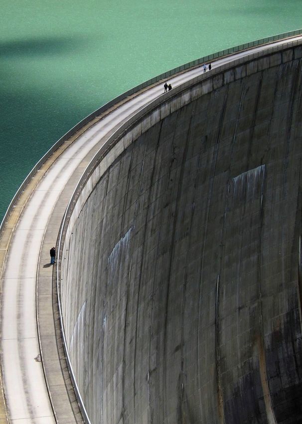
INTEGRATED PLATFORMS

MIKE CLOUD
Open innovation                                     The power of data, combined with scalable cloud computing, easy plug-in
                                                    of third-party technologies, multi-user collaboration and partnerships
platform where people,                              enable efficient and innovative ways of modelling. MIKE Cloud gives you access
technology, research and                            to a quickly evolving ecosystem for the water industry, helping you achieve
                                                    more – in less time.
business come together

COMPANY SUBSCRIPTION                                MESH BUILDER                                         FLOOD SCREENER

MIKE Cloud is DHI's cloud ecosystem for             Building high-quality meshes can require a           The Flood Screener is a drainage assessment
water experts. Built to take advantage of the       great deal of time. Automate the most time-          tool that allows for optimal screening of flood
infinite compute, storage and connectivity          consuming step in the model building                 -prone areas based on accumulated rainfall
potential of the cloud, it is clear that the MIKE   process with the Mesh Builder, and quickly           and sea level variations. Use the results to
Cloud will benefit your projects no matter          create high-quality 2D meshes for river and          help inform the creation of more detailed
where you are in the world. The open                flood applications in record time.                   flood models.
innovation platform offers a suite of web-
                                                    BENEFITS                                             BENEFITS
based modelling applications as well as the
tools you need to unlock team productivity          Mesh Builder offers a new workflow to                The application calculates flood inundation
through multi-user collaboration.                   streamline the mesh creation process. The            maps with a Digital Elevation Model (DEM),
                                                    Mesh Builder offers you:                             using user-defined rainfall amounts and
CLOUD STORAGE                                                                                            potentially sea elevation as key input. Flood
                                                    •   Smart control of mesh operations,
                                                                                                         Screener is the application for you if you wish
                                                        including full flexibility to control variable
                                                                                                         to:
At the core of MIKE Cloud is cloud storage.             mesh density
Secure, scalable, API-enabled and purpose-          •   Comprehensive toolbox to prepare your            •   Make a rapid, overall assessment of
built for the water industry, MIKE Cloud has            data                                                 potential, local flooding in the planning
specific support for Timeseries, GIS and            •   3D visualition to investigate the quality of         phase of your project
Multidimensional datasets as well as regular            the dataset and meshes                           •   Identify areas prone to flooding, and
binary files. MIKE Cloud supports and               •   Extraction of GIS vector data from Open              obtain estimates of flood extent and flood
converts most popular file formats found in             Street Map for use in the meshing process            volumes during an event
the water industry and connects easily with                                                              •   Obtain a first impression on the effect of
                                                    •   A multi-user workspace to support users
the MIKE Desktop suite and third-party                                                                       proposed physical flood protection or
                                                        working in parallel to modify, document
software like Microsoft Power BI. It is your                                                                 mitigation measures like flood walls,
                                                        and review the mesh
central hub for working with data in MIKE                                                                    diversion channels or collection ponds
applications.                                       •   A mesh generation process centred on
                                                                                                         •   Identify flood areas of particular interest
                                                        mesh quality driven by interactive
                                                        feedback                                             which require a refined and more detailed
                                                                                                             analysis with accurate, fully dynamic flood
                                                    •   Mesh scenarios tied back to the original
                                                                                                             modelling prior to final decision-making
                                                        data and embedded in a project framework
                                                    •   Significant time savings in terms of data        If you’re a MIKE user, you may export Flood
                                                        management and mesh generation                   Screener results for direct use in our 2D MIKE
                                                        allowing you to respond quickly to               flood modelling software products. This will
                                                        changing project needs                           support you in creating more detailed flood
                                                                                                         model results required for supporting project
                                                                                                         target achievements.

9
CITIES
Driven by rapid urbanisation in emerging as well as
mature markets, cities continue to grow in number
and scale. To make future cities competitive and
resilient, effective infrastructure investments and
sound planning are essential.
We help our clients solve the toughest water
challenges – even in real-time across the entire
water cycle.
Our technologies embed DHI’s industry leading
expertise and are perfect tools for developing
efficient, accurate, intelligent and resilient urban
solutions.
CITIES

WEST
Modelling and simulation                           WEST is a powerful and user-friendly software package for dynamic
                                                   modelling and simulation of wastewater treatment plants (WWTP) and
of wastewater treatment                            other types of water quality related systems. It is designed for operators,
plants                                             engineers and researchers interested in studying physical, biological or
                                                   chemical processes in WWTPs, sewer systems and rivers.

APPLICATIONS                                       APPLICATIONS                                       FEATURES

EVALUATION OF DESIGN OPTIONS                       MONITORING OF PLANT OPERATION AND                  PHYSICAL MODELS
When designing or upgrading a WWTP, WEST           TROUBLESHOOTING                                    • Preliminary treatment (screen, grit removal)
enables you to compare different design            A calibrated model of a WWTP can be used to        • Buffer and settling tanks (with reactions)
solutions in terms of performance with             predict the dynamic response to different          • Activated sludge (AS) tanks
respect to specific objectives, such as effluent   types of variations, for example in the influent
                                                                                                      • Oxidation ditch
quality, investments and operational costs.        composition, in order to identify bottlenecks
The Scenario Analysis tool and the possibility     and the appropriate countermeasures. It can        • Integrated fixed film activated sludge and
to define custom objective functions in WEST       also be used for training operators through          moving bed bioreactor (IFAS, MBBR)
allow you to select the best design for your       the offline simulation of a variety of control     • Sand and trickling filters
plant.                                             actions. The Scenario and Uncertainty              • Sequencing batch reactors (SBR)
You can also take a more conventional              Analysis tools in WEST are very beneficial to      • Membrane bioreactors (MBR)
approach to plant design by means of the           understand the complex processes taking
                                                                                                      • Upflow anaerobic sludge blanket (UASB)
Designer Application. This allows you to           place in a modern WWTP.
                                                                                                      • Sludge treatment (dewatering, aerobic and
design a WWTP according to a template and          RESEARCH AND DEVELOPMENT                             anaerobic digestion)
following a design protocol, such as ATV.          When studying novel treatment approaches,          • Heat exchanger and gas turbine
PROCESS OPTIMISATION                               you require a software tool that is both
                                                                                                      • Chemical dosing units
Improvements to the operations of a WWTP           sufficiently flexible to capture newly acquired
                                                   knowledge, such as models and data, and fast       • Disinfection
may lead to considerable benefits in terms of
                                                   enough to evaluate a large number of               • Pumps and blowers
process performance, effluent quality as well
as operational costs, for example for aeration.    alternatives within a reasonable timeframe.        • Controllers and timers
The Parameter Estimation tool enables you to       WEST excels in both areas, demonstrated by         • Nutrient recovery
identify the combination of operational            its Block Editor and Model Editor applications
                                                   (for developing custom model libraries) and        BIOCHEMICAL PROCESS MODEL
conditions that optimise a given objective.
                                                   the availability of the WEST engine on a           • Activated sludge model (ASM) no. 1,
MODEL CALIBRATION                                  number of high performance computing                 2d (with inorganic solids) and 3
Model calibration is an essential part of the      (HPC) infrastructures and supercomputers.          • Anaerobic digestion model no. 1 (ADM1)
model development process. The local and                                                                with extension for sulphur
                                                   MODELLING INTEGRATED URBAN WATER
global Sensitivity Analysis and Parameter
                                                   SYSTEMS                                            • Anaerobic ammonium oxidation
Estimation tools in WEST are invaluable to
                                                   The water quality in integrated urban                (Anammox) model
efficiently calibrate your model.
                                                   water systems (IUWS) is simulated taking           • Activated sludge models for greenhous
DEVELOPMENT OF ADVANCED CONTROL                    into account WWTPs, sewers and river                 gases (ASMG)
STRATEGIES                                         catchments. The integrated IUWS library            • Comprehensive C-N-P-S model
To assess different control strategies by          makes WEST a powerful tool to identify
                                                                                                      • Plant-wide model (PWM_ZA)
experimenting is typically a cumbersome            synergies and to globally optimise the
exercise. WEST provides flexible control                                                              • Wastewater Aerobic/Anaerobic
                                                   wastewater system performance.
models as well as automated conversion of                                                               Transformation in Sewers (WATS) model
MATLAB fuzzy logic controllers. This makes it                                                         • Integrated urban water systems (IUWS)
the tool of choice for evaluating control
strategies prior to their actual
implementation.

12
MODULES MODULES BENEFITS
WEST Basic WEST+ • User-friendly and intuitive graphical tools
This is an entry-level license that allows for This is the full product that allows you to • Extensive and transparent default model
the construction of a plant layout and the create both basic projects, which are solely library
execution of simulations. The layout is limited based on steady state or dynamic simulation, • Limitless flexibility for developing
in size and only a sub-set of all unit processes as well as more complex projects exploiting customised model libraries
can be used. All advanced features (tools and powerful tools for model calibration (Global
• Easy implementation of control strategies
experiment types) are not enabled. It is the Sensitivity Analysis and Parameter
• Customisable project documentation
ideal starting point to acquire familiarity with Estimation), reliable predictions of plant
the software and get a feeling for its huge performance (Uncertainty Analysis) and through inclusion of rich text notes and
potential. process optimisation (Parameter Estimation). automated report generation
In addition, it enables you to create entirely • Fully customisable objective functions
WEST Player
customised model libraries by using the • Wide range of statistical criteria
This module is limited to steady state and
Model Editor and Block Editor applications. • Advanced tools for scenario analysis,
dynamic simulation and the computation of
custom objective functions. Essentially, it WEST SDK sensitivity analysis, uncertainty analysis and
allows you to execute projects that are based This is a software development kit (SDK) that parameter estimation
on read-only models and plant layouts enables you to develop custom applications • Software development kit (SDK) for
prepared with higher versions of the through integration of WEST engine with integration with other software systems
software. It is well-suited for training and for other software systems, such as SCADA • Very high simulation speed
evaluation of operational strategies on a fixed systems and databases. It is an essential • Engine installable on high performance
or pre-constructed plant model. component for developing sophisticated, computing (HPC) infrastructures
WEST tailor-made decision support systems.
• Multi-language support
Based on a read-only model library, this
module enables the construction and
modification of plant layouts with no
limitations in terms of process units. For any
plant layout, it allows for the performance of
steady state and dynamic simulation as well as
computing custom objective functions. In
addition, you can exploit powerful tools for
model calibration (Global Sensitivity Analysis
and Parameter Estimation) and what-if
scenario evaluation (Scenario Analysis).
WEST is ideal for projects with limited amount
of data, limited time and need to compare
scenarios such as different loads, layout
configurations or control strategies.
13CITIES
WATERNET ADVISOR
Modelling and result WaterNet Advisor is a powerful and user-friendly web-based application for
displaying EPANET, MIKE1D, SWMM model layers, editing model data, setting
presentation through the up scenarios, as well as running and displaying model results. You can access it
web browser using a web browser on any device, such as a desktop or laptop (running on
Microsoft Windows, Apple or other operating systems), and smartphones or
tablets.
SOFTWARE USAGE AND APPLICATIONS APPLICATIONS FEATURES
Get answers at your fingertips with the WATER DISTRIBUTION Many water utility operators or emergency
WaterNet Advisor web application. Typical applications within water distribution response teams depend on experts to get
If you work with a water supply network, you are: data from the hydraulic models of the water
may find these daily operational challenges • Master planning and system rehabilitation network. This process slows down decision-
familiar: making, delays tasks and impacts your
• Pressure optimisation
bottom line.
• Where is the source of the leaking pipe? • Leakage analysis and reduction
Imagine a web application that enables you to
• Can the network provide sufficient • Fire flow analysis
make better and faster decisions – and which
pressure for a new housing area? • Shut-down planning
doesn’t require any special knowledge to
• How much water can a particular fire • Flushing programmes operate. Here are its core features:
hydrant supply? • Contaminant event analysis
• Instantly access your hydraulic models
If you work with collection systems, you may • Water quality risk analysis
• No special expertise required
find these daily operational challenges • Multi-source trace analysis
• Work anywhere
familiar: • Water age analysis
• Online control
• Where may I experience flooding in the • Online analysis based on SCADA data
network? WaterNet Advisor allows you to work with any
COLLECTION SYSTEMS MIKE+ Water Distribution (EPANET) or MIKE+
• Are there any bottlenecks or insufficient Typical applications within collection systems Collection Systems (MIKE1D, SWMM) or
capacity in the network? are: EPANET, SWMM model within Internet
• In the event of pump failure, where in the Explorer.
• Master planning and system rehabilitation
system will I experience sewer overflows?
• Optimise network capacity and It is possible to open any MIKE+ model
These challenges – and many more – often maintenance work database, display the contents of the model
need a quick response. What if you could • Wet weather management planning to using predefined layers and edit the model
have the information you need at your reduce SSOs/CSOs data using any of edit tools running on the
fingertips wherever you are? • Design and optimise real-time controls simulations based on:
With WaterNet Advisor, you can access your • Manage rainfall dependent inflow and • EPANET
hydraulic models and get immediate answers infiltration (RDI) & LTS • MIKE1D
with just a few clicks on your tablet, • Control of sulphide gas (H2S) formation • SWMM
smartphone, laptop or desktop.
• Assessments of stormwater quality and
You can also load the simulation results and
green solutions
display them in the Map view, create thematic
maps, display time series, browse and
animate the results in accordance with the
focus of the application.
14WATER DISTRIBUTION COLLECTON SYSTEMS BENEFITS
MODEL MANAGEMENT MODEL MANAGEMENT SERVER HOSTING
• Create, edit and delete a model • Create, edit and delete a model • The application can be hosted by Microsoft
• Register any MIKE+ EPANET or EPANET file • Register any MIKE+ MIKE1D file Azure or other Cloud service providers
• Register GIS layers • Register any MIKE+ SWMM or SWMM file • The applicaion can be hosted on-premise
• Share the model with other users or keep it • Register GIS layers • There is no need for any software
private • Share the model with other users or keep it
installation on end-user devices as the
private application runs from within the web
SCENARIO MANAGEMENT browser
• Create, edit and delete a scenario SCENARIO MANAGEMENT
MODEL SHARING
• Share the scenario with other users or keep • Create, edit and delete a scenario
• Hydraulic models are shared by multiple
it private • Share the scenario with other users or keep
users across the organisation
HYDRAULIC MODELLING - EPANET it private
• Models can be accessed by multiple users
• Editing (tanks, reservoirs, pipes, pumps, HYDRAULIC MODELLING - MIKE1D at the same time
valves, node demands) • Editing (manholes, basins, soakaways, • Various users roles (administrator,
• Hydraulic analysis (steady state, extended pipes, pumps, valves, orifices, weirs and modeller, reviewer, manager, etc) are
period analysis) gates, wastewater loads) available
• Fire flow analysis • Hydrology and Hydraulic analysis
EASY-TO-USE
• Network capacity analysis • Flow trace analysis
• Use case-driven interface
• Water age analysis
RESULTS PRESENTATION • The user selects a predefined task from the
• Multi-source trace analysis • Map views list and the application displays all relevant
• Contaminant event analysis • Information browser entries on a single screen
• Flow trace analysis • Time series • No special expertise required when the
• Online analysis (may require additional • Scatter plots
application is used for information
software) browsing
• Profile plots
RESULTS PRESENTATION • Animations
• Map views
• Information browser
• Time series
• Scatter plots
• Profile plots
• Animations
15COAST AND SEA Human activities at sea are growing and becoming ever more complex in sectors such as transport, energy and aquaculture. With increasing demands for coastal resources, advanced expertise and technologies are necessary to analyse these complex challenges and find optimal solutions. Our numerical modelling software embeds DHI’s industry leading expertise and provides maximum versatility and quality in coastal and marine modelling. Our technologies help clients develop efficient, reliable and sustainable solutions.
COAST AND SEA

MIKE 21
2D modelling                                           MIKE 21 is by far the most versatile tool for coastal modelling. If you need to
                                                       simulate physical, chemical or biological processes in coastal or marine
of coast and sea                                       areas, MIKE 21 has the tools you need.

APPLICATIONS                                           ENGINES                                            MODULES

The following is a small subset of the almost          MIKE 21 comprises the following simulation         MIKE 21 is modular. You buy what you need
endless list of possible MIKE 21 applications.         engines:                                           and nothing more. It includes a wide range of
TYPICAL APPLICATIONS                                   • Single Grid, which is a classic rectilinear      modules, allowing you to create your own
                                                         model that is easy to set up and with easy       tailored modelling framework for your
MIKE 21 is the ideal software for:
                                                         I/O exchange                                     coastal and marine studies.
•    Design assessment for coastal and offshore
                                                       • Multiple Grids, which is a dynamically           PP - PREPROCESSING AND
     structures
                                                         nested rectilinear model with the ability to     POSTPROCESSING
•    Optimisation of port layouts and coastal            focus the grid resolution                        This module offers an integrated work
     protection measures
                                                       • Flexible Mesh, which allows maximum              environment which provides convenient and
•    Cooling water, desalination and                                                                      compatible routines to ease the tasks of data
                                                         flexibility for adapting grid resolution of
     recirculation analysis                              the model domain                                 input, analysis and presentation of simulation
•    Optimisation of coastal outfalls                                                                     results.
                                                       PARALLEL PROCESSING (CPU)
•    Environmental impact assessment of                                                                   HD - HYDRODYNAMICS
     marine infrastructures                            All Flexible Mesh and Single Grid engines
                                                       support parallel processing. The Flexible          This module simulates water level variations
•    Ecological modelling including                                                                       and flows in response to a variety of forcing
                                                       Mesh (FM) engines show excellent
     optimisation of aquaculture systems                                                                  functions.
                                                       performance when parallel processing is
•    Optimisation of renewable energy systems          undertaken - also on a large number of             AD - TRANSPORT
•    Water forecast for safe marine operations         computational cores. On multicore Windows          This simulates the transport, dispersion and
     and navigation                                    computers, parallelisation is menu-driven and      decay of dissolved or suspended substances.
•    Coastal flooding and storm surge warnings         straightforward. The FM engines are also           It is typically used in cooling water and
•    Inland river, flooding and overland flow          available for Linux, which gives the possibility   wastewater discharge studies.
     modelling                                         to utilise High Performance Computing (HPC)
                                                                                                          COUPLED MODELLING
                                                       systems.
                                                                                                          The FM series include a powerful, integrated
                                                       GRAPHICAL PROCESSING UNITS (GPU)                   system which, in a surprisingly easy manner,
                                                       For the FM engines, the use of graphical           combines wave, flow and sediment transport
                                                       processing units (GPU) is also supported and       models into a fully dynamic morphological
                                                       gives easy access to spectacular increases in      model.
                                                       simulation speed.

The unique 3-in-1 package includes all three engines
in one great package deal.                             Example of CPU-based speedup tests.

18
MODULES MODULES BENEFITS
MIKE 21 includes the following modules MIKE 21 includes the following modules MIKE 21 is proven technology. No other
specifically for sediment transport and water specifically for wave modelling. modelling package has been used for as many
quality modelling. SW - SPECTRAL WAVES coastal and marine engineering projects
ST - SAND TRANSPORT around the world as MIKE 21.
This is a spectral wind-wave model that
This is an advanced sand transport model simulates the growth, decay and The recipe for the unique success of MIKE 21
with several formulations for current as well transformation of wind-generated waves and is simple. It gives you maximum flexibility,
as current-wave generated transport, swell. higher productivity and full confidence in the
including 3D description of sediment BW - BOUSSINESQ WAVES results.
transport rates. It is, for example, used for
The state-of-the-art tool for studies and Also, MIKE 21 is much more than just the
morphological optimisation of port layouts,
analyses of wave disturbance in ports, right tool for your project. It also gives access
impact of shore protection schemes and
harbours and coastal areas. It includes full surf to other benefits of MIKE software products,
stability of tidal inlets.
and swash zone dynamics. including unparalleled technical support,
MT - MUD TRANSPORT training courses and access to DHI’s expertise
MA – MOORING ANALYSIS
This is a combined multi-fraction and multi- and know-how regardless of where you are in
This module simulates the motions of single
layered model that describes erosion, the world.
or multiple vessels subject to winds, waves
transport and deposition of mud (cohesive
and currents. It also calculates the forces in MIKE 21 also comes with a wealth of first class
sediment) or mixtures of sand and mud.
fenders and mooring lines and can directly tools that enhance and ease modelling
PT - PARTICLE TRACKING use results from MIKE 21 BW, MIKE 3 possibilities.
This module simulates transport and fate of Wave FM and MIKE 21 HD as input.
dissolved and suspended substances, MIKE C-MAP and MIKE ANIMATOR PLUS
SELECTED TOOLS IN MIKE 21
including sediments. Setting up the basic model bathymetries is
In addition to its variety of modules, MIKE 21
SM - SHORELINE MORPHOLOGY also includes a number of tools to optimise normally a tedious and expensive part of
This module combines detailed 2D modelling your work. Here is a subset of tools: coastal and marine modelling projects. MIKE
of currents and waves with a constrained C-MAP can reduce this task to minutes,
• Global tide data and tools for tidal analysis
morphological model, making it possible to offering model bathymetries generated fast
and prediction and easy from an electronic chart database.
undertake fast, stable and robust modelling
• MIKE’s Climate Change Editor With MIKE C-Map, you no longer need to
of shoreline evolution in 2D environments.
• Cyclone wind generation and wind manually digitise your model bathymetries.
OS - OIL SPILL generation from pressure maps
This module simulates the spreading and Regardless of how well you undertake your
• Advanced mesh and grid generators and modelling work, clear communication of
weathering of hydrocarbons and is used for
editors results is crucial to its value and recognition.
oil spill modelling.
• Advanced tools for generation of graphical MIKE ANIMATOR PLUS turns model results
MIKE ECO LAB - ECOLOGICAL MODELLING output into amazing 3D video presentations,
This is a complete numerical laboratory for • An interface (API) for reading and facilitates communication between specialists
water quality and ecological modelling. See modifying files in MIKE 21’s internal, binary and non-specialists, and demonstrates your
page 24. format modelling insights better than any printed
ABM LAB - AGENT BASED MODELLING material.
This is a flexible numerical laboratory used to
define agents, their behaviour and states. See
page 23.
19COAST AND SEA
MIKE 3
3D modelling MIKE 3 provides the simulation tools you need to model 3D free surface
flows and associated sediment or water quality processes. All over the world,
of coast and sea MIKE 3 is widely recognised as the platinum standard for environmental and
ecological studies.
APPLICATIONS ENGINES MODULES
The following is a small subset of the almost MIKE 3 offers our state-of-the-art Flexible MIKE 3 is modular. You buy what you need
endless list of possible MIKE 3 applications. Mesh (FM) simulation engine which allows and nothing more. It includes a wide range of
TYPICAL APPLICATIONS maximum flexibility for adapting grid modules, allowing you to create your own
resolution of the model domain tailored modelling framework for your
MIKE 3 is the ideal software for:
SHORT DESCRIPTION environmental and ecological studies.
• Assessment of hydrographic conditions for
The model solves the 3D incompressible PP - PREPROCESSING AND
design, construction and operation of
Reynolds averaged Navier-Stokes equations. POSTPROCESSING
structures and plants in stratified waters
Both the full 3D Navier-Stokes equations This module offers an integrated work
• Coastal and oceanographic circulation
(non-hydrostatic) and the 3D shallow water environment which provides convenient and
studies including fine sediment dynamics
equations (hydrostatic) can be applied. Thus, compatible routines to ease the task of data
• Optimisation of coastal, thermal or the model consists of continuity, momentum, input, analysis and presentation of simulation
wastewater disposal outlets temperature, salinity and density equations results. If you already have MIKE 21, you do
• Environmental impact assessment of and is closed by a turbulent closure scheme. not need another PP module for your MIKE 3
marine infrastructures installation on the same PC.
The spatial discretisation of the governing
• Ecological modelling including equations is performed using a cell-centred HD - HYDRODYNAMICS
optimisation of aquaculture systems finite volume method on triangular , This module simulates the water level
• Lake hydrodynamics and ecology quadrangular or mixed element domains, variations and flows in response to a variety of
• Coastal and marine restoration projects employing a shock-capturing Riemann solver forcing functions. It includes a wide range of
• Analysis and optimisation of cooling water to ensure robust and stable simulation of hydraulic phenomena in the simulations and
recirculation and desalination flows. it can be used for any 3D free surface flow.
PARALLEL PROCESSING (CPU) The Flexible Mesh engine, which uses a depth
The Flexible Mesh (FM) engines show and surface adaptive vertical grid, is
excellent performance when parallel particularly suitable in areas with a high tidal
processing is undertaken - also on a large range.
number of computational cores. On AD - TRANSPORT
multicore Windows computers, parallelisation This simulates the transport, dispersion and
is menu-driven and straightforward. decay of dissolved or suspended substances.
The FM engines are also available for Linux, It is typically used in cooling water and
which gives the possibility to utilise High sewage outfall studies.
Performance Computing (HPC) systems. UAS – UNDERWATER ACOUSTIC
GRAPHICAL PROCESSING UNITS (GPU) SIMULATOR
For the FM engines, the use of graphical This module offers modelling of the
processing units (GPU) is also supported and propagation of underwater noise from a
gives easy access to spectacular increases in variety of man-made activities at sea. It is the
simulation speed. ideal tool for managing noise impacts.
20MODULES MODULES BENEFITS
MIKE 3 includes the following modules OS - OIL SPILL MIKE 3 builds on the same solid technology
specifically for sediment transport and water This module simulates the spreading and as MIKE 21 and is the obvious choice when
quality modelling. weathering of suspended substances and is your project requires 3D modelling.
ST - SAND TRANSPORT used for forecasting of oil spills, spill
If you are familiar with MIKE 21, you will
The advanced sand transport model in MIKE scenarios for contingency plans and so on.
immediately feel at home with MIKE 3. With
21 has been ported to MIKE 3 and MIKE ECO LAB - ECOLOGICAL MODELLING the combination of the two in your toolbox,
dynamically coupled to the 3D hydrodynamic This is a complete numerical laboratory for hardly any coastal or marine modelling job
flow model. MIKE 3 ST includes two options water quality and ecological modelling. See will exceed your capabilities.
for extracting 2D information from the 3D page 24.
flow: mean and derivation or bed shear If you are not yet an expert in 3D modelling,
ABM LAB - AGENT-BASED MODELLING you do not have to go far for assistance.
stress. This extends the use further into, for
This is a flexible numerical laboratory used to Expert support is available from any of our
example, river morphology and to areas with
define agents, their behaviour and states. See more than 30 offices around the world.
current circulation such as confined bays.
page 23.
MT - MUD TRANSPORT MIKE 3 comes with a wealth of first class tools
SELECTED TOOLS IN MIKE 3 that enhance and ease modelling
This is a combined multi-fraction and multi-
In addition to its variety of modules, MIKE 3 possibilities.
layer model that describes erosion, transport
also includes a number of tools to optimise
and deposition of mud (cohesive sediments). MIKE C-MAP and MIKE ANIMATOR PLUS
your work. Here is a subset of tools:
A dredging module has been added to the
versatile features of the MT module, allowing • Global tide data and tools for tidal analysis Setting up the basic model bathymetries is
dynamic simulation of all stages of the and prediction normally a tedious and expensive part of
dredging process. coastal and marine modelling projects. MIKE
• MIKE’s Climate Change Editor
C-MAP can reduce this task to minutes,
PT - PARTICLE TRACKING • Cyclone wind generation and wind offering model bathymetries generated fast
This simulates transport and fate of dissolved generation from pressure maps and easy from an electronic chart database.
and suspended substances. It is, for example, • Advanced mesh and grid generators and With MIKE C-Map, you no longer need to
used for risk analyses, accidental spillage and editors manually digitise your model bathymetries.
monitoring of dredging works. • Advanced tools for generation of Regardless of how well you undertake your
WFM - WAVES graphical output modelling work, clear communication of
The state-of-the-art flexible mesh tool for • An interface (API) for reading and results is crucial to its value and recognition.
simulating fully non-linear and fully dispersive modifying files in MIKE 3’s internal, binary MIKE ANIMATOR PLUS turns model results
3D wave kinematics with no depth format into amazing 3D video presentations,
restrictions in the model domain. Featuring facilitates communication between specialists
excellent flood & dry capabilities, the tool and non-specialists, and demonstrates your
handles run-up and overtopping events in modelling insights better than any printed
coastal flooding studies exceptionally well. material.
BOUNDARY CONDITIONS GENERATOR
Create high quality MIKE 3 HD boundary
conditions automatically in a matter of
minutes. This advanced online tool is a free
premium feature for our SMA customers –
Try it out today:
https://boundary-generator.dhigroup.com
21COAST AND SEA
LITPACK
Littoral processes and Design and implementation of efficient coastline management strategies,
locally as well as regionally, require detailed knowledge of the physical
coastline kinetics processes controlling the transport and sedimentation of beach materials.
LITPACK models apply a unique deterministic approach to give you a
powerful tool for a wide range of coastal zone management applications.
APPLICATIONS MODULES BENEFITS
LITPACK is applicable for a wide range of LITPACK includes the same well-proven LITPACK is proven science turned into a
coastal management and optimisation graphical user interface (GUI) as our MIKE 21 productive tool for coastal engineers.
projects. and MIKE 3 products.
It combines unique expert knowledge about
TYPICAL APPLICATIONS PP - PREPROCESSING AND physical processes within waves, currents and
LITPACK is the ideal software for: POSTPROCESSING sediment transport with efficient numerical
• Impact assessment of coastal works on LITPACK also utilises the same pre-processing simulation and an efficient user interface. The
coastline dynamics and post-processing (PP) module as MIKE 21 professional user is able to undertake
and MIKE 3. This module provides an complex studies in a productive and safe
• Evaluation of different designs and types of
integrated work environment with manner.
coastal constructions, including groynes,
convenient and compatible routines. It
revetments, harbours and breakwaters To facilitate this, LITPACK also contains a
simplifies the tasks of data input, analysis and
• Optimisation of beach redevelopment presentation of simulation results. series of productivity tools, such as graphical
plans, including artificial nourishment editors and animated presentation of results.
If you already have a MIKE 21 or a MIKE 3 on
• Design and evaluation of coastal LITPACK simulates a wide range of wave and
the same installation, you do not need an
protection current scenarios along straight or nearly
additional PP module for LITPACK.
• Execution of morphological baseline straight coastlines. It combines these
studies. These studies often lead to the THE CORE OF LITPACK: SEDIMENT
simulations into predictions of coastal
definition of more detailed studies TRANSPORT MODEL
profiles and long-term coastline evolution.
undertaken with other tools The core of LITPACK is the sediment
transport model - a deterministic description MIKE C-MAP and MIKE ANIMATOR PLUS
of non-cohesive sediment transport in a Setting up the basic model bathymetries is
single point. For decades, this model has normally a tedious and expensive part of
been used and improved and has proven very coastal and marine modelling projects. MIKE
reliable. C-MAP can reduce this task to minutes,
Applying the model in a series of points in a offering model bathymetries generated fast
profile and using the actual wave and current and easy from an electronic chart database.
climate permit the calculation of the littoral With MIKE C-Map, you no longer need to
drift and annual net and gross sediment manually digitise your model bathymetries.
transport. The combination of these data Regardless of how well you undertake your
enables modelling and analysis of coastline modelling work, clear communication of
evolution, including the effects of results is crucial to its value and recognition.
constructions and other measures on the MIKE ANIMATOR PLUS turns model results
coastline. into amazing 3D video presentations,
facilitates communication between specialists
and non-specialists, and demonstrates your
modelling insights better than any printed
material.
22COAST AND SEA
ABM LAB
Agent based ABM Lab offers unique integration of agent based modelling with classical
water quality and hydrodynamic modelling. It is possible to address questions
modelling beyond the scope of more traditional water quality and ecological models.
ABM Lab is a flexible numerical laboratory used to define agents, their
behaviour and states.
APPLICATIONS FEATURES BENEFITS
ABM Lab is a flexible numerical laboratory ABM Lab is a general tool which permits you Combined with the hydrodynamic MIKE
where the user can define agents, their to define agents, including their internal state models and MIKE ECO Lab, ABM Lab is unique
behaviour and states. It integrates with our and processes, movement, interaction with for undertaking agent based modelling.
hydrodynamic models in two and three the environment as well as interaction with
It is possible to establish a user-friendly tool
dimensions (MIKE 21 and MIKE 3). other agents of the same or different types.
that makes it feasible to apply this type of
The Lagrangian ABM Lab can work with the With ABM Lab, you can model: technique in the context of real engineering
hydrodynamics alone, or it can be combined • Movement, which can be passive (drift) projects.
with the Eulerian MIKE ECO Lab in order to or active (depending on other model
make the agents react to water quality MIKE C-MAP and MIKE ANIMATOR PLUS
parameters). The resulting movement
parameters. can be the sum of several independent Setting up the basic model bathymetries is
TYPICAL APPLICATIONS movement vectors normally a tedious and expensive part of
ABM Lab is the ideal software for: coastal and marine modelling projects. MIKE
• Sensing, where the individual's sensing
C-MAP can reduce this task to minutes,
• Numerical modelling of the impacts of of the environment and of other agents
offering model bathymetries generated fast
dredging plumes on coral spawning and is done through ‘Restricted Area Search
and easy from an electronic chart database.
recruitment Functions’
With MIKE C-Map, you no longer need to
• Modelling eelgrass succession patterns • Interaction with other elements, including manually digitise your model bathymetries.
and determining the recolonisation of functions such as create, split, remove,
eliminate and transfer Regardless of how well you undertake your
eelgrass
modelling work, clear communication of
• Modelling the migration of salmonid fish The use of these functions permits modelling results is crucial to its value and recognition.
larvae through different wetland of complicated behaviours such as: MIKE ANIMATOR PLUS turns model results
construction designs • Complicated horizontal and vertical into amazing 3D video presentations,
• Modelling of bull shark migration patterns movement facilitates communication between specialists
in a semi-enclosed ecosystem • Migration and swarming and non-specialists, and demonstrates your
• Foraging and breeding
modelling insights better than any printed
material.
• Growth, death and predator-prey relations
23COAST AND SEA
MIKE ECO LAB
Ecological With MIKE ECO Lab you get a complete numerical laboratory for water
quality and ecological modelling. You can develop exactly the model you
modelling need and describe the processes you wish. No ecological problem is too
made simple simple or too complicated for MIKE ECO Lab and there is no time-consuming
programming involved.
APPLICATIONS FEATURES BENEFITS
With MIKE ECO Lab, you simply define the One of the preconditions of ecological MIKE ECO Lab combines the best of two
process using standard templates as a basis. modelling is an accurate flow model for the worlds - you get access to our well-proven
It lets you transform any aquatic ecosystem area of interest. MIKE ECO Lab integrates and widely used standard water quality
into a reliable numerical model for accurate seamlessly with the MIKE suite of flow models and you get complete freedom to
predictions. simulation models covering all aspects - include your own know-how or research
ranging from 1D, 2D and 3D free surface ideas and test them against your field data.
TYPICAL APPLICATIONS modelling to integrated hydrology: MIKE ECO Lab models work across the range
MIKE ECO Lab is the ideal software for: of 1D, 2D and 3D MIKE modelling packages -
• MIKE HYDRO River (1D)
• Water quality and ecological studies as will your own templates.
• MIKE 21 (2D)
related to subsurface and groundwater,
• MIKE 3 (3D) You can focus on the processes and forget
rivers, wetlands, lakes, reservoirs,
• MIKE SHE (Hydrology) about programming. You can exchange ideas
estuaries, coastal waters and the sea
• MIKE+ Collection Systems (MIKE 1D) and models with colleagues around the
• Spatial predictions of any ecosystem world. Simply send them a copy of your
response MIKE ECO Lab works out of the box, using templates.
• Simple and complex water quality studies predefined templates covering standard
water quality issues. As MIKE ECO Lab contains a generic equation
• Impact and remediation studies
solver, it can also be used for generic
• Planning and permitting studies The predefined templates can be used as the post-processing of hydrodynamic results, for
• Water quality forecasts basis for user-defined ecosystem models. example, in calculating flood risk indices or
You may also start from a blank template scour risk formula.
making use of the wide range of libraries of
MIKE C-MAP and MIKE ANIMATOR PLUS
constants and functions, which make it easy
to generate and edit your own templates. Setting up the basic model bathymetries is
normally a tedious and expensive part of
coastal and marine modelling projects. MIKE
C-MAP can reduce this task to minutes,
offering model bathymetries generated fast
and easy from an electronic chart database.
With MIKE C-Map, you no longer need to
manually digitise your model bathymetries.
Regardless of how well you undertake your
modelling work, clear communication of
results is crucial to its value and recognition.
MIKE ANIMATOR PLUS turns model results
into amazing 3D video presentations,
facilitates communication between specialists
and non-specialists, and demonstrates your
modelling insights better than any printed
material.
24You can also read