TOWN OF DOUGLAS - MUNICIPAL VULNERABILITY PREPAREDNESS SUMMARY OF FINDINGS MAY 2020 - Mass.gov
←
→
Page content transcription
If your browser does not render page correctly, please read the page content below
TOWN OF DOUGLAS

MUNICIPAL VULNERABILITY PREPAREDNESS
SUMMARY OF FINDINGS

MAY 2020
LAST REVISED 5/26/2020

With Assistance from
CONTENTS
Town of Douglas ............................................................................................................................. 0
CMRPC Mission ............................................................................................................................... 2
Our History and Progress ................................................................................................................ 2
Federal Title VI/Nondiscrimination Protections ............................................................................. 2
State Nondiscrimination Protections .............................................................................................. 2
Acknowledgements......................................................................................................................... 3
     The Core Team .......................................................................................................................... 3
Executive Order 569 and the Massachusetts Municipal Vulnerability Preparedness program .... 4
Douglas: A Profile ............................................................................................................................ 5
Workshop Summary ....................................................................................................................... 6
     Core Team and Project Team ................................................................................................... 6
     Douglas Residents and Invitees ................................................................................................ 7
     Workshop Invitees and Participants ......................................................................................... 8
     Top Hazards .............................................................................................................................. 9
Summary of Findings..................................................................................................................... 11
Current Concerns and Challenges Presented by Hazards and Climate Change ........................... 11
Vulnerable Areas ........................................................................................................................... 13
Specific Categories of Concerns and Challenges .......................................................................... 14
     Infrastructure Concerns: ......................................................................................................... 14
     Societal Concerns: ................................................................................................................... 16
     Environmental Concerns:........................................................................................................ 18
Current Strengths and Assets ....................................................................................................... 20
     Infrastructure Strengths: ........................................................................................................ 20
     Societal Strengths: .................................................................................................................. 21
     Environmental Strengths: ....................................................................................................... 22
Recommendations to Improve Resilience .................................................................................... 22
     Infrastructure Actions ............................................................................................................. 23
     Societal Actions ....................................................................................................................... 23
     Environmental Actions ............................................................................................................ 24
     Top Recommendations ........................................................................................................... 25
Appendix ....................................................................................................................................... 29

Douglas MVP Summary of Findings
May 2020
                                                                                                                                                 1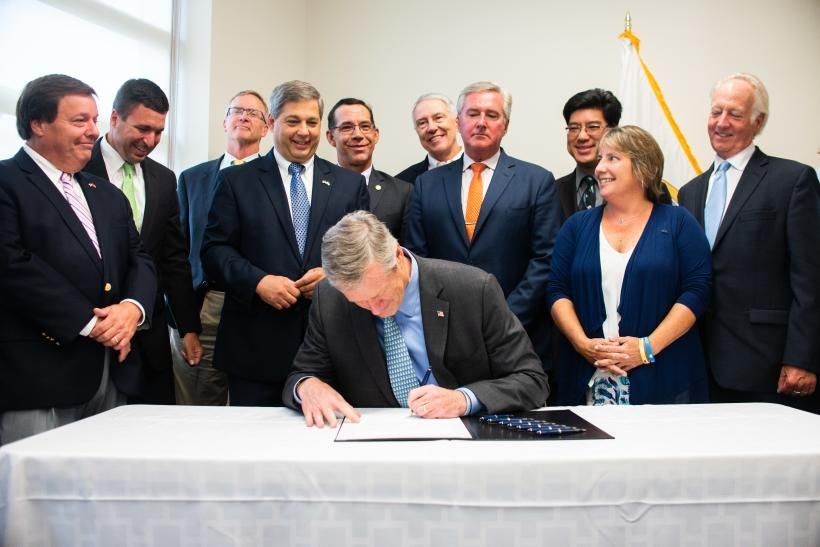
CMRPC MISSION
The Central Massachusetts Regional Planning Commission is a regional
partnership serving the planning and development interests of 40
member communities in southern Worcester County in
Massachusetts. Our primary mission is to improve the quality of life for
those who live and work in our region.

We do this by (1) addressing growth and development issues that extend
beyond community boundaries; (2) maintaining the region’s certification for federal transportation
improvement funds; (3) providing technical knowledge an resources to assist local government in addressing
specific land use, economic or environmental problems resulting from growth or decline, and (4) building
strong working relationships with member communities, state and federal officials, as well as the range of area
stakeholders.

OUR HISTORY AND PROGRESS
Founded by the Massachusetts Legislature in 1963, the Central
Massachusetts Regional Planning Commission (CMRPC) provides a
variety of services to its constituencies and brings a regional perspective
to planning and development. One of 13 regional planning agencies in
Massachusetts, CMRPC serves the city of Worcester and 39 surrounding
communities in the southern two-thirds of Worcester County. CMPRC’s
programs include Transportation, Regional Services, Geographic
Information Systems (GIS), and Community Development and Planning.

 FEDERAL TITLE VI/NONDISCRIMINATION PROTECTIONS
 The Central Massachusetts Metropolitan Planning Organization (CMMPO) hereby states its policy to operate its
 programs, services and activities in full compliance with federal nondiscrimination laws including Title VI of the
 Civil Rights Act of 1964 (Title VI), the Civil Rights Restoration Act of 1987, and related federal and state statutes and
 regulations. Title VI prohibits discrimination in federally assisted programs and requires that no person in the
 United States of America shall, on the grounds of race, color, or national origin, including limited English
 proficiency, be excluded from participation in, be denied the benefits of, or be otherwise subjected to
 discrimination under any program or activity receiving Federal assistance. Related federal nondiscrimination laws
 administered by the Federal Highway Administration, the Federal Transit Administration, or both prohibit
 discrimination on the basis of age, sex, and disability. These protected categories are contemplated within the
 CMMPO’s Title VI Programs consistent with federal and state interpretation and administration. Additionally, the
 CMMPO provides meaningful access to its programs, services, and activities to individuals with limited English
 proficiency, in compliance with US Department of Transportation policy and guidance on federal Executive Order
 13166.

 STATE NONDISCRIMINATION PROTECTIONS
 The CMMPO also complies with the Massachusetts Public Accommodation Law, M.G.L. c272§§ 92a, 98, 98a,
 prohibiting making any distinction, discrimination, or restriction in admission to or treatment in a place of public
 accommodation based on race, color, religious creed, national origin, sex, sexual orientation, disability or ancestry.
 Likewise, CMMPO complies with the Governor’s Executive Order 526, section 4, requiring all programs, activities
 and services provided, performed, licensed, chartered, funded, regulated, or contracted for by the state shall be
Douglas  MVPwithout
 conducted     Summary   of Findings
                     unlawful  discrimination based on race, color, age, gender, ethnicity, sexual orientation, gender
May  2020or expression, religion, creed, ancestry, national origin, disability, veteran’s status (including Vietnam-era
 identity
 veterans), or background.                                                                                         2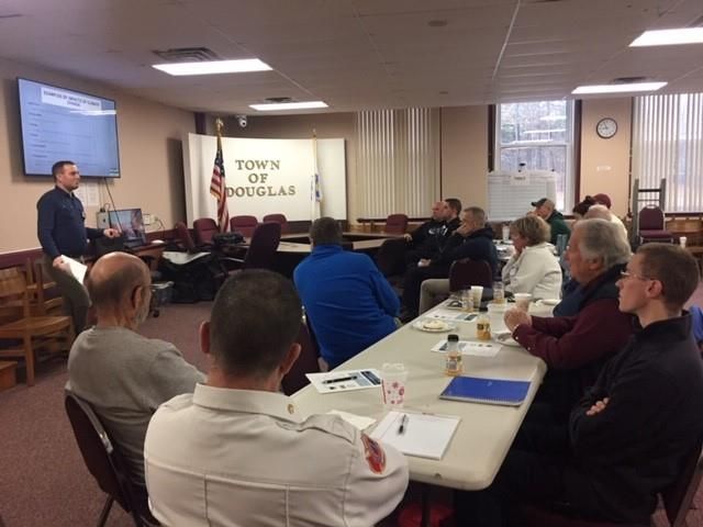
ACKNOWLEDGEMENTS
This Community Resiliency Workshop has been prepared for the community of Douglas by the
Central Massachusetts Regional Planning Commission with funding from the Massachusetts
Municipal Vulnerability Program. The MVP encourages cities and towns to begin the process of
planning for climate change and for implementing priority projects to safeguard against
identifiable hazards. Communities that complete the MVP program and develop action-oriented
resiliency plans become certified and are eligible for additional MVP Action Grant funding and
other opportunities.

The Core Team
The CMRPC would like to acknowledge the Town of Douglas and its residents for their time and
hard work in participating in this project. These include, but are not limited to:

                           Bill Cundiff, Town Engineer, Project lead

                         John Furno, Town Highways Superintendent

                                    Kent Vinson, Fire Chief

                              Matt Wojcik, Town Administrator

                                  Nick Miglionico, Police Chief

                   Robert Sullivan, Town Water & Sewer Systems Manager

The following individuals were directly and personally involved in planning and conducting the
Douglas Community Resilience Building Workshop:

                          Peter Peloquin, Associate Planner, CMRPC

                           Ian McElwee, Associate Planner, CMRPC

                           Andrew Loew, Principal Planner, CMRPC

                          Danielle Marini, Associate Planner, CMRPC

                           Sarah Adams, Principal Planner, CMRPC

                          Hillary King, Regional Coordinator, EOEEA

Douglas MVP Summary of Findings
May 2020
                                                                                            3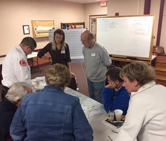
EXECUTIVE ORDER 569 AND THE MASSACHUSETTS MUNICIPAL
VULNERABILITY PREPAREDNESS PROGRAM
In September 2016, Massachusetts Governor Baker signed Executive Order 569, directing
multiple state agencies to develop and implement a statewide comprehensive climate
adaptation plan with the best climate-change data available. Recognizing that many adaptation
solutions are local in nature, a key commitment of Executive Order 569 is to assist local
governments in completing their own assessments and resiliency plans. The MVP Grant and
Designation Program represent the first step in fulfilling this commitment.

The MVP program provides planning grants to municipalities to complete vulnerability
assessments and develop action-oriented resiliency plans. Funding is used by cities and towns to
hire a MVP-certified consultant who is trained to provide technical assistance and complete a
community's vulnerability assessment and resiliency plan using the Community Resilience
Building (CRB) Framework. Towns and cities are free to choose the consultant of their choice
from a list of certified MVP providers. The Town of Douglas invited the Central Massachusetts
Regional Planning Commission to lead them in this planning effort.

Communities that complete the MVP planning process become certified "MVP Communities" and
are eligible for Action Grant funding and other opportunities through the Commonwealth.

Governor Baker signing legislation to authorize capital allocations for investments in climate change adaptation, environmental
                                    protection, and community investments. Retrieved from
      https://www.mass.gov/news/governor-baker-signs-legislation-directing-24-billion-to-climate-change-adaptation

Douglas MVP Summary of Findings
May 2020
                                                                                                                             4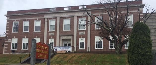
DOUGLAS: A PROFILE
Located in the southern portion of Worcester County, MA, and bordering the states of Rhode
Island and Connecticut, Douglas was first settled in 1715 and officially incorporated in 1746.
According to the United States Census Bureau, the town has a total area of 37.7 square miles of
which 36.4 square miles is land and 1.3 square miles is water.

The Town of Douglas is dominated by forested land, with the Department of Conservation and
Recreation owned Douglas State Forest occupying one quarter of the area of the town. A
tributary of the Blackstone River, the Mumford River flows through the town, linking the Whitin
Reservoir, Mumford River Reservoir, and Gilboa Pond, all within the town, then flowing eastward
into the neighboring town of Uxbridge.

As of the 2010 census, there were 8,471 people residing in the town. The population density was
240 people per square mile. Approximately 97 percent of its residents were Caucasian. The
median age of residents was 42 with 27 percent of residents under the age of 18. According to
the 2017 American Community Survey, the median income for the town was $94,675 with four
percent of the population living below the poverty line.

The northeastern portion of the town known as East Douglas is the most densely settled area of
the town and has the oldest infrastructure in the town, including the North St. Bridge over the
Mumford River. The eastern portion of the town is served by municipal wells and town sewer,
while the remainder relies on septic systems and private wells. Emergency services in Douglas
are a hybrid of professional and volunteer; professional police force and two professional fire
staff on duty at all times with volunteers able to be called in for major events. Douglas has several
town facilities, including a Town Hall, Fire and Police stations, a wastewater treatment plant,
drinking water wells, one high school, one middle school, and two elementary schools.

                       The Douglas Municipal Center, Photo by Peter Peloquin.

Douglas MVP Summary of Findings
May 2020
                                                                                                   5
WORKSHOP SUMMARY
November 20, 2019, 8:00am – 4:30pm, Douglas Municipal Center:
CMRPC Presenters: Peter Peloquin, Ian McElwee, Andrew Loew
EOEEA Presenter: Hillary King
Total Attendees: 20

The Town of Douglas’ Municipal Vulnerability Preparedness (MVP) workshop was held on
November 20, 2019 at the Douglas Municipal Center. Douglas contracted with the Central
Massachusetts Regional Planning Commission (CMRPC) to serve as the MVP provider, including
the Community Resilience Building (CRB) Workshop. A small group of Town officials and board
members convened on August 10, 2019 to form the ‘Core Team’ which, together with CMRPC
staff, organized and planned the day.

Core Team and Project Team
 Name             Affiliation           Role
 Bill Cundiff     Town of Douglas       Engineer, Project Lead
 Robert Sullivan  Town of Douglas       Water & Sewer Systems Manager
 John Furno       Town of Douglas       Highways Superintendent
 Kent Vinson      Town of Douglas       Fire Chief
 Matt Wojcik      Town of Douglas       Administrator
 Nick Miglionico  Town of Douglas       Police Chief
 Peter Peloquin   CMRPC                 Associate Planner, Staff Lead
 Ian McElwee      CMRPC                 Associate Planner

The Workshop’s goal was to identify top hazards and develop strategies to enhance the town’s
resiliency related to climate change. Following the CRB work plan process, CMRPC facilitators and
planners gave three presentations:

           •   Information about the CRB process and the MVP program.
           •   A summary of climate change projections and a detailed profile of natural hazards
               in the Town of Douglas, including the top four hazards perceived by the core team.
           •   Description of climate mitigation strategies.

CMRPC facilitators then guided stakeholders in small groups to Identify the resources of the Town
and:
          • Identify the Town’s most serious concerns regarding natural and climate-related
              hazards that threaten their community.
          • Categorize existing and potential strengths and vulnerabilities.

Douglas MVP Summary of Findings
May 2020
                                                                                               6
Next, Hillary King of the Executive Office of Energy and Environmental Affairs presented examples
of projects from other municipalities in the state that were funded by MVP Action Grants,
providing inspiration for participants to:

             •    Develop and prioritize actions to prevent or allay threats.
             •    Identify opportunities for collaboration aimed at increasing the Town’s resilience.

Douglas Residents and Invitees

Twenty people attended the MVP Workshop, including representatives from the town
government, emergency services, the MVP Core team and the Department of Conservation and
Recreation which has significant land holdings in town. One person from the Senior Center along
with local three students from Douglas High School acted as scribes, and contributed their
perspective as well.

Participants were divided among four tables where they discussed issues raised during the
presentations, completed the Community Resilience Building matrices, and annotated maps with
the locations of opportunities or vulnerable areas in Douglas. CMRPC staff helped to facilitate
discussions at each table. A public listening session to discuss MVP results and recommendations
for future actions was held on February 4, 2020. Between the two meetings, a total of 35 people
participated in the process.

  MVP workshop participants identifying locations of opportunities or vulnerable areas in Douglas, Photo by Peter Peloquin.

Douglas MVP Summary of Findings
May 2020
                                                                                                                              7
Workshop Invitees and Participants

 Name                      Affiliation                         Attended   Table #
 Carol Gogolinski          Local Developer / Various Boards        Y          1
 Kent Vinson               Fire Chief                              Y          1
 Matthew Wojcik            Town Administrator                      Y          1
 Michael Fitzpatrick       Local Developer / Various Boards        N          1
 Patrice Rousseau          Adult Center                            Y          1
 Nick Daley                Emergency Mgmt Asst. Dir                Y          2
 Adam Furno                Facilities Maintenance                  Y          2
 Cary Vandenakker          DCR                                     Y          2
 Chuck Stone               DCR                                     Y          2
 Robert Minarik            Economic Development Committee          Y          2
 William Cundiff           Town Engineer                           Y          2
 Colin Haire               Local Developer / Various Boards        Y          3
 Daniel Heney              Local Developer / Various Boards        N          3
 John Furno                Highway Supt. / Deputy Fire Chief       N          3
 Kevin Morse               Board of Selectmen                      N          3
 Matthew Keith             Fire Department Intern                  Y          3
 Robert Larson             DCR - Fire District #7                  N          3
 Timothy Bonin             Board of Selectmen                      N          4
 Andy Leonard              Pyne Sand and Stone                     N          4
 Ernest Marks              Planning Board Chair                    N          4
 Linda Brown               Conservation / Various Boards           Y          4
 John C Coyne              Fire Department                         Y          4
 Nick Miglionico           Police Chief                            Y          4
 Robert Sullivan           Water/Sewer Supt.                       Y          4
 Shirley Mosczynski        Fmr. Selectman, Various Boards          N          4
 Christin Waller           Douglas High School                     Y          1
 Lauren D'Amico            Douglas High School                     Y          2
 Angelina Carneiro         Douglas High School                     Y          4
 Janis Duchan              Adult Center                            Y          3

Douglas MVP Summary of Findings
May 2020
                                                                                    8
Top Hazards
The hazards identified by the Core Team and workshop participants are flood, drought, winter
storms, and wind events. In 2016, Douglas experienced extreme drought along with the majority
of the state of Massachusetts. In the late 1990s a wildfire burned a 200-acre area east of Whitin
Reservoir. And in 2001, a larger wildfire burned 600 acres in the northwest portion of Town.
Severe storms, including high wind and intense rainfall, have been increasing in frequency. All of
these have caused disruption to the town, including localized flooding, power outages, and calling
upon mutual aid agreements. With climate change, all of these types of events are expected to
increase in severity and frequency.
FLOODING
DROUGHTS & WILDFIRES Expected increase in
Projecting an increase of
precipitation across all seasons.
consecutive dry days, with the Heavy rainfall will become more
driest periods in the summer and
frequent, increasing the risk for
fall. This leads to increased
flash floods. Also increases non-
wildfire risk and stress on
point source pollution.
drinking water systems.
WINTER STORMS HIGH WIND
Annual days below freezing will Intensity of storm events is
decrease resulting in winter expected to increase due to the
precipitation falling as rain or warmer atmosphere. This will
freezing rain. This increases risk lead to increased severe
for ice storms and flash flooding thunderstorm and hurricane
when rain falls on frozen ground.
activity with higher wind speeds.
Flooding. Extreme weather in recent years demonstrates how various hazards impact the town.
There have been numerous flooding events over the years. Specific areas with critical
infrastructure have been shown to be prone to flooding, thereby creating a variety of safety
concerns.
Winter Storms. Winter ice storms are a regional problem every winter, and are expected to be
more intense, include more mixed participation, and will damage trees, power lines, and other
infrastructure.
Droughts/Wildfires. The frequency of wildfires is expected to increase due to the impact of
prolonged droughts and extreme heat. Drier forests and wooded areas will be more combustible
in drought conditions. Drought will also likely lead to water shortages impacting the entire town
whether or not residents and businesses are on town water or have wells.
Douglas MVP Summary of Findings
May 2020
9High Wind. Heavy wind events are of primary concern as well. The town and the surrounding
area have experienced an uptick in storms with hurricane-level winds. This phenomenon can be
linked in part to the previously mentioned increase in average temperature and rising
precipitation rates. However, the fourth hazard is focused primarily on the winds associated with
these storms, leaving heavy rain events to be discussed under flooding.
The workshop participants agreed that different hazards affect the town at different times of the
year. Flexibility and comprehensive response by town officials is needed to ensure the safety of
the citizens in different hazard situations exacerbated by climate change.
The climate projections that these conclusions were based on include data provided by the
Massachusetts Climate Clearinghouse as well as watershed-specific data from the Northeast
Climate Adaptation Science Center (NECASC) at the University of Massachusetts at Amherst. For
the Blackstone River Basin, projections show an expected increase in precipitation overall, with
the greatest increase in the
winter. The number of days
with over 2” of rainfall,
potentially leading to inland
flooding, is also expected to
increase, with the average
expected to be close to 15
days by the year 2100
compared with approximately
10 days currently. Consecutive
dry days and days above 90
degrees Fahrenheit are
expected to increase, leading
to longer periods of drought,
and days above freezing are
also expected to increase,
leading to a greater likelihood
of freezing rain in the winter Workshop attendees listening to the 2019 Douglas MVP presentation.
and higher wind as storm severity
increases with warmer temperatures.
Douglas MVP Summary of Findings
May 2020
10SUMMARY OF FINDINGS
Overall, the workshop was received positively. Though some attendees questioned the accuracy
of the presented climate projections, they agreed with the goal of being better prepared and
more resilient as a town. Following the presentations, participants were asked if they agreed with
the core team’s identification of, in no particular order, flooding, drought and wildfire, winter
storms, and high wind as the primary hazards facing Douglas. All of the participants felt these
hazards were the most relevant for Douglas.
The Town’s emergency shelters and backup generators were described as strengths, along with
mutual aid agreements with neighboring towns. Budget and tax burden were considered a
weakness and barrier to action identified by several attendees, along with a complex relationship
between the town and the Whitin Reservoir Water District. Other vulnerabilities mentioned were
issues of tree health and maintenance, water provision for firefighting, and local bridges, culverts,
and dams.
Recommendations centered on emergency response, water and power resources, and road
infrastructure. Each table identified specific vulnerable locations that are already in need of
attention and will likely face worsening impacts due to climate change. These include the North
Street Bridge, properties adjacent to water bodies, the Whitins Reservoir Causeway, and forests
throughout the town.
CURRENT CONCERNS AND CHALLENGES PRESENTED BY HAZARDS AND CLIMATE
CHANGE
At the workshop, CMRPC staff presented downscaled climate change data provided by
Massachusetts’s Executive Office of Energy and Environment Affairs (EOEEA) and the Northeast
Climate Science Center at the University of Massachusetts, Amherst. Douglas lies mostly in the
Blackstone River Basin, and should projections for the watershed hold true, by mid-century,
annual average temperatures will increase in the range of 3 to 6.4 degrees from the historical
baseline. Hot days over 90 degrees will increase 8 to 29 days annually by mid-century, and will
increase 11 to 69 days annually by end of century. Days below freezing will fall 19 to 38 days
annually; annual precipitation will increase by 1.2 to 6.3 inches. Seasonal drought conditions will
become more frequent as precipitation becomes more concentrated in extreme intensity events
and winter snowpack is reduced. The fall season is expected to experience an increase of 0-3 days
in consecutive dry days by the end of the century. Some of the challenges of these projected
changes – many of which are already being observed – were discussed in a presentation at the
workshop focused on specific hazards in the Douglas area.
Challenges highlighted in the presentations and/or discussed as a group or in the breakout
groups:
➢ In general, attendees cited concerns that climate change will exacerbate problems that
are already apparent and the town lacks the resources to address comprehensively. These
Douglas MVP Summary of Findings
May 2020
11problems include flooding and storm water management, vulnerable roads, ecological
damage, and vulnerable populations, all within the context of a small community.
➢ An increase in hot and warm days and decrease in cold days will mean increased need for
cooling and less need for heating, especially among vulnerable groups such as children
and seniors. This concern was elevated because of the Town’s electrical grids.
Transmission lines are already at maximum capacity and will not be able to handle
increased air conditioning loads as hot days increase.
➢ Increased temperatures are also expected to cause changes in the water cycle, which will
lead to more intense rain events. Increased precipitation rates will lead to more frequent
and severe flooding in areas outside of designated flood zones defined using historical
data, particularly along Route 16 in front of the fire station.
➢ Increased storm intensity will likely cause more tree damage leading to power outages
and road closures, higher peak river flows requiring new approaches to storm water
management, and increased erosion of river and brook banks and nearby infrastructure.
Severe storms will still likely damage and impact the power lines throughout the town
and especially the overhead transmission lines owned and maintained by National Grid.
Tree damage will occur from intense wind storms such as recent tornadoes or from heavy
snow and ice storms.
➢ More frequent and severe droughts will challenge water supplies and increase risks from
wildfire. Increased risk of wildfire can lead to a wide-range of ecological outcomes
including increased damage to human property and life, removal of suitable habitat
space, and changes in ecosystem services made available by forest cover.
➢ Invasive plant and animal species can impact public health through increasing numbers
of disease carrying pests (e.g., ticks and mosquitoes) and by damaging key ecosystems
such as forests and wetlands, thereby increasing wildfire and flood risks.
As the climate continues to change and natural disasters increase in frequency and strength there
is a greater need to communicate with residents, businesses, and other institutions. Changing
climate will dictate the need for enhanced communications systems and related infrastructure
and flexible emergency response and evacuation plans. These flexible response and evacuation
plans will be particularly important for the senior citizens who live alone and do not have access
to a vehicle.
Douglas MVP Summary of Findings
May 2020
12VULNERABLE AREAS
The locations in Douglas identified by workshop VULNERABLE AREAS
participants during discussion as vulnerable to the
hazards discussed include areas adjacent to water • Forested Areas
bodies, forested areas, roadways that frequently • Localized Flooding
flood, and neighborhoods that are dense and difficult
• Dams
to access in case of emergency.
• Safety Education
Forested areas throughout town are vulnerable to
increasing pressures from heat, drought, and invasive
insect species. Questions of state, town, or private ownership, the aging tree population, and the
lack of fire safety awareness is of concern for the overall health of the forested areas covering
approximately 73% of the Town. Roadside trees were also noted as a vulnerability due to tree
cutting and maintenance, especially those areas managed by National Grid.
Localized flooding was identified on Route 16 immediately in front of the Douglas Fire
Department. This is a particular concern because it could impede emergency response. Other
roadway flooding concerns include SE Main Street, Linden Street, and Shore Road.
Neighborhoods that are low-lying and near water are at risk for flooding, especially those near
Wallum Lake, Whitin Reservoir, the Mumford River, and senior housing along Centerville Brook.
Crossings over streams and the Mumford River are vulnerable as increased precipitation and
intensity of storms raise water levels. In particular, the North Street Bridge has been identified
as a bottleneck for evacuation and vulnerable to high water and debris flow in case of flooding.
Dams were considered vulnerable to all groups during the breakout session. There are 20
regulated dams in town, 1 of which is designated as High Hazard, and 3 that are identified as
Significant Hazard dams. The Whitin Reservoir Dam was designated as High Hazard, and the
Dudley Pond Dam, the Douglas Mill Pond Dam, and the Hunts Pond Dam were all designated as
Significant Hazards. The Gilboa Pond Dam, Potter Road Dam, Wallis Pond Dam, Morse Pond Dam,
and Riddle Road Pond Dam were all designated as Low Hazard. The Wallis Pond Dam and the
Whitin Reservoir Dam were thought of to be upgraded or replaced. In addition to town-wide
dams, many participants discussed beaver dams and beaver activities as points of concerns. Dams
outside of town, such as the High Hazard designated dams in Sutton, could also have negative
impacts to Douglas.
Public safety education and training was also a worry to all groups. A lack of education on fire
hazards and fire safety was concerning due to the due to the projected increases in temperature
and drought. Attendees identified several other areas in need of better emergency planning and
training, such as runoff pollution prevention, evacuation planning, and information on insect-
borne disease, specifically Eastern Equine Encephalitis (EEE) and Lyme Disease.
Douglas MVP Summary of Findings
May 2020
13SPECIFIC CATEGORIES OF CONCERNS AND CHALLENGES
Identification of current concerns and challenges was part of the first step in completing the
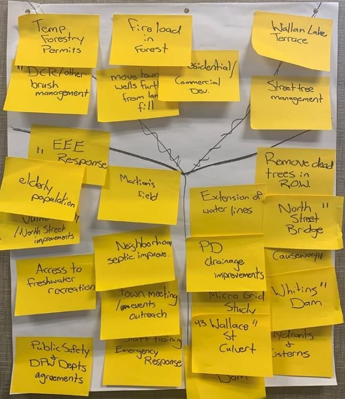
Community Resilience Building (CRB) Matrix at each table. These topics are compiled from the
matrices from all four tables at the Douglas MVP Workshop.
Infrastructure Concerns:
INFRASTRUCTURE
Water Service
The Town of Douglas is impacted by two subcategories • Water Services
of water service: limited geographic coverage, and poor • Dams, Culverts, Bridges
system infrastructure. The limited geographic coverage • Tree Management
of a public water system will have negative impacts on • Municipal Facilities
both firefighting efforts and drinking water. During • Flood/Stormwater
workshop discussions, it was noted that the western Management
side of town lacks public water service. Within the
Blackstone River Basin, an increase in consecutive dry
days is projected. The fall and summer seasons are expected to continue to experience the
highest number of consecutive dry days. As these occurrences of drought increase, the fuel load
in forests and fire risks will also increase. Those areas outside of the town’s water district,
particularly the northeast corner, will require water to be brought in via tanker or pumped from
nearby surface water bodies for firefighting. If fires are not an issue, access to drinking water will
be. With more dry days, well pump outage could increase and will lead to emergency water
needs.
Poor water system infrastructure was also discussed as an area of concern. The town has
experienced a number of water main breaks. Route 16 was noted as having frequent water main
breaks leading to constant flooding. The East Douglas neighborhood, especially upper North
Street, also experiences water main breaks frequently. Not only will water main breaks lead to
increased flooding and cause concern during fires and droughts, they can also increase risk of
contaminants. Efforts should be made to study the existing public water systems to see where
services could be expanded or updated with better source protections and infrastructure.
Dams, Culverts, and Bridges
There are a number of dams, culverts, and bridges located throughout town. Each of these
features contribute to the ongoing flooding issues in town and should be addressed. As stated
above, the Town of Douglas has 20 regulated dams. The Whitin Reservoir Dam is designated as a
high hazard dam. Dams assigned as high hazard are those where failure or mis-operation may
cause loss of human life. The emergency spillway at the northwest corner of the reservoir no
longer functions, and water levels have not been well-managed due to issues with ownership
between the Town and the Whitin Reservoir Watershed District. Another dam of concern that
Douglas MVP Summary of Findings
May 2020
14was discussed is the Wallis Pond Dam. The Wallis Pond Dam is designated as a low hazard dam,
meaning that failure or mis-operation results in no probable loss of human life and low economic
and/or environmental losses. While it is only designated as low hazard, attendees noted that the
dam is not sufficient and should either be upgraded or replaced. In addition to these two dams
of concern, there are also several high hazard dams located in the Town of Sutton. Failures with
any of these dams could negatively impact Douglas, which lies just south of Sutton.
Douglas has a number of culverted streams throughout town, several of which have been
identified by workshop participants as currently undersized. Notable culverts were located at the
Whitin Reservoir causeway, Wallis Street, and North Street. As precipitation volume and intense
rain events increase with climate change, these culverts will not be able to handle the capacity
of water needing to flow through them. The Wallis Street culvert is currently a 3-sided culvert. It
should be replaced with a box culvert, the causeway should be elevated, and the road should be
widened in order to increase capacity. The North Street Bridge over the Mumford River was
identified by several participants as a concern because of its low arch over the water and narrow
roadway. The low arch is a risk during flooding when debris may become trapped under the
bridge, and the narrow roadway creates a bottleneck along an important evacuation route for
the town. The spillway there should be replaced and a culvert should be installed. Though not as
high a risk, the Mechanic Street bridge over the Mumford River is low and should also be
upgraded.
Tree Management
Street trees are a critical tool in managing and mitigating the effects of climate change. They, like
their forest counterparts, have the ability to sequester carbon and remove CO2 from the
atmosphere. They can also provide shading to houses, people, and infrastructure. While street
trees can be helpful in mitigating climate change effects, they can also be vulnerable to them as
well. The Town of Douglas has many streets trees that will be at risk as climate change impacts
worsen. As winter storms and high wind events increase, dead, dying, and unhealthy trees could
be at risk of falling or losing limbs. Fallen trees can cause power outages and roadway hazards.
Trimming and monitoring trees on a regular basis can help trees stay healthy longer. Though the
Town of Douglas has a tree trimming program, funding and ownership control has been a
concern. Due to a lack of funding, tree trimming has not been sufficient town-wide, and especially
along Manchaug Street, Gilboa Street, and Route 16. In addition, the town shares tree trimming
responsibilities with National Grid. Those areas managed by National Grid are of great concern
because they abut the utility lines in town. If a high wind event occurs and causes these trees to
fall or lose limbs, utility lines could be damaged causing power outages across town.
Municipal Facilities
The town is fortunate to have a number of Municipal facilities throughout town. However, it was
noted that several of these facilities need significant upgrades or redesigns. Municipal buildings
throughout town will require a roof maintenance study. In particular, the Town Hall, Douglas
High School, Douglas Middle School, and Douglas Elementary School all have a flat roof. Flat roofs
Douglas MVP Summary of Findings
May 2020
15are at risk for pooling water, snow build up, and extreme changes in temperature. As rain events
become more frequent, pooling water will become more frequent, leading to damage and
potential leakage. As the climate changes snow events may not be as frequent, but the snow will
be heavier and will pose more risks as it builds up on flat roofs. In addition, the schools also serve
as shelters in case of emergency. While it is considered a strength to have these shelters in town,
the current sites have limited access. In the event of an evacuation emergency, it could be
difficult to safely access these shelters.
In addition to the buildings and shelters in town, it was also noted that there is a lack of capacity
on the transmission lines throughout Douglas. These transmission lines are already functioning
at maximum capacity. As the temperatures increase and as hot days become more frequent, air
conditioning usage will increase. The current transmission lines will be unable to handle the
increased air conditioning loads.
Flood/Stormwater Management
As rain events become more frequent, and precipitation volumes increase, flooding hazards will
increase. Flooding risks are already a major concern in town, so this risk will only worsen with
climate change. Southeast Main Street, Linden Street, and Perry Street were identified as areas
where groundwater is heaving the road from below. This flooding could impede travel and is
causing roadway destruction. Route 16 was another area of concern as it was identified as
flooding frequently, especially in front of the fire station. Flooding here could impede emergency
response. There was also concern for storm drains and catch basins throughout town, such as at
the Police Station.
Societal Concerns:
SOCIETAL
Senior Residents
The Riddlebrook Apartments is a senior housing • Senior Residents
community in Douglas. It is located on West Street, • Flood-Prone Neighborhoods
south of the Mumford River and east of the Centerville • Community Preparedness
Brook. Though the senior community within Douglas is • Recreational Programming
considered a strength, these residents will need greater
assistance in times of emergency. Senior citizens will
feel the effects of climate change more than other
citizens in town. Due to their age, they will be more vulnerable to both extreme temperatures
and the limited drinking water supply that will accompany drought and hot days. In addition,
older residents are more susceptible to disease, particularly EEE and other insect-borne diseases
which will only increase with the changing climate. Older residents will be more vulnerable in
times of emergency when evacuation is necessary due to their reduced ability to mobilize quickly.
Due to the location of the Riddlebrook Apartments in relation to the Mumford River and
Douglas MVP Summary of Findings
May 2020
16Centerville Brook, residents there will be even more vulnerable to increased flooding risks.
Physical health status, psychological well-being, and social characteristics will make it more
challenging for senior residents to move, recover, or evacuate quickly in the time of crisis.
Flood-Prone Neighborhoods
Three other neighborhoods of concern were discussed by attendees. These neighborhoods
included Hayward Landing, Cottage Colony, and Wallum Lake Terrace. The Hayward Landing
Apartments are located along North Street and is bordered on the north and west by the
Mumford River, and on the south by the Mumford River Reservoir. The Cottage Colony
community is located in the northwestern section of Douglas, and is bordered on the south by
the Whitin Reservoir. And Wallum Lake Terrace is located in south Douglas bordered on the west
by Wallum Lake. Due to their proximity to lakes, all three of these neighborhoods are at increased
risk from flooding. Attendees felt that residents living in flood-prone areas are at greater
vulnerability to septic systems being impacted by rising water tables. In particular, Wallum Lake
Terrace and Cottage Colony both have older septic systems that could leach into nearby
groundwater. This could cause property damage or possibly contaminate drinking water.
Additionally, flooding in these low-lying neighborhoods could impede travel. These communities
will likely need help evacuating in the event of severe climate.
Community Preparedness
Public safety education, emergency notification, and training were of high concern for attendees.
The residents of Douglas are not well informed to handle emergencies, especially those in
vulnerable populations. Douglas’s vulnerable populations include flood-prone neighborhoods,
senior residents, low-income residents, and those with limited English language proficiency. Each
of these vulnerable populations will likely need assistance during severe climate emergencies,
yet evacuation procedures are not well known or developed among them. There is also concern
that, in general, climate change risks are not well known throughout the town. Despite Douglas
being a highly forested town, there is not much understanding of fire hazards or prevention
techniques. Safety and prevention information regarding insect-borne illness as well as runoff
pollution and contamination are also know well understood throughout Douglas. Notable
communities that would benefit from education and outreach are the East Douglas
neighborhood, the Riddle Brook Apartments, Wallum Lake Terrace, and Cottage Colony.
Douglas currently has a Code Red system in place. This was seen as a strength for the community,
but there was discussion that this system should continue to be updated and maintained.
The Lake Manchaug Campground was another area of concern where emergency notification
and response are not well developed. This area is at higher risk for flooding, forest fires, and
insect-borne disease breakouts, so notification in times of emergency will be critical. Public safety
training for first responders, especially volunteers was also noted as a concern.
Douglas MVP Summary of Findings
May 2020
17Recreational Programming
Environmental risks will be touched upon in the following section, but it was also discussed how
insect-borne diseases can have affects on the community as well. Outdoor programming has
suffered disturbance due to the heightened risk of Eastern Equine Encephalitis (EEE) and state
mandated insecticide spraying. Both of these factors have led to the postponement or
cancellation of outdoor activities in order to keep residents safe. With a lack of indoor facilities
or alternative recreational opportunities, there was a concern that climate change will severely
limit recreational programming in town.
Environmental Concerns:
ENVIRONMENTAL
Insect-Borne Disease
Risk of insect-borne diseases, especially EEE and Lyme • Insect-Borne Disease
disease, will worsen as the climate warms and periods of • Forest Management
flood and drought increase. Mosquitos carry EEE and West • Runoff Pollution
Nile Virus (NV). They tend to lay their eggs in and around
• Nuisance Species
standing water, so populations of mosquitos will likely
increase in times of flooding. Mosquitos are also more
aggressive on hot, dry days, and will feed more frequently
during those periods, causing greater instances of contracting those diseases. In Massachusetts,
deer ticks (lxodes scapularis) can carry Lyme disease. Typically, deer ticks will die out during the
cold winter months, controlling the deer tick population and managing the spread of Lyme
disease. However, climate change will result in milder and warmer winters, causing fewer
disease-carrying ticks to die out during those winter months. With fewer ticks dying, the overall
tick population will increase, creating a greater chance of contracting Lyme-disease. Children and
senior citizens are more susceptible to the effects of insect-borne diseases, and those living near
open water or flood-prone areas could be more exposed to insect-borne diseases. Education and
prevention measures of insect-borne disease should be taught town-wide.
Forest Maintenance
Forested areas in Douglas, including Douglas State Forest managed by the Department of
Conservation and Recreation (DCR), are at risk from drought and invasive species. Both of these
hazards lead to increased fire load and risk of wildfires, and many of these areas have limited
access to water for firefighting. The Town of Douglas has already experienced 107 wildfire
incidents between 2005-2017, totaling 115 acres burned. With an increase in temperatures and
numbers of consecutive hot days, drought, and consequently more wildfires, will be an ongoing
hazard. Along with drought, climate change will bring a shift in flora and fauna of the region.
Plants and animals that have adapted to warmer and drier climates will increase in
Massachusetts, and native species that are better adapted to cooler weather will decrease. When
a non-native species invades an area, it can often outcompete the native species. And without a
Douglas MVP Summary of Findings
May 2020
18predator to manage population numbers, invasive species can dominate an ecosystem very
quickly. This is especially detrimental to forest ecosystems. Attendees noted the gypsy moth and
emerald ash borer as invasive insect concerns. While these insects typically do not have direct
harmful effects to humans, they do have disastrous effects on native tree species in
Massachusetts. The gypsy moth prefers to feed on oak and birch trees among other species,
while the emerald ash borer feeds on ash trees. Trees that are impacted by invasive insects are
much more vulnerable to damage during intense storm events as well as drought. Issues
regarding ownership of forested lands has hindered monitoring of these lands historically.
Relations between the town, the state (DCR), and private landowners should be improved so that
these fire hazards can be properly managed or prevented.
Runoff Pollution
As noted above, climate change impacts will increase rain frequency and volume. Aside from
concerns over roadway flooding or infrastructure damage, attendees also discussed worries of
runoff pollution from neighborhoods, solar farms, and brownfields in town. Douglas has a
number of water resources and, as such, has a number of neighborhoods located around or near
various streams, lakes, and ponds. Wallum Lake Terrace was noted above as a neighborhood that
is vulnerable to flooding due to its proximity to Wallum Lake. Cottage Colony, which lies near the
Whitin Reservoir, also has similar flooding risks. The location of these dense neighborhoods
increases the risk of pollution and contamination to the town’s natural resources from use of
fertilizers, septic systems, and even from exposed cracks in surface lots and driveways. Risk of
chemical pollution from ice melt will also increase in these areas due to more frequent icing.
In addition to household runoff, attendees identified a solar farm and landfill as other points of
contamination. A solar farm was identified along West Street, just north of a stream that flows
into the Whitin Reservoir. While there are current requirements for managing runoff in place,
attendees were concerned that these will need to be updated as intensity and frequency of rain
events increase. In addition, the Douglas Transfer Station, located on Riedell Road, has an
uncapped landfill. Riddle Brook runs north and west of the transfer station, and the town wells
are located downstream of it. The proximity of the transfer station to Riddle Brook increases
flooding risks at this location. It also increases the likelihood that contaminants from the landfill
could either flow into Riddle Brook or could run downstream to the town wells.
Nuisance Species: Beavers/Deer
The Town of Douglas has many woodlands and water resources. As a result, there is also a large
population of beavers and dams. While not invasive species, due to both the abundance of
resources and lack of natural predators, beaver and deer populations have grown in recent years.
Attendees noted that overpopulated deer have been a concern. An even larger concern regarded
the presence of beavers and beaver-made dams. Current Massachusetts regulations mostly
protect beavers and beaver dams from human interference. As such, it can be difficult to trap
beavers or breach dams outside of the trapping season. Beaver dams can often cause a backup
of stream water that may impact to communities downstream. Especially since climate change
Douglas MVP Summary of Findings
May 2020
19should bring more powerful and more frequent storms, risks of increased flooding should these
dams break was of even greater concern to attendees.
CURRENT STRENGTHS AND ASSETS
Identification of current strengths in Douglas was part of the first step in completing the CRB
Matrix at each table. These topics were compiled from the matrices from all four tables at the
Douglas MVP Workshop. The completed matrix for each table can be found in the Appendix of
this document. Douglas’ emergency preparedness is the source of infrastructure strengths
identified by workshop attendees. Good working relationships between emergency services in
Douglas and neighboring towns is a major societal strength that will protect the town in the event
of a disaster.
Infrastructure Strengths:
INFRASTRUCTURE
Municipal Facilities
While some municipal buildings are in need of updates or • Municipal Facilities
flat roof engineering, Douglas has been able to provide a • Public Safety
number of services to the community through these • Public Water System
facilities. The Douglas Municipal Center houses the Town
Hall and the Police Department. Douglas offers a variety of
different schools in town. The High School, Middle School,
and Elementary School are all located along Davis Street, and collectively serve students in grades
2 - 12. The Douglas Primary School is located at 17 Gleason Court and offers full day pre-
kindergarten, kindergarten, and first grade. The Adult Social Center (Senior Center), Douglas
Simon Fairfield Public Library, Fire Station, and Highway Department can all be found on Main
Street and offer a variety of services from social activities to safety and maintenance.
Public Safety
Despite a lack of public awareness, Douglas has taken steps to be prepared in times of
emergency. There are back-up generators at a number of municipal facilities throughout town
that will enable services to be provided in the event of a power outage. In addition, the High
School and Middle School act as the town’s emergency shelters. The town is also fortunate to
have fully staffed and operational Police and Fire Departments, and a Highway Department that
is highly regarded for their street maintenance and snow clearing. The Southern New England
Trunkline Trail runs through town and while not utilized yet, could be used to improve fire and
emergency access.
Public Water System
Though limited in coverage area, the Town of Douglas does have a municipal water system. The
town sources water from underground aquifers in two wellfields. Water is then distributed
Douglas MVP Summary of Findings
May 2020
20through several miles of mains and two storage tanks. The town is discussing creating cistern
regulations for subdivisions to provide access to water in times of need. Douglas is also diligent
in trying to conserve water every year. They have a standard water use restriction policy to
preserve water supplies as a preventative measure which runs from May 1 st to September 30th
yearly. During dry years, Douglas has implemented more severe restrictions.
Societal Strengths:
Community SOCIETAL
While there is a desire to unify the town more, there are
a number of communities in Douglas that can serve as a • Community
great starting point. The dense East Douglas • Adult Social Center
neighborhood provides a town center, links to the history
• E.N. Jenckes Store
of town, and helps create a sense of community. Hayward
• Public Safety
Landing offers housing and services for low-income
individuals. The Riddlebrook Senior Living Community
provides affordable housing for senior citizens. And the
high school, middle school, elementary school, and primary schools provide education and
programs to engage the youth in town. Continued residential and commercial development
provides the opportunity to build up and connect other neighborhoods in town.
Adult Social Center (Senior Center)
The Adult Social Center, or more commonly referred to as the Senior Center, is a highly regarded
asset in town. Located in East Douglas and managed by the Council on Aging, the Senior Center
provides a number of services and programs to the senior citizen community in Douglas. In
addition, the center also provides emergency preparedness sheets, mailings, and public service
announcements to the senior community.
E.N. Jenckes Store
The E.N. Jenckes Store is located on Main Street and was built in 1833. It has become a museum
that is now operated by the Douglas Historical Society. In 1988, the building was listed on the
National Register of Historic Places.
Public Safety
In addition to being an infrastructural strength, public safety is also regarded as a societal
strength in town. The Town of Douglas, along with many other towns in Worcester County, voted
to approve a Central Mass Law Enforcement Mutual Aid Agreement. This agreement, along with
other approved mutual aid agreements, can provide assistance in case of major events and help
Douglas provide services despite the town’s limited budget. The town also runs a Code Red
program that can alert residents in times of crises.
Douglas MVP Summary of Findings
May 2020
21Environmental Strengths:
ENVIRONMENTAL
Forests
The tree canopy and large areas of forest were • Forests
identified by participants as beneficial for the overall • Water Resources
feel of the town and a buffer to increasing heat. While • Open Space and Recreation
relations with DCR should be improved, Douglas State
Forest was regarded as an important feature in town.
With 5,907 acres, the state forest provides a point of tourism, passive recreation, and wildlife
viewing in town.
Water Resources
Douglas has a number of lakes, ponds, and streams in town. Wallum Lake, Manchaug Pond,
Whitin Reservoir, Wallis Pond, and Badluck Pond are a few notable surface water bodies.
Coopertown Brook and the Mumford River are notable rivers that provide flowing water through
the town. Each of the mentioned bodies of water provide cooling off points on hot days, as well
as tourism opportunities. Wetlands in town were also noted as an asset for their flood storage
capabilities.
Open Space and Recreation
As mentioned above, the Town of Douglas is full of various forested areas and water resources.
Each of those areas provide the town with a number of different recreational opportunities.
Residents can enjoy swimming, boating, hiking, camping, and much more. The Southern New
England Trunkline Trail also runs through Douglas and provides hiking opportunities.
RECOMMENDATIONS TO IMPROVE RESILIENCE
After watching the presentation by Hillary King on projects already funded by MVP Action Grants
and examples of best practice, Workshop participants at each table took the next step in
completing the CRB Matrix by suggesting actions that would address vulnerabilities, or further
bolster strengths they identified. The following actions are compiled from the matrices from all
four tables at the Douglas MVP Workshop. The completed Matrix for each table can be found in
the Appendix of this document.
Douglas MVP Summary of Findings
May 2020
22Infrastructure Actions
Evaluating dams and culverts in towns for potential INFRASTRUCTURE
updates will improve current infrastructure and help
Douglas prepare for expected increases in flood events.
• Evaluate Dams and Culverts
Similarly, identifying bridges that are at risk from
• Update Bridges
flooding will help the town better prepare. A study on
• Assess Roadways
upgrading or replacing the North Street Bridge should
• Improve Water Provision
be done in order to improve flooding and evacuation
issues.
Addressing roadway flooding, especially along Route 16, the Causeway across Whitin Reservoir,
Linden Street, Perry Street, and Southeast Main Street was recommended. This action will be
important to provide regular access to homes and evacuation routes in case of emergency.
Limited water provision was a frequent concern, and will only become more hazardous as
climate change impacts worsen. Adding drinking water wells or relocating existing ones since the
current well field is downstream from the uncapped town landfill is recommended. The landfill
could contaminate the wells if groundwater tables rise or if a prolonged flooding event occurs.
Multiple groups discussed installing dry hydrants or cisterns to provide water in case of wildfire.
Others suggested expanding the town’s water supplies to reach further into forested areas.
Collaboration with the DCR on these efforts is essential. Maintenance of the Southern New
England Trunkline Trail and the town-owned former pipeline corridor to increase firefighting
access was also recommended.
Societal Actions
Resident outreach on emergency preparedness, and
SOCIETAL
promoting resident engagement in general was
discussed as important. Regarding emergency • Outreach and Education
preparedness, the historic neighborhood of East • Emergency Training
Douglas including Jenkes Store, Riddlebrook Senior • Improve Recreation Access
Housing, Hayward Landing, Wallum Lake Terrace, and
local campgrounds was identified as needing
evacuation planning assistance. To address insect-borne disease hazards, education on
prevention techniques was the primary suggestion, and developing a town policy for how to
address the increasing incidence of tick and mosquito diseases. Educating residents about forest
management and reducing fuel load on privately owned land is another topic for outreach.
Improved engagement throughout the town was seen as important to building support for future
projects, including those generated from the MVP process
Douglas MVP Summary of Findings
May 2020
23You can also read


