The COPERNICUS Emergency management service monitors impact
of floods in Sweden
←
→
Page content transcription
If your browser does not render page correctly, please read the page content below
The COPERNICUS Emergency management service monitors impact of floods in Sweden
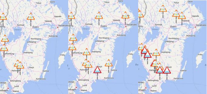
From 9 to 20 February 2020, Sweden was hit by storm Ciara and storm Dennis.

The combination of winds that reached 36 m/s (130 km/h) and low-pressure areas has caused storm
surges along the southern and western coast of Sweden. This particular condition hindered the runoff
of rivers, swollen by heavy rains, which caused diffuse flooding in the southern part of Sweden.

From 7 February onwards, the Copernicus EMS Flood Early Warning and Monitoring component
send out EFAS1 Flash Flood Notifications to the Swedish authorities. On 9 February the first EFAS
Flood Notification was released for the Mörrumsån basin, which was followed by more notifications
on the 12 - 14 February for the affected regions in the south of Sweden (see Figure 1 below).
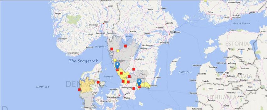
Figure 1: Flood notifications from the European Flood Awareness System (EFAS) send to the
Swedish authorities on the 07 (left), 09 (middle) and 14 (right) February for the South of Sweden.
Orange triangles = EFAS Flash Flood notification; red triangle = EFAS Flood Notification.

According to the European Flood Awareness System (EFAS) the severity of floods seems to vary
strongly depending on the river basin but in general this is affecting only small river basins. In some
river basins EFAS simulates exceedances well over the 20yr return period but for the majority this
event is between a 5 and 20 year return period flood.

Figure 2: EFAS forecast of the 12 February 2020, with the predicted evolution of the forecast for the
two locations: Viskan (left) and Mrrumsn (right) river.

On 18 February, the Copernicus EMS Rapid Mapping module was activated by the Swedish Civil
Contingencies Agency (MSB), in order to map the flooded areas initially in five Areas of Interest
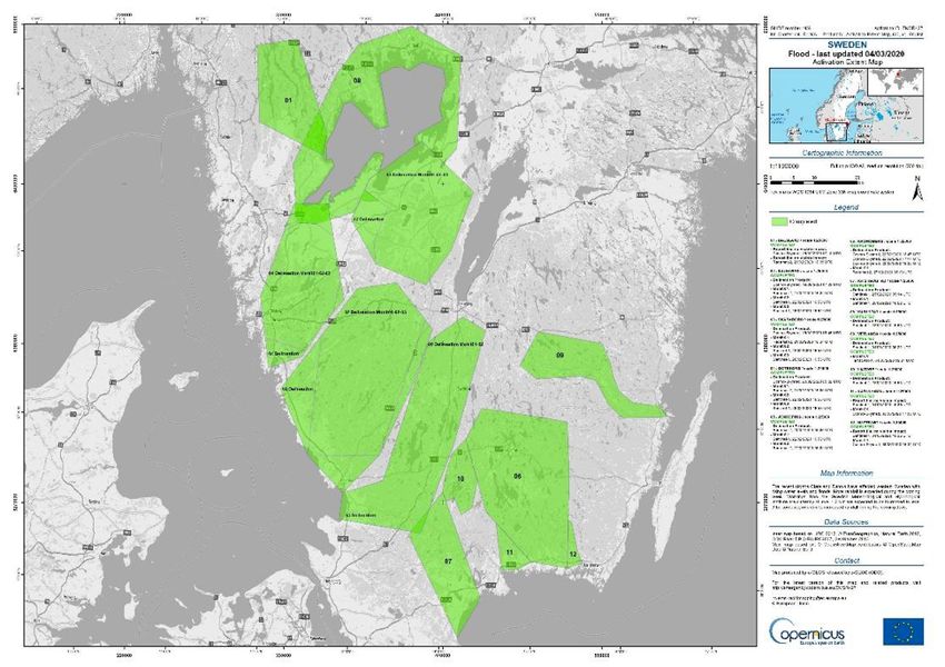
(AOIs) located in the south-west of Sweden. The first flood maps were produced using high
resolution radar data acquired on 19 and 20 February. Except from one AOI, flood was detected on
an area covering 4.281 ha and as a consequence the first set of delineation products was published.

Considering the evolution of the situation in the field and forecast of strong rain potentially leading to
a rise of the river and lake levels, MSB requested frequent monitoring of the situation. The flood
maps published in the following week showed that in most of the AOIs monitored an increase of the
flooded area was detected, whilst in some areas the flood started decreasing. Between 21 and 28
February, monitoring of the situation in additional AOIs was also requested.

Between 28 February and 02 March, all requested monitoring products showed a decrease of the
flooded area. In the newly added AoIs, the extent of the flooded area detected ranged from no impact
to 3.465,7 ha (34,66 km2) of flooded area.

In total, the 12 AoIs of this activation covered 41.222,61 km2 of the southern part of Sweden.
Between 19 February and 4 March, 29 products were produced, including 17 monitoring products
(see the activation extent map below). The images used for flood detection were provided by the
Copernicus Sentinel-1 satellite and Copernicus contributing missions (Cosmo-Skymed, TerraSAR-X
and Radarsat-2).

According to the latest flood forecasts of the European Flood Awareness System on 4 March 2020,
water levels will remain high for the affected area and only decrease slowly. At the moment, the MSB,
together with the local and regional end-users, is assessing the need for further satellite-based
assessment of the situation.

The maps and vector data are available for viewing and download on the Copernicus EMS Website:
https://emergency.copernicus.eu/mapping/list-of-components/EMSR427/.

For updates on our activations, follow Copernicus EMS on Twitter.

Learn more about the Copernicus Programme and its Emergency Management Service online.

The Activation Extent Map (AEM) showing the areas of interest and associated products (Copernicus
EMS © 2020 EU, [EMSR 427: Floods in Vastra Götaland, Sweden).
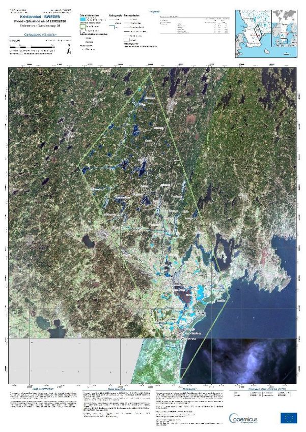
The delineation map of the area around Kristianstad (Sweden), showing 4,559.7 ha (45.60 km2) of
                                   flooded area at the time of satellite imagery acquisition (Copernicus EMS © 2020 EU, [EMSR 427:
                                   Kristianstad (Sweden): Delineation Overview map 01]).

                                   For more information contact

                                   support@copernicus.eu

                                   Follow our Twitter feed @CopernicusEMS where maps and vector data are posted automatically in
                                   near real-time.

Powered by TCPDF (www.tcpdf.org)
You can also read