Flood risks and environmental vulnerability - Exploring the synergies between floodplain restoration, water policies and thematic policies ...
←
→
Page content transcription
If your browser does not render page correctly, please read the page content below
EEA Report     No 1/2016

Flood risks and environmental vulnerability
  Exploring the synergies between floodplain restoration,
                     water policies and thematic policies

                                                     ISSN 1977-8449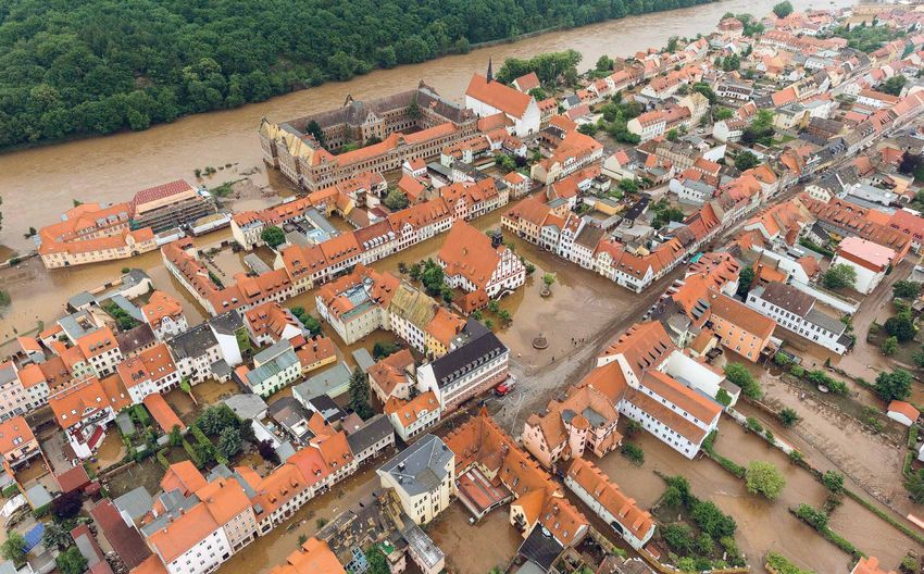
EEA Report   No 1/2016

Flood risks and environmental vulnerability
  Exploring the synergies between floodplain restoration,
                     water policies and thematic policies
Cover design: EEA
Cover photos: © André Künzelmann/UFZ
Layout: Rosendahls a/s

Legal notice
The contents of this publication do not necessarily reflect the official opinions of the European Commission or other
institutions of the European Union. Neither the European Environment Agency nor any person or company acting on
behalf of the Agency is responsible for the use that may be made of the information contained in this report.

Copyright notice
© European Environment Agency, 2016
Reproduction is authorised provided the source is acknowledged.

More information on the European Union is available on the Internet (http://europa.eu).

Luxembourg: Publications Office of the European Union, 2016

ISBN 978-92-9213-716-8
ISSN 1977-8449
doi:10.2800/039463

European Environment Agency
Kongens Nytorv 6
1050 Copenhagen K
Denmark

Tel.: +45 33 36 71 00
Web: eea.europa.eu
Enquiries: eea.europa.eu/enquiries
Contents

Contents

Acronyms and abbreviations..................................................................................................... 4

Acknowledgements..................................................................................................................... 5

Executive summary..................................................................................................................... 6

1 Introduction............................................................................................................................ 9
     1.1 Floods in Europe..................................................................................................................... 10
     1.2 Environmental aspects of floods and floodplains..............................................................12
     1.3 Floodplain areas.....................................................................................................................13
     1.4 Strategic flood risk management.........................................................................................16
     1.5 Outline and reading guidance..............................................................................................18

2 Status of Europe's floodplains............................................................................................ 20
     2.1 Ecological importance of floodplains...................................................................................20
     2.2 Status of Europe's floodplains: remaining areas and environmental quality................21
     2.3 Pressures on the functioning of floodplains.......................................................................26
     2.4 Floodplain management and restoration...........................................................................31

3 Anthropogenic drivers......................................................................................................... 37
     3.1 Socio-economic development and land use change.........................................................37
     3.2 Climate change....................................................................................................................... 38

4 Policy developments and implementation....................................................................... 42
     4.1 Disaster risk reduction...........................................................................................................43
     4.2 European policies influencing the management of floods and floodplains ..................44
     4.3 Flood risk management, climate change adaptation and disaster risk reduction.........51
     4.4 Gaps in knowledge and policy integration..........................................................................57

5 Conclusions........................................................................................................................... 61
     5.1 Floodplains in Europe............................................................................................................61
     5.2 Coordination of flood risk management with adjacent policy fields...............................62
     5.3 Guiding principles for next steps in flood risk management...........................................64

References.................................................................................................................................. 66

                                                                               Flood risks and environmental vulnerability                          3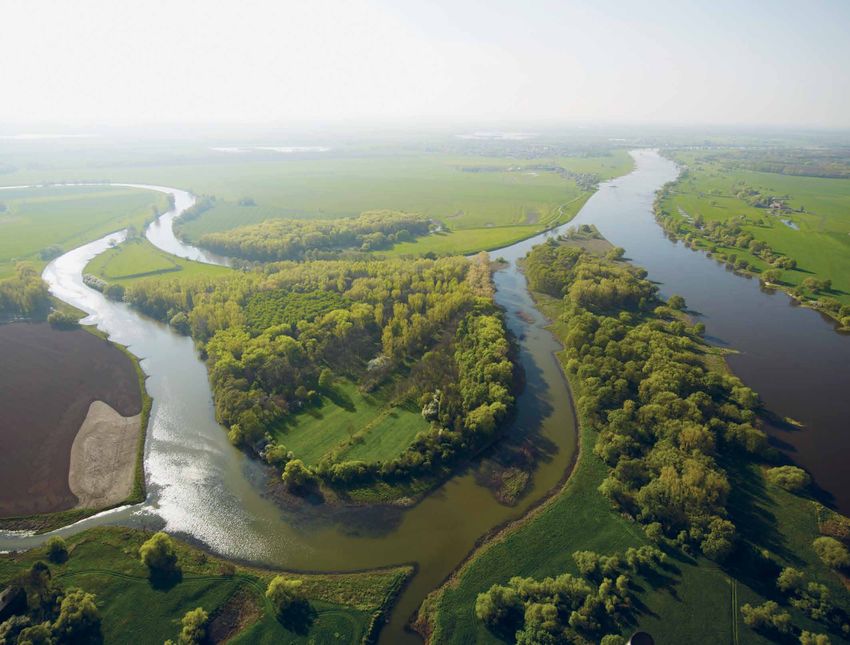
Acronyms and abbreviations

    Acronyms and abbreviations

    APSFR       Areas of Potential Significant Flood Risk
    CAP         Common Agricultural Policy
    CLC         Corine Land Cover
    DPSIR       Driving forces, Pressures, States, Impacts, Responses
    DRR         Disaster Risk Reduction
    EC          European Commission
    EEA         European Environment Agency
    EIA         Environmental Impact Assessment
    EM-DAT      Emergency Events Database from the Centre for Research on the Epidemiology of Disasters (CRED)
    ETC/CCA     European Topic Centre on Climate Change impacts, vulnerability and Adaptation
    ETC/ICM     European Topic Centre on Inland, Coastal and Marine water
    EU          European Union
    EUSF        European Union Solidarity Fund
    FHRM        Flood Hazard and Risk Map
    FRMP        Flood Risk Management Plan
    ha          hectares
    JRC         Joint Research Centre
    MAES        Mapping and Assessment of Ecosystems and their Services
    MFF         Multiannual Financial Framework
    NBMW        Nature, biodiversity, marine and water (policies)
    NUTS        Nomenclature of Territorial Units for Statistics
    NWRM        Natural Water Retention Measure
    OECD        Organisation for Economic Co-operation and Development
    PFRA        Preliminary Flood Risk Assessment
    PWS         Payment for Watershed Services
    RBD         River basin district
    RBMP        River Basin Management Plan
    RDP         Rural Development Programmes
    SEA         Strategic Environmental Assessment
    SRES        Special Report on Emissions Scenarios
    UoM         Unit of management
    WFD         Water Framework Directive

4   Flood risks and environmental vulnerability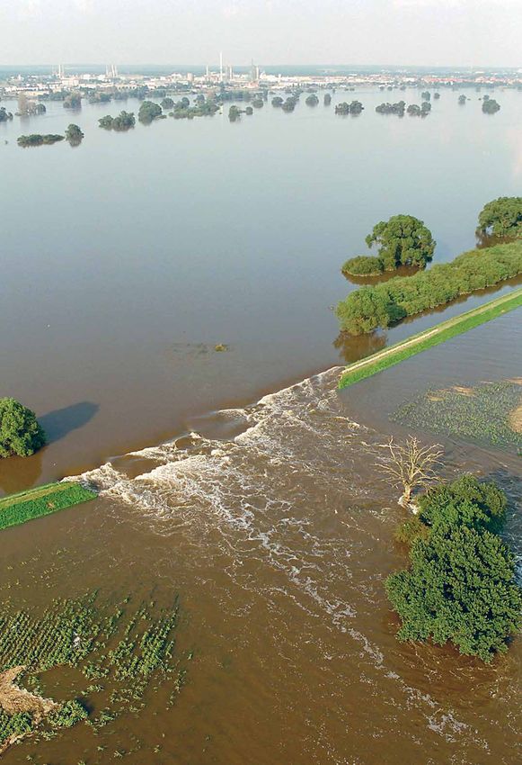
Acknowledgements

Acknowledgements

Authors                                                   EEA project manager: Wouter Vanneuville

Wouter Vanneuville (EEA), Henk Wolters (Deltares,         The report team would also like to thank:
ETC/ICM) and Mathias Scholz (The Helmholtz Centre
for Environmental Research (UFZ), ETC/ICM), under the     •   the many experts who provided support,
guidance of Beate Werner and Ronan Uhel (EEA).                comments and data throughout the development of
                                                              this report, in particular: Anita Künitzer
                                                              (UFZ, ETC/ICM), Ursula Schmedtje (German Federal
Contributors                                                  Environment Agency, ETC/ICM), Ioannis Kavvadas,
                                                              Thomas Petitguyot and Helen Clayton (European
Luka Snoj and Lidija Globevnik (TC Vode, ETC/ICM),            Commission, Directorate General Environment),
Jaroslav Mysiak (CMCC-FEEM, ETC/CCA), Chris Seijger           Clemens Neuhold (Austria), Jan Daňhelka and
(Deltares) and Christiane Schulz-Zunkel (UFZ)                 Jana Tejkalová (Czech Republic), Anette van Dillen,
                                                              Cindy Mathan and Martina Barborowoski
European Topic Centre on Inland, Coastal and                  (Germany), Antti Parjanne (Finland), Kees Schotten,
Marine waters (ETC/ICM) is an international                   Jean-Marie Stam and Jos Verhoeven
consortium brought together to support the European           (the Netherlands), Barbro Näslund-Landenmark
Environment Agency (EEA) in its mission to deliver            (Sweden) and Francine Hughes and Iain Blackwell
timely, targeted, relevant and reliable information to        (the United Kingdom);
policy-makers and the public for the development and
implementation of sound environmental policies in         •   the participants at the expert workshop on
the European Union and other EEA member countries.            Environmental effect of floods and flood-protection
Since 1 January 2014 the Helmholtz Centre for                 measures, 28–29 May 2015, Copenhagen, Denmark:
Environmental Research — UFZ is leading ETC/ICM with          Jovan Despotovic (University of Belgrade),
a consortium of 17 partners.                                  Georg Rast (WWF Germany), Adrian Schmid-Breton
                                                              (International Commission for the Protection of
European Topic Centre on Climate Change impacts,              the Rhine), Pavla Stepkanova (Czech Republic) and
vulnerability and Adaptation (ETC/CCA) is an                  János Fehér;
international consortium contracted by the European
Environment Agency (EEA) to carry out specific tasks in   •   our EEA colleagues Ronan Uhel, Beate Werner,
the area of climate change impacts, vulnerability and         Peter Kristensen, Carlos Romao and Nihat Zal,
adaptation across Europe. The 2014–2018 ETC/CCA               as well as Pia Schmidt, Hanne Andersen, Joanna
consortium is made up of 14 partner organisations, led        Karlsen, Carsten Iversen and Patrick McMullan, for
by the Italian Euro-Mediterranean Center on Climate           editorial and production assistance.
Change (CMCC).

                                                              Flood risks and environmental vulnerability           5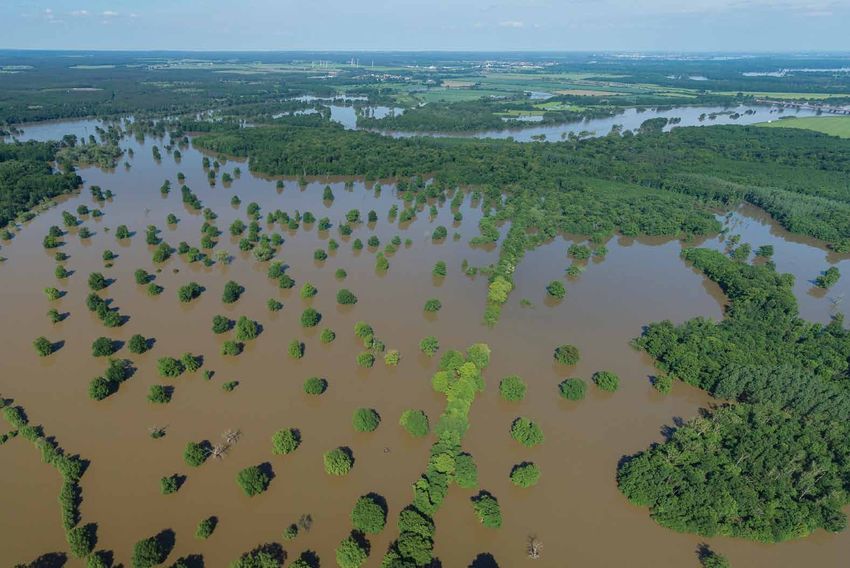
Executive summary

    Executive summary

    Nowadays floodplain areas are reduced in size or no         inventories of previous floods and their impacts are
    longer function as active floodplains, thereby impacting    available, quantitative information on flood impacts
    on the delivery of environmental services to local and      is scarce and hardly comparable on a European scale.
    regional communities and economies. These services          Environmental impacts are underrepresented in global
    include regulating services such as protection against      databases on floods or natural hazards.
    floods or water purification; provisioning services, such
    as nutrient collection and fertile soil formation; and      Meanwhile, significant differences remain in the way
    cultural services, such as recreational, tourism and        countries report on previous flood events. The next
    educational services; transport routes; and finally a       reporting cycle for the Floods Directive (2016–2021)
    secure water supply.                                        could benefit from additional guidance in order to
                                                                obtain more homogeneous information on the impacts
    Many of Europe's natural floodplains are under              of past flood events across Europe. Through the Floods
    pressure: besides land use changes, there are               Directive it is expected that for future flood events
    limitations in exactly how water is flowing and where to,   more information on the environmental impacts (both
    reduced storage capacity, water quality and pollution       negative and positive) will become available. Data
    issues, as well as a reduction in the natural support to    sources, such as the applications for major floods in
    lower flood waves. What remains of floodplains can          the European Solidarity Fund, can further improve the
    be viewed as important for nature conservation and          database on past floods in Europe.
    will play a part in the aim to restore at least 15 % of
    degraded ecosystems and their services by 2020 under        Significant data gaps remain on the European
    the targets of the EU Biodiversity Strategy.                scale, such as on floodplain delineation, land use in
                                                                floodplains, or the economic benefits from ecosystem
    Since 2012, a new source of information became              services. However, the knowledge currently available
    available for the European Environment Agency               allows progress to continue on the implementation of
    (EEA) following the assessment and mapping of               sustainable flood risk management practices, including
    floods in Europe for the 'Directive on the assessment       building synergies with other relevant environmental
    and management of flood risks', better known as             legislation such as the Water Framework Directive and
    the 'Floods Directive'. The EEA's 'Flood risks and          the Birds and Habitats directives.
    environmental vulnerability' report provides an
    overview of floods since 1980 and the related social,
    economic and environmental impacts. This report             Floodplain management and restoration
    improves the knowledge base on the subject as a
    European flood impact database had not existed              Floodplain management and restoration does not only
    prior to the publication of the EEA report. The report      focus on reducing flood risk but also on promoting
    combines the information from the Floods Directive,         environmental, societal and economic benefits.
    mainly from the preliminary flood risk assessments,         Sustainable flood risk management combines elements
    with information from global databases, as well as          to:
    an analysis of a questionnaire completed by national
    authorities. The result is a more complete overview of      •   reduce the exposure to flooding;
    significant floods events and impacts.
                                                                •   lessen the vulnerability of people and property;

    The need for data on the impact of flooding                 •   execute a sensible management of land and the
                                                                    environment;
    An essential element of the Floods Directive is the
    combined reporting on environmental, economic and           •   improve preparedness and early warning for
    social issues. While many detailed local and national           adverse events.

6   Flood risks and environmental vulnerability
Executive summary

Dikes, dams and other human-engineered solutions are         work between the various programmes emanating
examples of infrastructures that continue to prevent         from the different directives.
and protect many former floodplains from flooding.
Meanwhile, green infrastructure, a network of natural        The EEA's 'Flood risks and environmental vulnerability'
and semi-natural areas designed and managed to               report, together with the recent EEA report on
deliver a wide range of ecosystems services, also            'Water‑retention potential of Europe's forests', are
assists flood protection. Floodplain restoration is an       among the publications the EEA will make on synergies
important measure which gives more room to rivers,           between policies. Reports are also planned to come
develops ecological beneficial hydrological regimes and      out in the 2017–2018 period on the synergies between
enhances floodplain and wetland habitats.                    floods, climate change adaptation and disaster risk
                                                             reduction; and on the synergies between the WFD and
There are many examples where 'hard' infrastructure          environmental policies, including floods.
can be adapted to make better use of the natural
habitat and of the landscape ecology. Even when
human developments that need to be protected                 Climate change and land use planning
against flooding make it (almost) impossible to go back
to a complete natural state, natural water retention         Over time, climate change and adaptation have become
measures (NWRMs) can contribute to reduced flood             more prominent in water and nature policies. In the
risk, less soil erosion or water purification and nutrient   Water Blueprint, climate change, together with land
recycling. To manage floodplains and to assist in the        use and economic activities, are depicted as having
restoration of wetlands and alluvial areas by promoting      a negative impact on Europe's water status. Climate
NWRMs, synergies between different policy fields have        change adaptation and building resilience to disasters
to be explored.                                              are key activities for sustainable water management.
                                                             River basin and flood risk management, as well as
                                                             reporting obligations from the Birds and Habitats
Synergies in water, nature and sectoral policies             directives, are updated once every six years. New
                                                             knowledge on climate change and adaptation can
In 2012 the European Commission published                    therefore be built into these plans.
'A Blueprint to Safeguard Europe's Water Resources'
(the Water Blueprint) to tackle the obstacles which          Extreme floods (and droughts) are likely to be the
hamper action to improve the status of EU waters.            biggest challenge for adaptation and likely to be
Synergies between managing flood risk, reaching or           the cost drivers for adapting the infrastructure.
maintaining a good ecological status, and safeguarding       While strategies for flood risk management require
the nature or ecosystem services in floodplains can          locally adapted measures, including sustainable land
be very complex. Some form of prioritisation needs           management and spatial planning, using a river basin
to take place at least on the level of river basin           management approach — congruent with ecosystem-
management planning. Interactions along rivers need          based management principles — avoids passing on
to be taken into account, as well as targets such as the     negative consequences further downstream.
15 % restoration of degraded ecosystems by 2020 from
the Biodiversity Strategy.
                                                             Financing and governance
To recognise the synergies between water and nature
policies, the aims and working methods of the Floods         Measures that work with natural processes, such as
Directive should also be taken into account when             the maintenance or restoration of floodplains, have a
developing actions for the Water Framework Directive         multitude of benefits. An ecosystem services approach
(WFD) and the Birds and Habitats directives. Although        is important which would highlight any benefits and
the WFD does contribute to mitigating the effects of         makes the cost effectiveness of these measures more
floods; managing and reducing flood risk is not one          explicit.
of its principal objectives. The restoration of healthy
ecosystems, e.g. through the Natura 2000 networks, is        Most of the nature-based solutions for flood risk
often a very effective way of preventing and mitigating      management are related to the prevention of and
floods. 'Green' flood prevention measures, through           protection against flooding. In addition, the Floods
the restoration of floodplains, are also beneficial.         Directive also focusses on preparedness measures
Currently, synergies between water and nature                such as flood forecasting and warning. While many
policies are underexploited as well as the links to the      of them are financed from national funds, the EU
Common Agricultural Policy (CAP). Early cooperation,         LIFE programme is an important financial instrument
negotiation and flexibility can avoid any crossover          to support environmental, nature conservation and

                                                                Flood risks and environmental vulnerability            7
Executive summary

    climate action projects, such as NWRMs. Other sources      to be beneficial. However, these processes can only
    to prevent flood damage based on natural processes         be driven at the European level and yet need to be
    are the EU's rural development programmes or the           implemented at the river basin level.
    Cohesion Funds.
                                                               Successes in nature, water and marine policies
    Financial instruments also need to be in place for         invariably depend on progress across various sectors.
    response during and recovery after a flood event, such     A coordinated implementation of the WFD, the Marine
    as insurance mechanisms or the EU Solidarity Fund.         Strategy Framework Directive, the Birds and Habitats
    Unfortunately due to the need to make decisions            Directives, the Biodiversity 2020 strategy and the
    quickly little attention is paid to ecosystem services     Floods Directive would help achieve a higher quality
    during periods of response and recovery.                   environment by using integrated solutions and,
                                                               through coherent measures and actions, enhance the
    The better the coordination across the various levels of   effectiveness of the policies. As the objectives of water
    planning and management, the more attention can go         and nature legislation do not contradict themselves
    to reduce vulnerability and integrated measures which      no obvious obstacles should exist for efficient
    will be sustainable over the long term. Combining          collaboration, as shown by many examples across
    efforts on the WFD and the Floods Directive may prove      Europe, some of which are presented in this report.

    Photo:   © André Künzelmann/UFZ

8   Flood risks and environmental vulnerability
Introduction
1 Introduction
In 2012, the European Commission (EC) published of the quantitative and qualitative status of Europe's
'A blueprint to safeguard Europe's water resources' water resources and the ecosystem services that
(EC, 2012d) to tackle the obstacles that hamper action they provide. Although we do not suggest that the
to further improve the status of European Union information is complete and taking account of changes
(EU) waters. The EEA's state of water reports (1) made still being implemented in the FRMPs, the information
an important contribution to the argument that allows us to make suggestions for an improved
water‑quality and quantity need concerted action. There second implementation cycle of the Floods Directive
are numerous challenges to be faced in attaining the in terms of information structure and environmental
objectives of the Water Framework Directive (WFD) objectives. It also enables us to develop a better
(EU, 2000, Art. 4), and floods, inundations, modifications understanding of freshwater ecosystem services,
of the water flow and morphological changes are among and of the environmental impact of flooding and
the many pressures affecting Europe's water bodies. flood-protection measures. Therefore, Natural Water
Retention Measures (NWRMs), Green Infrastructures
Whereas the report 'Water resources in Europe in and other measures that work with natural processes
the context of vulnerability' (EEA, 2012d) focused on are explored in more detail in Chapter 2.
droughts, water scarcity and floods, this report focuses
on flooding, the role of floodplains and the impact The second objective is to explore the synergies
of hydromorphological alterations on the ecosystem between the Floods Directive and other water and
services that floodplains provide. The aim is to nature directives and the most relevant sectoral
support the implementation of the EU Floods Directive legislation. In particular, the WFD (EU, 2000) and
(EU, 2007), in particular with regard to environmental the Birds and Habitats Directives (EU, 1992, 2010)
impacts. To do this, it is necessary to investigate are of interest in the framework of streamlining
EU water and nature policies as well as thematic environmental requirements as expressed in the
policies affecting floodplains to identify synergies and Biodiversity 2020 Strategy (EC, 2011a) and the potential
approaches to capitalise on them. The report assesses revision of the WFD after 2018. Notwithstanding
the pressures affecting floodplains as well as the the similarities in content and process between the
wider driving forces that have an overall influence on Floods Directive, the WFD and the Birds and Habitats
catchment areas, such as climate change. Directives, there are also important differences
between them. Whereas the WFD and the Birds and
In 2016–2018, the EEA will prepare a series of updates Habitats Directives are mainly environment‑related
on the state of EU waters based on the information legislation (although with some overlaps with economic
that becomes available from the second generation of and social issues), an essential element of the
River Basin Management Plans (RBMPs). The updates Floods Directive is its combination of environmental,
will include flood impacts and flood risk management. economic and social issues (Evers and Nyberg, 2013).
The principal information on flood impacts and flood Human health, the environment, cultural heritage
risk management at EU level is based on the reporting and economic activities are the four impact categories
under the Floods Directive, which contains information that EU Member States are required to report on for
on past and potential future floods, the Flood Hazard the Floods Directive and it is feasible and desirable
and Risk Maps (FHRMs) and the draft Flood Risk to reduce the risk of adverse consequences in these
Management Plans (FRMPs). areas. Where the WFD contributes to mitigating the
effects of floods, assessing, managing and reducing
The first objective of this report is to provide a flood risk is not one of the principal objectives of the
conceptual assessment of how existing information can directive, and it does not take into account any future
be used to provide a more comprehensive assessment changes in flood risk as a result of climate change.
(1) See http://www.eea.europa.eu/themes/water/water-assessments-2012, accessed 13 November 2015.
Flood risks and environmental vulnerability 9Introduction
The third objective of this report is to identify and share the sustainable development of floodplains. In general,
good practice to improve the Preliminary Flood Risk this report provides examples for all those interested in
Assessment (PFRA) in the next cycle of implementation how water management (and, more specifically, flood
of the Floods Directive in 2018. The second cycle will risk management) based on an ecosystem services
begin soon after the reporting of the FRMPs, which approach is shaped and how flood risk management is
will complete the first cycle of implementation with its linked to a wide variety of thematic polices influencing
reporting in March 2016. Although many details about and influenced by flood risk management.
floods and their impacts are known at a local level, it
remains difficult to get a detailed European overview.
The Floods Directive collects information on significant 1.1 Floods in Europe
past floods as part of the PFRA (EU, 2007, Art. 4).
To be of most value for European-wide assessments, Flooding is a natural and not uncommon process
the structured information provided needs to be associated with river dynamics, but across Europe
detailed enough to create added value beyond some and throughout the ages, floods have affected human
descriptive terms such as 'extreme event' or 'large health (2), the environment, cultural heritage and
impact' but at the same time be general enough to economic activities. The floods in Ireland and the United
be comparable. Although this is achieved to a certain Kingdom from April 2012 onwards were caused by a
extent in the 2011 PFRA, an analysis of the information series of weather events that lasted through the winter
(e.g. ETC/ICM, 2013) shows that more can be done in of 2013. Central Europe was hit by extreme floods in
this regard. May and June 2013, affecting both the Elbe and Danube
river catchments. In many locations, these floods
This report limits itself mainly to the environmental caused the highest water levels and/or discharges
aspects related to floods and flood-protection ever recorded (BfG, 2013; Gierk, 2013; ICPDR, 2014).
measures. Economic, health and cultural impacts will Although the damage was still significant, the measures
not be dealt with in detail, although their consideration taken for example in Austria and Germany after the
is necessary for integrated (flood) risk management. 2002 floods proved to be highly effective (Neuhold,
And, notwithstanding the fact that coastal water bodies 2013).
are covered by the WFD and coastal flooding by the
Floods Directive, this report primarily focuses on rivers, In May 2014, a low-pressure cyclone affected a
river floodplains and fluvial flooding. large area of south-east and central Europe, causing
floods and landslides (e.g. along the River Sava).
Serbia and Bosnia and Herzegovina suffered the
Target audience for this report greatest damage. In Serbia alone, there were over
50 fatalities, roughly 32 000 people were evacuated
The main audience in mind when writing this report and over 1.5 million people were affected (Pavlović,
are flood risk managers involved in the FRMPs and 2014). Kundzewicz edited a book with many detailed
the programmes of measures. On account of budget national and regional perspectives on floods in Europe
restrictions, and with water and land being scarce (Kundzewicz, 2012) and Chorynski and colleagues
resources, searching for synergies with other water and provide an overview of large floods in Europe in the
nature protection communities and creating integrated 20th century (Chorynski et al., 2012).
visions and measures is an (perhaps even the) effective
and efficient way forward. Although it may seem that After a flood event, different data typically circulate
working in isolation results in quicker action (at least on the damage caused and the numbers of people
initially), collaborative working ultimately enables affected. However, a consistent database of the impacts
greater progress. of past floods is not available for Europe (EEA, 2011b).
Overviews of flooding and its impacts on a European
The report is also meant as an introduction for water scale have been extracted from global disaster
managers involved in the RBMPs and for people databases. Nevertheless, information on past flood
involved in nature conservation and restoration to events is the basis for a sound understanding of flood-
better understand how their actions can contribute generating processes across Europe and for reliable
to sustainable flood risk management. Given the predictions of future flood changes. Therefore, the
importance of land use changes and developments such development of a comprehensive, publicly available,
as urbanisation as significant pressures, spatial planners database of flood events and their impacts in Europe is
and developers will find information on synergies and desirable (EEA, 2011b).
(2) Including social impacts to individuals or the community.
10 Flood risks and environmental vulnerabilityIntroduction
Based on the information on past floods reported Nevertheless, the PFRA reporting in itself is insufficient
by EU Member States in the PFRA under the Floods to function as the single database on European floods
Directive (EU, 2007, Art. 4) and complemented by data and flood impacts (ETC/ICM, 2013). In addition, floods
from global databases such as the Emergency Events are not restricted by administrative boundaries and,
Database (EM‑DAT) from the Centre for Research on for example, no information was available on non-EU
the Epidemiology of Disasters (CRED) (EM-DAT, 2015) European countries.
or Dartmouth Flood Observatory (Brakenridge, 2015),
an EU overview of significant floods and their impact Using the information on past floods reported by EU
is now available for the 39 EEA member countries and Member States and combining that information with
cooperating countries available data from global data sets on floods and
additions by national authorities on a voluntary basis has
already provided a more complete overview of European
European Flood Impact Database floods since 1980. A country consultation for corrections
and additions ran from February to May 2015. The
A European Flood Impact Database has not been resulting database, which includes environmental
available so far. In most European countries, national impacts and impacts on cultural heritage where available,
databases for natural hazards are available but they as well as fatalities and economic damage, is available
are very different in terms of the types of hazards at http://www.eea.europa.eu/data-and-maps/data/
included, information on impacts, thresholds to include european-past-floods (accessed 13 November 2015).
events, availability of the detailed data, etc. (ETC/CCA,
2013a, 2013b). The amount of information available Between 1980 and 2010, 3 563 distinct flood phenomena
increased significantly after the reporting of the PFRA (floods) were evidenced in 37 European countries (3).
(mainly on flood impacts, although these were often As Figure 1.1 shows, the highest number of floods is
not quantified or expressed in monetary terms) and the reported for 2010 (321 floods), when 27 countries were
information was better structured owing to the template affected. This number is associated with the 'central
imposed by the Floods Directive reporting schemas. European floods', which occurred across several
Figure 1.1 Reported flood phenomena between 1980 and 2010
Number of reported flood phenomena between 1980 and 2010 (EEA-39)
350
300
250
200
150
100
50
0
85
86
96
98
88
05
00
03
95
87
02
07
80
89
99
01
83
90
94
09
91
10
97
06
08
81
92
82
84
93
04
19
19
19
19
19
20
20
20
19
19
20
20
19
19
19
20
19
19
19
20
19
20
19
20
20
19
19
19
19
19
20
Flood phemona severity: Very high High Moderate
Note: Flood severity is an assessment of flood phenomena magnitude. It considers the reported values on frequency, reported total damage
(in Euros and descriptive classes), number of flood events within one flood phenomena unit and severity classes as reported in the
Dartmouth Flood Observatory database (ETC/ICM, 2015b). All phenomena with fatalities are in the 'very high' severity class.
Source: http://www.eea.europa.eu/data-and-maps/data/european-past-floods, accessed 13 November 2015.
(3) All EEA member and cooperating countries (see http://www.eea.europa.eu/about-us/countries-and-eionet, accessed 13 November 2015),
except for Liechtenstein and Malta.
Flood risks and environmental vulnerability 11Introduction
central European countries during May and June environmental quality and water-quality management.
2010. In Poland, more than 20 people lost their lives, As mentioned in the 'Blueprint to safeguard Europe's
approximately 3 400 km2 of land was inundated by the water resources' (EC, 2012d) water over-abstraction
floods and the total cost of flood damage has been is the second most common reported pressure in
assessed as more than EUR 2 billion (2 000 million). the first generation of RBMPs. At the same time,
Bulgaria, France, Germany, Hungary, Serbia, Slovakia the hydrological regime defines the physical habitat
and other countries were affected (ETC/ICM, 2015b). The in and along water bodies. The flow requirements
apparent increase in the number of reported floods has required to reach a good ecological status therefore
not been cross-checked with the natural flooding of the go beyond minimum discharges during dry periods
rivers. Therefore, based on Figure 1.1, no conclusions but have to take into account the full range of
can yet be made about trends or patterns of flooding discharges, from base flows (including low flows) to
in Europe because, besides the length of time series, flood regimes with different magnitudes, frequency,
a reporting bias (EEA, 2015a) means that the method duration, etc. This link between quantity and quality is
of reporting across Europe is not homogeneous. The clearly made in the guidance document on ecological
EEA will further improve knowledge on past floods and flows in the implementation of the WFD (EC, 2015d).
their impacts, including trend analyses for European The objectives on protection and conservation of
regions. Map 1.1 shows the number of reported flood freshwater‑dependent ecosystems can be reached only
phenomena since 1980, which are weighted in respect of when discharges and water levels vary over weeks,
country areas. months and years. This is because these ecosystems
usually need varied intra- and inter-annual flows to
remain functionally intact.
1.2 Environmental aspects of floods and
floodplains Consequently, it is possible that flow requirements for
the conservation of certain species or habitats go beyond
Water-quantity management, including extremes those to reach 'Good Ecological Status' and therefore
such as floods or hydrological droughts, should should be considered in the implementation of the WFD
always be considered together with their impacts on (EC, 2015d). In this context, it is useful to consider the
Map 1.1 Reported flood phenomena (number of floods per 10 000 km2) per country (since 1980)
-30° -20° -10° 0° 10° 20° 30° 40° 50° 60° 70° Reported flood phenomena
per country since 1980
Number of floods per 10 000 km2
Iceland
0–1
Finland
1–3
60°
3–10
Sweden
Norway 10–20
Estonia > 20
50°
Latvia
No data
Denmark Lithuania
Ireland Note:
Kosovo under UNSCR 1244/99
50° United Kingdom
Poland
Netherlands
Germany
Belgium
Luxembourg Czech Republic
Slovakia
Austria Hungary
France Liechtenstein
Romania 40°
Switzerland
Slovenia
Croatia
Bosnia Serbia
&
Herzegovina
Bulgaria
Montenegro
Italy Kosovo
40° Spain Albania Turkey
Portugal
Greece
The former
Yugoslav
Republic of Cyprus
Macedonia
0 500 0° 1000 1500 km10° Malta 20° 30° 40°
12 Flood risks and environmental vulnerabilityIntroduction
fact that, in many cases, these ecosystems do not need overtopped or fails. Because flood‑protection provides
high flows in every year. For example, floodplain forests increased security, the areas behind a flood-protection
require only occasional flood events for their continued infrastructure are often highly developed, which has
regeneration, and this gives considerable flexibility to considerable economic and social consequences if the
long-term water-quantity management for these forested flood event is of a higher magnitude than the protection
ecosystems in which environmental flows are used as level. In addition, these protection measures may
a water-quantity management approach (Hughes et al., have a strong negative impact on the environmental
2008). quality of the water body and the floodplain, limiting
the potential of the area to provide ecosystem services.
Where a flood, according to the definition in the Floods A natural floodplain provides a wide range of services,
Directive (EU, 2007, Art. 2 (1)), is 'the temporary covering which people can rely on directly, including water flow
by water of land not normally covered by water', the regulation, water‑retention or habitat for wildlife and
main area of interest is the floodplain in which this recreation, and which are limited when the connectivity
flood happens. The natural floodplain can be defined in between water body and floodplain is hampered by
different ways (see Section 1.3) and four key questions permanent infrastructures.
define the role that this area can have in mitigating or
reducing flood risk: A final issue is water-quality and pollution. This takes
account of both the quality of the water entering the
• How is the area used? What are the potential floodplain and the pollution that occurs as a result of
consequences of flooding? contaminated inert soils brought in suspension or of the
flooding of polluting installations (industries, but also oil
• What is the hydrological regime? and septic tanks). In Chapter 2 we look in more detail at
these different aspects and at how natural floodplains
• What is the connectivity of the water body (river) and can provide several ecosystem services that help to
the floodplain? improve water-quality.
• What is the water-quality?
1.3 Floodplain areas
Many former natural floodplains are currently under
pressure from urbanisation, infrastructural developments Although the Floods Directive (EU, 2007, Art. 2) defines
and agriculture. In order to reduce the negative economic a 'flood' as the temporary covering by water of land not
and human impacts of floods, protection or regulation normally covered by water, a 'floodplain' is not defined
measures have been implemented along many rivers. in this directive. Water management and flood risk
These have the negative side effect that the amount of management do not apply to only the riverbed or the
water that can be stored is limited. Owing to soil sealing lake area, which are covered with water all year round.
or soil compaction, the water-retention capacity to They include the whole catchment, from the area from
reduce the amount of overland flow is reduced as well. which raindrops flow into a river, lake or reservoir. Land
cover patterns in the catchment, soil, topography, etc.
However, the impact of soil sealing is certainly not limited are some of the parameters defining how much and
to the floodplain itself, as it is even more relevant at how quickly rain ends in the river or lakes within the
the scale of the catchment, where it affects the river catchment.
hydrology. Both the peak flows that cause floods and the
low flows that occur in dry periods are becoming more The floodplain is the area that is irregularly but more or
extreme, with a higher variation in water levels over time. less frequently covered with water in times of high water
We also have to question the degree to which the water discharges in its adjacent rivers. Despite several individual
level is managed within narrow boundaries to support case studies, there is no comprehensive classification
navigation, hydropower or other economic activities. of floodplains (Nanson and Croke, 1992). The genetic
These issues have to be considered with regard to the floodplain, that is, the alluvial landform adjacent to a
hydrological regime close to the environmental flow, river and built of its sediments, differs from the hydraulic
which will have variations over time, including periods of floodplain, which is the area inundated with a certain
low flows and floods. frequency regardless of land use, soil, etc. In this report,
we use the term 'floodplain' to describe intermittently
Reduced connectivity between river beds, river channels inundated lands next to river beds and channels (Matella
and floodplains is often related to flood‑protection. and Jagt, 2014). First, we give an overview of terms closely
Dykes, dams and other infrastructural measures related to 'floodplains', before, second, discussing the
prevent water from entering a protected area, unless status, functions and trends relating to floodplains in
a major flood event happens and the infrastructure is Chapter 2.
Flood risks and environmental vulnerability 13Introduction
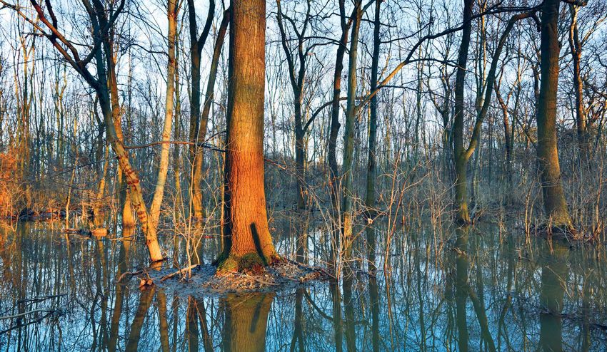
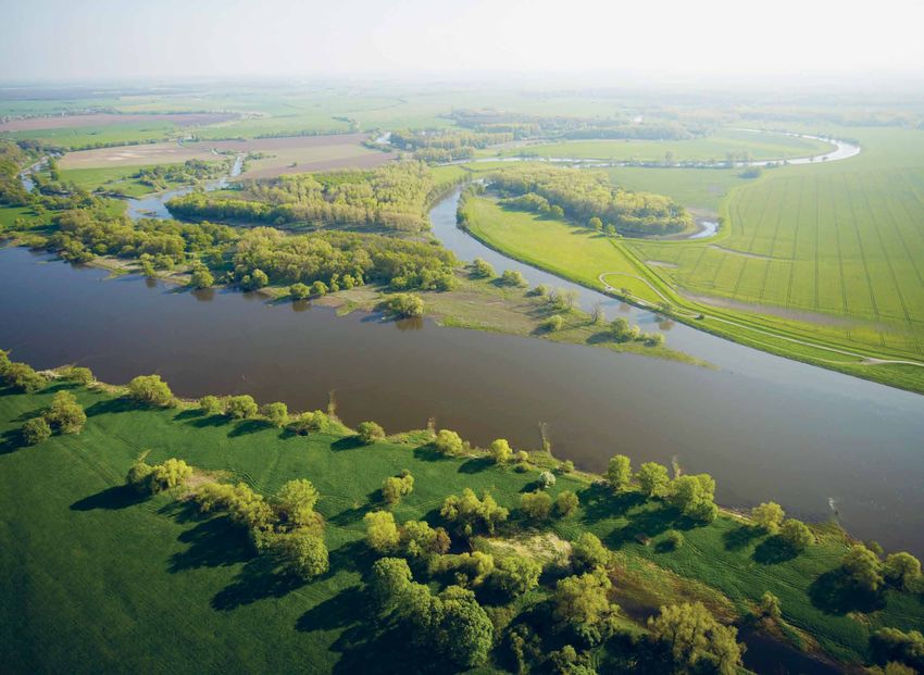
Photo: © André Künzelmann/UFZ
1.3.1 Alluvial areas Flow variations, together with different sediment
deposition patterns, create patches with different levels
Floodplains in alluvial areas are the low-lying areas of connectivity to the stream and soil features. The
along a river, which are characterised by the alternation heterogeneous and quickly changing habitats, together
of floods and low water, and which are built of with natural fertilisation caused by suspended matter
sediments deposited during overflow and lateral and nutrients introduced by flooding, lead to the high
migration of the streams. As part of the river landscape, biodiversity and productivity in floodplains (Craft and
floodplains are in a permanent state of exchange with Casey, 2000; Naiman and Décamps, 1997; Robinson
the river and its catchment area (Gautier et al., 2009). et al., 2002).
Water sources are primarily from the lateral overspill
of river water; however, high groundwater levels can
also contribute to floodplain inundation (Tockner 1.3.2 Riparian zones
and Stanford, 2002). The water flow in floodplains is
multidimensional. Upstream–downstream interactions Riparian zones are transitional areas at the interplay of
constitute the longitudinal dimension. The lateral land and freshwater ecosystems, with distinctive soil,
dimension includes interactions between the river hydrology and biotic conditions, which are strongly
bed or river channel and the riparian floodplain influenced by the streamflow, as typical characteristics
areas, whereas the vertical dimension encompasses (Naiman et al., 2005). In this way, riparian zones
exchanges with the groundwater aquifer. The fourth refer not only to floodplains and wetlands, but also
dimension (i.e. time) provides the temporal scale include uplands where a direct water–land interaction
(Ward, 1989). The soil of alluvial areas consists of sands, is important. For more details about concept and
silts, clays or gravels and is called fluviosoils, whereas definitions, see Clerici et al. (2011). Mountainous areas
floodplains with organic soils are not understood as show a high portion of natural riparian zones, although
being alluvial areas. their presence is lower in the main European plains
14 Flood risks and environmental vulnerabilityIntroduction
where the landscape is characterised by agricultural use and cooperating countries (Stevenson and Frazier,
(Clerici et al., 2011). The EC Joint Research Centre (JRC) 1999a, 1999b). Over one-third (12.8 million ha) is
developed a zonation tool for riparian zones, which, attributed to Sweden; and Estonia, Finland and Norway
although not designed as a high-precision mapping were all assessed as having > 3 million ha each. Other
tool, provides a European overview, which is a key countries with extensive wetland areas (all > 1 million ha)
requirement of the European Green Infrastructure in this study are Denmark, France, Germany, Poland,
(Clerici et al., 2011; EC, 2013d). The high-resolution Turkey and the United Kingdom. It is clear that the
delineation of riparian zones is actually done as part means of measuring the extent of wetland areas
of the Copernicus Land Monitoring Services (4) and will across Europe are not very precise: not only are data
support the objectives of several European legal acts and missing for many countries, but the methodologies to
policy initiatives, such as the EU Biodiversity Strategy to delineate wetlands would also benefit from the inclusion
2020 (EC, 2011a), the HBDs (EU, 1992, 2010) and the WFD of seasonal and inter-annual climate variations and
(EU, 2000). anthropogenic influences as well as the elimination of
variations potentially introduced by the investigator
(Kriegner et al., 2015). This becomes clear when the
1.3.3 Wetlands detailed Swedish wetland survey is considered, which
has identified 9.3 million ha of wetlands, representing
Wetland is a very general term (with many different 23 % of the land area of the country, of which mires
definitions) that refers to areas such as marshes, count for 5.2 million ha. Of the mires, 3.7 million ha are
swamps, bogs, fens, mangroves, etc., all of which have in non-forested bogs, whereas 1.4 million ha are forested
common periodic inundation or prolonged waterlogging (Gunnarsson and Löfroth, 2014; Statistics Sweden, 2013).
which creates suitable conditions for aquatic life (Tiner,
2013). A view closer to the definition of the hydraulic In Corine Land Cover (CLC) (EC and EEA, 1995), wetlands
floodplain (see Section 1.3.4) includes a basis for the are mapped with different codes for inland wetlands and
frequency and duration of flooding required for an coastal wetlands. Inland wetlands are further divided
ecological effect. Wetland has been defined as 'land that into inland marshes (defined as 'Low-lying land usually
is saturated with water long enough to promote wetland flooded in winter and more or less saturated by water
or aquatic processes as indicated by poorly drained soils, all year round') and peatbogs (defined as 'Peatland
hydrophyte vegetation and various kinds of biological consisting mainly of decomposed moss and vegetable
activity which are adapted to a wet environment' matter. May or may not be exploited'). Coastal wetlands
(National Wetlands Working Group, 1997). The ecological were further split into coastal marshes, salines and
effects do not need to be changes in the vegetation but intertidal flats. In 2000, 114 217 km2 were mapped as
could include aspects such as reduced redox potential wetland, of which 110 987 km2 were inland wetlands. In
that have consequences for biogeochemical cycles. 2006, this increased to 119 021 km2 and 115 537 km2,
respectively, and further increased in 2012, when
The Ramsar Convention (UNESCO, 1994) uses a very 131 022 km2 and 127 458 km2 were mapped as total
broad definition whereby wetlands include 'all lakes and wetland areas and inland wetlands, respectively (5).
rivers, underground aquifers, swamps and marshes,
wet grasslands, peatlands, oases, estuaries, deltas and As part of the Copernicus Land Services, a high-
tidal flats, mangroves and other coastal areas, coral resolution layer for wetlands is currently under
reefs, and all human-made sites such as fish ponds, rice development. Based on remote sensing, it aims to
paddies, reservoirs and salt pans' (Ramsar Convention provide a more homogeneous overview of Europe's
Secretariat, 2014). In total, 42 different wetland wetlands, but the results are not yet validated
types are distinguished in the Ramsar multinational (Copernicus Land Monitoring Services, 2015; Langanke,
classification system: 12 types of marine and coastal 2013).
wetlands, 20 inland wetland types and 10 man-made
types of wetland (Ramsar Convention Secretariat, 2013).
Floodplains are not listed as a specific type of wetland, 1.3.4 Hydraulic floodplains
but overlap partly or in full with several wetland types.
The hydraulic floodplain delineates an area that
According to one wetlands inventory, there are has a certain statistical probability of flooding.
> 37 million hectares (ha) of wetlands in EEA member Mapping of these floodplains is based on evidence
(4) See http://land.copernicus.eu/local/riparian-zones accessed 13 November 2015.
(5) Calculation based on CLC data for 34 European countries (data for Greece, Spain and Turkey could not been included into the analysis owing to
data gaps).
Flood risks and environmental vulnerability 15Introduction
from historic events and/or hydraulic modelling. adaptive approach, which works with natural processes,
Different methodological choices, including but not relies on ecosystem services in a positive way and is
limited to extreme value statistics, equations for flow part of an integrated water management approach
computations in the river bed or channel and the (Sayers et al., 2013; WMO, 2009). Despite having
adjacent floodplain, the accuracy and precision of a received attention in academia and at local scale, a
digital elevation model, the inclusion of flood defences focus on the beneficial relationship between floods and
or not, etc., make the detailed results for most (if not all) ecosystem services at planning level is a rather recent
EU Member States difficult to compare or to join into a development (Sayers et al., 2015).
European map.
Large flood events have an impact on thinking, policy
A global overview of river flood extents is publicly and practices in flood risk management. The river
available on the PREVIEW Global Data Platform (6) floods of 1947 and the devastating coastal floods
(Herold and Mouton, 2011). The JRC makes European of 1953 in the Netherlands, Belgium and the United
flood maps based on simulation with the LISFLOOD Kingdom, raised issues of food security and the
model (Rojas et al., 2012, 2013) for eight different return need for clear roles and responsibilities in flood risk
periods between 2 and 500 years. Although these results management together with a boost in increased
have value for European-wide studies on climate change performance of warning systems. The large river floods
impacts, the river-routing network does not include the that occurred over several years during the 1990s
plentiful small tributaries. paved the way for basin-wide flood risk management
and a larger role for non-structural measures in
Remaining floodplains on the European scale addition to structural ones (7) and an increased
correspond roughly to the Floods Directive reporting awareness for the role of spatial planning (e.g. in Room
categories of flood hazard and risk areas with a high for the River and related policies and practices). In
or medium probability of flooding, being a likely yearly the first decade of the 21st century, Europe suffered
probability of 1 % or less. Former floodplains are major damaging floods, including the catastrophic
usually disconnected from the flood dynamic by dyke floods along the Danube and Elbe rivers in the summer
constructions. Often, the groundwater table in these of 2002. Severe floods in 2005 further reinforced the
areas is still connected to the river dynamics and during need for concerted action. In 2006, the EC proposed a
floods seepage water can occur. directive on the assessment and management of flood
risks, which was published in the Official Journal on
In the Floods Directive (EU, 2007, Art. 6) flood hazard 6 November 2007 and which is known as the Floods
maps for different scenarios have to be produced where Directive (EU, 2007).
the medium probability scenario for all mapped floods in
the FHRM is the 100-year return period flood event. This The review process for the 2007 floods in the United
does not mean that these maps can easily be merged Kingdom (Pitt, 2008) clearly indicates the need to
to get one fully homogeneous flood hazard map for consider all sources of flooding and their combined
Europe, but, at least for those countries where data were occurrence as well as the need for detailed spatial
available, they give the most detailed overview available information. It is probably too early to define how the
so far. All the above confirms that there is no single data recent floods (see Section 1.2) in central Europe and
set suitable to answer all questions and that many data the Balkans have shaped and changed our thinking on
sets are still under development and need improvement. flood risk management.
To understand flood risk, one has to understand its
1.4 Strategic flood risk management different components and their interrelationships to
make informed decisions (Figure 1.2). Not all areas of
Strategic flood risk management can be described as flood risk are discussed in this report: topics such as
a section of the wider integrated water management the protection of critical infrastructure or vital societal
and planning approach for river basins and coastal functions are extremely relevant and important for
areas. It focuses on reducing flood risks and integrated risk management but are outside the scope
promoting environmental, societal and economic of this report.
opportunities both at present and in the longer term
(Sayers et al., 2015). The concept of risk management is Flood risk management, like the management of
under constant evolution, in particular in adopting an natural hazards in general, is one of the elements
(6) See http://preview.grid.unep.ch, accessed 13 November 2015.
(7) For definitions, see Pichler et al., 2009.
16 Flood risks and environmental vulnerabilityIntroduction
Figure 1.2 The components of risk
The source of the flood
(the rainfall or marine storm)
The probability of a flood
(the depth, velocity, duration,
salinity, pollution load …)
The pathway between the source
and the receptor
(the performance of the intervening
Risk
system of channels, control infrastructure
(either described for
and floodplains)
a single event or an
expectation of the risk
(Receptor) Exposure over a given timeframe)
(number and type of receptors that would
be affected by a given flood)
Susceptibility
(the harm that results
The consequences of
when a receptor is
a given flood
flooded)
Value (Receptor) Vulnerability
(an agreed means of (the agreed expression of the
describing the harm consequences that result when a
to a receptor) receptor is exposed to a given flood)
Resilience
(the ability of a
receptor to recover
from a flood event)
Note: This is one possible visualisation of the components of risk and other models including more, fewer or different components exist as well.
Source: Sayers et al., 2015.
supporting the broad aims of sustainable development −− being effective under a wide set of plausible
(UNISDR, 2015) as clearly stated in the Sendai future scenarios;
Framework for Disaster Risk Reduction 2015–2030
(UN, 2015). A strategic flood risk management approach −− observing changes and reassessing scenarios of
that supports sustainability is, therefore, in contrast to possible futures;
the still widespread misconception, much more than
maintaining the integrity of flood control structures −− modifying policies, strategies and structure plans
now and in the long term (Sayers et al., 2015). Such appropriately;
an approach includes maintaining, restoring and
strengthening the long-term health of all associated • safeguarding ecosystem services: soft-path
ecosystems, societies and economies by promoting the measures (e.g. land use changes or wetland
following key principles (Sayers et al., 2015): restoration) and selective hard-path measures
(e.g. bypass channels or controlled storage) both
• efficiency and fairness: maximising the utility of offer opportunities to simultaneously manage flood
an investment while ensuring a process that also risk and rely on ecosystem services simultaneously.
protects the most vulnerable members of society
and including consistent non-structural strategies There can be trade-offs between safeguarding
that are available to all; ecosystem services and safeguarding nature, and
synergies between managing flood risk, promoting
• resilience and adaptive capacity: purposeful ecosystem services and safeguarding nature can
approaches to strategy development and design be very complex and require some form of spatial
that are inherently risk-based and that actively prioritisation or the prioritisation of the services to be
manage uncertainty. These strategies rely upon promoted.
creativity and innovation in:
The synergies between different types of measures,
−− selecting responses that do not rule out future even between different types of infrastructural
options; measures, are often overlooked, and concepts such as
Flood risks and environmental vulnerability 17You can also read